Trafford Park

Settlement in Lancashire

England

Trafford Park

Entering Mode Wheel Locks – 1978 Taken during one of the Mersey Ferries regular cruises along the Manchester Ship Canal. The locks effectively marked the change from canal to docks. No sign yet of the redevelopment of the area as Salford Quays!
Entering Mode Wheel Locks – 1978 Credit: Alan Murray-Rust

Trafford Park is a vibrant industrial estate located in Lancashire, England. Situated approximately three miles southwest of Manchester city center, it covers an area of about 4.7 square miles. The park is renowned for its historical significance as the first planned industrial estate in the world, dating back to 1896.

Initially developed as a response to the growing demand for industrial space, Trafford Park became a hub for manufacturing and production. Throughout the 20th century, it played a crucial role in the development of Manchester's industrial sector, particularly in industries such as engineering, textiles, and chemicals.

Today, Trafford Park remains a significant commercial and industrial center, hosting a diverse range of businesses and enterprises. The park boasts a mix of factories, warehouses, offices, and retail spaces, attracting both multinational corporations and local entrepreneurs. It is home to numerous well-known companies, including Kellogg's, Adidas, and L'Oreal.

In addition to its industrial importance, Trafford Park offers a variety of amenities and attractions. The Trafford Centre, one of the largest shopping malls in the UK, is situated within the park's boundaries and attracts millions of visitors each year. The park is also home to Old Trafford, the iconic stadium of Manchester United Football Club, which draws football enthusiasts from around the world.

Trafford Park enjoys excellent transportation links, with the M60 motorway running along its southern border and several train stations within close proximity. This accessibility has contributed to its appeal for businesses, residents, and visitors alike.

If you have any feedback on the listing, please let us know in the comments section below.

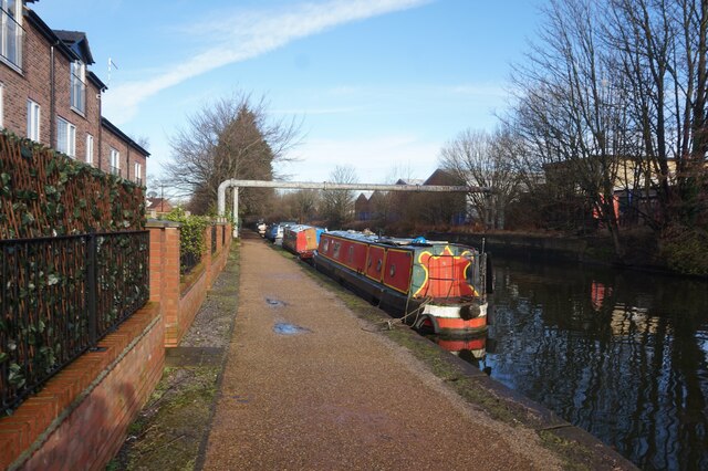
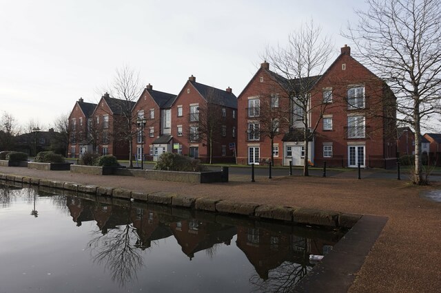
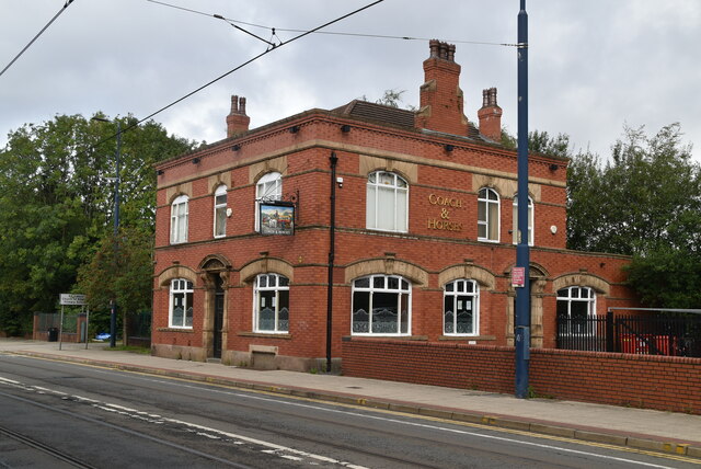
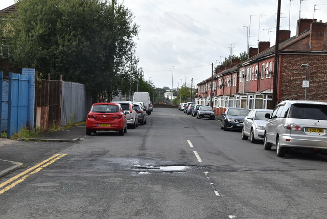
Trafford Park Images

Images are sourced within 2km of 53.467952/-2.319627 or Grid Reference SJ7896. Thanks to Geograph Open Source API. All images are credited.

Entering Mode Wheel Locks – 1978 Taken during one of the Mersey Ferries regular cruises along the Manchester Ship Canal. The locks effectively marked the change from canal to docks. No sign yet of the redevelopment of the area as Salford Quays!
Entering Mode Wheel Locks – 1978
Taken during one of the Mersey Ferries regular cruises along the Manchester Ship Canal. The locks effectively marked the change from canal to docks. No sign yet of the redevelopment of the area as Salford Quays!
Manchester Ship Canal - Centenary Bridge, Eccles
Bridgewater Canal at Europa Gate Road Bridge
Bridgewater Canal towards Stretford
Bridgewater Canal towards the Manchester Ship Canal
Bridgewater Canal towards Stretford
Canal boat Crusader, Bridgewater Canal
Houses at Stretford Marina, Bridgewater Canal
Bridgewater Canal at Stretford Marina
The Eccles Cross Built in buff terracotta and brick, this fine building opened in September 1920 as the Regent Cinema. It closed as a cinema in 1962, becoming unsurprisingly a Bingo Hall. It lasted in this guise for only four years before lying empty until 1983 when it became a wine bar, and later a night club called The Silver Screen. In 1999 it re-opened as a Wetherspoons pub under the name The Eccles Cross, the original of which had once stood close by.
The Eccles Cross
Built in buff terracotta and brick, this fine building opened in September 1920 as the Regent Cinema. It closed as a cinema in 1962, becoming unsurprisingly a Bingo Hall. It lasted in this guise for only four years before lying empty until 1983 when it became a wine bar, and later a night club called The Silver Screen. In 1999 it re-opened as a Wetherspoons pub under the name The Eccles Cross, the original of which had once stood close by.
Trafford Centre Tram Terminus The end of the line for the tram.
Trafford Centre Tram Terminus
The end of the line for the tram.
Outside the Trafford Centre 
The tramline follows the  B5211 Barton Dock Road.
Outside the Trafford Centre
The tramline follows the B5211 Barton Dock Road.
Kerrera Drive
Kerrera Drive
Coach & Horses
Coach & Horses
Mole Wheel Rd
Mole Wheel Rd
Foster St
Foster St
Brough Rd
Brough Rd
Show me another place!

Trafford Park is located at Grid Ref: SJ7896 (Lat: 53.467952, Lng: -2.319627)

Unitary Authority: Trafford

Police Authority: Greater Manchester

What 3 Words

///than.traded.jelly. Near Trafford Park, Manchester

Nearby Locations

Trafford Park

Related Wikis

Trafford Park Aerodrome

Trafford Park Aerodrome (Manchester) was the first purpose-built airfield in the Manchester area. Its large all-grass landing field was just south of...
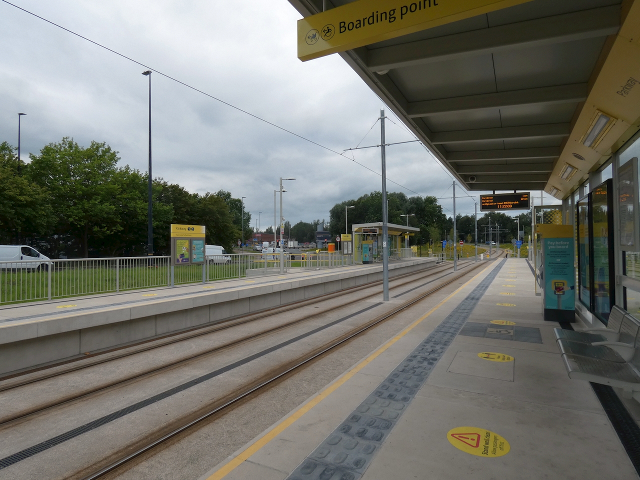
Parkway tram stop

Parkway (originally proposed as Parkway Circle) is a Manchester Metrolink tram stop built on the line to the Trafford Centre. It is located just east of...

Trafford Park

Trafford Park is an area of the Metropolitan Borough of Trafford, Greater Manchester, England, opposite Salford Quays on the southern side of the Manchester...
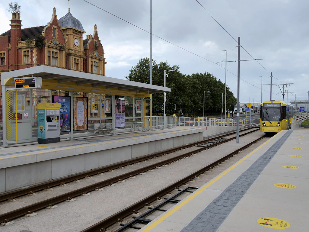
Village tram stop

Village is a Metrolink tram stop built as part of the line to the Trafford Centre, within the Trafford Park Village area of Trafford. Specifically, the...

Ford Trafford Park Factory

Ford Trafford Park Assembly Plant was a car assembly plant established by Ford of Britain at Trafford Park, beside the Manchester Ship Canal, a short distance...

Trafford power station

Trafford power station supplied electricity to the Trafford and Stretford areas of Greater Manchester, and to the national grid, from 1929 to 1976. The...
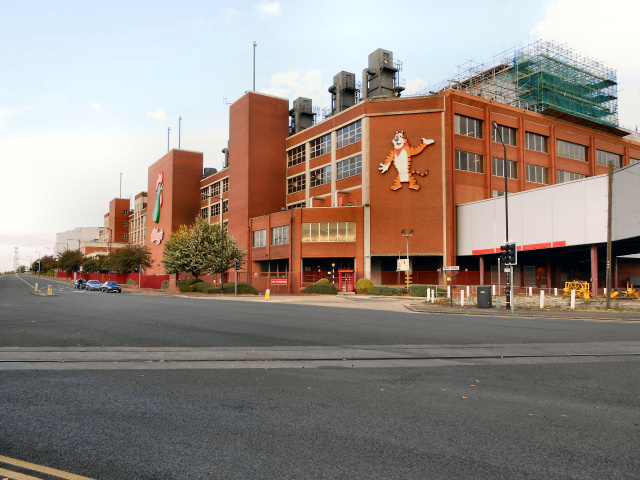
Manchester Plant

The Manchester Plant is a large food factory in North West England; during World War II, it was the largest food factory in Europe. It is devoted to manufacturing...

Therme Manchester

Therme Manchester is a spa and water park resort under construction in Greater Manchester, England. As of 2023, it is scheduled to open in 2025, and is...

Nearby Amenities

Located within 500m of 53.467952,-2.319627
Bus Stop
Mosley Road/Redwing Centre
Bus: yes
Naptan AtcoCode: 1800SJ01901
Naptan Bearing: S
Naptan CommonName: Mosley Road/Redwing Centre
Naptan Indicator: Nr Garage
Naptan Landmark: STONE MASONS
Naptan NaptanCode: manjmwjp
Naptan PlusbusZoneRef: MNCRPIC
Naptan ShortCommonName: Redwing Centre
Naptan Street: MOSLEY ROAD
Naptan Verified: no
Network: TfGM
Public Transport: platform
Route Ref: 19
Source: naptan_import
Lat/Long: 53.4666808/-2.3173401
Bus Stop
Trafford Park Road/Carborundum
Bus: yes
Naptan AtcoCode: 1800SJ01961
Naptan Bearing: NW
Naptan CommonName: Trafford Park Road/Carborundum
Naptan Indicator: Nt Warehouses
Naptan Landmark: WAREHOUSES
Naptan NaptanCode: manjmwmd
Naptan PlusbusZoneRef: MNCRPIC
Naptan ShortCommonName: Carborundum
Naptan Street: Trafford Pk Road
Naptan Verified: no
Network: TfGM
Public Transport: platform
Source: naptan_import
Lat/Long: 53.4711504/-2.3144589
Bus Stop
Trafford Park, Westinghouse Road / near Textilose Road
Bus: yes
Naptan AtcoCode: 1800SJ01491
Naptan Bearing: NW
Naptan CommonName: Westinghouse Road/Textilose Road
Naptan Indicator: Op Packaging
Naptan Landmark: WAREHOUSE
Naptan NaptanCode: manjmtpg
Naptan PlusbusZoneRef: MNCRPIC
Naptan ShortCommonName: Textilose Road
Naptan Street: Westinghouse Road
Naptan Verified: no
Network: TfGM
Operator: TfGM
Public Transport: platform
Route Ref: 243;251;270;272;290;291
Source: naptan_import
Lat/Long: 53.4635682/-2.3209762
Bus Stop
Trafford Park, Westinghouse Road / opposite Hattons Road
Bus: yes
Naptan AtcoCode: 1800SJ01501
Naptan Bearing: NW
Naptan CommonName: Westinghouse Road/Hattons Road
Naptan Indicator: Op Opal Comps
Naptan Landmark: KNOWSLEY SK
Naptan NaptanCode: manjmtpj
Naptan PlusbusZoneRef: MNCRPIC
Naptan ShortCommonName: Hattons Road
Naptan Street: Westinghouse Road
Naptan Verified: no
Network: TfGM
Operator: TfGM
Public Transport: platform
Route Ref: 243;251;270;272;290;291;51A
Source: naptan_import
Lat/Long: 53.4649833/-2.3235374
Bus Stop
Westinghouse Road/Hattons Road
Bus: yes
Naptan AtcoCode: 1800SJ01511
Naptan Bearing: SE
Naptan CommonName: Westinghouse Road/Hattons Road
Naptan Indicator: Nr Warehouse
Naptan Landmark: GREGGS
Naptan NaptanCode: manjmtpm
Naptan PlusbusZoneRef: MNCRPIC
Naptan ShortCommonName: Hattons Road
Naptan Street: Westinghouse Road
Naptan Verified: no
Network: TfGM
Public Transport: platform
Route Ref: 54;241;270;272;290;291;293;294;297
Source: naptan_import
Lat/Long: 53.4652514/-2.3237514
Bus Stop
Westinghouse Road/Textilose Road
Bus: yes
Naptan AtcoCode: 1800SJ01521
Naptan Bearing: SE
Naptan CommonName: Westinghouse Road/Textilose Road
Naptan Indicator: Central Park Es
Naptan Landmark: CENTRAL PARK ES
Naptan NaptanCode: manjmtpt
Naptan PlusbusZoneRef: MNCRPIC
Naptan ShortCommonName: Textilose Road
Naptan Street: Westinghouse Road
Naptan Verified: no
Network: TfGM
Public Transport: platform
Route Ref: 54;241;251;270;272;290;291;293;294;297
Source: naptan_import
Lat/Long: 53.4638026/-2.3210929
Bus Stop
Trafford Park, Ashburton Road W / Park Way (Stop B)
Bus: yes
Local Ref: B
Naptan AtcoCode: 1800SJ03261
Naptan Bearing: SE
Naptan CommonName: Ashburton Road West/Park Way
Naptan Indicator: Hss
Naptan Landmark: H S S
Naptan NaptanCode: manjpdwm
Naptan Notes: INDICATOR AMENDED
Naptan PlusbusZoneRef: MNCRPIC
Naptan ShortCommonName: Park Way
Naptan Street: Ashburton Road W
Naptan Verified: no
Network: TfGM
Operator: TfGM
Public Transport: platform
Ref: B
Source: naptan_import
Lat/Long: 53.4695283/-2.3260317
Bus Stop
Trafford Park, Ashburton Road W / Park Way (Stop A)
Bus: yes
Local Ref: A
Naptan AtcoCode: 1800SJ04131
Naptan Bearing: NW
Naptan CommonName: Ashburton Road West/Park Way
Naptan Indicator: Op Hss
Naptan Landmark: HSS
Naptan NaptanCode: manjpjpg
Naptan PlusbusZoneRef: MNCRPIC
Naptan ShortCommonName: Park Way
Naptan Street: Ashburton Road W
Naptan Verified: no
Network: TfGM
Operator: TfGM
Public Transport: platform
Ref: A
Source: naptan_import
Lat/Long: 53.4694194/-2.3264376
Give Way
Lat/Long: 53.4672214/-2.3125551
Power: substation
Ref: 165839
Lat/Long: 53.4665762/-2.323299
Fast Food
Greggs
Addr City: Manchester
Addr Country: GB
Addr Postcode: M17 1PZ
Addr Street: Longwood Road
Addr Unit: 1B
Brand: Greggs
Brand Wikidata: Q3403981
Brand Wikipedia: en:Greggs
Contact Website: https://www.greggs.co.uk/shop-finder?shop-code=2434
Cuisine: sandwich;bakery
Fhrs Id: 1084923
Takeaway: yes
Lat/Long: 53.4653908/-2.3235596
Telephone
Booth: KXPlus
Covered: booth
Phone: +44 161 876 4284
Lat/Long: 53.4661429/-2.317366
Fuel
BP
Brand: BP
Brand Wikidata: Q152057
Brand Wikipedia: en:BP
Operator: Motor Fuel Group
Operator Website: https://www.motorfuelgroup.com/locations/trafford-park-fs440/
Operator Wikidata: Q107271358
Website: https://map.bp.com/en-GB/GB/petrol-station/manchester/trafford-park-s-stn-fs440/4739
Lat/Long: 53.4643761/-2.3171458
Post Box
Ref: M5 701
Lat/Long: 53.4654815/-2.324066
Crossing
Crossing: uncontrolled
Kerb: lowered
Tactile Paving: no
Lat/Long: 53.4694314/-2.3249409
Historic Railway: level_crossing
Lat/Long: 53.4690395/-2.3170803
Noexit: yes
Lat/Long: 53.4697899/-2.3191338
Traffic Signals
Traffic Signals: signal
Traffic Signals Direction: forward
Lat/Long: 53.4670981/-2.3174418
Traffic Signals
Button Operated: yes
Crossing: traffic_signals
Lat/Long: 53.4675434/-2.3173858
Railway: level_crossing
Lat/Long: 53.4691391/-2.3242908
Railway: level_crossing
Lat/Long: 53.4693853/-2.3251679
Railway: level_crossing
Lat/Long: 53.4692469/-2.3248197
Railway: level_crossing
Lat/Long: 53.4693191/-2.325014
Traffic Signals
Traffic Signals Direction: forward
Lat/Long: 53.4677561/-2.325682
Traffic Signals
Traffic Signals: tram_priority
Lat/Long: 53.4682543/-2.3265639
Crossing Barrier: no
Railway: level_crossing
Tramway: level_crossing
Lat/Long: 53.468309/-2.3246903
Traffic Signals
Traffic Signals: tram_priority
Traffic Signals Direction: forward
Lat/Long: 53.4683665/-2.3246775
Traffic Signals
Traffic Signals Direction: forward
Lat/Long: 53.4686412/-2.3244482
Traffic Signals
Traffic Signals Direction: forward
Lat/Long: 53.468885/-2.3260211
South Field Industrial Estate
Place: locality
Lat/Long: 53.4652468/-2.3143178
Trafford Park
Name Ur: ٹریفورڈ پارک
Place: suburb
Wikidata: Q940877
Wikipedia: en:Trafford Park
Lat/Long: 53.4717516/-2.3209276
Historic Railway: level_crossing
Lat/Long: 53.4689287/-2.3130082
Toilets
Access: customers
Lat/Long: 53.471355/-2.315891
Railway: crossing
Lat/Long: 53.4675504/-2.3126265
Crossing
Crossing: uncontrolled
Kerb: lowered
Tactile Paving: no
Lat/Long: 53.4696602/-2.3252358
Crossing
Crossing: uncontrolled
Kerb: lowered
Tactile Paving: no
Lat/Long: 53.4707107/-2.3248754
Crossing
Crossing: uncontrolled
Kerb: lowered
Tactile Paving: no
Lat/Long: 53.4707708/-2.325208
Crossing
Crossing: uncontrolled
Kerb: lowered
Tactile Paving: no
Lat/Long: 53.4695427/-2.3252416
Railway: crossing
Lat/Long: 53.4694195/-2.3252557
Railway: crossing
Lat/Long: 53.469294/-2.3249509
Railway: crossing
Lat/Long: 53.4674478/-2.3167748
Railway: crossing
Lat/Long: 53.4674168/-2.3167783
Crossing Barrier: no
Railway: level_crossing
Tramway: level_crossing
Lat/Long: 53.4674148/-2.3172238
Crossing
Bicycle: yes
Crossing: uncontrolled
Railway: level_crossing
Tactile Paving: yes
Tramway: level_crossing
Lat/Long: 53.4682694/-2.3267519
Crossing
Bicycle: yes
Crossing: uncontrolled
Crossing Barrier: no
Railway: level_crossing
Tactile Paving: yes
Tramway: level_crossing
Lat/Long: 53.4683014/-2.3267709
Crossing
Crossing: traffic_signals
Traffic Signals: pedestrian_crossing
Lat/Long: 53.4678224/-2.3266485
Crossing
Crossing: traffic_signals
Tactile Paving: yes
Lat/Long: 53.4679335/-2.3267264
Traffic Signals
Crossing: traffic_signals
Tactile Paving: yes
Traffic Signals: pedestrian_crossing
Lat/Long: 53.468488/-2.3267885
Traffic Signals
Crossing: traffic_signals
Tactile Paving: yes
Traffic Signals: pedestrian_crossing
Lat/Long: 53.4686132/-2.3267861
Traffic Signals
Bicycle: yes
Crossing: traffic_signals
Tactile Paving: yes
Traffic Signals: pedestrian_crossing
Lat/Long: 53.4690223/-2.3262712
Traffic Signals
Crossing: traffic_signals
Tactile Paving: yes
Traffic Signals: pedestrian_crossing
Lat/Long: 53.4689918/-2.3259766
Traffic Signals
Bicycle: yes
Crossing: traffic_signals
Tactile Paving: yes
Traffic Signals: pedestrian_crossing
Lat/Long: 53.4690808/-2.3252148
Crossing
Crossing: traffic_signals
Tactile Paving: yes
Traffic Signals: pedestrian_crossing
Lat/Long: 53.4688977/-2.3249412
Crossing
Crossing: traffic_signals
Tactile Paving: yes
Traffic Signals: pedestrian_crossing
Lat/Long: 53.4686305/-2.3243706
Crossing
Bicycle: yes
Crossing: uncontrolled
Crossing Barrier: no
Railway: level_crossing
Tactile Paving: yes
Tramway: level_crossing
Lat/Long: 53.468289/-2.3245124
Crossing
Bicycle: yes
Crossing: uncontrolled
Crossing Barrier: no
Railway: level_crossing
Tactile Paving: yes
Tramway: level_crossing
Lat/Long: 53.4682559/-2.3245192
Crossing
Crossing: traffic_signals
Tactile Paving: yes
Traffic Signals: pedestrian_crossing
Lat/Long: 53.4680422/-2.3246175
Crossing
Bicycle: yes
Tactile Paving: yes
Lat/Long: 53.467622/-2.3253812
Crossing
Crossing: traffic_signals
Tactile Paving: yes
Traffic Signals: pedestrian_crossing
Lat/Long: 53.4676418/-2.3257267
Crossing
Tactile Paving: yes
Lat/Long: 53.4675653/-2.3257929
Traffic Signals
Lat/Long: 53.4678189/-2.3265723
Crossing Barrier: no
Railway: level_crossing
Tramway: level_crossing
Lat/Long: 53.4682748/-2.3246997
Traffic Signals
Traffic Signals: signal
Traffic Signals Direction: forward
Lat/Long: 53.4679343/-2.3266675
Traffic Signals
Traffic Signals Direction: forward
Lat/Long: 53.468791/-2.3259537
Traffic Signals
Traffic Signals Direction: backward
Lat/Long: 53.4675952/-2.3122024
Railway: level_crossing
Tramway: level_crossing
Lat/Long: 53.4675606/-2.3122887
Railway: level_crossing
Tramway: level_crossing
Lat/Long: 53.4675298/-2.3123076
Traffic Signals
Lat/Long: 53.4674556/-2.3124088
Traffic Signals
Lat/Long: 53.4674284/-2.3125028
Crossing Barrier: no
Railway: level_crossing
Tramway: level_crossing
Lat/Long: 53.467367/-2.3172283
Crossing Barrier: no
Railway: level_crossing
Tramway: level_crossing
Lat/Long: 53.4673656/-2.3173879
Crossing Barrier: no
Railway: level_crossing
Tramway: level_crossing
Lat/Long: 53.4673523/-2.317272
Give Way
Lat/Long: 53.4671694/-2.317539
Traffic Signals
Button Operated: yes
Crossing: traffic_signals
Traffic Signals Direction: forward
Lat/Long: 53.4671504/-2.3169788
Noexit: yes
Lat/Long: 53.4708834/-2.3177752
Noexit: yes
Lat/Long: 53.4704888/-2.3185142
Noexit: yes
Lat/Long: 53.4692656/-2.3189207
Noexit: yes
Lat/Long: 53.4697029/-2.3191807
Noexit: yes
Lat/Long: 53.4692509/-2.3177726
Barrier: yes
Lat/Long: 53.4706052/-2.3236876
Railway: level_crossing
Tramway: level_crossing
Lat/Long: 53.4683146/-2.3265856
Traffic Signals
Traffic Signals Direction: forward
Lat/Long: 53.4687823/-2.3250573
Crossing Barrier: no
Railway: level_crossing
Tramway: level_crossing
Lat/Long: 53.4683469/-2.3265942
Noexit: yes
Lat/Long: 53.4704494/-2.3137853
Noexit: yes
Lat/Long: 53.4707261/-2.3177654
Noexit: yes
Lat/Long: 53.4699046/-2.3174274
Noexit: yes
Lat/Long: 53.4716933/-2.315571
Barrier: lift_gate
Lat/Long: 53.4678485/-2.3169236
Railway: level_crossing
Tramway: level_crossing
Lat/Long: 53.4675582/-2.3121179
Parkway
Naptan AtcoCode: 9400ZZMAPAR2
Network: Manchester Metrolink
Network Wikidata: Q18548
Operator: Transport for Greater Manchester
Operator Wikidata: Q7834921
Public Transport: stop_position
Railway: tram_stop
Tram: yes
Lat/Long: 53.4681982/-2.3239603
Parkway
Naptan AtcoCode: 9400ZZMAPAR1
Network: Manchester Metrolink
Network Wikidata: Q18548
Operator: Transport for Greater Manchester
Operator Wikidata: Q7834921
Public Transport: stop_position
Railway: tram_stop
Tram: yes
Lat/Long: 53.4682331/-2.3239482
Traffic Signals
Button Operated: yes
Crossing: traffic_signals
Lat/Long: 53.4672251/-2.3169693
Traffic Signals
Button Operated: yes
Crossing: traffic_signals
Cycleway: asl
Lat/Long: 53.4671746/-2.3172542
Traffic Signals
Lat/Long: 53.4673905/-2.317611
Traffic Signals
Lat/Long: 53.4672197/-2.3122613
Traffic Signals
Lat/Long: 53.4673709/-2.3124578
Crossing
Crossing: marked
Lat/Long: 53.467501/-2.3172183
Crossing
Crossing: traffic_signals
Lat/Long: 53.4671971/-2.3122625
Railway: level_crossing
Lat/Long: 53.469513/-2.3254952
Crossing
Crossing: marked
Lat/Long: 53.4672256/-2.3170504
Crossing
Crossing: marked
Lat/Long: 53.4673246/-2.3168788
Railway: crossing
Lat/Long: 53.4675216/-2.312624
Railway: level_crossing
Lat/Long: 53.4698863/-2.3264351
Crossing
Lat/Long: 53.4671471/-2.3172541
Crossing
Lat/Long: 53.4674555/-2.3172184
Give Way
Lat/Long: 53.4670526/-2.3171324
Railway: level_crossing
Lat/Long: 53.4697344/-2.326432
Railway: level_crossing
Lat/Long: 53.469729/-2.326298
Noexit: yes
Lat/Long: 53.4722537/-2.3181179
Noexit: yes
Lat/Long: 53.4715831/-2.3158649
Noexit: yes
Lat/Long: 53.4713189/-2.3159949
Noexit: yes
Lat/Long: 53.4703323/-2.3183325
Noexit: yes
Lat/Long: 53.4695078/-2.3159321
Give Way
Lat/Long: 53.4669597/-2.3259085
Give Way
Lat/Long: 53.4676058/-2.3270633
Give Way
Lat/Long: 53.4676162/-2.3267008
Give Way
Lat/Long: 53.4668387/-2.3258678
Crossing
Lat/Long: 53.4674346/-2.3261315
Crossing
Lat/Long: 53.4673533/-2.3262597
Crossing
Lat/Long: 53.467239/-2.32644
Crossing
Lat/Long: 53.467125/-2.3266196
Barrier: kerb
Kerb: lowered
Tactile Paving: yes
Wheelchair: yes
Lat/Long: 53.4671848/-2.3124362
Barrier: kerb
Kerb: lowered
Tactile Paving: yes
Wheelchair: yes
Lat/Long: 53.4671963/-2.3123532
Barrier: kerb
Kerb: lowered
Tactile Paving: yes
Wheelchair: yes
Lat/Long: 53.467197/-2.3121889
Entrance: yes
Lat/Long: 53.4679227/-2.3132181
Railway: crossing
Lat/Long: 53.4674118/-2.3154138
Railway: crossing
Lat/Long: 53.4673814/-2.3154155
Barrier: kerb
Kerb: lowered
Tactile Paving: yes
Wheelchair: yes
Lat/Long: 53.4674767/-2.3124577
Barrier: kerb
Kerb: lowered
Tactile Paving: yes
Wheelchair: yes
Lat/Long: 53.4674406/-2.3123744
Traffic Signals
Lat/Long: 53.4671323/-2.3124425
Give Way
Lat/Long: 53.4665167/-2.3260476
Give Way
Lat/Long: 53.4667638/-2.3258965
Give Way
Lat/Long: 53.4667494/-2.3260132
Bus Stop
Mosley Road
Bus: yes
Naptan AtcoCode: 1800SJ01911
Naptan Bearing: E
Naptan CommonName: Mosley Road
Naptan Indicator: nr
Naptan NaptanCode: MANJMWJT
Naptan Street: Village Way
Naptan Verified: no
Network: TfGM
Operator: TfGM
Public Transport: platform
Source: naptan;bing;naptan_compare_tool
Lat/Long: 53.467348/-2.3163647
Traffic Signals
Traffic Signals Direction: forward
Lat/Long: 53.4680514/-2.3245478
Traffic Signals
Traffic Signals Direction: forward
Lat/Long: 53.4676115/-2.3256937
Barrier: cycle_barrier
Lat/Long: 53.4682123/-2.3267201
Traffic Signals
Traffic Signals Direction: forward
Lat/Long: 53.4689347/-2.3249607
Barrier: kerb
Kerb: lowered
Tactile Paving: yes
Wheelchair: yes
Lat/Long: 53.4673315/-2.3201097
Barrier: kerb
Kerb: lowered
Tactile Paving: yes
Wheelchair: yes
Lat/Long: 53.4673217/-2.3200321
Crossing
Lat/Long: 53.4673169/-2.3199933
Crossing
Lat/Long: 53.467341/-2.3201859
Barrier: kerb
Kerb: lowered
Tactile Paving: yes
Wheelchair: yes
Lat/Long: 53.4673457/-2.3202233
Barrier: kerb
Kerb: lowered
Tactile Paving: yes
Wheelchair: yes
Lat/Long: 53.4673042/-2.3198923
Parkway
Public Transport: station
Lat/Long: 53.4682157/-2.3239543
Bus Stop
Fifth Avenue
Bus: yes
Naptan AtcoCode: 1800SJ01981
Naptan Bearing: W
Naptan CommonName: Fifth Avenue
Naptan Indicator: nr
Naptan NaptanCode: MANJMWMJ
Naptan Street: Village Way
Naptan Verified: no
Network: TfGM
Public Transport: platform
Source: naptan;bing;naptan_compare_tool
Lat/Long: 53.4672145/-2.3132524
Bus Stop
Mosley Road
Bench: no
Bin: no
Bus: yes
Naptan AtcoCode: 1800SJ01571
Naptan Bearing: W
Naptan CommonName: Mosley Road
Naptan Indicator: adj
Naptan Landmark: Ford
Naptan NaptanCode: MANJMTWJ
Naptan Street: Village Way
Naptan Verified: no
Network: TfGM
Public Transport: platform
Shelter: no
Source: naptan;bing;naptan_compare_tool
Lat/Long: 53.4672183/-2.3186301
Railway: crossing
Lat/Long: 53.4698379/-2.3263133
Railway: switch
Lat/Long: 53.470821/-2.3168508
Railway: switch
Lat/Long: 53.4706147/-2.3168072
The data included in this document is from www.openstreetmap.org. The data is made available under ODbL.

Have you been to Trafford Park?

Leave your review of Trafford Park below (or comments, questions and feedback).