Townsend

Settlement in Hertfordshire St. Albans

England

Townsend

Childwickbury Manor House Childwickbury manor, formerly Stanley Kubrick's house.
Childwickbury Manor House Credit: Gary Houston

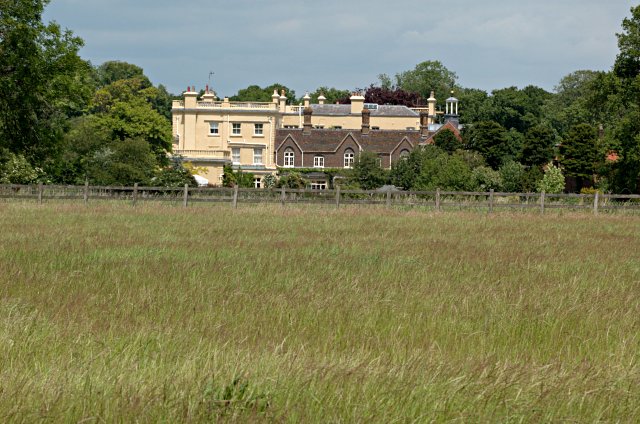
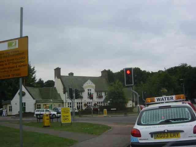
Townsend is a small village located in the county of Hertfordshire, England. Situated approximately 25 miles north of London, it falls within the boundaries of the Welwyn Hatfield district. The village is surrounded by picturesque countryside, with rolling green hills, open fields, and a few scattered farms.

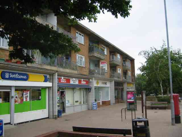
With a population of around 500 residents, Townsend maintains a close-knit community atmosphere. The village consists mostly of residential properties, ranging from charming cottages to modern houses. The architectural style is predominantly traditional, reflecting the village's long history.

Townsend is well-connected to neighboring towns and cities, making it a desirable place to live for commuters. The A1(M) motorway is easily accessible, providing convenient links to London and other major cities in the South East. Additionally, Welwyn Garden City and Hatfield, both within a few miles' distance, offer extensive amenities such as shopping centers, schools, and healthcare facilities.

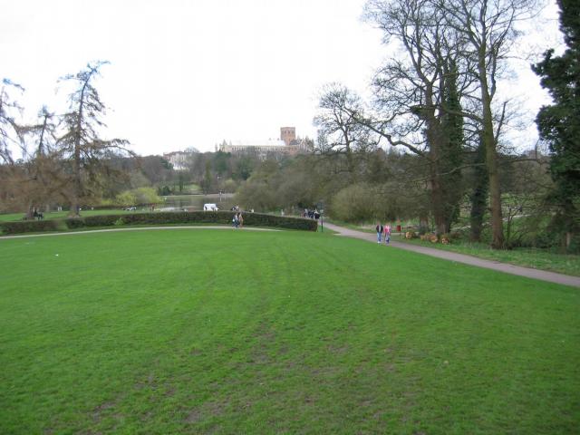
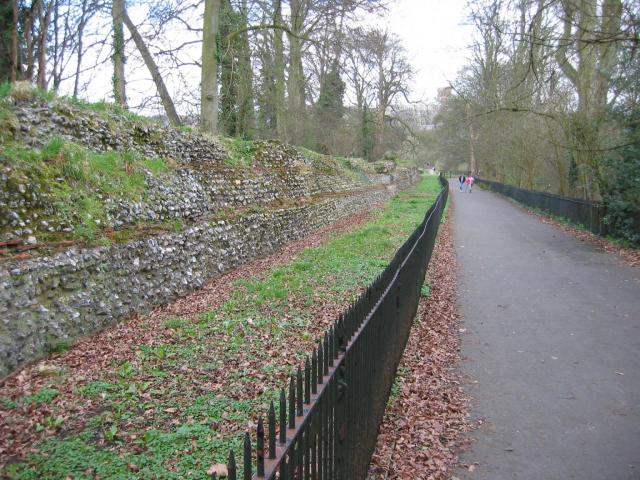
Nature enthusiasts will appreciate the tranquil surroundings of Townsend. The village is surrounded by beautiful countryside, making it an ideal location for outdoor activities such as hiking, cycling, and horse riding. The nearby Stanborough Lakes and Tewin Orchard Nature Reserve offer additional recreational opportunities for residents and visitors alike.

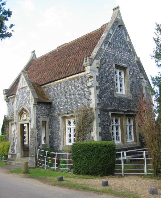
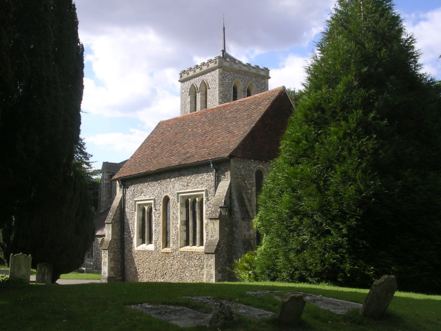
Despite its small size, Townsend has a rich history. The village dates back to medieval times and has several listed buildings, including the St. Mary Magdalene Church, which dates back to the 12th century. The church serves as a focal point for the community and hosts various events throughout the year.

Overall, Townsend offers a peaceful and idyllic setting, making it an attractive place to live for those seeking a countryside lifestyle within easy reach of urban amenities.

If you have any feedback on the listing, please let us know in the comments section below.
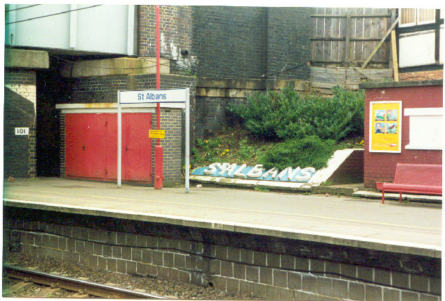
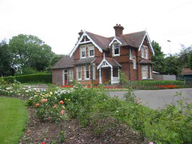
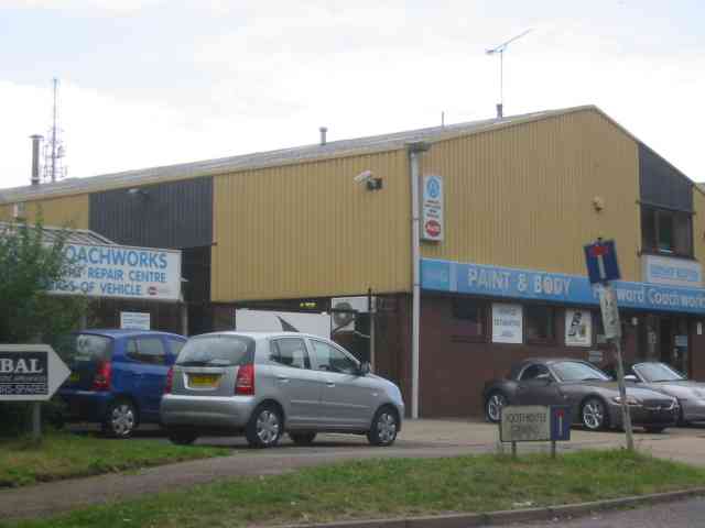
Townsend Images

Images are sourced within 2km of 51.76198/-0.34334276 or Grid Reference TL1408. Thanks to Geograph Open Source API. All images are credited.

Childwickbury Manor House Childwickbury manor, formerly Stanley Kubrick's house.
Childwickbury Manor House
Childwickbury manor, formerly Stanley Kubrick's house.
Park Looking NE from TL138067 across the lake in the park, toward the abbey in TL1407
Park
Looking NE from TL138067 across the lake in the park, toward the abbey in TL1407
Roman city wall Looking NE from TL137066, with the old Roman city wall on the left.
Roman city wall
Looking NE from TL137066, with the old Roman city wall on the left.
Stone house House by the entrance to Verulamium Roman Theatre, on the left hand side coming into St Albans along the A4147 (TL135074).
Stone house
House by the entrance to Verulamium Roman Theatre, on the left hand side coming into St Albans along the A4147 (TL135074).
Roman theatre at Verulamium Remains of the theatre at the Roman city of Verulamium (Saint Albans), TL134074.
Roman theatre at Verulamium
Remains of the theatre at the Roman city of Verulamium (Saint Albans), TL134074.
St Alban's cathedral The west front as rebuilt in the late C19 by a benefactor, Lord Grimthorpe, to his own specification. From TL143071, looking East
St Alban's cathedral
The west front as rebuilt in the late C19 by a benefactor, Lord Grimthorpe, to his own specification. From TL143071, looking East
St Albans cathedral Looking West from TL146070
St Albans cathedral
Looking West from TL146070
Beech Bottom Dyke Iron Age earthwork in the middle of an urban area.
Beech Bottom Dyke
Iron Age earthwork in the middle of an urban area.
The Allotments Near the River Ver are the Allotments just off Cottonmill Lane.
The Allotments
Near the River Ver are the Allotments just off Cottonmill Lane.
Where are we? St. Albans Railway Station is not shy in proclaiming its identity.  See Stacey Harris's photo <a href="https://www.geograph.org.uk/photo/788654">TL1507 : St Albans Station</a> for the context of this close-up.
Where are we?
St. Albans Railway Station is not shy in proclaiming its identity. See Stacey Harris's photo TL1507 : St Albans Station for the context of this close-up.
Clarence Park Cafe  St Albans This cafe used to be the public lavatories until 
using a toilet went out of fashion.
Clarence Park Cafe St Albans
This cafe used to be the public lavatories until using a toilet went out of fashion.
The Lodge  Clarence Park St Albans A tied cottage provided for the Parks Superintendent. His office is the small room to the left
The Lodge Clarence Park St Albans
A tied cottage provided for the Parks Superintendent. His office is the small room to the left
The King Harry Pub St Albans This is an awkward junction with a double mini roundabout. Best avoided if possible. {see note re St Stephens Church}
The King Harry Pub St Albans
This is an awkward junction with a double mini roundabout. Best avoided if possible. {see note re St Stephens Church}
The Parish Church of St Michael, St Albans This church is on the edge of Verulamium park, close to the Roman museum. It was probably originally created to receive pilgrims on their way to the shrine of St Alban at the Abbey.
The Parish Church of St Michael, St Albans
This church is on the edge of Verulamium park, close to the Roman museum. It was probably originally created to receive pilgrims on their way to the shrine of St Alban at the Abbey.
Warehouses in Valley Road St Albans This business park is in complete contrast to the rural look of the beech bottom
Warehouses in Valley Road St Albans
This business park is in complete contrast to the rural look of the beech bottom
Harvester Pub on Harpenden Road crossing The pub has been refurbished and enlarged
Harvester Pub on Harpenden Road crossing
The pub has been refurbished and enlarged
Parade of shops on High Oaks in New Greens The group of shops includes the Co-op mini market and a post office.
Parade of shops on High Oaks in New Greens
The group of shops includes the Co-op mini market and a post office.
Changing rooms for football  and tennis  New Greens The appearance is rather grim but the buildings suffer rough treatment
Changing rooms for football and tennis New Greens
The appearance is rather grim but the buildings suffer rough treatment
Show me another place!

Townsend is located at Grid Ref: TL1408 (Lat: 51.76198, Lng: -0.34334276)

Administrative County: Hertfordshire

District: St. Albans

Police Authority: Hertfordshire

What 3 Words

///toned.rope.glove. Near St Albans, Hertfordshire

Related Wikis

St Albans City Hospital

St Albans City Hospital is an acute District General Hospital in St Albans, Hertfordshire operated by the West Hertfordshire Hospitals NHS Trust. ��2...

Bernards Heath

Bernards Heath is a heathland in St Albans, Hertfordshire, the site of the Second Battle of St Albans in 1461 during the Wars of the Roses. In the 19th...

St Peter, Hertfordshire

St Peter was an ancient parish in Hertfordshire, England that was abolished for civil purposes in 1894. It was also known as St Albans St Peter. The parish...

Verulam House, St Albans

Verulam House is located in Verulam Road, St Albans on the northwestern side between Church Crescent and Britton Avenue opposite College Street. It has...

St Albans High School for Girls

St Albans High School for Girls is a selective, private day school for girls aged 4 – 18 years, which is affiliated to the Church of England and takes...

St Albans

St Albans () is a cathedral city in Hertfordshire, England, east of Hemel Hempstead and west of Hatfield, 20 miles (32 km) north-west of London, 8 miles...

Second Battle of St Albans

The Second Battle of St Albans was fought on 17 February 1461 during the Wars of the Roses in St Albans, Hertfordshire, England (the First Battle of St...

Church of St Peter, St Albans

St Peter's Church is a Church of England parish church. It is located in St Albans, England, at the northern end of the town centre. == Background == It...

Nearby Amenities

Located within 500m of 51.76198,-0.34334276
Mini Roundabout
Direction: clockwise
Lat/Long: 51.760092/-0.34112
Mini Roundabout
Direction: clockwise
Lat/Long: 51.7635524/-0.3472106
Crossing
Crossing: unmarked
Crossing Island: yes
Tactile Paving: yes
Lat/Long: 51.7600251/-0.3411594
Noexit: yes
Lat/Long: 51.7605397/-0.3419538
Mini Roundabout
Lat/Long: 51.7603901/-0.3440372
Traffic Calming: island
Lat/Long: 51.7613561/-0.3437145
Bus Stop
Links View
Bench: yes
Bin: yes
Bus: yes
Naptan AtcoCode: 210021502875
Naptan Bearing: NE
Naptan CommonName: Links View
Naptan Crossing: opp Links View
Naptan Indicator: opp
Naptan Landmark: opp Links View
Naptan NaptanCode: hrtawtmw
Naptan PlusbusZoneRef: STALBCY
Naptan ShortCommonName: NA
Naptan Street: Batchwood Drive
Naptan Verified: no
Public Transport: platform
Shelter: yes
Source: naptan_import
Lat/Long: 51.7620187/-0.3495732
Bus Stop
Alverton
Bus: yes
Naptan AtcoCode: 210021502990
Naptan Bearing: SW
Naptan CommonName: Alverton
Naptan Crossing: Batchwood Drive
Naptan Indicator: adj
Naptan Landmark: Batchwood Drive
Naptan NaptanCode: hrtawtja
Naptan PlusbusZoneRef: STALBCY
Naptan ShortCommonName: NA
Naptan Street: Green Lane
Naptan Verified: no
Public Transport: platform
Source: naptan_import
Lat/Long: 51.7656432/-0.3432238
Bus Stop
Batchwood Hall
Bus: yes
Naptan AtcoCode: 210021503020
Naptan Bearing: SW
Naptan CommonName: Batchwood Hall
Naptan Crossing: Beckett's Avenue
Naptan Indicator: opp
Naptan Landmark: Beckett's Avenue
Naptan NaptanCode: hrtawtjp
Naptan PlusbusZoneRef: STALBCY
Naptan ShortCommonName: NA
Naptan Street: Batchwood Drive
Naptan Verified: no
Public Transport: platform
Shelter: yes
Source: naptan_import
Lat/Long: 51.7646474/-0.344666
Bus Stop
Batchwood Drive
Bench: yes
Bus: yes
Naptan AtcoCode: 210021503040
Naptan Bearing: SE
Naptan CommonName: Batchwood Drive
Naptan Crossing: Everlasting Lane
Naptan Indicator: E-bound
Naptan Landmark: Everlasting Lane
Naptan NaptanCode: hrtawtjt
Naptan PlusbusZoneRef: STALBCY
Naptan ShortCommonName: NA
Naptan Street: Waverley Road
Naptan Verified: no
Public Transport: platform
Shelter: yes
Source: naptan_import
Lat/Long: 51.7632378/-0.3463596
Bus Stop
Hospital
Bus: yes
Local Ref: A
Naptan AtcoCode: 210021503060
Naptan Bearing: SE
Naptan CommonName: Hospital
Naptan Crossing: Alban Avenue
Naptan Indicator: Stop A
Naptan Landmark: Alban Avenue
Naptan NaptanCode: hrtawtjw
Naptan PlusbusZoneRef: STALBCY
Naptan ShortCommonName: NA
Naptan Street: Waverley Road
Naptan Verified: no
Public Transport: platform
Source: naptan_import
Lat/Long: 51.7612005/-0.342546
Bus Stop
Goldsmith Way
Bench: yes
Bin: yes
Bus: yes
Lit: no
Naptan AtcoCode: 210021503080
Naptan Bearing: SE
Naptan CommonName: Goldsmith Way
Naptan Crossing: opp Kimberley Road
Naptan Indicator: opp
Naptan Landmark: opp Kimberley Road
Naptan NaptanCode: hrtawtaw
Naptan PlusbusZoneRef: STALBCY
Naptan ShortCommonName: NA
Naptan Street: Normandy Road
Naptan Verified: no
Public Transport: platform
Shelter: yes
Source: naptan_import
Tactile Paving: no
Lat/Long: 51.7594013/-0.3412208
Bus Stop
Goldsmith Way
Bus: yes
Naptan AtcoCode: 210021508640
Naptan Bearing: NE
Naptan CommonName: Goldsmith Way
Naptan Crossing: Waverley Road
Naptan Indicator: adj
Naptan Landmark: Waverley Road
Naptan NaptanCode: hrtatwgd
Naptan PlusbusZoneRef: STALBCY
Naptan ShortCommonName: NA
Naptan Street: Normandy Road
Naptan Verified: no
Public Transport: platform
Shelter: yes
Source: naptan_import
Tactile Paving: yes
Lat/Long: 51.7598061/-0.3413656
Bus Stop
Hospital
Bench: yes
Bus: yes
Local Ref: B
Naptan AtcoCode: 210021508660
Naptan Bearing: NW
Naptan CommonName: Hospital
Naptan Crossing: opp Batchwood View
Naptan Indicator: Stop B
Naptan Landmark: opp Batchwood View
Naptan NaptanCode: hrtatwgj
Naptan PlusbusZoneRef: STALBCY
Naptan ShortCommonName: NA
Naptan Street: Waverley Road
Naptan Verified: no
Public Transport: platform
Shelter: yes
Source: naptan_import
Lat/Long: 51.7617959/-0.3433212
Bus Stop
Batchwood Drive
Bus: yes
Naptan AtcoCode: 210021508680
Naptan Bearing: NW
Naptan CommonName: Batchwood Drive
Naptan Crossing: Ladies Grove
Naptan Indicator: W-bound
Naptan Landmark: Ladies Grove
Naptan NaptanCode: hrtatwgm
Naptan PlusbusZoneRef: STALBCY
Naptan ShortCommonName: NA
Naptan Street: Waverley Road
Naptan Verified: no
Public Transport: platform
Source: naptan_import
Lat/Long: 51.7632428/-0.3465425
Bus Stop
Batchwood Hall
Bus: yes
Local Ref: NR
Naptan AtcoCode: 210021508700
Naptan Bearing: NE
Naptan CommonName: Batchwood Hall
Naptan Crossing: opp Beckett's Avenue
Naptan Indicator: nr
Naptan Landmark: opp Beckett's Avenue
Naptan NaptanCode: hrtatwgp
Naptan PlusbusZoneRef: STALBCY
Naptan ShortCommonName: NA
Naptan Street: Batchwood Drive
Naptan Verified: no
Public Transport: platform
Source: naptan_import
Lat/Long: 51.7648132/-0.3446048
Bus Stop
Links View
Bus: yes
Naptan AtcoCode: 210021508845
Naptan Bearing: SW
Naptan CommonName: Links View
Naptan Crossing: Links View
Naptan Indicator: adj
Naptan Landmark: Links View
Naptan NaptanCode: hrtatwaw
Naptan PlusbusZoneRef: STALBCY
Naptan ShortCommonName: NA
Naptan Street: Batchwood Drive
Naptan Verified: no
Public Transport: platform
Shelter: no
Source: naptan_import
Lat/Long: 51.7613971/-0.3501321
Townsend
Place: suburb
Lat/Long: 51.7635507/-0.3409183
Traffic Calming: table
Lat/Long: 51.7591857/-0.3433635
Crossing
Crossing: uncontrolled
Crossing Island: no
Crossing Markings: zebra
Tactile Paving: yes
Lat/Long: 51.7611122/-0.3428131
Crossing
Crossing: unmarked
Crossing Island: yes
Tactile Paving: yes
Lat/Long: 51.7614071/-0.3429003
Crossing
Crossing: marked
Crossing Island: no
Crossing Markings: zebra
Kerb: lowered
Tactile Paving: yes
Lat/Long: 51.7605337/-0.3437938
Addr Housenumber: 71
Lat/Long: 51.7596256/-0.3493563
Barrier: bollard
Lat/Long: 51.7583282/-0.347447
Addr Housenumber: 12
Lat/Long: 51.7592333/-0.3462489
Addr Housenumber: 34
Lat/Long: 51.7595173/-0.3463184
Addr Housenumber: 39
Lat/Long: 51.7588503/-0.3438059
Addr Housenumber: 107
Lat/Long: 51.7579298/-0.3456204
Addr Housenumber: 81
Lat/Long: 51.7575852/-0.3439937
Addr Housenumber: 1
Lat/Long: 51.7582419/-0.3457384
Addr Housenumber: 18
Lat/Long: 51.7582004/-0.3450478
Addr Housenumber: 6
Lat/Long: 51.7584328/-0.3454447
Addr Housename: Harriets Heights
Lat/Long: 51.7587142/-0.3446334
Addr Housenumber: 117
Lat/Long: 51.7581638/-0.3460362
Addr Housenumber: 83
Lat/Long: 51.7577654/-0.3443196
Addr Housenumber: 23
Lat/Long: 51.7580061/-0.3453428
Addr Housenumber: 45
Lat/Long: 51.7584394/-0.3436624
Traffic Calming: table
Lat/Long: 51.7594963/-0.3425051
Addr Housename: Waverley Court former St Albans Union Workhouse
Historic: heritage
Lat/Long: 51.7601103/-0.3418299
Addr Housenumber: 71
Lat/Long: 51.7589568/-0.3412435
Addr Housenumber: 47
Lat/Long: 51.7587777/-0.3420448
Addr Housenumber: 3
Lat/Long: 51.7578305/-0.3424511
Addr Housenumber: 50
Lat/Long: 51.7588864/-0.3417484
Addr Housenumber: 2
Lat/Long: 51.7578969/-0.3419871
Barrier: lift_gate
Lat/Long: 51.7623917/-0.3454198
Crossing
Crossing: unmarked
Crossing Island: yes
Tactile Paving: yes
Lat/Long: 51.7625706/-0.3447564
Pharmacy
Normandy Pharmacy
Addr City: St Albans
Addr Housenumber: 52
Addr Postcode: AL3 5PE
Addr Street: Waverley Road
Dispensing: yes
Drive Through: no
Healthcare: pharmacy
Opening Hours: Mo-Fr 09:00-18:30; Sa 09:00-13:00
Phone: +44 1727 851 448
Lat/Long: 51.7602063/-0.3407191
Waverley Sports and Social Club
Leisure: sports_centre
Lat/Long: 51.7604471/-0.3410087
Turning Circle
Lat/Long: 51.7583577/-0.3396247
Addr Housenumber: 7
Lat/Long: 51.7584309/-0.3400064
Addr Housenumber: 80
Lat/Long: 51.7587/-0.3383798
Addr Housenumber: 61
Addr Postcode: AL3 5LZ
Lat/Long: 51.7587083/-0.3388452
Addr Housenumber: 59
Lat/Long: 51.7592907/-0.3383617
Addr Housenumber: 36
Lat/Long: 51.7597187/-0.3392455
Addr Housenumber: 1
Lat/Long: 51.7606133/-0.3415071
Addr Housenumber: 1
Lat/Long: 51.7619638/-0.3403256
Addr Housenumber: 4
Lat/Long: 51.7621688/-0.3405697
Addr Housenumber: 9
Lat/Long: 51.7625357/-0.3409975
Addr Housenumber: 76
Lat/Long: 51.7611758/-0.3423036
Addr Housenumber: 1
Lat/Long: 51.7633883/-0.3411663
Addr Housenumber: 10
Lat/Long: 51.7631833/-0.341623
Crossing
Crossing: unmarked
Crossing Island: yes
Tactile Paving: yes
Lat/Long: 51.7625153/-0.3442671
Addr Housenumber: 1A
Lat/Long: 51.7628728/-0.3441725
Addr Housenumber: 9
Lat/Long: 51.7641127/-0.3433587
Addr Housenumber: 14
Lat/Long: 51.7637333/-0.3444859
Addr Housenumber: 1
Lat/Long: 51.7639388/-0.3436055
Addr Housenumber: 1
Lat/Long: 51.7637956/-0.3429021
Addr Housenumber: 2
Lat/Long: 51.7641106/-0.3438927
Crossing
Crossing: unmarked
Crossing Island: yes
Tactile Paving: yes
Lat/Long: 51.7634958/-0.3471416
Addr Housename: Garages
Lat/Long: 51.7630057/-0.3471839
Addr Housenumber: 59
Lat/Long: 51.7594754/-0.3482244
Addr Housenumber: 1
Lat/Long: 51.761389/-0.3465673
Addr Housenumber: 5
Lat/Long: 51.7612437/-0.3464157
Crossing
Crossing: unmarked
Crossing Island: yes
Tactile Paving: yes
Lat/Long: 51.7618075/-0.3497543
Crossing
Crossing: unmarked
Crossing Island: no
Tactile Paving: yes
Lat/Long: 51.7648103/-0.3441578
Post Box
Brand: Royal Mail
Brand Wikidata: Q638098
Brand Wikipedia: en:Royal Mail
Operator: Royal Mail
Operator Wikidata: Q638098
Post Box Type: pillar
Ref: AL3 237D
Royal Cypher: EIIR
Royal Cypher Wikidata: Q33102113
Lat/Long: 51.7603284/-0.3489163
Post Box
Brand: Royal Mail
Brand Wikidata: Q638098
Brand Wikipedia: en:Royal Mail
Operator: Royal Mail
Operator Wikidata: Q638098
Post Box Type: pillar
Ref: AL3 144
Royal Cypher: GR
Royal Cypher Wikidata: Q33102273
Lat/Long: 51.7636826/-0.3421946
Addr Housenumber: 2
Lat/Long: 51.7660312/-0.3427287
Addr Housenumber: 2a
Lat/Long: 51.7658494/-0.3428615
Traffic Calming: island
Lat/Long: 51.7652453/-0.3430402
Traffic Calming: island
Lat/Long: 51.7652518/-0.3434892
Crossing
Crossing: uncontrolled
Crossing Island: no
Crossing Markings: zebra
Tactile Paving: no
Lat/Long: 51.7595343/-0.3435641
Communication Mobile Phone: yes
Man Made: mast
Tower Type: communication
Lat/Long: 51.7596846/-0.3437928
Bicycle Repair Station
Brand: Dero
Fixme: Verified by a call to hospital reception desk. It's unclear if it's on the northeast or southwest edge of the bike shed... but it should be pretty close.
Note: St Albans City Hospital
Opening Hours: 24/7
Service Bicycle Chain Tool: no
Source: osmsync:dero
Lat/Long: 51.7607368/-0.3426243
Crossing
Crossing: marked
Crossing Island: no
Crossing Markings: zebra
Tactile Paving: yes
Lat/Long: 51.7606769/-0.343551
Crossing
Crossing: marked
Crossing Island: no
Crossing Markings: zebra
Tactile Paving: yes
Lat/Long: 51.7608208/-0.3433072
Crossing
Crossing: marked
Lat/Long: 51.760743/-0.3431668
Operator: UK Power Networks
Operator Wikidata: Q7864927
Power: substation
Lat/Long: 51.7590323/-0.347777
Post Box
Brand: Royal Mail
Brand Wikidata: Q638098
Brand Wikipedia: en:Royal Mail
Collection Times: Mo-Fr 16:30; Sa 12:29
Operator: Royal Mail
Operator Wikidata: Q638098
Post Box Type: pillar
Ref: AL3 160
Royal Cypher: EIIR
Royal Cypher Wikidata: Q33102113
Lat/Long: 51.7601882/-0.34101
Direction: 290
Generator Method: photovoltaic
Generator Output Electricity: yes
Generator Solar Modules: 12
Generator Source: solar
Generator Type: solar_photovoltaic_panel
Location: roof
Power: generator
Lat/Long: 51.7632687/-0.3452424
Direction: 110
Generator Method: photovoltaic
Generator Output Electricity: yes
Generator Solar Modules: 12
Generator Source: solar
Generator Type: solar_photovoltaic_panel
Location: roof
Power: generator
Lat/Long: 51.7632705/-0.3451934
Direction: 225
Generator Method: photovoltaic
Generator Output Electricity: yes
Generator Solar Modules: 8
Generator Source: solar
Generator Type: solar_photovoltaic_panel
Location: roof
Power: generator
Lat/Long: 51.7634162/-0.3445831
Traffic Calming: island
Lat/Long: 51.7634999/-0.3473142
Traffic Calming: island
Lat/Long: 51.7636125/-0.3471208
Direction: 230
Generator Method: photovoltaic
Generator Output Electricity: yes
Generator Solar Modules: 17
Generator Source: solar
Generator Type: solar_photovoltaic_panel
Location: roof
Power: generator
Lat/Long: 51.7640725/-0.3433422
Direction: 240
Generator Method: photovoltaic
Generator Output Electricity: yes
Generator Solar Modules: 6
Generator Source: solar
Generator Type: solar_photovoltaic_panel
Location: roof
Power: generator
Lat/Long: 51.7638576/-0.340209
Direction: 150
Generator Method: photovoltaic
Generator Output Electricity: yes
Generator Solar Modules: 6
Generator Source: solar
Generator Type: solar_photovoltaic_panel
Location: roof
Power: generator
Lat/Long: 51.763847/-0.3401431
Direction: 225
Generator Method: photovoltaic
Generator Output Electricity: yes
Generator Solar Modules: 6
Generator Source: solar
Generator Type: solar_photovoltaic_panel
Location: roof
Power: generator
Lat/Long: 51.7603662/-0.3369452
Direction: 235
Generator Method: photovoltaic
Generator Output Electricity: yes
Generator Solar Modules: 14
Generator Source: solar
Generator Type: solar_photovoltaic_panel
Location: roof
Power: generator
Lat/Long: 51.7601482/-0.3376669
Direction: 145
Generator Method: photovoltaic
Generator Output Electricity: yes
Generator Solar Modules: 6
Generator Source: solar
Generator Type: solar_photovoltaic_panel
Location: roof
Power: generator
Lat/Long: 51.7601467/-0.3376351
Direction: 230
Generator Method: photovoltaic
Generator Output Electricity: yes
Generator Solar Modules: 16
Generator Source: solar
Generator Type: solar_photovoltaic_panel
Location: roof
Power: generator
Lat/Long: 51.7624383/-0.3419261
Crossing
Button Operated: yes
Crossing: traffic_signals
Crossing Island: no
Tactile Paving: yes
Lat/Long: 51.7656985/-0.3407391
Direction: 255
Generator Method: photovoltaic
Generator Output Electricity: yes
Generator Solar Modules: 4
Generator Source: solar
Generator Type: solar_photovoltaic_panel
Location: roof
Power: generator
Lat/Long: 51.7659389/-0.3409066
Direction: 165
Generator Method: photovoltaic
Generator Output Electricity: yes
Generator Solar Modules: 12
Generator Source: solar
Generator Type: solar_photovoltaic_panel
Location: roof
Power: generator
Lat/Long: 51.7659266/-0.3408236
Direction: 170
Generator Method: photovoltaic
Generator Output Electricity: 18
Generator Solar Modules: 6
Generator Source: solar
Generator Type: solar_photovoltaic_panel
Location: roof
Power: generator
Lat/Long: 51.7656348/-0.3425583
Direction: 190
Generator Method: photovoltaic
Generator Output Electricity: yes
Generator Solar Modules: 10
Generator Source: solar
Generator Type: solar_photovoltaic_panel
Location: roof
Power: generator
Lat/Long: 51.7575954/-0.3449568
Direction: 240
Generator Method: photovoltaic
Generator Output Electricity: yes
Generator Solar Modules: 11
Generator Source: solar
Generator Type: solar_photovoltaic_panel
Location: roof
Power: generator
Lat/Long: 51.7612758/-0.3416711
Direction: 235
Generator Method: photovoltaic
Generator Output Electricity: yes
Generator Solar Modules: 11
Generator Source: solar
Generator Type: solar_photovoltaic_panel
Location: roof
Power: generator
Lat/Long: 51.7620404/-0.3409754
Direction: 230
Generator Method: photovoltaic
Generator Output Electricity: yes
Generator Solar Modules: 5
Generator Source: solar
Generator Type: solar_photovoltaic_panel
Location: roof
Power: generator
Lat/Long: 51.7595454/-0.3384871
Direction: 230
Generator Method: photovoltaic
Generator Output Electricity: yes
Generator Solar Modules: 12
Generator Source: solar
Generator Type: solar_photovoltaic_panel
Location: roof
Power: generator
Lat/Long: 51.7596268/-0.3383515
Direction: 135
Generator Method: photovoltaic
Generator Output Electricity: yes
Generator Solar Modules: 6
Generator Source: solar
Generator Type: solar_photovoltaic_panel
Location: roof
Power: generator
Lat/Long: 51.7608582/-0.3386333
Direction: 225
Generator Method: photovoltaic
Generator Output Electricity: yes
Generator Solar Modules: 6
Generator Source: solar
Generator Type: solar_photovoltaic_panel
Location: roof
Power: generator
Lat/Long: 51.760858/-0.3387032
Traffic Signals
Traffic Signals: traffic_lights
Traffic Signals Direction: forward
Lat/Long: 51.7656864/-0.3407981
Traffic Signals
Traffic Signals: traffic_lights
Traffic Signals Direction: backward
Lat/Long: 51.7657106/-0.340676
Crossing
Crossing: unmarked
Crossing Island: yes
Tactile Paving: yes
Lat/Long: 51.7649801/-0.3439156
Crossing
Crossing: unmarked
Crossing Island: no
Tactile Paving: yes
Lat/Long: 51.7600974/-0.3409519
Colour: black
Man Made: street_cabinet
Street Cabinet: postal_service
Lat/Long: 51.7603172/-0.3488961
Man Made: street_cabinet
Operator: Virgin Media
Ref: AL101-D15
Street Cabinet: cable_tv
Lat/Long: 51.760318/-0.3488666
Crossing
Crossing: uncontrolled
Crossing Markings: yes
Lat/Long: 51.764477/-0.3386031
Crossing
Crossing: uncontrolled
Crossing Markings: yes
Lat/Long: 51.76454/-0.33871
Man Made: chimney
Material: concrete
Lat/Long: 51.7603959/-0.344488
The data included in this document is from www.openstreetmap.org. The data is made available under ODbL.

Have you been to Townsend?

Leave your review of Townsend below (or comments, questions and feedback).