Townfield

Settlement in Durham

England

Townfield

Presser Pumping Station near the top of Bale Hill Consett Water Company established in 1859 merged and became the Weardale and Consett Water Company in 1902. Some time late in the 19th or early 20th century one of the two former companies had taken over the engine house of closed Derwent Lead Mines and developed this Grade II Listed pumping house to supply water to Consett. It is reported that they started paying rent to the estate in 1902 and the rent in 1911 was £360.
Presser Pumping Station near the top of Bale Hill Credit: Jo and Steve Turner

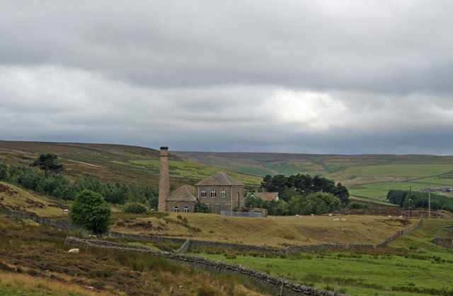
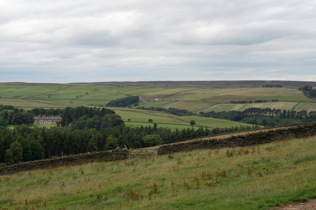
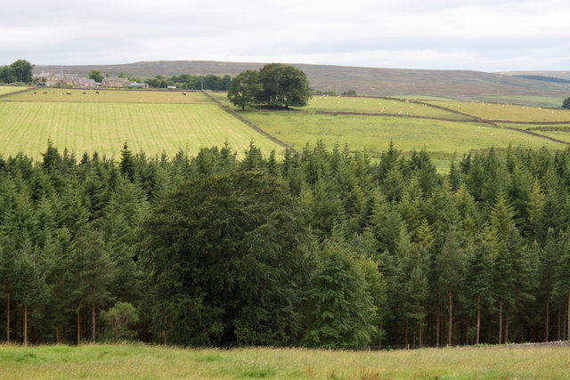
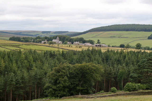
Townfield is a small village located in County Durham, in the northeast of England. Situated about 7 miles southwest of the city of Durham, Townfield is nestled amidst picturesque countryside, offering residents and visitors a peaceful and rural environment.

The village itself is characterized by a traditional English charm, with a scattering of quaint cottages and well-maintained gardens. The community of Townfield is close-knit, fostering a strong sense of belonging and camaraderie among its residents. The village is home to a small population, estimated to be around 500 people, creating a close community atmosphere.

Although Townfield is predominantly residential, it benefits from its proximity to Durham city, with easy access to a range of amenities and services. The city provides opportunities for employment, education, and shopping, making Townfield an ideal location for those seeking a tranquil rural lifestyle without being too far from urban conveniences.

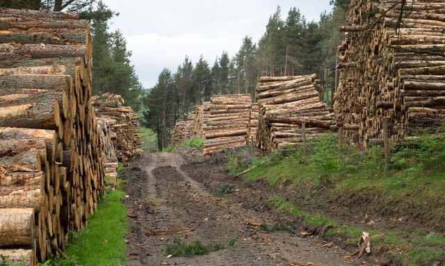
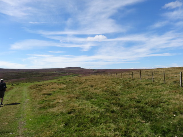
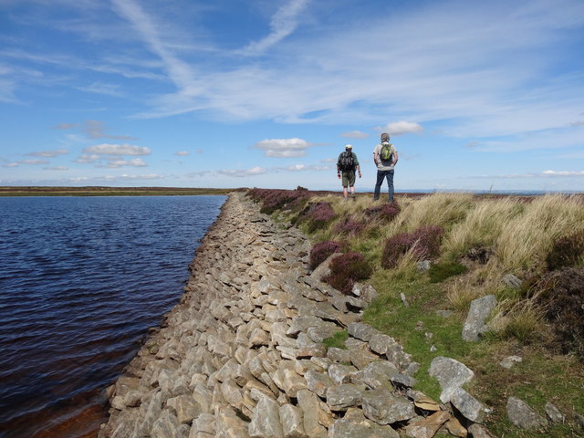
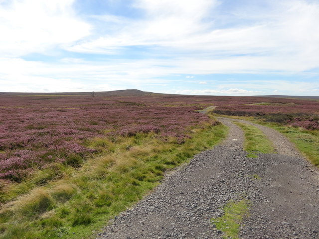
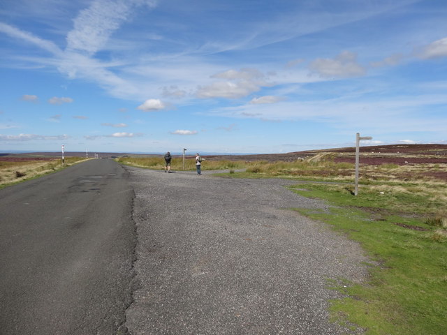
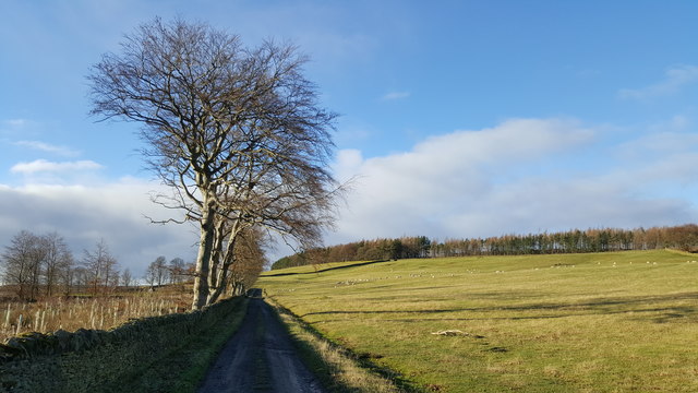
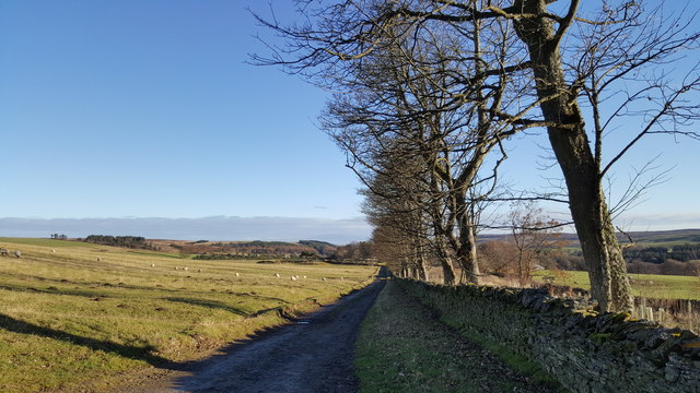
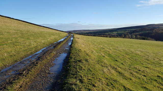
Surrounded by beautiful natural landscapes, Townfield offers ample opportunities for outdoor activities. The village is close to the River Wear, which provides scenic walks and fishing spots. Additionally, the nearby Durham Dales and North Pennines Area of Outstanding Natural Beauty offer stunning countryside vistas, perfect for hiking, cycling, and exploring.

Overall, Townfield presents an idyllic rural retreat with a strong sense of community, while still providing access to the wider amenities and opportunities available in Durham city.

If you have any feedback on the listing, please let us know in the comments section below.
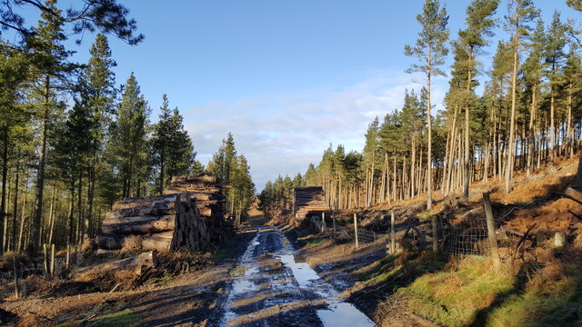
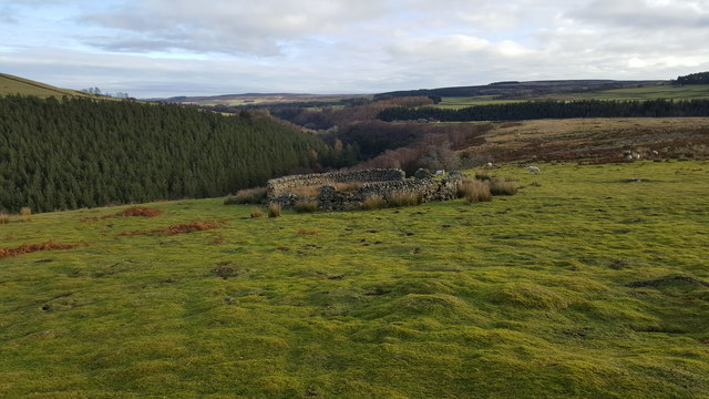
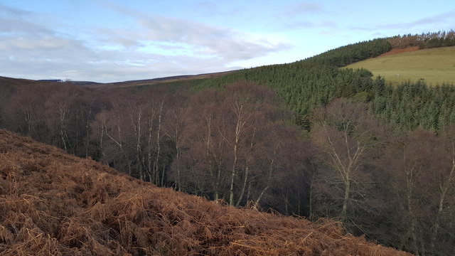
Townfield Images

Images are sourced within 2km of 54.829635/-2.0777849 or Grid Reference NY9548. Thanks to Geograph Open Source API. All images are credited.

Presser Pumping Station near the top of Bale Hill Consett Water Company established in 1859 merged and became the Weardale and Consett Water Company in 1902. Some time late in the 19th or early 20th century one of the two former companies had taken over the engine house of closed Derwent Lead Mines and developed this Grade II Listed pumping house to supply water to Consett. It is reported that they started paying rent to the estate in 1902 and the rent in 1911 was £360.
Presser Pumping Station near the top of Bale Hill
Consett Water Company established in 1859 merged and became the Weardale and Consett Water Company in 1902. Some time late in the 19th or early 20th century one of the two former companies had taken over the engine house of closed Derwent Lead Mines and developed this Grade II Listed pumping house to supply water to Consett. It is reported that they started paying rent to the estate in 1902 and the rent in 1911 was £360.
Newbiggin Hall and Birkside Farm from Bale Hill The Reverend Daniel Capper sold up Newbiggin and Hunstanworth estate by auction in London on 1st August 1865. The sales brochure describes the mansion house of Newbiggin as the jewel in the estate crown. Rev Capper had recently spent £30,000 on new farm buildings, the latest water power machinery and rebuilding the estate cottages "with four rooms each". Kelly's Directory 1894 tells us it is owned by Edward Joicey esq. J.P. Pevsner documents that the house was rebuilt in Neo-classical style in 1906 after a fire of 1904 from a Latin inscription on the west wall. Reports indicate it has been a First World War sanatorium, a turkey farm and hotel and was more recently owned by a member of the Arabian royal family who stays a couple of times a year for the grouse shooting.
Newbiggin Hall and Birkside Farm from Bale Hill
The Reverend Daniel Capper sold up Newbiggin and Hunstanworth estate by auction in London on 1st August 1865. The sales brochure describes the mansion house of Newbiggin as the jewel in the estate crown. Rev Capper had recently spent £30,000 on new farm buildings, the latest water power machinery and rebuilding the estate cottages "with four rooms each". Kelly's Directory 1894 tells us it is owned by Edward Joicey esq. J.P. Pevsner documents that the house was rebuilt in Neo-classical style in 1906 after a fire of 1904 from a Latin inscription on the west wall. Reports indicate it has been a First World War sanatorium, a turkey farm and hotel and was more recently owned by a member of the Arabian royal family who stays a couple of times a year for the grouse shooting.
View to East High House Farm from Bale Hill
Hunstanworth from Bale Hill Hunstanworth is one of the 'Thankful Villages' (a term popularised by the writer Arthur Mee in the 1930s) that suffered no fatalities during the Great War of 1914-1918. The unusual patterns in the roof tiles was a creation of architect Samuel Sanders Teulon who had been commissioned by Reverend Daniel Capper, landowner who would stay in Newbiggin Hall during the grouse shooting season, to build a new church, school, reading room, shop and workers' terraced cottages in 1863. The distinctive diamond-patterned, steep-pitched roofs and Victorian Gothic detail make Hunstanworth unique among the villages of the North Pennines. Closure of the local lead mines in the 1880s diminished the 800 strong population (778 in 1861) to just 200 by 1901. The population of the village in 2011 was 116. John Marius Wilson's Imperial Gazetteer of England and Wales of 1870-72 informs us that "the church was rebuilt in 1865, at a cost of £2,500".
Hunstanworth from Bale Hill
Hunstanworth is one of the 'Thankful Villages' (a term popularised by the writer Arthur Mee in the 1930s) that suffered no fatalities during the Great War of 1914-1918. The unusual patterns in the roof tiles was a creation of architect Samuel Sanders Teulon who had been commissioned by Reverend Daniel Capper, landowner who would stay in Newbiggin Hall during the grouse shooting season, to build a new church, school, reading room, shop and workers' terraced cottages in 1863. The distinctive diamond-patterned, steep-pitched roofs and Victorian Gothic detail make Hunstanworth unique among the villages of the North Pennines. Closure of the local lead mines in the 1880s diminished the 800 strong population (778 in 1861) to just 200 by 1901. The population of the village in 2011 was 116. John Marius Wilson's Imperial Gazetteer of England and Wales of 1870-72 informs us that "the church was rebuilt in 1865, at a cost of £2,500".
Timber stacks alongside estate road The road passes between Beldon High and Beldon Low Plantations on the north side of the valley of the Beldon Burn.
Timber stacks alongside estate road
The road passes between Beldon High and Beldon Low Plantations on the north side of the valley of the Beldon Burn.
Footpath towards Sikehead Dams
Sikehead Dam
Sikehead Dam
Sikehead reservoir and Bolt's Law
Track towards Sikehead Dams
Meadows Edge Road towards Baybridge Choice of Bridleway or footpath
Meadows Edge Road towards Baybridge
Choice of Bridleway or footpath
Road between Baybridge and Newbiggin House and Hall This is a private road to the homes on this lane, however it carries a footpath up  the valley to the fells.
Road between Baybridge and Newbiggin House and Hall
This is a private road to the homes on this lane, however it carries a footpath up the valley to the fells.
Track by Long Plantation
Track in grazing field between High and Low Beldon Plantations
Timber stacks either side of track in Low Beldon Plantation
Sheepfold at Nookton East Park
Footpath between Nookton East Park and Gibraltar Banks
Natural Birch woodland and Low Beldon Pine Plantation beyond
Show me another place!

Townfield is located at Grid Ref: NY9548 (Lat: 54.829635, Lng: -2.0777849)

Unitary Authority: County Durham

Police Authority: Durham

What 3 Words

///tablet.exhaling.shams. Near Muggleswick, Co. Durham

Related Wikis

Townfield

Townfield is a village in County Durham, in England. It is situated just to the south of Hunstanworth and part of that parish, about 10 miles (16 km) west...

Hunstanworth

Hunstanworth is a village in County Durham, England. It is situated approximately 10 miles to the west of Consett, south-west of the village of Blanchland...

Ramshaw, Consett

Ramshaw is a small village in County Durham, in England. It is situated to the south of Hunstanworth, a few miles west of Consett. Lead mining was an important...

Beldon Burn

Beldon Burn is a headwater stream of the River Derwent in Northumberland and County Durham, England.It rises at Quickcleugh Moss as the Quickcleugh Burn...

Nearby Amenities

Located within 500m of 54.829635,-2.0777849
Townfield
Place: hamlet
Wikidata: Q7830113
Wikipedia: en:Townfield
Lat/Long: 54.8295787/-2.077821
High House
Addr City: Consett
Addr Postcode: DH8 9UN
Place: isolated_dwelling
Source Postcode: CodePoint Open
Lat/Long: 54.8318149/-2.0788449
Post Box
Ref: DH8 18
Lat/Long: 54.8297843/-2.077754
Bus Stop
Townfield
Naptan AtcoCode: 13001078A
Naptan Bearing: N
Naptan CommonName: Townfield
Naptan Indicator: north bound
Naptan Landmark: Landmark not known
Naptan NaptanCode: duradagd
Naptan Notes: Opposite South View.
Naptan Street: Unclassified Road
Naptan Verified: no
Source: naptan_import
Lat/Long: 54.8297486/-2.0779431
Bus Stop
Townfield
Naptan AtcoCode: 13001078E
Naptan Bearing: S
Naptan CommonName: Townfield
Naptan Indicator: south bound
Naptan Landmark: Landmark not known
Naptan NaptanCode: duradagj
Naptan Notes: 1 Townfield Cottages.
Naptan Street: Unclassified Road
Naptan Verified: no
Source: naptan_import
Lat/Long: 54.8297487/-2.0777407
Giant's Stride
Disused: yes
Wikidata: Q26523644
Lat/Long: 54.8302634/-2.0774721
Power: pole
Lat/Long: 54.8314109/-2.0802422
Power: pole
Lat/Long: 54.8314341/-2.0795354
Power: pole
Lat/Long: 54.8314627/-2.0788313
Power: pole
Lat/Long: 54.8312054/-2.0783177
Power: pole
Lat/Long: 54.8309521/-2.0778067
Power: pole
Lat/Long: 54.8306933/-2.0772877
Power: pole
Lat/Long: 54.8314333/-2.0764066
Power: pole
Lat/Long: 54.8320683/-2.0764871
Power: pole
Lat/Long: 54.8327295/-2.076585
Power: pole
Lat/Long: 54.8333652/-2.076699
The data included in this document is from www.openstreetmap.org. The data is made available under ODbL.

Have you been to Townfield?

Leave your review of Townfield below (or comments, questions and feedback).