Town End

Settlement in Buckinghamshire

England

Town End

View looking East towards Bennett End This photo shows the track, known as Collier's Lane, looking East towards Bennett End from Hallbottom Farm. Beechwood Shaw can be seen on the left beyond the field of crops.
View looking East towards Bennett End Credit: David Hillas

Town End is a small village located in the county of Buckinghamshire, England. Situated in the southern part of the county, it lies approximately 6 miles northwest of the town of Aylesbury. Despite its small size, Town End is known for its picturesque countryside and charming rural atmosphere.

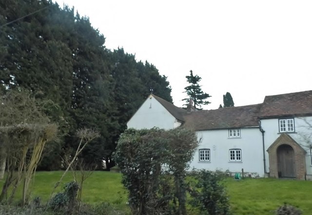
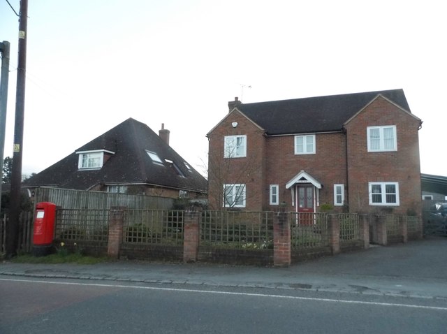
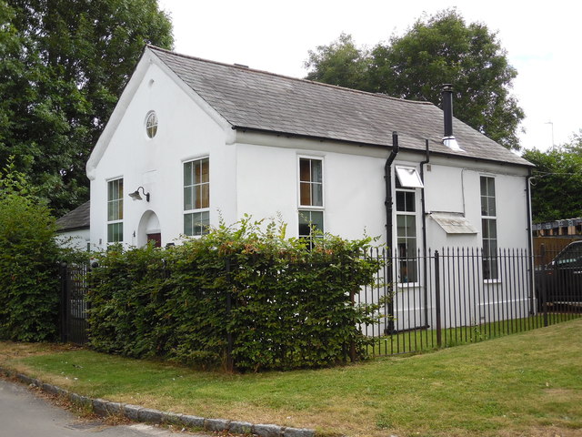
The village is characterized by its traditional architecture, with many historic buildings dating back to the 18th and 19th centuries. The centerpiece of the village is the St. Mary's Church, a beautiful medieval church that stands as a reminder of the area's long history. The village also features a handful of quaint cottages and a local pub that serves as a gathering place for residents.

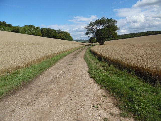
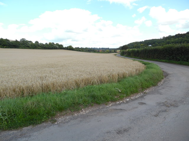
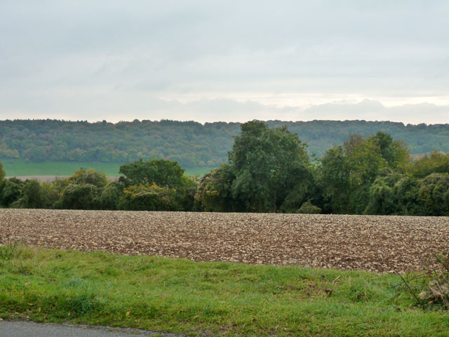
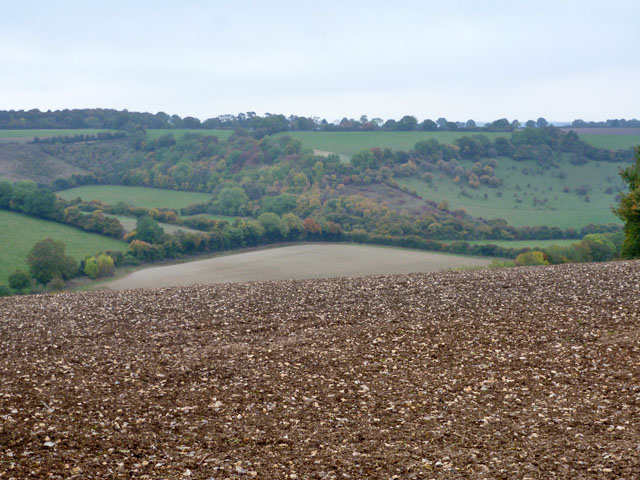
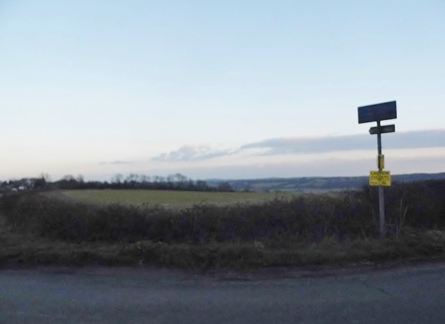
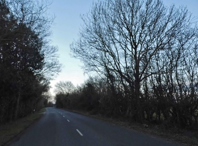
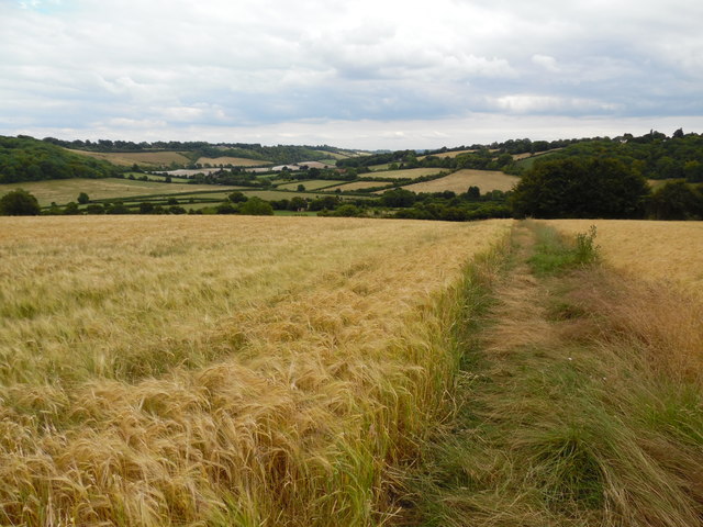
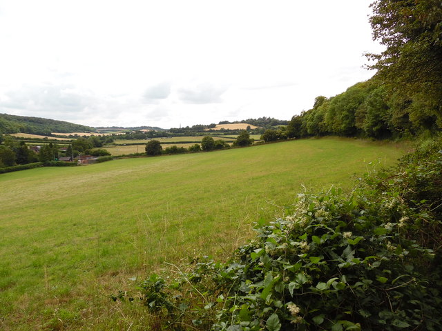
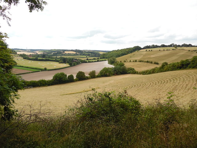
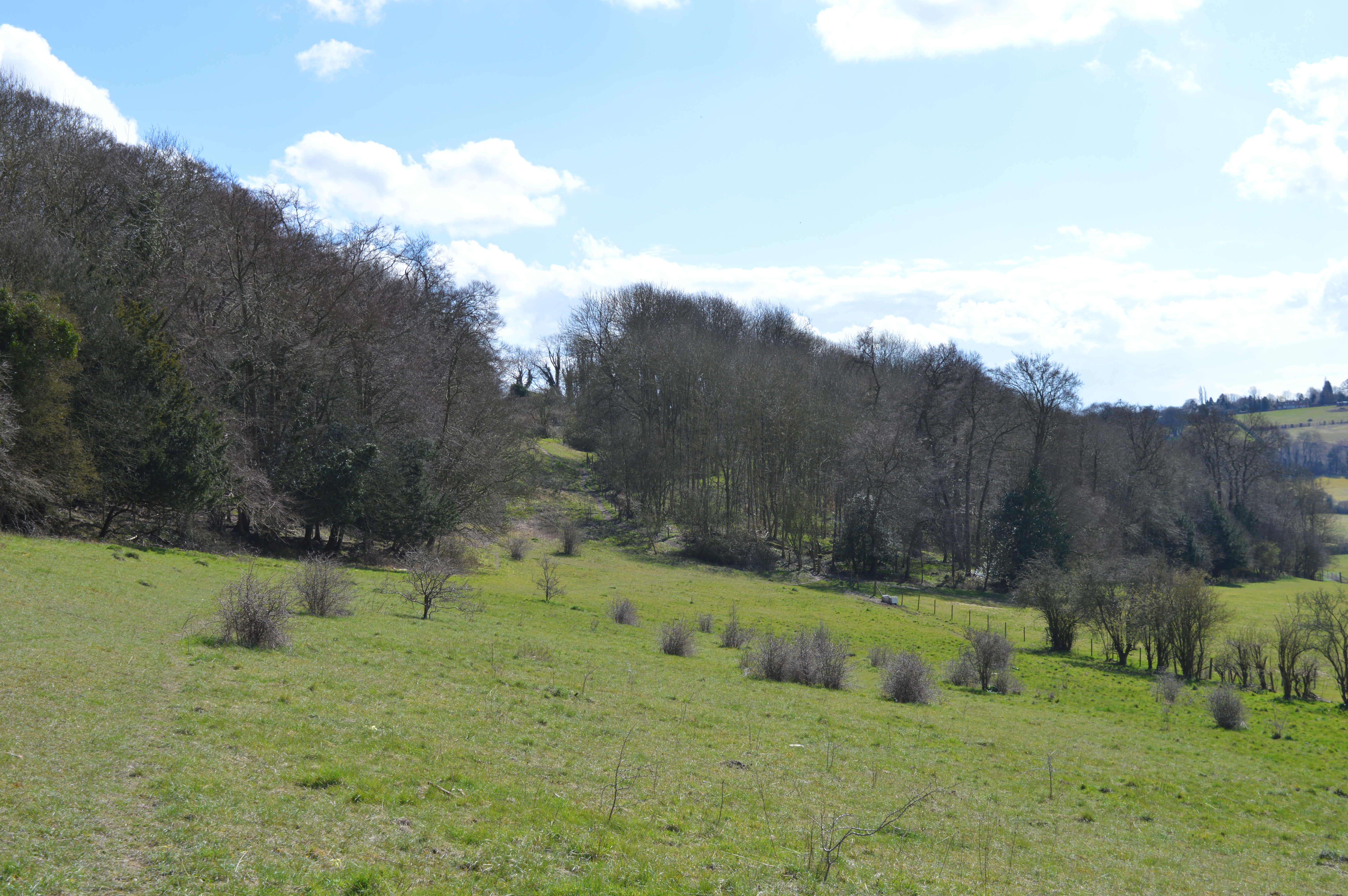
Surrounded by rolling hills and lush green fields, Town End offers ample opportunities for outdoor activities such as hiking, cycling, and horseback riding. The nearby countryside provides stunning views and peaceful surroundings, making it an ideal place for nature lovers and those seeking a tranquil escape from city life.

While Town End is primarily a residential area, it benefits from its proximity to larger towns and cities. The bustling market town of Aylesbury is easily accessible, offering a range of amenities including shopping centers, restaurants, and entertainment options. Additionally, Town End benefits from its location within the Buckinghamshire countryside, allowing residents to enjoy the best of both worlds - a peaceful village setting with convenient access to urban amenities.

If you have any feedback on the listing, please let us know in the comments section below.

Town End Images

Images are sourced within 2km of 51.673212/-0.869798 or Grid Reference SU7897. Thanks to Geograph Open Source API. All images are credited.

View looking East towards Bennett End This photo shows the track, known as Collier's Lane, looking East towards Bennett End from Hallbottom Farm. Beechwood Shaw can be seen on the left beyond the field of crops.
View looking East towards Bennett End
This photo shows the track, known as Collier's Lane, looking East towards Bennett End from Hallbottom Farm. Beechwood Shaw can be seen on the left beyond the field of crops.
View looking West near Hallbottom Farm This photo shows a view looking West from Collier's Lane towards the edge of the Chiltern Hills. Lott Wood can be seen towards the right of the photo, whilst the BT radio tower, Northwest of Stokenchurch can be seen on the horizon, SU7496 refers.
View looking West near Hallbottom Farm
This photo shows a view looking West from Collier's Lane towards the edge of the Chiltern Hills. Lott Wood can be seen towards the right of the photo, whilst the BT radio tower, Northwest of Stokenchurch can be seen on the horizon, SU7496 refers.
View looking East towards Bennett End This photo shows Grange Farm Road looking East towards Bennett End. Barley can be seen in this field before it is harvested.
View looking East towards Bennett End
This photo shows Grange Farm Road looking East towards Bennett End. Barley can be seen in this field before it is harvested.
Radnage Church of England Primary School The older part - a more modern part is off to the right.
Radnage Church of England Primary School
The older part - a more modern part is off to the right.
Radnage church St. Mary's.
Radnage church
St. Mary's.
View south from Sprigs Holly Lane A very flinty field, often the case in high areas of chalk land where the elements have dissolved the chalk away.
View south from Sprigs Holly Lane
A very flinty field, often the case in high areas of chalk land where the elements have dissolved the chalk away.
View north-east from Sprigs Holly Lane
Path and field entrance on Chinnor Road
Cottage on Chinnor Road
Radnage Lane, Bledlow Ridge
Fields by Radnage Lane
Chinnor Road, Rout's Green
Houses on Chinnor Road, Bledlow Ridge The portaloo was a bonus
Houses on Chinnor Road, Bledlow Ridge
The portaloo was a bonus
Houses on Chinnor Road, Bledlow Ridge
Former Methodist Church, Radnage Situated in Green End Road at the junction with Radnage Common Road, this church dates from 1865 and was one of several churches in the High Wycombe Methodist Circuit. Services were held here each Sunday at 3.00pm until the final service took place on Sunday 23rd March 2003. It was then converted into a private dwelling.
Former Methodist Church, Radnage
Situated in Green End Road at the junction with Radnage Common Road, this church dates from 1865 and was one of several churches in the High Wycombe Methodist Circuit. Services were held here each Sunday at 3.00pm until the final service took place on Sunday 23rd March 2003. It was then converted into a private dwelling.
View above Bennett End Taken in a field full of barley below Andridge Farm, this view is looking south east towards The City and the surrounding Chiltern Hills.
View above Bennett End
Taken in a field full of barley below Andridge Farm, this view is looking south east towards The City and the surrounding Chiltern Hills.
View from Yoesden Wood This photo shows a view of fields looking westwards from Yoesden Wood towards Stokenchurch. The houses to the left of the photo are in Bottom Road.
View from Yoesden Wood
This photo shows a view of fields looking westwards from Yoesden Wood towards Stokenchurch. The houses to the left of the photo are in Bottom Road.
View from near Bledlow Ridge (1) This photo shows a typical Chiltern view looking north west towards Yoesden Wood and Radnage from the path between Bledlow Ridge and Bottom Wood.
View from near Bledlow Ridge (1)
This photo shows a typical Chiltern view looking north west towards Yoesden Wood and Radnage from the path between Bledlow Ridge and Bottom Wood.
Show me another place!

Town End is located at Grid Ref: SU7897 (Lat: 51.673212, Lng: -0.869798)

Unitary Authority: Buckinghamshire

Police Authority: Thames Valley

What 3 Words

///baker.track.trump. Near Stokenchurch, Buckinghamshire

Related Wikis

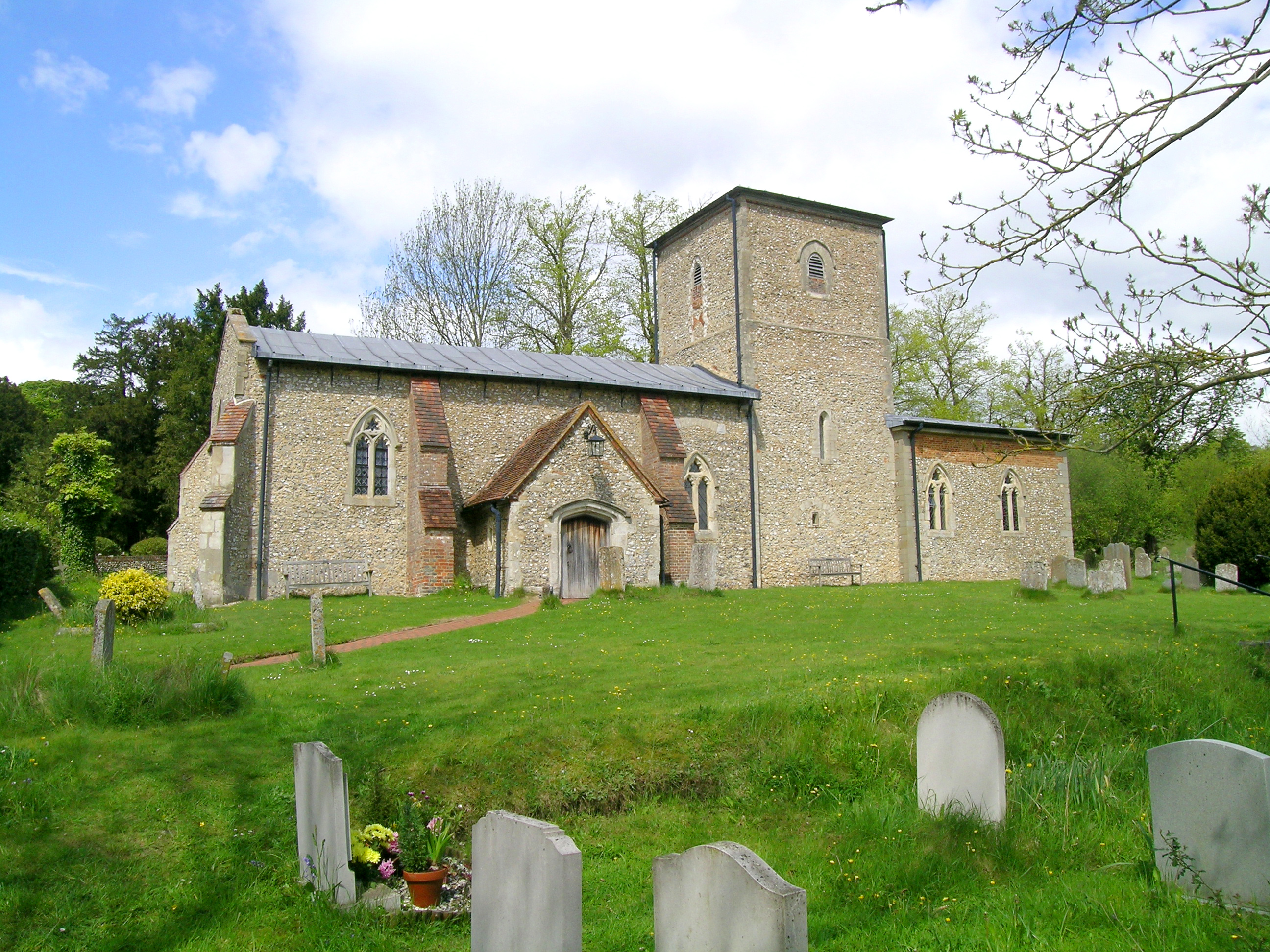
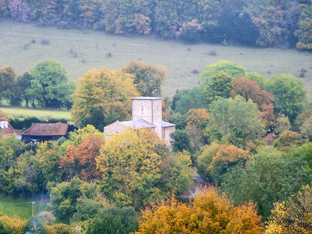
St Mary the Virgin, Radnage

St Mary the Virgin is the parish church of Radnage in Buckinghamshire, situated towards the northeastern edge of the village. The church is part of the...

Radnage

Radnage is a village and civil parish in the Buckinghamshire district of Buckinghamshire, England. It is in the Chiltern Hills about two miles north east...

Bennett End

Bennett End is a hamlet near Radnage and Bledlow Ridge in Buckinghamshire, England. At the 2011 Census the population of the hamlet was included in the...

Yoesden

Yoesden, often known as Yoesden Bank, is a 13-hectare (32-acre) nature reserve in Bledlow Ridge in Buckinghamshire. It is managed by the Berkshire, Buckinghamshire...

Nearby Amenities

Located within 500m of 51.673212,-0.869798
Radnage
Description: village in Buckinghamshire, United Kingdom
Place: village
Wikidata: Q1925344
Lat/Long: 51.6727686/-0.8674128
Bench
Dedication: Don & Joan Britnell
Lat/Long: 51.6747971/-0.8642101
Bench
Lat/Long: 51.6747591/-0.8644837
Barrier: stile
Lat/Long: 51.6722846/-0.8699668
Barrier: stile
Lat/Long: 51.6724087/-0.8693005
Bench
Backrest: yes
Lat/Long: 51.674651/-0.8640079
Bench
Backrest: yes
Lat/Long: 51.6745898/-0.8646342
Bench
Backrest: yes
Lat/Long: 51.6745362/-0.864598
Direction: 160
Generator Method: photovoltaic
Generator Output Electricity: yes
Generator Solar Modules: 16
Generator Source: solar
Generator Type: solar_photovoltaic_panel
Location: roof
Power: generator
Lat/Long: 51.6736942/-0.8682545
The data included in this document is from www.openstreetmap.org. The data is made available under ODbL.

Have you been to Town End?

Leave your review of Town End below (or comments, questions and feedback).