Town End

Settlement in Yorkshire

England

Town End

Gas works on Outgang Northern Gas Networks were laying new HDPE gas mains, and the 4-way traffic control of the junction with Raynville Road would cause disruption for a few weeks.
Gas works on Outgang Credit: Stephen Craven

Town End is a charming village located in the county of Yorkshire, in the northern part of England. Situated amidst the picturesque landscape of the Yorkshire Dales, Town End offers residents and visitors a serene and idyllic setting. The village is known for its rich history, dating back several centuries.

With its cobbled streets and quaint stone houses, Town End exudes a sense of old-world charm. The village is surrounded by lush green meadows and rolling hills, making it a popular destination for nature lovers and outdoor enthusiasts. The nearby River Wharfe adds to the village's beauty, offering opportunities for leisurely walks and picnics by the water.

Despite its small size, Town End boasts a close-knit community and a range of amenities for its residents. The village is home to a local pub, a small grocery store, and a primary school, ensuring that the everyday needs of its inhabitants are met. Additionally, the village has a village hall which hosts various community events and gatherings throughout the year.

Town End is conveniently located near several popular attractions in Yorkshire, including the historic Bolton Abbey and the bustling market town of Skipton. The village also serves as a gateway to the stunning Yorkshire Dales National Park, offering visitors the opportunity to explore its breathtaking landscapes and enjoy activities such as hiking, cycling, and wildlife spotting.

In summary, Town End is a delightful village in Yorkshire that offers a tranquil and picturesque setting, a strong sense of community, and convenient access to the natural beauty of the Yorkshire Dales.

If you have any feedback on the listing, please let us know in the comments section below.
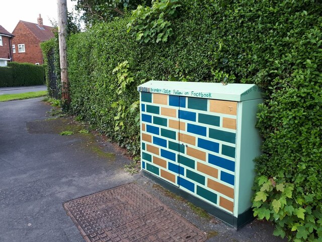
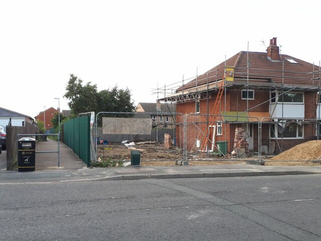
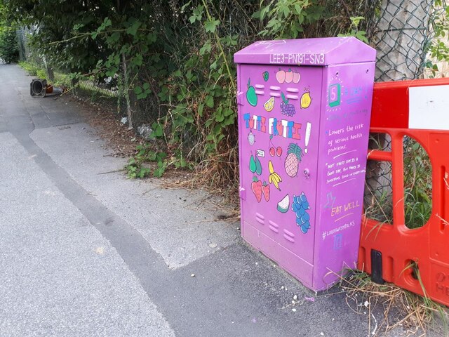
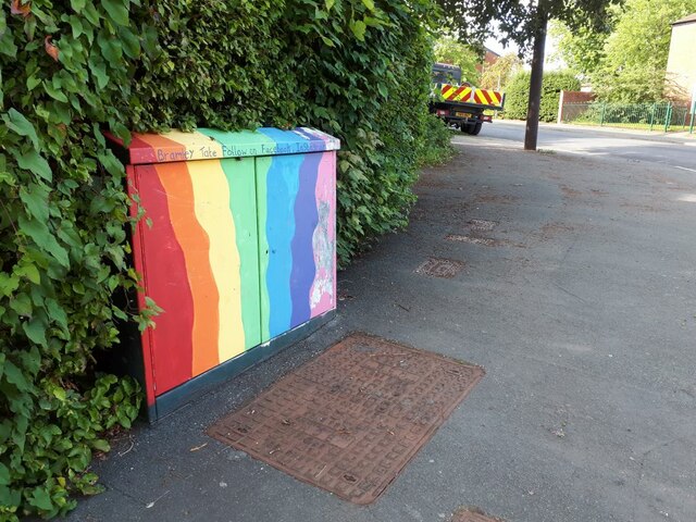
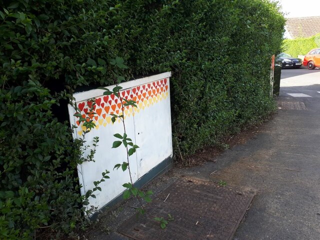
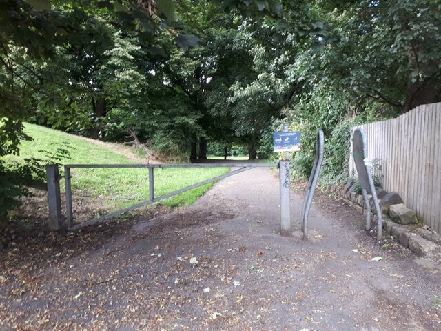
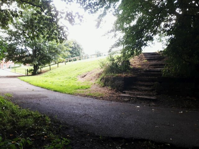
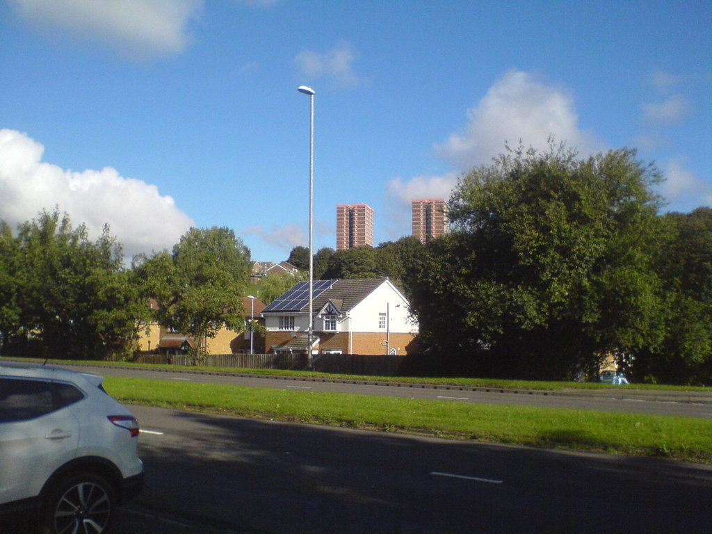
Town End Images

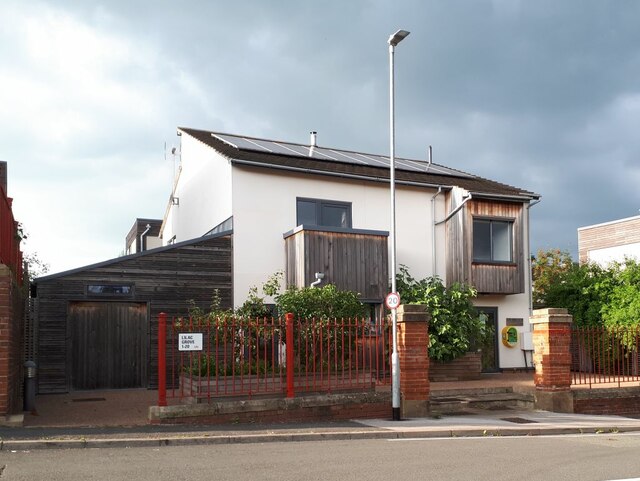
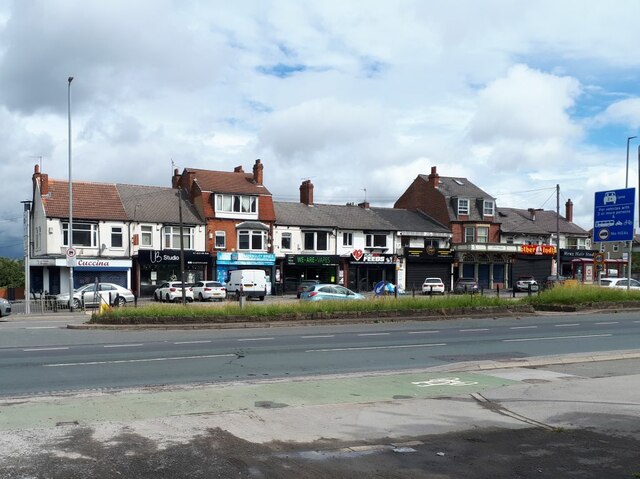
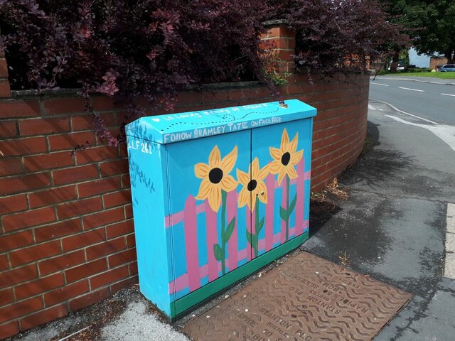
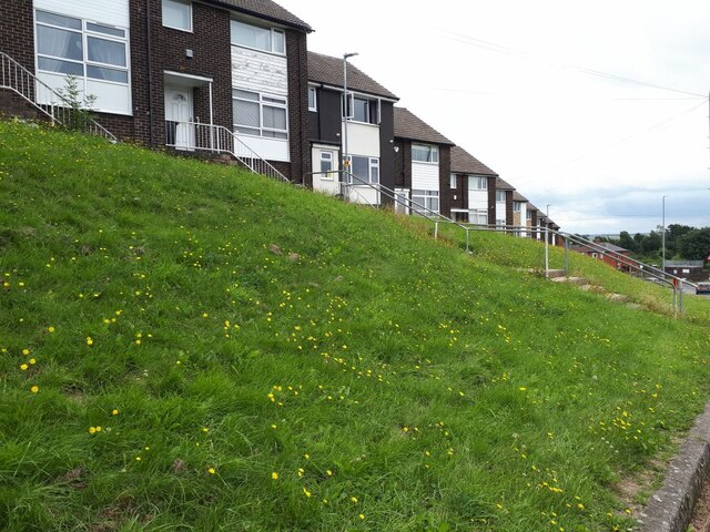
Images are sourced within 2km of 53.805742/-1.620344 or Grid Reference SE2534. Thanks to Geograph Open Source API. All images are credited.

Gas works on Outgang Northern Gas Networks were laying new HDPE gas mains, and the 4-way traffic control of the junction with Raynville Road would cause disruption for a few weeks.
Gas works on Outgang
Northern Gas Networks were laying new HDPE gas mains, and the 4-way traffic control of the junction with Raynville Road would cause disruption for a few weeks.
Gas works on Outgang - detail Outgang, as the name suggests, is one of the oldest routes in this part of Leeds, originally linking Kirkstall Abbey with the chapel of ease in Bramley. This neatly cut utility trench gave the opportunity to view the layers of old road construction. For context see <a href="https://www.geograph.org.uk/photo/7690402">SE2435 : Gas works on Outgang</a>.
Gas works on Outgang - detail
Outgang, as the name suggests, is one of the oldest routes in this part of Leeds, originally linking Kirkstall Abbey with the chapel of ease in Bramley. This neatly cut utility trench gave the opportunity to view the layers of old road construction. For context see SE2435 : Gas works on Outgang.
Defibrillator, Lilac Grove The defibrillator is on one of the houses in Lilac Grove on Victoria Park Avenue. I presume it's intended for public use when needed.
Defibrillator, Lilac Grove
The defibrillator is on one of the houses in Lilac Grove on Victoria Park Avenue. I presume it's intended for public use when needed.
Road closed at Wyther Lane bridge Nearly five months after the collision that damaged the bridge parapets <a href="https://www.geograph.org.uk/photo/6778612">SE2535 : Damage to Wyther Lane bridge</a>, work had begin on the repair. It was due to last three weeks, but one week into that period only a crash deck had been installed below the bridge.
Road closed at Wyther Lane bridge
Nearly five months after the collision that damaged the bridge parapets SE2535 : Damage to Wyther Lane bridge, work had begin on the repair. It was due to last three weeks, but one week into that period only a crash deck had been installed below the bridge.
Crash deck, Wyther Lane bridge Nearly five months after the collision that damaged the bridge parapets <a href="https://www.geograph.org.uk/photo/6778612">SE2535 : Damage to Wyther Lane bridge</a>, work had begin on the repair. It was due to last three weeks, but one week into that period only this crash deck had been installed below the bridge to stop debris falling into the canal or onto the towpath. <a href="https://www.geograph.org.uk/photo/4598825">SE2535 : Wyther Lane canal bridge</a> shows the bridge with parapet intact, some years earlier.
Crash deck, Wyther Lane bridge
Nearly five months after the collision that damaged the bridge parapets SE2535 : Damage to Wyther Lane bridge, work had begin on the repair. It was due to last three weeks, but one week into that period only this crash deck had been installed below the bridge to stop debris falling into the canal or onto the towpath. SE2535 : Wyther Lane canal bridge shows the bridge with parapet intact, some years earlier.
Bench by the canal The canal is actually just off to the right of the photo, and the bench which is adjacent to a path through woodland on the canal bank affords a view of it.  This is not the official towpath, which is on the opposite bank.
Bench by the canal
The canal is actually just off to the right of the photo, and the bench which is adjacent to a path through woodland on the canal bank affords a view of it. This is not the official towpath, which is on the opposite bank.
Gotts Park golf course There was no-one playing, despite this being a sunny summer evening.
Gotts Park golf course
There was no-one playing, despite this being a sunny summer evening.
Wyther Parade A row of shops on the north side of Stanningley Road, occupying an eclectic set of buildings, so clearly not planned as a shopping parade.  As of 2021 it comprises Cuccina (takeaway), UB Studio (hairdresser, formerly EGAS <a href="https://www.geograph.org.uk/photo/1765111">SE2534 : Everall Gas Appliance Spares - Stanningley Road</a>), Stanningley Wines (convenience store), We Are Vapes (formerly Daniels Cafe <a href="https://www.geograph.org.uk/photo/2373787">SE2534 : Daniels Cafe & Take Away - Stanningley Road</a>), Pure Raw Feeds, Burgerama, FibreMold, Mother India (another takeaway) and Menz (sic) Hair Studio.
Wyther Parade
A row of shops on the north side of Stanningley Road, occupying an eclectic set of buildings, so clearly not planned as a shopping parade. As of 2021 it comprises Cuccina (takeaway), UB Studio (hairdresser, formerly EGAS SE2534 : Everall Gas Appliance Spares - Stanningley Road), Stanningley Wines (convenience store), We Are Vapes (formerly Daniels Cafe SE2534 : Daniels Cafe & Take Away - Stanningley Road), Pure Raw Feeds, Burgerama, FibreMold, Mother India (another takeaway) and Menz (sic) Hair Studio.
Trevor's memorial box A recent work by the Bramley Tate group, maybe commissioned specially for the family of someone called Trevor in whose loving memory it is dedicated. This is on the corner of Trescoe Avenue.
Trevor's memorial box
A recent work by the Bramley Tate group, maybe commissioned specially for the family of someone called Trevor in whose loving memory it is dedicated. This is on the corner of Trescoe Avenue.
August dandelions August seems rather late in the year for this fine display of dandelions, usually thought of as a spring flower. But the plantlife.org.uk website says they can flower as late as October. For a wider view of the houses behind, see <a href="https://www.geograph.org.uk/photo/6614570">SE2533 : Staggered terrace houses, Henconner Lane, Bramley</a>.
August dandelions
August seems rather late in the year for this fine display of dandelions, usually thought of as a spring flower. But the plantlife.org.uk website says they can flower as late as October. For a wider view of the houses behind, see SE2533 : Staggered terrace houses, Henconner Lane, Bramley.
Henconner Lane shops (3) Not counting the Leeds Bacon Company at left, as of 2021 the other shops comprise Jackson's Stores (formerly Premier), Curry Corner (formerly Lighthouse fish and chips <a href="https://www.geograph.org.uk/photo/4643176">SE2533 : Henconner Lane shops (2)</a>), and in the second block Canton Takeaway, TLC hair design, Local Barber (formerly Xerxes), Ewe Move (estate agent - formerly Antique garden <a href="https://www.geograph.org.uk/photo/4643169">SE2533 : Henconner Lane shops</a>), Pizza Corner and one other (not legible).
Henconner Lane shops (3)
Not counting the Leeds Bacon Company at left, as of 2021 the other shops comprise Jackson's Stores (formerly Premier), Curry Corner (formerly Lighthouse fish and chips SE2533 : Henconner Lane shops (2)), and in the second block Canton Takeaway, TLC hair design, Local Barber (formerly Xerxes), Ewe Move (estate agent - formerly Antique garden SE2533 : Henconner Lane shops), Pizza Corner and one other (not legible).
Brick effect box, Landseer Road A recent addition to the Bramley Tate outdoor gallery.
Brick effect box, Landseer Road
A recent addition to the Bramley Tate outdoor gallery.
Sold: one garage The householder on Waterloo Lane is having an extension built, and there was a sign on the fence saying "Garage for sale". Obviously they found a buyer, as only the garage door and concrete floor slab panels remained, stacked against the side fence.

To the left is a path cutting through to Wellington Gardens <a href="https://www.geograph.org.uk/photo/4775123">SE2435 : Footpath from Waterloo Lane to Wellington Gardens</a>.
Sold: one garage
The householder on Waterloo Lane is having an extension built, and there was a sign on the fence saying "Garage for sale". Obviously they found a buyer, as only the garage door and concrete floor slab panels remained, stacked against the side fence. To the left is a path cutting through to Wellington Gardens SE2435 : Footpath from Waterloo Lane to Wellington Gardens.
Tutti Frutti A recent addition, I think, to the painted boxes in this area.  I've included it in the shared description for Bramley Tate but this one is credited to "Leeds West Rocks" which may be a different group of people. The artwork is to encourage healthy eating.
Tutti Frutti
A recent addition, I think, to the painted boxes in this area. I've included it in the shared description for Bramley Tate but this one is credited to "Leeds West Rocks" which may be a different group of people. The artwork is to encourage healthy eating.
Rainbow box A recent addition, I think, to the painted boxes in this area by Bramley Tate. This one is on the corner of Ganners Hill and Wellington Grove.
Rainbow box
A recent addition, I think, to the painted boxes in this area by Bramley Tate. This one is on the corner of Ganners Hill and Wellington Grove.
Box with coloured hearts A recent addition, I think, to the painted boxes in this area by Bramley Tate. This one is on the corner of Ganners Hill and Ganners Road.
Box with coloured hearts
A recent addition, I think, to the painted boxes in this area by Bramley Tate. This one is on the corner of Ganners Hill and Ganners Road.
Entrance to Bramley Fall woods  This entrance is off Leeds and Bradford Road, just east of the football pitches.
Entrance to Bramley Fall woods
This entrance is off Leeds and Bradford Road, just east of the football pitches.
Steps out of Bramley Fall woods  There was a deep contrast between the sunlit playing fields to the left, and the shade of the woods.  The steps are also seen in <a href="https://www.geograph.org.uk/photo/3477659">SE2436 : Steps - Bramley Fall Park</a>.
Steps out of Bramley Fall woods
There was a deep contrast between the sunlit playing fields to the left, and the shade of the woods. The steps are also seen in SE2436 : Steps - Bramley Fall Park.
Show me another place!

Town End is located at Grid Ref: SE2534 (Lat: 53.805742, Lng: -1.620344)

Division: West Riding

Unitary Authority: Leeds

Police Authority: West Yorkshire

What 3 Words

///simple.patio.milk. Near Pudsey, West Yorkshire

Nearby Locations

Town End Hill Top

Related Wikis

Barley Mow, Bramley

Barley Mow was a former home ground of the Bramley rugby league club in Leeds, West Yorkshire, England who moved there in 1881, just two years after their...

McLaren Field

McLaren Field was a rugby league stadium in Bramley, Leeds, England. It was the home of Bramley R.L.F.C. from 1965 to 1995. The ground was also used as...

Bramley, Leeds

Bramley is a district in west Leeds, West Yorkshire, England. It is part of the City of Leeds Ward of Bramley and Stanningley with a population of 21...

Gamble Hill

Gamble Hill is an area of Bramley a few miles away from Leeds city centre, in the City of Leeds District, in the English county of West Yorkshire. The...

Nearby Amenities

Located within 500m of 53.805742,-1.620344
Traffic Signals
Traffic Signals: signal
Traffic Signals Direction: forward
Lat/Long: 53.8035969/-1.6200607
Traffic Signals
Traffic Signals: signal
Traffic Signals Direction: forward
Lat/Long: 53.8049534/-1.6191394
Atm
Lat/Long: 53.8050358/-1.6212513
Traffic Signals
Lat/Long: 53.8080321/-1.6242275
Telephone
Booth: KX100
Covered: booth
Lat/Long: 53.8055507/-1.623712
Turning Circle
Abutters: residential
Lat/Long: 53.8050559/-1.6273128
Motorway Junction
Lat/Long: 53.8047949/-1.6181508
Crossing
Button Operated: yes
Crossing: traffic_signals
Crossing Markings: dots
Lat/Long: 53.8041754/-1.6208169
Crossing
Crossing: uncontrolled
Crossing Ref: zebra
Lat/Long: 53.8059354/-1.6230279
Crossing
Button Operated: yes
Crossing: traffic_signals
Crossing Island: no
Crossing Markings: dots
Tactile Paving: yes
Lat/Long: 53.8040646/-1.6210682
Crossing
Crossing: zebra
Crossing Island: no
Crossing Ref: zebra
Tactile Paving: yes
Lat/Long: 53.8055371/-1.6232177
Crossing
Crossing: uncontrolled
Crossing Island: no
Crossing Markings: zebra
Crossing Ref: zebra
Tactile Paving: yes
Lat/Long: 53.8053971/-1.6218332
The Kar House Leeds
Old Name: Local Garages
Shop: car
Lat/Long: 53.8048236/-1.621025
Traffic Signals
Traffic Signals: signal
Lat/Long: 53.8042736/-1.6206124
Traffic Signals
Traffic Signals: signal
Lat/Long: 53.8039813/-1.6207464
Traffic Signals
Traffic Signals: signal
Lat/Long: 53.8044918/-1.6214897
Traffic Signals
Traffic Signals: signal
Lat/Long: 53.8045094/-1.6213095
Post Box
Operator: Royal Mail
Post Box Type: pillar
Postal Code: LS12
Ref: LS12 647
Lat/Long: 53.8043985/-1.6144517
Turning Circle
Lat/Long: 53.807091/-1.6229724
Crossing
Lat/Long: 53.8056699/-1.6268794
NPK Stores
Addr City: Leeds
Addr Housenumber: 160
Addr Postcode: LS13 3AD
Addr Street: Stanningley Road
Addr Suburb: Bramley
Fhrs Id: 321144
Shop: convenience
Lat/Long: 53.8057491/-1.6267539
Cafe
Bramley Cafe
Addr City: Leeds
Addr Housenumber: 156
Addr Postcode: LS13 3AD
Addr Street: Stanningley Road
Fhrs Id: 1292539
Old Name: Daisy Cafe
Lat/Long: 53.80577/-1.6263443
Fast Food
Daisy Fisheries
Addr City: Leeds
Addr Housenumber: 166
Addr Postcode: LS13 3AD
Addr Street: Stanningley Road
Cuisine: fish_and_chips
Fhrs Id: 1603492
Lat/Long: 53.8057536/-1.6270566
Barrier: bollard
Lat/Long: 53.8055484/-1.6270654
Turning Circle
Lat/Long: 53.8065369/-1.6247538
Parking
Lat/Long: 53.8059863/-1.627237
Turning Circle
Lat/Long: 53.8065026/-1.6276245
Turning Circle
Lat/Long: 53.8070687/-1.6257005
Turning Circle
Lat/Long: 53.8075972/-1.6261746
Turning Circle
Lat/Long: 53.8071094/-1.6252171
Turning Circle
Lat/Long: 53.8073351/-1.6269212
Post Box
Operator: Royal Mail
Postal Code: LS13
Ref: LS13 134
Lat/Long: 53.8082641/-1.6241953
Bus Stop
Cockshott Lane
Bench: yes
Bus: yes
Live Display: yes
Local Ref: 45010995
Naptan AtcoCode: 450010995
Naptan Bearing: E
Naptan CommonName: Cockshott Lane
Naptan Crossing: Cockshott Lane
Naptan Indicator: Stop 45010995
Naptan Landmark: Church
Naptan PlusbusZoneRef: LEEDS
Naptan ShortCommonName: Cockshott Lane
Naptan Street: Stanningley Road
Naptan Verified: yes
Network: Metro
Operator: First
Public Transport: platform
Shelter: yes
Source: naptan_import
Timetable: yes
Lat/Long: 53.8041556/-1.6138265
Bus Stop
Bramley Town End
Bus: yes
Local Ref: 45010993
Naptan AtcoCode: 450010993
Naptan Bearing: E
Naptan CommonName: Bramley Town End
Naptan Crossing: South End Grove
Naptan Indicator: Stop 45010993
Naptan Landmark: Filling Station
Naptan PlusbusZoneRef: LEEDS
Naptan ShortCommonName: Bramley Town End
Naptan Street: Stanningley Road
Naptan Verified: yes
Public Transport: platform
Shelter: yes
Source: naptan_import
Timetable: yes
Lat/Long: 53.8052911/-1.6211069
Bus Stop
Stanningley Road Brighton Grove
Bus: yes
Local Ref: 45012317
Naptan AtcoCode: 450012317
Naptan Bearing: E
Naptan CommonName: Stanningley Road Brighton Grove
Naptan Crossing: Brighton Grove
Naptan Indicator: Stop 45012317
Naptan Landmark: The Daisy PH
Naptan Notes: Adrian requested YEDL to investigate faults 21/03/08
Naptan PlusbusZoneRef: LEEDS
Naptan ShortCommonName: Brighton Grove
Naptan Street: Stanningley Road
Naptan Verified: yes
Public Transport: platform
Shelter: yes
Source: naptan_import
Timetable: yes
Lat/Long: 53.8057286/-1.627509
Turning Circle
Lat/Long: 53.8081972/-1.6241128
Turning Circle
Lat/Long: 53.8061921/-1.6208128
Parking
Lat/Long: 53.805643/-1.6198438
Parking
Access: private
Capacity Disabled: 1
Parking: surface
Lat/Long: 53.8054896/-1.621696
Steps
Lat/Long: 53.8063285/-1.6238019
Barrier: bollard
Lat/Long: 53.806485/-1.6275097
Cycleway: asl
Lat/Long: 53.8037802/-1.6203969
Turning Circle
Lat/Long: 53.8045865/-1.627592
Turning Circle
Lat/Long: 53.8029419/-1.6254206
Turning Circle
Lat/Long: 53.8100701/-1.6194114
Turning Circle
Lat/Long: 53.8097373/-1.6177793
Turning Circle
Lat/Long: 53.8098298/-1.6185471
Turning Circle
Lat/Long: 53.803757/-1.6197815
Turning Circle
Lat/Long: 53.8045422/-1.6186755
Barrier: bollard
Lat/Long: 53.804171/-1.6152738
Post Box
Operator: Royal Mail
Operator Wikidata: Q638098
Postal Code: LS13
Ref: LS13 942
Royal Cypher: EIIR
Lat/Long: 53.8037727/-1.619553
Turning Circle
Lat/Long: 53.8028199/-1.6184291
Bus Stop
Green Hill Road Cockshott Lane
Bus: yes
Local Ref: 45012763
Naptan AtcoCode: 450012763
Naptan Bearing: E
Naptan CommonName: Green Hill Road Cockshott Lane
Naptan Crossing: Cockshott Lane
Naptan Indicator: Stop 45012763
Naptan Landmark: Church
Naptan PlusbusZoneRef: LEEDS
Naptan ShortCommonName: Cockshott Lane
Naptan Street: Green Hill Road
Naptan Verified: no
Public Transport: platform
Source: naptan_import
Lat/Long: 53.8034453/-1.614289
Barrier: bollard
Lat/Long: 53.8035885/-1.614422
Turning Circle
Lat/Long: 53.804506/-1.6142097
Access: no
Barrier: bollard
Bicycle: yes
Foot: yes
Horse: yes
Lat/Long: 53.8044453/-1.6131363
Barrier: bollard
Lat/Long: 53.8056619/-1.6132273
Turning Circle
Lat/Long: 53.8050946/-1.613599
Turning Circle
Lat/Long: 53.8059827/-1.6147593
Prospect Plants
Man Made: works
Lat/Long: 53.8074536/-1.6214766
Everard Gas Appliance Spares
Addr City: Leeds
Addr Housenumber: 150B
Addr Postcode: LS12 2RF
Addr Street: Stanningley Road
Shop: hardware
Lat/Long: 53.8044156/-1.6141524
Michael's Hair Fashions
Addr City: Leeds
Addr Housenumber: 147
Addr Postcode: LS12 2RF
Addr Street: Stanningley Road
Disused Shop: hairdresser
Opening Hours: closed
Lat/Long: 53.8043203/-1.6138916
Power: substation
Lat/Long: 53.8031482/-1.6204018
Bus Stop
Henconner Lane Stanningley Road
Bus: yes
Local Ref: 45010388
Naptan AtcoCode: 450010388
Naptan Bearing: NW
Naptan CommonName: Henconner Lane Stanningley Road
Naptan Crossing: Stanningley Road
Naptan Indicator: Stop 45010388
Naptan Landmark: Garage
Naptan PlusbusZoneRef: LEEDS
Naptan ShortCommonName: Bramley Town End
Naptan Street: Henconner Lane
Naptan Verified: yes
Public Transport: platform
Ref: 45010388
Shelter: yes
Source: naptan_import
Lat/Long: 53.8049463/-1.6219352
Turning Circle
Lat/Long: 53.8071949/-1.6133467
Carl & Paul Barber's
Shop: hairdresser
Lat/Long: 53.8057507/-1.6269417
Beauty Box
Shop: hairdresser
Lat/Long: 53.8057492/-1.626859
Bus Stop
Stanningley Road Green Hill Mount
Bus: yes
Local Ref: 45012319
Naptan AtcoCode: 450012319
Naptan Bearing: W
Naptan CommonName: Stanningley Road Green Hill Mount
Naptan Crossing: Green Hill Mount
Naptan Indicator: Stop 45012319
Naptan PlusbusZoneRef: LEEDS
Naptan ShortCommonName: Green Hill Mount
Naptan Street: Stanningley Road
Naptan Verified: yes
Public Transport: platform
Shelter: no
Source: naptan_import
Timetable: yes
Lat/Long: 53.8045664/-1.6168495
Barrier: cycle_barrier
Cycle Barrier: double
Cycle Barrier Installation: fixed
Foot: yes
Lat/Long: 53.8024876/-1.6205144
Turning Circle
Lat/Long: 53.8014234/-1.621626
Turning Circle
Lat/Long: 53.8029035/-1.6154599
Bus Stop
Green Hill Road Bramley
Bench: yes
Bin: no
Bus: yes
Lit: yes
Local Ref: 45012798
Naptan AtcoCode: 450012798
Naptan Bearing: N
Naptan CommonName: Green Hill Road Bramley
Naptan Crossing: Green Hill Road
Naptan Indicator: Stop 45012798
Naptan Landmark: Bus Depot
Naptan PlusbusZoneRef: LEEDS
Naptan ShortCommonName: Green Hill Road
Naptan Street: Henconner Lane
Naptan Verified: no
Public Transport: platform
Shelter: yes
Source: naptan_import
Tactile Paving: no
Lat/Long: 53.8031595/-1.6203273
Power: substation
Lat/Long: 53.8057504/-1.6259613
Bus Stop
Bramley Town End Bramley
Bus: yes
Local Ref: 45010389
Naptan AtcoCode: 450010389
Naptan Bearing: SE
Naptan CommonName: Bramley Town End Bramley
Naptan Crossing: Stanningley Road
Naptan Indicator: Stop 45010389
Naptan Landmark: BP Garage
Naptan PlusbusZoneRef: LEEDS
Naptan ShortCommonName: Bramley Town End
Naptan Street: Henconner Lane
Naptan Verified: no
Public Transport: platform
Source: naptan_import
Lat/Long: 53.8049962/-1.6216562
Bus Stop
Stanningley Road Houghley Lane
Bus: yes
Local Ref: 45010994
Naptan AtcoCode: 450010994
Naptan Bearing: E
Naptan CommonName: Stanningley Road Houghley Lane
Naptan Crossing: Houghley Lane
Naptan Indicator: Stop 45010994
Naptan PlusbusZoneRef: LEEDS
Naptan ShortCommonName: Houghley Lane
Naptan Street: Stanningley Road
Naptan Verified: yes
Public Transport: platform
Shelter: yes
Source: naptan_import
Timetable: yes
Lat/Long: 53.804537/-1.6157383
Bus Stop
Green Hill Road Green Hill Mount
Bench: no
Bin: no
Bus: yes
Local Ref: 45012761
Naptan AtcoCode: 450012761
Naptan Bearing: E
Naptan CommonName: Green Hill Road Green Hill Mount
Naptan Crossing: Greenhill Mount
Naptan Indicator: Stop 45012761
Naptan PlusbusZoneRef: LEEDS
Naptan ShortCommonName: Greenhill Mount
Naptan Street: Green Hill Road
Naptan Verified: no
Public Transport: platform
Shelter: no
Source: naptan_import
Lat/Long: 53.8036664/-1.6189502
Bus Stop
Green Hill Road Green Hill Mount
Bench: no
Bin: no
Bus: yes
Local Ref: 45012762
Naptan AtcoCode: 450012762
Naptan Bearing: W
Naptan CommonName: Green Hill Road Green Hill Mount
Naptan Crossing: Green Hill Mount
Naptan Indicator: Stop 45012762
Naptan PlusbusZoneRef: LEEDS
Naptan ShortCommonName: Green Hill Mount
Naptan Street: Green Hill Road
Naptan Verified: no
Public Transport: platform
Shelter: no
Source: naptan_import
Lat/Long: 53.8035856/-1.6189661
Bus Stop
Lower Town Street Rossefield Avenue
Bus: yes
Local Ref: 45012796
Naptan AtcoCode: 450012796
Naptan Bearing: N
Naptan CommonName: Lower Town Street Rossefield Avenue
Naptan Crossing: Rossefield Avenue
Naptan Indicator: Stop 45012796
Naptan Notes: Adrian requested YEDL to investigate faults 21/03/08
Naptan PlusbusZoneRef: LEEDS
Naptan ShortCommonName: Rossefield Avenue
Naptan Street: Lower Town Street
Naptan Verified: no
Public Transport: platform
Source: naptan_import
Lat/Long: 53.8084478/-1.6245409
Bus Stop
Lower Town Street Highfield Road
Bus: yes
Local Ref: 45012797
Naptan AtcoCode: 450012797
Naptan Bearing: S
Naptan CommonName: Lower Town Street Highfield Road
Naptan Crossing: Highfield Road
Naptan Indicator: Stop 45012797
Naptan Landmark: Barley Mow PH
Naptan PlusbusZoneRef: LEEDS
Naptan ShortCommonName: Highfield Road
Naptan Street: Lower Town Street
Naptan Verified: no
Public Transport: platform
Source: naptan_import
Lat/Long: 53.8075835/-1.624093
Bus Stop
Henconner Lane Green Hill Road
Bus: yes
Local Ref: 45012799
Naptan AtcoCode: 450012799
Naptan Bearing: S
Naptan CommonName: Henconner Lane Green Hill Road
Naptan Crossing: Green Hill Road
Naptan Indicator: Stop 45012799
Naptan PlusbusZoneRef: LEEDS
Naptan ShortCommonName: Green Hill Road
Naptan Street: Henconner Lane
Naptan Verified: no
Public Transport: platform
Source: naptan_import
Lat/Long: 53.8031577/-1.6201088
Bramley Depot
Naptan AtcoCode: 450029019
Naptan Bearing: SW
Naptan BusStopType: CUS
Naptan CommonName: Bramley Depot
Naptan Landmark: Unknown
Naptan Notes: dummy stop created for real time trigger
Naptan ShortCommonName: Bramley Depot
Naptan Street: Bramley Bus Depot
Naptan Verified: no
Source: naptan_import
Lat/Long: 53.8023881/-1.624018
Crossing
Button Operated: yes
Crossing: traffic_signals
Crossing Markings: dots
Tactile Paving: yes
Lat/Long: 53.8041004/-1.6207335
Traffic Signals
Traffic Signals: signal
Traffic Signals Direction: forward
Lat/Long: 53.8048582/-1.6190989
Turning Circle
Lat/Long: 53.8082001/-1.6266876
Barrier: cycle_barrier
Lat/Long: 53.8068759/-1.6184396
Speed Camera
Maxspeed: 40 mph
Note: On A647 NE bound
Lat/Long: 53.80437/-1.6211694
Bicycle Parking
Lat/Long: 53.8059718/-1.6256309
Post Box
Operator: Royal Mail
Post Box Type: pillar
Postal Code: LS13
Ref: LS13 353
Royal Cypher: GVIR
Royal Cypher Wikidata: Q33102169
Lat/Long: 53.805702/-1.6237963
Waste Basket
Lat/Long: 53.804175/-1.6137807
Street Lamp
Lamp Type: electric
Lat/Long: 53.8041556/-1.6137178
Street Lamp
Lamp Type: electric
Lat/Long: 53.8042551/-1.6143525
Telephone: pole
Lat/Long: 53.8041892/-1.6138431
Entrance: yes
Lat/Long: 53.8057885/-1.6254754
William Hill
Brand: William Hill
Brand Wikidata: Q4053147
Brand Wikipedia: en:William Hill (bookmaker)
Shop: bookmaker
Lat/Long: 53.8074604/-1.623954
Roops
Addr City: Leeds
Addr Housename: Hilltop Commercial Centre
Addr Postcode: LS13 2DN
Addr Street: Houghley Lane
Addr Suburb: Bramley
Addr Unit: 4 8
Shop: bakery
Lat/Long: 53.8083457/-1.6175169
The Marshmallowist
Addr City: Leeds
Addr Housename: Hilltop Commercial Centre
Addr Postcode: LS13 2DN
Addr Street: Houghley Lane
Addr Suburb: Bramley
Addr Unit: 4 5
Lat/Long: 53.808371/-1.6177368
Cafe
Canteen
Addr City: Leeds
Addr Housename: First Bus Depot
Addr Postcode: LS13 4LD
Addr Street: Henconner Lane
Addr Suburb: Bramley
Fhrs Id: 1016321
Lat/Long: 53.8021795/-1.6233453
Traffic Signals
Traffic Signals: signal
Lat/Long: 53.8037438/-1.6202417
Give Way
Lat/Long: 53.8036347/-1.6200489
Traffic Signals
Traffic Signals: request_button
Traffic Signals Direction: forward
Lat/Long: 53.804166/-1.6206965
Waste Basket
Collection Times: Mo; Th
Condition: GOOD
Ref UK Leedscc Bin: 3024
Waste Basket Model: METAL SQUARE
Lat/Long: 53.804262/-1.614345
Waste Basket
Collection Times: Mo; Th
Condition: GOOD
Ref UK Leedscc Bin: 4647
Waste Basket Model: METAL SQUARE
Lat/Long: 53.804615/-1.618648
Waste Basket
Collection Times: Mo; Th
Condition: GOOD
Ref UK Leedscc Bin: 1622
Waste Basket Model: METAL SQUARE
Lat/Long: 53.806222/-1.6172959
Waste Basket
Collection Times: Mo; Th
Condition: GOOD
Ref UK Leedscc Bin: 4642
Waste Basket Model: METAL SQUARE
Lat/Long: 53.805321/-1.621028
Waste Basket
Collection Times: Mo; Th
Condition: FAIR
Ref UK Leedscc Bin: 4646
Waste Basket Model: METAL TWIN
Lat/Long: 53.805009/-1.621465
Waste Basket
Collection Times: Mo; Th
Condition: GOOD
Ref UK Leedscc Bin: 1423
Waste Basket Model: METAL SQUARE
Lat/Long: 53.801248/-1.620102
Waste Basket
Collection Times: Mo; Th
Condition: FAIR
Ref UK Leedscc Bin: 4645
Waste Basket Model: METAL TWIN
Lat/Long: 53.804868/-1.621948
Waste Basket
Collection Times: We; Sa
Condition: FAIR
Ref UK Leedscc Bin: 5762
Waste Basket Model: METAL TWIN
Lat/Long: 53.80801/-1.619193
Waste Basket
Collection Times: Mo; Th
Condition: FAIR
Ref UK Leedscc Bin: 4651
Waste Basket Model: METAL TWIN
Lat/Long: 53.805619/-1.62325
Waste Basket
Collection Times: Mo; Th
Condition: FAIR
Ref UK Leedscc Bin: 4643
Waste Basket Model: METAL TWIN
Lat/Long: 53.805516/-1.623895
Waste Basket
Collection Times: We; Sa
Condition: GOOD
Ref UK Leedscc Bin: 5764
Waste Basket Model: METAL SQUARE
Lat/Long: 53.80742/-1.623968
Waste Basket
Collection Times: We; Sa
Condition: GOOD
Ref UK Leedscc Bin: 5766
Waste Basket Model: METAL SQUARE
Lat/Long: 53.809178/-1.624366
Waste Basket
Collection Times: Tu; Th
Condition: GOOD
Ref UK Leedscc Bin: 5815
Waste Basket Model: METAL SQUARE
Lat/Long: 53.808478/-1.625898
PureGym
Addr City: Leeds
Addr Postcode: LS13 4UD
Addr Street: Elmfield Way
Addr Suburb: Bramley
Brand: PureGym
Brand Wikidata: Q18345898
Brand Wikipedia: en:PureGym
Contact Website: https://www.puregym.com/gyms/leeds-bramley/
Leisure: fitness_centre
Lat/Long: 53.804915/-1.6245121
Gymfinity Kids
Addr City: Leeds
Addr Postcode: LS13 4UD
Addr Street: Elmfield Way
Addr Suburb: Bramley
Addr Unit: 1a
Fhrs Id: 1049659
Leisure: fitness_centre
Lat/Long: 53.8047376/-1.6242278
Crossing
Button Operated: yes
Crossing: traffic_signals
Crossing Island: no
Crossing Markings: dots
Tactile Paving: yes
Traffic Signals Sound: no
Traffic Signals Vibration: no
Lat/Long: 53.8035902/-1.6201266
Crossing
Button Operated: yes
Crossing: traffic_signals
Crossing Island: no
Crossing Markings: dots
Tactile Paving: yes
Lat/Long: 53.8037131/-1.6201961
Noexit: yes
Lat/Long: 53.8019341/-1.6201184
Noexit: yes
Lat/Long: 53.8019417/-1.6199001
Stop
Lat/Long: 53.8052524/-1.6230317
Crossing
Lat/Long: 53.8045117/-1.6158419
Crossing
Lat/Long: 53.8044247/-1.6159126
Generator Method: photovoltaic
Generator Output Electricity: yes
Generator Source: solar
Generator Type: solar_photovoltaic_panel
Power: generator
Lat/Long: 53.804628/-1.6225793
Crossing
Crossing: unmarked
Crossing Island: no
Tactile Paving: yes
Lat/Long: 53.8051464/-1.6236209
Crossing
Crossing: marked
Crossing Island: no
Tactile Paving: no
Lat/Long: 53.8051334/-1.6238055
Crossing
Crossing: marked
Crossing Island: no
Tactile Paving: no
Lat/Long: 53.8050206/-1.6240131
Generator Method: photovoltaic
Generator Output Electricity: small_installation
Generator Source: solar
Generator Type: solar_photovoltaic_panel
Location: roof
Power: generator
Lat/Long: 53.8068747/-1.6273855
Generator Method: photovoltaic
Generator Output Electricity: small_installation
Generator Source: solar
Generator Type: solar_photovoltaic_panel
Location: roof
Power: generator
Lat/Long: 53.806876/-1.6269134
Generator Method: photovoltaic
Generator Output Electricity: small_installation
Generator Source: solar
Generator Type: solar_photovoltaic_panel
Location: roof
Power: generator
Lat/Long: 53.8073917/-1.6253513
Generator Method: photovoltaic
Generator Output Electricity: small_installation
Generator Source: solar
Generator Type: solar_photovoltaic_panel
Location: roof
Power: generator
Lat/Long: 53.8067968/-1.6270936
Generator Method: photovoltaic
Generator Output Electricity: small_installation
Generator Source: solar
Generator Type: solar_photovoltaic_panel
Location: roof
Power: generator
Lat/Long: 53.8067955/-1.6276548
Generator Method: photovoltaic
Generator Output Electricity: small_installation
Generator Source: solar
Generator Type: solar_photovoltaic_panel
Location: roof
Power: generator
Lat/Long: 53.808572/-1.6261964
Cycleway: asl
Lat/Long: 53.8040049/-1.6207722
Traffic Signals
Traffic Signals: signal
Lat/Long: 53.8043363/-1.6209884
Crossing
Button Operated: yes
Crossing: traffic_signals
Crossing Markings: dots
Lat/Long: 53.8041887/-1.6209732
Crossing
Crossing: unmarked
Crossing Markings: no
Tactile Paving: yes
Lat/Long: 53.8037525/-1.6203633
Traffic Signals
Traffic Signals: signal
Lat/Long: 53.8033954/-1.6202749
Crossing
Button Operated: yes
Crossing: traffic_signals
Crossing Markings: dots
Tactile Paving: yes
Lat/Long: 53.8034608/-1.6201614
Cycleway: asl
Lat/Long: 53.8034315/-1.620295
Crossing
Button Operated: yes
Crossing: traffic_signals
Crossing Markings: dots
Tactile Paving: yes
Lat/Long: 53.8034689/-1.6203167
Traffic Signals
Traffic Signals: signal
Lat/Long: 53.8038067/-1.6204294
Crossing
Crossing: unmarked
Crossing Markings: no
Tactile Paving: yes
Lat/Long: 53.8037273/-1.620486
Crossing
Button Operated: yes
Crossing: traffic_signals
Crossing Markings: dots
Tactile Paving: yes
Lat/Long: 53.8040374/-1.6208077
Crossing
Button Operated: yes
Crossing: traffic_signals
Crossing Island: no
Crossing Markings: dots
Tactile Paving: yes
Lat/Long: 53.8042532/-1.6206705
Crossing
Lat/Long: 53.8045657/-1.621136
Traffic Signals
Traffic Signals: signal
Traffic Signals Direction: backward
Lat/Long: 53.8035212/-1.6205589
The data included in this document is from www.openstreetmap.org. The data is made available under ODbL.

Have you been to Town End?

Leave your review of Town End below (or comments, questions and feedback).