Boswyn

Settlement in Cornwall

England

Boswyn

Plantation Chapel
Plantation Chapel Credit: Paul Barnett

The requested URL returned error: 503 Service Temporarily Unavailable

If you have any feedback on the listing, please let us know in the comments section below.
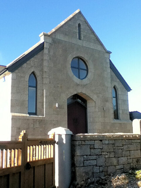
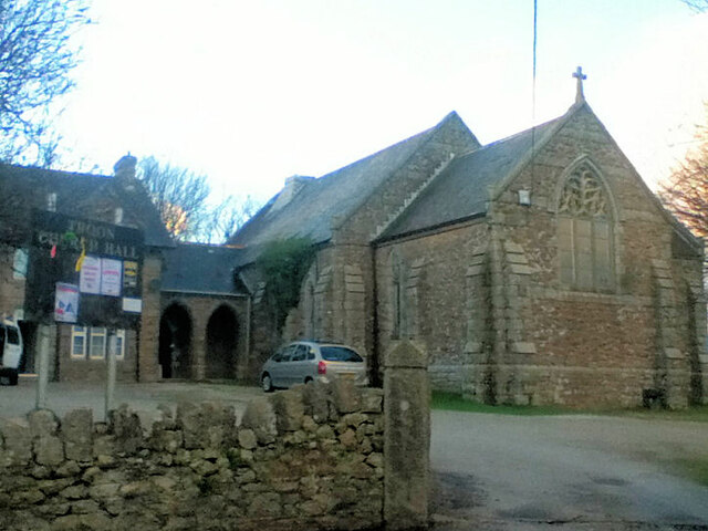
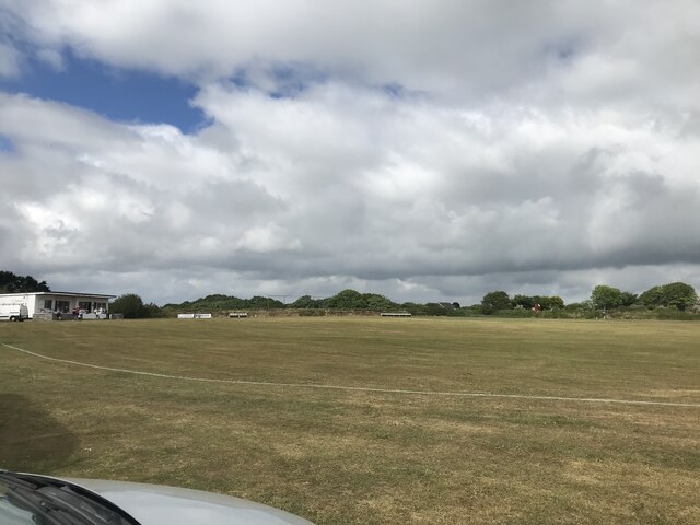
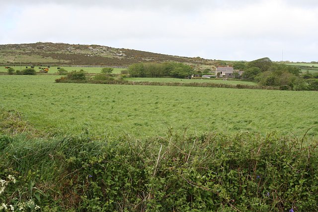
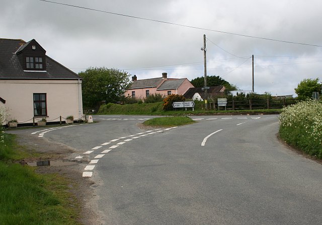
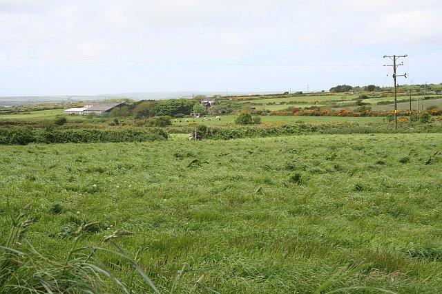
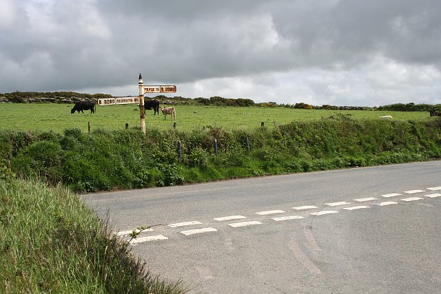
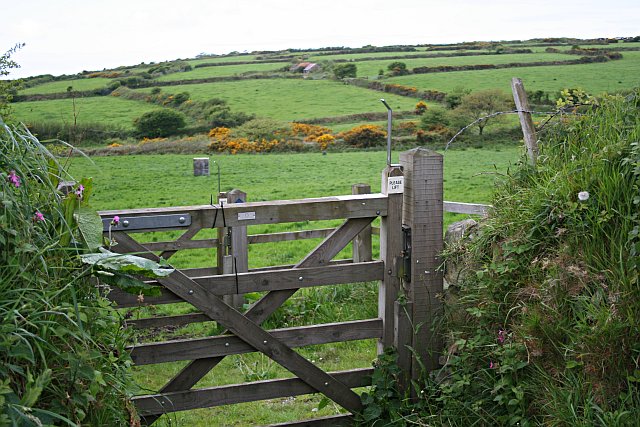
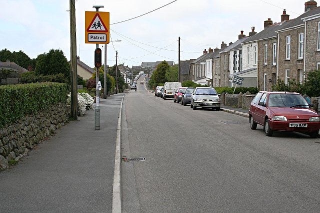
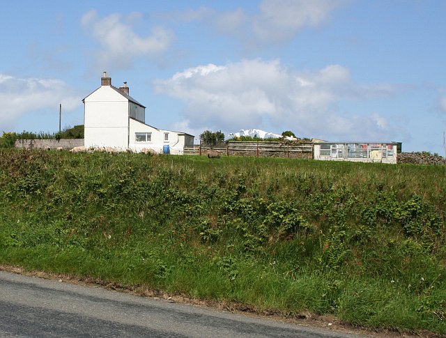
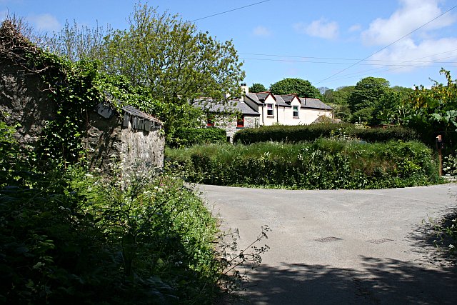
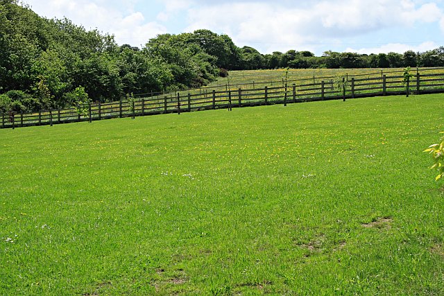
Boswyn Images

Images are sourced within 2km of 50.177713/-5.2787649 or Grid Reference SW6636. Thanks to Geograph Open Source API. All images are credited.

Plantation Chapel
Plantation Chapel
Former Mission Church with adjoining Sunday School at left
Troon cricket ground on match day
Pasture and Carn Meor Farm
Southern Slope of Crowan Beacon Pasture land gives way to heathland where the granite boulders become too large and numerous on the higher hills.
Southern Slope of Crowan Beacon
Pasture land gives way to heathland where the granite boulders become too large and numerous on the higher hills.
Road Junction near Blackrock Farm There is a small scattering of houses and a couple of farms here.
Road Junction near Blackrock Farm
There is a small scattering of houses and a couple of farms here.
Cargenwen Looking diagonally across the square from the southeast corner.
Cargenwen
Looking diagonally across the square from the southeast corner.
Road Junction and Crowan Beacon This shot looks up to the edge of the heathland at the summit of Crowan Beacon.
Road Junction and Crowan Beacon
This shot looks up to the edge of the heathland at the summit of Crowan Beacon.
Gate and Fields This double gate is the start of a bridlepath which leads from the road out over this patchwork of pasture fields.  The gates allow horses to be taken on the bridlepath without letting out any stock which might be in the fields.
Gate and Fields
This double gate is the start of a bridlepath which leads from the road out over this patchwork of pasture fields. The gates allow horses to be taken on the bridlepath without letting out any stock which might be in the fields.
Chycarn Moor Heathland and farmland to the east of the village of Troon.  In the distance is the hill of Carn Brea.
Chycarn Moor
Heathland and farmland to the east of the village of Troon. In the distance is the hill of Carn Brea.
New Road, Troon Troon is a large village just south of Camborne.  With the development of several mines around the village in the 19th century, Troon grew rapidly from a tiny hamlet into a village almost large enough to call a town.
New Road, Troon
Troon is a large village just south of Camborne. With the development of several mines around the village in the 19th century, Troon grew rapidly from a tiny hamlet into a village almost large enough to call a town.
House on High Downs This is an area of high land on the Carnmenellis Plateau.  It can be very windy up here.
House on High Downs
This is an area of high land on the Carnmenellis Plateau. It can be very windy up here.
The View From High Downs To the west of High Downs the land slopes downhill for a couple of kilometres and gives a good view out towards St Ives.  Although it is a bit hazy today so you may have to take my word that the lighter colouration on the slope in the distant mid-right of the photo is the buildings of St Ives.
The View From High Downs
To the west of High Downs the land slopes downhill for a couple of kilometres and gives a good view out towards St Ives. Although it is a bit hazy today so you may have to take my word that the lighter colouration on the slope in the distant mid-right of the photo is the buildings of St Ives.
Minor Road Junction near Copper Hill Looking to the northeast out over the square.  Most of the rest of the land in the square disappears into the valley.  The land in the distance is the lowlands around Hayle and across St Ives bay to St Ives itself in the haze.
Minor Road Junction near Copper Hill
Looking to the northeast out over the square. Most of the rest of the land in the square disappears into the valley. The land in the distance is the lowlands around Hayle and across St Ives bay to St Ives itself in the haze.
Stennack Stennack is a hamlet in a wooded valley on the western edge of Troon.
Stennack
Stennack is a hamlet in a wooded valley on the western edge of Troon.
Deciduous Woodland near Stennack
Carwynnen This is a hamlet in the bottom of the valley sandwiched between three areas of woodland.
Carwynnen
This is a hamlet in the bottom of the valley sandwiched between three areas of woodland.
Pasture Land near Carwynnen This looks more like pasture which is kept for horses than for cattle grazing.
Pasture Land near Carwynnen
This looks more like pasture which is kept for horses than for cattle grazing.
Show me another place!

Boswyn is located at Grid Ref: SW6636 (Lat: 50.177713, Lng: -5.2787649)

Unitary Authority: Cornwall

Police Authority: Devon and Cornwall

What 3 Words

///toward.sunbeam.narrowest. Near Four Lanes, Cornwall

Nearby Locations

No Man's Land Boswyn

Related Wikis

Boswyn

Boswyn is a hamlet in west Cornwall, England, United Kingdom, approximately one mile south of Troon. It is in the civil parish of Camborne. == References ==

Croft Mitchell

Croft Mitchell is a hamlet in the parish of Camborne, Cornwall, England. == References ==

Carwynnen

Carwynnen is a hamlet in Cornwall, England. It is located between the villages of Troon and Praze-an-Beeble, and is situated 2 miles (3.2 km) south of...
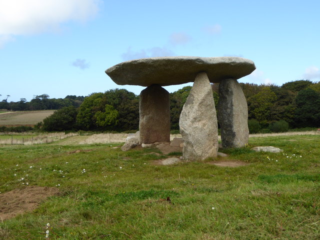
Carwynnen Quoit

Carwynnen Quoit (grid reference SW650372) is a dolmen belonging to the Neolithic period, at Carwynnen near Camborne in west Cornwall. It is also known...

Nearby Amenities

Located within 500m of 50.177713,-5.2787649
Power: pole
Source: bing
Lat/Long: 50.1798352/-5.2816748
Power: pole
Source: bing
Lat/Long: 50.1788302/-5.2781808
Power: pole
Lat/Long: 50.1775317/-5.2735835
Power: pole
Source: bing
Lat/Long: 50.1794765/-5.2803819
Power: tower
Source: bing
Lat/Long: 50.1782059/-5.2760002
Place: farm
Lat/Long: 50.1790333/-5.2807803
Barrier: entrance
Lat/Long: 50.1804253/-5.280246
Barrier: entrance
Lat/Long: 50.1802627/-5.2798372
Barrier: cattle_grid
Lat/Long: 50.1800011/-5.2771973
Barrier: cattle_grid
Lat/Long: 50.1800381/-5.2777847
Barrier: cattle_grid
Lat/Long: 50.1800522/-5.2787596
Barrier: cattle_grid
Lat/Long: 50.1811962/-5.2755142
Information: guidepost
Tourism: information
Lat/Long: 50.1812464/-5.2820427
Barrier: stile
Lat/Long: 50.1812661/-5.2820233
Power: pole
Source: bing
Lat/Long: 50.1770162/-5.281226
Power: pole
Source: bing
Lat/Long: 50.1784286/-5.2805024
Power: pole
Source: bing
Lat/Long: 50.1777845/-5.2806982
Power: pole
Source: bing
Lat/Long: 50.1758391/-5.2830626
Power: pole
Source: bing
Lat/Long: 50.1766048/-5.2848221
Power: pole
Source: bing
Lat/Long: 50.1767779/-5.2846867
Power: pole
Source: bing
Lat/Long: 50.1763738/-5.2842884
Power: pole
Source: bing
Lat/Long: 50.1766619/-5.283077
Power: pole
Source: bing
Lat/Long: 50.1767203/-5.2839786
Power: pole
Source: bing
Lat/Long: 50.1791657/-5.285256
Power: pole
Source: bing
Lat/Long: 50.1787404/-5.2851507
Power: pole
Source: bing
Lat/Long: 50.1781864/-5.2850112
Power: pole
Source: bing
Lat/Long: 50.1774336/-5.2848523
Power: pole
Source: bing
Lat/Long: 50.1752954/-5.2835803
Post Box Type: po
Power: pole
Source: bing
Lat/Long: 50.1775191/-5.2784881
Power: pole
Source: bing
Lat/Long: 50.1773087/-5.2796347
Power: pole
Lat/Long: 50.1756682/-5.274619
Post Box Type: po
Power: pole
Lat/Long: 50.1761135/-5.2761519
Post Box Type: po
Power: pole
Lat/Long: 50.1761243/-5.276449
Post Box Type: po
Power: pole
Lat/Long: 50.1764348/-5.2777116
Power: pole
Source: bing
Lat/Long: 50.1756605/-5.2763973
Power: pole
Source: bing
Lat/Long: 50.175572/-5.2763222
Power: pole
Source: bing
Lat/Long: 50.1758872/-5.2754223
Post Box Type: po
Power: pole
Source: bing
Lat/Long: 50.1759181/-5.275586
Power: pole
Source: bing
Lat/Long: 50.1751907/-5.2766562
Power: pole
Source: bing
Lat/Long: 50.1746848/-5.2767071
Power: pole
Source: bing
Lat/Long: 50.1741909/-5.2767098
Power: pole
Source: bing
Lat/Long: 50.1736815/-5.2767178
Post Box Type: po
Power: pole
Lat/Long: 50.1771111/-5.2781582
The data included in this document is from www.openstreetmap.org. The data is made available under ODbL.

Have you been to Boswyn?

Leave your review of Boswyn below (or comments, questions and feedback).