Bosleake

Settlement in Cornwall

England

Bosleake

View of Carn Brea The Great Flat Lode, a circular mining area around Carn Brea Cornwall. In the foreground the chimney of the old Wheal Basset mine. With a view across to other old mine workings, the edge of an old mining village of Carnkie, and the "Basset" monument on top of the hill. The development (buildings) in the mid-distance is that of Redruth

The Great Flat Lode, a rich mineral seam of predominantly tin, the seam of which was in and around Carn Brea.

The North Cornish coast can be seen on the horizon.
View of Carn Brea Credit: Pete Cruse

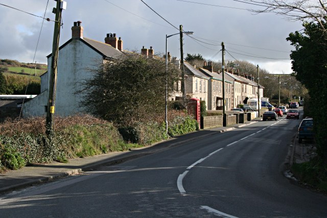
Bosleake is a small village located in the county of Cornwall, England. Situated in the western part of the country, it lies about 6 miles northwest of the town of Penzance and is nestled within the rural countryside. With a population of around 200 residents, Bosleake is a tight-knit community that exudes a tranquil and picturesque charm.

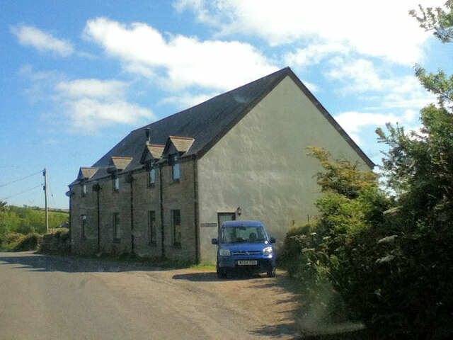
The village is known for its stunning natural beauty, with rolling hills and lush green fields surrounding the area. It offers breathtaking views of the nearby coast, providing a perfect escape for nature enthusiasts and those seeking a peaceful retreat. The landscape is dotted with traditional Cornish stone cottages, adding to the village's idyllic charm.

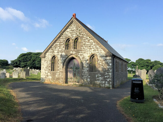
Bosleake is also home to a historic church, St. Levan's Church, which dates back to the 13th century. This ancient place of worship attracts visitors due to its fascinating architectural features and the peaceful atmosphere it offers.

Although Bosleake is small, it benefits from its proximity to larger towns such as Penzance, which offer a range of amenities including shops, restaurants, and leisure facilities. This allows residents to enjoy the tranquility of village life while still having access to modern conveniences.

Overall, Bosleake is a quaint and scenic village that allows residents and visitors alike to experience the beauty of the Cornish countryside. Its peaceful atmosphere and stunning surroundings make it a sought-after destination for those seeking a slower pace of life.

If you have any feedback on the listing, please let us know in the comments section below.
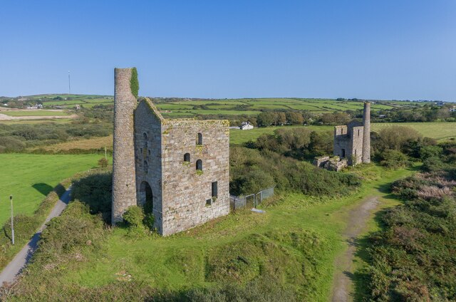
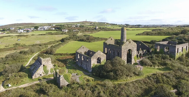
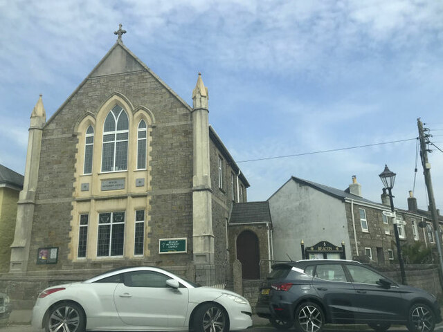
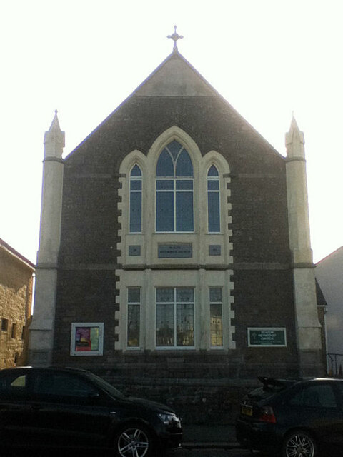
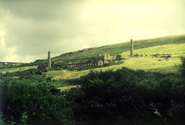
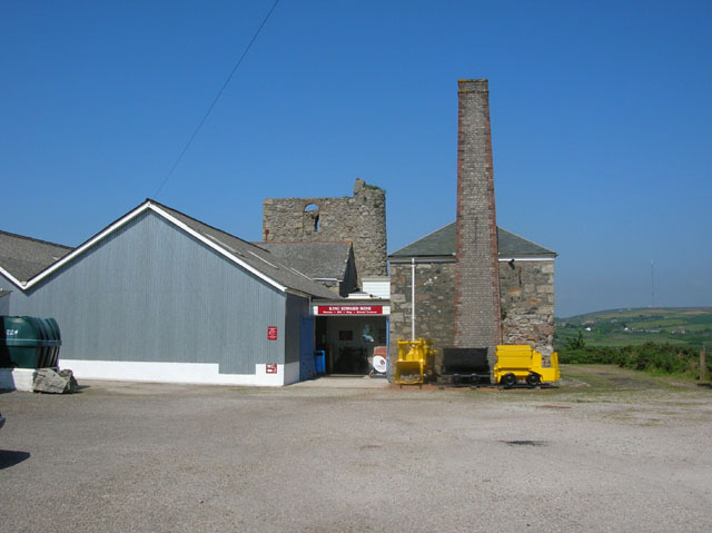
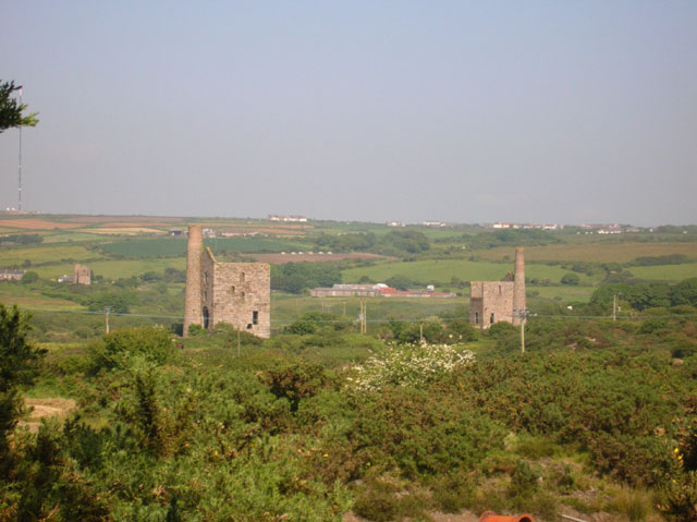
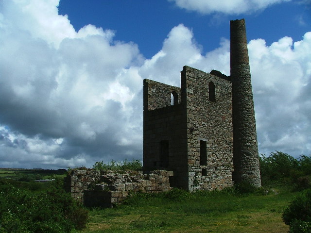
Bosleake Images

Images are sourced within 2km of 50.214824/-5.261914 or Grid Reference SW6740. Thanks to Geograph Open Source API. All images are credited.

View of Carn Brea The Great Flat Lode, a circular mining area around Carn Brea Cornwall. In the foreground the chimney of the old Wheal Basset mine. With a view across to other old mine workings, the edge of an old mining village of Carnkie, and the "Basset" monument on top of the hill. The development (buildings) in the mid-distance is that of Redruth

The Great Flat Lode, a rich mineral seam of predominantly tin, the seam of which was in and around Carn Brea.

The North Cornish coast can be seen on the horizon.
View of Carn Brea
The Great Flat Lode, a circular mining area around Carn Brea Cornwall. In the foreground the chimney of the old Wheal Basset mine. With a view across to other old mine workings, the edge of an old mining village of Carnkie, and the "Basset" monument on top of the hill. The development (buildings) in the mid-distance is that of Redruth The Great Flat Lode, a rich mineral seam of predominantly tin, the seam of which was in and around Carn Brea. The North Cornish coast can be seen on the horizon.
Wheal Grenville Fortesque's shaft and whim The impressive engine house at Fortesque's shaft with the drawing whim beyond. See
<a title="https://www.geograph.org.uk/photo/4131867" href="https://www.geograph.org.uk/photo/4131867">Link</a> for more details.
Wheal Grenville Fortesque's shaft and whim
The impressive engine house at Fortesque's shaft with the drawing whim beyond. See Link for more details.
South Frances Mine ruins Widely regarded as the finest group of mining remains in Cornwall, South Frances is located on the Great Flat Lode. Working into the 1900s this site was the scene of the last-ditch attempt to mine this lode in depth, with an up-to-date new steam pump installed in the cathedral-like ruins. It was intended to eventually sink the shaft to 500 fathoms (3000 feet, 914 metres) but ingress of water from other nearby closed mines caused the mission to be eventually abandoned. The collar of the shaft has been safely covered by a grille which allows a view into the massive brick-lined shaft.  A large ore bin, miners' dry, boiler house and other sundry buildings complete with fine site.
South Frances Mine ruins
Widely regarded as the finest group of mining remains in Cornwall, South Frances is located on the Great Flat Lode. Working into the 1900s this site was the scene of the last-ditch attempt to mine this lode in depth, with an up-to-date new steam pump installed in the cathedral-like ruins. It was intended to eventually sink the shaft to 500 fathoms (3000 feet, 914 metres) but ingress of water from other nearby closed mines caused the mission to be eventually abandoned. The collar of the shaft has been safely covered by a grille which allows a view into the massive brick-lined shaft. A large ore bin, miners' dry, boiler house and other sundry buildings complete with fine site.
Beacon Methodist Church
Carnkie Methodist Church
Carnkie Community Institute
Former chapel
Former chapel
Troon Cemetery
Troon Cemetery
South Wheal Frances
South Wheal Frances
Old Boundary Marker on Pendarves Street, Beacon Boundary Marker on the grass verge outside No.62 on the west side of Pendarves Street. Camborne parish. Inscribed N T and S T. The function of this stone is unclear as neither a boundary nor the stone are marked on any OS maps.

Milestone Society National ID: CW_CAMB03bm
Old Boundary Marker on Pendarves Street, Beacon
Boundary Marker on the grass verge outside No.62 on the west side of Pendarves Street. Camborne parish. Inscribed N T and S T. The function of this stone is unclear as neither a boundary nor the stone are marked on any OS maps. Milestone Society National ID: CW_CAMB03bm
Wheal Basset This is the area of the Great Flat Lode, one of the richest sources of copper and tin in Cornwall and where the Basset family made their fortune. The countryside is littered with the remains of mining activity.
Wheal Basset
This is the area of the Great Flat Lode, one of the richest sources of copper and tin in Cornwall and where the Basset family made their fortune. The countryside is littered with the remains of mining activity.
King Edward Mine King Edward mine (just outside of Troon) has recently been turned into a visitor centre all about the mine and Cornish mining.
King Edward Mine
King Edward mine (just outside of Troon) has recently been turned into a visitor centre all about the mine and Cornish mining.
Grenville United Mines Grenville United mines (just outside of Troon) are now just two engine houses. Fortescue's engine house is on the left and Fortescue's pumping house is on the right (both part of Fortescue's shaft).
Grenville United Mines
Grenville United mines (just outside of Troon) are now just two engine houses. Fortescue's engine house is on the left and Fortescue's pumping house is on the right (both part of Fortescue's shaft).
Carnkie Methodist Church In the village of Carnkie just south of Carn Brea hill.
Carnkie Methodist Church
In the village of Carnkie just south of Carn Brea hill.
Steep lane from Carn Arthen to Beacon Now part of the Great Flat Lode walking trail.
Steep lane from Carn Arthen to Beacon
Now part of the Great Flat Lode walking trail.
Great Flat Lode Old tin mines line the route of the Great Flat Lode, looking east across the valley, from South Wheal Frances towards West Wheal Basset.
Great Flat Lode
Old tin mines line the route of the Great Flat Lode, looking east across the valley, from South Wheal Frances towards West Wheal Basset.
Goold's Engine House Set off to the northeast of the Grenville United Mine, on Newton Moor, lies the remains of Goold's Engine House
Goold's Engine House
Set off to the northeast of the Grenville United Mine, on Newton Moor, lies the remains of Goold's Engine House
Show me another place!

Bosleake is located at Grid Ref: SW6740 (Lat: 50.214824, Lng: -5.261914)

Unitary Authority: Cornwall

Police Authority: Devon and Cornwall

What 3 Words

///beep.slogged.charm. Near Four Lanes, Cornwall

Related Wikis

Bosleake

Bosleake is a mining hamlet southwest of Redruth in west Cornwall, England, UK. It is in the civil parish of Carn Brea. == References ==

Piece, Cornwall

Piece is a village in Cornwall, England. == References == Media related to Piece, Cornwall at Wikimedia Commons

Carn Arthen

Carn Arthen (Cornish: Karn Arthur, meaning Arthur's rock-pile) is farmstead 1.7 miles (2.7 km) south-east of Camborne near to Tuckingmill in Cornwall,...

Penhallick

Penhallick is a hamlet near Pool in Cornwall, England, UK. Penhallick House was built in 1892 by Richard Cowlin the local miller and grocer who owned Cowlin...

Nearby Amenities

Located within 500m of 50.214824,-5.261914
Carn Arthen
Place: hamlet
Lat/Long: 50.2132871/-5.2660542
Barrier: cattle_grid
Lat/Long: 50.2181521/-5.2637125
Barrier: cattle_grid
Lat/Long: 50.2171038/-5.2638278
Power: pole
Source: bing
Lat/Long: 50.2172712/-5.2673012
Power: pole
Source: GPS;survey;Bing
Lat/Long: 50.2175553/-5.2649369
Material: wood
Power: pole
Source: GPS;survey;Bing
Lat/Long: 50.2184348/-5.2637936
Material: wood
Power: pole
Source: GPS;survey;Bing
Lat/Long: 50.2191026/-5.2628683
Barrier: entrance
Lat/Long: 50.2158861/-5.2653208
Barrier: entrance
Lat/Long: 50.2134994/-5.2581355
Barrier: entrance
Lat/Long: 50.2136024/-5.2573255
Barrier: entrance
Lat/Long: 50.2146782/-5.2588597
Barrier: entrance
Lat/Long: 50.2172273/-5.2633095
Barrier: entrance
Lat/Long: 50.2164893/-5.2555364
Barrier: entrance
Lat/Long: 50.2182502/-5.2632853
Barrier: entrance
Lat/Long: 50.2165271/-5.2626336
Barrier: entrance
Lat/Long: 50.2189247/-5.261845
Barrier: entrance
Lat/Long: 50.2144829/-5.2634704
Barrier: entrance
Lat/Long: 50.2146473/-5.2588476
Barrier: entrance
Lat/Long: 50.219153/-5.2631432
Barrier: entrance
Lat/Long: 50.2170918/-5.2626202
Barrier: entrance
Lat/Long: 50.2179121/-5.2630171
Barrier: entrance
Lat/Long: 50.2181352/-5.2637789
Barrier: entrance
Lat/Long: 50.2176169/-5.2623358
Barrier: entrance
Lat/Long: 50.2189419/-5.2620193
Barrier: entrance
Lat/Long: 50.2134393/-5.2629983
Barrier: entrance
Lat/Long: 50.2136573/-5.2637628
Power: pole
Source: bing
Lat/Long: 50.217541/-5.2626604
Power: pole
Source: bing
Lat/Long: 50.2172239/-5.263406
Historic: mine_shaft
Lat/Long: 50.2175706/-5.2673784
Barrier: entrance
Lat/Long: 50.2155934/-5.26582
Power: pole
Lat/Long: 50.2125279/-5.2677955
Power: pole
Lat/Long: 50.2170197/-5.2643073
Material: wood
Power: pole
Lat/Long: 50.216074/-5.2684566
Material: wood
Power: pole
Lat/Long: 50.2163366/-5.2673154
Material: wood
Power: pole
Lat/Long: 50.216585/-5.2661359
Material: wood
Power: pole
Lat/Long: 50.2168815/-5.2650315
Information: guidepost
Tourism: information
Lat/Long: 50.2155737/-5.2635006
Information: guidepost
Tourism: information
Lat/Long: 50.2133432/-5.2651522
Information: guidepost
Tourism: information
Lat/Long: 50.2127854/-5.2670096
Historic: mine_shaft
Lat/Long: 50.2137852/-5.2677861
Information: guidepost
Tourism: information
Lat/Long: 50.2167382/-5.2654955
Barrier: stile
Lat/Long: 50.2164157/-5.2678267
Generator Method: photovoltaic
Generator Output Electricity: small_installation
Generator Source: solar
Generator Type: solar_photovoltaic_panel
Location: roof
Power: generator
Source: bing
Lat/Long: 50.2148648/-5.263225
Man Made: utility_pole
Note: telephone pole
Lat/Long: 50.2175719/-5.2605823
Information: guidepost
Tourism: information
Lat/Long: 50.2167015/-5.2639619
Barrier: cattle_grid
Lat/Long: 50.2167324/-5.2639204
Information: guidepost
Tourism: information
Lat/Long: 50.2163557/-5.2641973
Information: guidepost
Tourism: information
Lat/Long: 50.2183772/-5.2605797
Power: pole
Source: bing;wpd_open_data
Lat/Long: 50.2150978/-5.2614175
Power: pole
Source: bing;wpd_open_data
Lat/Long: 50.2167748/-5.2620858
Power: pole
Source: bing;wpd_open_data
Lat/Long: 50.2160388/-5.2615224
Power: pole
Source: bing;wpd_open_data
Lat/Long: 50.215572/-5.2614971
Power: pole
Source: bing;wpd_open_data
Lat/Long: 50.215081/-5.2612881
Power: pole
Source: bing;wpd_open_data
Lat/Long: 50.2145188/-5.2604919
Power: pole
Source: bing;wpd_open_data
Lat/Long: 50.2143295/-5.2589069
Power: pole
Source: bing;wpd_open_data
Lat/Long: 50.2141464/-5.257307
Power: pole
Source: bing;wpd_open_data
Lat/Long: 50.2139642/-5.2557917
Power: pole
Source: bing
Lat/Long: 50.2174693/-5.2656525
The data included in this document is from www.openstreetmap.org. The data is made available under ODbL.

Have you been to Bosleake?

Leave your review of Bosleake below (or comments, questions and feedback).