Borough Park

Settlement in Staffordshire Tamworth

England

Borough Park

St Leonard's Church  (1) The above photograph shows the Lychgate, which is the main entrance to the Graveyard and Church.
St Leonard's Church (1) Credit: Chris' Buet

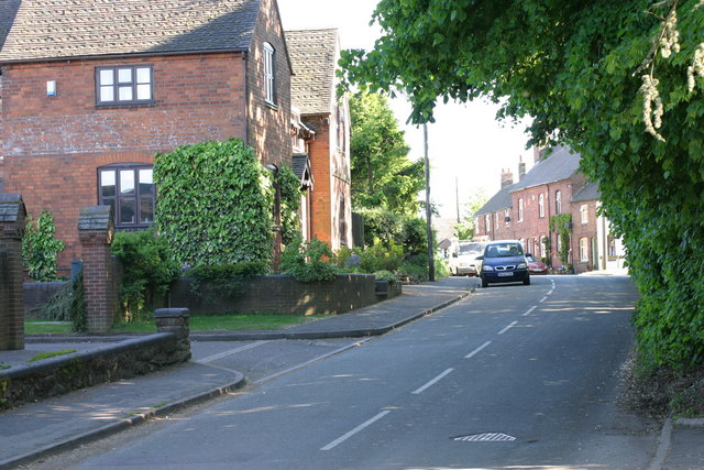
Borough Park is a small village located in the Staffordshire county of England. Situated in the West Midlands region, it lies approximately 7 miles northeast of the town of Stafford. The village is surrounded by picturesque countryside, offering residents and visitors a serene and peaceful environment.

With a population of around 1,000 residents, Borough Park maintains a close-knit community atmosphere. The village primarily consists of residential properties, ranging from quaint cottages to modern houses. The architecture of the buildings is predominantly traditional, reflecting the area's rich history.

Despite its small size, Borough Park offers a range of amenities for its residents. The village is home to a local primary school, providing education for children in the area. Additionally, there are several shops and small businesses, including a convenience store and a few local pubs.

The surrounding countryside provides ample opportunities for outdoor activities and recreational pursuits. Walking and cycling paths are abundant, allowing residents to explore the beautiful landscapes that encompass the village. The nearby Cannock Chase, an Area of Outstanding Natural Beauty, offers extensive woodland and wildlife for nature enthusiasts to enjoy.

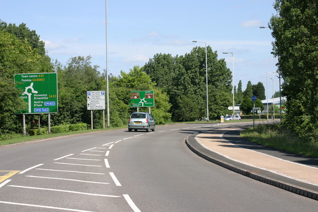
Transportation in Borough Park is facilitated by a network of roads connecting the village to nearby towns and cities. The A518 road runs through the village, providing easy access to Stafford and other surrounding areas.

Overall, Borough Park is a charming village in Staffordshire, boasting a tranquil setting, a friendly community, and a picturesque countryside that attracts both residents and visitors alike.

If you have any feedback on the listing, please let us know in the comments section below.
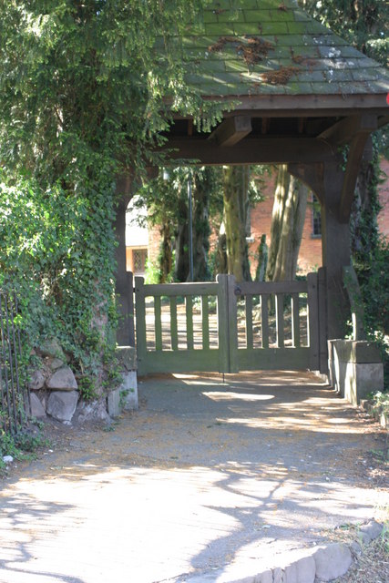
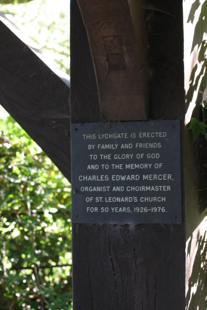
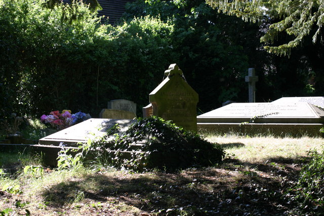
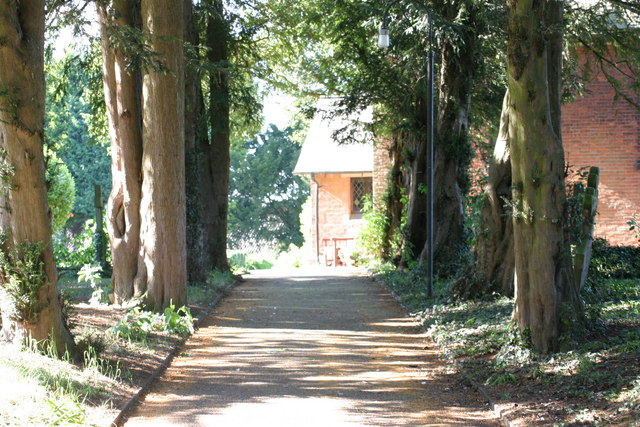
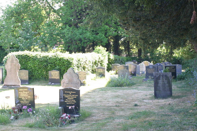
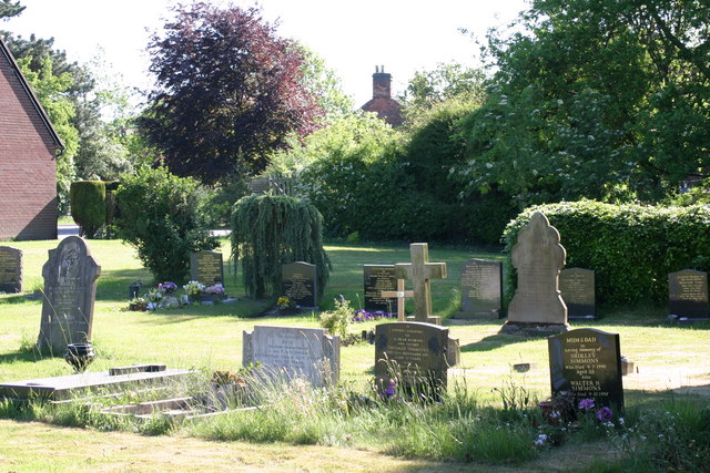
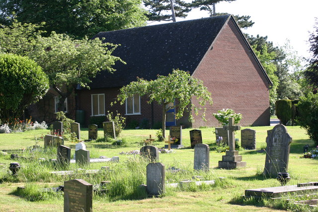
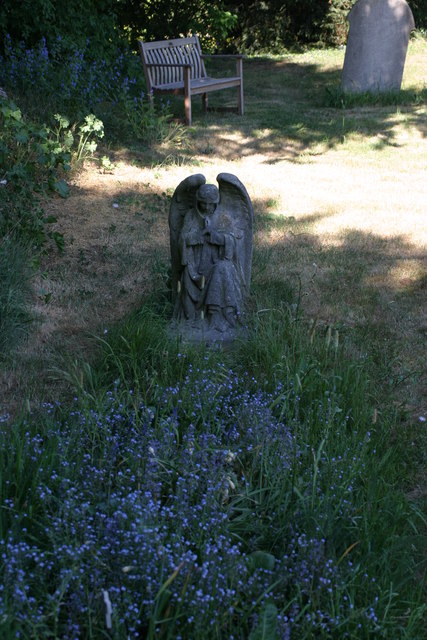
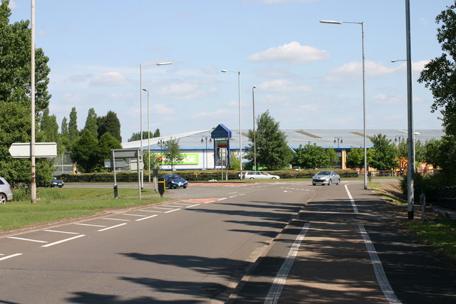
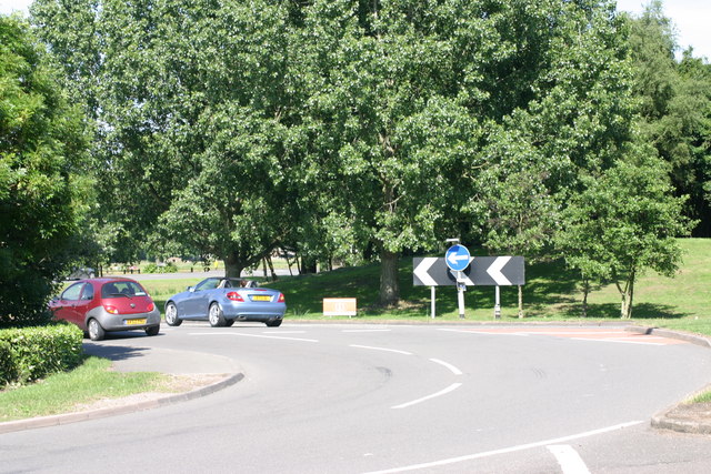
Borough Park Images

Images are sourced within 2km of 52.642339/-1.6910849 or Grid Reference SK2105. Thanks to Geograph Open Source API. All images are credited.

St Leonard's Church  (1) The above photograph shows the Lychgate, which is the main entrance to the Graveyard and Church.
St Leonard's Church (1)
The above photograph shows the Lychgate, which is the main entrance to the Graveyard and Church.
St Leonard's Church  (2) The plaque in the above photograph is attached to the Lychgate in this photograph <a href="https://www.geograph.org.uk/photo/2393376">SK2006 : St Leonard's Church  (1)</a>
St Leonard's Church (2)
The plaque in the above photograph is attached to the Lychgate in this photograph SK2006 : St Leonard's Church (1)
St Leonard's  Church  (3) This photograph <a href="https://www.geograph.org.uk/photo/2393376">SK2006 : St Leonard's Church  (1)</a> shows the Lychgate, which is the main entrance to the Graveyard shown in the above photograph.
St Leonard's Church (3)
This photograph SK2006 : St Leonard's Church (1) shows the Lychgate, which is the main entrance to the Graveyard shown in the above photograph.
St Leonards  Church  (4) The path in the above photograph leads from the Lychgated entrance up to the Church. This photograph shows <a href="https://www.geograph.org.uk/photo/2393376">SK2006 : St Leonard's Church  (1)</a> a view of that Lychgate.
St Leonards Church (4)
The path in the above photograph leads from the Lychgated entrance up to the Church. This photograph shows SK2006 : St Leonard's Church (1) a view of that Lychgate.
St Leonard's Church  (5) The above photograph shows the church's main entrance. This photograph <a href="https://www.geograph.org.uk/photo/2393417">SK2006 : St Leonard's  Church  (3)</a> shows a view of this church's graveyard.
St Leonard's Church (5)
The above photograph shows the church's main entrance. This photograph SK2006 : St Leonard's Church (3) shows a view of this church's graveyard.
St Leonard's  Church  (6) The above photograph shows a memorial bench located outside the Church entrance, which can be seen in this photograph <a href="https://www.geograph.org.uk/photo/2393473">SK2006 : St Leonard's Church  (5)</a>.
St Leonard's Church (6)
The above photograph shows a memorial bench located outside the Church entrance, which can be seen in this photograph SK2006 : St Leonard's Church (5).
St Leonards Church  (7) The above photograph shows the Church Tower. This photograph <a href="https://www.geograph.org.uk/photo/2393376">SK2006 : St Leonard's Church  (1)</a> shows a view of this Churches Lychgate.
St Leonards Church (7)
The above photograph shows the Church Tower. This photograph SK2006 : St Leonard's Church (1) shows a view of this Churches Lychgate.
St Leonards Church  (8) The above photograph shows a view of this Churches Graveyard. This photograph <a href="https://www.geograph.org.uk/photo/2393473">SK2006 : St Leonard's Church  (5)</a> shows a view of this Church.
St Leonards Church (8)
The above photograph shows a view of this Churches Graveyard. This photograph SK2006 : St Leonard's Church (5) shows a view of this Church.
St Leonards Church  (9) This photograph <a href="https://www.geograph.org.uk/photo/2393417">SK2006 : St Leonard's  Church  (3)</a> shows another view of this Graveyard.
St Leonards Church (9)
This photograph SK2006 : St Leonard's Church (3) shows another view of this Graveyard.
St Leonards Church  (10) This photograph <a href="https://www.geograph.org.uk/photo/2393441">SK2006 : St Leonards  Church  (4)</a> shows a path located within the Graveyard shown in the photograph above.
St Leonards Church (10)
This photograph SK2006 : St Leonards Church (4) shows a path located within the Graveyard shown in the photograph above.
St Leonards Church  (11) This photograph <a href="https://www.geograph.org.uk/photo/2412066">SK2006 : St Leonards Church  (8)</a> shows another view of this Graveyard.
St Leonards Church (11)
This photograph SK2006 : St Leonards Church (8) shows another view of this Graveyard.
St Leonards Church  (12) The above photograph <a href="https://www.geograph.org.uk/photo/2412090">SK2006 : St Leonards Church  (10)</a> shows a Stone Angel, located at a Grave. This photograph shows another view of this Graveyard.
St Leonards Church (12)
The above photograph SK2006 : St Leonards Church (10) shows a Stone Angel, located at a Grave. This photograph shows another view of this Graveyard.
Main Street The above photograph shows a view of Main Street, which is located next to St Leonard's Church, which is located out of view just to the right hand side of the above photograph. This photograph <a href="https://www.geograph.org.uk/photo/2393376">SK2006 : St Leonard's Church  (1)</a> shows a view of the Lychgate which is located next to the above stretch of road.
Main Street
The above photograph shows a view of Main Street, which is located next to St Leonard's Church, which is located out of view just to the right hand side of the above photograph. This photograph SK2006 : St Leonard's Church (1) shows a view of the Lychgate which is located next to the above stretch of road.
Bonehill Road  (7) This photograph <a href="https://www.geograph.org.uk/photo/2434787">SK1903 : Bonehill Road  (6)</a> shows another view of Bonehill Road.
Bonehill Road (7)
This photograph SK1903 : Bonehill Road (6) shows another view of Bonehill Road.
The Jolly Sailor, Retail park  (4) The above photograph shows a view the car park which part of the Jolly Sailor, retail park. This photograph <a href="https://www.geograph.org.uk/photo/2437906">SK1903 : The Jolly Sailor, Retail Park  (2)</a> shows another view of this retail park.
The Jolly Sailor, Retail park (4)
The above photograph shows a view the car park which part of the Jolly Sailor, retail park. This photograph SK1903 : The Jolly Sailor, Retail Park (2) shows another view of this retail park.
The Jolly Sailor, Retail park  (10) This photograph <a href="https://www.geograph.org.uk/photo/2439862">SK1903 : The Jolly Sailor, Retail park  (3)</a> shows another view of this Retail park.
The Jolly Sailor, Retail park (10)
This photograph SK1903 : The Jolly Sailor, Retail park (3) shows another view of this Retail park.
Bonehill Road  (10) The above photograph shows a view of Bonehill Road, exiting a traffic island. The traffic island which is just about visible, located to the left of this photograph, joins on to this stretch of Bonehill Road. This photograph <a href="https://www.geograph.org.uk/photo/2437749">SK2003 : Bonehill Road  (7)</a> shows a view of Bonehill Road approaching the traffic Island mentioned above. Ventura retail park can be seen in the background.
Bonehill Road (10)
The above photograph shows a view of Bonehill Road, exiting a traffic island. The traffic island which is just about visible, located to the left of this photograph, joins on to this stretch of Bonehill Road. This photograph SK2003 : Bonehill Road (7) shows a view of Bonehill Road approaching the traffic Island mentioned above. Ventura retail park can be seen in the background.
Bonehill Road  (11) The above photograph shows a section of Bonehill Road, joining a traffic island along the (A453) This photograph <a href="https://www.geograph.org.uk/photo/2443771">SK1903 : Bonehill Road  (9)</a> shows another view Bonehill Road.
Bonehill Road (11)
The above photograph shows a section of Bonehill Road, joining a traffic island along the (A453) This photograph SK1903 : Bonehill Road (9) shows another view Bonehill Road.
Show me another place!

Borough Park is located at Grid Ref: SK2105 (Lat: 52.642339, Lng: -1.6910849)

Administrative County: Staffordshire

District: Tamworth

Police Authority: Staffordshire

What 3 Words

///agrees.silk.words. Near Tamworth, Staffordshire

Nearby Locations

Browns Lane Borough Park

Related Wikis

Landau Forte Academy QEMS

Landau Forte Academy QEMS (Formerly "Queen Elizabeth's Mercian School", until 1 September 2011) is an 11-16 secondary school with academy status located...

Landau Forte Academy Tamworth Sixth Form

Landau Forte Academy Tamworth Sixth Form is a Sixth form centre and academy situated in Tamworth, Staffordshire, England. == History == The Sixth form...

Perry Crofts

Perry Crofts is a housing estate in Tamworth, Staffordshire, England, built in the 1970s. It is a small suburb consisting of brick and wood houses. The...

Borough Park, Tamworth

Borough Park is a small residential area of Tamworth, Staffordshire, 1 mile north of the town centre, and close to the River Anker. The area is served...

Nearby Amenities

Located within 500m of 52.642339,-1.6910849
Bus Stop
Farm Close
Bus: yes
Naptan AtcoCode: 3800C903100
Naptan Bearing: S
Naptan CommonName: Farm Close
Naptan Indicator: Adj
Naptan Landmark: Farm Close
Naptan PlusbusZoneRef: TAMWORTH
Naptan Street: Perrycrofts Cres
Naptan Verified: no
Public Transport: platform
Source: naptan_import
Lat/Long: 52.6437759/-1.6848868
Bus Stop
Aldergate Clinic
Bus: yes
Naptan AtcoCode: 3800C906601
Naptan Bearing: S
Naptan CommonName: Aldergate Clinic
Naptan Indicator: Adj
Naptan Landmark: Aldergate Clinic
Naptan PlusbusZoneRef: TAMWORTH
Naptan Street: Salters Lane
Naptan Verified: no
Public Transport: platform
Source: naptan_import
Lat/Long: 52.6389485/-1.6952808
Bus Stop
Old School Walk
Bus: yes
Naptan AtcoCode: 3800C917001
Naptan Bearing: E
Naptan CommonName: Old School Walk
Naptan Indicator: Adj
Naptan Landmark: Old School Walk
Naptan PlusbusZoneRef: TAMWORTH
Naptan Street: Salters Lane
Naptan Verified: no
Public Transport: platform
Source: naptan_import
Lat/Long: 52.6399943/-1.6964263
Bus Stop
Old School Walk
Bus: yes
Naptan AtcoCode: 3800C917002
Naptan Bearing: W
Naptan CommonName: Old School Walk
Naptan Indicator: Opp
Naptan Landmark: Old School Walk
Naptan PlusbusZoneRef: TAMWORTH
Naptan Street: Salters Lane
Naptan Verified: no
Public Transport: platform
Source: naptan_import
Lat/Long: 52.6399059/-1.6970032
Bus Stop
Kensington Drive
Bus: yes
Naptan AtcoCode: 3800C917201
Naptan Bearing: S
Naptan CommonName: Kensington Drive
Naptan Indicator: Adj
Naptan Landmark: Kensington Drive
Naptan PlusbusZoneRef: TAMWORTH
Naptan Street: Wiggington Rd
Naptan Verified: no
Public Transport: platform
Source: naptan_import
Lat/Long: 52.6442459/-1.6926723
Bus Stop
Kensington Drive
Bus: yes
Naptan AtcoCode: 3800C917202
Naptan Bearing: N
Naptan CommonName: Kensington Drive
Naptan Indicator: opp
Naptan Landmark: Kensington Drive
Naptan PlusbusZoneRef: TAMWORTH
Naptan Street: Wiggington Rd
Naptan Verified: no
Public Transport: platform
Source: naptan_import
Lat/Long: 52.6441385/-1.6928652
Bus Stop
Hillcroft Close
Bus: yes
Naptan AtcoCode: 3800C922901
Naptan Bearing: N
Naptan CommonName: Hillcroft Close
Naptan Indicator: Adj
Naptan Landmark: Hillcroft Cl
Naptan PlusbusZoneRef: TAMWORTH
Naptan Street: Comberford Rd
Naptan Verified: no
Public Transport: platform
Source: naptan_import
Lat/Long: 52.6423822/-1.6950796
Bus Stop
The Riftswood Inn
Bus: yes
Naptan AtcoCode: 3800C923001
Naptan Bearing: S
Naptan CommonName: The Riftswood Inn
Naptan Indicator: Opp
Naptan Landmark: The Riftswood Inn
Naptan PlusbusZoneRef: TAMWORTH
Naptan Street: Comberford Rd
Naptan Verified: no
Public Transport: platform
Source: naptan_import
Lat/Long: 52.6440485/-1.6963243
Bus Stop
The Riftswood Inn
Bus: yes
Naptan AtcoCode: 3800C923002
Naptan Bearing: NW
Naptan CommonName: The Riftswood Inn
Naptan Indicator: Adj
Naptan Landmark: The Riftswood
Naptan PlusbusZoneRef: TAMWORTH
Naptan Street: Comberford Road
Naptan Verified: no
Public Transport: platform
Source: naptan_import
Lat/Long: 52.6439498/-1.6963989
Bus Stop
Wigginton Road
Bus: yes
Naptan AtcoCode: 3800C923901
Naptan Bearing: W
Naptan CommonName: Wigginton Road
Naptan Indicator: Adj
Naptan Landmark: Wigginton Rd
Naptan PlusbusZoneRef: TAMWORTH
Naptan Street: Chestnut Ave
Naptan Verified: no
Public Transport: platform
Source: naptan_import
Lat/Long: 52.646585/-1.6933506
Bus Stop
Tennis Courts
Bus: yes
Naptan AtcoCode: 3800C924301
Naptan Bearing: N
Naptan CommonName: Tennis Courts
Naptan Indicator: Adj
Naptan Landmark: Tennis Courts
Naptan PlusbusZoneRef: TAMWORTH
Naptan Street: Wigginton Road
Naptan Verified: no
Public Transport: platform
Source: naptan_import
Lat/Long: 52.6425763/-1.6936742
Tennis Courts
Naptan AtcoCode: 3800C924302
Naptan Bearing: S
Naptan BusStopType: CUS
Naptan CommonName: Tennis Courts
Naptan Indicator: Opp
Naptan Landmark: Tennis Courts
Naptan PlusbusZoneRef: TAMWORTH
Naptan Street: Wigginton Road
Naptan Verified: no
Source: naptan_import
Lat/Long: 52.6426205/-1.6933931
Bus Stop
Chestnut Avenue
Bus: yes
Naptan AtcoCode: 3800C924401
Naptan Bearing: N
Naptan CommonName: Chestnut Avenue
Naptan Indicator: Adj
Naptan Landmark: Chestnut Ave
Naptan PlusbusZoneRef: TAMWORTH
Naptan Street: Wigginton Road
Naptan Verified: no
Public Transport: platform
Source: naptan_import
Lat/Long: 52.6463582/-1.6925393
Chestnut Avenue
Naptan AtcoCode: 3800C924402
Naptan Bearing: S
Naptan BusStopType: CUS
Naptan CommonName: Chestnut Avenue
Naptan Indicator: Opp
Naptan Landmark: Chestnut Ave
Naptan PlusbusZoneRef: TAMWORTH
Naptan Street: Wigginton Road
Naptan Verified: no
Source: naptan_import
Lat/Long: 52.6464747/-1.6923907
Bus Stop
Henley Close
Bus: yes
Naptan AtcoCode: 3800C924901
Naptan Bearing: NW
Naptan CommonName: Henley Close
Naptan Indicator: Adj
Naptan Landmark: Henley Cl
Naptan PlusbusZoneRef: TAMWORTH
Naptan Street: Perrycrofts Cres
Naptan Verified: no
Public Transport: platform
Source: naptan_import
Lat/Long: 52.6428555/-1.6869625
Bus Stop
Perrycrofts Crescent
Bus: yes
Naptan AtcoCode: 3800C925201
Naptan Bearing: NE
Naptan CommonName: Perrycrofts Crescent
Naptan Indicator: Adj
Naptan Landmark: Perrycrofts Cres
Naptan PlusbusZoneRef: TAMWORTH
Naptan Street: Ashby Rd
Naptan Verified: no
Public Transport: platform
Source: naptan_import
Lat/Long: 52.6443197/-1.6899376
Bus Stop
Perrycrofts Crescent
Bus: yes
Naptan AtcoCode: 3800C925202
Naptan Bearing: SW
Naptan CommonName: Perrycrofts Crescent
Naptan Indicator: Adj
Naptan Landmark: Perrycrofts Cres
Naptan PlusbusZoneRef: TAMWORTH
Naptan Street: Ashby Rd
Naptan Verified: no
Public Transport: platform
Source: naptan_import
Lat/Long: 52.6441667/-1.6898943
Bus Stop
Queen Elizabeth School
Bus: yes
Naptan AtcoCode: 3800C925301
Naptan Bearing: S
Naptan CommonName: Queen Elizabeth School
Naptan Indicator: Adj
Naptan Landmark: Queen Elizabeth School
Naptan PlusbusZoneRef: TAMWORTH
Naptan Street: Ashby Rd
Naptan Verified: no
Public Transport: platform
Source: naptan_import
Lat/Long: 52.6420795/-1.6927762
Queen Elizabeth School
Naptan AtcoCode: 3800C925302
Naptan Bearing: N
Naptan BusStopType: CUS
Naptan CommonName: Queen Elizabeth School
Naptan Indicator: Opp
Naptan Landmark: Queen Elizabeth School
Naptan PlusbusZoneRef: TAMWORTH
Naptan Street: Ashby Rd
Naptan Verified: no
Source: naptan_import
Lat/Long: 52.6421967/-1.6928936
Bus Stop
Tamworth College
Bus: yes
Naptan AtcoCode: 3800C925401
Naptan Bearing: S
Naptan CommonName: Tamworth College
Naptan Indicator: Adj
Naptan Landmark: Tamworth College
Naptan PlusbusZoneRef: TAMWORTH
Naptan Street: Upper Gungate
Naptan Verified: no
Public Transport: platform
Source: naptan_import
Lat/Long: 52.6384066/-1.694324
Croft Street
Power: substation
Ref: 0092
Lat/Long: 52.6391113/-1.6918952
Gungate Hotel
Tourism: hotel
Lat/Long: 52.640531/-1.6938814
Moran & Co
Lawyer: solicitor
Office: lawyer
Lat/Long: 52.6388306/-1.6941485
Nursing Home
Sunningdale Nursing & Residential Home
Lat/Long: 52.6397274/-1.694438
Belmont
Tourism: guest_house
Lat/Long: 52.6399695/-1.6939216
Post Box
Ref: B79 1277
Lat/Long: 52.6427693/-1.6865273
Traffic Signals
Source: bing
Lat/Long: 52.6414641/-1.6938442
Shop: hairdresser
Lat/Long: 52.6463407/-1.6901284
Harwell Close
Power: substation
Ref: B9 4843
Lat/Long: 52.6462091/-1.68736
Kangs
Shop: convenience
Lat/Long: 52.6463976/-1.6901376
Post Box
Post Box Type: pillar
Royal Cypher: EVIIR
Royal Cypher Wikidata: Q33102324
Lat/Long: 52.6426281/-1.6936663
Borough Park Stores
Shop: convenience
Lat/Long: 52.6454911/-1.6911031
Suffield Lodge Working Mens Club
Leisure: social_club
Lat/Long: 52.6459912/-1.6927419
St Edythas Hospital
Power: substation
Ref: 32 062
Lat/Long: 52.6446073/-1.6928209
Kensington Drive
Power: substation
Ref: 420 0526
Lat/Long: 52.6440122/-1.6938842
Pub
The Riftswood
Lat/Long: 52.6445442/-1.6974656
Speed Camera
Lat/Long: 52.6441807/-1.6966149
Traffic Signals
Source: bing
Lat/Long: 52.6415246/-1.6934864
Traffic Signals
Source: bing
Lat/Long: 52.6412487/-1.6937748
Generator Method: photovoltaic
Generator Output Electricity: yes
Generator Source: solar
Generator Type: solar_photovoltaic_panel
Location: roof
Power: generator
Lat/Long: 52.644398/-1.6948476
Generator Method: photovoltaic
Generator Output Electricity: yes
Generator Source: solar
Generator Type: solar_photovoltaic_panel
Location: roof
Power: generator
Lat/Long: 52.6432636/-1.6973233
Generator Method: photovoltaic
Generator Output Electricity: yes
Generator Source: solar
Generator Type: solar_photovoltaic_panel
Location: roof
Power: generator
Lat/Long: 52.6432994/-1.6909021
Generator Method: photovoltaic
Generator Output Electricity: yes
Generator Source: solar
Generator Type: solar_photovoltaic_panel
Location: roof
Power: generator
Lat/Long: 52.6422122/-1.6871873
Generator Method: photovoltaic
Generator Output Electricity: yes
Generator Source: solar
Generator Type: solar_photovoltaic_panel
Location: roof
Power: generator
Lat/Long: 52.642266/-1.6872999
Generator Method: photovoltaic
Generator Output Electricity: yes
Generator Source: solar
Generator Type: solar_photovoltaic_panel
Location: roof
Power: generator
Lat/Long: 52.6419079/-1.6889334
Generator Method: photovoltaic
Generator Output Electricity: yes
Generator Source: solar
Generator Type: solar_photovoltaic_panel
Location: roof
Power: generator
Lat/Long: 52.643332/-1.6857308
Generator Method: photovoltaic
Generator Output Electricity: yes
Generator Source: solar
Generator Type: solar_photovoltaic_panel
Location: roof
Power: generator
Lat/Long: 52.6438723/-1.6876164
Generator Method: photovoltaic
Generator Output Electricity: yes
Generator Source: solar
Generator Type: solar_photovoltaic_panel
Location: roof
Power: generator
Lat/Long: 52.6438023/-1.6869083
Generator Method: photovoltaic
Generator Output Electricity: yes
Generator Source: solar
Generator Type: solar_photovoltaic_panel
Location: roof
Power: generator
Lat/Long: 52.6439097/-1.686675
Generator Method: photovoltaic
Generator Output Electricity: yes
Generator Source: solar
Generator Type: solar_photovoltaic_panel
Location: roof
Power: generator
Lat/Long: 52.6443394/-1.6858596
Generator Method: photovoltaic
Generator Output Electricity: yes
Generator Source: solar
Generator Type: solar_photovoltaic_panel
Location: roof
Power: generator
Lat/Long: 52.6443817/-1.6857979
Generator Method: photovoltaic
Generator Output Electricity: yes
Generator Source: solar
Generator Type: solar_photovoltaic_panel
Location: roof
Power: generator
Lat/Long: 52.6451832/-1.6876151
Generator Method: photovoltaic
Generator Output Electricity: yes
Generator Source: solar
Generator Type: solar_photovoltaic_panel
Location: roof
Power: generator
Lat/Long: 52.643319/-1.6927555
Generator Method: photovoltaic
Generator Output Electricity: yes
Generator Source: solar
Generator Type: solar_photovoltaic_panel
Location: roof
Power: generator
Lat/Long: 52.6418851/-1.6968298
Generator Method: photovoltaic
Generator Output Electricity: yes
Generator Source: solar
Generator Type: solar_photovoltaic_panel
Location: roof
Power: generator
Lat/Long: 52.6428893/-1.6970953
The data included in this document is from www.openstreetmap.org. The data is made available under ODbL.

Have you been to Borough Park?

Leave your review of Borough Park below (or comments, questions and feedback).