Aird

Settlement in Ross-shire

Scotland

Aird

The Pier at Port nan Giuran
The Pier at Port nan Giuran Credit: Peter Moore

Aird is a small village located in the county of Ross-shire, Scotland. Situated on the eastern banks of the picturesque Beauly Firth, Aird offers breathtaking views of the surrounding natural beauty. The village is nestled between the larger towns of Inverness and Dingwall, making it a convenient location for residents and visitors alike.

Aird is known for its tranquil atmosphere, offering a peaceful retreat from the hustle and bustle of city life. The village is characterized by its charming cottages and traditional stone-built houses, reflecting its rich history and heritage. The local community is warm and welcoming, creating a sense of belonging for residents and a friendly environment for tourists.

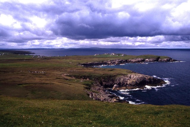
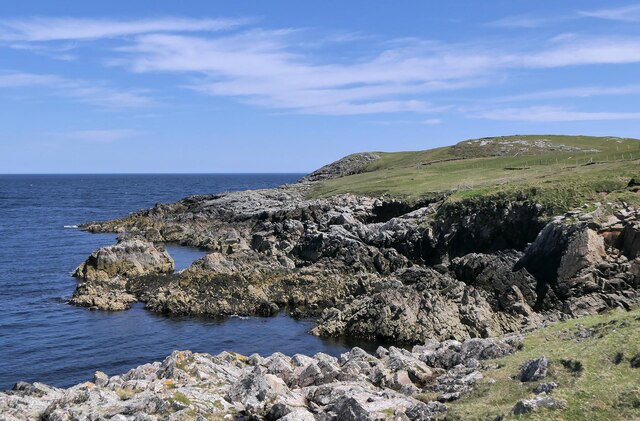
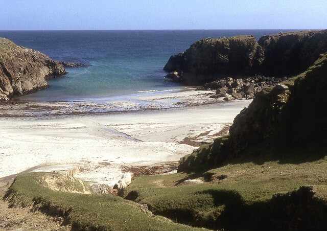
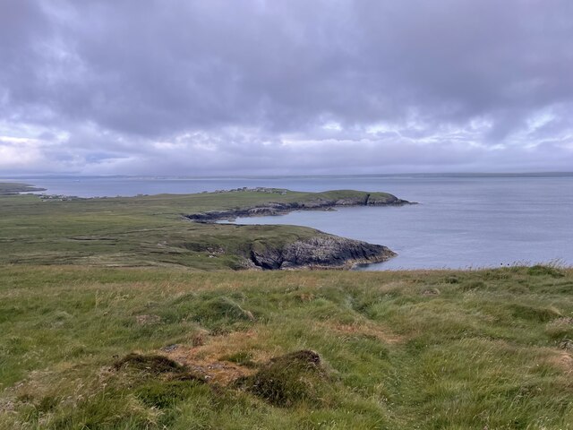
Nature lovers will find themselves in paradise in Aird, as the village is surrounded by stunning landscapes and diverse wildlife. The nearby Aird Peninsula offers opportunities for scenic walks along the coastline, where visitors can spot seals, dolphins, and a variety of seabirds. Aird also benefits from its close proximity to the Black Isle, a renowned area for its beautiful beaches and nature reserves.

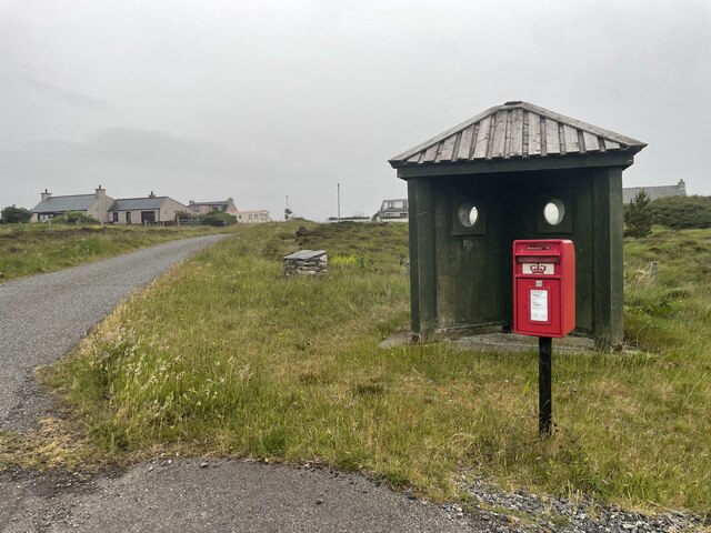
Despite its small size, Aird boasts a range of amenities for its residents. The village has a primary school, ensuring that families have access to quality education for their children. There are also local shops and amenities, providing convenient access to everyday necessities.

In summary, Aird in Ross-shire is a charming and peaceful village, offering stunning natural landscapes and a close-knit community. It is an ideal location for those seeking a tranquil retreat and a chance to connect with nature.

If you have any feedback on the listing, please let us know in the comments section below.
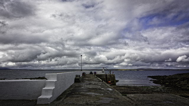
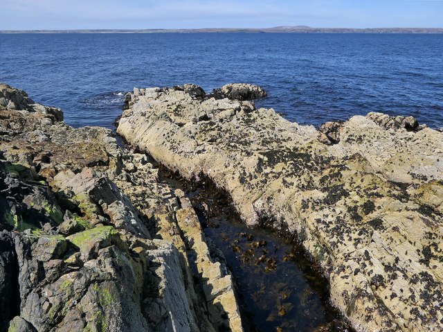
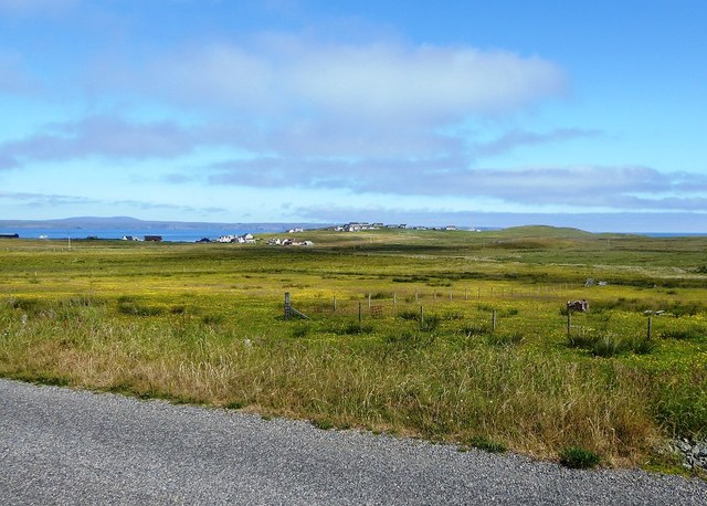
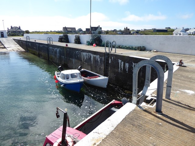
Aird Images

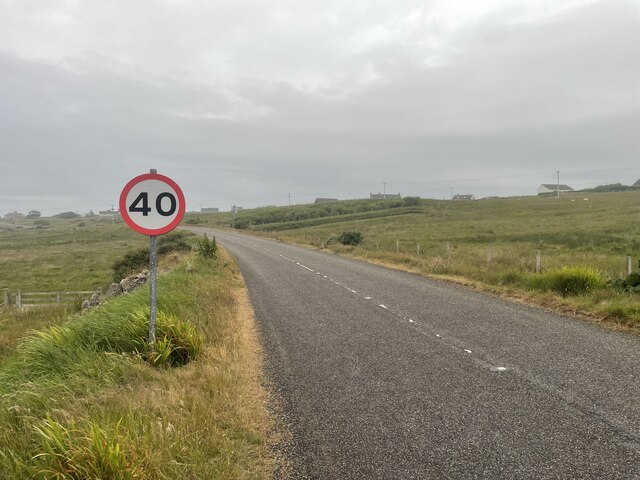
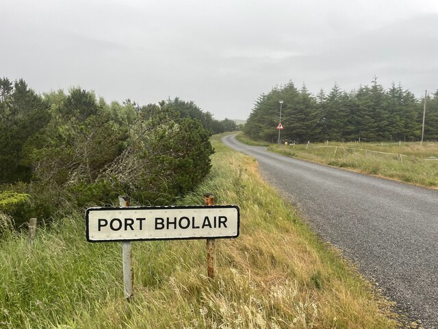
Images are sourced within 2km of 58.247366/-6.1646508 or Grid Reference NB5536. Thanks to Geograph Open Source API. All images are credited.

The Pier at Port nan Giuran
Coastline, Rubha Chuidhtinis, Eye Peninsula, Isle of Lewis
Coastline below Cnoc Beag, Isle of Lewis Looking across Broad Bay/Loch a Tuath towards Bac and Griais.
Coastline below Cnoc Beag, Isle of Lewis
Looking across Broad Bay/Loch a Tuath towards Bac and Griais.
Coastline, Gob Chaileagadh, Isle of Lewis Looking towards Port nan Giuran.

The OS Name Book of 1848-1852 says of what was then spelled Gob cha leig, "A low rocky shore forming a part of the northern boundary of Portnagiuran Farm.  NB The name is derived from the words "we can't weather it" i.e. if the wind is in a certain direction the fishermen in their boats are not able to pass the shore without making another tack".
Coastline, Gob Chaileagadh, Isle of Lewis
Looking towards Port nan Giuran. The OS Name Book of 1848-1852 says of what was then spelled Gob cha leig, "A low rocky shore forming a part of the northern boundary of Portnagiuran Farm. NB The name is derived from the words "we can't weather it" i.e. if the wind is in a certain direction the fishermen in their boats are not able to pass the shore without making another tack".
Looking across fields towards Cnoc Beag from the A866
The small pier at Portnagnan
View west from Tiumpan Head
Coast below Cnoc Beag, Isle of Lewis Looking towards Rubha Meadhonach, the northern tip of the Eye Peninsula/An Rubha.
Coast below Cnoc Beag, Isle of Lewis
Looking towards Rubha Meadhonach, the northern tip of the Eye Peninsula/An Rubha.
Remains of the Wyre Law, Gob Chaileagadh, Isle of Lewis The Wyre Law was a Fleetwood based steam trawler which was built in Hull in 1915 and launched with the name Miletus. She ran around during a gale in October 1952.  At first she remained upright but continuing bad weather made her unsalvageable.
Remains of the Wyre Law, Gob Chaileagadh, Isle of Lewis
The Wyre Law was a Fleetwood based steam trawler which was built in Hull in 1915 and launched with the name Miletus. She ran around during a gale in October 1952. At first she remained upright but continuing bad weather made her unsalvageable.
Small beach at Sinigeadh, Eye Peninsula
Roads around An Rubha In around 1999, the Ordnance Survey replaced English-language placenames in the Western Isles with Gaelic-language names. Some of the more prominent features (e.g. Isle of Barra; Stornoway; Sound of Harris) do have bilingual labels but, on the whole, villages, lochs, peaks etc. generally have the Gaelic names on the modern-day mapping.

Because the English versions have a tendency not to appear on the maps any more, I have decided to use them in my image titles and, as such, a translation will be readily available from the Gaelic labelling on the map. 

(NB I have not translated some of the more minor loch and river names, where I have not easily found the English version.)
Roads around An Rubha
In around 1999, the Ordnance Survey replaced English-language placenames in the Western Isles with Gaelic-language names. Some of the more prominent features (e.g. Isle of Barra; Stornoway; Sound of Harris) do have bilingual labels but, on the whole, villages, lochs, peaks etc. generally have the Gaelic names on the modern-day mapping. Because the English versions have a tendency not to appear on the maps any more, I have decided to use them in my image titles and, as such, a translation will be readily available from the Gaelic labelling on the map. (NB I have not translated some of the more minor loch and river names, where I have not easily found the English version.)
Roads around An Rubha Geocaching is a type of global treasure hunt of people looking for caches, or hidden stashes of objects. Geocaching may also be described as a series of hide-and-seek games, where hiders provide online clues for seekers. Seekers use global positioning system (GPS) devices to find hidden caches
Roads around An Rubha
Geocaching is a type of global treasure hunt of people looking for caches, or hidden stashes of objects. Geocaching may also be described as a series of hide-and-seek games, where hiders provide online clues for seekers. Seekers use global positioning system (GPS) devices to find hidden caches
Roads around An Rubha
Roads around An Rubha Geocaching is a type of global treasure hunt of people looking for caches, or hidden stashes of objects. Geocaching may also be described as a series of hide-and-seek games, where hiders provide online clues for seekers. Seekers use global positioning system (GPS) devices to find hidden caches
Roads around An Rubha
Geocaching is a type of global treasure hunt of people looking for caches, or hidden stashes of objects. Geocaching may also be described as a series of hide-and-seek games, where hiders provide online clues for seekers. Seekers use global positioning system (GPS) devices to find hidden caches
Coastline of An Rubhan
Roads around An Rubha Geocaching is a type of global treasure hunt of people looking for caches, or hidden stashes of objects. Geocaching may also be described as a series of hide-and-seek games, where hiders provide online clues for seekers. Seekers use global positioning system (GPS) devices to find hidden caches
Roads around An Rubha
Geocaching is a type of global treasure hunt of people looking for caches, or hidden stashes of objects. Geocaching may also be described as a series of hide-and-seek games, where hiders provide online clues for seekers. Seekers use global positioning system (GPS) devices to find hidden caches
Hungry Ducks As I drew in to the side of the road by Loch an t-Siumpain, a flock of ducks came waddling up from the water and lined up so close to the car that I could not have opened the door without risking hitting them. This was taken from the driver's seat. They look like some sort of hybrid between wild Mallard and domesticated ducks.
Hungry Ducks
As I drew in to the side of the road by Loch an t-Siumpain, a flock of ducks came waddling up from the water and lined up so close to the car that I could not have opened the door without risking hitting them. This was taken from the driver's seat. They look like some sort of hybrid between wild Mallard and domesticated ducks.
More Hungry Ducks As I drew in to the side of the road by Loch an t-Siumpain, a flock of ducks came waddling up from the water and lined up so close to the car that I could not have opened the door without risking hitting them. This was taken from the driver's seat. They look like some sort of hybrid between wild Mallard and domesticated ducks.
More Hungry Ducks
As I drew in to the side of the road by Loch an t-Siumpain, a flock of ducks came waddling up from the water and lined up so close to the car that I could not have opened the door without risking hitting them. This was taken from the driver's seat. They look like some sort of hybrid between wild Mallard and domesticated ducks.
Show me another place!

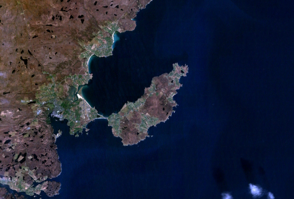
Aird is located at Grid Ref: NB5536 (Lat: 58.247366, Lng: -6.1646508)

Unitary Authority: Na h-Eileanan an Iar

Police Authority: Highlands and Islands

What 3 Words

///fruitcake.nicknames.elevator. Near North Tolsta, Na h-Eileanan Siar

Related Wikis

Broker, Lewis

Broker (Scottish Gaelic: Brocair) is a small hamlet next to the village of Portvoller and Portnaguran on the Eye Peninsula located on the east side of...

Aird, Lewis

Aird (Scottish Gaelic: Àird an Rubha) is a village in the Scottish council area of Eileanan Siar (Western Isles). It is located on the Eye Peninsula on...

Portvoller

Portvoller (Scottish Gaelic: Port Mholair) is a small village on the north tip of the Eye Peninsula (which along with Melbost and Parkend makes up Point...

Flesherin

Flesherin (Scottish Gaelic: Na Fleisirean) is a small village on the Point peninsula of the Isle of Lewis in the Outer Hebrides. Located near Portnaguran...

Portnaguran

Portnaguran (Scottish Gaelic: Port nan Giùran) is a settlement situated within Point, on the Isle of Lewis, in the Outer Hebrides, Scotland. Portnaguran...

Tiumpan Head Lighthouse

The Tiumpan Head Lighthouse is an active lighthouse located in Tiumpan Head, Isle of Lewis, Outer Hebrides, Scotland. == History == The idea for the Tiumpan...

Shulishader

Shulishader (Scottish Gaelic: Siadar an Rubha) is a small village with a population of around 120 people in Point, Outer Hebrides on the Isle of Lewis...

Point, Lewis

Point (Scottish Gaelic: An Rubha), also known as the Eye Peninsula, is a peninsula some 11 km long in the Outer Hebrides (or Western Isles), Scotland....

Nearby Amenities

Located within 500m of 58.247366,-6.1646508
Passing Place
Lat/Long: 58.2459606/-6.1612174
Passing Place
Lat/Long: 58.2467261/-6.163498
Brocair
Name En: Broker
Name Gd: Brocair
Place: hamlet
Wikidata: Q4973541
Wikipedia: en:Broker, Lewis
Lat/Long: 58.2507439/-6.1621736
Àird an Rubha
Name En: Aird
Name Gd: Àird an Rubha
Place: village
Wikidata: Q4698588
Wikipedia: en:Aird, Lewis
Lat/Long: 58.2446631/-6.1617821
Passing Place
Lat/Long: 58.2462916/-6.1617218
Passing Place
Lat/Long: 58.2464357/-6.1630632
Passing Place
Lat/Long: 58.2476468/-6.1650789
Passing Place
Lat/Long: 58.2489022/-6.1661223
Passing Place
Lat/Long: 58.2502114/-6.1662362
Passing Place
Lat/Long: 58.2443733/-6.1602563
Passing Place
Lat/Long: 58.2450904/-6.1606532
Passing Place
Lat/Long: 58.2458541/-6.1643654
Turning Circle
Lat/Long: 58.2461519/-6.1654383
Power: pole
Lat/Long: 58.2431223/-6.1645222
Power: pole
Lat/Long: 58.2513366/-6.1628727
Power: pole
Lat/Long: 58.2508432/-6.1639259
Power: pole
Lat/Long: 58.2505303/-6.1644032
Power: pole
Lat/Long: 58.2499604/-6.1652084
Power: pole
Lat/Long: 58.2495032/-6.1658583
Power: pole
Lat/Long: 58.2490402/-6.1665339
Power: pole
Lat/Long: 58.2487855/-6.1677953
Power: pole
Lat/Long: 58.2485749/-6.1656532
Power: pole
Lat/Long: 58.2480958/-6.1647835
Power: pole
Lat/Long: 58.2476048/-6.1638632
Power: pole
Lat/Long: 58.2471485/-6.163068
Power: pole
Lat/Long: 58.2467237/-6.1622292
Power: pole
Lat/Long: 58.248508/-6.1691613
Power: pole
Lat/Long: 58.2482146/-6.1705745
Power: pole
Lat/Long: 58.2479378/-6.1719781
Power: pole
Lat/Long: 58.2429352/-6.1658467
Power: pole
Lat/Long: 58.2442851/-6.1705808
Power: pole
Lat/Long: 58.2449758/-6.1711632
Power: pole
Lat/Long: 58.2456357/-6.1717171
Power: pole
Lat/Long: 58.246306/-6.1722703
Power: pole
Lat/Long: 58.2469833/-6.1728429
Man Made: tower
Operator: H.M. Coastgaurd
Tower Construction: lattice
Tower Type: communication
Lat/Long: 58.2466714/-6.1636479
Àird Uarach
Name En: Upper Aird
Name Gd: Àird Uarach
Place: locality
Lat/Long: 58.2475806/-6.1647862
Generator Method: photovoltaic
Generator Output Electricity: small_installation
Generator Source: solar
Generator Type: solar_photovoltaic_panel
Power: generator
Lat/Long: 58.2504833/-6.1668341
Street Lamp
Lamp Type: electric
Lat/Long: 58.2501965/-6.1706484
Street Lamp
Lamp Type: electric
Lat/Long: 58.2507667/-6.1693549
Power: pole
Lat/Long: 58.2512304/-6.1648869
Street Lamp
Lamp Type: electric
Lat/Long: 58.2512656/-6.1679071
Bus Stop
Bus: yes
Public Transport: platform
Shelter: yes
Lat/Long: 58.2512199/-6.1678712
Street Lamp
Lamp Type: led
Lat/Long: 58.2507448/-6.1668194
Street Lamp
Lamp Type: electric
Lat/Long: 58.2509065/-6.1642942
Street Lamp
Lamp Type: electric
Lat/Long: 58.2501486/-6.1612204
Street Lamp
Lamp Type: electric
Lat/Long: 58.2505576/-6.1631603
Street Lamp
Lamp Type: electric
Lat/Long: 58.2502209/-6.1607448
Street Lamp
Lamp Type: electric
Lat/Long: 58.247275/-6.1646904
Street Lamp
Lamp Type: electric
Lat/Long: 58.2475666/-6.1661417
Street Lamp
Lamp Type: electric
Lat/Long: 58.2492773/-6.1584214
Street Lamp
Lamp Type: electric
Lat/Long: 58.2494788/-6.1581914
Street Lamp
Lamp Type: electric
Lat/Long: 58.2490663/-6.1586809
Street Lamp
Lamp Type: electric
Lat/Long: 58.2486757/-6.1592375
Street Lamp
Lamp Type: electric
Lat/Long: 58.2483761/-6.159674
Street Lamp
Lamp Type: electric
Lat/Long: 58.2481446/-6.1600086
Street Lamp
Lamp Type: electric
Lat/Long: 58.2479209/-6.1603305
Street Lamp
Lamp Type: electric
Lat/Long: 58.2472913/-6.1612324
Street Lamp
Lamp Type: electric
Lat/Long: 58.2468576/-6.1618265
Street Lamp
Lamp Type: electric
Lat/Long: 58.2466265/-6.1620927
Street Lamp
Lamp Type: electric
Lat/Long: 58.2461847/-6.1625111
Street Lamp
Lamp Type: electric
Lat/Long: 58.2459437/-6.1626901
Street Lamp
Lamp Type: electric
Lat/Long: 58.2457083/-6.1628365
Height: 9
Man Made: tower
Tower Construction: mast
Tower Type: communication
Lat/Long: 58.245733/-6.1628379
Street Lamp
Lamp Type: electric
Lat/Long: 58.2451479/-6.1630967
Street Lamp
Lamp Type: electric
Lat/Long: 58.243552/-6.1633837
Street Lamp
Lamp Type: electric
Lat/Long: 58.243816/-6.1632965
Street Lamp
Lamp Type: electric
Lat/Long: 58.243329/-6.1635098
Street Lamp
Lamp Type: electric
Lat/Long: 58.244886/-6.163177
Street Lamp
Lamp Type: electric
Lat/Long: 58.2446132/-6.1632085
Street Lamp
Lamp Type: electric
Lat/Long: 58.2443538/-6.1632407
Street Lamp
Lamp Type: electric
Lat/Long: 58.244081/-6.1632715
Street Lamp
Lamp Type: electric
Lat/Long: 58.2454115/-6.1629865
The data included in this document is from www.openstreetmap.org. The data is made available under ODbL.

Have you been to Aird?

Leave your review of Aird below (or comments, questions and feedback).