Borgue

Settlement in Kirkcudbrightshire

Scotland

Borgue

Arriving at Borgue On a minor road from Carrick.
Arriving at Borgue Credit: Billy McCrorie

Borgue is a small village located in the historical county of Kirkcudbrightshire, Scotland. Situated in the southwest of the country, Borgue lies about 4 miles southeast of Kirkcudbright town. With a population of just over 200 people, it is a close-knit community that exudes a tranquil and picturesque charm.

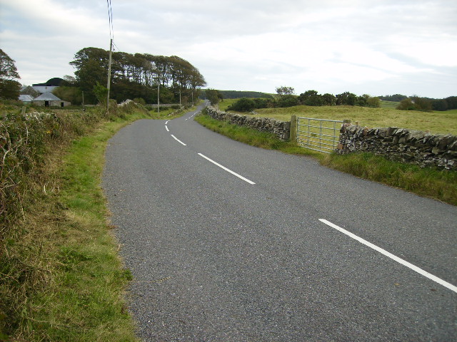
The village is surrounded by stunning countryside, with rolling hills and fields stretching as far as the eye can see. Borgue is nestled along the Solway Firth, providing residents and visitors with breathtaking views of the coastline. The area is also known for its rich wildlife, making it a popular destination for nature enthusiasts.

Borgue boasts a fascinating history, with evidence of human settlement dating back to the prehistoric era. The village is home to several historical landmarks, including the 12th-century Borgue Parish Church, which features beautiful stained glass windows and an ancient graveyard. The nearby Borgue Tower, a 16th-century tower house, is another notable attraction, offering a glimpse into the region's past.

While Borgue is predominantly a residential area, it offers a range of amenities for its residents. These include a local primary school, a village hall, and a community garden. There is also a popular pub that serves as a social hub for locals and visitors alike.

Overall, Borgue is a charming and peaceful village, perfect for those seeking a serene and idyllic setting. Its rich history, natural beauty, and close-knit community make it a hidden gem in the heart of Kirkcudbrightshire.

If you have any feedback on the listing, please let us know in the comments section below.

Borgue Images

Images are sourced within 2km of 54.811651/-4.133777 or Grid Reference NX6248. Thanks to Geograph Open Source API. All images are credited.

Arriving at Borgue On a minor road from Carrick.
Arriving at Borgue
On a minor road from Carrick.
Public Footpath to Brighouse Bay And Borness Bay from Borgue.
Public Footpath to Brighouse Bay
And Borness Bay from Borgue.
Marie Curie Field of Hope At Borgue Village.
Marie Curie Field of Hope
At Borgue Village.
Borgue Parish Church On a minor road just off the B727.
Borgue Parish Church
On a minor road just off the B727.
Borgue Village Road leading down to the B727.
Borgue Village
Road leading down to the B727.
Borgue Church taken from the east
Borgue Church
taken from the east
Hillside with Cairneyhill farm near Brighouse bay
Hillside with Cairneyhill farm
near Brighouse bay
Looking towards Chapelton Row from Ivy Cottage
Borgue Village Looking down on Borgue Village from outside the church.  The shadows in the road are from the row of houses adjacent to the church.  The large building in the centre of the picture is Borgue School - a primary school now but previously a naval academy.  The imposing dark grey building further to the right is the Borgue Hotel.
Borgue Village
Looking down on Borgue Village from outside the church. The shadows in the road are from the row of houses adjacent to the church. The large building in the centre of the picture is Borgue School - a primary school now but previously a naval academy. The imposing dark grey building further to the right is the Borgue Hotel.
Lodge house at entrance by the B727 north of Borgue
Approach to Borgue on the B727 road
Borgue Old House The roofless remains of a substantial 17th century mansion house.
Borgue Old House
The roofless remains of a substantial 17th century mansion house.
Approach to Borgue from the east on the B727 road
Bungalow on the B727 east of Borgue
The B727 approaching Culraven Farm The road just cuts the corner of the gridsquare.
The B727 approaching Culraven Farm
The road just cuts the corner of the gridsquare.
Track to Culraven and footpath to The Doon
Fire Escape A metal fire escape ladder behind Borgue Parish Kirk.
Fire Escape
A metal fire escape ladder behind Borgue Parish Kirk.
Borgue Parish Kirk Borgue Parish Kirk.
Borgue Parish Kirk
Borgue Parish Kirk.
Show me another place!

Borgue is located at Grid Ref: NX6248 (Lat: 54.811651, Lng: -4.133777)

Unitary Authority: Dumfries and Galloway

Police Authority: Dumfries and Galloway

What 3 Words

///stiletto.extremes.twee. Near Kirkcudbright, Dumfries & Galloway

Related Wikis

Borgue, Dumfries and Galloway

Borgue (pronounced /ˈbɔrɡ/; Scottish Gaelic: Borgh) is a village and parish in the Stewartry of Kirkcudbright in Dumfries and Galloway, Scotland. It lies...

Borgue Old House

Borgue Old House is a ruined Y-plan house, about 300 metres (0.2 mi) east of Borgue in Dumfries and Galloway, Scotland. Built in 1680, but probably incorporating...

Kirkandrews, Dumfries and Galloway

Kirkandrews, sometimes written as Kirkanders in older documents, is a coastal hamlet about 9 kilometres (6 mi) west-southwest of Kirkcudbright in Dumfries...

Plunton Castle

Plunton Castle is a ruined L-plan tower house between Kirkandrews and Gatehouse of Fleet in Dumfries and Galloway, Scotland. Built around 1575 for the...

Nearby Amenities

Located within 500m of 54.811651,-4.133777
Borgue
Is In: UK ,Scotland,Kirkcudbrightshire
Name En: Borgue
Name Gd: Borgh
Place: village
Lat/Long: 54.8123394/-4.1326508
Borgue Hotel
Tourism: hotel
Website: https://www.borguehotel.co.uk/
Lat/Long: 54.8119797/-4.1333796
Bus Stop
Village
Naptan AtcoCode: 680000460333
Naptan Bearing: W
Naptan CommonName: Village
Naptan Indicator: Centre
Naptan Landmark: B727
Naptan NaptanCode: 34236542
Naptan Notes: none
Naptan Street: Main Street
Naptan Verified: no
Source: naptan_import
Lat/Long: 54.8112981/-4.1336374
Bus Stop
Village
Naptan AtcoCode: 680000460444
Naptan Bearing: E
Naptan CommonName: Village
Naptan Indicator: Centre
Naptan Landmark: B727
Naptan NaptanCode: 34236539
Naptan Notes: none
Naptan Street: Main Street
Naptan Verified: no
Source: naptan_import
Lat/Long: 54.8113186/-4.1334984
Post Box
Ref: DG6 75
Lat/Long: 54.8124477/-4.1338209
Defibrillator
Access: yes
Defibrillator Location: Borgue Village Hall. In porch behind unlocked door.
Emergency: defibrillator
Indoor: no
Lat/Long: 54.8112247/-4.133901
Power: pole
Lat/Long: 54.8129276/-4.1402597
Power: pole
Lat/Long: 54.8127595/-4.1388857
Power: pole
Lat/Long: 54.8125794/-4.137409
Power: pole
Lat/Long: 54.8123845/-4.1358134
Power: pole
Lat/Long: 54.8122191/-4.134437
Power: pole
Lat/Long: 54.8133403/-4.1368818
Power: pole
Lat/Long: 54.8141024/-4.1363453
Power: pole
Lat/Long: 54.8147732/-4.135881
Power: pole
Lat/Long: 54.8155421/-4.1353398
The data included in this document is from www.openstreetmap.org. The data is made available under ODbL.

Have you been to Borgue?

Leave your review of Borgue below (or comments, questions and feedback).