Larks Meadow
Downs, Moorland in Kirkcudbrightshire
Scotland
Larks Meadow

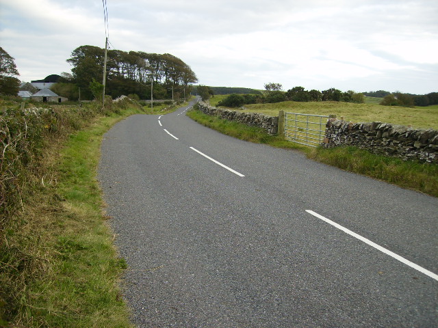
Larks Meadow is a picturesque expanse of downs and moorland situated in Kirkcudbrightshire, a county in southwest Scotland. Covering an area of approximately 500 acres, it is a haven for nature lovers and outdoor enthusiasts alike.
Dominated by rolling hills and open grasslands, Larks Meadow offers breathtaking panoramic views of the surrounding countryside. The downs, characterized by their gently sloping terrain, are covered in a patchwork of vibrant wildflowers during the spring and summer months, creating a stunning display of colors. Visitors can enjoy leisurely walks or hikes along the well-marked trails that crisscross the meadow, taking in the serene beauty of the landscape.
The moorland portion of Larks Meadow presents a more rugged and untamed aspect of the area. Here, heather and gorse dominate the landscape, providing a habitat for a variety of bird species. Birdwatchers can spot rare species such as the merlin and the short-eared owl, which nest and forage in the moorland throughout the year.
The meadow also boasts a diverse array of wildlife, with rabbits, hares, and deer frequently seen grazing in the open grasslands. In addition, the area is home to a number of small mammals, including voles and shrews, which thrive in the meadow's rich biodiversity.
Larks Meadow offers a tranquil retreat from the hustle and bustle of everyday life, providing an opportunity for visitors to immerse themselves in the beauty of nature. Whether it be a peaceful stroll through the downs or an adventurous hike through the moorland, this idyllic landscape is sure to captivate all who visit.
If you have any feedback on the listing, please let us know in the comments section below.
Larks Meadow Images
Images are sourced within 2km of 54.810376/-4.1450909 or Grid Reference NX6248. Thanks to Geograph Open Source API. All images are credited.


Larks Meadow is located at Grid Ref: NX6248 (Lat: 54.810376, Lng: -4.1450909)
Unitary Authority: Dumfries and Galloway
Police Authority: Dumfries and Galloway
What 3 Words
///desktops.thousands.reading. Near Kirkcudbright, Dumfries & Galloway
Nearby Locations
Related Wikis

Borgue, Dumfries and Galloway
Borgue (pronounced /ˈbɔrɡ/; Scottish Gaelic: Borgh) is a village and parish in the Stewartry of Kirkcudbright in Dumfries and Galloway, Scotland. It lies...

Borgue Old House
Borgue Old House is a ruined Y-plan house, about 300 metres (0.2 mi) east of Borgue in Dumfries and Galloway, Scotland. Built in 1680, but probably incorporating...

Kirkandrews, Dumfries and Galloway
Kirkandrews, sometimes written as Kirkanders in older documents, is a coastal hamlet about 9 kilometres (6 mi) west-southwest of Kirkcudbright in Dumfries...

Plunton Castle
Plunton Castle is a ruined L-plan tower house between Kirkandrews and Gatehouse of Fleet in Dumfries and Galloway, Scotland. Built around 1575 for the...

Corseyard Farm
Corseyard Farm, known locally as the Coo Palace and now marketed under that name, is an architecturally unusual dairy farm near Kirkandrews in Scotland...

Borness
Borness is a farm of around 1550 acres on the coast of Borgue Parish in the Stewartry of Kirkcudbrightshire (now part of Dumfries and Galloway). It is...

Islands of Fleet
The Islands of Fleet are a group of small islands in Galloway, Scotland. They are in Fleet Bay, which is part of Wigtown Bay, and is in turn part of the...

River Dee, Galloway
The River Dee (Scottish Gaelic: Dè / Uisge Dhè), in south-west Scotland, flows from its source in Loch Dee amongst the Galloway Hills, firstly to Clatteringshaws...
Nearby Amenities
Located within 500m of 54.810376,-4.1450909Have you been to Larks Meadow?
Leave your review of Larks Meadow below (or comments, questions and feedback).