Ainsworth

Settlement in Lancashire

England

Ainsworth

WWII Lancashire: Ghost Signs of the Home Front  (5) -
Constellation Mill, Ainsworth Road, Radcliffe

"Gas Cleansing Centre"

The fear of poison gas or of chemical weapons being used by the enemy was a very real threat in 1940. In preparation for this eventuality Decontamination Centres were set up throughout the country; this building on Ainsworth Road, Radcliffe was such a centre during the war, it retains its old sign, proclaiming "Gas Cleansing Centre".

<a href="https://www.geograph.org.uk/photo/6945038">SD7708 : WWII Lancashire: Ghost Signs of the Home Front  (6)</a>
WWII Lancashire: Ghost Signs of the Home Front (5) Credit: Mike Searle

Ainsworth is a small village located in the county of Lancashire, in the North West of England. Situated approximately 12 miles north of the city of Manchester, it falls within the Metropolitan Borough of Bury. The village is nestled in the Irwell Valley, surrounded by picturesque countryside and rolling hills.

Historically, Ainsworth has been an agricultural settlement, with farming playing a significant role in the local economy. The village retains its rural charm, with a scattering of traditional stone-built houses and farm buildings. However, in recent years, there has been some residential development, leading to an increase in population.

Ainsworth is well-connected to nearby towns and cities, with convenient road links to Bury, Bolton, and Manchester. The village is located close to major motorways, including the M60 and M66, allowing for easy access to the wider region.

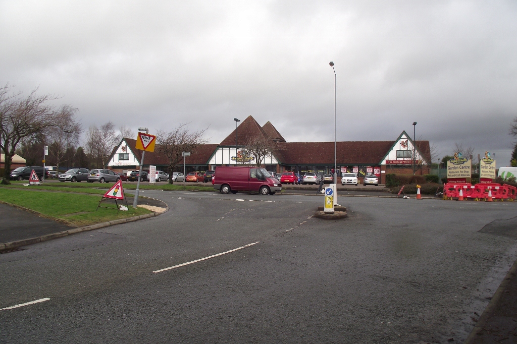
Despite its small size, Ainsworth boasts a strong sense of community, with a range of local amenities to cater to residents' needs. These include a village hall, a primary school, a post office, and a few local shops. The village also has several pubs and restaurants, providing a social hub for residents and visitors alike.

For those seeking outdoor activities, Ainsworth offers plenty of opportunities for walking, hiking, and cycling in the surrounding countryside. The nearby Burrs Country Park is a popular destination, offering scenic trails, picnic areas, and a reservoir.

Overall, Ainsworth is a charming village that combines a rural setting with convenient access to nearby urban centers, making it an attractive place to live or visit for those seeking a peaceful retreat within easy reach of city amenities.

If you have any feedback on the listing, please let us know in the comments section below.

Ainsworth Images

Images are sourced within 2km of 53.586497/-2.356474 or Grid Reference SD7610. Thanks to Geograph Open Source API. All images are credited.

WWII Lancashire: Ghost Signs of the Home Front  (5) -
Constellation Mill, Ainsworth Road, Radcliffe

"Gas Cleansing Centre"

The fear of poison gas or of chemical weapons being used by the enemy was a very real threat in 1940. In preparation for this eventuality Decontamination Centres were set up throughout the country; this building on Ainsworth Road, Radcliffe was such a centre during the war, it retains its old sign, proclaiming "Gas Cleansing Centre".

<a href="https://www.geograph.org.uk/photo/6945038">SD7708 : WWII Lancashire: Ghost Signs of the Home Front  (6)</a>
WWII Lancashire: Ghost Signs of the Home Front (5)
- Constellation Mill, Ainsworth Road, Radcliffe "Gas Cleansing Centre" The fear of poison gas or of chemical weapons being used by the enemy was a very real threat in 1940. In preparation for this eventuality Decontamination Centres were set up throughout the country; this building on Ainsworth Road, Radcliffe was such a centre during the war, it retains its old sign, proclaiming "Gas Cleansing Centre". SD7708 : WWII Lancashire: Ghost Signs of the Home Front (6)
WWII Lancashire: Ghost Signs of the Home Front  (6) -
Constellation Mill, Ainsworth Road, Radcliffe

"Gas Cleansing Centre"

<a href="https://www.geograph.org.uk/photo/6945041">SD7708 : WWII Lancashire: Ghost Signs of the Home Front  (7)</a>
WWII Lancashire: Ghost Signs of the Home Front (6)
- Constellation Mill, Ainsworth Road, Radcliffe "Gas Cleansing Centre" SD7708 : WWII Lancashire: Ghost Signs of the Home Front (7)
WWII Lancashire: Ghost Signs of the Home Front  (7) -
Constellation Mill, Ainsworth Road, Radcliffe

"Gas Cleansing Centre". A fine example of the signwriters' art.

<a href="https://www.geograph.org.uk/photo/6945052">SD8110 : WWII Lancashire: Ghost Signs of the Home Front  (8)</a>
WWII Lancashire: Ghost Signs of the Home Front (7)
- Constellation Mill, Ainsworth Road, Radcliffe "Gas Cleansing Centre". A fine example of the signwriters' art. SD8110 : WWII Lancashire: Ghost Signs of the Home Front (8)
Spar Radcliffe Petrol Station New shops and fuel forecourt on the site of the former Jolly Carters public house at the junction of Watling Street with Bury and Bolton Road (A58).
Spar Radcliffe Petrol Station
New shops and fuel forecourt on the site of the former Jolly Carters public house at the junction of Watling Street with Bury and Bolton Road (A58).
Bradley Fold Road
Bradley Fold Road
Sunset behind St Andrew's Church The spire of St Andrew's Church is silhouetted against the evening sky.

St Andrew’s is a parish church in the northern part of Radcliffe, at the corner of St Andrew's Road and St Andrew's View. Consecrated in 1877, it is a Grade II listed building (Historic England List entry Number: 1067218 <span class="nowrap"><a title="https://historicengland.org.uk/listing/the-list/list-entry/1067218" rel="nofollow ugc noopener" href="https://historicengland.org.uk/listing/the-list/list-entry/1067218">Link</a><img style="margin-left:2px;" alt="External link" title="External link - shift click to open in new window" src="https://s1.geograph.org.uk/img/external.png" width="10" height="10"/></span>  ).

<span class="nowrap"><a title="http://www.standrewsradcliffe.org.uk/" rel="nofollow ugc noopener" href="http://www.standrewsradcliffe.org.uk/">Link</a><img style="margin-left:2px;" alt="External link" title="External link - shift click to open in new window" src="https://s1.geograph.org.uk/img/external.png" width="10" height="10"/></span> for the church website
Sunset behind St Andrew's Church
The spire of St Andrew's Church is silhouetted against the evening sky. St Andrew’s is a parish church in the northern part of Radcliffe, at the corner of St Andrew's Road and St Andrew's View. Consecrated in 1877, it is a Grade II listed building (Historic England List entry Number: 1067218 LinkExternal link ). LinkExternal link for the church website
Bus Stop on Bolton Road
Ainsworth Old Hall Trig Point Flush Bracket S4493
Rest a while Bench at the junction of Starling Road and Bury and Bolton Road.
Rest a while
Bench at the junction of Starling Road and Bury and Bolton Road.
Roadworks and pylons On Bradley Fold Road near its junction with Bury Road.
Roadworks and pylons
On Bradley Fold Road near its junction with Bury Road.
Barn at Plane Trees Farm Off Bradley Fold Road near Ainsworth.
Barn at Plane Trees Farm
Off Bradley Fold Road near Ainsworth.
Field off Bradley Fold Road
Bradley Fold Road
Bradley Fold Road
St Andrew's View
St Andrew's View
St Andrews
St Andrews
OS Cut Mark - Radcliffe, St Andrews Church <span class="nowrap"><a title="https://www.bench-marks.org.uk/bm74856" rel="nofollow ugc noopener" href="https://www.bench-marks.org.uk/bm74856">Link</a><img style="margin-left:2px;" alt="External link" title="External link - shift click to open in new window" src="https://s1.geograph.org.uk/img/external.png" width="10" height="10"/></span>
OS Cut Mark - Radcliffe, St Andrews Church
Location of OS Cut Mark - Radcliffe, St Andrews Church
Show me another place!

Ainsworth is located at Grid Ref: SD7610 (Lat: 53.586497, Lng: -2.356474)

Unitary Authority: Bury

Police Authority: Greater Manchester

What 3 Words

///digit.medium.closet. Near Little Lever, Manchester

Nearby Locations

Ainsworth George's Wood

Related Wikis

Ainsworth, Greater Manchester

Ainsworth (archaically known as Cockey) is a village and former civil parish in the Bury district, in Greater Manchester, England. It lies on the western...

Ainsworth Mill, Breightmet

Ainsworth Mill, Breightmet is a mercerising mill near the Breightmet neighborhood of Bolton, Greater Manchester. It was bought by the Lancashire Cotton...

Radcliffe Black Lane railway station

Radcliffe Black Lane was a railway station in Radcliffe, Greater Manchester on the now closed Liverpool and Bury Railway between Bury and Bolton. ��2...

Bradley Fold

Bradley Fold is a small district within the Metropolitan Borough of Bury, in Greater Manchester, England. It lies midway between Bolton and Bury, approximately...

Harwood, Greater Manchester

Harwood is a suburb to the north-northeast of Bolton, Greater Manchester, bordering Bury in North West England. Harwood is also part of the historic county...

Bradley Fold railway station

Bradley Fold railway station served Bradley Fold on the now closed line between Bury and Bolton. The route was lost to a housing development at Bradley...

Christ Church, Walshaw

Christ Church (grid reference SD775116) is an active church in Walshaw, Greater Manchester, England, and is a Grade II* listed building. Designed in the...

Ainsworth Road Halt railway station

Ainsworth Road Halt railway station was a railway station serving the northern part of Radcliffe, Greater Manchester, England. == History == Opened by...

Nearby Amenities

Located within 500m of 53.586497,-2.356474
Ainsworth
Is In: Bury, Greater Manchester, England, UK
Old Name: Cockey
Place: village
Source: npe
Wikidata: Q4697504
Lat/Long: 53.58619/-2.3560596
Turning Circle
Lat/Long: 53.5887901/-2.3573967
Bus Stop
Church Street/Harley Avenue
Bus: yes
Naptan AtcoCode: 1800NC03771
Naptan Bearing: W
Naptan CommonName: Church Street/Harley Avenue
Naptan Indicator: Opp Village Store
Naptan Landmark: FLATS 96/98
Naptan NaptanCode: mandmjwm
Naptan Notes: INDICATOR AMENDED
Naptan PlusbusZoneRef: MNCRPIC
Naptan ShortCommonName: Harley Avenue
Naptan Street: CHURCH STREET
Naptan Verified: no
Network: TfGM
Public Transport: platform
Source: naptan_import
Lat/Long: 53.5885591/-2.3535384
Bus Stop
Church Street/Harley Avenue
Bus: yes
Naptan AtcoCode: 1800NC22191
Naptan Bearing: E
Naptan CommonName: Church Street/Harley Avenue
Naptan Indicator: Builders Yard
Naptan Landmark: HOUSE 69G
Naptan NaptanCode: mandptjw
Naptan PlusbusZoneRef: MNCRPIC
Naptan ShortCommonName: Harley Avenue
Naptan Street: CHURCH STREET
Naptan Verified: no
Network: TfGM
Public Transport: platform
Source: naptan_import
Lat/Long: 53.588716/-2.3521169
Bus Stop
Church Street/Sumner Avenue
Bus: yes
Naptan AtcoCode: 1800NC22201
Naptan Bearing: W
Naptan CommonName: Church Street/Sumner Avenue
Naptan Indicator: Opp House 83
Naptan Landmark: OPP HOUSE 83
Naptan NaptanCode: mandptma
Naptan PlusbusZoneRef: MNCRPIC
Naptan ShortCommonName: Sumner Avenue
Naptan Street: CHURCH STREET
Naptan Verified: no
Network: TfGM
Public Transport: platform
Source: naptan_import
Lat/Long: 53.5886911/-2.3513916
Bus Stop
Church Street/Old White Horse
Bus: yes
Naptan AtcoCode: 1800NC22221
Naptan Bearing: E
Naptan CommonName: Church Street/Old White Horse
Naptan Indicator: Opp House 52
Naptan Landmark: OPPOSITE HOUSE
Naptan NaptanCode: mandptmd
Naptan Notes: INDICATOR AMENDED
Naptan PlusbusZoneRef: MNCRPIC
Naptan ShortCommonName: Old White Horse
Naptan Street: CHURCH STREET
Naptan Verified: no
Network: TfGM
Public Transport: platform
Source: naptan_import
Lat/Long: 53.5882546/-2.3561618
Bus Stop
Church Street/Old White Horse
Bus: yes
Naptan AtcoCode: 1800NC22231
Naptan Bearing: W
Naptan CommonName: Church Street/Old White Horse
Naptan Indicator: O/s House 24
Naptan Landmark: HOUSE 24
Naptan NaptanCode: mandptmg
Naptan PlusbusZoneRef: MNCRPIC
Naptan ShortCommonName: Old White Horse
Naptan Street: CHURCH STREET
Naptan Verified: no
Network: TfGM
Public Transport: platform
Source: naptan_import
Lat/Long: 53.5880081/-2.3574287
Bus Stop
Church Street/Ainsworth Hall Road
Bus: yes
Naptan AtcoCode: 1800NC22241
Naptan Bearing: E
Naptan CommonName: Church Street/Ainsworth Hall Road
Naptan Indicator: Park
Naptan Landmark: PARK
Naptan NaptanCode: mandptmj
Naptan PlusbusZoneRef: MNCRPIC
Naptan ShortCommonName: Ainsworth Hall Rd
Naptan Street: CHURCH STREET
Naptan Verified: no
Network: TfGM
Public Transport: platform
Source: naptan_import
Lat/Long: 53.5878738/-2.3602374
Bus Stop
Bury Old Road/Ainsworth Hall Road
Bus: yes
Naptan AtcoCode: 1800NC22251
Naptan Bearing: W
Naptan CommonName: Bury Old Road/Ainsworth Hall Road
Naptan Indicator: Methodist Chpl
Naptan Landmark: CHURCH
Naptan NaptanCode: mandptmp
Naptan PlusbusZoneRef: MNCRPIC
Naptan ShortCommonName: Ainsworth Hall Rd
Naptan Street: BURY OLD ROAD
Naptan Verified: no
Network: TfGM
Public Transport: platform
Source: naptan_import
Lat/Long: 53.5877627/-2.3613393
Turning Circle
Lat/Long: 53.588604/-2.357504
Post Box
Lat/Long: 53.5880037/-2.3585717
Post Office
Ainsworth Post Office
Addr City: Bolton
Addr Postcode: BL2 5RA
Addr Suburb: Ainsworth
Branch: Ainsworth
Brand: Post Office
Brand Wikidata: Q1783168
Check Date: 2020-02-20
Contact Website: https://www.postoffice.co.uk/branch-finder/1514067/ainsworth
Ref Pol Id: 2879
Lat/Long: 53.5880423/-2.3585614
The Hair Loft
Shop: hairdresser
Lat/Long: 53.5880447/-2.3585335
Post Box
Lat/Long: 53.5886257/-2.3519842
The data included in this document is from www.openstreetmap.org. The data is made available under ODbL.

Have you been to Ainsworth?

Leave your review of Ainsworth below (or comments, questions and feedback).