Marsh, The

Settlement in Staffordshire Stafford

England

Marsh, The

Ruins at Ranton Quite a sight. It stopped me in my tracks. I could see Ranton Abbey (remains of) marked on my Ordnance Survey 1:25,000 scale map, but I was not expecting two ruins for the price of one. Here is a rare sight indeed; a ruined medieval priory or abbey and hugger-mugger bang right next door, a gloriously ruined country house of some import too! 

My mind raced. How had this juxtaposition come to be? What was the story here? How were two ruins so closely sited and who, what and when were involved.

A mystery. Not being remotely local I have no knowledge to draw upon. Google and Wikipedia will be my friends, teachers and enlighteners. 

Meanwhile, what a jaw-dropping spectacle. 

Both buildings have their own Wikpedia articles, as might be expected, <span class="nowrap"><a title="https://en.wikipedia.org/wiki/Abbey_House,_Ranton" rel="nofollow ugc noopener" href="https://en.wikipedia.org/wiki/Abbey_House,_Ranton">Link</a><img style="margin-left:2px;" alt="External link" title="External link - shift click to open in new window" src="https://s1.geograph.org.uk/img/external.png" width="10" height="10"/></span> here.
Ruins at Ranton Credit: Jeremy Bolwell

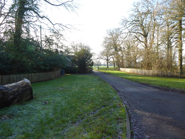
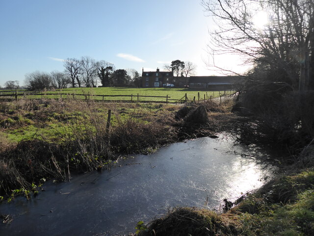
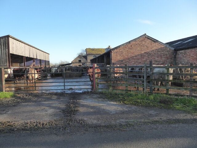
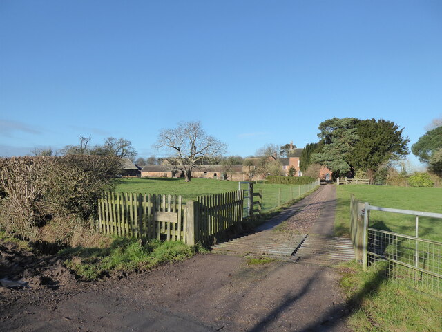
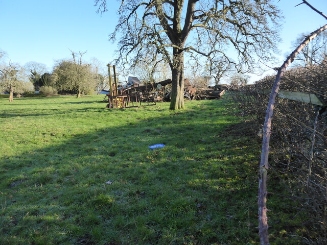
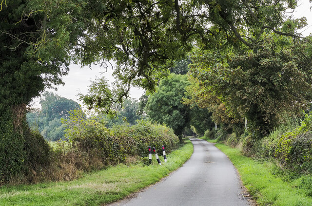
Marsh, The, Staffordshire, is a small village located in the county of Staffordshire, England. Situated approximately 5 miles northeast of the town of Stafford, Marsh is a rural community surrounded by picturesque countryside. The village is nestled close to the banks of the River Penk, which adds to the charm and tranquility of the area.

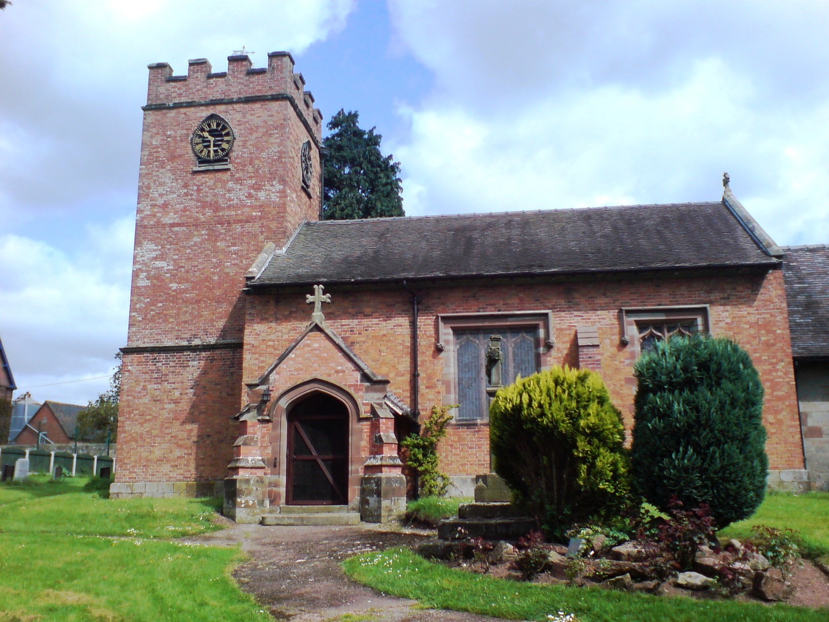
Marsh has a rich history dating back to medieval times. The village is known for its well-preserved timber-framed buildings, some of which date back to the 16th century. The architecture of Marsh reflects its historical significance and provides visitors with a glimpse into the past.

Despite its small size, Marsh offers a range of amenities to its residents. The village boasts a local pub, The Marsh Arms, which serves as a community hub and meeting place for locals and visitors alike. The pub offers a warm and friendly atmosphere, serving traditional English food and a variety of beverages.

The surrounding countryside provides ample opportunities for outdoor activities. Marsh is surrounded by beautiful walking trails and scenic landscapes, making it an ideal destination for nature lovers and hikers. The River Penk also offers opportunities for fishing and boating.

Overall, Marsh, The, Staffordshire, is a charming and historic village that offers a peaceful retreat from the bustling city life. With its rich heritage, stunning countryside, and friendly community, Marsh is an idyllic destination for those seeking a taste of rural England.

If you have any feedback on the listing, please let us know in the comments section below.

Marsh, The Images

Images are sourced within 2km of 52.831281/-2.2389239 or Grid Reference SJ8426. Thanks to Geograph Open Source API. All images are credited.

Ruins at Ranton Quite a sight. It stopped me in my tracks. I could see Ranton Abbey (remains of) marked on my Ordnance Survey 1:25,000 scale map, but I was not expecting two ruins for the price of one. Here is a rare sight indeed; a ruined medieval priory or abbey and hugger-mugger bang right next door, a gloriously ruined country house of some import too! 

My mind raced. How had this juxtaposition come to be? What was the story here? How were two ruins so closely sited and who, what and when were involved.

A mystery. Not being remotely local I have no knowledge to draw upon. Google and Wikipedia will be my friends, teachers and enlighteners. 

Meanwhile, what a jaw-dropping spectacle. 

Both buildings have their own Wikpedia articles, as might be expected, <span class="nowrap"><a title="https://en.wikipedia.org/wiki/Abbey_House,_Ranton" rel="nofollow ugc noopener" href="https://en.wikipedia.org/wiki/Abbey_House,_Ranton">Link</a><img style="margin-left:2px;" alt="External link" title="External link - shift click to open in new window" src="https://s1.geograph.org.uk/img/external.png" width="10" height="10"/></span> here.
Ruins at Ranton
Quite a sight. It stopped me in my tracks. I could see Ranton Abbey (remains of) marked on my Ordnance Survey 1:25,000 scale map, but I was not expecting two ruins for the price of one. Here is a rare sight indeed; a ruined medieval priory or abbey and hugger-mugger bang right next door, a gloriously ruined country house of some import too! My mind raced. How had this juxtaposition come to be? What was the story here? How were two ruins so closely sited and who, what and when were involved. A mystery. Not being remotely local I have no knowledge to draw upon. Google and Wikipedia will be my friends, teachers and enlighteners. Meanwhile, what a jaw-dropping spectacle. Both buildings have their own Wikpedia articles, as might be expected, LinkExternal link here.
Ruins at Ranton The abbey ruins are due to the ravages of time since the Dissolution of the Monasteries in the 1530s and the country house was gutted by a fire started during the Second World War. 

The estate encompassing both was once owned by Lord Lichfield, the famous photographer, aristocrat, Earl of Lichfield and member of the royal circle. 

I would have thought that the building would have been insured? Apparently the bodyguard of Wilhelmina, the Queen of the Netherlands, were billeted here during 1942 and it is then that fire caught hold of the whole building. Tragic. 

Lord Lichfield did intend to renovate the house, but sadly died before he was able to realise his plans. It has since been sold on a few times, recently for £3.5 million in 2011, I believe. 

Suitably interesting tale.
Ruins at Ranton
The abbey ruins are due to the ravages of time since the Dissolution of the Monasteries in the 1530s and the country house was gutted by a fire started during the Second World War. The estate encompassing both was once owned by Lord Lichfield, the famous photographer, aristocrat, Earl of Lichfield and member of the royal circle. I would have thought that the building would have been insured? Apparently the bodyguard of Wilhelmina, the Queen of the Netherlands, were billeted here during 1942 and it is then that fire caught hold of the whole building. Tragic. Lord Lichfield did intend to renovate the house, but sadly died before he was able to realise his plans. It has since been sold on a few times, recently for £3.5 million in 2011, I believe. Suitably interesting tale.
Buildings at Ranton The building on the right is an estate house, or flats. The church tower is the remains of Ranton Abbey. The ivy coated ruin is that of Abbery House, Ranton, a country house to my uneducated eye, but apparently just a shooting lodge to the Earls of Lichfield. It hosted many grand shooting parties in its heyday in the 1830s and 1840s, when Prime Ministers and influential politicians regularly attended.

If walls could talk. 

It was gutted by fire when Dutch soldiers were stationed here in 1942. Not arson. Could have been electrical, or a smoker forgetting a cigarette etc etc. 

Sad it has never been restored. But then again, what a sight to behold.
Buildings at Ranton
The building on the right is an estate house, or flats. The church tower is the remains of Ranton Abbey. The ivy coated ruin is that of Abbery House, Ranton, a country house to my uneducated eye, but apparently just a shooting lodge to the Earls of Lichfield. It hosted many grand shooting parties in its heyday in the 1830s and 1840s, when Prime Ministers and influential politicians regularly attended. If walls could talk. It was gutted by fire when Dutch soldiers were stationed here in 1942. Not arson. Could have been electrical, or a smoker forgetting a cigarette etc etc. Sad it has never been restored. But then again, what a sight to behold.
Ruined Ranton Abbey The tower remains really. I can imagine when the abbey was sited here and managed the landscape around and the people. Now it is just a lonely prong. I feel its pain.
Ruined Ranton Abbey
The tower remains really. I can imagine when the abbey was sited here and managed the landscape around and the people. Now it is just a lonely prong. I feel its pain.
Ruined shooting lodge at Ranton Burned out in 1942 when obviously other pressing matters meant that the building was not immediately revived. It has been decaying ever since. 

It is quite something to walk around and observe a glimpse into its ruined guts. Old fireplaces remain, where Prime Ministers and aristocrats must have conferred, the kitchen section (I think) is just visible, where harassed kitchen staff and servants must have bustled. 

Watercolour paintings depict the shooting parties that stayed here. Now jackdaws are the only residents.
Ruined shooting lodge at Ranton
Burned out in 1942 when obviously other pressing matters meant that the building was not immediately revived. It has been decaying ever since. It is quite something to walk around and observe a glimpse into its ruined guts. Old fireplaces remain, where Prime Ministers and aristocrats must have conferred, the kitchen section (I think) is just visible, where harassed kitchen staff and servants must have bustled. Watercolour paintings depict the shooting parties that stayed here. Now jackdaws are the only residents.
Twin ruins at Ranton Two sad old friends. They comfort each other.
Twin ruins at Ranton
Two sad old friends. They comfort each other.
Ruined Ranton Abbey House Ruins are more eloquent than extant buildings I think.
Ruined Ranton Abbey House
Ruins are more eloquent than extant buildings I think.
Rear view of ruined Ranton Abbey House This side gets shade so trees are able to thrive and ivy burgeon.
Rear view of ruined Ranton Abbey House
This side gets shade so trees are able to thrive and ivy burgeon.
Old entrance to Abbey House, Ranton The lodge remains.
Old entrance to Abbey House, Ranton
The lodge remains.
Frozen culvert near Ranton Hall farm I love and relish wintry walks. They are sometimes too rare. Even a drainage ditch is rendered an excess of grace and beauty after a frosty morning.
Frozen culvert near Ranton Hall farm
I love and relish wintry walks. They are sometimes too rare. Even a drainage ditch is rendered an excess of grace and beauty after a frosty morning.
Beef cattle at Ranton Hall farm These happy, healthy looking beef cattle are enjoying life at Ranton Hall farm.
Beef cattle at Ranton Hall farm
These happy, healthy looking beef cattle are enjoying life at Ranton Hall farm.
Ranton Hall farm Nice place. Remnant of a moat way back there somewhere too.
Ranton Hall farm
Nice place. Remnant of a moat way back there somewhere too.
Pile of junk in front of Ranton Hall farm Looks like they've had a clear out; there is quite an assortment here, from old corners are god knows where.
Pile of junk in front of Ranton Hall farm
Looks like they've had a clear out; there is quite an assortment here, from old corners are god knows where.
Milepost beside A519 south of Eccleshall Despite its look of antiquity the milepost cast presumably in iron, was made as recently as 2008. In addition to the various locations and distances given on its two faces, the top has the wording, Eccleshall Parish.
Milepost beside A519 south of Eccleshall
Despite its look of antiquity the milepost cast presumably in iron, was made as recently as 2008. In addition to the various locations and distances given on its two faces, the top has the wording, Eccleshall Parish.
Road towards Ellenhall Park Farm The farm is a short distance along the minor road, hidden by the density of trees lining it.
Road towards Ellenhall Park Farm
The farm is a short distance along the minor road, hidden by the density of trees lining it.
Ranton Hall, Ranton
Ranton Hall, Ranton
Bridlepath to the Ruins of Ranton Abbey The Earls of Lichfield, who owned the 300-acre estate, left it to decay after  Dutch troops stationed there, accidentally set it alight in 1942
Bridlepath to the Ruins of Ranton Abbey
The Earls of Lichfield, who owned the 300-acre estate, left it to decay after Dutch troops stationed there, accidentally set it alight in 1942
Hilltop Farm Hilltop Farm is on the B4405 between Woodseaves and Broad Heath.
Hilltop Farm
Hilltop Farm is on the B4405 between Woodseaves and Broad Heath.
Show me another place!

Marsh, The is located at Grid Ref: SJ8426 (Lat: 52.831281, Lng: -2.2389239)

Administrative County: Staffordshire

District: Stafford

Police Authority: Staffordshire

What 3 Words

///traders.estimated.tearfully. Near Eccleshall, Staffordshire

Related Wikis

Ellenhall

Ellenhall is a small Staffordshire village roughly 2.5 miles south of Eccleshall originally comprising part of the extensive estates of the Earl of Lichfield...
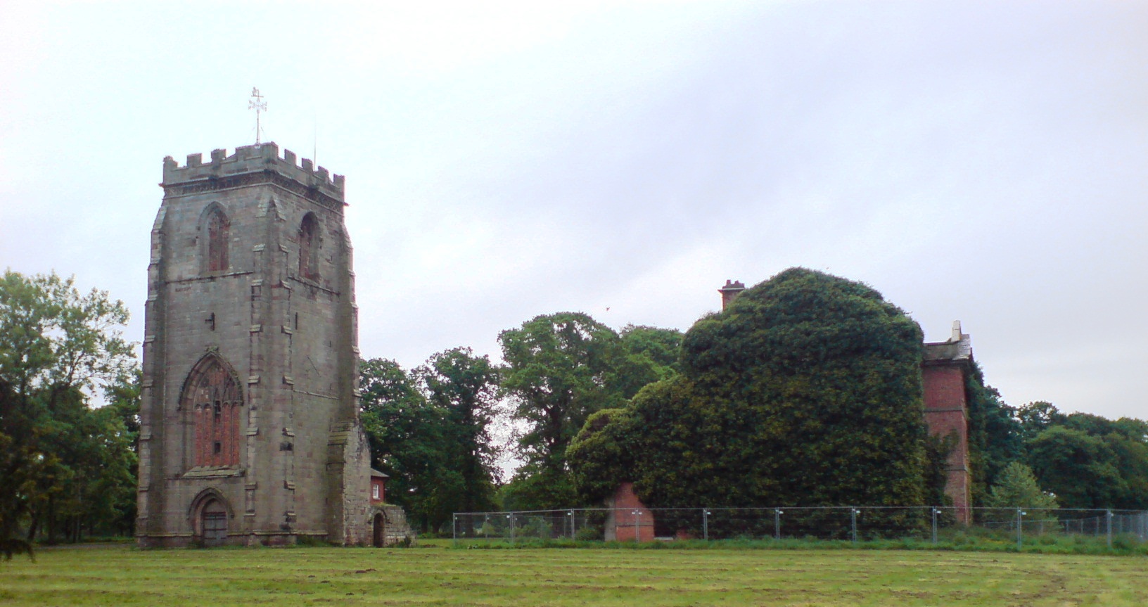
Ranton Abbey

Ranton Abbey or Ranton Priory was an Augustinian Priory in Ranton, Staffordshire, England, built c.1150 by Robert fitz Noel of Ellenhall. The priory flourished...
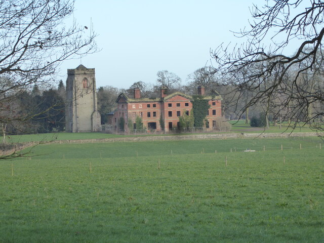
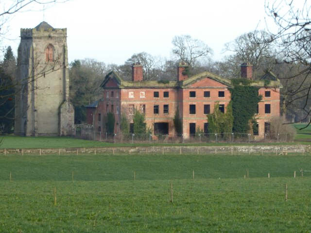
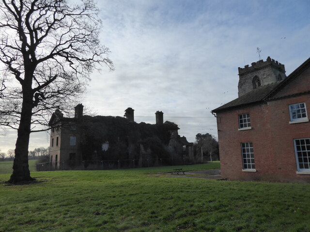
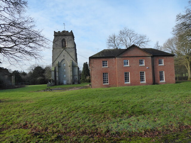
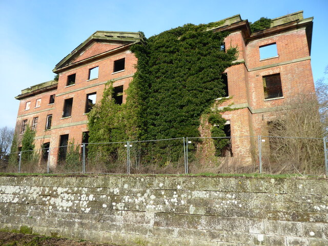
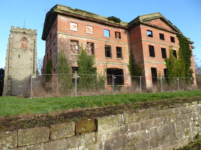
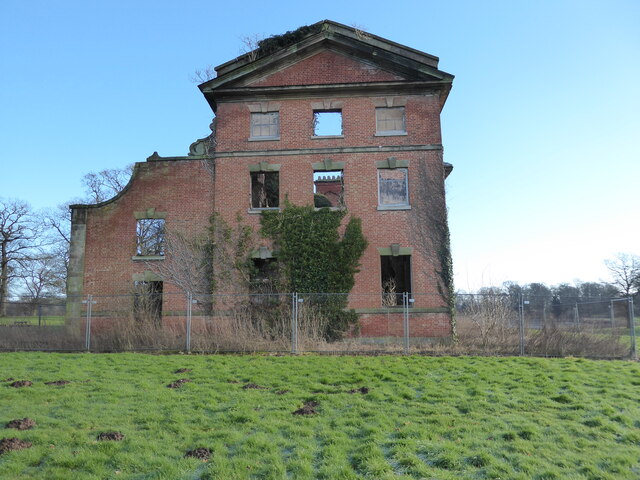
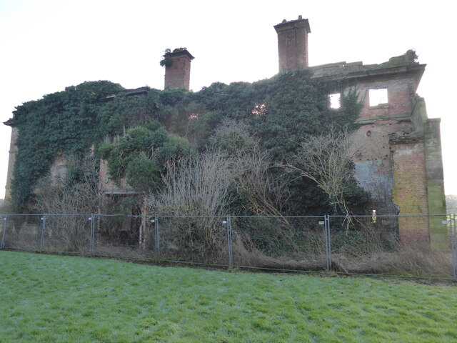
Abbey House, Ranton

Abbey House is an early 19th-century ruined stately home in Ranton, Staffordshire, England. == History == The red-brick Regency house was built in 1820...

Walton Hall Academy

Walton Hall Academy (formerly Walton Hall Community Special School) is a mixed special school of approximately 150 pupils. The school is based in Eccleshall...

Nearby Amenities

Located within 500m of 52.831281,-2.2389239
Bus Stop
Parish Room
Bus: yes
Naptan AtcoCode: 3800C792300
Naptan Bearing: SE
Naptan CommonName: Parish Room
Naptan Indicator: Adj
Naptan Landmark: Parish Room
Naptan Street: Grange Close
Naptan Verified: no
Public Transport: platform
Source: naptan_import
Lat/Long: 52.8329405/-2.2333857
The data included in this document is from www.openstreetmap.org. The data is made available under ODbL.

Have you been to Marsh, The?

Leave your review of Marsh, The below (or comments, questions and feedback).