Heath, The
Settlement in Norfolk Broadland
England
Heath, The
Heath, The, Norfolk is a small village located in the county of Norfolk, England. Situated approximately 10 miles south-west of Norwich, the village is nestled amidst the picturesque Norfolk countryside. With a population of around 500 residents, it offers a peaceful and close-knit community environment.
The village is known for its natural beauty, characterized by expansive heathland, lush green fields, and scattered woodland areas. The heathland, after which the village is named, is a prominent feature of the landscape and provides a habitat for a variety of flora and fauna. It is a popular spot for nature enthusiasts, offering opportunities for walking, bird-watching, and exploring the local biodiversity.
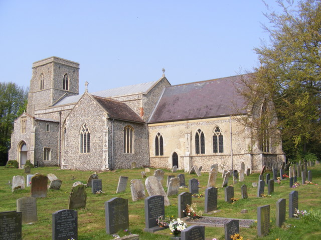
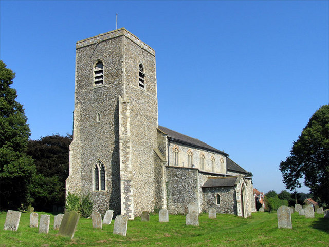
Heath, The, Norfolk has a rich history, with evidence of settlements dating back to the Roman period. The village retains some historical buildings, including a beautiful medieval church, St. Mary's, which serves as a focal point for the community. The church, with its stunning architecture and peaceful surroundings, is often visited by locals and tourists alike.
Amenities in the village include a village hall, a primary school, and a pub, which serves as a social hub for residents. While it may not have extensive commercial offerings, the village benefits from its proximity to larger towns and cities, ensuring easy access to a wider range of services and facilities.
Overall, Heath, The, Norfolk is a charming and idyllic village, offering a tranquil lifestyle and the opportunity to immerse oneself in the natural beauty of the Norfolk countryside.
If you have any feedback on the listing, please let us know in the comments section below.
Heath, The Images
Images are sourced within 2km of 52.747679/1.2343591 or Grid Reference TG1821. Thanks to Geograph Open Source API. All images are credited.


Heath, The is located at Grid Ref: TG1821 (Lat: 52.747679, Lng: 1.2343591)
Administrative County: Norfolk
District: Broadland
Police Authority: Norfolk
What 3 Words
///handsets.neatly.limp. Near Buxton, Norfolk
Nearby Locations
Related Wikis

St Faith's and Aylsham Rural District
St Faith's and Aylsham Rural Districts were adjacent rural districts in Norfolk, England from 1894 to 1935.They were formed under the Local Government...

Hevingham
Hevingham is a village and civil parish in the Broadland district of the English county of Norfolk. Situated between the A140 road Norwich to Cromer road...

Cawston and Marsham Heaths
Cawston and Marsham Heaths is a 116.7-hectare (288-acre) biological Site of Special Scientific Interest north of Norwich in Norfolk.These heaths are dominated...
Marsham, Norfolk
Marsham is a village and civil parish in the English county of Norfolk, about 10 miles (16 km) north of Norwich. It covers an area of 7.40 km2 (2.86 sq...

Haveringland
Haveringland is a village and civil parish in the English county of Norfolk about 8 miles (13 km) north-west of Norwich. It covers an area of 8.91 km2...

Bolwick Hall
Bolwick Hall is located at Marsham, Norfolk, 1 mile south of Aylsham. == History == The hall is recorded in the Domesday Book of 1086 and given to King...

Brampton, Norfolk
Brampton is a small village and parish in the county of Norfolk, England, in the Bure Valley, east of Aylsham. == History == Brampton was the subject of...

The Mermaid (river)
The Mermaid (river) is a minor tributary of the River Bure in Norfolk, England, and is approximately 6 kilometres (3.7 mi) in length. == Course == The...
Nearby Amenities
Located within 500m of 52.747679,1.2343591Have you been to Heath, The?
Leave your review of Heath, The below (or comments, questions and feedback).