Colony, The

Settlement in Oxfordshire Cherwell

England

Colony, The

Summer wheat fields View south from B 4035 near Gallow Hill Farm
Summer wheat fields Credit: John Smith

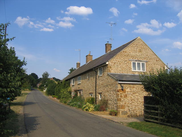
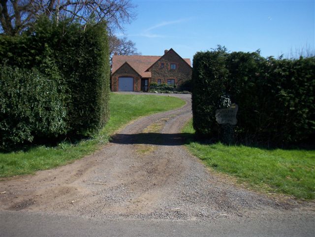
The Colony, located in Oxfordshire, England, is a small residential area known for its picturesque surroundings and architectural charm. Situated near the historic city of Oxford, the Colony offers residents a tranquil and idyllic retreat away from the bustling city center.

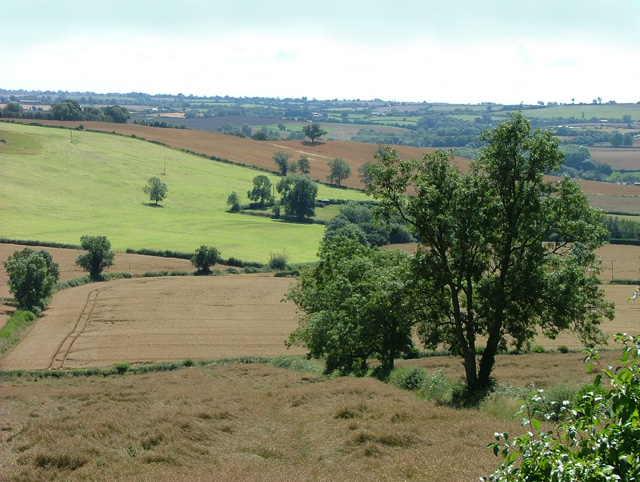
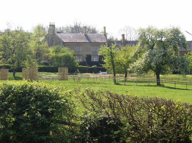
Characterized by its well-preserved Victorian and Edwardian houses, the Colony showcases a unique blend of architectural styles, including Queen Anne and Arts and Crafts. Each property exudes a distinct character, with many featuring large gardens and beautiful green spaces, enhancing the area's overall aesthetic appeal.

The Colony benefits from its close proximity to various amenities and facilities. The nearby town of Abingdon offers a range of shops, restaurants, and entertainment options, ensuring residents have easy access to everyday necessities. Additionally, the location provides excellent transport links, with regular bus services connecting the Colony to Oxford and surrounding areas.

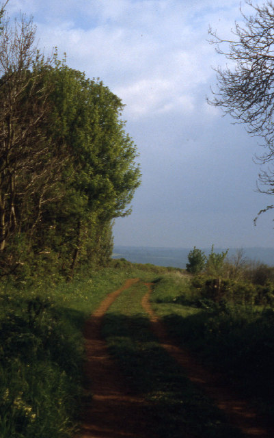
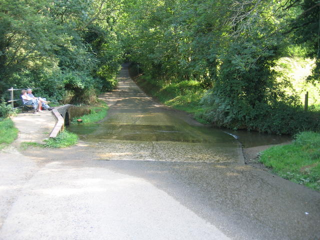
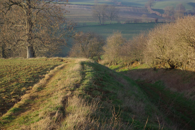
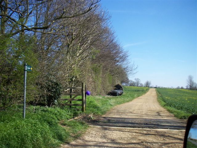
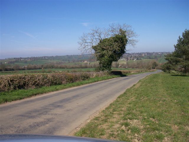
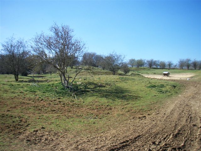
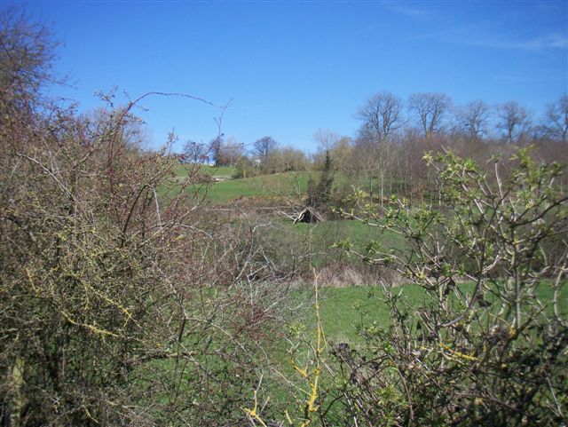
Nature enthusiasts are drawn to the Colony due to its abundance of green spaces and nearby countryside. Residents can enjoy leisurely walks or bike rides along the charming country lanes and explore the scenic Oxfordshire landscape. The Thames Path, a popular walking route, is also easily accessible from the Colony, providing opportunities for outdoor activities and relaxation.

Overall, the Colony in Oxfordshire offers a tranquil and scenic residential environment, with its unique architectural heritage and its desirable location near Oxford and the surrounding countryside.

If you have any feedback on the listing, please let us know in the comments section below.

Colony, The Images

Images are sourced within 2km of 52.030374/-1.5058273 or Grid Reference SP3437. Thanks to Geograph Open Source API. All images are credited.

Summer wheat fields View south from B 4035 near Gallow Hill Farm
Summer wheat fields
View south from B 4035 near Gallow Hill Farm
Ditchedge Lane A green road forming part of the boundary between Oxfordshire and Warwickshire, probably an old trading route.
Ditchedge Lane
A green road forming part of the boundary between Oxfordshire and Warwickshire, probably an old trading route.
Wykham Arms, Sibford Gower
Traitor's Ford I have not yet managed to trace the origins of the unusual name for the ford.  One thing is for certain however - it is a cool place to relax on the hottest July day since records began!
Traitor's Ford
I have not yet managed to trace the origins of the unusual name for the ford. One thing is for certain however - it is a cool place to relax on the hottest July day since records began!
The Colony The Colony consists of several rows of cottages beside the road approaching Sibford Gower from the south west.
The Colony
The Colony consists of several rows of cottages beside the road approaching Sibford Gower from the south west.
The Manor House, Sibford Gower According to the <a href="https://www.geograph.org.uk/photo/273647">SP3537 : Blue Plaque at the Manor House</a> this was the home of Frank William Thomas Charles Lascelles.
The Manor House, Sibford Gower
According to the SP3537 : Blue Plaque at the Manor House this was the home of Frank William Thomas Charles Lascelles.
Blue Plaque at the Manor House A close up of the blue plaque on the gateway of <a href="https://www.geograph.org.uk/photo/273646">SP3537 : The Manor House, Sibford Gower</a>.
Blue Plaque at the Manor House
A close up of the blue plaque on the gateway of SP3537 : The Manor House, Sibford Gower.
Bridleway west of Sibford Gower The bridleway is sunk below the level of the surrounding farmland as it makes its way into the valley of one of the headwaters of the River Stour. It leads from Sibford Gower to Gallow Hill Farm, across the valley on the B4035.
Bridleway west of Sibford Gower
The bridleway is sunk below the level of the surrounding farmland as it makes its way into the valley of one of the headwaters of the River Stour. It leads from Sibford Gower to Gallow Hill Farm, across the valley on the B4035.
Farm Buildings north of Sibford Gower Barn stacked with hay and straw just off the lane leading north out of Sibford Gower village.
Farm Buildings north of Sibford Gower
Barn stacked with hay and straw just off the lane leading north out of Sibford Gower village.
Sheep at Sibford Ferris Four sheep tuck into their winter hay rations while keeping a wary eye on the photographer. They were in a field between Sibford Ferris and Burdrop, with Sibford Gower in the distance.
Sheep at Sibford Ferris
Four sheep tuck into their winter hay rations while keeping a wary eye on the photographer. They were in a field between Sibford Ferris and Burdrop, with Sibford Gower in the distance.
Walford Road, Sibford Ferris Up-market housing development with a nod to traditional Cotswold architecture.
Walford Road, Sibford Ferris
Up-market housing development with a nod to traditional Cotswold architecture.
Approaching Sibford Gower Heading into Sibford Gower village from the north. 'Gower' is a manorial affix indicating ownership by the Guher family, distinguishing it from nearby Sibford Ferris which was in the possession of the de Ferrers. Burdrop is an adjoining hamlet.
Approaching Sibford Gower
Heading into Sibford Gower village from the north. 'Gower' is a manorial affix indicating ownership by the Guher family, distinguishing it from nearby Sibford Ferris which was in the possession of the de Ferrers. Burdrop is an adjoining hamlet.
Austin Grounds Farm
Austin Grounds Farm
Footpath
Footpath
Farm buildings
Farm buildings
Rough pasture
Rough pasture
Fields
Fields
Show me another place!

Colony, The is located at Grid Ref: SP3437 (Lat: 52.030374, Lng: -1.5058273)

Administrative County: Oxfordshire

District: Cherwell

Police Authority: Thames Valley

What 3 Words

///breathing.firmer.insect. Near Lower Brailes, Warwickshire

Nearby Locations

The Colony Colony, The

Related Wikis

Traitor's Ford

Traitor's Ford is a ford on the River Stour, in the English county of Warwickshire close to its border with Oxfordshire. It is about 2 miles (3.2 km) outside...

Sharp's Hill Quarry

Sharp's Hill Quarry is a 2.4-hectare (5.9-acre) geological Site of Special Scientific Interest west of Banbury in Oxfordshire. It is a Geological Conservation...

Woodford Bottom and Lamb's Pool

Woodford Bottom and Lamb's Pool is a 3-hectare (7.4-acre) nature reserve south of Sibford Ferris in Oxfordshire. It is managed by the Berkshire, Buckinghamshire...

Sibford School

Sibford School is a British co-educational independent school in Sibford Ferris, west of Banbury in north Oxfordshire, linked with the Religious Society...

Sibford Ferris

Sibford Ferris is a village and civil parish about 6.5 miles (10.5 km) west of Banbury in Oxfordshire. It is on the south side of the Sib valley opposite...
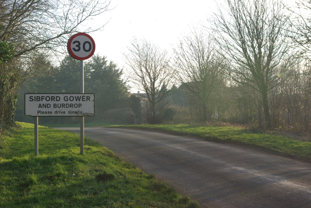
Burdrop

Burdrop is a village in Sibford Gower civil parish, about 6.5 miles (10.5 km) west of Banbury in Oxfordshire, England. Burdrop is contiguous with Sibford...

Ascott, Warwickshire

Ascott is a village in Warwickshire, England. Population details can be found under Whichford. == External links == Media related to Ascott, Warwickshire...

Hook Norton ironstone quarries (Baker)

The Hook Norton ironstone quarries (Baker) were ironstone quarries at Hook Norton, Oxfordshire, England, operating from the 1890s to the end of the First...

Nearby Amenities

Located within 500m of 52.030374,-1.5058273
Location Transition: yes
Power: pole
Lat/Long: 52.0332927/-1.503666
College Barn Farm
Building: farm
Source: OS_OpenData_StreetView
Lat/Long: 52.0274207/-1.5035385
College Barn
Building: barn
Source: OS_OpenData_StreetView
Lat/Long: 52.026852/-1.5066347
Power: pole
Lat/Long: 52.0264842/-1.5035457
College Barn Farm
Power: pole
Transformer: distribution
Voltage Primary: 11000
Lat/Long: 52.027185/-1.5034482
Power: pole
Lat/Long: 52.0340658/-1.5038133
Power: pole
Lat/Long: 52.0309344/-1.5099047
Power: pole
Lat/Long: 52.0307142/-1.510917
Power: pole
Lat/Long: 52.0316192/-1.506977
Power: pole
Lat/Long: 52.0321991/-1.5057035
Haynes Barn
Location Transition: yes
Power: pole
Transformer: distribution
Voltage Primary: 11000
Lat/Long: 52.0326675/-1.5046322
New Barn Farm
Power: pole
Transformer: distribution
Voltage Primary: 11000
Lat/Long: 52.0314236/-1.5037443
Power: pole
Lat/Long: 52.0313085/-1.5083201
Power: pole
Lat/Long: 52.0303274/-1.512332
The data included in this document is from www.openstreetmap.org. The data is made available under ODbL.

Have you been to Colony, The?

Leave your review of Colony, The below (or comments, questions and feedback).