Thankerton

Settlement in Lanarkshire

Scotland

Thankerton

The view upstream from Thankerton Bridge A view of this serene stretch of the River Clyde, looking upstream from Thankerton (Boat) Bridge.

This photograph was taken during the Coronavirus (COVID-19) pandemic of 2020/21.
The view upstream from Thankerton Bridge Credit: James T M Towill

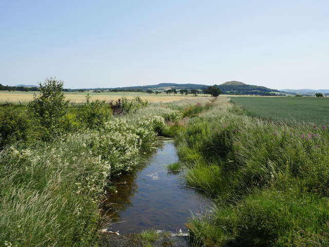
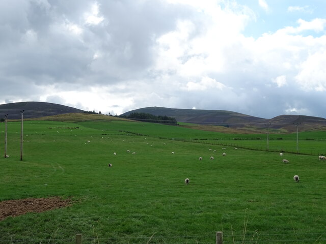
Thankerton is a small village located in the county of Lanarkshire, Scotland. Situated approximately 5 miles southeast of the town of Biggar, it is nestled within a picturesque rural landscape. The village is surrounded by stunning rolling hills and farmland, offering a tranquil and idyllic setting.

Historically, Thankerton was primarily an agricultural community, with farming playing a significant role in its economy. Over the years, the village has seen some expansion, with a few residential developments and amenities added to cater to the needs of its residents.

Although small in size, Thankerton has a tight-knit community with a friendly and welcoming atmosphere. The village boasts a primary school, providing education for local children, and a church, serving as a place of worship and community gatherings. Additionally, there is a village hall that hosts various events and activities throughout the year, fostering a sense of community spirit.

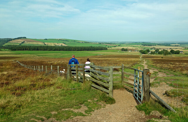
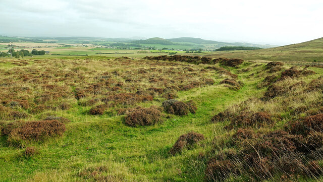
For those seeking outdoor activities, Thankerton offers plenty of opportunities. The surrounding countryside is perfect for walking, hiking, or cycling, with several scenic routes and trails to explore. The nearby Tinto Hill, a prominent landmark in the area, provides breathtaking panoramic views from its summit.

While the village itself may not have extensive amenities, the town of Biggar, just a short drive away, offers a wider range of services, including shops, supermarkets, restaurants, and leisure facilities.

In conclusion, Thankerton is a charming village in Lanarkshire, Scotland, known for its beautiful countryside, strong community spirit, and proximity to the amenities of larger towns. It provides an ideal location for those seeking a peaceful rural lifestyle.

If you have any feedback on the listing, please let us know in the comments section below.
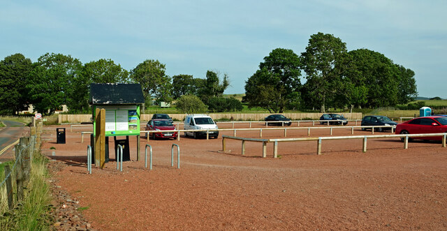
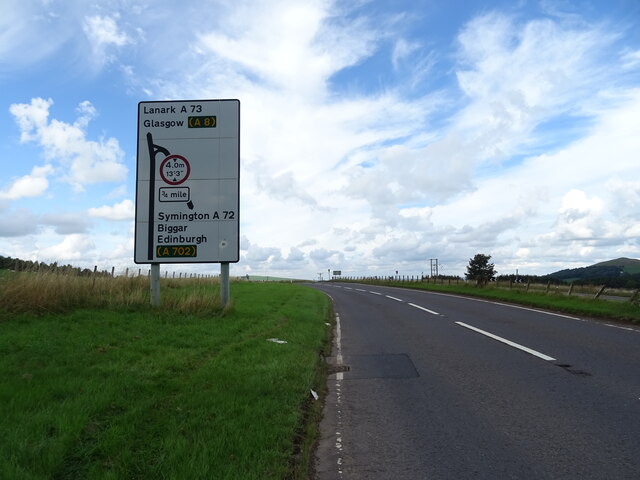
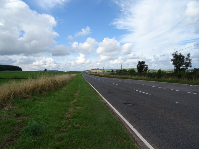
Thankerton Images

Images are sourced within 2km of 55.624039/-3.6325742 or Grid Reference NS9737. Thanks to Geograph Open Source API. All images are credited.

The view upstream from Thankerton Bridge A view of this serene stretch of the River Clyde, looking upstream from Thankerton (Boat) Bridge.

This photograph was taken during the Coronavirus (COVID-19) pandemic of 2020/21.
The view upstream from Thankerton Bridge
A view of this serene stretch of the River Clyde, looking upstream from Thankerton (Boat) Bridge. This photograph was taken during the Coronavirus (COVID-19) pandemic of 2020/21.
Glade Burn from Perryflats Road Looking downstream from the bridge carrying Perryflats Road over this small burn.  The distinctive dome of Quothquan Law can be seen in the distance.

This photograph was taken during the Coronavirus (COVID-19) pandemic of 2020/21.
Glade Burn from Perryflats Road
Looking downstream from the bridge carrying Perryflats Road over this small burn. The distinctive dome of Quothquan Law can be seen in the distance. This photograph was taken during the Coronavirus (COVID-19) pandemic of 2020/21.
Quothquan Law viewed from Covington Road A view of this dome-shaped hill rising to 335 metres at the summit.  The height above sea level at which the River Clyde flows (hidden from view in the centreground here) is 135 metres less.

This photograph was taken during the Coronavirus (COVID-19) pandemic of 2020/21.
Quothquan Law viewed from Covington Road
A view of this dome-shaped hill rising to 335 metres at the summit. The height above sea level at which the River Clyde flows (hidden from view in the centreground here) is 135 metres less. This photograph was taken during the Coronavirus (COVID-19) pandemic of 2020/21.
River Clyde downstream from Thankerton A lush verdant scene beside the Clyde, downstream from the village of Thankerton.  This image was taken from a farm access track downslope from Shieldhill Road.

This photograph was taken during the Coronavirus (COVID-19) pandemic of 2020/21.
River Clyde downstream from Thankerton
A lush verdant scene beside the Clyde, downstream from the village of Thankerton. This image was taken from a farm access track downslope from Shieldhill Road. This photograph was taken during the Coronavirus (COVID-19) pandemic of 2020/21.
On the western slopes of Quothquan Law A pleasant little climb, with only in the region of 135 metres of ascent from Shieldhill Road, below.  In this shot, Black Mount near Dolphinton is prominent in the distance.

This photograph was taken during the Coronavirus (COVID-19) pandemic of 2020/21.
On the western slopes of Quothquan Law
A pleasant little climb, with only in the region of 135 metres of ascent from Shieldhill Road, below. In this shot, Black Mount near Dolphinton is prominent in the distance. This photograph was taken during the Coronavirus (COVID-19) pandemic of 2020/21.
Triangulation pillar at the summit of Quothquan Law 335 metres above sea level; only about 140 metres above the Clyde floodplain at this point.

This photograph was taken during the Coronavirus (COVID-19) pandemic of 2020/21.
Triangulation pillar at the summit of Quothquan Law
335 metres above sea level; only about 140 metres above the Clyde floodplain at this point. This photograph was taken during the Coronavirus (COVID-19) pandemic of 2020/21.
Descending Quothquan Law Heading down from Quothquan Law with the village of Symington in the distance.

This photograph was taken during the Coronavirus (COVID-19) pandemic of 2020/21.
Descending Quothquan Law
Heading down from Quothquan Law with the village of Symington in the distance. This photograph was taken during the Coronavirus (COVID-19) pandemic of 2020/21.
Lonesome pine An outlier from Law Wood on the steep slopes of Quothquan Law.

This photograph was taken during the Coronavirus (COVID-19) pandemic of 2020/21.
Lonesome pine
An outlier from Law Wood on the steep slopes of Quothquan Law. This photograph was taken during the Coronavirus (COVID-19) pandemic of 2020/21.
Field edge on the lower slopes of Quothquan Law The edge of a grass field used for silage making on the lower slopes of Quothquan Law.

This photograph was taken during the Coronavirus (COVID-19) pandemic of 2020/21.
Field edge on the lower slopes of Quothquan Law
The edge of a grass field used for silage making on the lower slopes of Quothquan Law. This photograph was taken during the Coronavirus (COVID-19) pandemic of 2020/21.
On a track down to a field by the Clyde A dusty farm access track to fields recently cropped for silage.  The River Clyde runs in the middle distance, obscured by riparian vegetation.

This photograph was taken during the Coronavirus (COVID-19) pandemic of 2020/21.
On a track down to a field by the Clyde
A dusty farm access track to fields recently cropped for silage. The River Clyde runs in the middle distance, obscured by riparian vegetation. This photograph was taken during the Coronavirus (COVID-19) pandemic of 2020/21.
Tinto Hill car park Viewed on a quiet weekday in mid-September.
Tinto Hill car park
Viewed on a quiet weekday in mid-September.
The Tinto Hill track Looking back towards the car park on the north side of the hill on a lovely but hazy September afternoon.
The Tinto Hill track
Looking back towards the car park on the north side of the hill on a lovely but hazy September afternoon.
Fallburn Hill Fort This impressive Iron Age hill fort is roughly circular, about 60 metres across, with ramparts and ditches that are still clear. The outer ramparts are 5-6 metres higher than the adjacent ditches. Viewed in mid-September after the heather was in bloom.
Fallburn Hill Fort
This impressive Iron Age hill fort is roughly circular, about 60 metres across, with ramparts and ditches that are still clear. The outer ramparts are 5-6 metres higher than the adjacent ditches. Viewed in mid-September after the heather was in bloom.
A73 towards Lanark Approaching junction with the A72.
A73 towards Lanark
Approaching junction with the A72.
Sheep grazing near East Tinto Plantation
A73 towards Lanark
A73 towards Lanark
Stubble field, Sherifflatts Off the A73.
Stubble field, Sherifflatts
Off the A73.
Sherifflatts Farm
Sherifflatts Farm
Show me another place!

Thankerton is located at Grid Ref: NS9737 (Lat: 55.624039, Lng: -3.6325742)

Unitary Authority: South Lanarkshire

Police Authority: Lanarkshire

What 3 Words

///leap.stammer.pleasing. Near Biggar, South Lanarkshire

Nearby Locations

Thankerton

Related Wikis

Thankerton railway station

Thankerton railway station served the village of Thankerton, South Lanarkshire, Scotland, from 1848 to 1965 on the Caledonian main line. == History... ==

Thankerton

Thankerton is a small village in South Lanarkshire, Scotland, United Kingdom. It is located between Biggar and Lanark, and situated between Quothquan Law...

Symington railway station

Symington railway station served the village of Symington in Scotland between 1848 and 1965. It was on the main line of the Caledonian Railway and for...

Quothquan

Quothquan (also formerly spelled Couth-Boan, meaning "the beautiful hill"; Scottish Gaelic: A’ Choitcheann, pronounced [ə ˈxɔʰtʲçən̪ˠ], meaning "the common...

A72 road

The A72 road is a major route in Scotland connecting Hamilton in South Lanarkshire, with Galashiels in the Scottish Borders. It travels for over 97 kilometres...

Symington, South Lanarkshire

Symington is a small village in South Lanarkshire, Scotland, 3 miles (5 km) southwest of Biggar, 10 miles (16 km) east of Douglas and 13 miles (21 km)...

Shieldhill Castle

Shieldhill Castle is a category B listed building located near Biggar in South Lanarkshire. The building dates back to 1199 and is currently being run...

Tinto

Tinto is an isolated hill in the Southern Uplands of Scotland. It comprises little more than one top, which stands on the west bank of the River Clyde...

Nearby Amenities

Located within 500m of 55.624039,-3.6325742
Thankerton
Is In: South Lanarkshire
Place: village
Population: 521
Wikidata: Q7710526
Wikipedia: en:Thankerton
Lat/Long: 55.6249032/-3.6327995
Bus Stop
Dearg
Bus: yes
Naptan AtcoCode: 61501290
Naptan Bearing: S
Naptan CommonName: Dearg
Naptan Indicator: opp
Naptan Landmark: Dearg
Naptan NaptanCode: 75232829
Naptan Street: Sherifflats Road
Public Transport: platform
Ref: 61501290
Source: NaPTAN
Lat/Long: 55.6198194/-3.6306297
Bus Stop
Dundonald
Bus: yes
Naptan AtcoCode: 61501291
Naptan Bearing: N
Naptan CommonName: Dundonald
Naptan Indicator: at
Naptan Landmark: Dundonald
Naptan NaptanCode: 75234945
Naptan Street: Sherifflats Road
Public Transport: platform
Ref: 61501291
Source: NaPTAN
Lat/Long: 55.6201929/-3.630931
Bus Stop
Boat Road
Bus: yes
Naptan AtcoCode: 61501292
Naptan Bearing: N
Naptan CommonName: Boat Road
Naptan Indicator: opp
Naptan Landmark: Boat Road
Naptan NaptanCode: 75235868
Naptan Street: Sherifflats Road
Public Transport: platform
Ref: 61501292
Source: NaPTAN
Lat/Long: 55.6230074/-3.6321597
Bus Stop
Boat Road
Bus: yes
Naptan AtcoCode: 61501293
Naptan Bearing: S
Naptan CommonName: Boat Road
Naptan Indicator: at
Naptan Landmark: Boat Road
Naptan NaptanCode: 75235647
Naptan Street: Sherifflats Road
Public Transport: platform
Ref: 61501293
Source: NaPTAN
Lat/Long: 55.6230157/-3.6320262
Bus Stop
Station Road
Bus: yes
Naptan AtcoCode: 61501294
Naptan Bearing: NW
Naptan CommonName: Station Road
Naptan Indicator: before
Naptan Landmark: Station Road
Naptan NaptanCode: 75235734
Naptan Street: Sherifflats Road
Public Transport: platform
Ref: 61501294
Source: NaPTAN
Lat/Long: 55.6253505/-3.6343695
Bus Stop
Sherifflatts Road
Bus: yes
Naptan AtcoCode: 61501295
Naptan Bearing: SE
Naptan CommonName: Sherifflatts Road
Naptan Indicator: before
Naptan Landmark: Station Road
Naptan NaptanCode: 75235745
Naptan Street: Station Road
Public Transport: platform
Ref: 61501295
Source: NaPTAN
Lat/Long: 55.6255455/-3.6345682
Post Box
Source: survey
Lat/Long: 55.6229524/-3.6321672
Power: pole
Lat/Long: 55.6204762/-3.6294224
Power: pole
Lat/Long: 55.6267389/-3.6377864
Power: pole
Lat/Long: 55.6263448/-3.636513
Power: pole
Lat/Long: 55.6262958/-3.6364051
Power: pole
Lat/Long: 55.6270506/-3.6368303
Thankerton
Historic Railway: station
Railway: site
Wikidata: Q101003959
Wikipedia: en:Thankerton railway station
Lat/Long: 55.6253472/-3.6329739
Bus Stop
Boat Road
Bus: yes
Naptan AtcoCode: 61502000
Naptan Bearing: S
Naptan CommonName: Boat Road
Naptan Indicator: before
Naptan NaptanCode: 75285868
Naptan Street: Sherifflats Road
Public Transport: platform
Ref: 61502000
Source: NaPTAN
Lat/Long: 55.623795/-3.6323098
The data included in this document is from www.openstreetmap.org. The data is made available under ODbL.

Have you been to Thankerton?

Leave your review of Thankerton below (or comments, questions and feedback).