Ainderby Steeple

Settlement in Yorkshire Hambleton

England

Ainderby Steeple

Approaching the A684 Seen from the minor road heading north from Newby Wiske, where it reaches a cross roads junction with A684. The road ahead continues towards Yafforth and is much used by traffic heading towards the northern end of Northallerton, thus avoiding the busy town centre and two level crossings.
Approaching the A684 Credit: Gordon Hatton

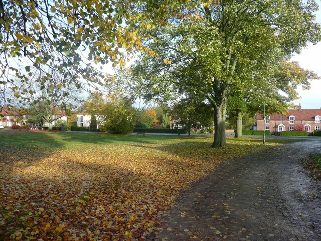
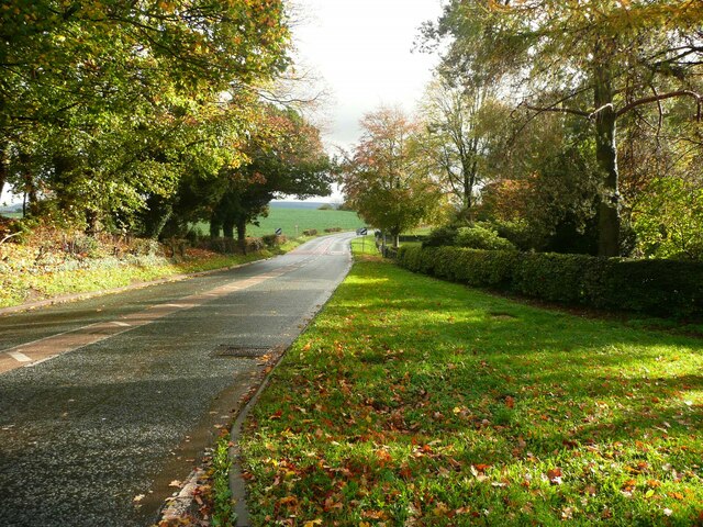
Ainderby Steeple is a picturesque village located in the county of Yorkshire, England. Situated in the Hambleton district, it lies approximately 5 miles southeast of the market town of Northallerton. The village is surrounded by rolling countryside, offering breathtaking views of the Yorkshire Dales National Park to the west.

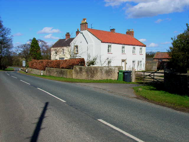
With a population of around 200 residents, Ainderby Steeple is known for its traditional charm and strong sense of community. The village features a range of architectural styles, from quaint stone cottages to elegant Georgian houses. The centerpiece of the village is its historic church, St Helen's, which dates back to the 12th century and boasts a distinctive steeple, giving the village its name.

Despite its small size, Ainderby Steeple offers a variety of amenities for its residents. These include a village hall, a primary school, and a pub, The Carpenters Arms, which serves as a popular gathering place for locals and visitors alike. The village is also well-served by public transportation, with regular bus services connecting it to nearby towns and cities.

Surrounded by idyllic countryside, Ainderby Steeple provides ample opportunities for outdoor activities. The village is located near the River Swale, offering excellent fishing spots and scenic riverside walks. The nearby Yorkshire Dales National Park provides further opportunities for hiking, cycling, and exploring the stunning natural landscapes of the region.

In conclusion, Ainderby Steeple is a charming village in Yorkshire, offering a peaceful and idyllic setting for its residents. With its rich history, strong sense of community, and stunning natural surroundings, it is a hidden gem in the heart of rural England.

If you have any feedback on the listing, please let us know in the comments section below.

Ainderby Steeple Images

Images are sourced within 2km of 54.320421/-1.483035 or Grid Reference SE3391. Thanks to Geograph Open Source API. All images are credited.

Approaching the A684 Seen from the minor road heading north from Newby Wiske, where it reaches a cross roads junction with A684. The road ahead continues towards Yafforth and is much used by traffic heading towards the northern end of Northallerton, thus avoiding the busy town centre and two level crossings.
Approaching the A684
Seen from the minor road heading north from Newby Wiske, where it reaches a cross roads junction with A684. The road ahead continues towards Yafforth and is much used by traffic heading towards the northern end of Northallerton, thus avoiding the busy town centre and two level crossings.
Level crossing on Dolly Lane The road here is unclassified but busy with traffic avoiding Northallerton town centre, whereas the level crossing is rarely used, being on the Wensleydale Railway which normally doesn't operate trains on this section.
Level crossing on Dolly Lane
The road here is unclassified but busy with traffic avoiding Northallerton town centre, whereas the level crossing is rarely used, being on the Wensleydale Railway which normally doesn't operate trains on this section.
Wensleydale Railway level crossing for farm track north of Morton-on-Swale
Milepost on NE side on A684 on the Green at Ainderby Steeple The milepost has Milestone Society National ID: YN_NALb03
Milepost on NE side on A684 on the Green at Ainderby Steeple
The milepost has Milestone Society National ID: YN_NALb03
Milepost, litter bin, bench and crocus on the village green <a href="https://www.geograph.org.uk/photo/7126031">SE3392 : Milepost on NE side on A684 on the Green at Ainderby Steeple</a> is a closeup of the milepost
Milepost, litter bin, bench and crocus on the village green
The village green, Ainderby Steeple
Hall Cottages, Ainderby Steeple
Bus shelter and mile post The mile post is unusual in that it is not fastened to a pillar of stone or concrete.
Bus shelter and mile post
The mile post is unusual in that it is not fastened to a pillar of stone or concrete.
The Wellington Heifer, Ainderby Steeple The inn sign shows a large 'beefy' heifer.
The Wellington Heifer, Ainderby Steeple
The inn sign shows a large 'beefy' heifer.
The road leaving the village, Ainderby Steeple
Old road to Howden Bridge Looking along the road off Ainderby Road leading to Howden Bridge, whereas the main road reaches Viewly Bridge.
Old road to Howden Bridge
Looking along the road off Ainderby Road leading to Howden Bridge, whereas the main road reaches Viewly Bridge.
Viewly Bridge from Howden Bridge Looking towards the new road bridge carrying Ainderby Road from the old road bridge over the River Wiske.
Viewly Bridge from Howden Bridge
Looking towards the new road bridge carrying Ainderby Road from the old road bridge over the River Wiske.
Howden Bridge The old road crossing the River Wiske.
Howden Bridge
The old road crossing the River Wiske.
Bridge over the River Wiske The old road crossing the River Wiske on Howden Bridge.
Bridge over the River Wiske
The old road crossing the River Wiske on Howden Bridge.
Road to Warlaby Looking along the road heading south from Ainderby Road.
Road to Warlaby
Looking along the road heading south from Ainderby Road.
Approaching Ainderby Road The road from Warlaby approaching Ainderby Road.
Approaching Ainderby Road
The road from Warlaby approaching Ainderby Road.
Road passing Warlaby The turning into the village is on the left.
Road passing Warlaby
The turning into the village is on the left.
Fields near Warlaby Looking across farmland to the east of the road.
Fields near Warlaby
Looking across farmland to the east of the road.
Show me another place!

Ainderby Steeple is located at Grid Ref: SE3391 (Lat: 54.320421, Lng: -1.483035)

Division: North Riding

Administrative County: North Yorkshire

District: Hambleton

Police Authority: North Yorkshire

What 3 Words

///directs.awestruck.collapsed. Near Northallerton, North Yorkshire

Related Wikis

Nearby Amenities

Located within 500m of 54.320421,-1.483035
Defibrillator
Emergency: defibrillator
Lat/Long: 54.3229881/-1.4875205
Barrier: stile
Lat/Long: 54.320671/-1.4816855
Waste Basket
Lat/Long: 54.3204454/-1.4830223
Sedgewell Barn
Addr City: Northallerton
Addr Postcode: DL7 9JY
Operator: Wigwam Holidays
Tourism: chalet
Lat/Long: 54.3183249/-1.4843003
The data included in this document is from www.openstreetmap.org. The data is made available under ODbL.

Have you been to Ainderby Steeple?

Leave your review of Ainderby Steeple below (or comments, questions and feedback).