Sytchampton

Settlement in Worcestershire Wychavon

England

Sytchampton

Farmland north of Ombersley Flat meadows as far as the eye can see
Farmland north of Ombersley Credit: Eirian Evans

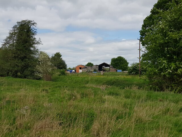
Sytchampton is a charming village located in the county of Worcestershire, England. Situated about 9 miles north of Worcester, it is nestled amidst picturesque countryside, offering residents and visitors a tranquil and idyllic setting.

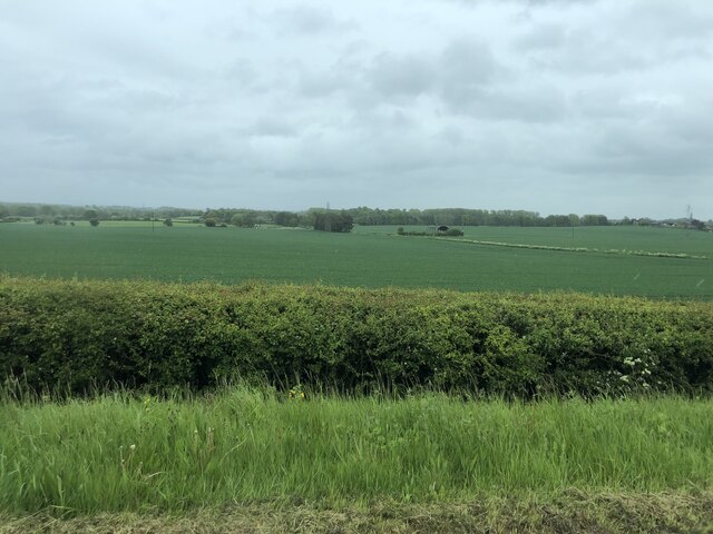
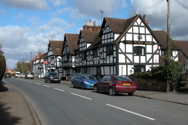
With a population of around 500 residents, Sytchampton exudes a close-knit community atmosphere. The village features an array of quaint cottages, some of which date back to the 17th century, adding to its historical charm. The surrounding countryside is dotted with beautiful fields, providing a scenic backdrop for leisurely walks and outdoor pursuits.

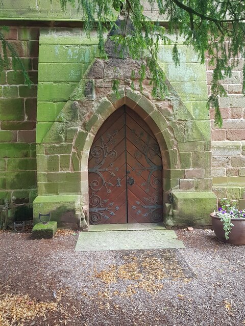
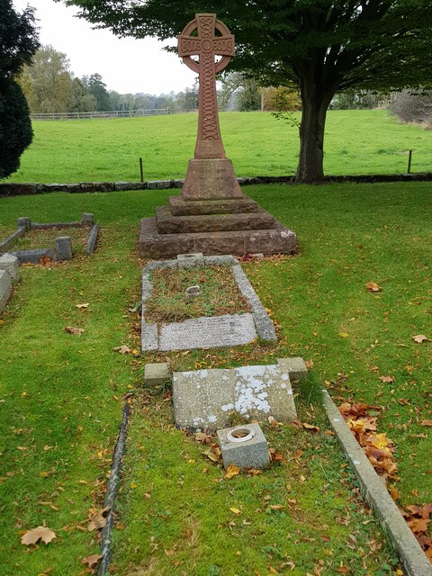
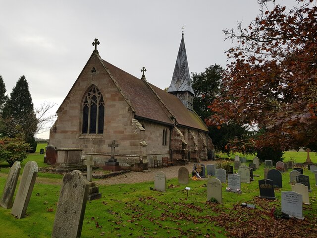
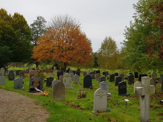
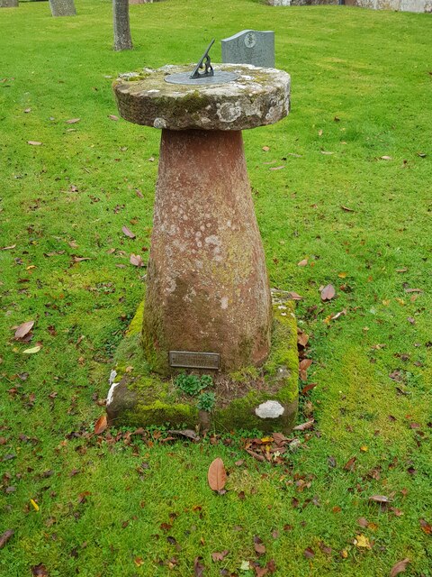
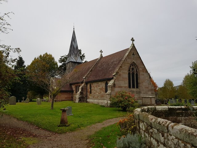
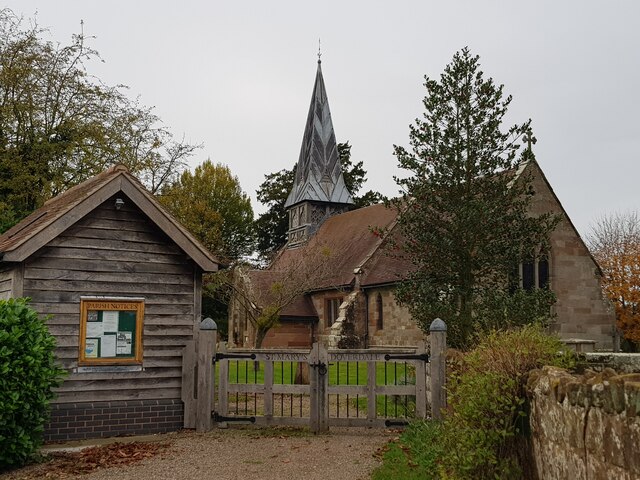
The heart of Sytchampton revolves around St. Mary's Church, a Grade II listed building that stands as a focal point of the village. The church showcases architectural elements from different eras, with the tower dating back to the 13th century. The churchyard offers a peaceful place for reflection and is often used for community events.

Despite its small size, Sytchampton boasts a vibrant community spirit. The village hall serves as a hub for various social activities, including clubs, classes, and events. The annual Sytchampton Summer Fete is a highly anticipated event, bringing residents together for a day of fun, games, and local food.

Sytchampton benefits from its proximity to larger towns and cities, with Worcester providing essential amenities and services. The village is well-connected by road, making it easily accessible for both residents and visitors alike.

In summary, Sytchampton offers a quintessential English village experience, with its charming architecture, stunning countryside, and tight-knit community making it a delightful place to live or visit.

If you have any feedback on the listing, please let us know in the comments section below.

Sytchampton Images

Images are sourced within 2km of 52.294119/-2.231638 or Grid Reference SO8466. Thanks to Geograph Open Source API. All images are credited.

Farmland north of Ombersley Flat meadows as far as the eye can see
Farmland north of Ombersley
Flat meadows as far as the eye can see
The door of Doverdale church
Gated stile at corner of Doverdale churchyard
Cross and graves in Doverdale Churchyard
Church of St Mary, Doverdale (from the North East)
Autumn colour, Doverdale churchyard
Sundial, Doverdale church
Church of St Mary, Doverdale (from the South East)
St Mary's Doverdale from the car park
Ditch with stream, near Church Farm, Doverdale
Footbridge and footpath through crops, Doverdale The spire of Doverdale Church <a href="https://www.geograph.org.uk/photo/5136945">SO8666 : St Mary's Church, Doverdale</a> can just be made out to the right of the path.
Footbridge and footpath through crops, Doverdale
The spire of Doverdale Church SO8666 : St Mary's Church, Doverdale can just be made out to the right of the path.
Two trees marking position of a stream, Doverdale
Lake by Dean's Wood, Oldfield
Lake by Dean's Wood showing island
Bluebells in Dean's Wood
Walkers heading for Yarding's Farm
Yarding's Farm, Oldfield
Doverdale Mill
Doverdale Mill
Show me another place!

Sytchampton is located at Grid Ref: SO8466 (Lat: 52.294119, Lng: -2.231638)

Administrative County: Worcestershire

District: Wychavon

Police Authority: West Mercia

What 3 Words

///nightcap.scale.deflection. Near Hartlebury, Worcestershire

Related Wikis

Dunhampton

Dunhampton is a village in Worcestershire, England.

Ombersley and Doverdale

Ombersley and Doverdale is an area in Wychavon district, Worcestershire, England served by a single parish council but comprising the two separate civil...

Crossway Green

Crossway Green is a village in Worcestershire, England.

Snead's Green

Snead's Green, sometimes written Sneads Green, is an area of Droitwich Spa, Worcestershire, England.Francis Moule, of Snead's Green House, sold the manorial...

Doverdale

Doverdale is a small village and civil parish in Worcestershire, England, to the west of Droitwich. It has a parish church. Doverdale Manor is one of largest...

Ombersley

Ombersley is a village and civil parish in Wychavon district, in the county of Worcestershire, England. The parish includes the hamlet of Holt Fleet,...

Dick Brook

Dick Brook is small tributary stream of the River Severn that flows through Worcestershire, England.The brook is formed from two small unnamed streams...

Cutnall Green Halt railway station

Cutnall Green Halt was a railway station in Worcestershire, England, serving the nearby village of Hampton Lovett on the Oxford, Worcester and Wolverhampton...

Nearby Amenities

Located within 500m of 52.294119,-2.231638
Bus Stop
A449 North Bound
Bus: yes
Naptan AtcoCode: 2000G002419
Naptan Bearing: N
Naptan CommonName: A449 North Bound
Naptan Indicator: Adj
Naptan Landmark: Struges Farm
Naptan NaptanCode: wocdagaj
Naptan Street: A449
Naptan Verified: no
Public Transport: platform
Source: naptan_import
Lat/Long: 52.2966741/-2.2276239
Bus Stop
Church
Bus: yes
Naptan AtcoCode: 2000G056600
Naptan Bearing: SW
Naptan CommonName: Church
Naptan Indicator: Adj
Naptan Landmark: Church
Naptan NaptanCode: wocgmgmw
Naptan Street: A449
Naptan Verified: no
Public Transport: platform
Source: naptan_import
Lat/Long: 52.294517/-2.2272609
Bus Stop
Church
Bus: yes
Naptan AtcoCode: 2000G056601
Naptan Bearing: N
Naptan CommonName: Church
Naptan Indicator: opp
Naptan Landmark: church
Naptan NaptanCode: wocdjgaw
Naptan Street: A449
Naptan Verified: no
Public Transport: platform
Source: naptan_import
Lat/Long: 52.293147/-2.2284811
A449 North Bound
Naptan AtcoCode: 2000G502417
Naptan Bearing: N
Naptan BusStopType: CUS
Naptan CommonName: A449 North Bound
Naptan Indicator: Adj
Naptan Landmark: Woodfield Lane
Naptan NaptanCode: wocdpwap
Naptan Street: Woodfield Lane
Naptan Verified: no
Source: naptan_import
Lat/Long: 52.2909696/-2.2299258
Bus Stop
Sytchampton Turn
Bus: yes
Naptan AtcoCode: 2000G502440
Naptan Bearing: S
Naptan CommonName: Sytchampton Turn
Naptan Crossing: Dark Lane
Naptan Indicator: Opp
Naptan Landmark: Sytchampton Turn
Naptan NaptanCode: wocgmgwg
Naptan Street: A449
Naptan Verified: no
Public Transport: platform
Source: naptan_import
Lat/Long: 52.2915921/-2.2288441
Bus Stop
A449 South Bound
Bus: yes
Naptan AtcoCode: 2000G502441
Naptan Bearing: S
Naptan CommonName: A449 South Bound
Naptan Indicator: Adj
Naptan Landmark: Woodfield Oaks
Naptan NaptanCode: wocgmgwj
Naptan Street: Woodfield Lane
Naptan Verified: no
Public Transport: platform
Source: naptan_import
Lat/Long: 52.2903767/-2.2297028
Power: tower
Lat/Long: 52.2935904/-2.2353895
Power: tower
Lat/Long: 52.2917568/-2.2328637
Power: tower
Lat/Long: 52.2958291/-2.2373586
Post Box
Collection Plate: CP7
Collection Times: Mo-Fr 16:00; Sa 09:00
Historic Operator: Royal Mail
Post Box Type: lamp
Ref: DY13 79
Source: survey;gps;bing
Lat/Long: 52.2951245/-2.2271553
Fuel
Texaco
Brand: Texaco
Brand Wikidata: Q775060
Website: https://locations.valero.com/en-gb/LocationDetails/Index/WORCESTER-ROAD/0000887202
Lat/Long: 52.296031/-2.226896
Pub
The Leaking Well
Lat/Long: 52.2957587/-2.2267029
Sytchampton
Place: hamlet
Lat/Long: 52.2932685/-2.2317294
Power: pole
Lat/Long: 52.2905137/-2.2353704
Power: pole
Lat/Long: 52.2902266/-2.2341648
Power: pole
Lat/Long: 52.2899624/-2.2330289
Power: pole
Lat/Long: 52.2898246/-2.2324549
Sytchampton
Power: pole
Transformer: distribution
Voltage Primary: 11000
Lat/Long: 52.2940072/-2.2324777
Power: pole
Lat/Long: 52.294729/-2.2329819
Brookhampton Farm Ombersley
Power: pole
Transformer: distribution
Voltage Primary: 11000
Lat/Long: 52.2955984/-2.2336008
Power: pole
Lat/Long: 52.2964715/-2.2342198
Power: pole
Lat/Long: 52.2971924/-2.2347334
Power: pole
Lat/Long: 52.2976579/-2.2352833
Power: pole
Lat/Long: 52.2978428/-2.2345825
Power: pole
Lat/Long: 52.2977985/-2.2337289
Power: pole
Lat/Long: 52.2977563/-2.2328632
Power: pole
Lat/Long: 52.2977022/-2.2315409
Power: pole
Lat/Long: 52.2972429/-2.2304412
Strudges Farm
Power: pole
Transformer: distribution
Voltage Primary: 11000
Lat/Long: 52.2967914/-2.2293616
Power: pole
Lat/Long: 52.296711/-2.2277268
Power: pole
Lat/Long: 52.2974397/-2.2268705
Power: pole
Lat/Long: 52.2927099/-2.2249044
Dunhampton South
Location Transition: yes
Power: pole
Transformer: distribution
Voltage Primary: 11000
Lat/Long: 52.2931676/-2.2275605
Location Transition: yes
Power: pole
Lat/Long: 52.2920384/-2.2258144
Dunhampton Bore Hole
Power: pole
Transformer: distribution
Voltage Primary: 11000
Lat/Long: 52.2919327/-2.2259498
Power: pole
Lat/Long: 52.2914841/-2.2265513
The data included in this document is from www.openstreetmap.org. The data is made available under ODbL.

Have you been to Sytchampton?

Leave your review of Sytchampton below (or comments, questions and feedback).