Ailsworth

Settlement in Northamptonshire

England

Ailsworth

The Village Pound, The Drift, Sutton The plaque reads: "Originally used to impound stray animals. These could be claimed by the owner on payment of a fine"
The Village Pound, The Drift, Sutton Credit: Tim Heaton

Ailsworth is a village located in the county of Northamptonshire, England. It is situated approximately 5 miles west of the city of Peterborough and about 2 miles south of the village of Castor. The village is part of the civil parish of Ailsworth and Castor.

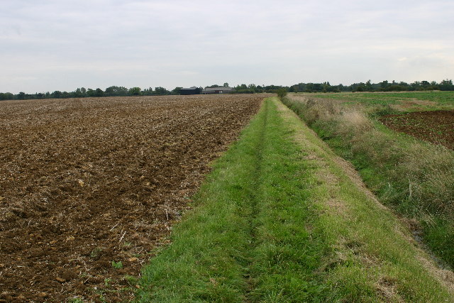
With a population of around 900 people, Ailsworth is a small and close-knit community. The village boasts a picturesque setting, surrounded by rolling countryside and farmland. It offers a peaceful and rural atmosphere, making it an ideal place for those seeking a tranquil lifestyle.

Ailsworth has a rich history, dating back to Roman times. Evidence of Roman occupation has been found in the area, including pottery and coins. The village is also known for its historic buildings, such as the St. John the Baptist Church, which dates back to the 12th century.

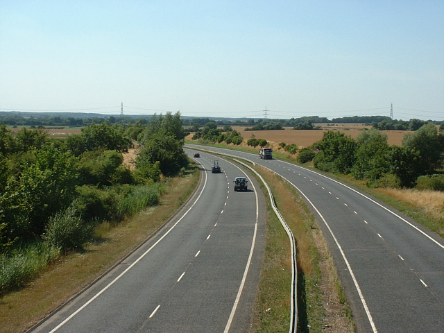
In terms of amenities, Ailsworth has a few local shops and services, including a village pub and a community center. The village is well-connected to nearby towns and cities, with regular bus services and easy access to major roads.

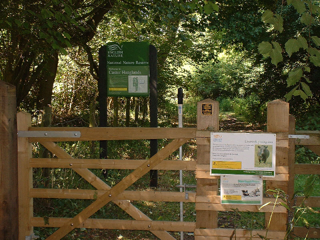
Residents of Ailsworth can enjoy the surrounding natural beauty, with plenty of opportunities for outdoor activities such as walking, cycling, and horse riding. The village is also within close proximity to Ferry Meadows Country Park, a popular recreational area offering lakes, woodlands, and various leisure facilities.

Overall, Ailsworth offers a charming and peaceful rural lifestyle, with a rich history and access to beautiful countryside.

If you have any feedback on the listing, please let us know in the comments section below.

Ailsworth Images

Images are sourced within 2km of 52.575756/-0.352896 or Grid Reference TL1198. Thanks to Geograph Open Source API. All images are credited.

The Village Pound, The Drift, Sutton The plaque reads: "Originally used to impound stray animals. These could be claimed by the owner on payment of a fine"
The Village Pound, The Drift, Sutton
The plaque reads: "Originally used to impound stray animals. These could be claimed by the owner on payment of a fine"
Sutton Village, Cambs
Manor House At Manor Farm In Manor Lane
Electricity Sub-Station Danger of death in Manor Road
Electricity Sub-Station
Danger of death in Manor Road
House at Manor Farm, Sutton
Old Milestone by the A47, east of Wansford Carved stone post by the A47, in parish of Sutton (Mid Bedfordshire District), 400m Nprth East of Sutton village West of roundabout, on the verge, on North side of road. Erected by the Wansford Road turnpike trust in the 19th century. 

Inscription reads:-
TO
PETERBORO
VI
MILES   

Milestone Society National ID: NR_PBLE06
Old Milestone by the A47, east of Wansford
Carved stone post by the A47, in parish of Sutton (Mid Bedfordshire District), 400m Nprth East of Sutton village West of roundabout, on the verge, on North side of road. Erected by the Wansford Road turnpike trust in the 19th century. Inscription reads:- TO PETERBORO VI MILES Milestone Society National ID: NR_PBLE06
Bridleway and farmland northeast of Castor
Upton Church near Peterborough Part of the Shrunken Medieval Village
Upton Church near Peterborough
Part of the Shrunken Medieval Village
Weir on the Nene Way A pleasant walk can be made by following the Nene Way from Ferry Meadows Country Park along the river to Wansford, the home of the Nene Valley steam railway.  This weir is just upstream from Water Newton mill.  Let the train take the strain for the journey back.
Weir on the Nene Way
A pleasant walk can be made by following the Nene Way from Ferry Meadows Country Park along the river to Wansford, the home of the Nene Valley steam railway. This weir is just upstream from Water Newton mill. Let the train take the strain for the journey back.
Castor Mill Bridge - Nene Valley Railway Castor mill bridge carries a quiet backroad over the preserved Nene Valley Railway.  The bridge has seen much action over the years as a favourite location for film and video sets.  On the Queen 'Breakthrough' pop video a steam locomotive is seen to smash its way through the blocked up bridge - the band are seen playing on an open wagon.  In the 1995 James Bond film Goldeneye a heavily disguised ex British Railways class 20 diesel locomotive collides with a tank under the bridge in a spectacular stunt sequence.
Castor Mill Bridge - Nene Valley Railway
Castor mill bridge carries a quiet backroad over the preserved Nene Valley Railway. The bridge has seen much action over the years as a favourite location for film and video sets. On the Queen 'Breakthrough' pop video a steam locomotive is seen to smash its way through the blocked up bridge - the band are seen playing on an open wagon. In the 1995 James Bond film Goldeneye a heavily disguised ex British Railways class 20 diesel locomotive collides with a tank under the bridge in a spectacular stunt sequence.
Castor Church The church of St Kyneburgha at Castor to the west of Peterborough.  Castor is the location of an important Roman settlement and the Roman palace was the second largest Roman building in Britain. The church is built on the site of the Roman courtyard.  The area was an important Roman industrial site where pottery known as 'Castor Ware' was produced.
Castor Church
The church of St Kyneburgha at Castor to the west of Peterborough. Castor is the location of an important Roman settlement and the Roman palace was the second largest Roman building in Britain. The church is built on the site of the Roman courtyard. The area was an important Roman industrial site where pottery known as 'Castor Ware' was produced.
Ailsworth Village Green Ailsworth and its close neighbour Castor lie to the west of Peterborough.  At one time this pleasant village scene would have been on the main road west from the city but the traffic now passes to the north on a modern bypass.  The 'Station Rd' sign gives a clue as to where the road on the right used to lead.  The station itself was about a mile from the village on what is now the Nene Valley Railway <a href="https://www.geograph.org.uk/gridref/TL1197">TL1197</a>.
Ailsworth Village Green
Ailsworth and its close neighbour Castor lie to the west of Peterborough. At one time this pleasant village scene would have been on the main road west from the city but the traffic now passes to the north on a modern bypass. The 'Station Rd' sign gives a clue as to where the road on the right used to lead. The station itself was about a mile from the village on what is now the Nene Valley Railway TL1197.
Castor Station (site of) This is/was the site of Castor station.  Hard to believe now but there would once have been typical country station buildings here manned by several staff.  The village of Castor lies about a mile away to the north-east along a quiet backroad.  The station is long gone but the steam trains are still here.  The line is now the Nene Valley Railway and on 29th April 2006 B1 locomotive Mayflower is seen heading back to the railway's main centre at Wansford.
Castor Station (site of)
This is/was the site of Castor station. Hard to believe now but there would once have been typical country station buildings here manned by several staff. The village of Castor lies about a mile away to the north-east along a quiet backroad. The station is long gone but the steam trains are still here. The line is now the Nene Valley Railway and on 29th April 2006 B1 locomotive Mayflower is seen heading back to the railway's main centre at Wansford.
Open Farmland Between Sutton and Ailsworth This photo emphasises the flat open farmland to the east of the village of Sutton.  The square contains very little of note apart from the very south-west corner where the Nene Valley preserved steam railway crosses.  This shot was taken from an open window on a steam train as it passed through the grid square.
Open Farmland Between Sutton and Ailsworth
This photo emphasises the flat open farmland to the east of the village of Sutton. The square contains very little of note apart from the very south-west corner where the Nene Valley preserved steam railway crosses. This shot was taken from an open window on a steam train as it passed through the grid square.
Men on Powerlines It is not often one sees men moving along high voltage powerlines. These three maintenance workers above the A47 are placing spacers. The power has been turned off.
Men on Powerlines
It is not often one sees men moving along high voltage powerlines. These three maintenance workers above the A47 are placing spacers. The power has been turned off.
Southern entrance to Castor Hanglands NNR, a few miles west of Peterborough The signs on the gate warn that Dexter cattle are grazing within the reserve. Elsewhere are signs warning walkers to be aware of the bull!
Southern entrance to Castor Hanglands NNR, a few miles west of Peterborough
The signs on the gate warn that Dexter cattle are grazing within the reserve. Elsewhere are signs warning walkers to be aware of the bull!
A47 at Ailsworth, Peterborough, looking west The A47 looking west as it passes beneath Helpston Road, Ailsworth, Peterborough. The break in the central barrier serves as a crossing for pedestrians and is signed as such on each carriageway. The road is quiet on Sundays - anyone using this crossing at any other time, risks life or limb!
A47 at Ailsworth, Peterborough, looking west
The A47 looking west as it passes beneath Helpston Road, Ailsworth, Peterborough. The break in the central barrier serves as a crossing for pedestrians and is signed as such on each carriageway. The road is quiet on Sundays - anyone using this crossing at any other time, risks life or limb!
The road into Ailsworth Helpston Road runs downhill into the village of Ailsworth, near Peterborough. The road narrows and levels out following a steep descent from the flyover crossing above the A47 just north of the village. The speed limit is often ignored, as I have confirmed on many occasions while walking pass the walls on the right.
The road into Ailsworth
Helpston Road runs downhill into the village of Ailsworth, near Peterborough. The road narrows and levels out following a steep descent from the flyover crossing above the A47 just north of the village. The speed limit is often ignored, as I have confirmed on many occasions while walking pass the walls on the right.
Show me another place!

Ailsworth is located at Grid Ref: TL1198 (Lat: 52.575756, Lng: -0.352896)

Division: Soke of Peterborough

Unitary Authority: Peterborough

Police Authority: Cambridgeshire

What 3 Words

///highways.officials.rebounded. Near Ailsworth, Cambridgeshire

Nearby Locations

Ailsworth

Related Wikis

Ailsworth

Ailsworth or Ailesworth is a village and civil parish in the City of Peterborough unitary authority, about 4.5 miles (7.2 km) west of the city centre....

Castor, Cambridgeshire

Castor is a village and civil parish in the City of Peterborough unitary authority, about 4 miles (6.4 km) west of the city centre. The parish is part...

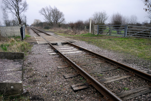
Castor railway station

Castor Railway Station was a station serving the villages Castor and Ailsworth in Cambridgeshire. It was on the old London and North Western Railway Northampton...

Nene Valley Railway

The Nene Valley Railway (NVR) is a preserved railway in Cambridgeshire, England, running between Peterborough Nene Valley and Yarwell Junction. The line...

Castor Flood Meadows

Castor Flood Meadows is a 41.8-hectare (103-acre) biological Site of Special Scientific Interest on the western outskirts of Peterborough in Cambridgeshire...

Durobrivae (Water Newton)

Durobrivae was a Roman fortified garrison town located at Water Newton in the English county of Cambridgeshire, where Ermine Street crossed the River Nene...

Sibson railway station

Sibson railway station served the village of Sibson, in the historic area of Soke of Peterborough, England, from 1870 to 1878 on the Stamford and Essendine...

Sutton, Peterborough

Sutton is a small village and civil parish in the Peterborough district, in the north-west of Cambridgeshire, England. Situated about 5.7 miles from Peterborough...

Nearby Amenities

Located within 500m of 52.575756,-0.352896
Ailsworth
Place: village
Wikidata: Q2790414
Lat/Long: 52.5764037/-0.3497949
Man Made: manhole
Manhole: drain
Lat/Long: 52.5757632/-0.3527927
Board Type: map;history
Information: board
Tourism: information
Lat/Long: 52.575654/-0.3528007
Bench
Backrest: yes
Lat/Long: 52.5757013/-0.3530569
Post Box
Post Box Type: pillar
Ref: PE5 332
Lat/Long: 52.5754976/-0.3527927
Bus Stop
Bench: no
Bus: yes
Fixme: note
Naptan AtcoCode: 0590PGA721
Naptan NaptanCode: PETGATA
Note: Needs putting into route relations: Centrebus R47/47 Whissendine-Oakham-Pbo; Delaine 205 Stamford-Wittering-Pbo. Source:survey https://preview.tinyurl.com/y2luopt2 ; https://preview.tinyurl.com/y4bnkoe5. Appears to be a bi-directional stop
Public Transport: platform
Shelter: no
Lat/Long: 52.5754739/-0.3527685
Playground: structure
Lat/Long: 52.5746966/-0.3545484
Man Made: manhole
Manhole: yes
Operator: Anglian Water
Lat/Long: 52.574113/-0.3543443
Information: board
Operator: Ailsworth Parish Council
Lat/Long: 52.5751066/-0.3518931
Defibrillator
Booth: K6
Colour: red
Defibrillator Location: Inside the telephone box, junction of Peterborough Road and Main Street, Ailsworth
Disused Amenity: telephone
Emergency: defibrillator
Man Made: telephone_box
Lat/Long: 52.5757424/-0.3526197
Nene Overland
Addr City: Ailsworth
Addr Housename: Manor Farm
Addr Postcode: PE5 7DL
Phone: +44 1733 380687
Shop: car
Website: https://www.neneoverland.co.uk/
Lat/Long: 52.5798235/-0.352934
Bench
Lat/Long: 52.5747285/-0.3545322
The data included in this document is from www.openstreetmap.org. The data is made available under ODbL.

Have you been to Ailsworth?

Leave your review of Ailsworth below (or comments, questions and feedback).