Swinton
Settlement in Yorkshire Ryedale
England
Swinton

Swinton is a small town located in the metropolitan borough of Rotherham, South Yorkshire, England. Situated approximately 5 miles northwest of Rotherham town center, Swinton lies within close proximity to the larger cities of Sheffield and Doncaster.
With a population of around 15,000 residents, Swinton is known for its tight-knit community and friendly atmosphere. The town has a rich history, with evidence of settlements dating back to the Iron Age. In the past, Swinton thrived as a coal mining and industrial center, contributing significantly to the local economy. However, like many mining communities in the region, the decline of the industry in the 20th century brought economic challenges to the area.
Today, Swinton offers a range of amenities and services for its residents. The town center features a variety of shops, including both independent retailers and well-known chain stores. There are also several supermarkets, providing convenient access to groceries and everyday essentials.
Swinton benefits from good transportation links, with regular bus services connecting the town to surrounding areas. The nearby Swinton railway station offers direct connections to Sheffield, Doncaster, and other major cities in the region.
For recreational activities, Swinton offers a range of green spaces and parks, including Kilnhurst Ings and Swinton Park. These areas provide opportunities for outdoor leisure activities such as walking, jogging, and picnicking.
In conclusion, Swinton is a small but welcoming town in South Yorkshire, offering a close-knit community, convenient amenities, and a rich historical background.
If you have any feedback on the listing, please let us know in the comments section below.
Swinton Images
Images are sourced within 2km of 54.148406/-0.84032309 or Grid Reference SE7573. Thanks to Geograph Open Source API. All images are credited.


Swinton is located at Grid Ref: SE7573 (Lat: 54.148406, Lng: -0.84032309)
Division: North Riding
Administrative County: North Yorkshire
District: Ryedale
Police Authority: North Yorkshire
What 3 Words
///secondly.equipping.composes. Near Malton, North Yorkshire
Nearby Locations
Related Wikis

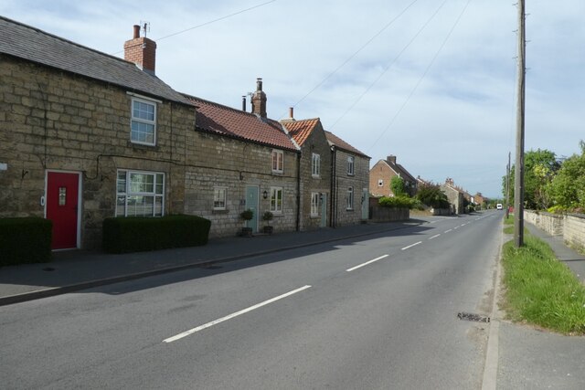
Swinton, Ryedale
Swinton is a village and civil parish in North Yorkshire, England. It is about 2 miles (3.2 km) west of Malton on the B1257 road, and is on the edge of...

Amotherby
Amotherby is a village and civil parish in North Yorkshire, England. It is about 3 miles (4.8 km) west of Malton. == Description == The village appears...

Broughton, Ryedale
Broughton is a village and civil parish in North Yorkshire, England. Broughton is situated 1.5 miles (2.4 km) north-west of Malton. According to the 2011...
Amotherby railway station
Amotherby railway station served the village of Amotherby in the Northern English county of North Yorkshire. It was located on a local line which ran...

Appleton-le-Street with Easthorpe
Appleton-le-Street with Easthorpe is a civil parish in North Yorkshire, England, consisting of Appleton-le-Street and Easthorpe. The parish contained the...

Appleton-le-Street
Appleton-le-Street is a small village and in the Ryedale district of North Yorkshire, England. It is approximately 3 miles (5 km) west of Malton and in...
Hildenley
Hildenley is a former civil parish 2 miles (3.2 km) south-west of Malton, North Yorkshire, England, on the north bank of the River Derwent. In 1961 the...

Malton Community Hospital
Malton Community Hospital is a health facility in Middlecave Road, Malton, North Yorkshire, England. It is managed by York and Scarborough Teaching Hospitals...
Nearby Amenities
Located within 500m of 54.148406,-0.84032309Have you been to Swinton?
Leave your review of Swinton below (or comments, questions and feedback).