Sutton St Edmund
Settlement in Lincolnshire South Holland
England
Sutton St Edmund

Sutton St Edmund is a small village located in the South Holland district of Lincolnshire, England. Situated approximately 9 miles east of Spalding, the village is nestled in the heart of the Fens, a flat and fertile agricultural region.
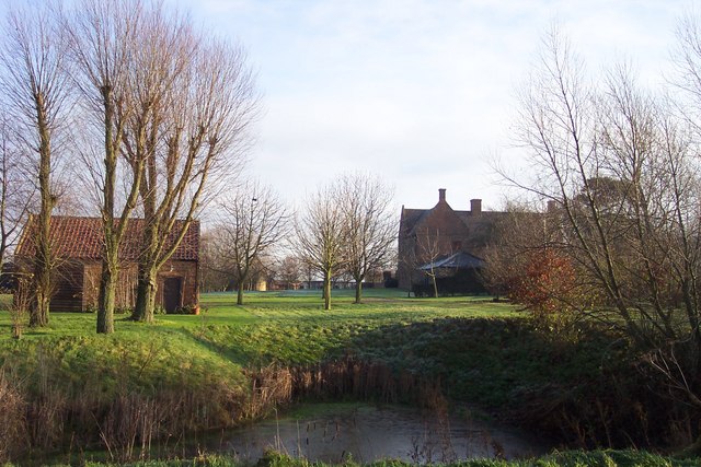
With a population of around 300 residents, Sutton St Edmund is a close-knit community renowned for its picturesque countryside and peaceful atmosphere. The village is characterized by its charming traditional cottages, many of which date back several centuries.
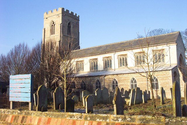
The centerpiece of Sutton St Edmund is its parish church, St Edmund's Church, which stands proudly on the village green. This beautiful medieval church showcases stunning architectural features, including a striking tower and intricate stained glass windows. The church plays an integral role in the community, hosting regular services and events throughout the year.
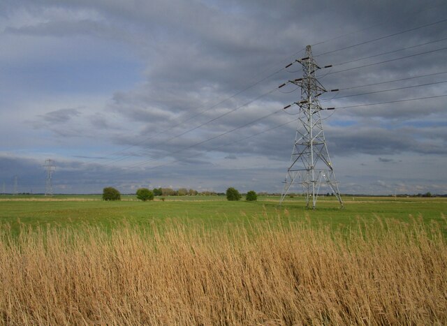
Surrounded by vast fields and farmland, Sutton St Edmund offers stunning views of the surrounding countryside. The village is a haven for nature lovers and outdoor enthusiasts, with ample opportunities for walking, cycling, and birdwatching in the nearby nature reserves and wetlands.
Despite its small size, Sutton St Edmund benefits from a strong community spirit and a range of amenities. These include a village hall, a primary school, and a local pub, providing residents with essential services and a place to socialize.
Overall, Sutton St Edmund is a quintessentially English village, offering a tranquil and idyllic setting for those seeking a peaceful rural lifestyle.
If you have any feedback on the listing, please let us know in the comments section below.
Sutton St Edmund Images
Images are sourced within 2km of 52.700087/0.024115 or Grid Reference TF3613. Thanks to Geograph Open Source API. All images are credited.


Sutton St Edmund is located at Grid Ref: TF3613 (Lat: 52.700087, Lng: 0.024115)
Division: Parts of Holland
Administrative County: Lincolnshire
District: South Holland
Police Authority: Lincolnshire
What 3 Words
///grounding.spillage.lyrics. Near Gedney Hill, Lincolnshire
Nearby Locations
Related Wikis
Sutton St Edmund
Sutton St Edmunds is a village and civil parish in the South Holland district of Lincolnshire, England, about 14 miles (23 km) south-east from the town...

Gedney Hill
Gedney Hill is a village and civil parish in South Holland district of Lincolnshire, England. The population of the civil parish at the 2011 census was...

The Museum of Technology
The Museum of Technology the History of Gadgets and Gizmos (formerly The Museum of Technology, The Great War and WWII) is a technology museum in Throckenholt...
Throckenholt
Throckenholt is a village in the civil parish of Sutton St Edmund (where the population is listed) in the South Holland district of Lincolnshire, England...

Holbeach Drove
Holbeach Drove is a village in the South Holland district of Lincolnshire, England. It is situated approximately 5 miles (8 km) east from Crowland, and...

Parson Drove
Parson Drove is a fen village in the Isle of Ely, Cambridgeshire, England. A linear settlement, it is 6 miles (10 km) west of Wisbech, the nearest town...
FC Parson Drove
Football Club Parson Drove is a football club based in Parson Drove, Cambridgeshire, England. They are currently members of the Eastern Counties League...
St John the Baptist's Church, Parson Drove
St John the Baptist's Church is a redundant Anglican church in the village of Parson Drove, Cambridgeshire, England. It is recorded in the National Heritage...
Nearby Amenities
Located within 500m of 52.700087,0.024115In front of garage.
All at the left of driveway to a house./Broadgate / Cross Road
Have you been to Sutton St Edmund?
Leave your review of Sutton St Edmund below (or comments, questions and feedback).