Surfleet

Settlement in Lincolnshire South Holland

England

Surfleet

Fenland crossroads, Surfleet, Lincs Belnie Lane from Gosberton meets Scoldhall Lane in the north of the parish and the south-east corner of the square.
Fenland crossroads, Surfleet, Lincs Credit: Rodney Burton

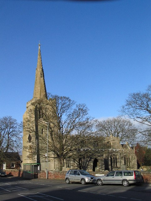
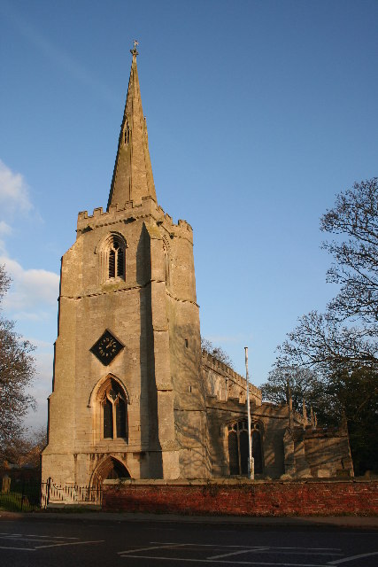
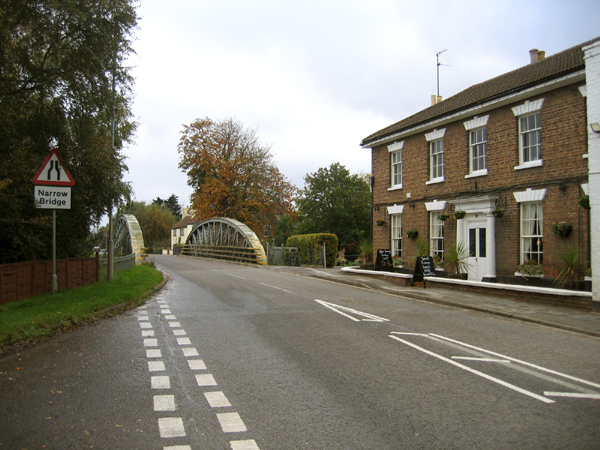
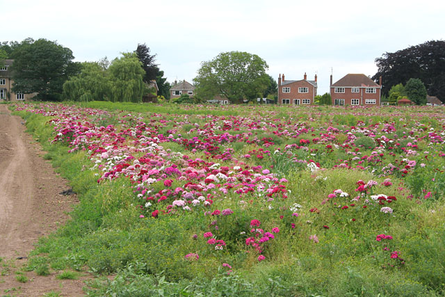
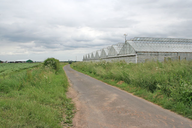
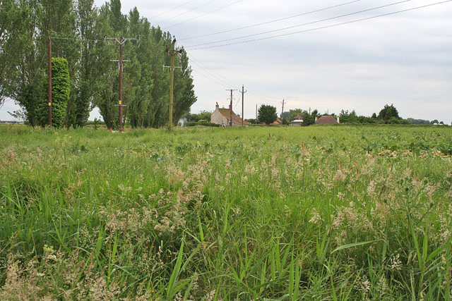
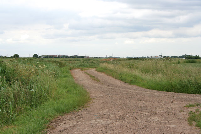
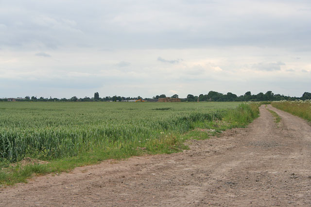
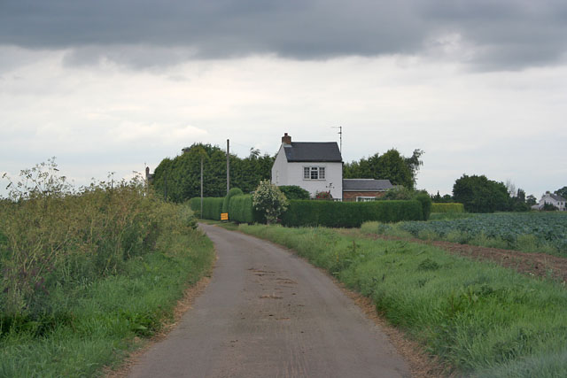
Surfleet is a village located in the South Holland district of Lincolnshire, England. Situated approximately five miles east of Spalding, it lies on the A17 road, which connects it to nearby towns and cities such as Boston and Kings Lynn. The village is nestled along the banks of the River Glen and is surrounded by picturesque farmland, characteristic of the Lincolnshire Fens.

Historically, Surfleet was an important trading port on the river, serving as a hub for the transportation of goods between Lincolnshire and the rest of the country. However, with the decline of river transport in the 19th century, Surfleet's role as a port diminished, and it gradually transformed into a quiet and charming village.

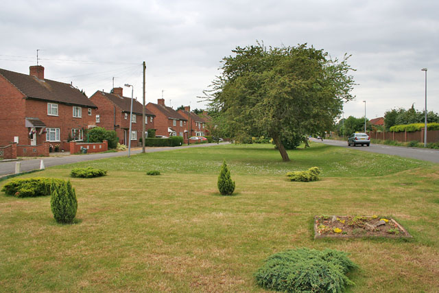
Today, Surfleet retains its rural charm and is known for its beautiful countryside views, offering residents and visitors a peaceful escape from the hustle and bustle of city life. The village is home to a close-knit community and boasts several amenities, including a primary school, a public house, a church, and a village hall.

Surfleet is also a popular destination for nature enthusiasts and outdoor activities. The River Glen provides opportunities for fishing, boating, and wildlife observation. Additionally, the surrounding countryside offers scenic walking and cycling routes, allowing visitors to immerse themselves in the tranquil beauty of the area.

Overall, Surfleet is a quintessential English village, steeped in history and surrounded by picturesque landscapes, making it an ideal place for those seeking a tranquil and idyllic retreat in Lincolnshire.

If you have any feedback on the listing, please let us know in the comments section below.

Surfleet Images

Images are sourced within 2km of 52.836708/-0.144168 or Grid Reference TF2528. Thanks to Geograph Open Source API. All images are credited.

Fenland crossroads, Surfleet, Lincs Belnie Lane from Gosberton meets Scoldhall Lane in the north of the parish and the south-east corner of the square.
Fenland crossroads, Surfleet, Lincs
Belnie Lane from Gosberton meets Scoldhall Lane in the north of the parish and the south-east corner of the square.
Wargate Field Lane
Wargate Field Lane
Church of St. Laurence, Surfleet The top of the tower is 6 feet off perpendicular; a result of subsidence common on the soft ground of the Fenlands.
Church of St. Laurence, Surfleet
The top of the tower is 6 feet off perpendicular; a result of subsidence common on the soft ground of the Fenlands.
St.Laurence's church, Surfleet, Lincs.
Bridge over the River Glen, Surfleet, Lincs An iron girder bridge, built in 1884, with the riverside Mermaid Inn on the right. <span class="nowrap"><a title="http://www.sholland.gov.uk/council/democratic/parishes/surfleet/History+of+Surfleet.htm" rel="nofollow ugc noopener" href="http://www.sholland.gov.uk/council/democratic/parishes/surfleet/History+of+Surfleet.htm">Link</a><img style="margin-left:2px;" alt="External link" title="External link - shift click to open in new window" src="https://s1.geograph.org.uk/img/external.png" width="10" height="10"/></span>
Bridge over the River Glen, Surfleet, Lincs
An iron girder bridge, built in 1884, with the riverside Mermaid Inn on the right. LinkExternal link
Council Houses, Surfleet, Lincs located on Scoldhall Lane, north east of the village.
Council Houses, Surfleet, Lincs
located on Scoldhall Lane, north east of the village.
Sewage works, Surfleet, Lincs on Bendike Lane, adjacent to the A152 road.
Sewage works, Surfleet, Lincs
on Bendike Lane, adjacent to the A152 road.
Farmland off West Marsh Road Onions as far as the eye can see!
Farmland off West Marsh Road
Onions as far as the eye can see!
Hill Marsh Farm, near Spalding
The A16,  Spalding to Boston road Looking towards Boston
The A16, Spalding to Boston road
Looking towards Boston
Farmland near Surfleet Rows of young cabbages.
Farmland near Surfleet
Rows of young cabbages.
Sweet Williams off Park Lane, Surfleet Grown for the cut flower trade.
Sweet Williams off Park Lane, Surfleet
Grown for the cut flower trade.
Glasshouses on Ten Acre Lane, Crossgate
Farmland on White Cross Lane, Surfleet
Crossgate near Spalding Oldham Drive to the left and Surfleet Road to the right.
Crossgate near Spalding
Oldham Drive to the left and Surfleet Road to the right.
Ten Acre Lane near Crossgate Looking towards the A16
Ten Acre Lane near Crossgate
Looking towards the A16
Farmland off Ten Acre Lane
Cuckoo Lane, Crossgate
Show me another place!

Surfleet is located at Grid Ref: TF2528 (Lat: 52.836708, Lng: -0.144168)

Division: Parts of Holland

Administrative County: Lincolnshire

District: South Holland

Police Authority: Lincolnshire

What 3 Words

///courier.worms.clip. Near Pinchbeck, Lincolnshire

Nearby Locations

Surfleet

Related Wikis

Surfleet

Surfleet is a small village and civil parish in the South Holland district of Lincolnshire, England. It is situated on the B1356 road, 3 miles (4.8 km...

Belnie

Belnie is a hamlet in the civil parish of Gosberton, Lincolnshire, England. == References ==

Gosberton

Gosberton is a village and civil parish in the South Holland district of Lincolnshire, England. It is situated 9 miles (14.5 km) south-west of Boston,...

Surfleet railway station

Surfleet railway station was a station in Surfleet, Lincolnshire, England. It closed to passenger traffic on 11 September 1961. The rail line is now the...
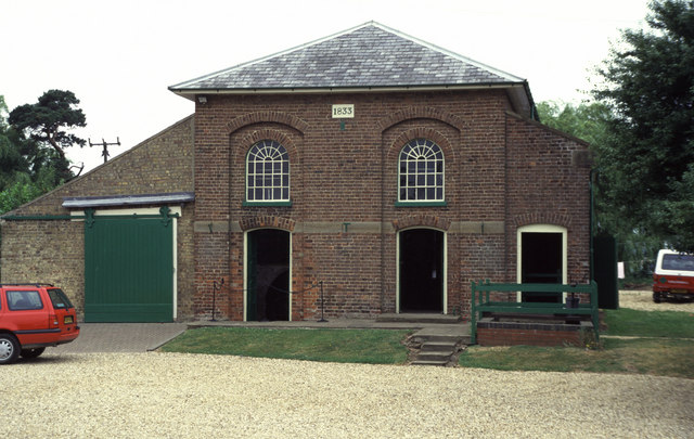
Pinchbeck Engine

The Pinchbeck Engine is a drainage engine, a rotative beam engine built in 1833 to drain Pinchbeck Marsh, to the north of Spalding, Lincolnshire, in England...

Pinchbeck, Lincolnshire

Pinchbeck is a village and civil parish in the South Holland district of Lincolnshire, England. The civil parish population was 5,153 at the 2001 census...

Pinchbeck railway station

Pinchbeck railway station was a station in Pinchbeck, Lincolnshire, England on the line between Spalding and Sleaford. The station opened in 1882, closed...

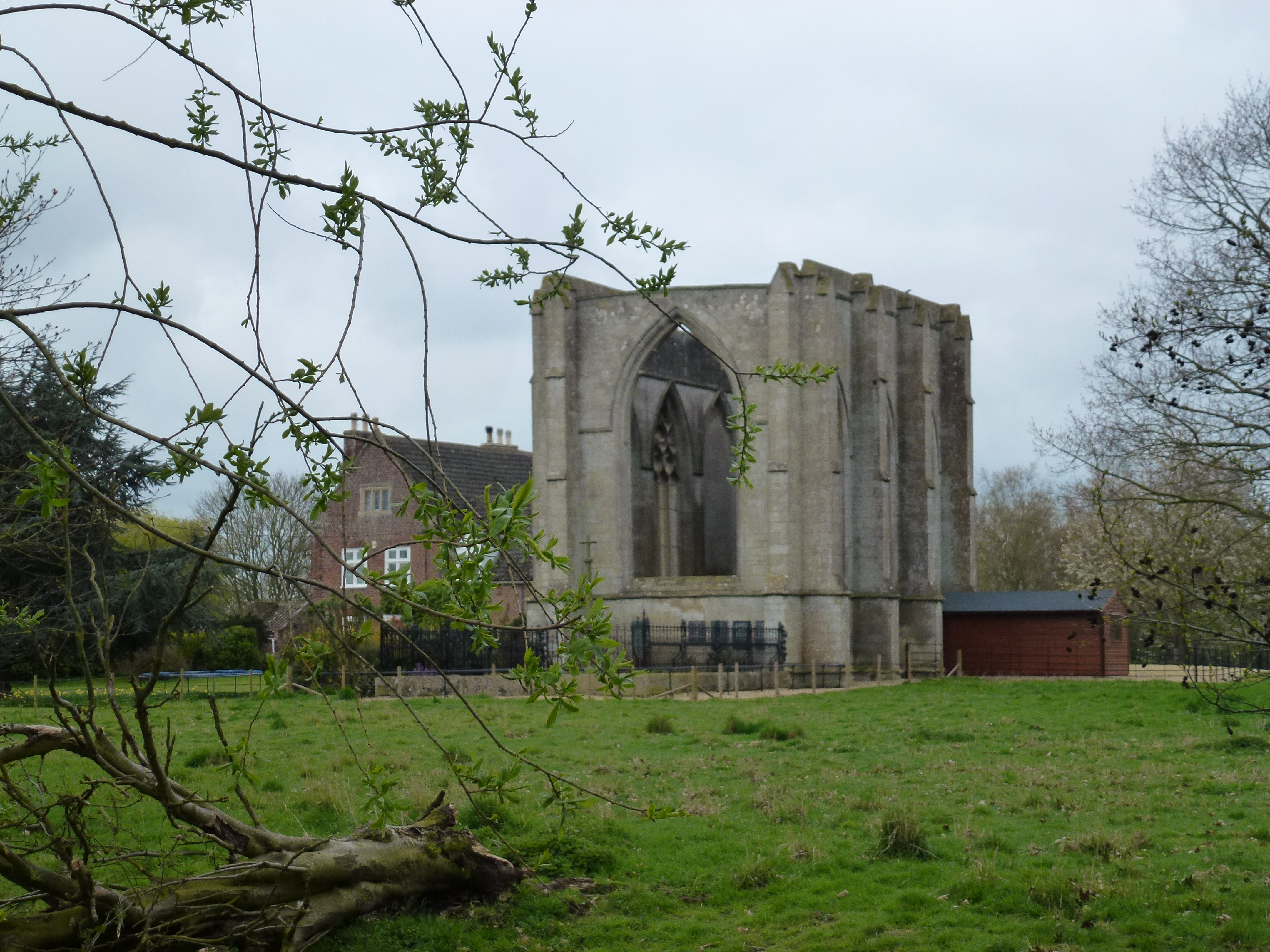
Wykeham, Weston, Lincolnshire

Wykeham /ˈwɪk.əm/ is a deserted medieval village in the civil parish of Weston in the South Holland district of Lincolnshire, England. Wykeham is the...

Related Videos

Great little CL by the river. Burrells CL, Lincolnshire. #motorhomelife #bürstner

Our base for the weekend in our Burstner Nexxo T660 Motorhome. The Burrells Caravan & Motorhome Club Certified Location ...

A Weekend at Burrell's CL

Arriving at Burrell's Caravan and motorhome club CL, drone footage and photos. Burrell's CL is on the outskirts of Surfleet, ...

Gosberton: Snapshots in Time (Part 1)

Photographs of people, places and events in and around Gosberton from a bygone era. Thanks are extended to all those people ...

Nearby Amenities

Located within 500m of 52.836708,-0.144168
Bus Stop
Wood's Lane
Bus: yes
Naptan AtcoCode: 270000009041
Naptan Bearing: SW
Naptan CommonName: Wood's Lane
Naptan Indicator: adj
Naptan Landmark: Wood's Lane
Naptan NaptanCode: lingwpdw
Naptan Street: Surfleet Road
Naptan Verified: no
Public Transport: platform
Source: naptan_import
Lat/Long: 52.8333229/-0.1445829
Bus Stop
Wood's Lane
Bus: yes
Naptan AtcoCode: 270000009042
Naptan Bearing: NE
Naptan CommonName: Wood's Lane
Naptan Indicator: opp
Naptan Landmark: Wood's Lane
Naptan NaptanCode: lingwpga
Naptan Street: Surfleet Road
Naptan Verified: no
Public Transport: platform
Source: naptan_import
Lat/Long: 52.8331649/-0.1448271
Bus Stop
Village Hall
Bus: yes
Naptan AtcoCode: 270000009894
Naptan Bearing: SW
Naptan CommonName: Village Hall
Naptan Indicator: opp
Naptan Landmark: Village Hall
Naptan NaptanCode: linjgdpm
Naptan Street: Station Road
Naptan Verified: no
Public Transport: platform
Source: naptan_import
Lat/Long: 52.8390902/-0.1379525
Bus Stop
St Laurence's Church
Bus: yes
Naptan AtcoCode: 2700LSC00037
Naptan Bearing: S
Naptan CommonName: St Laurence's Church
Naptan Indicator: adj
Naptan Landmark: St Laurence's Church
Naptan NaptanCode: linadagj
Naptan Street: Gosberton Road
Naptan Verified: no
Public Transport: platform
Source: naptan_import
Lat/Long: 52.8369111/-0.1440587
Bus Stop
St Laurence's Church
Bus: yes
Naptan AtcoCode: 2700LSP01983
Naptan Bearing: N
Naptan CommonName: St Laurence's Church
Naptan Indicator: opp
Naptan Landmark: St Laurence's Church
Naptan NaptanCode: linapajp
Naptan Street: Gosberton Road
Naptan Verified: no
Public Transport: platform
Source: naptan_import
Lat/Long: 52.837239/-0.1443269
Surfleet
Is In Country: UK
Is In County: Lincolnshire
Place: village
Wikidata: Q7646136
Wikipedia: en:Surfleet
Lat/Long: 52.835252/-0.143784
Park Farm
Place: farm
Source: Bing
Lat/Long: 52.8351402/-0.1402962
Pub
The Mermaid Inn
Addr City: Spalding
Addr Country: GB
Addr Housenumber: 2
Addr Postcode: PE11 4AB
Addr Street: Gosberton Road
Addr Suburb: Surfleet
Fhrs Authority: South Holland
Fhrs Id: 243259
Fhrs Local Authority Id: 4254
Operator: Free House
Lat/Long: 52.836394/-0.144358
Historic: memorial
Memorial: war_memorial
Lat/Long: 52.8374279/-0.1441124
Bench
Lat/Long: 52.8396298/-0.1396806
The Studio
Shop: art
Lat/Long: 52.8391955/-0.1392549
Fast Food
The Cod Squad
Addr City: Spalding
Addr Country: GB
Addr Housenumber: 7
Addr Postcode: PE11 4AB
Addr Street: Gosberton Road
Addr Suburb: Surfleet
Fhrs Authority: South Holland
Fhrs Id: 243284
Fhrs Local Authority Id: 4257
Lat/Long: 52.8383352/-0.1444665
Cafe
Surfleet Cafe
Addr City: Spalding
Addr Country: GB
Addr Housenumber: 14-18
Addr Postcode: PE11 4AB
Addr Street: Gosberton Road
Addr Suburb: Surfleet
Fhrs Authority: South Holland
Fhrs Id: 590170
Fhrs Local Authority Id: 36360
Lat/Long: 52.8374133/-0.1446757
B & M Autos
Shop: car_repair
Lat/Long: 52.8372885/-0.1446596
Pub
The Crown Inn
Addr City: Spalding
Addr Country: GB
Addr Housenumber: 6
Addr Postcode: PE11 4AB
Addr Street: Gosberton Road
Addr Suburb: Surfleet
Fhrs Authority: South Holland
Fhrs Id: 242850
Fhrs Local Authority Id: 4256
Lat/Long: 52.8370439/-0.1445603
Generator Method: photovoltaic
Generator Output Electricity: yes
Generator Source: solar
Generator Type: solar_photovoltaic_panel
Location: roof
Power: generator
Lat/Long: 52.8353672/-0.1436605
Generator Method: photovoltaic
Generator Output Electricity: yes
Generator Source: solar
Generator Type: solar_photovoltaic_panel
Location: roof
Power: generator
Lat/Long: 52.8360931/-0.1459055
Generator Method: photovoltaic
Generator Output Electricity: yes
Generator Source: solar
Generator Type: solar_photovoltaic_panel
Location: roof
Power: generator
Lat/Long: 52.8357431/-0.146568
Generator Method: photovoltaic
Generator Output Electricity: yes
Generator Source: solar
Generator Type: solar_photovoltaic_panel
Location: roof
Power: generator
Lat/Long: 52.8382691/-0.1403828
Generator Method: photovoltaic
Generator Output Electricity: yes
Generator Source: solar
Generator Type: solar_photovoltaic_panel
Location: roof
Power: generator
Lat/Long: 52.8382205/-0.1404633
Stop
Direction: backward
Lat/Long: 52.8359457/-0.1441412
Post Box
Collection Times: Mo-Fr 09:00; Sa 07:00
Operator: Royal Mail
Post Box Type: pillar
Ref: PE11 69
Lat/Long: 52.8379566/-0.1443455
The data included in this document is from www.openstreetmap.org. The data is made available under ODbL.

Have you been to Surfleet?

Leave your review of Surfleet below (or comments, questions and feedback).