Summer Hill

Settlement in Monmouthshire

Wales

Summer Hill

Work progressing on the eastward extension of Malpas to Caerleon cycleway and footpath The work is taking place beyond the eastern end <a title="https://www.geograph.org.uk/photo/1755714" href="https://www.geograph.org.uk/photo/1755714">Link</a> of the route from Malpas.
Work progressing on the eastward extension of Malpas to Caerleon cycleway and footpath Credit: Jaggery

Summer Hill is a quaint village located in Monmouthshire, Wales. Situated in the picturesque countryside, the village is known for its stunning views of the surrounding rolling hills and lush greenery. Summer Hill is a small community with a population of around 300 residents.

The village is characterized by its charming stone cottages, narrow winding lanes, and well-maintained gardens. The local church, St. Mary's, is a focal point of the village and dates back to the 12th century, adding to the rich history and heritage of the area.

Amenities in Summer Hill include a village hall, a small primary school, and a local pub that serves traditional Welsh food and drinks. The village is also close to the town of Monmouth, which offers a wider range of shops, restaurants, and services.

Nature lovers will appreciate the abundance of walking and hiking trails in the area, as well as the nearby Wye Valley Area of Outstanding Natural Beauty. Summer Hill offers a peaceful and idyllic setting for those seeking a quiet retreat in the Welsh countryside.

If you have any feedback on the listing, please let us know in the comments section below.

Summer Hill Images

Images are sourced within 2km of 51.594044/-2.974133 or Grid Reference ST3288. Thanks to Geograph Open Source API. All images are credited.

Work progressing on the eastward extension of Malpas to Caerleon cycleway and footpath The work is taking place beyond the eastern end <a title="https://www.geograph.org.uk/photo/1755714" href="https://www.geograph.org.uk/photo/1755714">Link</a> of the route from Malpas.
Work progressing on the eastward extension of Malpas to Caerleon cycleway and footpath
The work is taking place beyond the eastern end Link of the route from Malpas.
Low tide, River Usk, Newport Viewed from a bend on the Malpas to Caerleon cycleway and footpath. Extensive mudbanks are revealed at low tide.
Low tide, River Usk, Newport
Viewed from a bend on the Malpas to Caerleon cycleway and footpath. Extensive mudbanks are revealed at low tide.
Edge of the reeds, Malpas to Caerleon cycleway On the Caerleon side of the cycleway and footpath from Malpas, there is a sharp dividing line between a 200-metre long area of reeds, and a grassy area.
Edge of the reeds, Malpas to Caerleon cycleway
On the Caerleon side of the cycleway and footpath from Malpas, there is a sharp dividing line between a 200-metre long area of reeds, and a grassy area.
A4042 climbs towards Grove Park roundabout, Newport Viewed from the top of steps <a title="https://www.geograph.org.uk/photo/2422184" href="https://www.geograph.org.uk/photo/2422184">Link</a> at the edge of a riverside footpath and cycleway. This part of the A4042 is often referred to as the Malpas bypass.
A4042 climbs towards Grove Park roundabout, Newport
Viewed from the top of steps Link at the edge of a riverside footpath and cycleway. This part of the A4042 is often referred to as the Malpas bypass.
Edge of Brynglas hill viewed across A4042, Newport The western edge of this section of the A4042 passes steeply-rising ground leading up to Brynglas, one of the higher areas of Newport at about 80 metres (260 feet) above sea level.
Edge of Brynglas hill viewed across A4042, Newport
The western edge of this section of the A4042 passes steeply-rising ground leading up to Brynglas, one of the higher areas of Newport at about 80 metres (260 feet) above sea level.
M4 east of Brynglas tunnel
Looking from Pillmawr Road towards four Usk bridges, Newport Viewed from near a sharp bend on Pillmawr Road. The bridges <a title="https://www.geograph.org.uk/photo/1968953" href="https://www.geograph.org.uk/photo/1968953">Link</a> in the distance carry the M4 motorway and the A4042 connecting road across the River Usk.
Looking from Pillmawr Road towards four Usk bridges, Newport
Viewed from near a sharp bend on Pillmawr Road. The bridges Link in the distance carry the M4 motorway and the A4042 connecting road across the River Usk.
Eastern extension of National Cycle Network 88, Caerleon Viewed from the edge of Home Farm Crescent, Caerleon. Ahead is a new section of National Cycle Network Route 88. Opened in June 2011, the cycle route and footpath run parallel with railway lines for most of the way to Caerleon Comprehensive School. The extension is part of a £50 million UK-wide project by environment charity Sustrans, funded by the Big Lottery Fund.
Eastern extension of National Cycle Network 88, Caerleon
Viewed from the edge of Home Farm Crescent, Caerleon. Ahead is a new section of National Cycle Network Route 88. Opened in June 2011, the cycle route and footpath run parallel with railway lines for most of the way to Caerleon Comprehensive School. The extension is part of a £50 million UK-wide project by environment charity Sustrans, funded by the Big Lottery Fund.
National Cycle Network Route 88, Caerleon The view east from the Home Farm Crescent entrance barrier. <a title="https://www.geograph.org.uk/photo/2494687" href="https://www.geograph.org.uk/photo/2494687">Link</a>
National Cycle Network Route 88, Caerleon
The view east from the Home Farm Crescent entrance barrier. Link
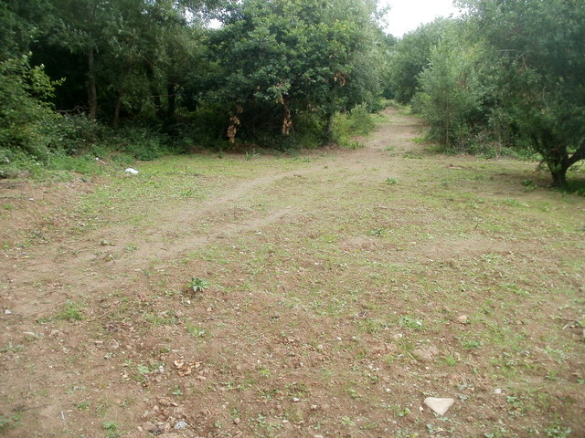
A track through woods, Caerleon Viewed from National Cycle Network Route 88. <a title="https://www.geograph.org.uk/photo/2494691" href="https://www.geograph.org.uk/photo/2494691">Link</a>
A track through woods, Caerleon
Viewed from National Cycle Network Route 88. Link
National Cycle Network Route 88 approaches Home Farm Crescent, Caerleon This section of the footpath and cycle route, <a title="https://www.geograph.org.uk/photo/2494687" href="https://www.geograph.org.uk/photo/2494687">Link</a> from Caerleon Comprehensive School, opened in June 2011.
National Cycle Network Route 88 approaches Home Farm Crescent, Caerleon
This section of the footpath and cycle route, Link from Caerleon Comprehensive School, opened in June 2011.
Fences, National Cycle Network route 88, Caerleon A view ENE along the section of the route opened in June 2011. The black fence on the left is newly installed. On the right, mostly obscured by vegetation, a smaller grey fence separates the footpath and cycle route from railway lines. <a title="https://www.geograph.org.uk/photo/2494738" href="https://www.geograph.org.uk/photo/2494738">Link</a>
Fences, National Cycle Network route 88, Caerleon
A view ENE along the section of the route opened in June 2011. The black fence on the left is newly installed. On the right, mostly obscured by vegetation, a smaller grey fence separates the footpath and cycle route from railway lines. Link
Railway lines, Caerleon The double-track Welsh Marches Line viewed from National Cycle Network route 88.
Railway lines, Caerleon
The double-track Welsh Marches Line viewed from National Cycle Network route 88.
Pathside yellow, National Cycle Route 88, Caerleon In early July yellow is the dominant colour (with a trace of purple at the edge) of the vegetation lining the Caerleon section of the footpath and cycle route, opened in June 2011.
Pathside yellow, National Cycle Route 88, Caerleon
In early July yellow is the dominant colour (with a trace of purple at the edge) of the vegetation lining the Caerleon section of the footpath and cycle route, opened in June 2011.
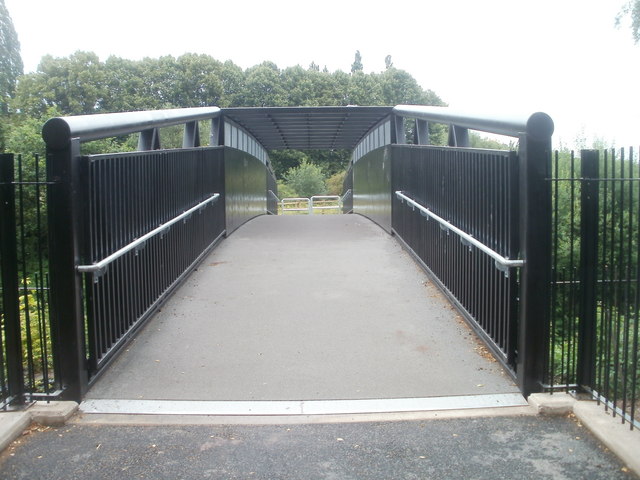
Footbridge across the railway, Caerleon The view south across a new footbridge, <a title="https://www.geograph.org.uk/photo/2494774" href="https://www.geograph.org.uk/photo/2494774">Link</a> built as part of the 2011 Caerleon extension to National Cycle Network Route 88.
Footbridge across the railway, Caerleon
The view south across a new footbridge, Link built as part of the 2011 Caerleon extension to National Cycle Network Route 88.
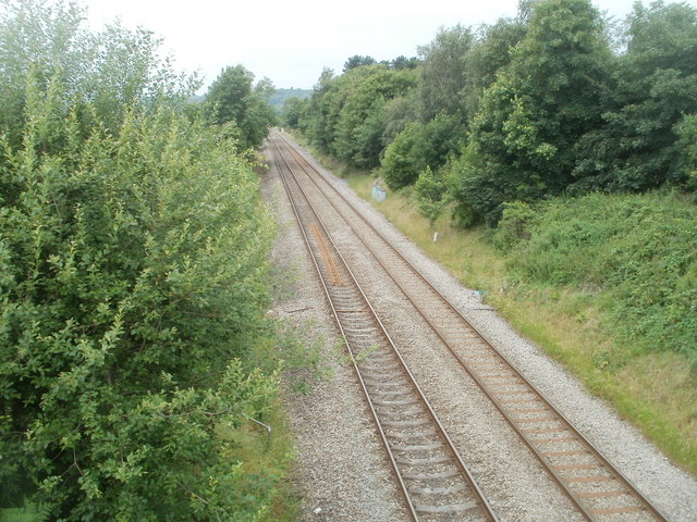
Welsh Marches railway lines, Caerleon Looking in the direction of Newport from the footbridge <a title="https://www.geograph.org.uk/photo/2494774" href="https://www.geograph.org.uk/photo/2494774">Link</a> carrying National Cycle Network route 88 across the tracks.
Welsh Marches railway lines, Caerleon
Looking in the direction of Newport from the footbridge Link carrying National Cycle Network route 88 across the tracks.
Graffiti-daubed metal boxes, Cycle Route 88, Newport The metal boxes, originally plain grey, have been painted with graffiti. They are located alongside the cycleway and footpath from Malpas to Crindau, Newport, part of National Cycle Network Route 88. The boxes are at the bottom of steps <a title="https://www.geograph.org.uk/photo/2422184leading" href="https://www.geograph.org.uk/photo/2422184leading">Link</a> up to the A4042.
Graffiti-daubed metal boxes, Cycle Route 88, Newport
The metal boxes, originally plain grey, have been painted with graffiti. They are located alongside the cycleway and footpath from Malpas to Crindau, Newport, part of National Cycle Network Route 88. The boxes are at the bottom of steps Link up to the A4042.
Archaeological excavations, Caerleon [1] The Roman amphitheatre.
The excavations in 2011 were in the field just behind the row of small trees on the left.
Archaeological excavations, Caerleon [1]
The Roman amphitheatre. The excavations in 2011 were in the field just behind the row of small trees on the left.
Show me another place!

Summer Hill is located at Grid Ref: ST3288 (Lat: 51.594044, Lng: -2.974133)

Unitary Authority: Newport

Police Authority: Gwent

Also known as: Summerhill

What 3 Words

///crazy.overnight.foods. Near Newport

Related Wikis

Victoria, Newport

Victoria is both a community (civil parish) and an electoral ward (division) of the city of Newport. The ward is bounded by the River Usk to the west and...

St John's Church, Maindee

The Church of St John is a Victorian Church in Wales parish church in Maindee, Newport, Wales. == History == The church was built between 1859 and 1860...

Maindee

Maindee (Welsh: Maendy) is a large inner-city commercial and residential area in the city of Newport, South Wales. It lies on the eastern side of the River...

Beechwood, Newport

Beechwood is a community (civil parish) and coterminous electoral ward (division) of the city of Newport. The community is bounded by the River Usk to...

Nearby Amenities

Located within 500m of 51.594044,-2.974133
Mini Roundabout
Direction: clockwise
Lat/Long: 51.5945615/-2.9680973
Turning Circle
Lat/Long: 51.5906202/-2.970368
Turning Circle
Lat/Long: 51.5928452/-2.9683364
Turning Circle
Lat/Long: 51.5934264/-2.970073
Maindee
Is In City: Newport
Name Cy: Maendy
Place: suburb
Population: 8282
Population Date: 2021-03-21
Source Population: https://www.nomisweb.co.uk
Wikidata: Q15243879
Lat/Long: 51.5922451/-2.975011
Summerhill
Is In City: Newport
Name Cy: Bryn yr Haf
Place: suburb
Wikidata: Q107032945
Lat/Long: 51.5955423/-2.9752045
Barrier: bollard
Lat/Long: 51.5959602/-2.9751554
Noexit: yes
Lat/Long: 51.5964587/-2.9680231
Noexit: yes
Lat/Long: 51.5965004/-2.9689816
Turning Circle
Lat/Long: 51.5938661/-2.9708377
Pub
Oddfellows Arms
Addr City: Newport
Addr Housenumber: 137
Addr Postcode: NP19 8FL
Addr Street: Duckpool Road
Contact Facebook: https://www.facebook.com/TheOddfellowsArmsNewport
Opening Hours: Mo-Su 13:00-23:30
Outdoor Seating: yes
Phone: +44 7727 104 410
Smoking: outside
Wikidata: Q80857255
Lat/Long: 51.592342/-2.9804419
Pub
The Crown Hotel
Addr City: Newport
Addr Housenumber: 18
Addr Postcode: NP19 8FU
Addr Street: Crown Street
Contact Facebook: https://www.facebook.com/The-Crown-Inn-160643317652518/
Phone: +44 1633 267 002
Wikidata: Q80577958
Lat/Long: 51.5916337/-2.9777484
Pub
Maindee Conservative Club
Addr City: Newport
Addr Housenumber: 2286-
Addr Postcode: NP19 8FG
Addr Street: Fairoak Terrace
Contact Facebook: https://www.facebook.com/people/Maindee-cons-Club/100063532075630/
Name Cy: Clwb Ceidwadol Maendy
Phone: +44 1633 662 023
Lat/Long: 51.5909066/-2.9790216
Bus Stop
Naptan AtcoCode: 5310WDB48010
Naptan NaptanCode: nwpgtjg
Lat/Long: 51.5975947/-2.9771764
Post Box
Lat/Long: 51.5971458/-2.9762719
Post Box
Operator: Royal Mail
Post Box Type: wall
Lat/Long: 51.594625/-2.9739098
Bench
Lat/Long: 51.5945752/-2.9683377
Post Box
Operator: Royal Mail
Post Box Type: pillar
Lat/Long: 51.5945993/-2.9683055
Lifestyle Express
Addr City: Newport
Addr Housenumber: 70
Addr Postcode: NP19 7QX
Addr Street: Heather Road
Brand: Lifestyle Express
Brand Wikidata: Q61994869
Opening Hours: Mo-Sa 09:00-21:00; Su 10:00-16:00
Shop: convenience
Lat/Long: 51.5979812/-2.9709012
Addr City: Newport
Addr Housenumber: 90
Addr Postcode: NP19 7QX
Addr Street: Heather Road
Disused Amenity: fast_food
Not Addr Postcode: NP19 9QX
Source Addr Postcode: code-point_open
Lat/Long: 51.5977934/-2.9705957
Beechwood Stores
Addr City: Newport
Addr Housenumber: 88BC
Addr Postcode: NP19 7SJ
Addr Street: Christchurch Road
Brand: Premier
Brand Wikidata: Q7240340
Brand Wikipedia: en:Premier Stores
Opening Hours: Mo-Sa 07:30-20:30; Su 08:00-20:30
Phone: +44 1633 730 689
Shop: convenience
Website: https://www.premier-stores.co.uk/our-stores/beechwood-stores
Lat/Long: 51.5944061/-2.9726419
Bus Stop
Christchurch Road
Bus: yes
Naptan AtcoCode: 5310AWB30708
Naptan NaptanCode: nwpgawd
Public Transport: platform
Shelter: no
Lat/Long: 51.5945831/-2.9734343
Bus Stop
Christchurch Road
Bus: yes
Naptan AtcoCode: 5310AWB30709
Naptan NaptanCode: nwpgawg
Public Transport: platform
Shelter: yes
Lat/Long: 51.5944752/-2.9731905
Bench
Lat/Long: 51.5954577/-2.9754813
Bench
Lat/Long: 51.595611/-2.9753901
The Star Inn
Addr City: Newport
Addr Housenumber: 138
Addr Postcode: NP19 8FH
Addr Street: Duckpool Road
Amenity Disused: pub
Postal Code: NP19 8FH
Wikidata: Q80857247
Lat/Long: 51.5921099/-2.9805193
Direction: SSW
Generator Method: photovoltaic
Generator Output Electricity: yes
Generator Solar Modules: 24
Generator Source: solar
Generator Type: solar_photovoltaic_panel
Location: roof
Power: generator
Lat/Long: 51.5919961/-2.9767765
Direction: SSW
Generator Method: photovoltaic
Generator Output Electricity: yes
Generator Solar Modules: 14
Generator Source: solar
Generator Type: solar_photovoltaic_panel
Location: roof
Power: generator
Lat/Long: 51.5914542/-2.9771258
Direction: SSW
Generator Method: photovoltaic
Generator Output Electricity: yes
Generator Solar Modules: 14
Generator Source: solar
Generator Type: solar_photovoltaic_panel
Location: roof
Power: generator
Lat/Long: 51.5911022/-2.9773687
Direction: SSW
Generator Method: photovoltaic
Generator Output Electricity: yes
Generator Solar Modules: 14
Generator Source: solar
Generator Type: solar_photovoltaic_panel
Location: roof
Power: generator
Lat/Long: 51.5911566/-2.9775636
Direction: ESE
Generator Method: photovoltaic
Generator Output Electricity: yes
Generator Solar Modules: 24
Generator Source: solar
Generator Type: solar_photovoltaic_panel
Location: roof
Power: generator
Lat/Long: 51.5912626/-2.9778893
Direction: ESE
Generator Method: photovoltaic
Generator Output Electricity: yes
Generator Solar Modules: 8
Generator Source: solar
Generator Type: solar_photovoltaic_panel
Location: roof
Power: generator
Lat/Long: 51.5906045/-2.9787939
Direction: SSE
Generator Method: photovoltaic
Generator Output Electricity: yes
Generator Solar Modules: 14
Generator Source: solar
Generator Type: solar_photovoltaic_panel
Location: roof
Power: generator
Lat/Long: 51.5944441/-2.9801993
Manos Garage
Addr City: Newport
Addr Housenumber: 171a
Addr Postcode: NP19 8GH
Addr Street: Chepstow Road
Alt Name: Mano's Garage
Opening Hours: Mo-Fr 09:30-17:00
Shop: car_repair
Lat/Long: 51.5898564/-2.9764089
Direction: 185
Generator Method: photovoltaic
Generator Output Electricity: yes
Generator Solar Modules: 12
Generator Source: solar
Generator Type: solar_photovoltaic_panel
Location: roof
Power: generator
Lat/Long: 51.594624/-2.9731059
Direction: 185
Generator Method: photovoltaic
Generator Output Electricity: yes
Generator Solar Modules: 12
Generator Source: solar
Generator Type: solar_photovoltaic_panel
Location: roof
Power: generator
Lat/Long: 51.594648/-2.973419
Direction: WNW
Generator Method: photovoltaic
Generator Output Electricity: yes
Generator Solar Modules: 7
Generator Source: solar
Generator Type: solar_photovoltaic_panel
Location: roof
Power: generator
Lat/Long: 51.5898021/-2.9757094
Direction: ESE
Generator Method: photovoltaic
Generator Output Electricity: yes
Generator Solar Modules: 7
Generator Source: solar
Generator Type: solar_photovoltaic_panel
Location: roof
Power: generator
Lat/Long: 51.5897944/-2.9756616
Dentist
Bupa Dental Care
Addr City: Newport
Addr Housenumber: 197
Addr Postcode: NP19 8GJ
Addr Street: Chepstow Road
Brand: Bupa
Brand Wikidata: Q931628
Healthcare: dentist
Lat/Long: 51.5896286/-2.974233
Bus Stop
Baths (S-Bound)
Bus: yes
Name Cy: Baddonau (tua'r de)
Network: Newport Bus
Operator: Newport Bus
Public Transport: platform
Lat/Long: 51.5903896/-2.9767173
Bus Stop
Baths (N-Bound)
Bus: yes
Name Cy: Baddonau (tua'r gogledd)
Network: Newport Bus
Operator: Newport Bus
Public Transport: platform
Lat/Long: 51.5903012/-2.9769649
Direction: 210
Generator Method: photovoltaic
Generator Output Electricity: yes
Generator Solar Modules: 6
Generator Source: solar
Generator Type: solar_photovoltaic_panel
Location: roof
Power: generator
Lat/Long: 51.5926898/-2.9772949
Direction: 215
Generator Method: photovoltaic
Generator Output Electricity: yes
Generator Solar Modules: 8
Generator Source: solar
Generator Type: solar_photovoltaic_panel
Location: roof
Power: generator
Lat/Long: 51.5981937/-2.9767792
Direction: 215
Generator Method: photovoltaic
Generator Output Electricity: yes
Generator Solar Modules: 4
Generator Source: solar
Generator Type: solar_photovoltaic_panel
Location: roof
Power: generator
Lat/Long: 51.5948272/-2.9681023
Direction: SSW
Generator Method: photovoltaic
Generator Output Electricity: yes
Generator Solar Modules: 8
Generator Source: solar
Generator Type: solar_photovoltaic_panel
Location: roof
Power: generator
Lat/Long: 51.5929322/-2.9744612
Direction: ESE
Generator Method: photovoltaic
Generator Output Electricity: yes
Generator Solar Modules: 12
Generator Source: solar
Generator Type: solar_photovoltaic_panel
Location: roof
Power: generator
Lat/Long: 51.5929056/-2.9745966
Direction: 190
Generator Method: photovoltaic
Generator Output Electricity: yes
Generator Solar Modules: 14
Generator Source: solar
Generator Type: solar_photovoltaic_panel
Location: roof
Power: generator
Lat/Long: 51.5943002/-2.9735734
Direction: 215
Generator Method: photovoltaic
Generator Output Electricity: yes
Generator Solar Modules: 16
Generator Source: solar
Generator Type: solar_photovoltaic_panel
Location: roof
Power: generator
Lat/Long: 51.5931147/-2.9718138
Direction: SSW
Generator Method: photovoltaic
Generator Output Electricity: yes
Generator Solar Modules: 9
Generator Source: solar
Generator Type: solar_photovoltaic_panel
Location: roof
Power: generator
Lat/Long: 51.5919824/-2.9759149
Direction: SSW
Generator Method: photovoltaic
Generator Output Electricity: yes
Generator Solar Modules: 16
Generator Source: solar
Generator Type: solar_photovoltaic_panel
Location: roof
Power: generator
Lat/Long: 51.5928156/-2.9761899
Direction: SSW
Generator Method: photovoltaic
Generator Output Electricity: yes
Generator Solar Modules: 16
Generator Source: solar
Generator Type: solar_photovoltaic_panel
Location: roof
Power: generator
Lat/Long: 51.5899111/-2.9728854
Direction: 175
Generator Method: photovoltaic
Generator Output Electricity: yes
Generator Solar Modules: 18
Generator Source: solar
Generator Type: solar_photovoltaic_panel
Location: roof
Power: generator
Lat/Long: 51.5935796/-2.966955
Direction: SSE
Generator Method: photovoltaic
Generator Output Electricity: yes
Generator Solar Modules: 4
Generator Source: solar
Generator Type: solar_photovoltaic_panel
Location: roof
Power: generator
Lat/Long: 51.5915058/-2.9681835
Direction: SSE
Generator Method: photovoltaic
Generator Output Electricity: yes
Generator Solar Modules: 13
Generator Source: solar
Generator Type: solar_photovoltaic_panel
Location: roof
Power: generator
Lat/Long: 51.5915283/-2.9682465
Direction: SW
Generator Method: photovoltaic
Generator Output Electricity: yes
Generator Solar Modules: 8
Generator Source: solar
Generator Type: solar_photovoltaic_panel
Location: roof
Power: generator
Lat/Long: 51.594601/-2.9713619
Direction: SE
Generator Method: photovoltaic
Generator Output Electricity: yes
Generator Solar Modules: 4
Generator Source: solar
Generator Type: solar_photovoltaic_panel
Location: roof
Power: generator
Lat/Long: 51.5946027/-2.9712908
Direction: 215
Generator Method: photovoltaic
Generator Output Electricity: yes
Generator Solar Modules: 7
Generator Source: solar
Generator Type: solar_photovoltaic_panel
Location: roof
Power: generator
Lat/Long: 51.5944985/-2.9711674
Direction: 125
Generator Method: photovoltaic
Generator Output Electricity: yes
Generator Solar Modules: 7
Generator Source: solar
Generator Type: solar_photovoltaic_panel
Location: roof
Power: generator
Lat/Long: 51.5945019/-2.9710923
Direction: 195
Generator Method: photovoltaic
Generator Output Electricity: yes
Generator Solar Modules: 5
Generator Source: solar
Generator Type: solar_photovoltaic_panel
Location: roof
Power: generator
Lat/Long: 51.5949521/-2.9723042
Direction: 105
Generator Method: photovoltaic
Generator Output Electricity: yes
Generator Solar Modules: 4
Generator Source: solar
Generator Type: solar_photovoltaic_panel
Location: roof
Power: generator
Lat/Long: 51.5949684/-2.972239
Direction: SSW
Generator Method: photovoltaic
Generator Output Electricity: yes
Generator Solar Modules: 12
Generator Source: solar
Generator Type: solar_photovoltaic_panel
Location: roof
Power: generator
Lat/Long: 51.5962047/-2.9700986
Direction: SSW
Generator Method: photovoltaic
Generator Output Electricity: yes
Generator Solar Modules: 13
Generator Source: solar
Generator Type: solar_photovoltaic_panel
Location: roof
Power: generator
Lat/Long: 51.5957965/-2.9696265
Direction: SSW
Generator Method: photovoltaic
Generator Output Electricity: yes
Generator Solar Modules: 15
Generator Source: solar
Generator Type: solar_photovoltaic_panel
Location: roof
Power: generator
Lat/Long: 51.5971311/-2.9702407
Clinic
Amy’s Fur Babies
Addr City: Newport
Addr Housenumber: 119
Addr Postcode: NP19 8FL
Addr Street: Duckpool Road
Healthcare: clinic
Healthcare Speciality: fertility
Opening Hours: Mo-Tu 10:00-15:00; We Off; Th-Fr 10:00-15:00
Pet: dog
Phone: +447471133787
Lat/Long: 51.5929844/-2.981054
Addr City: Newport
Addr Housenumber: 136
Addr Postcode: NP19 8FL
Addr Street: Duckpool Road
Shop: vacant
Lat/Long: 51.5924002/-2.9804806
Addr City: Newport
Addr Housenumber: 136a
Addr Street: Duckpool Road
Lat/Long: 51.5923867/-2.9804755
Duckpool Road Convenience Store
Addr City: Newport
Addr Housenumber: 120
Addr Postcode: NP19 8FL
Addr Street: Duckpool Road
Opening Hours: Mo-Sa 05:00-19:00; Su 06:00-16:00
Shop: convenience
Lat/Long: 51.5929415/-2.9810057
Waste Basket
Lat/Long: 51.5912198/-2.9783291
The data included in this document is from www.openstreetmap.org. The data is made available under ODbL.

Have you been to Summer Hill?

Leave your review of Summer Hill below (or comments, questions and feedback).