Sturminster Newton

Settlement in Dorset

England

Sturminster Newton

River Stour at Fiddleford Mill The weir pool below the mill race.
River Stour at Fiddleford Mill Credit: Des Blenkinsopp

Sturminster Newton is a small town located in the county of Dorset, England. Situated on the banks of the River Stour, it is nestled in the picturesque Blackmore Vale. With a population of around 4,000 inhabitants, it is a close-knit community that exudes charm and tranquility.

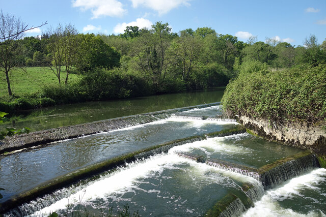
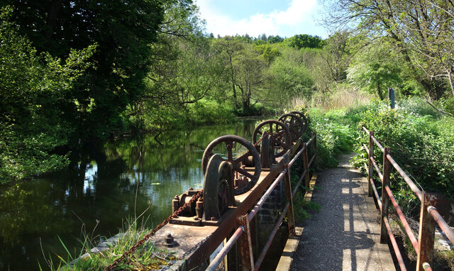
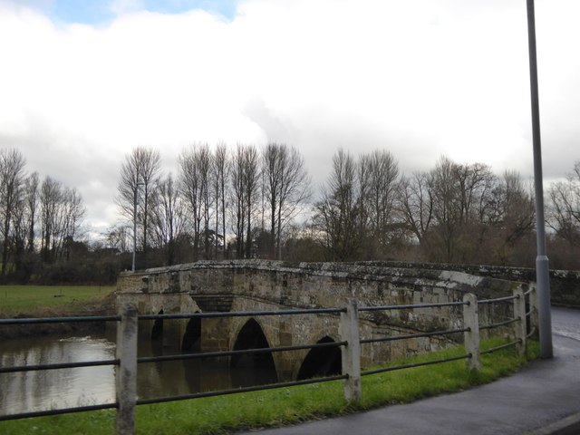
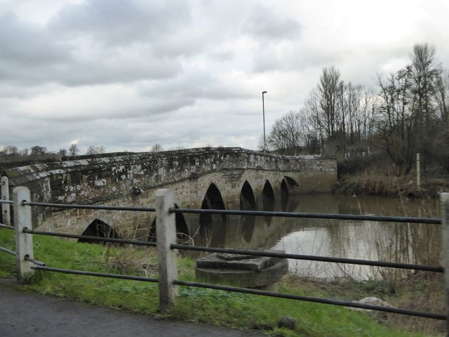
The town has a rich history dating back to the Saxon era, with evidence of human settlement found in the area. The iconic Sturminster Newton Mill, a working watermill, stands as a testament to the town's agricultural heritage. It is one of the oldest surviving mills in the country and is open to the public.

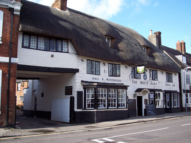
Sturminster Newton offers a range of amenities and facilities for its residents and visitors. The town center boasts a variety of independent shops, cafes, and pubs, where locals gather to socialize. The town also has a primary school, a secondary school, a library, and a leisure center, providing ample opportunities for education and recreation.

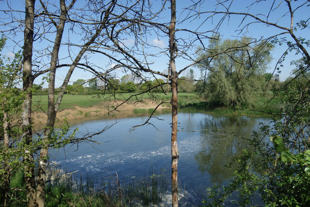
The surrounding countryside offers stunning natural beauty, making Sturminster Newton an ideal location for outdoor enthusiasts. The nearby trail along the River Stour provides scenic walks and cycling routes. Additionally, the town is within close proximity to the Cranborne Chase Area of Outstanding Natural Beauty, offering further opportunities for exploration.

Overall, Sturminster Newton is a charming and historic town, offering a peaceful and idyllic lifestyle for its residents and an inviting destination for visitors seeking a taste of rural Dorset.

If you have any feedback on the listing, please let us know in the comments section below.

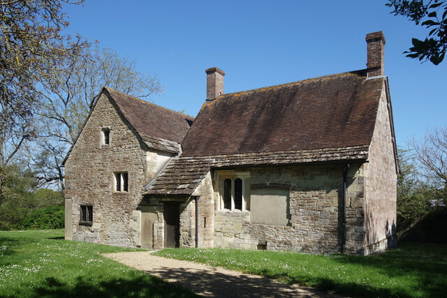
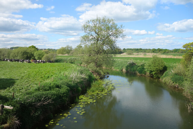
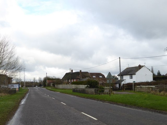
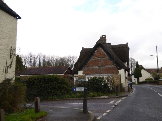
Sturminster Newton Images

Images are sourced within 2km of 50.926764/-2.3051621 or Grid Reference ST7814. Thanks to Geograph Open Source API. All images are credited.

River Stour at Fiddleford Mill The weir pool below the mill race.
River Stour at Fiddleford Mill
The weir pool below the mill race.
Weir at Fiddleford Mill The main River Stour drops over the weir while the mill race continues off to the left.
Weir at Fiddleford Mill
The main River Stour drops over the weir while the mill race continues off to the left.
Sluice gear at Fiddleford Mill A bit rusty looking but seemingly still in working order these sluices control the weir between the mill stream and the main river.
Sluice gear at Fiddleford Mill
A bit rusty looking but seemingly still in working order these sluices control the weir between the mill stream and the main river.
Wildflowers on the steps, Fiddleford Mill A disused stairway on one of the outbuildings.
Wildflowers on the steps, Fiddleford Mill
A disused stairway on one of the outbuildings.
Fiddleford Manor Part of a  Manor House built for the Sheriff of Somerset & Dorset in about 1370.
This part of the building is in the care of English Heritage and is open to the public. Another range of buildings behind is still lived in and isn't open.
Fiddleford Manor
Part of a Manor House built for the Sheriff of Somerset & Dorset in about 1370. This part of the building is in the care of English Heritage and is open to the public. Another range of buildings behind is still lived in and isn't open.
River Stour from the Trailway Bridge Along the old railway route east of Sturminster, now a cycleway.
River Stour from the Trailway Bridge
Along the old railway route east of Sturminster, now a cycleway.
Slightly Altered Weir Exactly the same spot as <a href="https://www.geograph.org.uk/photo/2324136">ST8013 : Pool at Fiddleford Weir</a> standing on the footbridge. This is 11 years later and some riffles have been added to the spillway, possibly to churn up the water a bit or make it easier for fish to get up.
Slightly Altered Weir
Exactly the same spot as ST8013 : Pool at Fiddleford Weir standing on the footbridge. This is 11 years later and some riffles have been added to the spillway, possibly to churn up the water a bit or make it easier for fish to get up.
Rolls Mill Bridge Now the bridge is insignificant, with traffic having a level crossing over the River Divelish
Rolls Mill Bridge
Now the bridge is insignificant, with traffic having a level crossing over the River Divelish
The end wall of a cottage in Newton This wall is interesting for the brick filling the gaps between the wooden beams of the thatched cottage
The end wall of a cottage in Newton
This wall is interesting for the brick filling the gaps between the wooden beams of the thatched cottage
Town Bridge, between Sturminster Newton and Newton
Town Bridge, between Sturminster Newton and Newton (2)
Used car dealer, Newton
A357 in Piddles Wood There is the end of a muddy lay-by on the left
A357 in Piddles Wood
There is the end of a muddy lay-by on the left
The Trailway near Fiddleford This pedestrian and cycle path follows the trackway of the Somerset and Dorset Joint Railway
The Trailway near Fiddleford
This pedestrian and cycle path follows the trackway of the Somerset and Dorset Joint Railway
Lone tree in a field north of the Trailway
Sewage works by the Trailway near Sturminster Newton
Field and woodland north of the Trailway, east of Sturminster Newton The woodland screens the sewage works
Field and woodland north of the Trailway, east of Sturminster Newton
The woodland screens the sewage works
Bridge on Trailway east of Sturminster Newton This pedestrian and cycle path follows the trackway of the Somerset and Dorset Joint Railway
Bridge on Trailway east of Sturminster Newton
This pedestrian and cycle path follows the trackway of the Somerset and Dorset Joint Railway
Show me another place!

Sturminster Newton is located at Grid Ref: ST7814 (Lat: 50.926764, Lng: -2.3051621)

Unitary Authority: Dorset

Police Authority: Dorset

What 3 Words

///tearfully.calendars.denote. Near Sturminster Newton, Dorset

Related Wikis

Sturminster Newton

Sturminster Newton is a town and civil parish situated on the River Stour in the north of Dorset, England. The town is at the centre of the Blackmore Vale...

Sturminster Newton railway station

Sturminster Newton railway station was a station in the town of Sturminster Newton, in the English county of Dorset. It was located on the Somerset and...

St Mary's Church, Sturminster Newton

St Mary's Church is a Church of England Parish Church in Sturminster Newton, Dorset. The present church dates from a rebuild in 1486 by the abbots of Glastonbury...

Rixon, Dorset

Rixon is a village near Sturminster Newton in Dorset, England. The village's transport links are currently provided by Damory Coaches, services 369 between...

Nearby Amenities

Located within 500m of 50.926764,-2.3051621
Crossing
Crossing: uncontrolled
Crossing Ref: zebra
Lat/Long: 50.926565/-2.3051017
Traffic Signals
Lat/Long: 50.9275871/-2.3058617
Sturminster Newton
Place: town
Lat/Long: 50.9273968/-2.3049206
Traffic Signals
Direction: backward
Traffic Signals: signal
Lat/Long: 50.927636/-2.3027839
Pharmacy
Boots
Addr Postcode: DT10 1AS
Addr Street: Market Place
Brand: Boots
Brand Wikidata: Q6123139
Brand Wikipedia: en:Boots (company)
Fhrs Id: 993696
Healthcare: pharmacy
Operator: Boots
Source Addr: FHRS Open Data
Website: https://www.boots.com/stores/5350-sturminster-newton-dt10-1as
Lat/Long: 50.9268578/-2.3052129
Cafe
Poets Corner
Addr Postcode: DT10 1BB
Addr Street: Station Road
Fhrs Id: 993700
Source Addr: FHRS Open Data
Lat/Long: 50.9269951/-2.3042728
Atm
Lat/Long: 50.9276304/-2.3038694
Post Box
Ref GB Uprn: 10015355953
Lat/Long: 50.9268923/-2.3047452
Library
Sturminster Newton Library
Wikidata: Q55173509
Lat/Long: 50.9272877/-2.3059708
Townhall
The Exchange
Addr Postcode: DT10 1FH
Addr Street: Old Market Hill
Fhrs Id: 993932
Source Addr: FHRS Open Data
Lat/Long: 50.9275881/-2.3043201
Turning Circle
Lat/Long: 50.9289799/-2.2994159
Turning Circle
Lat/Long: 50.92746/-2.2997212
Turning Circle
Lat/Long: 50.9273367/-2.2984289
Turning Circle
Lat/Long: 50.9287193/-2.3047281
Traffic Calming: yes
Lat/Long: 50.9282211/-2.3032057
Turning Circle
Lat/Long: 50.9237419/-2.3081197
Barrier: bollard
Lat/Long: 50.9247278/-2.3048775
Pub
Swan Inn
Addr Country: GB
Addr Postcode: DT10 1AR
Addr Street: Market Place
Brand: Hall & Woodhouse
Brand Wikidata: Q5642555
Brand Wikipedia: en:Hall & Woodhouse
Fhrs Id: 994375
Food: yes
Source Addr: FHRS Open Data
Wikidata: Q26404234
Lat/Long: 50.9264365/-2.3048765
Bicycle Parking
Capacity: 5
Lat/Long: 50.9270505/-2.3040038
Sturminster Museum
Phone: +44 1258 817116
Tourism: museum
Website: https://www.sturminsternewton-museum.co.uk/
Wikidata: Q113370052
Lat/Long: 50.9255949/-2.3051047
Crossing
Crossing: traffic_signals
Crossing Ref: pelican
Lat/Long: 50.9280741/-2.30363
Pub
Sturminster Newton Royal British Legion
Addr Housename: Sturminster Newton Royal British Legion
Addr Postcode: DT10 1DU
Addr Street: Bath Road
Fhrs Id: 993701
Source Addr: FHRS Open Data
Lat/Long: 50.9280312/-2.3057233
Crossing
Crossing: zebra
Lat/Long: 50.9266557/-2.3051278
Post Office
Sturminster Newton Post Office
Addr City: Sturminster Newton
Addr Country: GB
Addr Postcode: DT10 1BB
Addr Street: Station Road
Brand: Post Office
Brand Wikidata: Q1783168
Opening Hours: Tu-Fr 09:00-12:30,13:30-17:30
Operator: One Stop
Ref Pol Id: 7965
Website: https://www.postoffice.co.uk/branch-finder/216518x/sturminster-newton
Lat/Long: 50.9269139/-2.3045622
War Memorial
Historic: memorial
Lat/Long: 50.9244833/-2.3078667
Police
Lat/Long: 50.9271909/-2.3061283
Toilets
Lat/Long: 50.9269588/-2.3039475
Doctors
Healthcare: doctor
Lat/Long: 50.9278179/-2.3040934
Historic: monument
Lat/Long: 50.9275472/-2.305601
Dentist
Old Market Dental Practice
Healthcare: dentist
Level: 2
Lat/Long: 50.9276896/-2.3036528
Post Box
Brand: Royal Mail
Brand Wikidata: Q638098
Brand Wikipedia: en:Royal Mail
Collection Times: Mo-Fr 17:00
Operator: Royal Mail
Operator Wikidata: Q638098
Ref GB Uprn: 10015468730
Lat/Long: 50.9307149/-2.3049855
Turning Circle
Lat/Long: 50.9273868/-2.3006725
Leisure: playground
Lat/Long: 50.9291697/-2.3034331
Power: substation
Lat/Long: 50.927904/-2.305262
Historic: memorial
Lat/Long: 50.9273613/-2.3054709
Historic: monument
Lat/Long: 50.9273472/-2.3041603
Leisure: playground
Lat/Long: 50.9272662/-2.3045575
Wessex Photographic
Shop: yes
Lat/Long: 50.9266671/-2.3050334
Holebrooks Fine Food
Addr Housenumber: 6
Addr Postcode: DT10 1AR
Addr Street: Market Place
Fhrs Id: 993871
Shop: farm
Source Addr: FHRS Open Data
Lat/Long: 50.9261923/-2.3048378
E.B. Marsh & Son LTD.
Shop: electronics
Lat/Long: 50.9260167/-2.3049591
Root And Vine
Addr Postcode: DT10 1AS
Addr Street: Market Place
Fhrs Id: 993878
Shop: greengrocer
Source Addr: FHRS Open Data
Lat/Long: 50.9260639/-2.3051503
Candys
Addr Postcode: DT10 1AS
Addr Street: Market Place
Fhrs Id: 993703
Shop: newsagent
Source Addr: FHRS Open Data
Lat/Long: 50.9259761/-2.3052756
The Emporium
Addr City: Sturminster Newton
Addr Housename: John Romans Building
Addr Housenumber: 10
Addr Postcode: DT10 1AS
Addr Street: Market Place
Brand Wikipedia: en:Lloyds Bank
Operator: Sturminster Newton Community Benefit Society
Second Hand: yes
Shop: charity
Lat/Long: 50.9262086/-2.3052499
Atm
Lat/Long: 50.9262445/-2.3052221
Atm
Lat/Long: 50.9268977/-2.3045743
Symonds & Sampson
Addr City: Sturminster Newton
Brand: Symonds & Sampson
Brand Wikidata: Q90262955
Office: estate_agent
Website: https://www.symondsandsampson.co.uk/
Lat/Long: 50.9268876/-2.3052291
Traffic Signals
Direction: backward
Traffic Signals: signal
Lat/Long: 50.9278102/-2.3026181
Communication Mobile Phone: yes
Man Made: mast
Operator: Vodafone
Operator Wikidata: Q122141
Tower Type: communication
Lat/Long: 50.9288739/-2.3016962
Spears Travel
Shop: travel_agency
Lat/Long: 50.9258706/-2.3047355
The Marketplace Dry Cleaning
Shop: dry_cleaning
Lat/Long: 50.9264045/-2.3051928
Roy Barrett Estate Agents
Office: estate_agent
Lat/Long: 50.9263178/-2.305205
Eyesright Opticians
Shop: optician
Lat/Long: 50.926566/-2.3052118
Simply Hair
Shop: hairdresser
Lat/Long: 50.9261141/-2.3052579
Morton New
Office: estate_agent
Lat/Long: 50.9258501/-2.3051359
Entrance: yes
Lat/Long: 50.9275954/-2.3040839
Entrance: yes
Lat/Long: 50.9275342/-2.3041491
Entrance: yes
Lat/Long: 50.9277486/-2.3042498
Traffic Calming: yes
Lat/Long: 50.928055/-2.3038022
Waste Basket
Lat/Long: 50.9291562/-2.3047796
Street Lamp
Lat/Long: 50.9278035/-2.3058481
Street Lamp
Lat/Long: 50.9279404/-2.3059849
Street Lamp
Lat/Long: 50.9281737/-2.3059849
Street Lamp
Lat/Long: 50.9284636/-2.3059473
Street Lamp
Lat/Long: 50.9288271/-2.3057314
Street Lamp
Lat/Long: 50.9287299/-2.3059902
Street Lamp
Lat/Long: 50.9291033/-2.3055627
Street Lamp
Lat/Long: 50.9293892/-2.3053978
Street Lamp
Lat/Long: 50.929702/-2.3052771
Street Lamp
Lat/Long: 50.9299118/-2.3051967
Street Lamp
Lat/Long: 50.9303007/-2.3051028
Street Lamp
Lat/Long: 50.9305863/-2.3050465
Entrance: yes
Lat/Long: 50.9272902/-2.3059205
Crossing
Crossing: zebra
Lat/Long: 50.9240135/-2.3064658
Post Box
Lat/Long: 50.9294041/-2.3009922
Post Box
Mapillary: 762425067798771
Post Box Mounting: pier
Post Box Type: lamp
Ref GB Uprn: 10015332471
Survey Date: 2020-08-27
Lat/Long: 50.9248895/-2.3058533
Veterinary
Blackmore Vale Veterinary Centre
Lat/Long: 50.928415/-2.300548
Friends Of Blandford Hospital Charity Shop
Shop: yes
Lat/Long: 50.9269772/-2.3043909
Entrance: yes
Lat/Long: 50.9241115/-2.3071355
Toilets
Lat/Long: 50.9249343/-2.3074363
Give Way
Direction: backward
Lat/Long: 50.925243/-2.3056529
Exercise Equipment
Leisure: fitness_station
Sport: fitness
Lat/Long: 50.9253624/-2.3078349
Waste Basket
Lat/Long: 50.9249291/-2.310523
Bench
Lat/Long: 50.9283743/-2.2988096
Waste Basket
Lat/Long: 50.9283609/-2.2988005
Traffic Calming: yes
Lat/Long: 50.9280224/-2.3029983
Entrance: yes
Lat/Long: 50.9270669/-2.3028261
Entrance: yes
Lat/Long: 50.9272626/-2.3029469
Entrance: yes
Lat/Long: 50.9268721/-2.3052098
Entrance: yes
Lat/Long: 50.9268898/-2.3046798
Power: substation
Lat/Long: 50.9236662/-2.3063346
Recycling
Recycling Clothes: yes
Recycling Type: container
Lat/Long: 50.9290446/-2.3052683
Barrier: debris
Lat/Long: 50.9278185/-2.3054023
Barrier: debris
Lat/Long: 50.9278376/-2.3053638
Barrier: debris
Lat/Long: 50.9278523/-2.3053323
Entrance: yes
Lat/Long: 50.9272806/-2.3034498
Bus Stop
Car Park
Bus: yes
Naptan AtcoCode: 1200DOB21353
Naptan Bearing: SE
Naptan CommonName: Car Park
Naptan Indicator: SE-bound
Naptan NaptanCode: dorapdmp
Naptan Street: Barnes Close
Naptan Verified: no
Public Transport: platform
Lat/Long: 50.9270061/-2.3040212
Bus Stop
Car Park
Bus: yes
Naptan AtcoCode: 1200DOA90850
Naptan Bearing: W
Naptan CommonName: Car Park
Naptan Indicator: W-bound
Naptan NaptanCode: dordpmgm
Naptan Street: Barnes Close
Naptan Verified: no
Public Transport: platform
Lat/Long: 50.9267203/-2.3033242
Traffic Signals
Direction: backward
Traffic Signals: signal
Lat/Long: 50.9276151/-2.3025754
Traffic Signals
Direction: forward
Traffic Signals: signal
Lat/Long: 50.9277508/-2.3022691
Parking
Lat/Long: 50.9238911/-2.3063134
Brainwave
Brand: Brainwave
Brand Wikidata: Q90561455
Shop: charity
Lat/Long: 50.9270989/-2.3045968
Booth: K6
Removed Amenity: telephone
Lat/Long: 50.9268905/-2.3049723
Bench
Lat/Long: 50.9269018/-2.3049456
Waste Basket
Lat/Long: 50.9268969/-2.3049574
Bench
Lat/Long: 50.9268848/-2.3049901
Street Lamp
Lat/Long: 50.9268815/-2.3050038
Entrance: yes
Lat/Long: 50.9249333/-2.3071668
Street Lamp
Lat/Long: 50.9268988/-2.3028688
Barrier: bollard
Lat/Long: 50.927109/-2.3040843
Information: board
Tourism: information
Lat/Long: 50.9270783/-2.3040604
Phone
Emergency: phone
Lat/Long: 50.9271851/-2.3060051
Street Lamp
Lat/Long: 50.9309326/-2.3049863
Street Lamp
Lat/Long: 50.9312605/-2.3049812
Bank
Lloyds Bank
Addr City: Sturminster Newton
Addr Housename: Sturminster Newton Library
Addr Postcode: DT10 1EH
Addr Street: Brinsley Close
Brand: Lloyds Bank
Brand Wikidata: Q1152847
Brand Wikipedia: en:Lloyds Bank
Building: no
Description: Regular mobile banking van with fixed set times.
Opening Hours: Mo 12:30-15:00, We 9:30-11:00, Fr 12:30-15:00
Operator: Lloyds Bank Gillingham Dorset Mobile Branch
Lat/Long: 50.9271474/-2.3059076
Phone
Emergency: phone
Lat/Long: 50.9290573/-2.3051114
Power: pole
Source: bing
Lat/Long: 50.9227701/-2.3069237
Information: guidepost
Tourism: information
Lat/Long: 50.9268069/-2.3051637
Entrance: yes
Lat/Long: 50.9246248/-2.3031714
Entrance: yes
Lat/Long: 50.9245327/-2.3029943
The data included in this document is from www.openstreetmap.org. The data is made available under ODbL.

Have you been to Sturminster Newton?

Leave your review of Sturminster Newton below (or comments, questions and feedback).