Stretham

Settlement in Cambridgeshire East Cambridgeshire

England

Stretham

Stretham - St James's Church
Stretham - St James's Church Credit: Colin Park

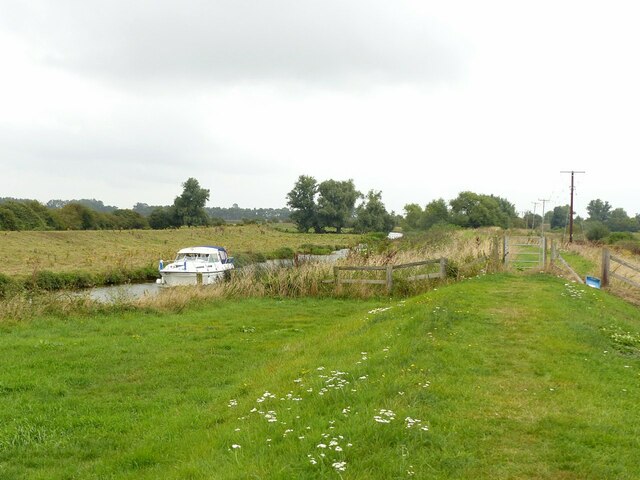
Stretham is a picturesque village located in the county of Cambridgeshire, England. Situated approximately 8 miles north of the city of Cambridge, it is part of the East Cambridgeshire district. The village lies on the banks of the River Great Ouse, adding to its scenic charm and providing opportunities for leisurely walks along the riverbank.

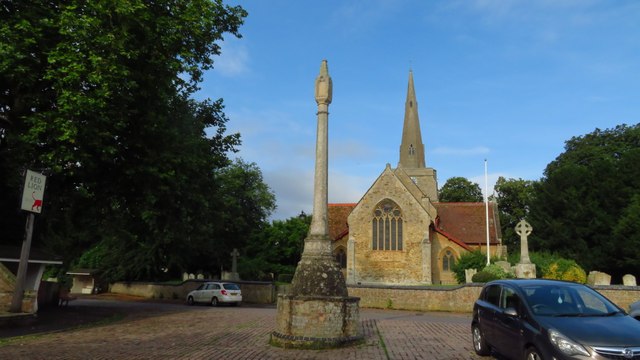
Stretham has a rich history dating back to the Saxon times, with evidence of Roman and Iron Age settlements in the area. The village is known for its beautiful architecture, with charming thatched cottages and historic buildings. The stunning St. James' Church, dating back to the 13th century, is a prominent landmark and a testament to the village's long-standing heritage.

Amenities in Stretham include a primary school, a village hall, a post office, and a convenience store, providing essential services to its residents. The village also boasts a couple of pubs, where locals and visitors can enjoy a relaxing drink or a meal.

The community in Stretham is vibrant and close-knit, with various events and activities organized throughout the year. The annual Stretham Feast Week is a highlight, featuring a range of festivities such as a carnival procession, live music, and family-friendly entertainment.

Stretham's location makes it an ideal base for exploring the surrounding countryside and nearby attractions. The village offers easy access to the beautiful Cambridgeshire Fens, renowned for their unique wildlife and tranquil landscapes. Additionally, the city of Ely, with its magnificent cathedral and historic sites, is just a short drive away.

Overall, Stretham is a charming village that blends historical character with natural beauty, providing residents and visitors with a peaceful and picturesque setting to enjoy.

If you have any feedback on the listing, please let us know in the comments section below.
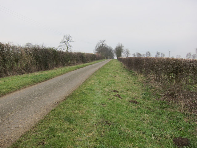
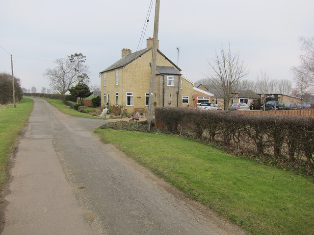
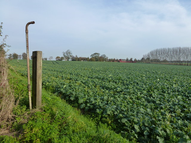
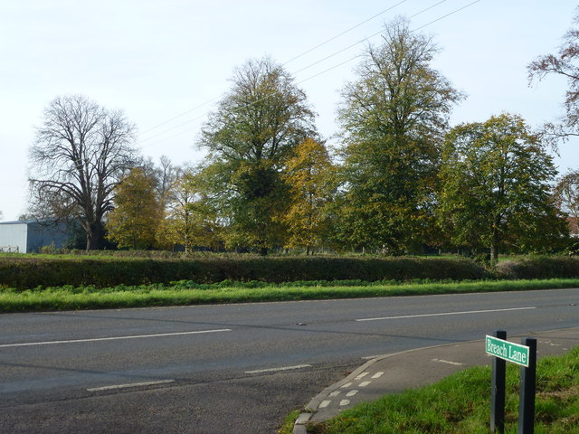
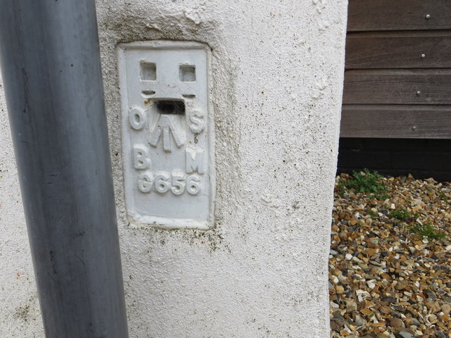
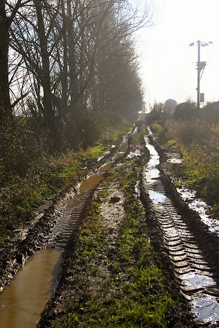
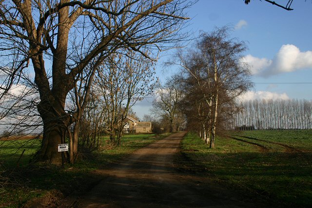
Stretham Images

Images are sourced within 2km of 52.348922/0.218899 or Grid Reference TL5174. Thanks to Geograph Open Source API. All images are credited.

Stretham - St James's Church
Stretham Old Engine, Stretham Mere
White Cross Hill From Breach Lane.
White Cross Hill
From Breach Lane.
Poplar windbreak on White Cross Hill
Breach Lane Farm access road off Stretham Road.
Breach Lane
Farm access road off Stretham Road.
House on Breach Lane
Rapeseed crop on White Cross Hill Off Breach Lane near Wilburton
Rapeseed crop on White Cross Hill
Off Breach Lane near Wilburton
Breach Lane joins Stretham Road, Wilburton
Ordnance Survey Flush Bracket G656 This can be found on the wall of a private dwelling in Stretham Road, Wilburton.
For more detail see : <span class="nowrap"><a title="http://www.bench-marks.org.uk/bm628" rel="nofollow ugc noopener" href="http://www.bench-marks.org.uk/bm628">Link</a><img style="margin-left:2px;" alt="External link" title="External link - shift click to open in new window" src="https://s1.geograph.org.uk/img/external.png" width="10" height="10"/></span>
Ordnance Survey Flush Bracket G656
This can be found on the wall of a private dwelling in Stretham Road, Wilburton. For more detail see : LinkExternal link
Orchard at White Cross Hill This orchard lies immediately south of the A1123, near the village of Wilburton.
Orchard at White Cross Hill
This orchard lies immediately south of the A1123, near the village of Wilburton.
Red Hill Drove, Wilburton This muddy track leads south from the A1123.
Red Hill Drove, Wilburton
This muddy track leads south from the A1123.
White Cross Hill This private track leads to Flexon Poultry Farm.
White Cross Hill
This private track leads to Flexon Poultry Farm.
Stretham Old Engine – 1 View from the west. The engine drained Stretham Mere which formed part of the Waterbeach Level drainage scheme.
Stretham Old Engine – 1
View from the west. The engine drained Stretham Mere which formed part of the Waterbeach Level drainage scheme.
Stretham Old Engine – 2 Commemorative plaque on the engine house, listing the Commissioners of the Waterbeach Level.
Stretham Old Engine – 2
Commemorative plaque on the engine house, listing the Commissioners of the Waterbeach Level.
Stretham Old Engine – 3 View from the north east. In the foreground is Stoker's Cottage, Listed Grade II separately from the engine buildings, and now a holiday let run by the Landmark Trust.
Stretham Old Engine – 3
View from the north east. In the foreground is Stoker's Cottage, Listed Grade II separately from the engine buildings, and now a holiday let run by the Landmark Trust.
Great Ouse or Old West River at Stretham Engine Only a narrow channel here, as the bulk of the Ouse's flow is taken by the Bedford Rivers. The riverside embankment carries the Ouse Valley Way long distance path.
Great Ouse or Old West River at Stretham Engine
Only a narrow channel here, as the bulk of the Ouse's flow is taken by the Bedford Rivers. The riverside embankment carries the Ouse Valley Way long distance path.
Stretham Old Engine – 4 View from the east. The building in the foreground was built in 1925 to house the Mirlees diesel engine which superseded the steam engine.
Stretham Old Engine – 4
View from the east. The building in the foreground was built in 1925 to house the Mirlees diesel engine which superseded the steam engine.
V&E tyre fitting centre, Elford Closes It was called EDA in the last few months before it got the new name.
V&E tyre fitting centre, Elford Closes
It was called EDA in the last few months before it got the new name.
Show me another place!

Stretham is located at Grid Ref: TL5174 (Lat: 52.348922, Lng: 0.218899)

Division: Isle of Ely

Administrative County: Cambridgeshire

District: East Cambridgeshire

Police Authority: Cambridgeshire

What 3 Words

///ruled.scavenger.upstairs. Near Stretham, Cambridgeshire

Nearby Locations

Stretham

Related Wikis

Stretham

Stretham is a village and civil parish 4 miles (6 km) south-south-west of Ely in Cambridgeshire, England, about 74 miles (119 km) by road from London...

St James' Church, Stretham

St James' Church, Stretham, is an active Anglican church in the village of Stretham, Cambridgeshire, England. Founded in the 12th century, it was heavily...

Mereham

Mereham was a potential new town near Ely in East Cambridgeshire, England. Developer Multiplex Stannifer has not received planning permission yet. East...
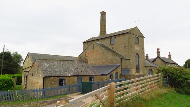
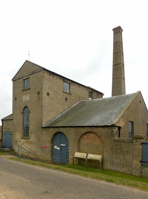
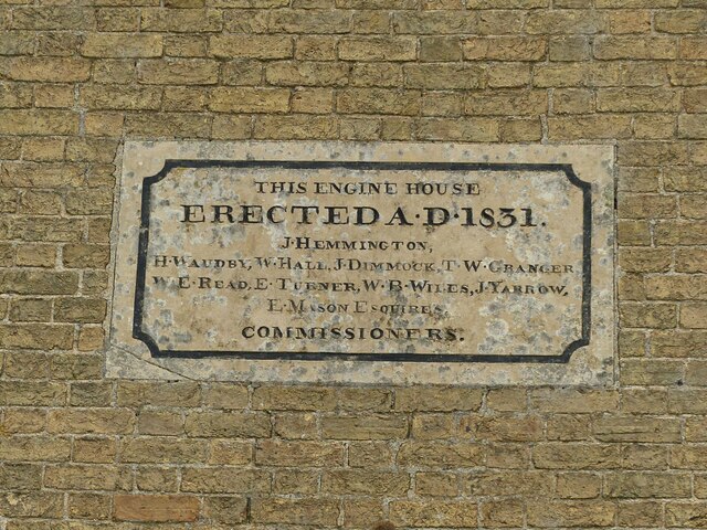
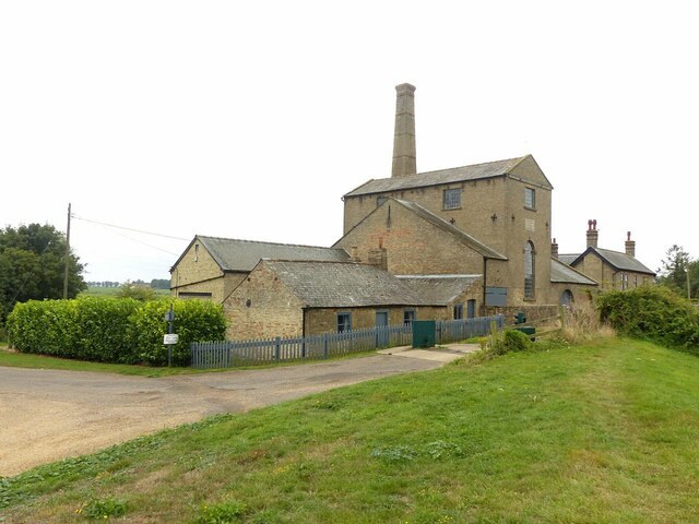
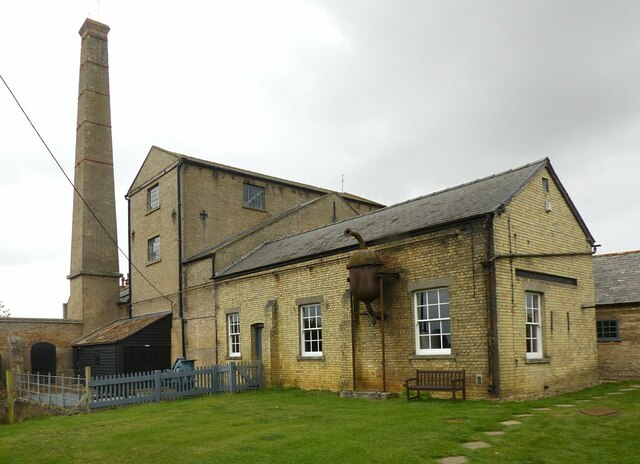
Stretham Old Engine

Stretham Old Engine is a steam-powered engine just south of Stretham in Cambridgeshire, England, that was used to pump water from flood-affected areas...

Stretham railway station

Stretham railway station was a station in Stretham, Cambridgeshire on the Ely and St Ives Railway. == History == The railway line between Ely and Sutton...

Thetford, Cambridgeshire

Thetford is a civil parish in the ward of Stretham, near Ely, in the East Cambridgeshire district, in the county of Cambridgeshire, England. The village...

River Cam

The River Cam () is the main river flowing through Cambridge in eastern England. After leaving Cambridge, it flows north and east before joining the River...

Cantabrigian Rowing Club

Cantabrigian Rowing Club (), known as Cantabs, is a 'town' (or CRA) rowing and sculling club in Cambridge, UK. == History == Cantabs was founded in 1950...

Nearby Amenities

Located within 500m of 52.348922,0.218899
Stretham
Is In: Cambridgeshire, England, UK
Place: village
Lat/Long: 52.3474972/0.2183066
Post Box
Collection Times: Mo-Fr 09:00; Sa 07:00
Operator: Royal Mail
Post Box Type: lamp
Ref: CB6 132
Royal Cypher: EIIR
Royal Cypher Wikidata: Q33102113
Lat/Long: 52.3474025/0.2143
Defibrillator
Booth: K6
Defibrillator Location: inside red phone box by Red Lion pub, opposite church, Stretham
Disused Amenity: telephone
Emergency: defibrillator
Man Made: telephone_box
Lat/Long: 52.3486592/0.2189028
Pub
Red Lion
Addr City: Ely
Addr Housenumber: 47
Addr Postcode: CB6 3LD
Addr Street: High Street
Addr Village: Stretham
Fhrs Id: 922018
Food: yes
Real Ale: usually 4
Rooms: yes
Source Addr: FHRS Open Data
Lat/Long: 52.3486154/0.2189977
Created By: Potlatch 0.8a
Historic: memorial
Lat/Long: 52.3487271/0.2190058
Post Box
Collection Times: Mo-Fr 09:00; Sa 07:00
Operator: Royal Mail
Post Box Type: lamp
Ref: CB6 130
Royal Cypher: EIIR
Royal Cypher Wikidata: Q33102113
Lat/Long: 52.3469032/0.2205612
Post Box
Collection Times: Mo-Fr 09:00, Sa 07:00
Operator: Royal Mail
Post Box Type: lamp
Ref: CB6 133
Royal Cypher: EIIR
Royal Cypher Wikidata: Q33102113
Lat/Long: 52.3454945/0.2183308
Bus Stop
Walnut Tree Close
Bench: no
Lit: no
Naptan AtcoCode: 0500ESTRE004
Naptan Bearing: S
Naptan CommonName: Walnut Tree Close
Naptan Indicator: near
Naptan Landmark: Walnut Tree Close
Naptan NaptanCode: cmbdjgjd
Naptan Street: Ely Road
Naptan Verified: no
Public Transport: platform
Shelter: no
Source: naptan_import
Tactile Paving: no
Lat/Long: 52.3515292/0.2191164
Bus Stop
Chapel Street
Bench: yes
Bus: yes
Lit: no
Naptan AtcoCode: 0500ESTRE005
Naptan Bearing: N
Naptan CommonName: Chapel Street
Naptan Indicator: opp
Naptan Landmark: Chapel Street
Naptan NaptanCode: cmbdjgjg
Naptan Street: High Street
Naptan Verified: no
Public Transport: platform
Shelter: yes
Source: naptan_import
Tactile Paving: no
Lat/Long: 52.3483394/0.2185781
Bus Stop
Chapel Street
Bench: yes
Bus: yes
Lit: yes
Naptan AtcoCode: 0500ESTRE006
Naptan Bearing: S
Naptan CommonName: Chapel Street
Naptan Indicator: near
Naptan Landmark: Chapel Street
Naptan NaptanCode: cmbdjgjm
Naptan Street: High Street
Naptan Verified: no
Public Transport: platform
Shelter: yes
Source: naptan_import
Tactile Paving: no
Lat/Long: 52.3484805/0.218755
Bus Stop
Short Road
Bench: no
Bus: yes
Lit: no
Naptan AtcoCode: 0500ESTRE007
Naptan Bearing: E
Naptan CommonName: Short Road
Naptan Indicator: opp
Naptan Landmark: Short Road
Naptan NaptanCode: cmbdjgjp
Naptan Street: Wilburton Road
Naptan Verified: no
Public Transport: platform
Shelter: yes
Source: naptan_import
Tactile Paving: no
Lat/Long: 52.3473189/0.2150963
Bus Stop
Short Road
Bench: yes
Bus: yes
Lit: no
Naptan AtcoCode: 0500ESTRE008
Naptan Bearing: W
Naptan CommonName: Short Road
Naptan Indicator: near
Naptan Landmark: Short Road
Naptan NaptanCode: cmbdjgjt
Naptan Street: Wilburton Road
Naptan Verified: no
Public Transport: platform
Shelter: yes
Source: naptan_import
Tactile Paving: no
Lat/Long: 52.347401/0.2144117
Bus Stop
Walnut Tree Close
Bench: yes
Lit: yes
Naptan AtcoCode: 0500ESTRE009
Naptan Bearing: N
Naptan CommonName: Walnut Tree Close
Naptan Indicator: opp
Naptan Landmark: Walnut Tree Close
Naptan NaptanCode: cmbdjgjw
Naptan Street: Ely Road
Naptan Verified: no
Public Transport: platform
Shelter: yes
Source: naptan_import
Tactile Paving: no
Lat/Long: 52.3516065/0.2189925
Class Bicycle: -1
Lat/Long: 52.3477026/0.2126572
Power: pole
Source: Bing
Lat/Long: 52.3484265/0.2255446
Power: pole
Source: Bing
Lat/Long: 52.3483308/0.2239555
Leisure: playground
Lat/Long: 52.3511026/0.2198307
Post Office
Stretham Post Office
Addr Country: GB
Addr Postcode: CB6 3JQ
Brand: Post Office
Brand Wikidata: Q1783168
Contact Website: https://www.postoffice.co.uk/branch-finder/1771132/stretham
Opening Hours: Mo-Sa 06:00-20:00; Su 08:00-16:00
Ref Pol Id: 5034
Lat/Long: 52.3488563/0.2192594
Post Box
Collection Times: Mo-Fr 17:15; Sa 10:00
Operator: Royal Mail
Post Box Design: ludlow
Post Box Type: wall
Ref: CB6 129
Royal Cypher: GR
Royal Cypher Wikidata: Q33102273
Lat/Long: 52.3488791/0.2191251
Crossing
Crossing: uncontrolled
Crossing Island: no
Crossing Ref: zebra
Source: Bing
Tactile Paving: no
Lat/Long: 52.3470079/0.2170803
Post Box
Collection Times: Mo-Fr 09:00; Sa 07:00
Operator: Royal Mail
Operator Wikidata: Q638098
Post Box Type: lamp
Ref: CB6 131
Royal Cypher: GVIR
Royal Cypher Wikidata: Q33102169
Source: survey
Lat/Long: 52.3508808/0.2220339
Generator Method: photovoltaic
Generator Output Electricity: yes
Generator Source: solar
Generator Type: solar_photovoltaic_panel
Location: roof
Power: generator
Lat/Long: 52.3526281/0.2200672
Generator Method: photovoltaic
Generator Output Electricity: yes
Generator Source: solar
Generator Type: solar_photovoltaic_panel
Location: roof
Power: generator
Lat/Long: 52.35271/0.2213466
Generator Method: photovoltaic
Generator Output Electricity: yes
Generator Source: solar
Generator Type: solar_photovoltaic_panel
Location: roof
Power: generator
Lat/Long: 52.352642/0.2215538
Generator Method: photovoltaic
Generator Output Electricity: yes
Generator Source: solar
Generator Type: solar_photovoltaic_panel
Location: roof
Power: generator
Lat/Long: 52.3526305/0.2216316
Generator Method: photovoltaic
Generator Output Electricity: yes
Generator Source: solar
Generator Type: solar_photovoltaic_panel
Location: roof
Power: generator
Lat/Long: 52.3519908/0.2234817
Generator Method: photovoltaic
Generator Output Electricity: yes
Generator Source: solar
Generator Type: solar_photovoltaic_panel
Location: roof
Power: generator
Lat/Long: 52.3482127/0.2232161
Generator Method: photovoltaic
Generator Output Electricity: yes
Generator Source: solar
Generator Type: solar_photovoltaic_panel
Location: roof
Power: generator
Lat/Long: 52.3482192/0.2237445
Generator Method: photovoltaic
Generator Output Electricity: yes
Generator Source: solar
Generator Type: solar_photovoltaic_panel
Location: roof
Power: generator
Lat/Long: 52.3471427/0.2230579
Generator Method: photovoltaic
Generator Output Electricity: yes
Generator Source: solar
Generator Type: solar_photovoltaic_panel
Location: roof
Power: generator
Lat/Long: 52.3475523/0.2224128
Generator Method: photovoltaic
Generator Output Electricity: yes
Generator Source: solar
Generator Type: solar_photovoltaic_panel
Location: roof
Power: generator
Lat/Long: 52.3475523/0.2223538
Generator Method: photovoltaic
Generator Output Electricity: yes
Generator Source: solar
Generator Type: solar_photovoltaic_panel
Location: roof
Power: generator
Lat/Long: 52.3455255/0.2169317
Generator Method: photovoltaic
Generator Output Electricity: yes
Generator Source: solar
Generator Type: solar_photovoltaic_panel
Location: roof
Power: generator
Lat/Long: 52.3455386/0.2168754
DNA Fence and Garden
Description: Fence and Garden Contractor
Lat/Long: 52.350085/0.2227702
Historic: memorial
Memorial: war_memorial
Lat/Long: 52.3488033/0.2186921
Shelter
Shelter Type: public_transport
Lat/Long: 52.348666/0.21893
Bicycle Parking
Bicycle Parking: stands
Capacity: 6
Covered: no
Cyclestreets Id: 185217
Lat/Long: 52.3490695/0.219013
Bicycle Parking
Bicycle Parking: stands
Capacity: 6
Covered: no
Cyclestreets Id: 185217
Lat/Long: 52.3456401/0.2139586
The data included in this document is from www.openstreetmap.org. The data is made available under ODbL.

Have you been to Stretham?

Leave your review of Stretham below (or comments, questions and feedback).