Strelley

Settlement in Nottinghamshire Broxtowe

England

Strelley

Insects on Corn Sow-thistle (Sonchus arvensis) A small bumblebee (Probably Small Carder Bee - Bombus pascuorum), hoverflies and others.
Insects on Corn Sow-thistle (Sonchus arvensis) Credit: Alan Murray-Rust

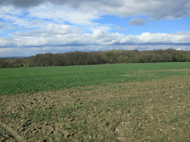
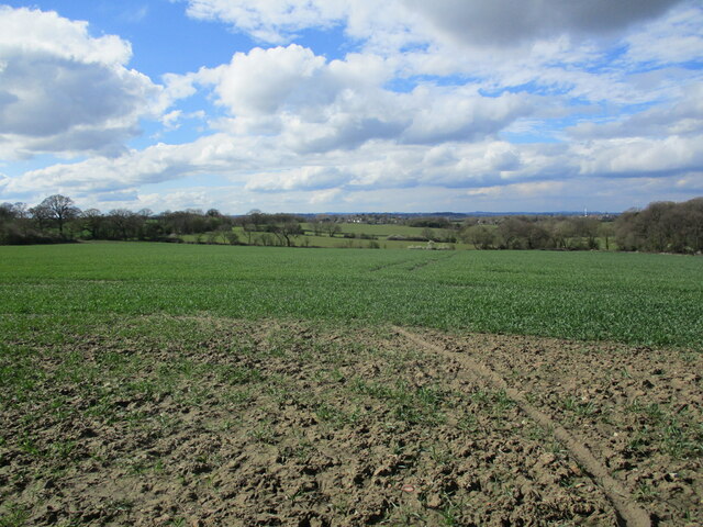
Strelley is a small village located in the county of Nottinghamshire, England. It is situated approximately 4 miles northwest of the city of Nottingham and falls within the local government district of Broxtowe. The village is surrounded by picturesque countryside, offering a peaceful and rural setting for its residents.

Strelley has a rich history, with its origins dating back to the medieval period. The village is known for its historic Strelley Hall, a Grade II* listed building that was constructed in the 16th century and has been well-preserved. The hall is renowned for its beautiful architecture and stunning gardens, which attract visitors from near and far.

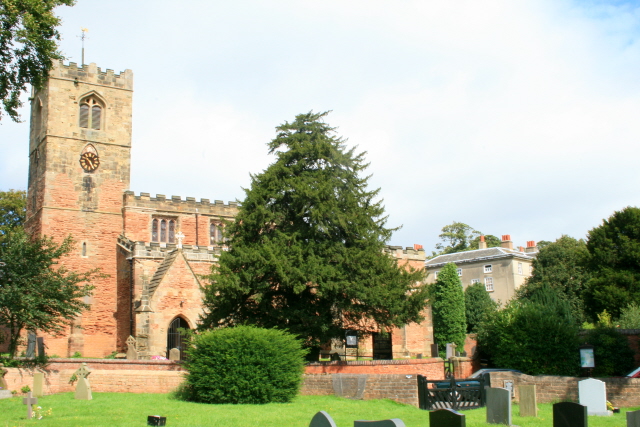
The village also boasts Strelley Church, a charming place of worship that has stood for over 800 years. The church is a significant landmark in the area and plays an important role in the community, hosting regular services and events.

In terms of amenities, Strelley has a primary school, providing education for the local children. There are also a few small businesses and shops scattered throughout the village, serving the needs of the residents.

Strelley is well-connected to the nearby city of Nottingham, with regular bus services and easy access to major road networks. This allows residents to enjoy the tranquility of village life while still benefiting from the amenities and opportunities of a larger urban center.

Overall, Strelley offers a peaceful and idyllic setting with a strong sense of community, making it an attractive place to live or visit.

If you have any feedback on the listing, please let us know in the comments section below.
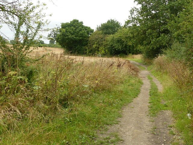
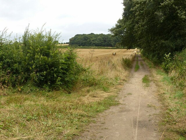
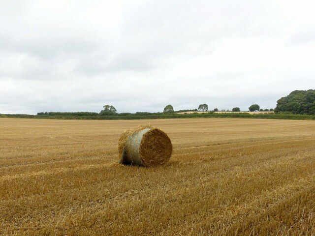
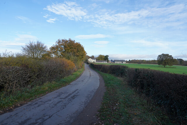
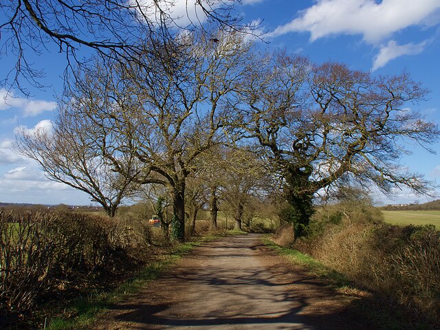
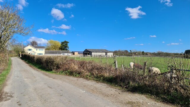
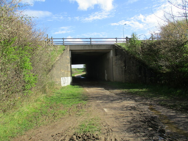
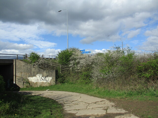
Strelley Images

Images are sourced within 2km of 52.970465/-1.23831 or Grid Reference SK5141. Thanks to Geograph Open Source API. All images are credited.

Insects on Corn Sow-thistle (Sonchus arvensis) A small bumblebee (Probably Small Carder Bee - Bombus pascuorum), hoverflies and others.
Insects on Corn Sow-thistle (Sonchus arvensis)
A small bumblebee (Probably Small Carder Bee - Bombus pascuorum), hoverflies and others.
Bridleway near Trowell Forming part of the Robin Hood Way and clearly well used.
Bridleway near Trowell
Forming part of the Robin Hood Way and clearly well used.
Bridleway on Trowell Moor Forming part of the Robin Hood Way and clearly well used. From this point it also forms field access.
Bridleway on Trowell Moor
Forming part of the Robin Hood Way and clearly well used. From this point it also forms field access.
Just one bale Why this one should have been left behind when all the others have been collected up is a mystery.
Just one bale
Why this one should have been left behind when all the others have been collected up is a mystery.
Robinettes Lane Robinettes Lane is a cul-de-sac lane leading to a farm.
Robinettes Lane
Robinettes Lane is a cul-de-sac lane leading to a farm.
Bridleway near Turkey Fields Farm
Robinettes Lane
Robinettes Lane
Bridleway beneath the M1
Blackthorn by the motorway Just past its best.
Blackthorn by the motorway
Just past its best.
Autumn sown crop and Oldmoor Wood
Autumn sown crop near Cossall Looking down into the Erewash valley.
Autumn sown crop near Cossall
Looking down into the Erewash valley.
Heading north on the M1
Robin Hood Way near Trowell Service Station Looks tranquil enough, but this path is just a small field away from the M1 and its traffic.
Robin Hood Way near Trowell Service Station
Looks tranquil enough, but this path is just a small field away from the M1 and its traffic.
Robin Hood Way between Trowell and Strelley A stretch of gentle open country and green pasture encountered on this long distance footpath.
Robin Hood Way between Trowell and Strelley
A stretch of gentle open country and green pasture encountered on this long distance footpath.
Track beside the M1 Walking parallel to the M1 on the track between Trowell Moor and Cossall - seeking an underpass.
Track beside the M1
Walking parallel to the M1 on the track between Trowell Moor and Cossall - seeking an underpass.
Underpass north of Trowell Service Station Underpass created to provide access for the bridleway between Trowell Moor and Cossall.
Underpass north of Trowell Service Station
Underpass created to provide access for the bridleway between Trowell Moor and Cossall.
Bridleway between Trowell Moor and Cossall Rural scene encountered on the bridleway between Trowell Moor and Cossall, although the M1 was only 100 yards away - behind the camera.
Bridleway between Trowell Moor and Cossall
Rural scene encountered on the bridleway between Trowell Moor and Cossall, although the M1 was only 100 yards away - behind the camera.
Footpath crossing fields towards Awsworth Path leading passed a pile of manure in the direction of Grange Farm - however it strikes north before reaching this objective.
Footpath crossing fields towards Awsworth
Path leading passed a pile of manure in the direction of Grange Farm - however it strikes north before reaching this objective.
Show me another place!

Strelley is located at Grid Ref: SK5141 (Lat: 52.970465, Lng: -1.23831)

Administrative County: Nottinghamshire

District: Broxtowe

Police Authority: Nottinghamshire

What 3 Words

///grant.facing.town. Near Kimberley, Nottinghamshire

Nearby Locations

Strelley

Related Wikis

Bilborough College

Bilborough Sixth Form College is a sixth-form college in Nottingham, England. The college has students from across the conurbation. A third of its students...

Strelley Village

Strelley is a village and civil parish in the Borough of Broxtowe and City of Nottingham in Nottinghamshire, England. It is to the west of Nottingham....

All Saints' Church, Strelley

All Saints' Church, Strelley is a Grade I listed parish church in the Church of England in Strelley, Nottinghamshire. == History == The church dates from...

Nottingham University Samworth Academy

Nottingham University Samworth Academy (formerly William Sharp School) is a coeducational secondary school and sixth form with academy status, located...

Strelley, Nottingham

Strelley Estate is a post war housing estate located in the Bilborough ward in the City of Nottingham. The estate is located around 3.5 miles (6 km) from...

Bilborough

Bilborough is a suburb of the city of Nottingham, in the Nottingham district, in the ceremonial county of Nottinghamshire, England. The population of the...

Oldmoor Wood

Oldmoor Wood is a woodland in Nottinghamshire, England, near the village of Strelley. It covers a total area of 15.11 hectares (37.34 acres). It is owned...

Harvey Hadden Stadium

The Harvey Hadden Stadium is a purpose-built athletics stadium in the Bilborough district of Nottingham, England which is the home of Notts Athletics Club...

Nearby Amenities

Located within 500m of 52.970465,-1.23831
Strelley
Is In: Broxtowe;Nottinghamshire
Is In District: Broxtowe
Place: village
Wikidata: Q7623203
Wikipedia: en:Strelley Village
Lat/Long: 52.971471/-1.2387673
Barrier: kissing_gate
Lat/Long: 52.9719684/-1.2335174
Bus Stop
Bilborough College
Bus: yes
Local Ref: BC
Naptan AtcoCode: 3390BC
Naptan Bearing: NW
Naptan CommonName: Bilborough College
Naptan Indicator: Stop BC
Naptan Landmark: Bilborough College
Naptan NaptanCode: ntmagmjp
Naptan Street: Bilborough College
Naptan Verified: no
Public Transport: platform
Source: naptan_import
Lat/Long: 52.9665322/-1.2358912
Bus Stop
Gayton Close
Both Ways: yes
Bus: yes
Local Ref: BI57
Naptan AtcoCode: 3390BI57
Naptan Bearing: SE
Naptan CommonName: Gayton Close
Naptan Indicator: Stop BI57
Naptan Landmark: Gayton Close
Naptan NaptanCode: ntmajagt
Naptan PlusbusZoneRef: NTNG
Naptan Street: Melbury Road
Naptan Verified: yes
Public Transport: platform
Shelter: no
Source: naptan_import
Lat/Long: 52.9705411/-1.2322008
Bus Stop
Melford Road
Both Ways: yes
Bus: yes
Local Ref: BI58
Naptan AtcoCode: 3390BI58
Naptan Bearing: W
Naptan CommonName: Melford Road
Naptan Indicator: Stop BI58
Naptan Landmark: Melford Road
Naptan NaptanCode: ntmajagw
Naptan PlusbusZoneRef: NTNG
Naptan Street: Melbury Road
Naptan Verified: yes
Public Transport: platform
Shelter: no
Source: naptan_import
Lat/Long: 52.9714549/-1.2322511
Bus Stop
College
Bus: yes
Naptan AtcoCode: 3300BR0468
Naptan Bearing: NE
Naptan CommonName: College
Naptan Indicator: opp
Naptan Landmark: Bilborough College
Naptan NaptanCode: ntsawgjt
Naptan Notes: None (This stop renumbered from 3300BIT3)
Naptan Street: Bilborough Road
Naptan Verified: yes
Public Transport: platform
Shelter: no
Source: naptan_import
Lat/Long: 52.9662658/-1.2383664
Mini Roundabout
Direction: clockwise
Source: GPS
Lat/Long: 52.9670695/-1.2352155
Post Box
Collection Times: Mo-Fr 17:05; Sa 10:30
Post Box Type: lamp
Ref: NG8 338
Royal Cypher: EIIR
Royal Cypher Wikidata: Q33102113
Source: survey
Lat/Long: 52.971724/-1.2382118
Archaeological Site: bell_pit
Historic: archaeological_site
Source: Yahoo
Lat/Long: 52.9696537/-1.2383911
Archaeological Site: bell_pit
Historic: archaeological_site
Source: Yahoo
Lat/Long: 52.9703063/-1.2384877
Archaeological Site: bell_pit
Historic: archaeological_site
Source: Yahoo
Lat/Long: 52.9709718/-1.2376938
Archaeological Site: bell_pit
Historic: archaeological_site
Source: Yahoo
Lat/Long: 52.9697119/-1.2375221
Archaeological Site: bell_pit
Historic: archaeological_site
Source: Yahoo
Lat/Long: 52.9700156/-1.2376025
Ele: 103.707153
Man Made: boundary_marker
Lat/Long: 52.9718459/-1.2370121
Traffic Signals
Lat/Long: 52.9720284/-1.2339231
Traffic Signals
Lat/Long: 52.9716904/-1.2341754
Traffic Signals
Lat/Long: 52.9718548/-1.2337601
Traffic Signals
Lat/Long: 52.9717969/-1.2343526
Crossing
Crossing: traffic_signals
Crossing Ref: pelican
Lat/Long: 52.9719897/-1.2339361
Crossing
Crossing: traffic_signals
Crossing Ref: pelican
Lat/Long: 52.9719637/-1.2340971
Addr City: Nottingham
Addr Housename: Boundary Cottage
Addr Postcode: NG8 6PD
Addr Street: Main Street
Entrance: main
Source: survey; Bing
Source Postcode: NCC open data planning
Lat/Long: 52.9715533/-1.2369508
Addr City: Nottingham
Addr Housename: Fountain Cottage
Addr Postcode: NG8 6PB
Addr Street: Strelley Road
Entrance: main
Fixme: Street/postcode needs confirming: Street given twice in Land Registry prices paid as Strelley Road, but logically should be Main Street
Source: survey; Bing
Source Postcode: Land registry prices paid
Lat/Long: 52.9716153/-1.2370642
Entrance: main
Lat/Long: 52.9718956/-1.2388138
Source: survey
Traffic Calming: cushion
Lat/Long: 52.9693772/-1.2314272
Source: survey
Traffic Calming: cushion
Lat/Long: 52.9697496/-1.2317084
Source: Bing
Traffic Calming: hump
Lat/Long: 52.9697912/-1.2312049
Source: survey
Traffic Calming: cushion
Lat/Long: 52.9702836/-1.2321124
Source: Bing
Traffic Calming: cushion
Lat/Long: 52.9708122/-1.2324987
Source: survey
Traffic Calming: cushion
Lat/Long: 52.971497/-1.2317929
Addr City: Nottingham
Addr Housenumber: 1
Addr Postcode: NG8 4JH
Addr Street: College Way
Entrance: yes
Source: survey; Bing
Source Postcode: Land Registry Price Paid
Lat/Long: 52.9672265/-1.2356461
Addr City: Nottingham
Addr Housenumber: 1-12
Addr Interpolation: all
Addr Postcode: NG8 4JR
Addr Street: Greenwood Gardens
Entrance: main
Source: survey; Bing
Source Postcode: Land Registry Price Paid
Lat/Long: 52.967895/-1.2353862
Addr City: Nottingham
Addr Housenumber: 1-6
Addr Interpolation: all
Addr Postcode: NG8 4JN
Addr Street: Spring Gardens
Entrance: yes
Source: survey; Bing
Source Postcode: Land Registry Price Paid
Lat/Long: 52.9673277/-1.2354995
Addr City: Nottingham
Addr Housenumber: 14-25
Addr Interpolation: all
Addr Postcode: NG8 4JR
Addr Street: Greenwood Gardens
Entrance: main
Source: survey; Bing
Source Postcode: Land Registry Price Paid
Lat/Long: 52.9678634/-1.2356785
Addr City: Nottingham
Addr Housenumber: 15-20
Addr Interpolation: all
Addr Postcode: NG8 4JN
Addr Street: Spring Gardens
Entrance: yes
Source: survey; Bing
Source Postcode: Land Registry Price Paid
Lat/Long: 52.9674396/-1.236071
Addr City: Nottingham
Addr Housenumber: 21
Addr Postcode: NG8 4JN
Addr Street: Spring Gardens
Entrance: yes
Source: survey; Bing
Source Postcode: Land Registry Price Paid
Lat/Long: 52.9675584/-1.2361275
Addr City: Nottingham
Addr Housenumber: 22-27
Addr Interpolation: all
Addr Postcode: NG8 4JN
Addr Street: Spring Gardens
Entrance: yes
Source: survey; Bing
Source Postcode: Land Registry Price Paid
Lat/Long: 52.9676219/-1.2359035
Addr City: Nottingham
Addr Housenumber: 26-37
Addr Interpolation: all
Addr Postcode: NG8 4JR
Addr Street: Greenwood Gardens
Entrance: main
Source: survey; Bing
Source Postcode: Land Registry Price Paid
Lat/Long: 52.9682874/-1.2352228
Addr City: Nottingham
Addr Housenumber: 3-12;14-15
Addr Interpolation: all
Addr Postcode: NG8 4JL
Addr Street: Redwood Close
Entrance: main
Source: survey; Bing
Source Postcode: Land Registry Price Paid
Lat/Long: 52.9676903/-1.2331943
Addr City: Nottingham
Addr Housenumber: 38-49
Addr Interpolation: all
Addr Postcode: NG8 4JR
Addr Street: Greenwood Gardens
Entrance: main
Source: survey; Bing
Source Postcode: Land Registry Price Paid
Lat/Long: 52.9680995/-1.2352347
Addr City: Nottingham
Addr Housenumber: 7
Addr Postcode: NG8 4JN
Addr Street: Spring Gardens
Entrance: yes
Source: survey; Bing
Source Postcode: Land Registry Price Paid
Lat/Long: 52.9672348/-1.2357669
Addr City: Nottingham
Addr Housenumber: 8-12;14
Addr Interpolation: all
Addr Postcode: NG8 4JN
Addr Street: Spring Gardens
Entrance: yes
Source: survey; Bing
Source Postcode: Land Registry Price Paid
Lat/Long: 52.9673765/-1.2358839
Crossing
Crossing: traffic_signals
Crossing Ref: pelican
Source: survey
Lat/Long: 52.966463/-1.2379751
Entrance: main
Lat/Long: 52.9669033/-1.2343389
Post Box
Collection Times: Mo-Fr 09:00; Sa 07:00
Post Box Type: pillar
Ref: NG8 360D
Royal Cypher: EIIR
Royal Cypher Wikidata: Q33102113
Source: survey
Lat/Long: 52.9671038/-1.2356351
Entrance: yes
Note: Another entrance to 1-6
Lat/Long: 52.9672931/-1.2353754
Entrance: yes
Note: Another entrance to 8-12;14
Lat/Long: 52.9672979/-1.2359652
Entrance: yes
Note: Another entrance to 15-20
Lat/Long: 52.9674146/-1.236189
Entrance: yes
Note: Another entrance to 22-27
Lat/Long: 52.9676748/-1.2360445
Bus Stop
Strelley Village
Bus: yes
Naptan AtcoCode: 3390BI99
Naptan NaptanCode: ntmwtmpa
Public Transport: platform
Ref: BI99
Shelter: no
Source: survey
Lat/Long: 52.9713626/-1.2343693
Bus Stop
Strelley Village
Bus: yes
Naptan AtcoCode: 3390BI98
Naptan NaptanCode: ntmwtmpj
Public Transport: platform
Ref: BI98
Shelter: no
Source: survey
Source Ref: NaPTAN open data
Lat/Long: 52.9714048/-1.2341186
Generator Location: roof
Generator Method: photovoltaic
Generator Output Electricity: yes
Generator Source: solar
Generator Type: solar_photovoltaic_panel
Note: roof household
Notional Area: 15 sq m
Power: generator
Source: survey
Lat/Long: 52.9708574/-1.2316081
Generator Location: roof
Generator Method: photovoltaic
Generator Output Electricity: yes
Generator Source: solar
Generator Type: solar_photovoltaic_panel
Note: roof household
Notional Area: 15 sq m
Power: generator
Source: survey
Lat/Long: 52.9708736/-1.2316752
Generator Location: roof
Generator Method: photovoltaic
Generator Output Electricity: yes
Generator Source: solar
Generator Type: solar_photovoltaic_panel
Note: roof household
Notional Area: 15 sq m
Power: generator
Source: survey
Lat/Long: 52.971061/-1.2315625
Generator Location: roof
Generator Method: photovoltaic
Generator Output Electricity: yes
Generator Source: solar
Generator Type: solar_photovoltaic_panel
Note: roof household
Notional Area: 15 sq m
Power: generator
Source: survey
Lat/Long: 52.9714749/-1.2314729
Snake Tree
Artwork Type: sculpture
Material: wood
Tourism: artwork
Lat/Long: 52.9720623/-1.2335957
Dwarven Door
Artwork Type: sculpture
Material: wood
Tourism: artwork
Lat/Long: 52.9721334/-1.2334991
Camera Mount: pole
Camera Type: dome
Contact Webcam: http://data.nottinghamtravelwise.org.uk/images192.jpg
Man Made: surveillance
Surveillance: public
Surveillance Type: camera
Surveillance Zone: traffic
Lat/Long: 52.971762/-1.2342809
The data included in this document is from www.openstreetmap.org. The data is made available under ODbL.

Have you been to Strelley?

Leave your review of Strelley below (or comments, questions and feedback).