Strathkinness

Settlement in Fife

Scotland

Strathkinness

West Third and the road to Kincaple
West Third and the road to Kincaple Credit: Mark Anderson

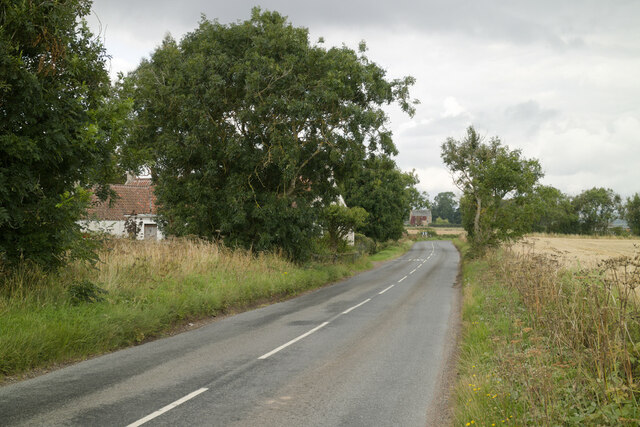
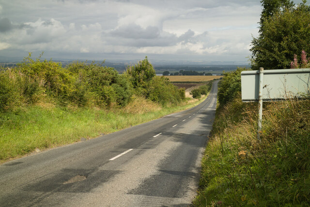
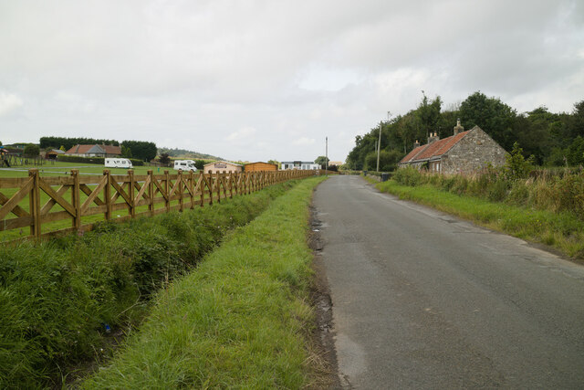
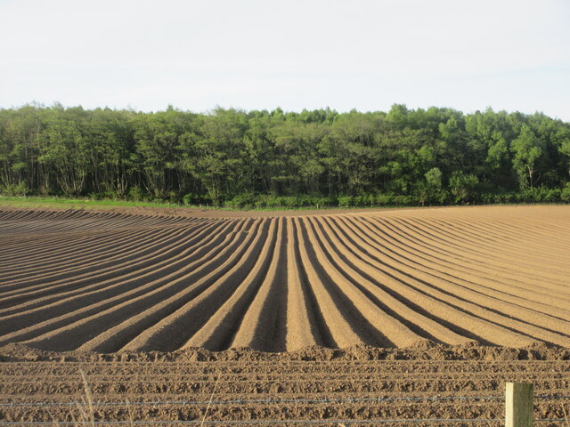
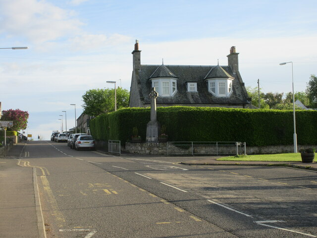
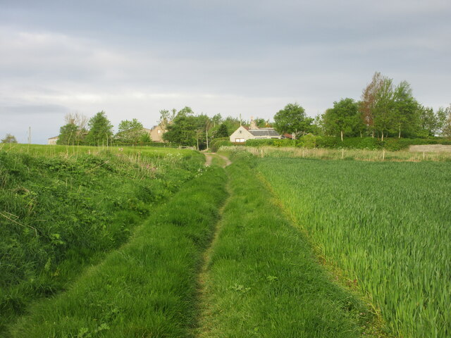
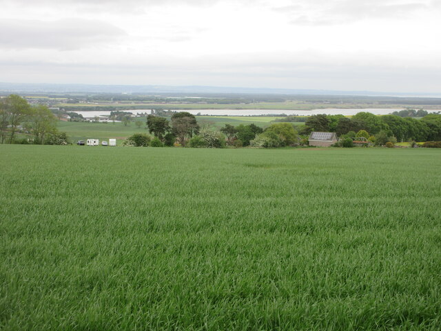
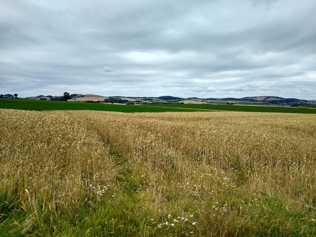
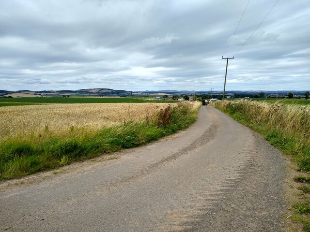
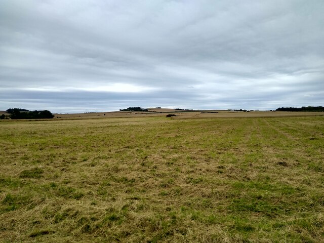
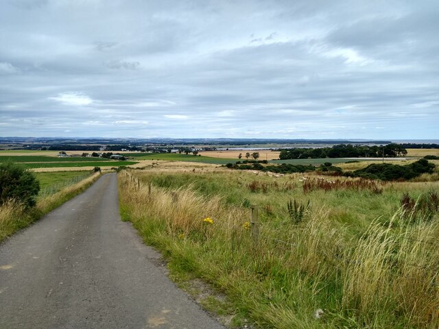
Strathkinness is a picturesque village located in the county of Fife, Scotland. Situated just 3 miles southwest of the historic city of St Andrews, it is nestled in the heart of the rolling countryside. The village is surrounded by lush green fields, offering stunning views of the surrounding landscape.

This charming village has a population of around 600 residents and is renowned for its peaceful and tranquil atmosphere. The architecture in Strathkinness is predominantly traditional, with many stone-built houses dating back to the 18th and 19th centuries. The village center is characterized by its quaint cottages and well-maintained gardens, creating a truly idyllic setting.

Strathkinness is home to a close-knit community that takes pride in its local amenities. The village boasts a primary school, a village hall, and a church, which serve as important gathering places for residents. There is also a popular pub that offers a warm and welcoming atmosphere for locals and visitors alike.

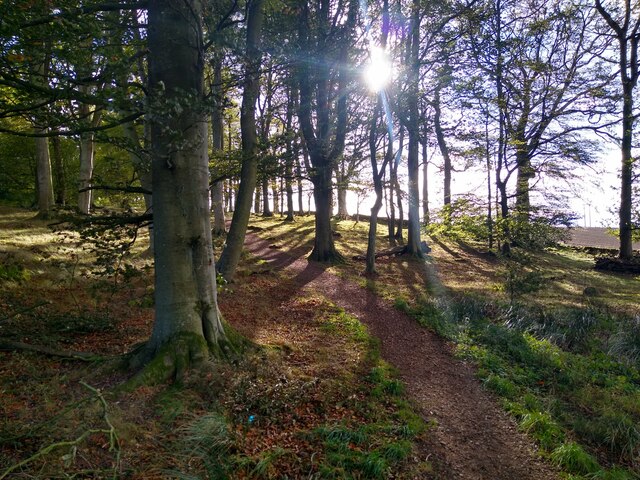
Nature lovers will find plenty to explore in the surrounding area. The village is located near the Lomond Hills Regional Park, a haven for outdoor enthusiasts. Here, visitors can enjoy scenic walks, cycling routes, and even horse riding trails. The nearby Fife Coastal Path also provides a stunning route for hikers, offering breathtaking views of the coast.

With its charming countryside setting, rich history, and close proximity to the vibrant city of St Andrews, Strathkinness offers a peaceful escape for those seeking a rural retreat while still having access to modern amenities.

If you have any feedback on the listing, please let us know in the comments section below.

Strathkinness Images

Images are sourced within 2km of 56.335743/-2.8768767 or Grid Reference NO4516. Thanks to Geograph Open Source API. All images are credited.

West Third and the road to Kincaple
The road to Kincaple, Strathkinness
Nydie Caravan & Campsite
Furrows south of Strathkinness Looking south over a furrowed field from the B939 south of Strathkinness.
Furrows south of Strathkinness
Looking south over a furrowed field from the B939 south of Strathkinness.
Strathkinness War Memorial The war memorial on the main street in the village of Strathkinness.
Strathkinness War Memorial
The war memorial on the main street in the village of Strathkinness.
Old track heading for Clatto Looking west along the old track between Strathkinness and Clatto.
Old track heading for Clatto
Looking west along the old track between Strathkinness and Clatto.
Looking down from Knock Hill Looking north-east down a field near Knockhill, with the Eden Estuary in the distance.
Looking down from Knock Hill
Looking north-east down a field near Knockhill, with the Eden Estuary in the distance.
Autumnal forest Loose trees at the edge of Bishop's Wood, seen on an early autumn afternoon.
Autumnal forest
Loose trees at the edge of Bishop's Wood, seen on an early autumn afternoon.
Horses in Bishop's Woods Or rather, an old and abandoned trailer for horses. This part of the woodland is used as storage for debris, container, trash, as seen in <a href="https://www.geograph.org.uk/photo/6840031">NO4615 : An area of Bishop's Wood being used for storage of demolished materials</a>. The horse trailer is only the most prominent part of this unofficial dumping site.
Horses in Bishop's Woods
Or rather, an old and abandoned trailer for horses. This part of the woodland is used as storage for debris, container, trash, as seen in NO4615 : An area of Bishop's Wood being used for storage of demolished materials. The horse trailer is only the most prominent part of this unofficial dumping site.
Nether Strathkinness This square is surprisingly difficult to Geograph, because it offers basically no parking.
Nether Strathkinness
This square is surprisingly difficult to Geograph, because it offers basically no parking.
View across the Kinness Burn Behind on the hill is Windward Farm
View across the Kinness Burn
Behind on the hill is Windward Farm
Field near Nydie A mature cereal field near the farm Nydie Mains.
Field near Nydie
A mature cereal field near the farm Nydie Mains.
Road to Newton of Nydie A very minor road leads to Newton of Nydie and not much further.
Road to Newton of Nydie
A very minor road leads to Newton of Nydie and not much further.
Knock Hill from the east Rough grassland, lots of it, which slopes gently towards the west. The 'hill', if we are allowed to call it that, is called Knock Hill.
Knock Hill from the east
Rough grassland, lots of it, which slopes gently towards the west. The 'hill', if we are allowed to call it that, is called Knock Hill.
Sheep at Newton Wood This road leads past Newton Wood to Newton of Nydie.
Sheep at Newton Wood
This road leads past Newton Wood to Newton of Nydie.
Old Milestone by the B939, south of Strathkinness 'A' type milestone by the B939, in parish of St Andrews (Fife District), South of Strathkinness, near crossroads. An earlier photograph can be found here <a title="https://www.geograph.org.uk/photo/6102694" href="https://www.geograph.org.uk/photo/6102694">Link</a>.

Inscription reads:-
: Ceres 4¾ / Cupar 6½ / Bᵗ.Iᵈ. 27 : : Sᵗ.Andˢ. 3 :
(To Ceres, Cupar, Burntisland, St Andrews)

Metal cap 'replaced' after June 2018.

Milestone Society National ID: FF_SACE03
Old Milestone by the B939, south of Strathkinness
'A' type milestone by the B939, in parish of St Andrews (Fife District), South of Strathkinness, near crossroads. An earlier photograph can be found here Link. Inscription reads:- : Ceres 4¾ / Cupar 6½ / Bᵗ.Iᵈ. 27 : : Sᵗ.Andˢ. 3 : (To Ceres, Cupar, Burntisland, St Andrews) Metal cap 'replaced' after June 2018. Milestone Society National ID: FF_SACE03
View from the road Cauldside is on the right, Rummond on the left.
View from the road
Cauldside is on the right, Rummond on the left.
Cauldside steading Converted farm buildings.
Cauldside steading
Converted farm buildings.
Show me another place!

Strathkinness is located at Grid Ref: NO4516 (Lat: 56.335743, Lng: -2.8768767)

Unitary Authority: Fife

Police Authority: Fife

What 3 Words

///backfired.tumble.protected. Near St Andrews, Fife

Nearby Locations

Strathkinness Newton Wood

Related Wikis

Strathkinness

Strathkinness is a small village located 3 miles to the west of St Andrews in North East Fife. A key characteristic of the village is the newly developed...

Rufflets Hotel

Rufflets Hotel is a 4 star hotel near St. Andrews, Fife, Scotland. == History == === Rufflets House 1924–1952 === Rufflets House itself was built in 1924...

St Andrews Rail Link

The St Andrews Rail Link (StARLink) Campaign was established in 1989 with the aim of reconnecting Scottish town of St Andrews to the railway. The historical...

Guardbridge railway station

Guardbridge railway station served the village of Guardbridge, Fife, Scotland from 1862 to 1965 on The St. Andrews Railway. == History == The station opened...

Craigtoun Country Park

Craigtoun Country Park is a country park located approximately 4 miles to the south-west of St Andrews in the county of Fife, Scotland. The site is currently...

Blebo Craigs

Blebo Craigs, or Blebocraigs is a village in rural Fife, Scotland. The village contains around one hundred houses on the south-facing slope of the hill...

Craigtoun Miniature Railway

The Craigtoun Park Railway is a 15 in (381 mm) gauge railway operating on a circular track around part of the Craigtoun Country Park in St Andrews, Fife...

Guardbridge

Guardbridge (Scots: Gairbrig) is a village in the north-east of Fife, on the east coast of Scotland. It is approximately 3 miles (5 km) north-west of St...

Nearby Amenities

Located within 500m of 56.335743,-2.8768767
Traffic Calming: cushion
Lat/Long: 56.332054/-2.8763658
Strathkinness
Is In: Fife, Scotland, UK
Place: village
Wikidata: Q1011990
Wikipedia: en:Strathkinness
Lat/Long: 56.3355368/-2.8763984
Turning Circle
Lat/Long: 56.3360231/-2.8713474
Post Box
Collection Times: Mo-Fr 17:00; Sa 11:00
Operator: Royal Mail
Post Box Type: lamp
Ref: KY16 369
Royal Cypher: scottish_crown
Lat/Long: 56.3324394/-2.8763655
Pub
The Tavern
Lat/Long: 56.3369984/-2.8771596
Post Box
Collection Times: Mo-Fr 15:00; Sa 11:00
Operator: Royal Mail
Post Box Type: lamp
Ref: KY16 390
Royal Cypher: scottish_crown
Lat/Long: 56.3370681/-2.8795296
Post Box
Collection Times: Mo-Fr 15:00; Sa 10:45
Operator: Royal Mail
Post Box Type: lamp
Ref: KY16 353
Royal Cypher: scottish_crown
Lat/Long: 56.3370741/-2.8699703
Traffic Calming: cushion
Lat/Long: 56.3370954/-2.8735646
Traffic Calming: cushion
Lat/Long: 56.3340487/-2.8767853
Crossing
Crossing: traffic_signals
Lat/Long: 56.3353388/-2.8768576
Crossing
Crossing: zebra
Tactile Paving: yes
Lat/Long: 56.3357403/-2.8761604
Traffic Calming: cushion
Lat/Long: 56.3371057/-2.8760445
Traffic Calming: cushion
Lat/Long: 56.3371113/-2.8793978
Bench
Backrest: yes
Material: wood
Lat/Long: 56.3370568/-2.8795895
Bench
Backrest: yes
Lat/Long: 56.337202/-2.8767483
Bench
Backrest: yes
Lat/Long: 56.3371462/-2.874038
Bench
Backrest: yes
Lat/Long: 56.3370696/-2.8740453
Noexit: yes
Lat/Long: 56.3329382/-2.8770608
Telephone
Gallery 201
Booth: K6
Covered: booth
Description: Micro gallery in old red phone box
Man Made: telephone_box
Tourism: gallery
Lat/Long: 56.3358394/-2.8728557
Bus Stop
Bus: yes
Naptan AtcoCode: 6500N0195
Naptan NaptanCode: 34343478
Public Transport: platform
Lat/Long: 56.3354884/-2.8767351
Addr Housenumber: 39
Addr Street: Main Street
Lat/Long: 56.3316664/-2.8762032
EJ Cockburn & Son
Shop: car_repair
Lat/Long: 56.3362872/-2.8759834
Noexit: yes
Lat/Long: 56.3367083/-2.8800105
Noexit: yes
Lat/Long: 56.332976/-2.8770608
Historic: memorial
Memorial: war_memorial
Lat/Long: 56.3357958/-2.8767838
Barrier: bollard
Lat/Long: 56.3349129/-2.8757243
Barrier: bollard
Lat/Long: 56.3351561/-2.8757329
Post Office
Addr City: Strathkinness
Addr Housename: Strathkinness Village Hall
Addr Street: Main Street
Opening Hours: Mo 12:30-14:30; Fr 13:00-15:00
Operator: Strathkinness Community Council
Lat/Long: 56.3352011/-2.8770673
Generator Method: photovoltaic
Generator Output Electricity: yes
Generator Source: solar
Generator Type: solar_photovoltaic_panel
Power: generator
Lat/Long: 56.3351248/-2.8733945
Generator Method: photovoltaic
Generator Output Electricity: yes
Generator Source: solar
Generator Type: solar_photovoltaic_panel
Power: generator
Lat/Long: 56.336962/-2.8700783
Crossing
Lat/Long: 56.3360832/-2.8824267
Crossing
Lat/Long: 56.335836/-2.8819553
Entrance: yes
Lat/Long: 56.3352117/-2.8769949
Defibrillator
Access: yes
Defibrillator Location: outside Strathkinness Village Hall - to right of entrance
Emergency: defibrillator
Indoor: no
Lat/Long: 56.3352449/-2.8770139
Bench
Lat/Long: 56.335587/-2.8764363
Bench
Lat/Long: 56.3355077/-2.8764023
Bicycle Parking
Bicycle Parking: stands
Capacity: 10
Covered: no
Lat/Long: 56.3358451/-2.8761723
Recycling
Recycling Type: container
Lat/Long: 56.3369674/-2.8805569
Crossing
Lat/Long: 56.335833/-2.8824222
The data included in this document is from www.openstreetmap.org. The data is made available under ODbL.

Have you been to Strathkinness?

Leave your review of Strathkinness below (or comments, questions and feedback).