Boldon Colliery

Settlement in Durham

England

Boldon Colliery

Open Land Near Boldon Colliery
Open Land Near Boldon Colliery Credit: David Robinson

Boldon Colliery is a small village located in the county of Durham, England. Situated approximately six miles south-east of Newcastle upon Tyne, it falls within the metropolitan borough of South Tyneside. Historically known for its rich coal mining heritage, Boldon Colliery has undergone significant changes over the years.

The village was established in the mid-19th century when coal mining became the primary industry in the area. Several collieries were opened, attracting a large population of miners and their families to settle in the village. However, the decline of the coal industry in the latter half of the 20th century led to the closure of the mines and the subsequent loss of jobs.

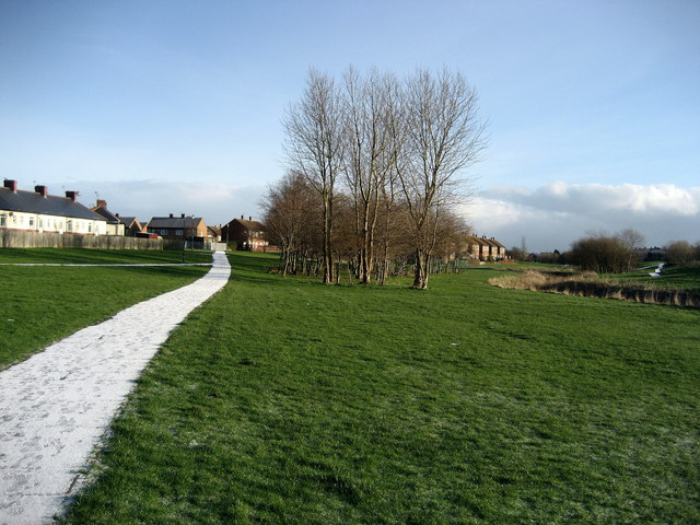
Today, Boldon Colliery is a residential area with a mix of housing types, ranging from terraced houses to modern developments. The village offers a range of amenities to its residents, including local shops, schools, and recreational facilities. The nearby Boldon Retail Park provides additional shopping options.

Transport links in Boldon Colliery are well-developed, with easy access to major roads such as the A19 and A184. The village is also served by the Tyne and Wear Metro system, providing convenient connections to nearby towns and cities.

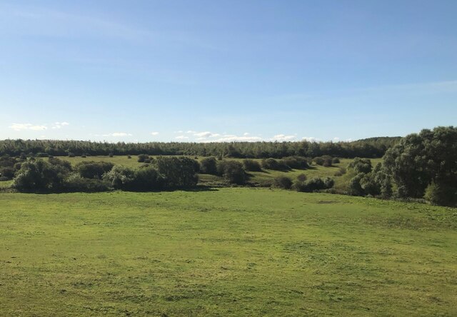
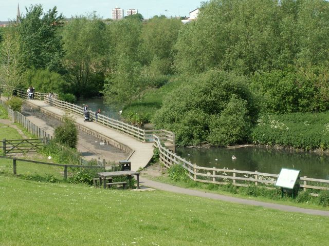
Despite its industrial past, Boldon Colliery has managed to retain some green spaces, including Boldon Flats Nature Reserve, which offers opportunities for outdoor activities and wildlife observation.

Overall, Boldon Colliery is a village that has undergone a transformation from a mining community to a residential area, offering its residents a mix of amenities, good transport links, and access to natural spaces.

If you have any feedback on the listing, please let us know in the comments section below.

Boldon Colliery Images

Images are sourced within 2km of 54.951496/-1.4706729 or Grid Reference NZ3462. Thanks to Geograph Open Source API. All images are credited.

Open Land Near Boldon Colliery
Primrose Local Nature Reserve The Nature Reserve was created in 1990 by excavating a series of ponds and ditches where there had previously been amenity grassland. prone to occasional flooding. Planting them up resulted in a mosaic of marsh and open water habitats, which offers shelter and sustenance to a wide range of wetland wildlife.
Primrose Local Nature Reserve
The Nature Reserve was created in 1990 by excavating a series of ponds and ditches where there had previously been amenity grassland. prone to occasional flooding. Planting them up resulted in a mosaic of marsh and open water habitats, which offers shelter and sustenance to a wide range of wetland wildlife.
The Quadrus Centre, Boldon Business Park No comment!
The Quadrus Centre, Boldon Business Park
No comment!
Interesting office building Not sure what these premises are used for, but spotted them overlooking a lake on a fairly new business park in West Boldon.
Interesting office building
Not sure what these premises are used for, but spotted them overlooking a lake on a fairly new business park in West Boldon.
Fellgate Metro Station An imaginative solution to the problem of designing a new station to fit on the old embankment.
Fellgate Metro Station
An imaginative solution to the problem of designing a new station to fit on the old embankment.
Calfclose Burn A tributary of the river Don this stream would once have been surrounded by marshland, now it is surrounded by the housing estates of Fellgate and Hedworth.
Calfclose Burn
A tributary of the river Don this stream would once have been surrounded by marshland, now it is surrounded by the housing estates of Fellgate and Hedworth.
Old railway bridge over the River Don near Brockley Whins Boldon Colliery closed in the early 1980's and this branch line presumably died with it.
Old railway bridge over the River Don near Brockley Whins
Boldon Colliery closed in the early 1980's and this branch line presumably died with it.
Newton Garths, Biddick Hall The Garths, now much built on, are on the other side of the River Don, which winds across the centre of the photograph.
Newton Garths, Biddick Hall
The Garths, now much built on, are on the other side of the River Don, which winds across the centre of the photograph.
Boldon School These buildings (built in the 1930's?) are about to be replaced by a brand new school behind this site.
Boldon School
These buildings (built in the 1930's?) are about to be replaced by a brand new school behind this site.
Abandoned Garage, Addison Road Passers-by can see a helpful notice stating that this business has moved.
Abandoned Garage, Addison Road
Passers-by can see a helpful notice stating that this business has moved.
The Monkton Burn The burn runs through the Monkton area of Jarrow
The Monkton Burn
The burn runs through the Monkton area of Jarrow
Roundabout at Simonside Busy roundabout at the junction of Newcastle Road and John Reid Road.
Roundabout at Simonside
Busy roundabout at the junction of Newcastle Road and John Reid Road.
Make Me Rich Farm, Boldon
Down Hill Farm, Boldon
Sunrise over the Lakeside fishery, 6:32am
Boldon Fellgate Farm
CineWorld Boldon Started off as a Virgin Cinema but has had several name changes.  Strange South Shields is the main town in South Tyneside and at one time couldn't support a cinema.  CineWorld on the edge of South Tyneside is a multiplex cinema with 10 or 12 screens.  Progress works in mysterious ways.
CineWorld Boldon
Started off as a Virgin Cinema but has had several name changes. Strange South Shields is the main town in South Tyneside and at one time couldn't support a cinema. CineWorld on the edge of South Tyneside is a multiplex cinema with 10 or 12 screens. Progress works in mysterious ways.
Path by River Don at Boldon Slight sprinkling of snow on the path.  The River Don wends its way through a green corridor between West Boldon and New Town
Path by River Don at Boldon
Slight sprinkling of snow on the path. The River Don wends its way through a green corridor between West Boldon and New Town
Show me another place!

Boldon Colliery is located at Grid Ref: NZ3462 (Lat: 54.951496, Lng: -1.4706729)

Unitary Authority: South Tyneside

Police Authority: Northumbria

What 3 Words

///swooning.darkest.doll. Near The Boldons, Tyne & Wear

Nearby Locations

Boldon Colliery

Related Wikis

Boldon Community Association F.C.

Boldon Community Association F.C. is an association football club that plays in the Northern Football League. The club was founded as Boldon Villa, joining...

Jarrow Roofing Boldon Community Association F.C.

Jarrow Roofing Boldon Community Association Football Club was a football club based in Boldon Colliery, near Sunderland, England. The club was founded...

Jarrow F.C.

Jarrow Football Club is a football club based in Jarrow, Tyne and Wear, England. They are currently members of the Northern League Division Two. ��2�...

Brockley Whins

Brockley Whins is an area in South Tyneside, part of South Shields, with a postcode of NE32 [1] It is served by Brockley Whins Metro station. The name...

Brockley Whins Metro station

Brockley Whins is a Tyne and Wear Metro station, serving the suburbs of Boldon Colliery and Brockley Whins, South Tyneside in Tyne and Wear, England. It...

Fellgate Metro station

Fellgate is a Tyne and Wear Metro station, serving the suburbs of Fellgate and Hedworth, South Tyneside in Tyne and Wear, England. It joined the network...

Boldon railway station

Boldon railway station served the village of East Boldon, Tyne and Wear, England, from 1844 to 1967 on the Pontop and South Shields Railway. == History... ==

Boldon School

Boldon School is a coeducational secondary school located in Boldon Colliery, South Tyneside, England.A community school administered by South Tyneside...

Nearby Amenities

Located within 500m of 54.951496,-1.4706729
Traffic Signals
Lat/Long: 54.9547748/-1.4723986
Motorway Junction
Testo's Roundabout
Lat/Long: 54.948236/-1.4734612
Bus Stop
NORTH ROAD-HEDWORTH HOUSE-N/B
Bench: yes
Bin: yes
Bus: yes
Covered: yes
Local Ref: N
Naptan AtcoCode: 410000016106
Naptan Bearing: N
Naptan CommonName: NORTH ROAD-HEDWORTH HOUSE-N/B
Naptan Indicator: N
Naptan Landmark: OPPOSITE NEW HEDWORTH HOUSE
Naptan NaptanCode: twrdjpdg
Naptan Street: NORTH ROAD
Naptan Verified: no
Public Transport: platform
Shelter: yes
Source: naptan_import
Lat/Long: 54.9506277/-1.4634862
Bus Stop
HEDWORTH LANE-DONKINS STREET-W/B
Bench: no
Bus: yes
Covered: yes
Local Ref: SW
Naptan AtcoCode: 410000016107
Naptan Bearing: SW
Naptan CommonName: HEDWORTH LANE-DONKINS STREET-W/B
Naptan Indicator: SW
Naptan Landmark: 65M NORTH EAST OF CROWN HOTEL OPPOSITE
Naptan NaptanCode: twrdjpdj
Naptan Street: HEDWORTH LANE
Naptan Verified: no
Public Transport: platform
Shelter: yes
Source: naptan_import
Lat/Long: 54.9534564/-1.4652764
Bus Stop
Hedworth Lane
Bench: no
Bus: yes
Local Ref: W
Naptan AtcoCode: 410000016108
Naptan Bearing: W
Naptan CommonName: HEDWORTH LANE-FAWLEY CLOSE-W/B
Naptan Indicator: W
Naptan Landmark: OPPOSITE HEDWORTH PARISH CHURCH OF ST NICHOLAS
Naptan NaptanCode: twrdjpdm
Naptan Street: HEDWORTH LANE
Naptan Verified: no
Shelter: yes
Source: naptan_import
Lat/Long: 54.952412/-1.4686
Bus Stop
HEDWORTH LANE-WEST VIEW-N/B
Bus: yes
Local Ref: N
Naptan AtcoCode: 410000016109
Naptan Bearing: N
Naptan CommonName: HEDWORTH LANE-WEST VIEW-N/B
Naptan Indicator: N
Naptan Landmark: OPPOSITE VICARAGE
Naptan NaptanCode: twrdjpdp
Naptan Street: HEDWORTH LANE
Naptan Verified: no
Public Transport: platform
Shelter: yes
Source: naptan_import
Lat/Long: 54.9536609/-1.4713144
Bus Stop
HEDWORTH LANE-WEST VIEW-S/B
Bus: yes
Departures Board: timetable
Local Ref: S
Naptan AtcoCode: 410000016124
Naptan Bearing: S
Naptan CommonName: HEDWORTH LANE-WEST VIEW-S/B
Naptan Indicator: S
Naptan Landmark: OUTSIDE VICARAGE
Naptan NaptanCode: twrdjpjt
Naptan Street: HEDWORTH LANE
Naptan Verified: no
Public Transport: platform
Shelter: yes
Source: naptan_import
Lat/Long: 54.9532025/-1.4706972
Bus Stop
Hedworth Lane
Bus: yes
Local Ref: NE
Naptan AtcoCode: 410000016125
Naptan Bearing: NE
Naptan CommonName: HEDWORTH LANE-FRONT STREET-E/B
Naptan Indicator: NE
Naptan Landmark: OPPOSITE HEDWORTH LANE METHODIST CHURCH
Naptan NaptanCode: twrdjpjw
Naptan Street: HEDWORTH LANE
Naptan Verified: no
Public Transport: platform
Shelter: yes
Source: naptan_import
Lat/Long: 54.952777/-1.4675257
Bus Stop
North Road
Bus: yes
Local Ref: S
Naptan AtcoCode: 410000016126
Naptan Bearing: S
Naptan CommonName: NORTH ROAD-HEDWORTH LANE-S/B
Naptan Indicator: S
Naptan Landmark: OUTSIDE NO.1 NORTH ROAD
Naptan NaptanCode: twrdjpma
Naptan Street: NORTH ROAD
Naptan Verified: no
Public Transport: platform
Shelter: yes
Source: naptan_import
Wheelchair: yes
Lat/Long: 54.9534415/-1.4636986
Bus Stop
NORTH ROAD-HEDWORTH HOUSE-S/B
Bus: yes
Departures Board: timetable
Local Ref: S
Naptan AtcoCode: 410000016127
Naptan Bearing: S
Naptan CommonName: NORTH ROAD-HEDWORTH HOUSE-S/B
Naptan Indicator: S
Naptan Landmark: OUTSIDE THE QUEENS HEAD PUBLIC HOUSE
Naptan NaptanCode: twrdjpmd
Naptan Street: NORTH ROAD
Naptan Verified: no
Public Transport: platform
Shelter: yes
Source: naptan_import
Lat/Long: 54.9508967/-1.4633577
Bus Stop
COTSWOLD LANE-SHIPTON CLOSE-W/B
Local Ref: W
Naptan AtcoCode: 410000016351
Naptan Bearing: W
Naptan CommonName: COTSWOLD LANE-SHIPTON CLOSE-W/B
Naptan Indicator: W
Naptan Landmark: OPPOSITE CINDERFORD CLOSE
Naptan NaptanCode: twrdmamd
Naptan Street: COTSWOLD LANE
Naptan Verified: no
Source: naptan_import
Lat/Long: 54.9555786/-1.4694635
Boldon Colliery
Place: suburb
Source: OS_OpenData_StreetView
Lat/Long: 54.9501682/-1.4652557
Motorway Junction
Boldon Interchange
Lat/Long: 54.9554807/-1.4727742
Design: three-level
Line Attachment: suspension
Power: tower
Triple Tower: yes
Lat/Long: 54.9477269/-1.471726
Design: three-level
Power: tower
Lat/Long: 54.9509063/-1.4732221
Design: three-level
Power: tower
Lat/Long: 54.9548894/-1.4720022
Crossing
Crossing: zebra
Sloped Curb: yes
Tactile Paving: yes
Lat/Long: 54.9478289/-1.4661747
Crossing
Crossing: unmarked
Crossing Island: yes
Tactile Paving: yes
Lat/Long: 54.9474296/-1.4678547
Crossing
Traffic Calming: table
Lat/Long: 54.9544033/-1.4727043
M & S Prestige Sales
Shop: car
Lat/Long: 54.9508802/-1.4629144
Colliery Corner
Addr City: Boldon Colliery
Addr County: Tyne & Wear
Addr Housenumber: 10
Addr Postcode: NE35 9HS
Addr Street: Hedworth Lane
Fhrs Id: 1678420
Shop: convenience
Source Addr: FHRS Open Data
Lat/Long: 54.9539152/-1.4644712
The Parlour Hair Salon
Addr City: Boldon Colliery
Addr Street: Hedworth Lane
Shop: hairdresser
Lat/Long: 54.9538904/-1.4645723
Post Box
Ref: NE35 463
Lat/Long: 54.9537902/-1.4646501
Integrity Computers
Addr City: Boldon Colliery
Addr Street: Hedworth Lane
Shop: computer
Lat/Long: 54.9537779/-1.4648968
T.P. & M. McKenna
Addr City: Boldon Colliery
Addr Street: Hedworth Lane
Shop: newsagent
Lat/Long: 54.9532638/-1.465552
M & J Sangha
Addr City: Boldon Colliery
Addr County: Tyne & Wear
Addr Housenumber: 64
Addr Postcode: NE35 9HS
Addr Street: Hedworth Lane
Fhrs Id: 1677919
Shop: convenience
Source Addr: FHRS Open Data
Lat/Long: 54.9533809/-1.4660616
Waste Basket
Lat/Long: 54.9532915/-1.466067
Pub
The Crown
Addr City: Boldon Colliery
Addr County: Tyne & Wear
Addr Housenumber: 68
Addr Postcode: NE35 9HZ
Addr Street: Hedworth Lane
Fhrs Id: 1677920
Source Addr: FHRS Open Data
Lat/Long: 54.9532576/-1.4663835
Fast Food
Golden Chippy
Addr City: Boldon Colliery
Addr Street: Hedworth Lane
Lat/Long: 54.952935/-1.466402
Boldon Motorshop
Addr City: Boldon Colliery
Addr Street: Hedworth Lane
Shop: car_parts
Lat/Long: 54.9527838/-1.4668378
Waste Basket
Lat/Long: 54.9528359/-1.4669705
Post Box
Ref: NE35 696
Lat/Long: 54.9539953/-1.4713302
Post Box
Ref: NE35 711
Lat/Long: 54.9501855/-1.4716693
Post Box
Post Box Type: lamp
Ref: NE32 699
Royal Cypher: EIIR
Royal Cypher Wikidata: Q33102113
Lat/Long: 54.9517918/-1.4767652
Generator Method: photovoltaic
Generator Output Electricity: yes
Generator Source: solar
Generator Type: solar_photovoltaic_panel
Location: roof
Power: generator
Lat/Long: 54.9520893/-1.4761682
Generator Method: photovoltaic
Generator Output Electricity: yes
Generator Source: solar
Generator Type: solar_photovoltaic_panel
Location: roof
Power: generator
Lat/Long: 54.9534586/-1.4752992
Generator Method: photovoltaic
Generator Output Electricity: yes
Generator Source: solar
Generator Type: solar_photovoltaic_panel
Location: roof
Power: generator
Lat/Long: 54.9540423/-1.476124
Generator Method: photovoltaic
Generator Output Electricity: yes
Generator Source: solar
Generator Type: solar_photovoltaic_panel
Location: roof
Power: generator
Lat/Long: 54.95405/-1.476191
Generator Method: photovoltaic
Generator Output Electricity: yes
Generator Source: solar
Generator Type: solar_photovoltaic_panel
Location: roof
Power: generator
Lat/Long: 54.9548047/-1.4750793
Generator Method: photovoltaic
Generator Output Electricity: yes
Generator Source: solar
Generator Type: solar_photovoltaic_panel
Location: roof
Power: generator
Lat/Long: 54.9547709/-1.4751651
Generator Method: photovoltaic
Generator Output Electricity: yes
Generator Source: solar
Generator Type: solar_photovoltaic_panel
Location: roof
Power: generator
Lat/Long: 54.9550697/-1.4750015
Generator Method: photovoltaic
Generator Output Electricity: yes
Generator Source: solar
Generator Type: solar_photovoltaic_panel
Location: roof
Power: generator
Lat/Long: 54.9551467/-1.4751946
Crossing
Crossing: unmarked
Crossing Island: yes
Tactile Paving: yes
Lat/Long: 54.9474672/-1.4679041
The data included in this document is from www.openstreetmap.org. The data is made available under ODbL.

Have you been to Boldon Colliery?

Leave your review of Boldon Colliery below (or comments, questions and feedback).