Storridge

Settlement in Herefordshire

England

Storridge

Norrest Wood from the footpath The footpath entrance stile was somewhat overgrown when visited, but can just about be negotiated by those with long legs or decent balance.  Look for a small gap in the hedge back from the road surface.
Norrest Wood from the footpath Credit: Peter Whatley

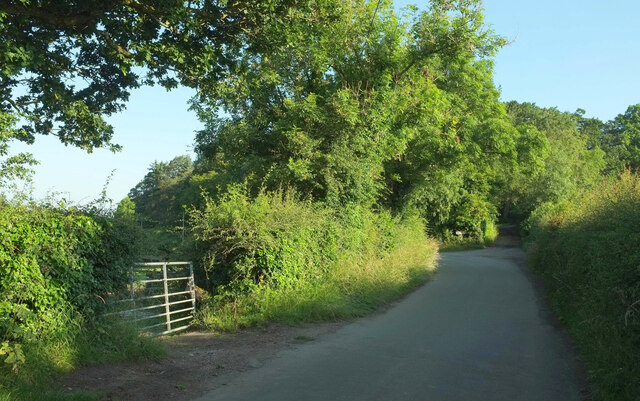
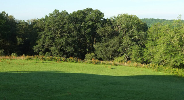
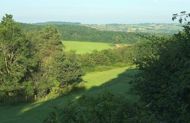
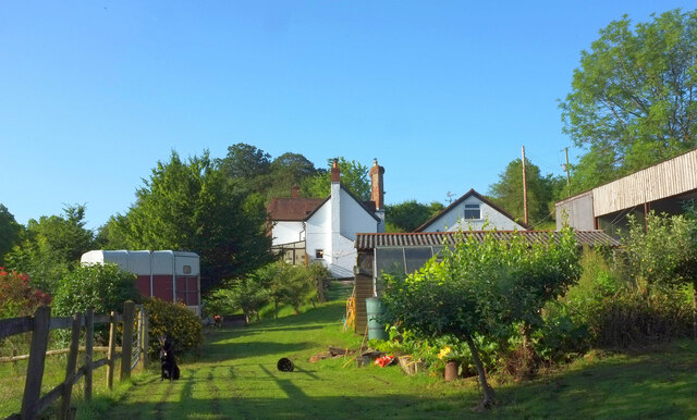
Storridge is a quaint village located in the county of Herefordshire, England. Situated in the Malvern Hills district, it is nestled within a picturesque landscape, surrounded by rolling hills and lush green countryside. With a population of around 300, it offers a peaceful and close-knit community environment.

The village dates back to medieval times and still retains much of its historic charm. Its architecture is a mix of traditional timber-framed cottages and more modern houses. Storridge is known for its well-preserved parish church, St. Mary's, which was built in the 12th century and offers visitors a glimpse into the village's rich heritage.

Despite its small size, Storridge provides several amenities for its residents. The village has a local pub, The Crown Inn, which serves as a social hub for both locals and visitors. Additionally, there is a village hall that hosts various community events and activities.

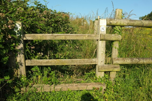
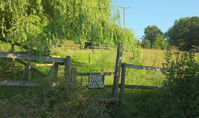
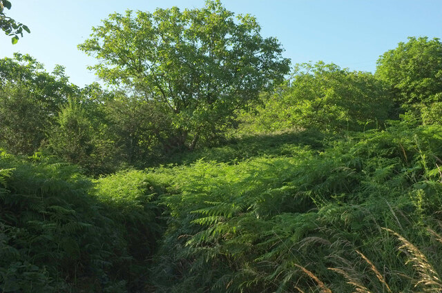
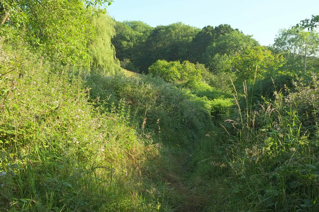
Nature enthusiasts will find plenty to explore in Storridge. The village is surrounded by beautiful countryside, offering numerous walking and hiking trails. The nearby Malvern Hills provide stunning panoramic views and are a popular destination for outdoor enthusiasts.

Storridge benefits from its proximity to larger towns such as Malvern and Worcester. These towns offer a wider range of amenities, including shops, supermarkets, schools, and healthcare facilities, which can be easily accessed by residents.

Overall, Storridge offers a peaceful and idyllic lifestyle, with its rich history, stunning natural surroundings, and a friendly community making it an attractive place to live or visit.

If you have any feedback on the listing, please let us know in the comments section below.

Storridge Images

Images are sourced within 2km of 52.133581/-2.3613387 or Grid Reference SO7548. Thanks to Geograph Open Source API. All images are credited.

Norrest Wood from the footpath The footpath entrance stile was somewhat overgrown when visited, but can just about be negotiated by those with long legs or decent balance.  Look for a small gap in the hedge back from the road surface.
Norrest Wood from the footpath
The footpath entrance stile was somewhat overgrown when visited, but can just about be negotiated by those with long legs or decent balance. Look for a small gap in the hedge back from the road surface.
Driveway to Birchwood House
Birchwood Common from Birchwood Lane
Birchwood Lane This shows the 40 metre stretch of the lane used by the Geopark Way, which has just joined from the right, and turns right into a field at the track junction ahead, although it rejoins the lane for a while about a kilometre ahead.
Birchwood Lane
This shows the 40 metre stretch of the lane used by the Geopark Way, which has just joined from the right, and turns right into a field at the track junction ahead, although it rejoins the lane for a while about a kilometre ahead.
Geopark Way leaves Birchwood Lane Larger sizes of this may reveal the pencil of light coming through the right-hand hedge where the Way follows Cradley footpath CD64 rather than the track to Birchwood House.
Geopark Way leaves Birchwood Lane
Larger sizes of this may reveal the pencil of light coming through the right-hand hedge where the Way follows Cradley footpath CD64 rather than the track to Birchwood House.
Birchwood Common From the junction where the Geopark Way leaves the lane as shown in <a href="https://www.geograph.org.uk/photo/7266435">SO7550 : Geopark Way leaves Birchwood Lane</a>. This field is on a ridge.
Birchwood Common
From the junction where the Geopark Way leaves the lane as shown in SO7550 : Geopark Way leaves Birchwood Lane. This field is on a ridge.
Birchwood Common The field and trees are seen from a different direction in <a href="https://www.geograph.org.uk/photo/7266462">SO7450 : Birchwood Common</a>.
Birchwood Common
The field and trees are seen from a different direction in SO7450 : Birchwood Common.
Birchwood Common Looking right from <a href="https://www.geograph.org.uk/photo/7266532">SO7450 : Birchwood Common</a>. The clump of tree on the left hides a pond.
Birchwood Common
Looking right from SO7450 : Birchwood Common. The clump of tree on the left hides a pond.
Birchwood Lane Looking right from <a href="https://www.geograph.org.uk/photo/7266548">SO7450 : Birchwood Common</a> along a lane in shadow from the wooded grounds of Birchwood Hall.
Birchwood Lane
Looking right from SO7450 : Birchwood Common along a lane in shadow from the wooded grounds of Birchwood Hall.
Field on Geopark Way Taken looking right from <a href="https://www.geograph.org.uk/photo/7266638">SO7549 : Stile on Geopark Way</a>, on Cradley footpath CD62. The Way, having followed Birchwood lane for 40 metres (see <a href="https://www.geograph.org.uk/photo/7266211">SO7550 : Birchwood Lane</a> and <a href="https://www.geograph.org.uk/photo/7266435">SO7550 : Geopark Way leaves Birchwood Lane</a>), re-enters the same field on Cradley footpath CD64. However, electric fencing suggests that it is not permissible to take a short cut across the field.
Field on Geopark Way
Taken looking right from SO7549 : Stile on Geopark Way, on Cradley footpath CD62. The Way, having followed Birchwood lane for 40 metres (see SO7550 : Birchwood Lane and SO7550 : Geopark Way leaves Birchwood Lane), re-enters the same field on Cradley footpath CD64. However, electric fencing suggests that it is not permissible to take a short cut across the field.
Stile on Geopark Way On Cradley footpath CD62, with the Geopark Way logo visible on the waymark.
Stile on Geopark Way
On Cradley footpath CD62, with the Geopark Way logo visible on the waymark.
Geopark Way at Old Norrest The Way takes a rather eccentric course as it follows Cradley footpath CD62 around Old Norrest; see <a href="https://www.geograph.org.uk/photo/7268709">SO7550 : Geopark Way at Old Norrest</a>, for instance.
Geopark Way at Old Norrest
The Way takes a rather eccentric course as it follows Cradley footpath CD62 around Old Norrest; see SO7550 : Geopark Way at Old Norrest, for instance.
Geopark Way at Old Norrest A reverse view of <a href="https://www.geograph.org.uk/photo/7268625">SO7550 : Geopark Way at Old Norrest</a>. A damaged Geopark Way gives some semblance of authority to this route, the hand-painted directions over a stile lacking a cross-piece perhaps less so. This is Cradley footpath CD62.
Geopark Way at Old Norrest
A reverse view of SO7550 : Geopark Way at Old Norrest. A damaged Geopark Way gives some semblance of authority to this route, the hand-painted directions over a stile lacking a cross-piece perhaps less so. This is Cradley footpath CD62.
Old Norrest The listed cottage <span class="nowrap"><a title="https://historicengland.org.uk/listing/the-list/list-entry/1177082" rel="nofollow ugc noopener" href="https://historicengland.org.uk/listing/the-list/list-entry/1177082">Link</a><img style="margin-left:2px;" alt="External link" title="External link - shift click to open in new window" src="https://s1.geograph.org.uk/img/external.png" width="10" height="10"/></span> is also seen in <a href="https://www.geograph.org.uk/photo/6899038">SO7550 : Old Norrest</a>.
Old Norrest
The listed cottage LinkExternal link is also seen in SO7550 : Old Norrest.
Geopark Way at Old Norrest The Way follows painted arrows along Cradley footpath CD62.
Geopark Way at Old Norrest
The Way follows painted arrows along Cradley footpath CD62.
Geopark Way at Old Norrest Looking right from <a href="https://www.geograph.org.uk/photo/6899038">SO7550 : Old Norrest</a> past a willow as Cradley footpath CD62 - or 61, not quite sure which here - makes its way around the farm.
Geopark Way at Old Norrest
Looking right from SO7550 : Old Norrest past a willow as Cradley footpath CD62 - or 61, not quite sure which here - makes its way around the farm.
Geopark Way at Old Norrest Looking right from <a href="https://www.geograph.org.uk/photo/7268791">SO7550 : Geopark Way at Old Norrest</a>, as the Way, following Cradley footpath CD61, seems to vanish in a sea of bracken. Ahead is a walnut grove.
Geopark Way at Old Norrest
Looking right from SO7550 : Geopark Way at Old Norrest, as the Way, following Cradley footpath CD61, seems to vanish in a sea of bracken. Ahead is a walnut grove.
Geopark Way approaching Old Norrest Early morning on Cradley footpath CD61.
Geopark Way approaching Old Norrest
Early morning on Cradley footpath CD61.
Show me another place!

Storridge is located at Grid Ref: SO7548 (Lat: 52.133581, Lng: -2.3613387)

Unitary Authority: County of Herefordshire

Police Authority: West Mercia

What 3 Words

///shuttling.repeating.zoos. Near Great Malvern, Worcestershire

Related Wikis

Radar Research and Development Establishment

The Radar Research and Development Establishment, RRDE for short, was a civilian research organization run by the United Kingdom's Ministry of Supply that...

Church of St Peter, Cowleigh

The Church of St Peter, Cowleigh, is a Grade II listed Anglican church in the parish of Malvern Link and Cowleigh. It was built in 1865, and was designed...

End Hill

End Hill is the northernmost top of the Malvern Hills that runs approximately 13 kilometres (8 mi) north-south along the Herefordshire-Worcestershire border...

Church of the Ascension, Malvern Link

The first completed work by the renowned architect Sir Walter Tapper, this is a Grade II listed church in the parish of Malvern Link and Cowleigh. The...

North Malvern

North Malvern is a suburb of Malvern, Worcestershire, England. It nestles on the northern slopes of the Malvern Hills. It is a contiguous urban extension...

West Malvern

West Malvern is a village and a civil parish on the west side of the north part of the Malvern Hills, on the western edge of Worcestershire, England. It...

Dyson Perrins Church of England Academy

Dyson Perrins CofE Academy is a co-educational secondary school in Malvern, Worcestershire, England. It is named after its benefactor Charles William Dyson...

Cradley, Herefordshire

Cradley () is a village in the civil parish of Cradley and Storridge, in Herefordshire, England. The nearest Herefordshire to Cradley towns are Ledbury...

Nearby Amenities

Located within 500m of 52.133581,-2.3613387
Storridge
Place: village
Wikidata: Q21592556
Lat/Long: 52.1351315/-2.3666613
Knights Cider
Shop: alcohol
Website: https://www.astonmanor.co.uk/our-brands/brand/the-knights-range/
Lat/Long: 52.1332743/-2.3606345
Barrier: stile
Lat/Long: 52.1301627/-2.3650175
Barrier: stile
Lat/Long: 52.1306709/-2.3658151
Noexit: yes
Lat/Long: 52.1355514/-2.3625435
Information: board
Tourism: information
Lat/Long: 52.1351844/-2.365974
Information: board
Tourism: information
Lat/Long: 52.1351219/-2.3659224
Power: pole
Lat/Long: 52.1297044/-2.3592389
Power: pole
Lat/Long: 52.1303894/-2.3594776
Whitmans Hill Farm
Power: pole
Transformer: distribution
Voltage Primary: 11000
Lat/Long: 52.1318383/-2.3639958
Power: pole
Lat/Long: 52.1316922/-2.363232
Power: pole
Lat/Long: 52.1314662/-2.3620203
Power: pole
Lat/Long: 52.1312637/-2.3609488
Power: pole
Lat/Long: 52.1310217/-2.359672
Power: pole
Lat/Long: 52.1317169/-2.359896
Power: pole
Lat/Long: 52.1324944/-2.3597599
Power: pole
Lat/Long: 52.1333341/-2.3596291
Power: pole
Lat/Long: 52.1336189/-2.3595607
Location Transition: yes
Power: pole
Lat/Long: 52.1353974/-2.3580252
Power: pole
Lat/Long: 52.1350994/-2.3592744
Power: pole
Lat/Long: 52.1345619/-2.3593696
Hill Farm Storridge
Power: pole
Transformer: distribution
Voltage Primary: 11000
Lat/Long: 52.1340091/-2.3581874
Location Transition: yes
Power: pole
Lat/Long: 52.1340231/-2.3594863
Power: pole
Lat/Long: 52.1340449/-2.3601488
Power: pole
Lat/Long: 52.1343499/-2.3613766
Storridge South
Power: pole
Transformer: distribution
Voltage Primary: 11000
Lat/Long: 52.1345771/-2.3637021
Power: pole
Lat/Long: 52.1347055/-2.3629873
Power: pole
Lat/Long: 52.1348372/-2.3622758
Power: pole
Lat/Long: 52.134941/-2.3617554
Power: pole
Lat/Long: 52.1354048/-2.3620592
Power: pole
Lat/Long: 52.1359461/-2.3628062
Storridge Lodge
Power: pole
Transformer: distribution
Voltage Primary: 11000
Lat/Long: 52.1361809/-2.3622537
Power: pole
Lat/Long: 52.1364037/-2.361785
Power: pole
Lat/Long: 52.136968/-2.3611305
Power: pole
Lat/Long: 52.1375835/-2.3603862
Whitmans Hill
Power: pole
Transformer: distribution
Voltage Primary: 11000
Lat/Long: 52.1333567/-2.3685106
Power: pole
Lat/Long: 52.1341227/-2.3676234
Hillwyn
Power: pole
Transformer: distribution
Voltage Primary: 11000
Lat/Long: 52.1344565/-2.3663514
Power: pole
Lat/Long: 52.1346759/-2.3670153
Power: pole
Lat/Long: 52.1349122/-2.3677435
Storridge
Power: pole
Transformer: distribution
Voltage Primary: 11000
Lat/Long: 52.1358325/-2.3674183
Power: pole
Lat/Long: 52.135753/-2.3667035
Storridge School
Power: pole
Transformer: distribution
Voltage Primary: 11000
Lat/Long: 52.1356547/-2.3657224
Power: pole
Lat/Long: 52.1355682/-2.3648755
Power: pole
Lat/Long: 52.1354612/-2.3638321
Power: pole
Lat/Long: 52.1357045/-2.3633111
The data included in this document is from www.openstreetmap.org. The data is made available under ODbL.

Have you been to Storridge?

Leave your review of Storridge below (or comments, questions and feedback).