Stony Cross

Settlement in Herefordshire

England

Stony Cross

Archer's Mill, Cradley Five storey watermill with a 17' breast shot wheel. Being restored and converted to an ayuverdic yoga and wellness centre. The mill was open as part of National Mills Weekend.
Archer's Mill, Cradley Credit: Chris Allen

Stony Cross is a small village located in the county of Herefordshire, England. Situated in the picturesque countryside, it is surrounded by rolling hills and fields, providing a tranquil and idyllic setting. The village is nestled in the Wye Valley, an Area of Outstanding Natural Beauty, attracting visitors with its stunning landscapes and charming atmosphere.

Stony Cross is a close-knit community with a population of around 300 residents. The village is characterized by its quaint cottages, many of which date back several centuries, showcasing the area's rich history and heritage. The local church, St. Mary's, stands proudly in the heart of the village, serving as a focal point for both religious and community events.

Despite its small size, Stony Cross offers a range of amenities to its residents. These include a village hall, a primary school, and a local pub, which acts as a social hub for villagers to gather and socialize. The pub also provides a warm welcome to visitors, offering a taste of traditional English hospitality.

The surrounding countryside provides ample opportunities for outdoor activities, including hiking, cycling, and horse riding. The nearby River Wye is a popular spot for fishing and boating enthusiasts. For those seeking a taste of history, the historic town of Ross-on-Wye is just a short drive away, offering a range of shops, restaurants, and cultural attractions.

Stony Cross is a hidden gem in Herefordshire, offering a peaceful and picturesque setting, a strong sense of community, and easy access to both natural beauty and local amenities.

If you have any feedback on the listing, please let us know in the comments section below.
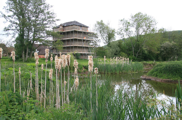
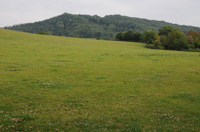
Stony Cross Images

Images are sourced within 2km of 52.123213/-2.4033502 or Grid Reference SO7247. Thanks to Geograph Open Source API. All images are credited.

Archer's Mill, Cradley Five storey watermill with a 17' breast shot wheel. Being restored and converted to an ayuverdic yoga and wellness centre. The mill was open as part of National Mills Weekend.
Archer's Mill, Cradley
Five storey watermill with a 17' breast shot wheel. Being restored and converted to an ayuverdic yoga and wellness centre. The mill was open as part of National Mills Weekend.
Archer's Mill, Cradley The five storey watermill is furthest from the camera. Between the mill and the mill house is a single storey building that was an earlier clover mill. The mill was open for National Mills Weekend and is being converted to a yoga and wellness centre. The machinery is being restored and will be retained.
Archer's Mill, Cradley
The five storey watermill is furthest from the camera. Between the mill and the mill house is a single storey building that was an earlier clover mill. The mill was open for National Mills Weekend and is being converted to a yoga and wellness centre. The machinery is being restored and will be retained.
Archer's Mill (otherwise known as Beanhouse Mill) (1), Cradley This late 19th century watermill was one of the last to be built in Herefordshire, which at one time had over four hundred mills.  It is often known as Archer's Mill, after one of the early millers, possibly the first. It is also known as Beanhouse Mill. It has a 17 foot diameter breastshot wheel, with a sliding hatch mechanism, and three pairs of stones. The mill was last used for milling in the 1960's or 70's. Currently it is being renovated, which does unfortunately mean it is enclosed in scaffolding.

This mill is not normally open to the public, but was open for National Mills Weekend in May 2011, when these pictures were taken.

<a href="https://www.geograph.org.uk/photo/2410552">SO7348 : Archer's Mill  (2), Cradley</a>.
<a href="https://www.geograph.org.uk/photo/2410567">SO7348 : Archer's Mill  (3), Cradley</a>.
<a href="https://www.geograph.org.uk/photo/2410636">SO7348 : Archer's Mill  (4) - mill race, Cradley</a>.
<a href="https://www.geograph.org.uk/photo/2410662">SO7348 : Archer's Mill  (5) - interior, Cradley</a>.
<a href="https://www.geograph.org.uk/photo/2410697">SO7348 : Archer's Mill  (6) - interior, Cradley</a>.
<a href="https://www.geograph.org.uk/photo/2410706">SO7348 : Archer's Mill  (7) - interior, Cradley</a>.
Archer's Mill (otherwise known as Beanhouse Mill) (1), Cradley
This late 19th century watermill was one of the last to be built in Herefordshire, which at one time had over four hundred mills. It is often known as Archer's Mill, after one of the early millers, possibly the first. It is also known as Beanhouse Mill. It has a 17 foot diameter breastshot wheel, with a sliding hatch mechanism, and three pairs of stones. The mill was last used for milling in the 1960's or 70's. Currently it is being renovated, which does unfortunately mean it is enclosed in scaffolding. This mill is not normally open to the public, but was open for National Mills Weekend in May 2011, when these pictures were taken. SO7348 : Archer's Mill (2), Cradley. SO7348 : Archer's Mill (3), Cradley. SO7348 : Archer's Mill (4) - mill race, Cradley. SO7348 : Archer's Mill (5) - interior, Cradley. SO7348 : Archer's Mill (6) - interior, Cradley. SO7348 : Archer's Mill (7) - interior, Cradley.
Archer's Mill  (2), Cradley The mill is currently undergoing restoration with the aim to use it for a health and well-being retreat. Although this will mean some equipment being removed, it is intended to store this safely, so the mill could, in the future, be used again for milling, if that was required. Once the retreat is in operation, visitors to the retreat will be able to see the waterwheel in motion.

For other photos of the mill see:- <a href="https://www.geograph.org.uk/photo/2410539">SO7348 : Archer's Mill (otherwise known as Beanhouse Mill) (1), Cradley</a>.
Archer's Mill (2), Cradley
The mill is currently undergoing restoration with the aim to use it for a health and well-being retreat. Although this will mean some equipment being removed, it is intended to store this safely, so the mill could, in the future, be used again for milling, if that was required. Once the retreat is in operation, visitors to the retreat will be able to see the waterwheel in motion. For other photos of the mill see:- SO7348 : Archer's Mill (otherwise known as Beanhouse Mill) (1), Cradley.
Archer's Mill  (3), Cradley Back view of the watermill, currently being restored. It is a Grade II listed building.

More photos of the mill:- <a href="https://www.geograph.org.uk/photo/2410539">SO7348 : Archer's Mill (otherwise known as Beanhouse Mill) (1), Cradley</a>.
Archer's Mill (3), Cradley
Back view of the watermill, currently being restored. It is a Grade II listed building. More photos of the mill:- SO7348 : Archer's Mill (otherwise known as Beanhouse Mill) (1), Cradley.
Archer's Mill  (4) - mill race, Cradley This appears to be part of the mill race.

More photos of the mill:- <a href="https://www.geograph.org.uk/photo/2410539">SO7348 : Archer's Mill (otherwise known as Beanhouse Mill) (1), Cradley</a>.
Archer's Mill (4) - mill race, Cradley
This appears to be part of the mill race. More photos of the mill:- SO7348 : Archer's Mill (otherwise known as Beanhouse Mill) (1), Cradley.
Archer's Mill  (5) - interior, Cradley As the mill was being renovated, access was only available to the ground floor. Eight species of bat, including the rare Lesser Horseshoe, and Brown Long-eared Natterer's bats, were found roosting and also breeding in the mill. Nearby barns have been extensively fitted out with boxes, baffles, thermal lining, batons etc to encourage bat activity. This has been successful with clear evidence of bat activity in one of the barns. This result has led to the issue of a Bat Licence to renovate the mill. Bats will still be allowed access to the mill's roof.

More photos of the mill:- <a href="https://www.geograph.org.uk/photo/2410539">SO7348 : Archer's Mill (otherwise known as Beanhouse Mill) (1), Cradley</a>.
Archer's Mill (5) - interior, Cradley
As the mill was being renovated, access was only available to the ground floor. Eight species of bat, including the rare Lesser Horseshoe, and Brown Long-eared Natterer's bats, were found roosting and also breeding in the mill. Nearby barns have been extensively fitted out with boxes, baffles, thermal lining, batons etc to encourage bat activity. This has been successful with clear evidence of bat activity in one of the barns. This result has led to the issue of a Bat Licence to renovate the mill. Bats will still be allowed access to the mill's roof. More photos of the mill:- SO7348 : Archer's Mill (otherwise known as Beanhouse Mill) (1), Cradley.
Archer's Mill  (6) - interior, Cradley Part of the mill's machinery. The waterwheel is an internal one, and is below the machinery. On the floor above, which wasn't accessible because of renovation work, are three pairs of millstones. These comprise two pairs of French Burr and one pair of Derby Peak stones.

More pictures of the mill:- <a href="https://www.geograph.org.uk/photo/2410539">SO7348 : Archer's Mill (otherwise known as Beanhouse Mill) (1), Cradley</a>.
Archer's Mill (6) - interior, Cradley
Part of the mill's machinery. The waterwheel is an internal one, and is below the machinery. On the floor above, which wasn't accessible because of renovation work, are three pairs of millstones. These comprise two pairs of French Burr and one pair of Derby Peak stones. More pictures of the mill:- SO7348 : Archer's Mill (otherwise known as Beanhouse Mill) (1), Cradley.
Archer's Mill  (7) - interior, Cradley Another view of some of the mill's machinery, photographed from the ground floor.

More photos of the mill:- <a href="https://www.geograph.org.uk/photo/2410539">SO7348 : Archer's Mill (otherwise known as Beanhouse Mill) (1), Cradley</a>.
Archer's Mill (7) - interior, Cradley
Another view of some of the mill's machinery, photographed from the ground floor. More photos of the mill:- SO7348 : Archer's Mill (otherwise known as Beanhouse Mill) (1), Cradley.
Beanhouse Mill Cottage, Cradley Standing next to Archer's Mill, otherwise known as Beanhouse Mill, this 17th century building housed a previous mill, but was long ago converted into a cottage. It is Grade II listed.
Beanhouse Mill Cottage, Cradley
Standing next to Archer's Mill, otherwise known as Beanhouse Mill, this 17th century building housed a previous mill, but was long ago converted into a cottage. It is Grade II listed.
Archer's Mill, Cradley The watermill is undergoing restoration. This wall shows the three meal-spouts and the three tentering wheels. The openings at each end give access to a rather crowded gear room. The mill was open as part of National Mills Weekend and is being converted to a yoga and wellness centre. The machinery is being overhauled fully.
Archer's Mill, Cradley
The watermill is undergoing restoration. This wall shows the three meal-spouts and the three tentering wheels. The openings at each end give access to a rather crowded gear room. The mill was open as part of National Mills Weekend and is being converted to a yoga and wellness centre. The machinery is being overhauled fully.
Archer's Mill, Cradley - gearing This shows the pit wheel and wallower. The great spur wheel is just visible top left. As part of the restoration a brand new heavy piece of timber has been fitted below the footstep bearing seen under the wallower and carrying the vertical main shaft. This watermill was open for National Mills Weekend
Archer's Mill, Cradley - gearing
This shows the pit wheel and wallower. The great spur wheel is just visible top left. As part of the restoration a brand new heavy piece of timber has been fitted below the footstep bearing seen under the wallower and carrying the vertical main shaft. This watermill was open for National Mills Weekend
Archer's mill, Cradley - close-up of mechanism This shows the arrangement pertaining to one of three pairs of stones. The great spur wheel is meshed with the stone nut (the gear in the top centre foreground) and this is driving the runner stone above. The big wheel at the bottom operates the jacking ring that lifts the stone nut out of engagement. The little bevel gears on the right raise and lower the tentering beam that adjusts the gap between the stones and the coarseness of the flour. This is an unusually fine example that is largely in iron. The pit wheel is seen at the bottom. This watermill was open for National Mills Weekend.
Archer's mill, Cradley - close-up of mechanism
This shows the arrangement pertaining to one of three pairs of stones. The great spur wheel is meshed with the stone nut (the gear in the top centre foreground) and this is driving the runner stone above. The big wheel at the bottom operates the jacking ring that lifts the stone nut out of engagement. The little bevel gears on the right raise and lower the tentering beam that adjusts the gap between the stones and the coarseness of the flour. This is an unusually fine example that is largely in iron. The pit wheel is seen at the bottom. This watermill was open for National Mills Weekend.
Archer's Mill, Cradley - the stone floor Three pairs of underdrift stones. The stone furniture is off for renovation. The watermill is being restored and converted to a yoga and wellness centre.
It was open for National Mills Weekend.
Archer's Mill, Cradley - the stone floor
Three pairs of underdrift stones. The stone furniture is off for renovation. The watermill is being restored and converted to a yoga and wellness centre. It was open for National Mills Weekend.
Archer's Mill, Cradley The crown wheel and auxiliary drive shafts. Apart from the sack hoist on the fifth floor, all the driven machinery was stripped out. It is possible some may return after renovation. The watermill is being restored and converted to a yoga and wellness centre.
Archer's Mill, Cradley
The crown wheel and auxiliary drive shafts. Apart from the sack hoist on the fifth floor, all the driven machinery was stripped out. It is possible some may return after renovation. The watermill is being restored and converted to a yoga and wellness centre.
Archer's Mill, Cradley This is the fifth floor with the sack hoist in the roof. The watermill is being converted to a yoga and wellness centre having been disused since the late 1960s. The machinery is being restored, including new wheel shaft bearings.
Archer's Mill, Cradley
This is the fifth floor with the sack hoist in the roof. The watermill is being converted to a yoga and wellness centre having been disused since the late 1960s. The machinery is being restored, including new wheel shaft bearings.
Archer's Mill, Cradley - waterwheel Seventeen foot diameter high breast shot waterwheel. The rack and pinions operates the sluice/shuttle to let water on to the wheel. A black shaft crosses above the wheel and seems to have driven machinery in the clover mill. This latter is an old single storey section between the mill house and the five storey later watermill.
Archer's Mill, Cradley - waterwheel
Seventeen foot diameter high breast shot waterwheel. The rack and pinions operates the sluice/shuttle to let water on to the wheel. A black shaft crosses above the wheel and seems to have driven machinery in the clover mill. This latter is an old single storey section between the mill house and the five storey later watermill.
View to High Grove Wood View to High Grove Wood at Vinesend to the east of Cradley.
View to High Grove Wood
View to High Grove Wood at Vinesend to the east of Cradley.
Show me another place!

Stony Cross is located at Grid Ref: SO7247 (Lat: 52.123213, Lng: -2.4033502)

Unitary Authority: County of Herefordshire

Police Authority: West Mercia

What 3 Words

///diverts.ballparks.blemishes. Near Evesbatch, Herefordshire

Nearby Locations

Stony Cross

Related Wikis

Cradley, Herefordshire

Cradley () is a village in the civil parish of Cradley and Storridge, in Herefordshire, England. The nearest Herefordshire to Cradley towns are Ledbury...

Mathon, Herefordshire

Mathon is a small village and civil parish in eastern Herefordshire, England, lying just to the west of the Malvern Hills between Malvern and Ledbury....

A4103 road

The A4103 is an A-road which runs from Worcester to the A480 in Stretton Sugwas, a village 2 miles (3.2 km) west of Hereford. The road is a primary route...

Acton Green, Herefordshire

Acton Green is a village in the north east of the English county of Herefordshire (historically Worcestershire) between Bromyard and Great Malvern. �...

Nearby Amenities

Located within 500m of 52.123213,-2.4033502
Westfield
Is In: Herefordshire
Place: hamlet
Source: NPE
Lat/Long: 52.1231631/-2.4013284
Bus Stop
Finchers Corner
Bus: yes
Naptan AtcoCode: 2090A062300
Naptan Bearing: E
Naptan BusStopType: CUS
Naptan CommonName: Finchers Corner
Naptan Indicator: adj
Naptan Landmark: No 6 Finchers Corner
Naptan NaptanCode: heradawj
Naptan Street: Finchers Corner
Naptan Verified: no
Public Transport: platform
Source: naptan_import
Lat/Long: 52.1198739/-2.3996671
Bus Stop
Prestons Cross
Bus: yes
Naptan AtcoCode: 2090A128400
Naptan Bearing: NE
Naptan BusStopType: CUS
Naptan CommonName: Prestons Cross
Naptan Indicator: opp B4220 junction
Naptan Landmark: B4220 junction
Naptan NaptanCode: heradwjp
Naptan Street: A4103
Naptan Verified: no
Public Transport: platform
Source: naptan_import
Lat/Long: 52.125141/-2.4027526
Bus Stop
Prestons Cross
Bus: yes
Naptan AtcoCode: 2090A18268
Naptan Bearing: SW
Naptan BusStopType: CUS
Naptan CommonName: Prestons Cross
Naptan Indicator: adj B4220 junction
Naptan Landmark: B4220 junction
Naptan NaptanCode: heragmgp
Naptan Street: A4103
Naptan Verified: no
Public Transport: platform
Source: naptan_import
Lat/Long: 52.1250168/-2.4028924
Bus Stop
Finchers Corner
Bus: yes
Naptan AtcoCode: 2090A18285
Naptan Bearing: W
Naptan CommonName: Finchers Corner
Naptan Indicator: opp No 6
Naptan Landmark: No 6 Finchers Corner
Naptan NaptanCode: heragmjt
Naptan Street: Finchers Corner
Naptan Verified: no
Public Transport: platform
Source: naptan_import
Lat/Long: 52.1197573/-2.3995931
Bus Stop
Finchers Corner
Bus: yes
Naptan AtcoCode: 2090A18741
Naptan Bearing: N
Naptan CommonName: Finchers Corner
Naptan Indicator: adj Chockbury Lane
Naptan Landmark: Telephone Box
Naptan NaptanCode: herajdam
Naptan Street: B4220. Stony Cross Road
Naptan Verified: no
Public Transport: platform
Source: naptan_import
Lat/Long: 52.1200664/-2.4012463
Bus Stop
Finchers Corner
Bus: yes
Naptan AtcoCode: 2090A18743
Naptan Bearing: S
Naptan BusStopType: CUS
Naptan CommonName: Finchers Corner
Naptan Indicator: opp Chockbury Lane
Naptan Landmark: Opp Telephone Box
Naptan NaptanCode: herajdap
Naptan Street: B4220. Stony Cross Road
Naptan Verified: no
Public Transport: platform
Source: naptan_import
Lat/Long: 52.1200761/-2.4010273
Bus Stop
Stony Cross
Bus: yes
Local Ref: NK
Naptan AtcoCode: 2090A20748
Naptan Bearing: N
Naptan BusStopType: CUS
Naptan CommonName: Stony Cross
Naptan Indicator: NK
Naptan Landmark: A4103 junction
Naptan NaptanCode: herapjwt
Naptan Street: B4220
Naptan Verified: no
Public Transport: platform
Source: naptan_import
Lat/Long: 52.1246722/-2.4031428
Bus Stop
Stony Cross
Bus: yes
Local Ref: NK
Naptan AtcoCode: 2090A20750
Naptan Bearing: S
Naptan BusStopType: CUS
Naptan CommonName: Stony Cross
Naptan Indicator: NK
Naptan Landmark: near A4103 junction
Naptan NaptanCode: herapmad
Naptan Street: B4220
Naptan Verified: no
Public Transport: platform
Source: naptan_import
Lat/Long: 52.1246372/-2.4028503
Stony Cross
Place: hamlet
Source: NPE
Lat/Long: 52.1254906/-2.4038072
Post Box
Collection Times: Mo-Fr 09:00; Sa 07:00
Historic Operator: Post Office
Operator: Royal Mail
Operator Wikidata: Q638098
Post Box Mounting: pier
Post Box Type: lamp
Ref: WR13 94
Royal Cypher: EIIR
Royal Cypher Wikidata: Q33102113
Source: GPS
Lat/Long: 52.1198031/-2.4003307
Post Box
Fixme: ref is by conjecture. Need to get better GPS position of road.
Post Box Mounting: brick_pillar
Post Box Type: wall
Ref: WR13 96
Lat/Long: 52.124683/-2.406236
Colour: black
Disused Amenity: post_box
Fixme2: This box is disused and is opposite a house called "Crossways", which is on the RM List. However, the RM list has a different postcode for this. Need to establish status for this one.
Post Box Type: wall
Royal Cypher: GVIR
Lat/Long: 52.1196811/-2.4006336
Generator Method: photovoltaic
Generator Output Electricity: yes
Generator Source: solar
Generator Type: solar_photovoltaic_panel
Location: roof
Power: generator
Lat/Long: 52.1214594/-2.396712
Generator Method: photovoltaic
Generator Output Electricity: yes
Generator Source: solar
Generator Type: solar_photovoltaic_panel
Location: roof
Power: generator
Lat/Long: 52.1198636/-2.4013871
Generator Output Electricity: yes
Generator Source: solar
Location: roof
Power: generator
Lat/Long: 52.1205306/-2.3982087
Generator Output Electricity: yes
Generator Source: solar
Location: roof
Power: generator
Lat/Long: 52.1204911/-2.398434
Generator Output Electricity: yes
Generator Source: solar
Location: roof
Power: generator
Lat/Long: 52.1199838/-2.398898
Generator Output Electricity: yes
Generator Source: solar
Location: roof
Power: generator
Lat/Long: 52.1200777/-2.3985252
Generator Output Electricity: yes
Generator Source: solar
Location: roof
Power: generator
Lat/Long: 52.1200744/-2.3983991
Generator Output Electricity: yes
Generator Source: solar
Location: roof
Power: generator
Lat/Long: 52.120249/-2.3981309
Generator Output Electricity: yes
Generator Source: solar
Location: roof
Power: generator
Lat/Long: 52.1202243/-2.3982355
Generator Output Electricity: yes
Generator Source: solar
Location: roof
Power: generator
Lat/Long: 52.1201913/-2.3984554
Generator Output Electricity: yes
Generator Source: solar
Location: roof
Power: generator
Lat/Long: 52.1202292/-2.3983589
Generator Output Electricity: yes
Generator Source: solar
Location: roof
Power: generator
Lat/Long: 52.1204697/-2.402527
Generator Output Electricity: yes
Generator Source: solar
Location: roof
Power: generator
Lat/Long: 52.1204598/-2.4023849
Generator Output Electricity: yes
Generator Source: solar
Location: roof
Power: generator
Lat/Long: 52.1242936/-2.4063411
Generator Output Electricity: yes
Generator Source: solar
Location: roof
Power: generator
Lat/Long: 52.1233862/-2.4033156
Generator Output Electricity: yes
Generator Source: solar
Location: roof
Power: generator
Lat/Long: 52.1234159/-2.403219
Barrier: stile
Lat/Long: 52.126136/-2.4082714
Power: pole
Lat/Long: 52.1213746/-2.4090569
Power: pole
Lat/Long: 52.1219477/-2.4080229
Power: pole
Lat/Long: 52.1222433/-2.4075052
Stoney Cross Cradley
Power: pole
Transformer: distribution
Voltage Primary: 11000
Lat/Long: 52.1228057/-2.4080497
Stoney Cross East
Power: pole
Transformer: distribution
Voltage Primary: 11000
Lat/Long: 52.1239288/-2.4043516
Power: pole
Lat/Long: 52.1235674/-2.4046963
Power: pole
Lat/Long: 52.1243821/-2.4056451
Rose Gate
Power: pole
Transformer: distribution
Voltage Primary: 11000
Lat/Long: 52.1250305/-2.4055727
Power: pole
Lat/Long: 52.1246513/-2.4056377
Power: pole
Lat/Long: 52.1241124/-2.4056451
Highlands
Power: pole
Transformer: distribution
Voltage Primary: 11000
Lat/Long: 52.1237946/-2.4056451
Power: pole
Lat/Long: 52.1233113/-2.4056599
Power: pole
Lat/Long: 52.1231869/-2.4061266
Power: pole
Lat/Long: 52.1225451/-2.4069346
Power: pole
Lat/Long: 52.1223154/-2.4059401
Power: pole
Lat/Long: 52.1220982/-2.405003
Power: pole
Lat/Long: 52.1218907/-2.4041099
Westfield South
Power: pole
Transformer: distribution
Voltage Primary: 11000
Lat/Long: 52.1192238/-2.4025726
Power: pole
Lat/Long: 52.1196207/-2.4027309
Power: pole
Lat/Long: 52.1201502/-2.4029119
Power: pole
Lat/Long: 52.120557/-2.4030688
Power: pole
Lat/Long: 52.1212379/-2.4035959
Power: pole
Lat/Long: 52.12141/-2.4028851
Power: pole
Lat/Long: 52.1215895/-2.4021328
Westfield North
Power: pole
Transformer: distribution
Voltage Primary: 11000
Lat/Long: 52.1218802/-2.400738
Power: pole
Lat/Long: 52.1220951/-2.3992775
Westfield East
Power: pole
Transformer: distribution
Voltage Primary: 11000
Lat/Long: 52.1222211/-2.3986687
Power: pole
Lat/Long: 52.1224368/-2.3976642
Power: pole
Lat/Long: 52.1226645/-2.3966688
The data included in this document is from www.openstreetmap.org. The data is made available under ODbL.

Have you been to Stony Cross?

Leave your review of Stony Cross below (or comments, questions and feedback).