Stonehall

Settlement in Worcestershire Malvern Hills

England

Stonehall

Wadborough Road near Stoulton
Wadborough Road near Stoulton Credit: Ian S

Stonehall is a charming village located in Worcestershire, England. Situated in the picturesque Wyre Forest District, it is nestled between the towns of Kidderminster and Bewdley. With a population of around 800 residents, Stonehall exudes a peaceful and rural atmosphere.

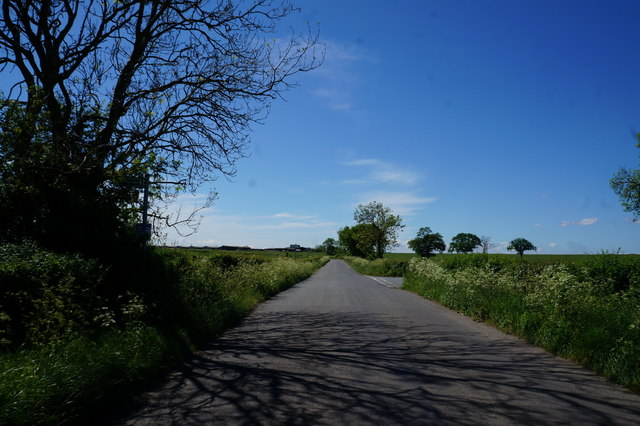
Surrounded by lush green fields and rolling hills, Stonehall offers breathtaking views of the Worcestershire countryside. The village is characterized by its quaint stone cottages, which add to its traditional English charm. The local community takes great pride in maintaining the village's historic character and preserving its natural beauty.

Stonehall has a strong sense of community, with various events and activities organized throughout the year. The village hall serves as a hub for social gatherings, hosting regular events such as community fairs, art exhibitions, and fitness classes. Residents also have access to a well-maintained playground and recreational area, providing an ideal space for families to enjoy outdoor activities.

Despite its tranquil setting, Stonehall benefits from its proximity to nearby towns. Kidderminster, just a short distance away, offers a range of amenities including shopping centers, schools, and healthcare facilities. The village is well-connected by road, with easy access to major routes such as the A456 and the M5 motorway, making it convenient for residents to commute to neighboring towns and cities.

In conclusion, Stonehall is a charming and idyllic village in Worcestershire, surrounded by stunning natural scenery. With its strong sense of community and convenient location, it offers a peaceful and picturesque place to call home.

If you have any feedback on the listing, please let us know in the comments section below.

Stonehall Images

Images are sourced within 2km of 52.139338/-2.1738754 or Grid Reference SO8849. Thanks to Geograph Open Source API. All images are credited.

Wadborough Road near Stoulton
Grassland near Wadborough Farm
Cow parsley and farmland A view over farmland in springtime towards Stoulton.
Cow parsley and farmland
A view over farmland in springtime towards Stoulton.
Wadborough Road Wadborough Road between Wadborough and Stoulton.
Wadborough Road
Wadborough Road between Wadborough and Stoulton.
Railway at Abbotswood Class 66 No 66506 hauls a train of scrap metal for South Wales past Abbotswood. This freight train was operated by Freightliner. Just to the north of this location is Abbotswood Junction where the line divides for Worcester and Bromsgrove [direct route]. The signal for the junction can be seen to the left of the locomotive.
Railway at Abbotswood
Class 66 No 66506 hauls a train of scrap metal for South Wales past Abbotswood. This freight train was operated by Freightliner. Just to the north of this location is Abbotswood Junction where the line divides for Worcester and Bromsgrove [direct route]. The signal for the junction can be seen to the left of the locomotive.
Railway Cutting and line at Abbotswood A Virgin Voyager train heads south by Abbotswood, having passed through a cutting and beneath the bridge from which the photograph was taken.
Railway Cutting and line at Abbotswood
A Virgin Voyager train heads south by Abbotswood, having passed through a cutting and beneath the bridge from which the photograph was taken.
M5 southbound near Green Street
Bridge over M5 from Kempsey to Kempsey Common
M5 northbound from under Green Street Bridge The M5 crosses a wide valley of a small stream before passing through a shallow cutting after about 500 metres
M5 northbound from under Green Street Bridge
The M5 crosses a wide valley of a small stream before passing through a shallow cutting after about 500 metres
Bridle way Looking back to the start of a path that has wonderful views to the Malverns
Bridle way
Looking back to the start of a path that has wonderful views to the Malverns
Littleworth Allotments
Sportsfield, Littleworth Sportsfield and club house at Littleworth.
Sportsfield, Littleworth
Sportsfield and club house at Littleworth.
Arable land at Pirton View across arable land from Hill Road at Pirton.  The view stretches to Wadborough which is on the horizon.
Arable land at Pirton
View across arable land from Hill Road at Pirton. The view stretches to Wadborough which is on the horizon.
Footpath to Wadborough Stile on a footpath to Wadborough, pictured here from Hill Road, the same stile as pictured in 2005 <a href="https://www.geograph.org.uk/photo/22490">SO8847 : Footpath from Hill Road, Pirton to Wadborough</a>
Footpath to Wadborough
Stile on a footpath to Wadborough, pictured here from Hill Road, the same stile as pictured in 2005 SO8847 : Footpath from Hill Road, Pirton to Wadborough
Country road at Pirton Country road approaching the village of Pirton.
Country road at Pirton
Country road approaching the village of Pirton.
M5 southbound near Green Street
Footpath near Abbotswood
Houses at Abbotswood
Show me another place!

Stonehall is located at Grid Ref: SO8849 (Lat: 52.139338, Lng: -2.1738754)

Administrative County: Worcestershire

District: Malvern Hills

Police Authority: West Merica

What 3 Words

///path.silver.laces. Near Kempsey, Worcestershire

Related Wikis

Littleworth, Worcestershire

Littleworth is a medium-sized village on the outskirts of Worcester. The village is the location of Nortan Juxta Kempsey Primary School and the Norton...

Hatfield, Worcestershire

Hatfield is a small hamlet in the district of Wychavon near the city of Worcester, in England. It is surrounded by the villages of Littleworth, Norton...

Abbots Wood Junction railway station

Abbots Wood Junction railway station was an early railway station in England, close to Worcester. The station, 68 miles 60 chains (68.75 miles, 110.64...

Norton-juxta-Kempsey

Norton-juxta-Kempsey is a civil parish to the south of Worcester in the United Kingdom. It contains the villages of Norton and Littleworth. The parish...

Wadborough railway station

Wadborough railway station was located in Wadborough, Worcestershire. It opened in 1841 and closed in January 1965. It was situated to the west on the...

Pirton, Worcestershire

Pirton is a small village in the English county of Worcestershire. The village has been occupied since at least 1086, when Domesday listed the village...

Worcestershire Parkway railway station

Worcestershire Parkway is a split-level railway station where the Cotswold and Cross Country lines cross near Norton, Worcester, England. It opened on...

Norton Halt railway station

Norton Halt railway station was a station in Norton, Worcestershire, England. The station was opened in 1879 and closed in 1966. == References == ��2...

Nearby Amenities

Located within 500m of 52.139338,-2.1738754
Stonehall Common-The Fruiterer's Arms
Naptan AtcoCode: 2000G066000
Naptan Bearing: S
Naptan BusStopType: CUS
Naptan CommonName: Stonehall Common-The Fruiterer's Arms
Naptan Indicator: Adj
Naptan Landmark: The Fruiterer's Arms Inn
Naptan NaptanCode: wocdtdwj
Naptan Street: Worcester Road
Naptan Verified: no
Source: naptan_import
Lat/Long: 52.1378468/-2.1740953
Fruiterer's Arms
Naptan AtcoCode: 2000G323296
Naptan Bearing: N
Naptan BusStopType: CUS
Naptan CommonName: Fruiterer's Arms
Naptan Indicator: opp
Naptan Landmark: Fruiterer's Arms- Inn
Naptan NaptanCode: wocdtwdj
Naptan Street: Worcester Road
Naptan Verified: no
Source: naptan_import
Lat/Long: 52.1378555/-2.1742999
Post Box
Ref: WR5 182
Lat/Long: 52.1390534/-2.1740211
Pub
The Inn at Stonehall
Old Name: Fruiterer's Arms
Lat/Long: 52.1380131/-2.1737653
Stonehall
Place: hamlet
Lat/Long: 52.1388816/-2.1744084
Barrier: stile
Foot: yes
Lat/Long: 52.1407492/-2.1691732
Barrier: stile
Foot: yes
Lat/Long: 52.1384611/-2.1721652
Power: pole
Lat/Long: 52.1380747/-2.1785411
Power: pole
Lat/Long: 52.1367009/-2.1791527
Power: pole
Lat/Long: 52.1374829/-2.1788053
Stonehall North
Power: pole
Transformer: distribution
Voltage Primary: 11000
Lat/Long: 52.1425535/-2.1787664
Power: pole
Lat/Long: 52.1426246/-2.1780489
Power: pole
Lat/Long: 52.1426897/-2.1773522
Power: pole
Lat/Long: 52.142651/-2.1765409
Power: pole
Lat/Long: 52.1425872/-2.1756893
Power: pole
Lat/Long: 52.1425382/-2.1748437
Power: pole
Lat/Long: 52.1380599/-2.1805581
Power: pole
Lat/Long: 52.1383644/-2.179492
Power: pole
Lat/Long: 52.1386928/-2.1782877
Stonehall Pumping Station
Power: pole
Transformer: distribution
Voltage Primary: 11000
Lat/Long: 52.1390353/-2.1770713
Power: pole
Lat/Long: 52.1392929/-2.1762076
Power: pole
Lat/Long: 52.1396756/-2.1760158
Stonehall
Power: pole
Transformer: distribution
Voltage Primary: 11000
Lat/Long: 52.1404172/-2.1754391
Power: pole
Lat/Long: 52.1410818/-2.1749906
Stonehall Farm
Power: pole
Transformer: distribution
Voltage Primary: 11000
Lat/Long: 52.1419769/-2.1743958
Power: pole
Lat/Long: 52.1424864/-2.1740136
Power: pole
Lat/Long: 52.1433399/-2.1734221
The data included in this document is from www.openstreetmap.org. The data is made available under ODbL.

Have you been to Stonehall?

Leave your review of Stonehall below (or comments, questions and feedback).