Stone Allerton
Settlement in Somerset Sedgemoor
England
Stone Allerton

Stone Allerton is a small village located in the county of Somerset, in southwest England. Situated approximately 5 miles south of the town of Wedmore, it lies in the picturesque Mendip Hills, an Area of Outstanding Natural Beauty. The village is surrounded by rolling countryside, boasting stunning views and a tranquil atmosphere.
With a population of around 200 residents, Stone Allerton is a close-knit community with a friendly and welcoming atmosphere. The village is known for its charming stone-built houses, many of which date back several centuries, providing a glimpse into the area's rich history. The architecture includes a mix of traditional cottages and larger, more modern residences.
Despite its small size, Stone Allerton has a strong community spirit, with various social activities and events taking place throughout the year. The village hall serves as a hub for these gatherings, hosting a range of activities such as yoga classes, art exhibitions, and community meetings.
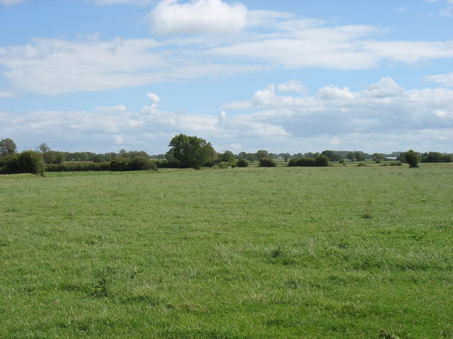
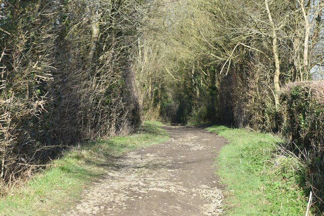
Surrounded by lush green fields and picturesque walks, Stone Allerton offers ample opportunities for outdoor enthusiasts. The nearby Mendip Hills provide a haven for hikers, cyclists, and nature lovers, with an extensive network of trails and paths to explore. The village is also within easy reach of Cheddar Gorge, a dramatic limestone gorge and popular tourist attraction.
While Stone Allerton may be a tranquil rural village, it benefits from its proximity to larger towns such as Wedmore and Cheddar, which provide essential amenities and services. The village is well-connected by road, with the A38 running nearby, providing convenient access to the wider region.
Overall, Stone Allerton offers a peaceful and idyllic setting for those seeking a rural retreat, surrounded by stunning natural beauty and a strong sense of community.
If you have any feedback on the listing, please let us know in the comments section below.
Stone Allerton Images
Images are sourced within 2km of 51.256341/-2.854054 or Grid Reference ST4051. Thanks to Geograph Open Source API. All images are credited.


Stone Allerton is located at Grid Ref: ST4051 (Lat: 51.256341, Lng: -2.854054)
Administrative County: Somerset
District: Sedgemoor
Police Authority: Avon and Somerset
What 3 Words
///skylights.grownup.shot. Near Axbridge, Somerset
Nearby Locations
Related Wikis
Chapel Allerton, Somerset
Chapel Allerton is a village and civil parish, south of Cheddar in the English county of Somerset. The parish includes the hamlets of Ashton and Stone...
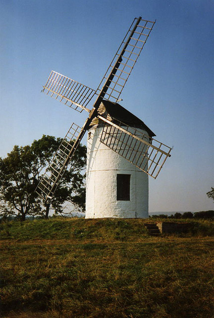
Ashton Windmill
Ashton windmill is a tower mill in Chapel Allerton, Somerset, England. Its tower is over 7.5 metres (25 ft) high with stone walls that are 60 cm (2.0 ft...

Badgworth
Badgworth is a village and civil parish in Somerset, England, 2 miles (3.2 km) south west of Axbridge. According to the 2011 census it had a population...

Weare, Somerset
Weare is a village and civil parish in Somerset, England, on the River Axe, south of the Mendip Hills. Other settlements in the parish are the village...

Church of St John the Baptist, Biddisham
The Anglican Church of St John The Baptist in Biddisham within the parish of Badgeworth, Somerset, England was built in the 13th century. It is a Grade...

Holy Trinity Church, Blackford
Holy Trinity Church is a Church of England church in Blackford, Somerset, England. It was built in 1821–23 to the designs of Richard Carver and has been...

Hugh Sexey Church of England Middle School
Hugh Sexey Church of England Middle School, formerly known as Sexey's School and Sexey's Grammar School, is a coeducational middle school located in Blackford...

Picken's Hole
Picken's Hole is a small cave on the southern side of Crook Peak in the Mendip Hills in the English county of Somerset. It has been designated as a scheduled...
Nearby Amenities
Located within 500m of 51.256341,-2.854054Have you been to Stone Allerton?
Leave your review of Stone Allerton below (or comments, questions and feedback).