Bogniebrae

Settlement in Aberdeenshire

Scotland

Bogniebrae

End of a Yowe It looks as if this yowe (ewe to you) has climbed into the tank, been unable to climb out, and has drowned.
End of a Yowe Credit: Anne Burgess

Bogniebrae is a small village located in the Aberdeenshire region of Scotland. Situated in the north-eastern part of the country, the village is surrounded by picturesque countryside and offers a tranquil and idyllic setting for residents and visitors alike.

With a population of around 200 people, Bogniebrae is a close-knit community that exudes a friendly and welcoming atmosphere. The village is known for its tight community spirit, with various events and gatherings organized throughout the year, bringing locals together.

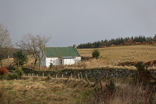
Bogniebrae is primarily an agricultural area, with much of its land used for farming and livestock. The fertile soil and favorable climate in the region make it suitable for various crops, including barley and wheat. As a result, agriculture plays a significant role in the local economy.

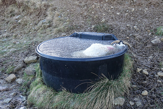
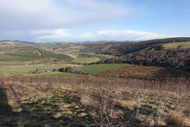
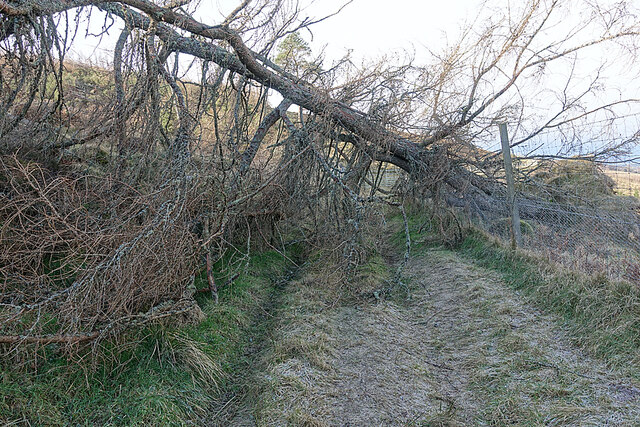
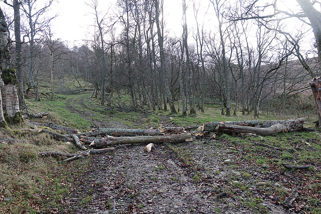
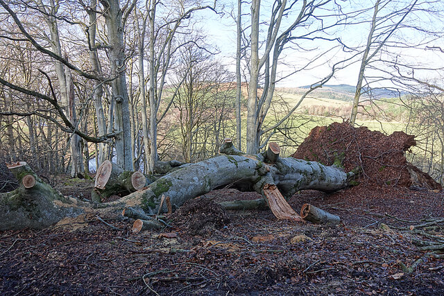
The village boasts stunning natural landscapes, with rolling hills and lush green fields surrounding the area. It is an ideal location for outdoor enthusiasts, offering numerous walking and cycling trails, as well as opportunities for fishing in nearby rivers. The area is also home to a diverse range of wildlife, making it popular among nature lovers.

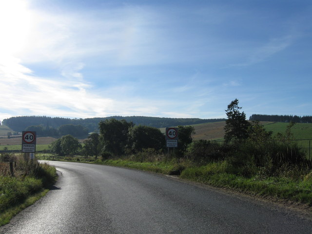
Although small, Bogniebrae is well-connected to neighboring towns and cities, with good transportation links. The nearby town of Huntly offers a range of amenities, including shops, restaurants, and schools, making it convenient for residents to access essential services.

In conclusion, Bogniebrae is a charming village in Aberdeenshire, Scotland, known for its tight-knit community, agricultural heritage, and stunning natural surroundings. It provides a serene and peaceful environment for residents and visitors to enjoy the beauty of the Scottish countryside.

If you have any feedback on the listing, please let us know in the comments section below.

Bogniebrae Images

Images are sourced within 2km of 57.493355/-2.6856375 or Grid Reference NJ5945. Thanks to Geograph Open Source API. All images are credited.

End of a Yowe It looks as if this yowe (ewe to you) has climbed into the tank, been unable to climb out, and has drowned.
End of a Yowe
It looks as if this yowe (ewe to you) has climbed into the tank, been unable to climb out, and has drowned.
River Deveron The glen of the Deveron between Rothiemay and Turriff is an excellent example of incised meanders, where the twisting course of an ancient river has been preserved as the river has cut down into the underlying bedrock. The bedrock here is mainly pelite and psammite, formed by metamorphosis of mudstones and sandstones deposited in a deep sea environment between 500 and 1000 million years ago.
River Deveron
The glen of the Deveron between Rothiemay and Turriff is an excellent example of incised meanders, where the twisting course of an ancient river has been preserved as the river has cut down into the underlying bedrock. The bedrock here is mainly pelite and psammite, formed by metamorphosis of mudstones and sandstones deposited in a deep sea environment between 500 and 1000 million years ago.
An Obstruction The road here is obstructed by trees felled by one of the recent gales. Fortunately it was not difficult to pick our way through it.
An Obstruction
The road here is obstructed by trees felled by one of the recent gales. Fortunately it was not difficult to pick our way through it.
Fourmanhill Croft In the 19th century there were two or three crofts here, but only this cottage remains.
Fourmanhill Croft
In the 19th century there were two or three crofts here, but only this cottage remains.
Hungry Sheep? Normally, when I come across a flock of sheep while out walking, they all turn tail, and all I manage to photograph is feeling backsides. This flock, however, came galloping towards us as soon as we hove into sight, and stood and watched us. I can't think they were really hungry, because there seem to be bales of fodder in the field, so I suppose they were just bored and taking an interest in anything out of the ordinary, like the rare sight of passers-by.
Hungry Sheep?
Normally, when I come across a flock of sheep while out walking, they all turn tail, and all I manage to photograph is feeling backsides. This flock, however, came galloping towards us as soon as we hove into sight, and stood and watched us. I can't think they were really hungry, because there seem to be bales of fodder in the field, so I suppose they were just bored and taking an interest in anything out of the ordinary, like the rare sight of passers-by.
Broken Tree More evidence of damage by recent gales. This tree has broken as it fell, and it was no problem to step over it.
Broken Tree
More evidence of damage by recent gales. This tree has broken as it fell, and it was no problem to step over it.
Fallen Beech A mature beech felled by a recent gale. It must have blocked the road, and has been dealt with by a chainsaw. There's going to be no shortage of firewood in the next year or two.
Fallen Beech
A mature beech felled by a recent gale. It must have blocked the road, and has been dealt with by a chainsaw. There's going to be no shortage of firewood in the next year or two.
An Old Petrol Pump Or perhaps a diesel pump. It stands just beside the road at Corniehaugh Farm, but it's obviously some years since it dispensed any fuel.
An Old Petrol Pump
Or perhaps a diesel pump. It stands just beside the road at Corniehaugh Farm, but it's obviously some years since it dispensed any fuel.
Entrance to Forgue
Entrance to Forgue
Yonder Bognie Recumbent Stone Circle (1) Only nine of the stones here are thought to be parts of the original circle, the rest being boulders collected from the fields and dumped inside the circle. See <span class="nowrap"><a title="https://canmore.org.uk/site/18335/yonder-bognie" rel="nofollow ugc noopener" href="https://canmore.org.uk/site/18335/yonder-bognie">Link</a><img style="margin-left:2px;" alt="External link" title="External link - shift click to open in new window" src="https://s1.geograph.org.uk/img/external.png" width="10" height="10"/></span> for more details. <a href="https://www.geograph.org.uk/photo/4743276">NJ6045 : Yonder Bognie Recumbent Stone Circle (2)</a>
Yonder Bognie Recumbent Stone Circle (1)
Only nine of the stones here are thought to be parts of the original circle, the rest being boulders collected from the fields and dumped inside the circle. See LinkExternal link for more details. NJ6045 : Yonder Bognie Recumbent Stone Circle (2)
Yonder Bognie Recumbent Stone Circle (2) The recumbent and west flanker are still standing. The alignment of the recumbent is towards the Hill of Foudland in <a href="https://www.geograph.org.uk/gridref/NJ6033">NJ6033</a>. See <span class="nowrap"><a title="https://canmore.org.uk/site/18335/yonder-bognie" rel="nofollow ugc noopener" href="https://canmore.org.uk/site/18335/yonder-bognie">Link</a><img style="margin-left:2px;" alt="External link" title="External link - shift click to open in new window" src="https://s1.geograph.org.uk/img/external.png" width="10" height="10"/></span> for more information. <a href="https://www.geograph.org.uk/photo/4743288">NJ6045 : Yonder Bognie Recumbent Stone Circle (3)</a>
Yonder Bognie Recumbent Stone Circle (2)
The recumbent and west flanker are still standing. The alignment of the recumbent is towards the Hill of Foudland in NJ6033. See LinkExternal link for more information. NJ6045 : Yonder Bognie Recumbent Stone Circle (3)
Yonder Bognie Recumbent Stone Circle (3) This shows the recumbent setting. The recumbent and west flanker (on the left) are still standing, but the east flanker has fallen.  See <span class="nowrap"><a title="https://canmore.org.uk/site/18335/yonder-bognie" rel="nofollow ugc noopener" href="https://canmore.org.uk/site/18335/yonder-bognie">Link</a><img style="margin-left:2px;" alt="External link" title="External link - shift click to open in new window" src="https://s1.geograph.org.uk/img/external.png" width="10" height="10"/></span> for more information. <a href="https://www.geograph.org.uk/photo/4743292">NJ6045 : Yonder Bognie Recumbent Stone Circle (4)</a>
Yonder Bognie Recumbent Stone Circle (3)
This shows the recumbent setting. The recumbent and west flanker (on the left) are still standing, but the east flanker has fallen. See LinkExternal link for more information. NJ6045 : Yonder Bognie Recumbent Stone Circle (4)
Yonder Bognie Recumbent Stone Circle (4) Several of the stones still standing are visible in this view. At extreme left is the recumbent setting. Two of the orthostats are on the right, one close to the camera and one on the far side of the circle. The remaining stones are difficult to pick out among the dumped field boulders. <a href="https://www.geograph.org.uk/photo/4743299">NJ6045 : Yonder Bognie Recumbent Stone Circle (5)</a>
Yonder Bognie Recumbent Stone Circle (4)
Several of the stones still standing are visible in this view. At extreme left is the recumbent setting. Two of the orthostats are on the right, one close to the camera and one on the far side of the circle. The remaining stones are difficult to pick out among the dumped field boulders. NJ6045 : Yonder Bognie Recumbent Stone Circle (5)
Yonder Bognie Recumbent Stone Circle (5) This is the easternmost of the stones, and the largest of the orthostats.  See <span class="nowrap"><a title="https://canmore.org.uk/site/18335/yonder-bognie" rel="nofollow ugc noopener" href="https://canmore.org.uk/site/18335/yonder-bognie">Link</a><img style="margin-left:2px;" alt="External link" title="External link - shift click to open in new window" src="https://s1.geograph.org.uk/img/external.png" width="10" height="10"/></span> for more information. <a href="https://www.geograph.org.uk/photo/4743301">NJ6045 : Yonder Bognie Recumbent Stone Circle (6)</a>
Yonder Bognie Recumbent Stone Circle (5)
This is the easternmost of the stones, and the largest of the orthostats. See LinkExternal link for more information. NJ6045 : Yonder Bognie Recumbent Stone Circle (6)
Yonder Bognie Recumbent Stone Circle (6) This is one of the four remaining stones in the circumference of the circle, with an accumulation of field boulders around it.  See <span class="nowrap"><a title="https://canmore.org.uk/site/18335/yonder-bognie" rel="nofollow ugc noopener" href="https://canmore.org.uk/site/18335/yonder-bognie">Link</a><img style="margin-left:2px;" alt="External link" title="External link - shift click to open in new window" src="https://s1.geograph.org.uk/img/external.png" width="10" height="10"/></span> for more information. <a href="https://www.geograph.org.uk/photo/4743305">NJ6045 : Yonder Bognie Recumbent Stone Circle (7)</a>
Yonder Bognie Recumbent Stone Circle (6)
This is one of the four remaining stones in the circumference of the circle, with an accumulation of field boulders around it. See LinkExternal link for more information. NJ6045 : Yonder Bognie Recumbent Stone Circle (7)
Yonder Bognie Recumbent Stone Circle (7) I think the tallest stone in this collection is one of the four surviving orthostats, and the upright one in the background is another, but the rest are field boulders that have been dumped here.  See <span class="nowrap"><a title="https://canmore.org.uk/site/18335/yonder-bognie" rel="nofollow ugc noopener" href="https://canmore.org.uk/site/18335/yonder-bognie">Link</a><img style="margin-left:2px;" alt="External link" title="External link - shift click to open in new window" src="https://s1.geograph.org.uk/img/external.png" width="10" height="10"/></span> for more information. <a href="https://www.geograph.org.uk/photo/4743309">NJ6045 : Yonder Bognie Recumbent Stone Circle (8)</a>
Yonder Bognie Recumbent Stone Circle (7)
I think the tallest stone in this collection is one of the four surviving orthostats, and the upright one in the background is another, but the rest are field boulders that have been dumped here. See LinkExternal link for more information. NJ6045 : Yonder Bognie Recumbent Stone Circle (8)
Yonder Bognie Recumbent Stone Circle (8) Closest to the camera is one of the stones of the circumference, with the recumbent setting to the right and one of the other standing stones in the background. The rest of the stones are dumped field boulders.  See <span class="nowrap"><a title="https://canmore.org.uk/site/18335/yonder-bognie" rel="nofollow ugc noopener" href="https://canmore.org.uk/site/18335/yonder-bognie">Link</a><img style="margin-left:2px;" alt="External link" title="External link - shift click to open in new window" src="https://s1.geograph.org.uk/img/external.png" width="10" height="10"/></span> for more information. <a href="https://www.geograph.org.uk/photo/4743316">NJ6045 : Yonder Bognie Recumbent Stone Circle (9)</a>
Yonder Bognie Recumbent Stone Circle (8)
Closest to the camera is one of the stones of the circumference, with the recumbent setting to the right and one of the other standing stones in the background. The rest of the stones are dumped field boulders. See LinkExternal link for more information. NJ6045 : Yonder Bognie Recumbent Stone Circle (9)
Yonder Bognie Recumbent Stone Circle (9) The closest stone is the most northerly of the circle, now fallen and moved out of position outside the circumference. Beyond it are the two remaining stones of the east arc, another, lower, stone which appears to be on the arc but is actually inside the circle, and the end of the recumbent.  See <span class="nowrap"><a title="https://canmore.org.uk/site/18335/yonder-bognie" rel="nofollow ugc noopener" href="https://canmore.org.uk/site/18335/yonder-bognie">Link</a><img style="margin-left:2px;" alt="External link" title="External link - shift click to open in new window" src="https://s1.geograph.org.uk/img/external.png" width="10" height="10"/></span> for more information. <a href="https://www.geograph.org.uk/photo/4743267">NJ6045 : Yonder Bognie Recumbent Stone Circle (1)</a>
Yonder Bognie Recumbent Stone Circle (9)
The closest stone is the most northerly of the circle, now fallen and moved out of position outside the circumference. Beyond it are the two remaining stones of the east arc, another, lower, stone which appears to be on the arc but is actually inside the circle, and the end of the recumbent. See LinkExternal link for more information. NJ6045 : Yonder Bognie Recumbent Stone Circle (1)
Show me another place!

Bogniebrae is located at Grid Ref: NJ5945 (Lat: 57.493355, Lng: -2.6856375)

Unitary Authority: Aberdeenshire

Police Authority: North East

What 3 Words

///scorching.zealous.rooting. Near Huntly, Aberdeenshire

Nearby Locations

Bogniebrae

Related Wikis

Bognie Castle

Bognie Castle (also called Conzie Castle) is a ruined castle near Huntly and Banff in the Aberdeenshire region of Scotland. It was built in the 17th century...

Bogniebrae

Bogniebrae () is a small rural settlement in Aberdeenshire, Scotland. It is located at the junction of the A97 and B9001 roads, six miles (ten kilometres...

Yonder Bognie

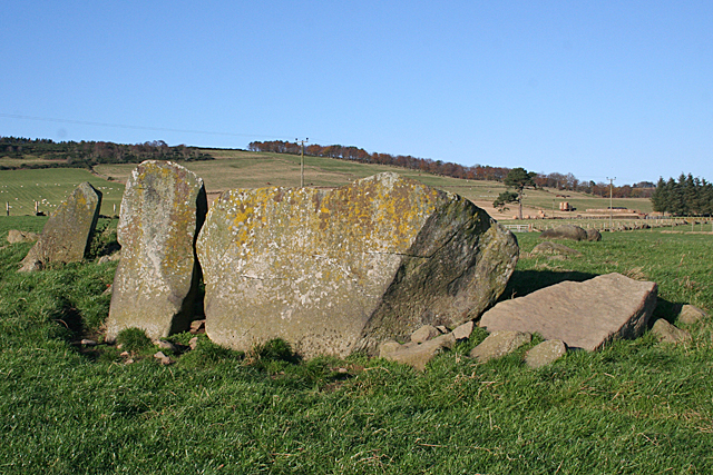
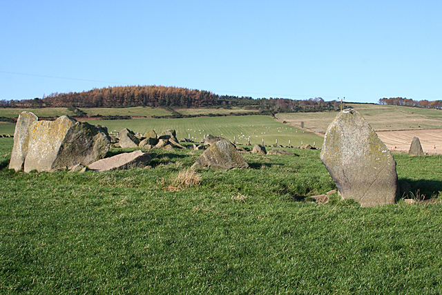
Yonder Bognie is a stone circle in Aberdeenshire, Scotland. It is located in an agricultural field under private ownership and is a scheduled monument...

Cobairdy Castle

Cobairdy Castle was a 16th-century tower house, about 4 miles (6.4 km) north-east of Huntly, Aberdeenshire, Scotland, west of Burn of Connairdy. It may...

Fourman Hill

Fourman Hill is a hill located west of Bogniebrae, Aberdeenshire, Scotland. It has an elevation of 1,127 feet (344 m). A cairn near the summit marked the...

Forgue

Forgue is a hamlet in Aberdeenshire. It lies 35 miles (56 km) northwest of Aberdeen and 8 miles (13 km) northeast of Huntly. The Glendronach distillery...

Mountains Burn

Mountains Burn is a burn which marks the boundary of the parish of Huntly, Aberdeenshire, Scotland. == References ==

Lessendrum

Lessendrum is a ruinous fortified house situated 7.65 kilometres (4.75 mi) to the north of Huntly, Aberdeenshire, Scotland. It is on the Buildings at Risk...

Nearby Amenities

Located within 500m of 57.493355,-2.6856375
Power: pole
Lat/Long: 57.4977158/-2.6841724
Power: pole
Lat/Long: 57.4971934/-2.6841283
Power: pole
Lat/Long: 57.496671/-2.6840976
Power: pole
Lat/Long: 57.4960331/-2.6840497
Power: pole
Lat/Long: 57.4954983/-2.6840036
Power: pole
Lat/Long: 57.4949522/-2.6839653
Power: pole
Lat/Long: 57.4942442/-2.6839825
Power: pole
Lat/Long: 57.493595/-2.6839998
Power: pole
Lat/Long: 57.492886/-2.6840247
Power: pole
Lat/Long: 57.4921832/-2.6840535
Power: pole
Lat/Long: 57.4914917/-2.6840765
Power: pole
Lat/Long: 57.4907796/-2.6841034
Power: pole
Lat/Long: 57.4902498/-2.6831426
Power: pole
Lat/Long: 57.4900932/-2.6824906
Power: pole
Lat/Long: 57.489853/-2.6814245
Power: pole
Lat/Long: 57.497314/-2.6852654
Power: pole
Lat/Long: 57.4974428/-2.6864256
Power: pole
Lat/Long: 57.4976231/-2.6878139
The data included in this document is from www.openstreetmap.org. The data is made available under ODbL.

Have you been to Bogniebrae?

Leave your review of Bogniebrae below (or comments, questions and feedback).