Stockton Heath

Settlement in Cheshire

England

Stockton Heath

Bridgewater canal towards Walton Bridge
Bridgewater canal towards Walton Bridge Credit: Ian S

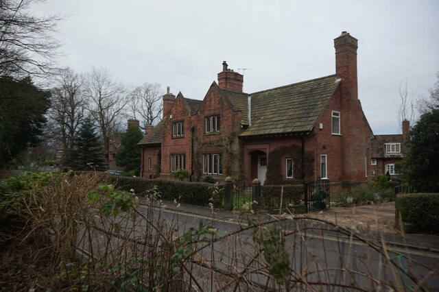
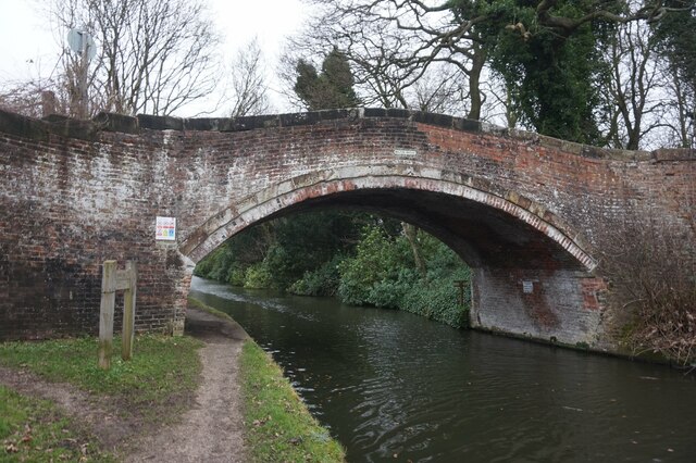
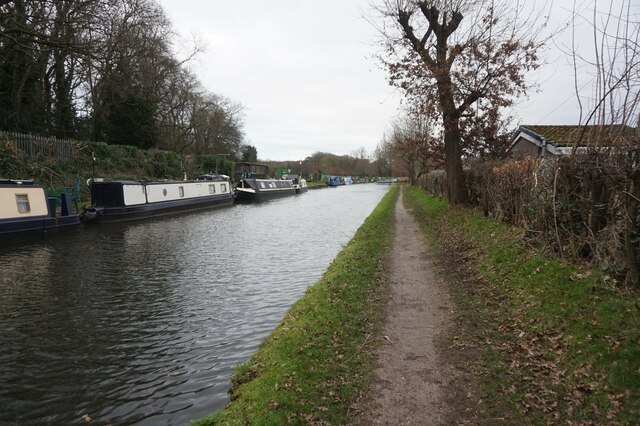
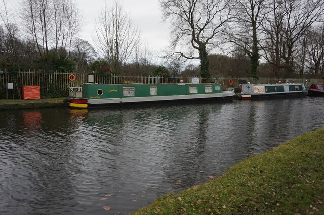
Stockton Heath is a picturesque village located in Cheshire, England. Situated along the Bridgewater Canal, the village is known for its charming streets lined with boutique shops, cafes, and restaurants. Stockton Heath has a rich history dating back to the 18th century when it was a popular stopping point for traders traveling along the canal.

The village is also home to a thriving community with a range of amenities including schools, churches, and parks. Stockton Heath is well-connected to nearby towns and cities with easy access to major roadways such as the M56 and M6, making it a desirable location for commuters.

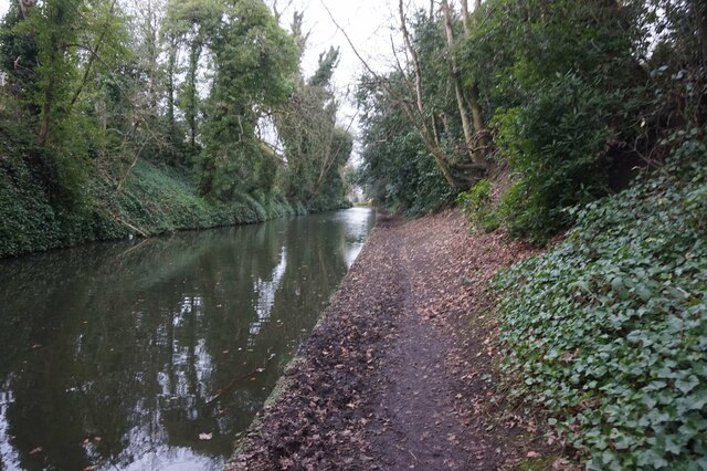
The local area offers plenty of recreational activities for residents and visitors alike, with scenic walking and cycling routes along the canal towpath and surrounding countryside. The village also hosts regular events and festivals, adding to its vibrant atmosphere.

Overall, Stockton Heath is a charming and vibrant village with a strong sense of community, making it a popular destination for both locals and tourists looking to explore the beauty of Cheshire.

If you have any feedback on the listing, please let us know in the comments section below.

Stockton Heath Images

Images are sourced within 2km of 53.368332/-2.584685 or Grid Reference SJ6185. Thanks to Geograph Open Source API. All images are credited.

Bridgewater canal towards Walton Bridge
Walton Lea Road, Higher Walton
Bridgewater canal towards Walton Bridge
Bridgewater canal at Walton Bridge
Bridgewater canal towards the A56 Bridge
Canal boat Desiderata,  Bridgewater canal
Canal boat Desiderata, Bridgewater canal
Canal boat Andante,  Bridgewater canal
Canal boat Andante, Bridgewater canal
Canal boat Veinarde,  Bridgewater canal
Canal boat Veinarde, Bridgewater canal
Canal boat Cosy Toes,  Bridgewater canal
Canal boat Cosy Toes, Bridgewater canal
Canal boat JusRomin,  Bridgewater canal
Canal boat JusRomin, Bridgewater canal
The River Mersey From the Trans Pennine Trail.
The River Mersey
From the Trans Pennine Trail.
Trans Pennine Trail
Trans Pennine Trail
Cereal crop and pylons off Mill Lane
A56, Higher Walton
A56, Higher Walton
Mill Lane
Mill Lane
Stockton Heath, narrowboat "Marjam" approaching on the Bridgewater Canal.
Stockton Heath, narrowboat
"Marjam" approaching on the Bridgewater Canal.
Show me another place!

Stockton Heath is located at Grid Ref: SJ6185 (Lat: 53.368332, Lng: -2.584685)

Unitary Authority: Warrington

Police Authority: Cheshire

What 3 Words

///trees.lines.coast. Near Stockton Heath, Cheshire

Nearby Locations

Stockton Heath

Related Wikis

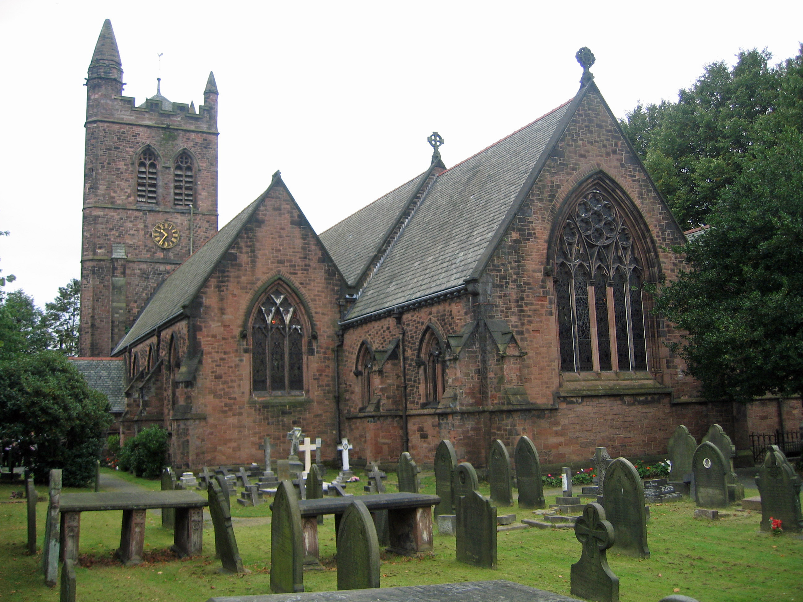
St Thomas' Church, Stockton Heath

St Thomas' Church is in Stockton Heath, to the south of Warrington, Cheshire, England. The church is recorded in the National Heritage List for England...

Stockton Heath

Stockton Heath is a civil parish and suburb of Warrington, in the Borough of Warrington, Cheshire, England. It is located to the north of the Bridgewater...

Walton Lea Road

Walton Lea Road is a cricket ground in Warrington. The first recorded match on the ground was in 1881, when Warrington played Huyton.The first Minor Counties...

Wilderspool

Wilderspool is a district of Warrington, Cheshire, near the town centre. It consists of Wilderspool Causeway and the streets coming off it, the limits...

Nearby Amenities

Located within 500m of 53.368332,-2.584685
Source: PGS
Lat/Long: 53.3719608/-2.5881073
Hillcliffe
Is In: Appleton
Place: quarter
Source: npe
Lat/Long: 53.3657183/-2.578857
Crossing
Button Operated: yes
Crossing: traffic_signals
Crossing Island: no
Crossing Markings: dots
Crossing Signals: yes
Crossing Ref: puffin
Kerb: lowered
Tactile Paving: yes
Traffic Signals Sound: no
Traffic Signals Vibration: yes
Lat/Long: 53.3692315/-2.5822232
Traffic Signals
Traffic Signals: crossing
Traffic Signals Direction: forward
Lat/Long: 53.3713579/-2.5816126
Give Way
Direction: forward
Lat/Long: 53.3683963/-2.5799665
Turning Circle
Lat/Long: 53.367212/-2.5867766
Pub
The Red Lion
HE Ref: 1135948
Addr City: Warrington
Addr Country: GB
Addr Housenumber: 58-60
Addr Postcode: WA4 6HN
Addr Street: London Road
Fhrs Id: 421085
Listed Status: Grade II
Opening Hours: Su-Th 12:00-23:00, Fr,Sa 12:00-01:00
Wikidata: Q26429289
Lat/Long: 53.3709375/-2.5816744
Parking
Access: yes
Created By: Potlatch 0.10f
Fee: no
Fee Conditional: yes @ (Mo-Sa 09:00-15:00)
Parking: surface
Lat/Long: 53.3713682/-2.5831386
Thingz That Make Noize
Addr City: Warrington
Addr Country: GB
Addr Housenumber: 165
Addr Postcode: WA4 5BG
Addr Street: London Road
Check Date: 2023-09-29
Opening Hours: Mo 11:30-16:30; Tu,Fr 12:00-17:00; We 12:30-18:00; Th,Su off; Sa 10:30-17:00
Shop: music
Source: GPS survey
Website: https://www.thingzthatmakenoize.co.uk/
Lat/Long: 53.3669182/-2.5790428
Bus Stop
London Bridge
Bench: no
Bin: no
Bus: yes
Departures Board: timetable
Lit: yes
Naptan AtcoCode: 069000013090
Naptan Bearing: S
Naptan CommonName: London Bridge
Naptan Indicator: S-bound
Naptan Landmark: Dingleway
Naptan LocalityName: Cobbs
Naptan NaptanCode: wrgdwmw
Naptan PlusbusZoneRef: WRGT
Naptan ShortCommonName: London Bridge
Naptan Street: London Road
Public Transport: platform
Shelter: no
Source: GPS survey
Tactile Paving: yes
Lat/Long: 53.3670193/-2.5790837
Crossing
Button Operated: yes
Crossing: traffic_signals
Crossing Island: no
Crossing Markings: dots
Crossing Signals: yes
Crossing Ref: puffin
Tactile Paving: yes
Traffic Signals Sound: yes
Traffic Signals Vibration: yes
Lat/Long: 53.3675221/-2.5794034
Bus Stop
Cobbs, Dingleway / Greenfields Avenue
Bench: yes
Bin: yes
Bus: yes
Lit: no
Naptan AtcoCode: 069000023200
Naptan Bearing: NW
Naptan CommonName: Greenfields Avenue
Naptan Crossing: Greenfields Avenue
Naptan Indicator: opp
Naptan Landmark: Greenfields Avenue
Naptan LocalityName: Cobbs
Naptan NaptanCode: wrgdwmj
Naptan PlusbusZoneRef: WRGT
Naptan ShortCommonName: Greenfields Avenue
Naptan Street: Dingleway
Public Transport: platform
Shelter: yes
Source: GPS survey
Tactile Paving: yes
Lat/Long: 53.3663471/-2.5781618
Barrier: bollard
Bicycle: yes
Foot: yes
Source: GPS survey
Lat/Long: 53.3670887/-2.5786835
Pub
London Bridge Inn
Addr City: Warrington
Addr Housenumber: 163
Addr Postcode: WA4 5BG
Addr Street: London Road
Fhrs Id: 419443
Opening Hours: Mo-Su 12:00-23:00
Source: GPS survey
Lat/Long: 53.3672256/-2.5789147
Bus Stop
Cobbs, Dingleway / Waverley Avenue
Alt Name: Undercliffe House
Bench: no
Bin: no
Bus: yes
Lit: yes
Naptan AtcoCode: 069000013095
Naptan Bearing: SE
Naptan CommonName: Waverley Avenue
Naptan Crossing: Waverley Avenue
Naptan Indicator: cnr
Naptan Landmark: Waverley Avenue
Naptan LocalityName: Cobbs
Naptan NaptanCode: wrgdwmp
Naptan PlusbusZoneRef: WRGT
Naptan ShortCommonName: Waverley Avenue
Naptan Street: Dingleway
Public Transport: platform
Shelter: no
Source: naptan_import
Tactile Paving: yes
Lat/Long: 53.3663741/-2.577942
Crossing
Crossing Island: no
Crossing Markings: no
Crossing Signals: no
Tactile Paving: no
Lat/Long: 53.3651228/-2.582211
Cafe
Esquires
Addr City: Warrington
Addr Country: GB
Addr Postcode: WA4 6HW
Fhrs Id: 421029
Source Addr Postcode: FHRS Open Data
Lat/Long: 53.3713124/-2.5823498
Give Way
Direction: backward
Lat/Long: 53.3669503/-2.5851344
Bridgfords
Addr City: Warrington
Addr Housenumber: 66-70
Addr Postcode: WA4 6HR
Addr Street: London Road
Addr Suburb: Stockton Heath
Office: estate_agent
Phone: +44 1925 899888
Website: https://www.bridgfords.co.uk/toletoffice/Stockton-Heath,-Warrington/884
Lat/Long: 53.3707409/-2.5814916
The Barber's Pole
Addr City: Warrington
Addr Housenumber: 54
Addr Postcode: WA4 6NL
Addr Street: Walton Road
Addr Suburb: Stockton Heath
Shop: hairdresser
Lat/Long: 53.3689837/-2.5826342
Bus Stop
Stockton Heath
Bench: yes
Bin: yes
Bus: yes
Departures Board: yes
Lit: yes
Naptan AtcoCode: 069000023430
Naptan Bearing: N
Naptan CommonName: Post Office
Naptan Indicator: N-bound
Naptan Landmark: Post Office
Naptan LocalityName: Stockton Heath
Naptan NaptanCode: wrgjwjt
Naptan PlusbusZoneRef: WRGT
Naptan ShortCommonName: Stockton Heath PO
Naptan Street: London Road
Public Transport: platform
Shelter: yes
Source: naptan_import
Tactile Paving: yes
Lat/Long: 53.3717225/-2.5816631
M&S Foodhall
Addr City: Warrington
Addr Country: GB
Addr Postcode: WA4 6HW
Brand: M&S Foodhall
Brand Wikidata: Q714491
Brand Wikipedia: en:Marks & Spencer
Contact Website: https://www.marksandspencer.com/stores/stockton-heath-foodhall-1920
Opening Hours: Mo-Fr 08:00-20:30; Sa 08:00-20:00; Su 10:00-16:00
Operator: Marks and Spencer
Shop: supermarket
Lat/Long: 53.3711457/-2.5826802
Post Office
Stockton Heath Post Office
Addr City: Warrington
Addr Housenumber: 49
Addr Postcode: WA4 6NW
Addr Street: Walton Road
Addr Village: Stockton Heath
Brand: Post Office
Brand Wikidata: Q1783168
Check Date Opening Hours: 2023-10-17
Opening Hours: Mo-Fr 07:30-17:30; Sa 07:30-14:00
Ref Pol Id: 140222
Lat/Long: 53.3692189/-2.5825788
Community Centre
St Thomas' Church Hall
Addr City: Warrington
Addr Country: GB
Addr Postcode: WA4 6DS
Addr Street: Ellesmere Road
Fhrs Id: 420414
Source Addr: FHRS Open Data
Lat/Long: 53.3725849/-2.583167
Doctors
Stockton Heath Medical Centre
Addr City: Warrington
Addr Housename: The Forge
Addr Postcode: WA4 6HJ
Addr Street: London Road
Addr Suburb: Stockton Heath
Healthcare: doctor
Opening Hours: Mo-Fr 08:00-18:30
Website: https://stocktonheathmedicalcentre.co.uk/
Lat/Long: 53.371964/-2.5822766
Recycling
Location: overground
Recycling Clothes: yes
Recycling Paper: yes
Recycling Shoes: yes
Recycling Type: container
Lat/Long: 53.3715247/-2.5822842
Bus Stop
Stockton Heath
Bench: yes
Bin: yes
Bus: yes
Departures Board: yes
Lit: no
Naptan AtcoCode: 069000012970
Naptan Bearing: S
Naptan CommonName: Mullberry Tree Pub
Naptan Crossing: West Avenue
Naptan Indicator: o/s
Naptan Landmark: Mullberry Tree Pub
Naptan LocalityName: Stockton Heath
Naptan NaptanCode: wrgjwjw
Naptan PlusbusZoneRef: WRGT
Naptan ShortCommonName: Mullberry Tree Pub
Naptan Street: London Road
Public Transport: platform
Shelter: yes
Source: naptan_import
Tactile Paving: yes
Lat/Long: 53.3710462/-2.5814688
Sainsbury's Local
Addr City: Warrington
Addr Country: GB
Addr Housenumber: 88-94
Addr Postcode: WA4 6LE
Addr Street: London Road
Brand: Sainsbury's Local
Brand Wikidata: Q13218434
Brand Wikipedia: en:Sainsbury's Local
Fhrs Id: 420638
Opening Hours: Mo-Su 07:00-23:00
Shop: convenience
Website: https://stores.sainsburys.co.uk/4038/stockton-heath-local
Lat/Long: 53.3699588/-2.5809435
Crossing
Button Operated: yes
Crossing: traffic_signals
Crossing Island: yes
Crossing Markings: dots
Crossing Ref: puffin
Tactile Paving: yes
Traffic Signals Sound: yes
Traffic Signals Vibration: yes
Lat/Long: 53.3713854/-2.581615
Bicycle Parking
Forge
Bicycle Parking: stands
Capacity: 10
Covered: no
Cyclestreets Id: 83662
Url: https://cyclestreets.net/location/83662/
Lat/Long: 53.3709988/-2.5827088
Bicycle Parking
Victoria Square
Access: yes
Bicycle Parking: stands
Capacity: 10
Covered: no
Cyclestreets Id: 83663
Fee: no
Url: https://cyclestreets.net/location/83663/
Lat/Long: 53.3707749/-2.5809294
Atm
Sainsburys
Check Date: 2023-09-27
Operator: Sainsbury
Lat/Long: 53.3700046/-2.5809599
Recycling
Stockton Heath Recylcing Centre
Addr City: Warrington
Addr Country: GB
Addr Postcode: WA4 2AY
Opening Hours: Mo-Su 08:00-16:00
Recycling Type: centre
Website: https://www.warrington.gov.uk/tip
Lat/Long: 53.3680628/-2.5784003
Parking
Access: permissive
Parking: surface
Lat/Long: 53.3707462/-2.5839586
Bar
Costello's Bar
Addr City: Warrington
Addr Housenumber: 23
Addr Postcode: WA4 6NJ
Addr Street: Walton Road
Addr Suburb: Stockton Heath
Brewery: yes
Fhrs Id: 643268
Not Addr Postcode: WA4 6NL
Outdoor Seating: yes
Website: http://costellosbar.co.uk/stocktonheath/
Lat/Long: 53.3704671/-2.5815379
Restaurant
Ego
Addr City: Warrington
Addr Housenumber: 25
Addr Postcode: WA4 6NJ
Addr Street: Walton Road
Addr Suburb: Stockton Heath
Fhrs Id: 420887
Outdoor Seating: yes
Source Addr: FHRS Open Data
Website: https://www.egorestaurants.co.uk/
Lat/Long: 53.3703953/-2.581566
Victoria Garage
Addr City: Warrington
Addr Country: GB
Addr Postcode: WA4 6HT
Shop: car_repair
Website: https://www.victoria-garage.co.uk/
Lat/Long: 53.3706617/-2.5820809
All That Jazz
Opening Hours: Mo-Sa 08:30-17:30; Su 10:00-16:00
Shop: houseware
Lat/Long: 53.3713458/-2.5821788
Fast Food
Stockton Fryer
Addr City: Warrington
Addr Housenumber: 111
Addr Postcode: WA4 6LG
Addr Street: London Road
Addr Suburb: Stockton Heath
Cuisine: fish_and_chips;kebab
Drive Through: no
Fhrs Id: 1228776
Opening Hours: Su-Th 16:30-21:50; Fr,Sa 16:30-22:30
Source Addr Postcode: FHRS Open Data
Lat/Long: 53.3695802/-2.580329
Clarks
Addr Housenumber: 46
Addr Street: London Road
Brand: Clarks
Brand Wikidata: Q1095857
Brand Wikipedia: en:C. & J. Clark
Opening Hours: Mo-Sa 09:30-17:30; Su 11:00-16:00
Shop: shoes
Lat/Long: 53.3713124/-2.5817609
Restaurant
Amans
Addr City: Warrington
Addr Country: GB
Addr Housenumber: 33
Addr Postcode: WA4 6NJ
Addr Street: Walton Road
Cuisine: indian
Fhrs Id: 1092165
Phone: +44 1925 266 999
Lat/Long: 53.3697681/-2.5817761
Smart Furnishings
Addr City: Warrington
Addr Country: GB
Addr Postcode: WA4 6LL
Addr Street: Chapel Lane
Check Date: 2023-09-29
Description: Furniture, bathrooms, flooring
Office: advertising_agency
Opening Hours: Mo-Sa 09:00-17:30
Lat/Long: 53.3684106/-2.5817108
DJ Sothern
Addr City: Warrington
Addr Country: GB
Addr Housenumber: 22
Addr Postcode: WA4 6LH
Addr Street: Orchard Street
Shop: doityourself
Lat/Long: 53.3681768/-2.5812214
Bargain Booze
Addr City: Warrington
Addr Housenumber: 1
Addr Postcode: WA4 6LU
Addr Street: Cawdor Street
Addr Suburb: Stockton heath
Brand: Bargain Booze
Brand Wikidata: Q16971315
Brand Wikipedia: en:Bargain Booze
Drive Through: no
Shop: alcohol
Lat/Long: 53.3677786/-2.5823421
Cheshire Shoe Repairs
Addr City: Warrington
Addr Country: GB
Addr Housenumber: 2
Addr Postcode: WA4 6NL
Addr Street: Walton Road
Shop: shoe_repair
Website: https://www.cheshireshoe.co.uk/
Lat/Long: 53.3702884/-2.5812845
The Card Gallery
Shop: gift
Lat/Long: 53.3712942/-2.5820103
Cafe
Jenny Wren’s Pottery Cafe
Addr City: Warrington
Addr Country: GB
Addr Housenumber: 3
Addr Postcode: WA4 6HT
Addr Street: West Avenue
Fhrs Id: 643280
Outdoor Seating: no
Website: https://www.jennywrensceramics.co.uk/
Lat/Long: 53.3706083/-2.5824977
Fast Food
Subway
Addr City: Warrington
Addr Country: GB
Addr Housenumber: 64
Addr Postcode: WA4 6HR
Addr Street: London Road
Brand: Subway
Brand Wikidata: Q244457
Brand Wikipedia: en:Subway (restaurant)
Contact Website: https://restaurants.subway.com/united-kingdom/en/warrington/64-london-roadstockton-heath
Cuisine: sandwich
Fhrs Id: 517513
Opening Hours: Mo-Sa 08:00-18:00; Su 10:00-17:00
Source Addr: FHRS Open Data
Takeaway: yes
Lat/Long: 53.3707419/-2.5816981
RIva Menswear
Addr City: Warrington
Addr Housenumber: 21
Addr Postcode: WA4 6NJ
Addr Street: Walton Road
Addr Suburb: Stockton Heath
Shop: clothes
Lat/Long: 53.3705101/-2.5814543
Addr City: Warrington
Addr Country: GB
Addr Housenumber: 1
Addr Postcode: WA4 6JS
Addr Street: Kimberley Drive
Lat/Long: 53.3691332/-2.5829247
Bus Stop
Walton Road
Bench: yes
Bin: yes
Bus: yes
Departures Board: no
Lit: yes
Public Transport: platform
Shelter: no
Tactile Paving: no
Lat/Long: 53.3695498/-2.5819152
Bus Stop
Walton Road
Bus: yes
Departures Board: no
Public Transport: platform
Shelter: no
Lat/Long: 53.3693496/-2.5819575
Post Box
Operator: Royal Mail
Operator Wikidata: Q638098
Post Box Design: type_b
Post Box Type: pillar
Ref: WA4 52
Royal Cypher: GR
Lat/Long: 53.3690433/-2.5823666
Restaurant
Satay Pan Asian Restaurant
Addr City: Warrington
Addr Country: GB
Addr Housenumber: 22
Addr Postcode: WA4 6HN
Addr Street: London Road
Check Date: 2023-10-09
Cuisine: chinese
Email: sataypanasianrestaurant@gmail.com
Fhrs Id: 420288
Opening Hours: Mo off; Tu-Su,PH 17:00-23:00
Phone: +44 1925 210594
Website: https://satayrestaurant.co.uk
Lat/Long: 53.3719411/-2.5817525
Post Box
Collection Times Signed: no
Operator: Royal Mail
Operator Wikidata: Q638098
Post Box Type: wall
Ref: WA4 114
Royal Cypher: EIIR
Royal Cypher Wikidata: Q33102113
Lat/Long: 53.3715485/-2.5816993
Addr Housenumber: 25
Addr Street: Kimberley Drive
Lat/Long: 53.3702367/-2.5839137
Addr Housenumber: 89a
Addr Street: Walton New Road
Lat/Long: 53.3691751/-2.5858115
Addr Housenumber: 22
Addr Street: Southern Street
Lat/Long: 53.3696757/-2.5852178
Clock Corner
Addr City: Warrington
Addr Country: GB
Addr Housenumber: 58
Addr Postcode: WA4 6NL
Addr Street: Walton Road
Shop: clocks
Website: https://www.clockcorner.co.uk/
Lat/Long: 53.3688971/-2.5829263
Gascoigne Halman
Addr City: Warrington
Addr Country: GB
Addr Housenumber: 29
Addr Postcode: WA4 6NJ
Addr Street: Walton Road
Office: estate_agent
Lat/Long: 53.3698877/-2.5817461
Adams
Addr City: Warrington
Addr Country: GB
Addr Housenumber: 12-14
Addr Postcode: WA4 6NL
Addr Street: Walton Road
Office: estate_agent
Lat/Long: 53.3700126/-2.5814055
Bench
Backrest: yes
Lat/Long: 53.3708009/-2.5811955
Bench
Backrest: yes
Lat/Long: 53.3708273/-2.5810813
Bench
Backrest: yes
Lat/Long: 53.3707444/-2.5811601
Bench
Backrest: yes
Lat/Long: 53.3707355/-2.5810199
Stockton Heath Carpet Centre
Shop: carpet
Lat/Long: 53.3706432/-2.582382
Addr City: Warrington
Addr Housenumber: 24
Addr Postcode: WA4 6LH
Addr Street: Orchard Street
Addr Suburb: Stockton Heath
Lat/Long: 53.3680997/-2.5815232
Parking
Access: customers
Fee: no
Parking: surface
Lat/Long: 53.3674391/-2.5786275
Traffic Signals
Traffic Signals: signal
Traffic Signals Direction: backward
Lat/Long: 53.3707271/-2.5813014
Dawsson Tatttoo Company
Shop: tattoo
Lat/Long: 53.3724115/-2.5815948
The Barber's Room
Shop: hairdresser
Lat/Long: 53.3723987/-2.5815653
Bayse Fitness Club
Leisure: fitness_centre
Lat/Long: 53.3723859/-2.5815787
Fast Food
Candolim Express
Addr City: Warrington
Addr Country: GB
Addr Housenumber: 32a
Addr Postcode: WA4 6HN
Addr Street: London Road
Fhrs Id: 1156255
Source Addr Postcode: FHRS Open Data
Takeaway: yes
Lat/Long: 53.371656/-2.5817522
Bar
Gin Alley
Addr City: Warrington
Addr Country: GB
Addr Housenumber: 85
Addr Postcode: WA4 6LG
Addr Street: London Road
Fhrs Id: 1087496
Opening Hours: Tu-Th 17:00-23:00; Fr 14:00-24:00; Sa 13:00-24:00; Su 13:00-23:00; Mo off
Source Addr Postcode: FHRS Open Data
Lat/Long: 53.3703656/-2.5808722
Barrier: bollard
Lat/Long: 53.37066/-2.5818018
C & G Mullen
Addr City: Warrington
Addr Country: GB
Addr Housenumber: 10
Addr Postcode: WA4 6HW
Addr Street: London Road
Addr Unit: The Forge
Shop: optician
Lat/Long: 53.3712832/-2.5819092
Cafe
M Jays
Addr City: Warrington
Addr Country: GB
Addr Housenumber: 26
Addr Postcode: WA4 6HN
Addr Street: London Road
Fhrs Id: 964429
Opening Hours: Tu-Fr,Su 14:00-22:00; Mo off; Sa 12:00-19:00
Source Addr Postcode: FHRS Open Data
Takeaway: yes
Lat/Long: 53.3718553/-2.5817348
Fast Food
Italian Express
Addr City: Warrington
Addr Country: GB
Addr Housenumber: 28
Addr Postcode: WA4 6HN
Addr Street: London Road
Fhrs Id: 1215335
Opening Hours: Mo-Th 16:00-21:45; Fr 16:00-22:45; Sa 13:45-22:45; Su 13:45-21:45
Source Addr Postcode: FHRS Open Data
Lat/Long: 53.3717585/-2.5817522
Mind
Brand: Mind
Brand Wikidata: Q3314763
Brand Wikipedia: en:Mind (charity)
Opening Hours: Mo-Sa 09:00-17:00; Su off
Shop: charity
Lat/Long: 53.3717136/-2.5817563
Johnsons
Addr Housenumber: 30
Addr Street: London Road
Brand: Johnsons
Brand Wikidata: Q6268527
Brand Wikipedia: en:Johnsons Cleaners UK
Shop: dry_cleaning
Lat/Long: 53.3716912/-2.5817562
Restaurant
Olive Tree Brasserie
Addr City: Warrington
Addr Country: GB
Addr Housenumber: 48
Addr Postcode: WA4 6HN
Addr Street: London Road
Fhrs Id: 1048917
Opening Hours: Mo-Th 11:00-22:00; Fr-Su 09:00-22:00
Was Addr Postcode: WA4 6HP
Lat/Long: 53.371184/-2.5817496
Betfred
Brand: Betfred
Brand Wikidata: Q4897425
Brand Wikipedia: en:Betfred
Shop: bookmaker
Lat/Long: 53.3711007/-2.5817093
Restaurant
Eastern Revive
Addr City: Warrington
Addr Country: GB
Addr Postcode: WA4 6HT
Addr Street: West Avenue
Cuisine: indian
Fhrs Id: 904791
Source Addr: FHRS Open Data
Lat/Long: 53.3706943/-2.582278
Fast Food
Saffy's
Addr City: Warrington
Addr Country: GB
Addr Housenumber: 18
Addr Postcode: WA4 6NL
Addr Street: Walton Road
Cuisine: sandwich
Fhrs Id: 420725
Takeaway: yes
Lat/Long: 53.3698941/-2.5814518
Anchor & Hops
Addr City: Warrington
Addr Country: GB
Addr Housenumber: 20
Addr Postcode: WA4 6NL
Addr Street: Walton Road
Shop: alcohol
Lat/Long: 53.3698573/-2.5814733
Fox Hair Company
Shop: hairdresser
Lat/Long: 53.3698253/-2.5814894
Unique Alterations
Shop: dry_cleaning
Lat/Long: 53.3697853/-2.5815189
Ashcroft Guest
Addr City: Warrington
Addr Country: GB
Addr Housenumber: 30
Addr Postcode: WA4 6NL
Addr Street: Walton Road
Office: estate_agent
Lat/Long: 53.3695868/-2.5816557
Purple Accounts
Addr Housenumber: 28
Addr Street: Walton Road
Office: accountant
Lat/Long: 53.3696269/-2.5816289
Cafe
Heaths
Addr City: Warrington
Addr Country: GB
Addr Housenumber: 26
Addr Postcode: WA4 6NL
Addr Street: Walton Road
Fhrs Id: 419792
Source Addr Postcode: FHRS Open Data
Lat/Long: 53.3696637/-2.5815967
The Insurance Centre
Addr Housenumber: 36
Addr Street: Walton Road
Office: insurance
Lat/Long: 53.3695052/-2.5817308
Bethany Hannah Bridal Wear
Addr City: Warrington
Addr Country: GB
Addr Housenumber: 40
Addr Postcode: WA4 6NL
Addr Street: Walton Road
Shop: clothes
Lat/Long: 53.3693724/-2.5817952
Restaurant
PizzaExpress
Addr City: Warrington
Addr Housename: Victoria Buildings
Addr Housenumber: 3
Addr Postcode: WA4 2AG
Addr Street: Grappenhall Road
Addr Suburb: Stockton Heath
Brand: PizzaExpress
Brand Wikidata: Q662845
Brand Wikipedia: en:PizzaExpress
Cuisine: pizza
Fhrs Id: 1367213
Website: https://www.pizzaexpress.com/stockton-heath-grappenhall-road
Lat/Long: 53.3705286/-2.5806906
Restaurant
a la turka
Addr City: Warrington
Addr Housename: Victoria Buildings
Addr Postcode: WA4 2AG
Addr Street: Grappenhall Road
Addr Suburb: Stockton Heath
Cuisine: turkish
Fhrs Id: 766310
Source Addr: FHRS Open Data
Lat/Long: 53.3705067/-2.5808037
Toni & Guy
Addr City: Warrington
Addr Housename: Victoria Buildings
Addr Postcode: WA4 2AG
Addr Street: Grappenhall Road
Addr Suburb: Stockton Heath
Brand: Toni & Guy
Brand Wikidata: Q324784
Brand Wikipedia: en:Toni & Guy
Shop: hairdresser
Lat/Long: 53.3704655/-2.5808867
Canine Cutting Club
Addr Housenumber: 32
Addr Street: London Road
Opening Hours: Tu,We,Fr 09:00-18:00; Th 10:00-20:00; Sa 09:00-13:00; Su,Mo off
Shop: pet_grooming
Lat/Long: 53.3716712/-2.5817522
Cafe
LD24
Addr City: Warrington
Addr Country: GB
Addr Housenumber: 24
Addr Postcode: WA4 6HN
Addr Street: London Road
Check Date: 2023-10-02
Fhrs Id: 1057004
Opening Hours: Mo-Sa 07:00-17:00; Su 11:00-17:00
Payment Mastercard: yes
Payment Visa: yes
Source Addr Postcode: FHRS Open Data
Lat/Long: 53.3718945/-2.5817388
Ashtons
Addr Housenumber: 100
Addr Street: London Road
Office: estate_agent
Opening Hours: Mo-Th 09:00-17:30; Fr 09:00-17:00; Sa 10:00-15:00
Lat/Long: 53.3696978/-2.5808261
Cowdel Clarke
Addr Housenumber: 98
Addr Street: London Road
Office: estate_agent
Opening Hours: Mo-Fr 08:45-17:30; Sa 09:00-16:00; Su off
Lat/Long: 53.369749/-2.5808395
Corks Out
Addr City: Warrington
Addr Country: GB
Addr Housenumber: 96
Addr Postcode: WA4 6LE
Addr Street: London Road
Fhrs Id: 420868
Opening Hours: Mo-We 11:00-21:00; Th 11:00-22:00; Fr 11:00-23:30; Sa 10:00-23:30; Su 11:00-21:00
Shop: wine
Lat/Long: 53.3697938/-2.5808771
Alexandra Flowers
Shop: florist
Lat/Long: 53.3712731/-2.5821191
Dentist
Walton Road Dental Practice
Addr City: Warrington
Addr Country: GB
Addr Housenumber: 44
Addr Postcode: WA4 6NL
Addr Street: Walton Road
Healthcare: dentist
Lat/Long: 53.3691155/-2.5821993
Johnsons
Shop: hairdresser
Lat/Long: 53.3690563/-2.5824433
Music School
Sixpence Voice Studio
Addr Housenumber: 50
Addr Street: Walton Road
Lat/Long: 53.3690387/-2.5825184
Cheetham Jackson
Addr Housenumber: 52
Addr Street: Walton Road
Office: financial_advisor
Lat/Long: 53.3690371/-2.5825801
Spencer Interiors
Addr City: Warrington
Addr Country: GB
Addr Housenumber: 51
Addr Postcode: WA4 6NW
Addr Street: Walton Road
Shop: interior_decoration
Lat/Long: 53.3691876/-2.5827491
MaD (Media and Digital Ltd)
Addr City: Warrington
Addr Housenumber: 146
Addr Postcode: WA4 6LE
Addr Street: London Road
Addr Suburb: Stockton Heath
Contact Email: hello@mad.uk.com
Office: advertising_agency
Opening Hours: Mo-Fr 09:00-18:00
Phone: +44 1925 912321
Website: https://www.mad.uk.com/
Lat/Long: 53.3684516/-2.5801215
Recycling
Description: Now little there, mainly cardboard
Recycling Type: centre
Lat/Long: 53.3718607/-2.583144
Addr Housenumber: 15
Addr Street: Kimberley Drive
Lat/Long: 53.3694044/-2.5831336
Addr Housenumber: 17
Addr Street: Kimberley Drive
Lat/Long: 53.3694732/-2.5832033
Addr Housenumber: 1
Addr Street: Derby Road
Lat/Long: 53.3695212/-2.5832328
Addr City: Warrington
Addr Housenumber: 24
Addr Postcode: WA4 6LY
Addr Street: Bedford Street
Addr Suburb: Stockton Heath
Lat/Long: 53.3680089/-2.5825381
Addr City: Warrington
Addr Housenumber: 53
Addr Postcode: WA4 6LP
Addr Street: Bedford Street
Addr Suburb: Stockton Heath
Lat/Long: 53.3679785/-2.5821891
Addr City: Warrington
Addr Housenumber: 35
Addr Postcode: WA4 6LP
Addr Street: Bedford Street
Addr Suburb: Stockton Heath
Lat/Long: 53.3683387/-2.5824393
Addr City: Warrington
Addr Housenumber: 7
Addr Postcode: WA4 6LY
Addr Street: Bedford Street
Addr Suburb: Stockton Heath
Lat/Long: 53.3682876/-2.5838063
Addr Housenumber: 3
Addr Street: Bedford Street
Lat/Long: 53.3683418/-2.5843191
Addr Housenumber: 42
Addr Street: Walton Road
Lat/Long: 53.3692012/-2.5820486
Addr Housenumber: 4
Addr Street: West Avenue
Lat/Long: 53.3708487/-2.5833589
Addr Housenumber: 2
Addr Street: West Avenue
Lat/Long: 53.3708783/-2.5831899
Addr Housenumber: 13
Addr Street: West Avenue
Lat/Long: 53.3706079/-2.5830008
Addr Housenumber: 11
Addr Street: West Avenue
Lat/Long: 53.3706255/-2.5827849
Entrance: main
Wheelchair: yes
Lat/Long: 53.3721044/-2.5822167
Pharmacy
Day Lewis Pharmacy
Addr City: Warrington
Addr Country: GB
Addr Postcode: WA4 6HJ
Addr Street: London Road
Brand: Day Lewis Pharmacy
Brand Wikidata: Q62563772
Dispensing: yes
Fhrs Id: 517511
Healthcare: pharmacy
Opening Hours: Mo-Fr 08:00-21:00; Sa 17:00-21:00; Su 10:00-17:00
Operator: Day Lewis Pharmacy
Source Addr: FHRS Open Data
Website: https://www.nhs.uk/Services/pharmacies/Overview/DefaultView.aspx?id=46920
Lat/Long: 53.3719924/-2.5824004
Entrance: shop
Lat/Long: 53.3720267/-2.5824152
Barrier: cycle_barrier
Bicycle: yes
Foot: yes
Motor Vehicle: no
Lat/Long: 53.3685903/-2.5852373
Crossing
Button Operated: yes
Crossing: traffic_signals
Crossing Island: no
Crossing Markings: dots
Crossing Ref: pelican
Tactile Paving: yes
Traffic Signals Sound: no
Traffic Signals Vibration: yes
Lat/Long: 53.3706386/-2.5810745
Traffic Signals
Traffic Signals: signal
Traffic Signals Direction: forward
Lat/Long: 53.3703801/-2.5813468
Crossing
Button Operated: yes
Crossing: traffic_signals
Crossing Island: no
Crossing Markings: dots
Crossing Ref: pelican
Tactile Paving: yes
Traffic Signals Sound: no
Traffic Signals Vibration: yes
Lat/Long: 53.3703694/-2.5810601
Turning Circle
Turning Circle: square
Lat/Long: 53.3648635/-2.5837534
Bus Stop
London Bridge
Bench: no
Bin: no
Bus: yes
Lit: no
Naptan AtcoCode: 069000023290
Naptan Bearing: N
Naptan CommonName: London Bridge
Naptan Indicator: N-bound
Naptan Landmark: London Road
Naptan LocalityName: Cobbs
Naptan NaptanCode: wrgdwmt
Naptan PlusbusZoneRef: WRGT
Naptan ShortCommonName: London Bridge
Naptan Street: Dingleway
Public Transport: platform
Shelter: no
Source: naptan_import
Tactile Paving: yes
Lat/Long: 53.3664096/-2.5790929
Traffic Signals
Traffic Signals: crossing
Traffic Signals Direction: backward
Lat/Long: 53.3714127/-2.5816134
Traffic Signals
Traffic Signals: signal
Traffic Signals Direction: backward
Lat/Long: 53.3703278/-2.5810346
Crossing
Button Operated: yes
Crossing: traffic_signals
Crossing Island: no
Crossing Markings: dots
Crossing Ref: pelican
Tactile Paving: yes
Traffic Signals Sound: no
Traffic Signals Vibration: yes
Lat/Long: 53.3706776/-2.5812648
Traffic Signals
Traffic Signals: signal
Traffic Signals Direction: forward
Lat/Long: 53.37061/-2.5809076
Crossing
Button Operated: yes
Crossing: traffic_signals
Crossing Island: no
Crossing Markings: dots
Crossing Ref: pelican
Tactile Paving: yes
Traffic Signals Sound: no
Traffic Signals Vibration: yes
Lat/Long: 53.3705926/-2.580959
Restaurant
Rudy's
Addr City: Warrington
Addr Housenumber: 19
Addr Postcode: WA4 6NJ
Addr Street: Walton Road
Addr Suburb: Stockton Heath
Cuisine: pizza
Fhrs Id: 1382004
Opening Hours: Su-Th 12:00-21:00; Fr,Sa 12:00-22:00
Lat/Long: 53.3705603/-2.5814412
Sorelle
Addr City: Warrington
Addr Country: GB
Addr Housenumber: 10
Addr Postcode: WA4 6NL
Addr Street: Walton Road
Shop: clothes
Lat/Long: 53.37006/-2.5813862
Addr Housenumber: 4
Addr Street: Walton Road
Disused Office: lawyer
Lat/Long: 53.3701932/-2.58133
Restaurant
Monpura
Addr City: Warrington
Addr Housenumber: 6
Addr Postcode: WA4 6NL
Addr Street: Walton Road
Addr Suburb: Stockton Heath
Cuisine: bangladeshi
Fhrs Id: 1535735
Takeaway: yes
Website: https://www.monpura.uk/
Lat/Long: 53.3701471/-2.5813511
Bus Stop
Walton Heath Road
Bus: yes
Public Transport: platform
Shelter: no
Lat/Long: 53.3716673/-2.5889674
Bench
Backrest: yes
Lat/Long: 53.365398/-2.5880641
Waste Basket
Lat/Long: 53.3654621/-2.5879787
Post Box
Collection Times: Mo-Fr 09:00; Sa 07:00
Operator: Royal Mail
Operator Wikidata: Q638098
Post Box Design: type_b
Post Box Type: pillar
Ref: WA4 116
Royal Cypher: GR
Royal Cypher Wikidata: Q33102273
Lat/Long: 53.3657459/-2.588727
Milestone
Lat/Long: 53.3705319/-2.5809799
Springs Health & Beauty Clinic
Addr Housenumber: 76-78
Addr Street: London Road
Shop: beauty
Lat/Long: 53.3703166/-2.5811702
Hays Travel
Addr Housenumber: 80
Addr Street: London Road
Brand: Hays Travel
Brand Wikidata: Q70250954
Brand Wikipedia: en:Hays Travel
Shop: travel_agency
Lat/Long: 53.3702142/-2.5811166
Mark Anthony Estates
Addr Housenumber: 82
Addr Street: London Road
Office: estate_agent
Opening Hours: Mo-Fr 09:00-17:30; Sa 09:00-15:00; Su off
Lat/Long: 53.3701774/-2.5811005
bells & whistles
Addr Housenumber: 84
Addr Street: London Road
Opening Hours: Mo-Sa 10:00-18:00; Su 11:00-16:00
Shop: gift
Lat/Long: 53.3701086/-2.5810522
Cafe
brew
Addr Housenumber: 86
Addr Street: London Road
Opening Hours: Mo-Sa 08:00-17:00; Su 09:00-16:00
Lat/Long: 53.3700573/-2.58102
Traffic Signals
Traffic Signals: crossing
Traffic Signals Direction: backward
Lat/Long: 53.3674858/-2.5793848
Traffic Signals
Traffic Signals: crossing
Traffic Signals Direction: forward
Lat/Long: 53.3675571/-2.579421
Crossing
Button Operated: yes
Crossing: traffic_signals
Crossing Island: no
Crossing Markings: dots
Crossing Signals: yes
Crossing Ref: pelican
Tactile Paving: yes
Traffic Signals Sound: no
Traffic Signals Vibration: no
Lat/Long: 53.3704024/-2.5813281
Barrier: kerb
Kerb: flush
Tactile Paving: yes
Lat/Long: 53.3705448/-2.5809179
Crossing
Crossing: unmarked
Crossing Island: no
Tactile Paving: yes
Lat/Long: 53.3676065/-2.5795689
Barrier: kerb
Kerb: flush
Tactile Paving: yes
Lat/Long: 53.3671643/-2.579355
Crossing
Crossing: unmarked
Crossing Island: no
Tactile Paving: yes
Lat/Long: 53.3671249/-2.579328
Crossing
Crossing: unmarked
Crossing Island: no
Tactile Paving: no
Lat/Long: 53.3675175/-2.5799013
Give Way
Direction: backward
Lat/Long: 53.3684439/-2.5798608
Crossing
Crossing: unmarked
Crossing Island: no
Tactile Paving: yes
Lat/Long: 53.3683899/-2.5799947
Crossing
Crossing: unmarked
Crossing Island: no
Tactile Paving: yes
Lat/Long: 53.3696199/-2.5804872
Barrier: kerb
Kerb: flush
Tactile Paving: yes
Lat/Long: 53.3681171/-2.5796499
Crossing
Crossing: unmarked
Crossing Island: no
Tactile Paving: yes
Lat/Long: 53.368449/-2.5798398
Barrier: kerb
Kerb: flush
Tactile Paving: yes
Lat/Long: 53.3680084/-2.579588
Crossing
Crossing: unmarked
Crossing Island: no
Tactile Paving: yes
Lat/Long: 53.3680669/-2.5796213
Barrier: kerb
Kerb: flush
Tactile Paving: yes
Lat/Long: 53.3670278/-2.5790796
Crossing
Crossing: unmarked
Crossing Island: no
Tactile Paving: yes
Lat/Long: 53.3670845/-2.5790961
Crossing
Crossing: pavement
Crossing Island: no
Tactile Paving: no
Lat/Long: 53.3693564/-2.5805471
Crossing
Crossing: unmarked
Crossing Island: no
Tactile Paving: yes
Lat/Long: 53.3708368/-2.5815826
Crossing
Crossing: yes
Crossing Island: no
Crossing Markings: dots
Crossing Ref: pelican
Tactile Paving: yes
Lat/Long: 53.3707425/-2.5808468
Bench
Backrest: yes
Lat/Long: 53.3707205/-2.5811803
Bench
Backrest: yes
Lat/Long: 53.3707753/-2.5810533
Barrier: kerb
Kerb: raised
Tactile Paving: no
Lat/Long: 53.3707683/-2.5817974
Crossing
Crossing: unmarked
Crossing Island: no
Tactile Paving: no
Lat/Long: 53.3707642/-2.5818342
Crossing
Crossing: unmarked
Crossing Island: no
Tactile Paving: no
Lat/Long: 53.3721903/-2.5815282
Give Way
Direction: forward
Lat/Long: 53.3712392/-2.5837807
Crossing
Crossing: pavement
Lat/Long: 53.3726769/-2.58345
Crossing
Crossing: unmarked
Crossing Island: no
Tactile Paving: no
Lat/Long: 53.3724269/-2.5847054
Crossing
Crossing: unmarked
Crossing Island: no
Tactile Paving: no
Lat/Long: 53.3722519/-2.5855762
Crossing
Crossing: unmarked
Crossing Island: no
Tactile Paving: no
Lat/Long: 53.3720753/-2.5864604
Crossing
Crossing: unmarked
Crossing Island: no
Tactile Paving: no
Lat/Long: 53.3719135/-2.5872934
Crossing
Crossing: unmarked
Crossing Island: no
Tactile Paving: no
Lat/Long: 53.3717309/-2.5881965
Crossing
Crossing: unmarked
Crossing Island: no
Tactile Paving: no
Lat/Long: 53.3715569/-2.5890707
Give Way
Direction: backward
Lat/Long: 53.3691098/-2.5823778
Traffic Signals
Traffic Signals: crossing
Traffic Signals Direction: backward
Lat/Long: 53.3692528/-2.5821874
Crossing
Crossing: unmarked
Crossing Island: no
Tactile Paving: yes
Lat/Long: 53.3697195/-2.5818082
Traffic Signals
Traffic Signals: crossing
Traffic Signals Direction: forward
Lat/Long: 53.3692103/-2.5822588
Crossing
Crossing: unmarked
Crossing Island: no
Tactile Paving: yes
Lat/Long: 53.3691062/-2.582372
Crossing
Crossing: pavement
Lat/Long: 53.3694318/-2.5818602
Crossing
Crossing: pavement
Lat/Long: 53.3697293/-2.5816206
Defibrillator
Defibrillator Location: Outside wall
Emergency: defibrillator
Indoor: no
Lat/Long: 53.370899/-2.5817298
Crossing
Crossing: unmarked
Crossing Island: no
Tactile Paving: yes
Lat/Long: 53.3657779/-2.5790685
Crossing
Crossing: pavement
Crossing Island: no
Tactile Paving: no
Lat/Long: 53.3662747/-2.5790442
Crossing
Crossing: unmarked
Crossing Island: no
Tactile Paving: yes
Lat/Long: 53.3667343/-2.5790085
Waste Basket
Colour: #000000
Material: plastic
Lat/Long: 53.3657123/-2.5789431
Bench
Backrest: yes
Material: wood
Lat/Long: 53.3657214/-2.5789674
Crossing
Crossing: pavement
Tactile Paving: no
Lat/Long: 53.3669832/-2.57908
Addr City: Warrington
Addr Housenumber: 37
Addr Postcode: WA4 6LP
Addr Street: Bedford Street
Addr Suburb: Stockton Heath
Lat/Long: 53.3682988/-2.5824115
Addr City: Warrington
Addr Housenumber: 39
Addr Postcode: WA4 6LP
Addr Street: Bedford Street
Addr Suburb: Stockton Heath
Lat/Long: 53.3682517/-2.5823789
Addr City: Warrington
Addr Housenumber: 41
Addr Postcode: WA4 6LP
Addr Street: Bedford Street
Addr Suburb: Stockton Heath
Lat/Long: 53.3682211/-2.5823576
Addr City: Warrington
Addr Housenumber: 43
Addr Postcode: WA4 6LP
Addr Street: Bedford Street
Addr Suburb: Stockton Heath
Lat/Long: 53.3681743/-2.5823251
Addr City: Warrington
Addr Housenumber: 45
Addr Postcode: WA4 6LP
Addr Street: Bedford Street
Addr Suburb: Stockton Heath
Lat/Long: 53.3681391/-2.5823006
Addr City: Warrington
Addr Housenumber: 47
Addr Postcode: WA4 6LP
Addr Street: Bedford Street
Addr Suburb: Stockton Heath
Lat/Long: 53.3680984/-2.5822724
Addr City: Warrington
Addr Housenumber: 49
Addr Postcode: WA4 6LP
Addr Street: Bedford Street
Addr Suburb: Stockton Heath
Lat/Long: 53.3680621/-2.5822472
Addr City: Warrington
Addr Housenumber: 51
Addr Postcode: WA4 6LP
Addr Street: Bedford Street
Addr Suburb: Stockton Heath
Lat/Long: 53.3680202/-2.5822181
Addr City: Warrington
Addr Housenumber: 26
Addr Postcode: WA4 6LH
Addr Street: Orchard Street
Addr Suburb: Stockton Heath
Lat/Long: 53.3680896/-2.5815851
Addr City: Warrington
Addr Housenumber: 28
Addr Postcode: WA4 6LH
Addr Street: Orchard Street
Addr Suburb: Stockton Heath
Lat/Long: 53.3680787/-2.5816522
Give Way
Direction: forward
Lat/Long: 53.3678723/-2.5825008
Give Way
Direction: backward
Lat/Long: 53.3678519/-2.5822597
Give Way
Direction: forward
Lat/Long: 53.3679176/-2.5823208
Addr City: Warrington
Addr Housenumber: 30
Addr Postcode: WA4 6LH
Addr Street: Orchard Street
Addr Suburb: Stockton Heath
Lat/Long: 53.368067/-2.5817243
Addr City: Warrington
Addr Housenumber: 32
Addr Postcode: WA4 6LH
Addr Street: Orchard Street
Addr Suburb: Stockton Heath
Lat/Long: 53.3680562/-2.5817909
Addr City: Warrington
Addr Housenumber: 34
Addr Postcode: WA4 6LH
Addr Street: Orchard Street
Addr Suburb: Stockton Heath
Lat/Long: 53.3680448/-2.5818611
Addr City: Warrington
Addr Housenumber: 36
Addr Postcode: WA4 6LH
Addr Street: Orchard Street
Addr Suburb: Stockton Heath
Lat/Long: 53.3680333/-2.5819317
Addr City: Warrington
Addr Housenumber: 38
Addr Postcode: WA4 6LH
Addr Street: Orchard Street
Addr Suburb: Stockton Heath
Lat/Long: 53.3680216/-2.5820035
Give Way
Direction: forward
Lat/Long: 53.3680767/-2.5813682
Grit Bin
Material: plastic
Lat/Long: 53.3679196/-2.5824201
Addr City: Warrington
Addr Housenumber: 23
Addr Postcode: WA4 6LY
Addr Street: Bedford Street
Addr Suburb: Stockton Heath
Lat/Long: 53.3680321/-2.5826436
Addr City: Warrington
Addr Housenumber: 22
Addr Postcode: WA4 6LY
Addr Street: Bedford Street
Addr Suburb: Stockton Heath
Lat/Long: 53.3680494/-2.5827223
Addr City: Warrington
Addr Housenumber: 21
Addr Postcode: WA4 6LY
Addr Street: Bedford Street
Addr Suburb: Stockton Heath
Lat/Long: 53.3680646/-2.5827917
Addr City: Warrington
Addr Housenumber: 19
Addr Postcode: WA4 6LY
Addr Street: Bedford Street
Addr Suburb: Stockton Heath
Lat/Long: 53.368098/-2.5829434
Addr City: Warrington
Addr Housenumber: 20
Addr Postcode: WA4 6LY
Addr Street: Bedford Street
Addr Suburb: Stockton Heath
Lat/Long: 53.36808/-2.5828616
Addr City: Warrington
Addr Housenumber: 18
Addr Postcode: WA4 6LY
Addr Street: Bedford Street
Addr Suburb: Stockton Heath
Lat/Long: 53.3681126/-2.58301
Addr City: Warrington
Addr Housenumber: 17
Addr Postcode: WA4 6LY
Addr Street: Bedford Street
Addr Suburb: Stockton Heath
Lat/Long: 53.3681281/-2.5830806
Addr City: Warrington
Addr Housenumber: 16
Addr Postcode: WA4 6LY
Addr Street: Bedford Street
Addr Suburb: Stockton Heath
Lat/Long: 53.3681455/-2.5831597
Addr City: Warrington
Addr Housenumber: 15
Addr Postcode: WA4 6LY
Addr Street: Bedford Street
Addr Suburb: Stockton Heath
Lat/Long: 53.3681634/-2.5832412
Addr City: Warrington
Addr Housenumber: 14
Addr Postcode: WA4 6LY
Addr Street: Bedford Street
Addr Suburb: Stockton Heath
Lat/Long: 53.3681805/-2.5833189
Addr City: Warrington
Addr Housenumber: 12A
Addr Postcode: WA4 6LY
Addr Street: Bedford Street
Addr Suburb: Stockton Heath
Lat/Long: 53.3681955/-2.5833871
Addr City: Warrington
Addr Housenumber: 12
Addr Postcode: WA4 6LY
Addr Street: Bedford Street
Addr Suburb: Stockton Heath
Lat/Long: 53.3682102/-2.5834544
Addr City: Warrington
Addr Housenumber: 11
Addr Postcode: WA4 6LY
Addr Street: Bedford Street
Addr Suburb: Stockton Heath
Lat/Long: 53.3682266/-2.5835286
Addr City: Warrington
Addr Housenumber: 10
Addr Postcode: WA4 6LY
Addr Street: Bedford Street
Addr Suburb: Stockton Heath
Lat/Long: 53.3682411/-2.5835949
Addr City: Warrington
Addr Housenumber: 9
Addr Postcode: WA4 6LY
Addr Street: Bedford Street
Addr Suburb: Stockton Heath
Lat/Long: 53.3682567/-2.5836659
Addr City: Warrington
Addr Housenumber: 8
Addr Postcode: WA4 6LY
Addr Street: Bedford Street
Addr Suburb: Stockton Heath
Lat/Long: 53.3682723/-2.5837369
Give Way
Lat/Long: 53.3685049/-2.5850283
Give Way
Lat/Long: 53.3685217/-2.5849341
Give Way
Direction: backward
Lat/Long: 53.3678859/-2.5847768
Give Way
Direction: backward
Lat/Long: 53.3687714/-2.5840545
Turning Circle
Lat/Long: 53.3677208/-2.5872047
Turning Circle
Lat/Long: 53.3677773/-2.5873274
Turning Circle
Lat/Long: 53.367019/-2.5879137
Turning Circle
Lat/Long: 53.3669346/-2.5878473
Information: guidepost
Tourism: information
Lat/Long: 53.3666909/-2.5791702
Give Way
Direction: backward
Lat/Long: 53.3658556/-2.5883418
Give Way
Direction: forward
Lat/Long: 53.3657922/-2.5885634
Post Box
Collection Times: Mo-Fr 09:00; Sa 07:00
Operator: Royal Mail
Operator Wikidata: Q638098
Post Box Type: lamp
Ref: WA4 51
Royal Cypher: EIIR
Lat/Long: 53.3675501/-2.579677
Defibrillator
Emergency: defibrillator
Indoor: no
Lat/Long: 53.3721888/-2.5825586
Bench
Backrest: yes
Lat/Long: 53.367916/-2.5797721
Waste Basket
Lat/Long: 53.3675424/-2.5795711
Waste Basket
Lat/Long: 53.3666699/-2.5832015
Post Box
Operator: Royal Mail
Operator Wikidata: Q638098
Post Box Design: type_b
Post Box Type: pillar
Ref: WA4 87
Royal Cypher: EIIR
Lat/Long: 53.3722264/-2.5856264
Give Way
Direction: forward
Lat/Long: 53.3693839/-2.5877472
Post Box
Operator: Royal Mail
Operator Wikidata: Q638098
Post Box Type: wall
Ref: WA4 162
Royal Cypher: EIIR
Lat/Long: 53.3691793/-2.5877077
Milestone
HE Ref: 1313013
Listed Status: Grade II
Wikidata: Q26599477
Lat/Long: 53.3704914/-2.5809063
Cafe
Starbucks
Cuisine: coffee_shop
Opening Hours: Mo-Sa 07:00-18:30; Su 09:00-17:00
Lat/Long: 53.3706645/-2.5814222
Bus Stop
Belvoir Road
Bus: yes
Departures Board: no
Flag: yes
Public Transport: platform
Shelter: no
Lat/Long: 53.3686567/-2.5878664
Bench
Backrest: yes
Material: wood
Lat/Long: 53.3695439/-2.5819628
Waste Basket
Colour: #000000
Material: plastic
Lat/Long: 53.3695561/-2.5819505
Stockton Heath
Board Type: welcome_sign
Direction: 285
Information: board
Inscription: Borough of Warrington;Stockton Heath;Please Drive Carefully
Is In City: Warrington
Operator: Warrington Borough Council
Operator Wikidata: Q17033474
Operator Wikipedia: en:Warrington Borough Council
Subject Wikidata: Q821890
Subject Wikipedia: en:Stockton Heath
Tourism: information
Lat/Long: 53.3685156/-2.5848447
Bus Stop
Belvoir Road
Bus: yes
Departures Board: no
Flag: yes
Public Transport: platform
Shelter: no
Lat/Long: 53.3687981/-2.5885967
Restaurant
Cardamon
Cuisine: indian
Opening Hours: Mo-Th 17:30-23:30; Fr,Sa 17:00-24:00; Su 16:00-22:00
Lat/Long: 53.3698254/-2.5804781
Restaurant
Tapas del Mundo
Lat/Long: 53.3698193/-2.5803974
Addr Housenumber: 81b
Addr Street: Whitefield Road
Lat/Long: 53.3655283/-2.5904462
Cafe
Santorini
Lat/Long: 53.3718598/-2.5814001
Traffic Calming: choker
Lat/Long: 53.3641603/-2.5863177
Give Way
Direction: backward
Lat/Long: 53.3640438/-2.5861669
Waste Basket
Lat/Long: 53.3703589/-2.5814464
Waste Basket
Lat/Long: 53.3707282/-2.5811927
Waste Basket
Lat/Long: 53.3706968/-2.5810311
Waste Basket
Lat/Long: 53.370799/-2.5812648
Advertising: board
Lat/Long: 53.371345/-2.5817447
Waste Basket
Lat/Long: 53.3713785/-2.5817157
Charging Station
Lat/Long: 53.371559/-2.5835235
Charging Station
Lat/Long: 53.3716224/-2.5833905
Vending Machine
Vending: parking_tickets
Lat/Long: 53.3715036/-2.583008
Grit Bin
Lat/Long: 53.3711688/-2.5828068
Vending Machine
Vending: parking_tickets
Lat/Long: 53.3720111/-2.5835663
Charging Station
Lat/Long: 53.3714127/-2.5834705
Vending Machine
Vending: parking_tickets
Lat/Long: 53.3710635/-2.5831993
Waste Basket
Lat/Long: 53.3647463/-2.5869541
Information: guidepost
Tourism: information
Lat/Long: 53.3651554/-2.5821986
Waste Basket
Lat/Long: 53.3707721/-2.5816516
Waste Basket
Lat/Long: 53.3709807/-2.5816953
The data included in this document is from www.openstreetmap.org. The data is made available under ODbL.

Have you been to Stockton Heath?

Leave your review of Stockton Heath below (or comments, questions and feedback).