Stock Hill

Settlement in Suffolk Mid Suffolk

England

Stock Hill

The Walled Garden, Langham Hall
The Walled Garden, Langham Hall Credit: John Myers

Stock Hill is a small village located in the county of Suffolk, England. Situated in the heart of the picturesque countryside, it is surrounded by rolling hills and lush green fields. The village is part of the Mid Suffolk district and lies approximately 14 miles north of Ipswich, the county town.

With a population of around 300 residents, Stock Hill exudes a charming and peaceful atmosphere. Its quaint and traditional architecture, consisting mainly of period cottages and farmhouses, adds to its idyllic appeal. The village is well-preserved, showcasing its rich history and heritage.

Stock Hill is known for its close-knit community, where residents often engage in various social activities. The village has a local pub, The Red Lion, which serves as a popular meeting place for both locals and visitors. Additionally, there is a village hall that hosts events and gatherings throughout the year.

Nature lovers are drawn to Stock Hill due to its proximity to the Suffolk countryside. The area offers ample opportunities for outdoor activities, such as hiking, cycling, and birdwatching. The village is also surrounded by several nature reserves and country parks, providing residents with the chance to explore the diverse flora and fauna of the region.

Overall, Stock Hill is a picturesque and welcoming village that provides a peaceful retreat from the hustle and bustle of city life. Its natural beauty, close community, and rich history make it an ideal place to live or visit for those seeking tranquility and a connection with nature.

If you have any feedback on the listing, please let us know in the comments section below.
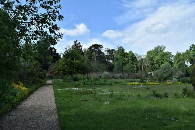
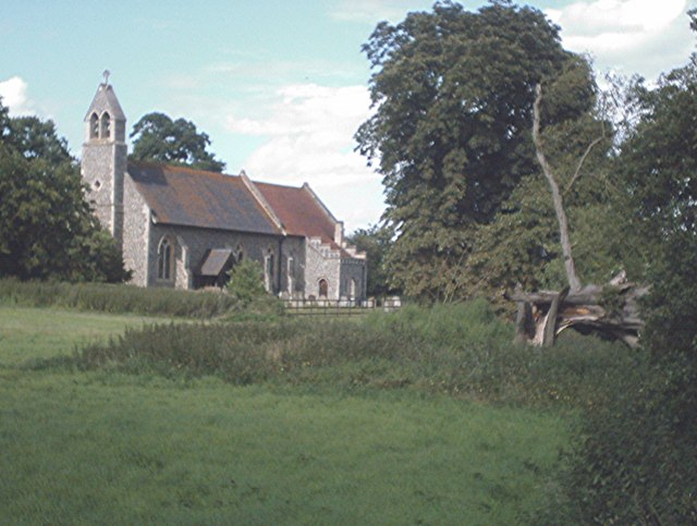
Stock Hill Images

Images are sourced within 2km of 52.283821/0.88670516 or Grid Reference TL9769. Thanks to Geograph Open Source API. All images are credited.

The Walled Garden, Langham Hall
Power Lines North of Badwell Ash
Power Lines
North of Badwell Ash
The road to Langham The road briefly splits here going over a  signed "Weak Bridge" to the left and a lower culvert/ford to the right. If "ford" it is, I have never seen water flowing over it.
The road to Langham
The road briefly splits here going over a signed "Weak Bridge" to the left and a lower culvert/ford to the right. If "ford" it is, I have never seen water flowing over it.
Church of St Mary, Badwell Ash <span class="nowrap"><a title="https://historicengland.org.uk/listing/the-list/list-entry/1032210?section=official-list-entry" rel="nofollow ugc noopener" href="https://historicengland.org.uk/listing/the-list/list-entry/1032210?section=official-list-entry">Link</a><img style="margin-left:2px;" alt="External link" title="External link - shift click to open in new window" src="https://s1.geograph.org.uk/img/external.png" width="10" height="10"/></span>
Church of St Mary, Badwell Ash
Vineyard at Wyken Hall The seven-acre vineyard was planted in 1988; it produced its first vintage in 1991.  Wyken Vineyard is well-established and recognised as producing some of the best of the English wines.
Vineyard at Wyken Hall
The seven-acre vineyard was planted in 1988; it produced its first vintage in 1991. Wyken Vineyard is well-established and recognised as producing some of the best of the English wines.
Farmland at Langham Looking north across a stubble field towards Hillwatering Farm.
Farmland at Langham
Looking north across a stubble field towards Hillwatering Farm.
Minor road and farmland near Badwell Ash This unfenced road leads across flat farmland, where a wide grassy margin has been retained, in keeping with Defra's Countryside Stewardship Scheme.
Minor road and farmland near Badwell Ash
This unfenced road leads across flat farmland, where a wide grassy margin has been retained, in keeping with Defra's Countryside Stewardship Scheme.
Country Footpath
Country Footpath
Pond Pond next to minor road near to Langham, Suffolk.
Pond
Pond next to minor road near to Langham, Suffolk.
18th century almshouses by Stowlangtoft church
A farm track by Street Farm
The Street, Hunston View looking west towards Rose Cottage
The Street, Hunston
View looking west towards Rose Cottage
The Street, Hunston Unfortunately the bright red K6 Giles Gilbert Scott telephone box was vandalised and replaced by this modern affair.
The Street, Hunston
Unfortunately the bright red K6 Giles Gilbert Scott telephone box was vandalised and replaced by this modern affair.
View towards Hunston from Langham Hills The ground gently slopes down to the valley of the quiet hamlet of Hunston
View towards Hunston from Langham Hills
The ground gently slopes down to the valley of the quiet hamlet of Hunston
Maize near Hunston This hardy maize is not for the jolly green giant but provides cover and feed for game birds. The footpath through the maize provides a welcome relief from the heavy Suffolk clay.
Maize near Hunston
This hardy maize is not for the jolly green giant but provides cover and feed for game birds. The footpath through the maize provides a welcome relief from the heavy Suffolk clay.
Part of Kiln Lane
Part of Kiln Lane
Track through Kiln Plantation One of a number of small patches of mixed woodland north of Stowlangtoft
Track through Kiln Plantation
One of a number of small patches of mixed woodland north of Stowlangtoft
Stowlangtoft Water Tower North of Kiln Farm
Stowlangtoft Water Tower
North of Kiln Farm
Show me another place!

Stock Hill is located at Grid Ref: TL9769 (Lat: 52.283821, Lng: 0.88670516)

Administrative County: Suffolk

District: Mid Suffolk

Police Authority: Suffolk

What 3 Words

///skinny.stapled.plantings. Near Ixworth, Suffolk

Related Wikis

Hunston, Suffolk

Hunston is a small Suffolk village and civil parish set in a conservation area of Mid-Suffolk and lies between Stowlangtoft and Badwell Ash off the A1088...

Stowlangtoft

Stowlangtoft is a village and civil parish in the Mid Suffolk district of Suffolk in eastern England two miles south-east from Ixworth. Located around...

Langham, Suffolk

Langham is a village and civil parish in the Mid Suffolk district of Suffolk in eastern England. Located around seven miles north east of Bury St Edmunds...

Badwell Ash

Badwell Ash is a village and civil parish in the Mid Suffolk district of Suffolk, England, near Bury St Edmunds and Stowmarket. According to Eilert Ekwall...

Great Ashfield Castle

Great Ashfield Castle, also known locally as Castle Hill, is a medieval motte and bailey castle near the village of Great Ashfield, Suffolk, England....

Stanton Woods

Stanton Woods is a 66.1-hectare (163-acre) biological Site of Special Scientific Interest south of Stanton in Suffolk.The site consists of several ancient...

The Gardens, Great Ashfield

The Gardens, Great Ashfield is a 3.8-hectare (9.4-acre) biological Site of Special Scientific Interest north of Great Ashfield in Suffolk.These ancient...

Mickle Mere

Mickle Mere is a 17 hectare nature reserve south of Ixworth in Suffolk. It is managed by the Suffolk Wildlife Trust.This area of open water and wet meadows...

Have you been to Stock Hill?

Leave your review of Stock Hill below (or comments, questions and feedback).