Bodrida

Settlement in Anglesey

Wales

Bodrida

Wal gerrig ger Gaerwen / Stone wall near Gaerwen
Wal gerrig ger Gaerwen / Stone wall near Gaerwen Credit: Ceri Thomas

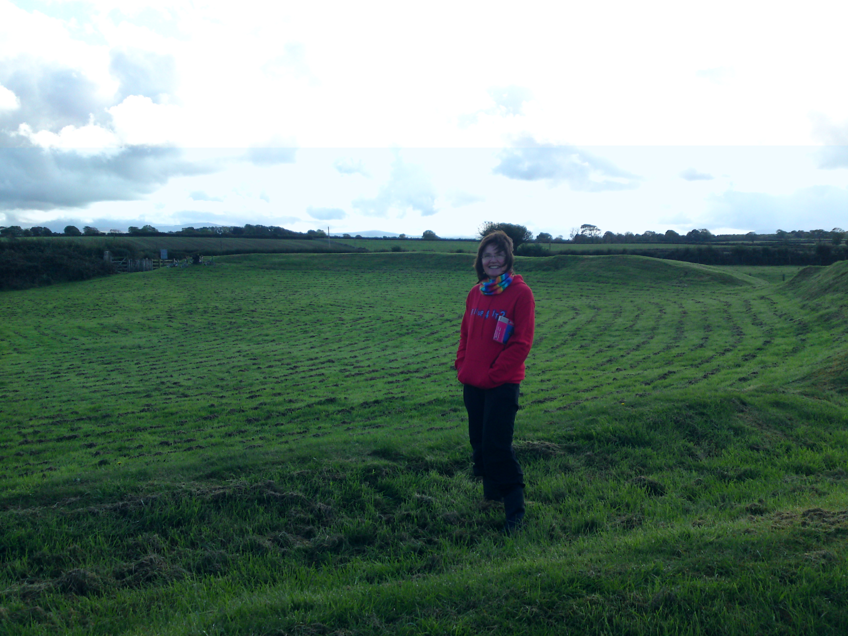
Bodrida is a small village located on the Isle of Anglesey, off the northwest coast of Wales. Situated in the community of Llanidan, Bodrida is nestled in a picturesque rural landscape characterized by rolling hills, lush green fields, and a tranquil atmosphere.

The village itself is home to a close-knit community comprising mainly of locals who have lived here for generations. It has a population of around 200 residents, giving it a cozy and intimate feel. The village is predominantly residential, with a scattering of traditional stone cottages and a few small farms.

Bodrida enjoys a peaceful and idyllic setting, making it a popular destination for those seeking a tranquil retreat away from the hustle and bustle of city life. The village is surrounded by beautiful countryside, offering ample opportunities for outdoor activities such as hiking, cycling, and birdwatching.

Despite its small size, Bodrida benefits from its proximity to nearby towns and amenities. The larger town of Llangefni is just a short drive away, providing residents with access to supermarkets, shops, schools, and healthcare facilities.

In terms of attractions, Bodrida is known for its natural beauty and charming rural setting. Visitors can explore the nearby Malltraeth Estuary, a stunning nature reserve renowned for its diverse wildlife and breathtaking views. Additionally, the village is within easy reach of Anglesey's stunning coastline, with its sandy beaches and rugged cliffs.

Overall, Bodrida offers a peaceful and picturesque setting, making it an ideal place for nature lovers and those seeking a serene lifestyle.

If you have any feedback on the listing, please let us know in the comments section below.

Bodrida Images

Images are sourced within 2km of 53.183537/-4.299245 or Grid Reference SH4667. Thanks to Geograph Open Source API. All images are credited.

Wal gerrig ger Gaerwen / Stone wall near Gaerwen
Pont Mynach
Pont Mynach
Plac ar Bont Mynach / Plaque on Pont Mynach The date of 1854 is just legible, but it is impossible to make out the top row apart from the final letter 'T'.  Possibly refers to the name of the stream (Braint)?
Plac ar Bont Mynach / Plaque on Pont Mynach
The date of 1854 is just legible, but it is impossible to make out the top row apart from the final letter 'T'. Possibly refers to the name of the stream (Braint)?
Cefn Maesoglan
Cefn Maesoglan
Gwartheg yn croesi / Cattle crossing
Adwy anrhydeddus / A charming field entrance
Siambr gladdu Bodowyr / Bodowyr burial chamber
Siambr gladdu Bodowyr / Bodowyr burial chamber (2)
Melin Bodowyr
Melin Bodowyr
Llys Lew Farm
Llys Lew Farm
Bryn Gwyn Prehistoric Stone Circle Only two of the original stones remain standing. Another six are known from archaeological excavation <span class="nowrap"><a title="https://www.megalithic.co.uk/article.php?sid=716" rel="nofollow ugc noopener" href="https://www.megalithic.co.uk/article.php?sid=716">Link</a><img style="margin-left:2px;" alt="External link" title="External link - shift click to open in new window" src="https://s1.geograph.org.uk/img/external.png" width="10" height="10"/></span>
Bryn Gwyn Prehistoric Stone Circle
Only two of the original stones remain standing. Another six are known from archaeological excavation LinkExternal link
Castell Bryn-Gwyn Henge A henge converted in the Iron Age or Roman period into a small hillfort <span class="nowrap"><a title="https://www.megalithic.co.uk/article.php?sid=5956" rel="nofollow ugc noopener" href="https://www.megalithic.co.uk/article.php?sid=5956">Link</a><img style="margin-left:2px;" alt="External link" title="External link - shift click to open in new window" src="https://s1.geograph.org.uk/img/external.png" width="10" height="10"/></span>
Castell Bryn-Gwyn Henge
A henge converted in the Iron Age or Roman period into a small hillfort LinkExternal link
Caer Leb Romano-British Defended Settlement <span class="nowrap"><a title="https://www.megalithic.co.uk/article.php?sid=8380" rel="nofollow ugc noopener" href="https://www.megalithic.co.uk/article.php?sid=8380">Link</a><img style="margin-left:2px;" alt="External link" title="External link - shift click to open in new window" src="https://s1.geograph.org.uk/img/external.png" width="10" height="10"/></span>
Caer Leb Romano-British Defended Settlement
Stryd Fawr (High Street), Brynsiencyn The A4080 road runs for 24½ miles along the southwestern side of Anglesey. It starts on the A5 at Llanfair Pwllgwyngyll and passes through several villages before terminating on the A5 between Bryngwran and Gwalchmai.
Stryd Fawr (High Street), Brynsiencyn
The A4080 road runs for 24½ miles along the southwestern side of Anglesey. It starts on the A5 at Llanfair Pwllgwyngyll and passes through several villages before terminating on the A5 between Bryngwran and Gwalchmai.
A4080 near Caer Leb The A4080 road runs for 24½ miles along the southwestern side of Anglesey. It starts on the A5 at Llanfair Pwllgwyngyll and passes through several villages before terminating on the A5 between Bryngwran and Gwalchmai.
A4080 near Caer Leb
The A4080 road runs for 24½ miles along the southwestern side of Anglesey. It starts on the A5 at Llanfair Pwllgwyngyll and passes through several villages before terminating on the A5 between Bryngwran and Gwalchmai.
A4080 near Brynsiencyn The A4080 road runs for 24½ miles along the southwestern side of Anglesey. It starts on the A5 at Llanfair Pwllgwyngyll and passes through several villages before terminating on the A5 between Bryngwran and Gwalchmai.
A4080 near Brynsiencyn
The A4080 road runs for 24½ miles along the southwestern side of Anglesey. It starts on the A5 at Llanfair Pwllgwyngyll and passes through several villages before terminating on the A5 between Bryngwran and Gwalchmai.
A4080 near Bryngwyn-mawr The A4080 road runs for 24½ miles along the southwestern side of Anglesey. It starts on the A5 at Llanfair Pwllgwyngyll and passes through several villages before terminating on the A5 between Bryngwran and Gwalchmai.
A4080 near Bryngwyn-mawr
The A4080 road runs for 24½ miles along the southwestern side of Anglesey. It starts on the A5 at Llanfair Pwllgwyngyll and passes through several villages before terminating on the A5 between Bryngwran and Gwalchmai.
A4080 near Maen Hir The A4080 road runs for 24½ miles along the southwestern side of Anglesey. It starts on the A5 at Llanfair Pwllgwyngyll and passes through several villages before terminating on the A5 between Bryngwran and Gwalchmai.
A4080 near Maen Hir
The A4080 road runs for 24½ miles along the southwestern side of Anglesey. It starts on the A5 at Llanfair Pwllgwyngyll and passes through several villages before terminating on the A5 between Bryngwran and Gwalchmai.
Show me another place!

Bodrida is located at Grid Ref: SH4667 (Lat: 53.183537, Lng: -4.299245)

Unitary Authority: Isle of Anglesey

Police Authority: North Wales

What 3 Words

///crunched.hopeless.explorer. Near Gaerwen, Isle of Anglesey

Related Wikis

Bodrida

Bodrida is an insular hamlet in the community of Rhosyr, Anglesey, Wales, which is 126 miles (203 km) from Cardiff and 210 miles (340 km) from London....

Bodowyr

Bodowyr Burial Chamber is a Neolithic burial chamber made of a few large stacked stones (also known as a dolmen or a passage grave) in a farmer's field...

Castell Bryn Gwyn

Castell Bryn Gwyn is a prehistoric site on the Isle of Anglesey, west of Brynsiencyn. It is a circular clay and gravel bank covered with grass, still some...
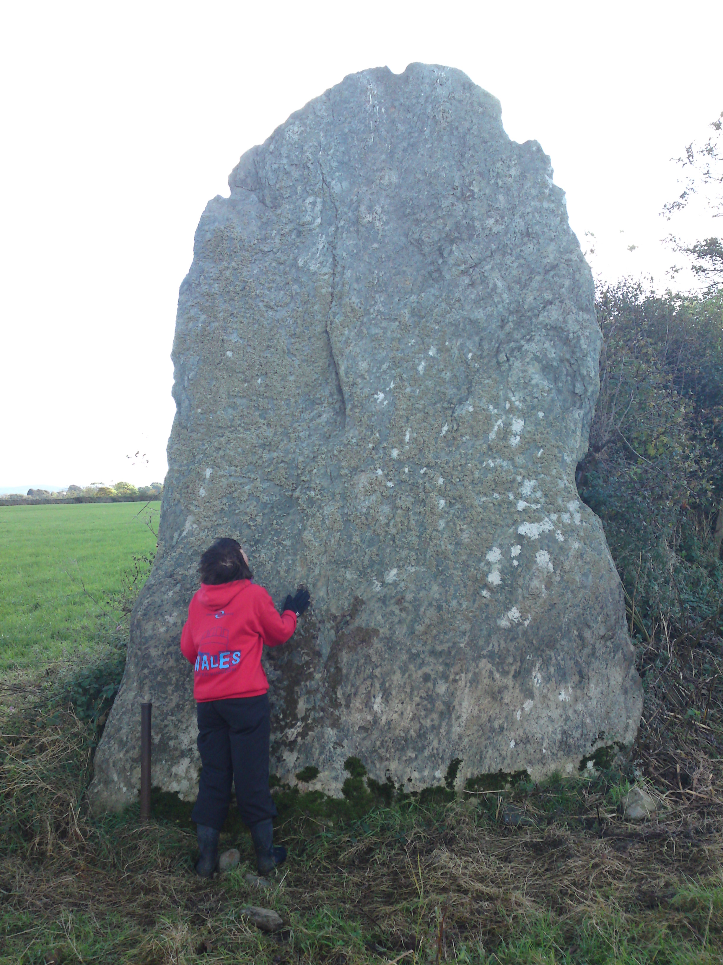
Bryn Gwyn stones

The Bryn Gwyn Stones (Welsh: Cerrig Bryn Gwyn) or Bryn Gwyn Standing Stones are neolithic stones in Brynsiencyn on Anglesey. == Description and History... ==

Caer Lêb

Caer Lêb is a Roman and mediaeval site on the Welsh island of Anglesey, west of Brynsiencyn. Its name means "Leaven Castle". It is a low-lying site near...

Perthi-Duon Burial Chamber

Perthi-Duon Burial Chamber is a Neolithic dolmen located to the west of Brynsiencyn, Anglesey, Wales. == Description == The monument is a collapsed burial...

Llanidan

Llanidan is a community in the south of Anglesey, Wales which includes the village of Brynsiencyn (). The parish is along the Menai Strait, about 4 miles...

Llanfair-y-Cwmwd

Llanfair-y-Cwmwd (or Llanfair-yn-y-Cwmwd) is a village in the community of Rhosyr, Anglesey, Wales, which is 126.5 miles (203.5 km) from Cardiff and 211...

Nearby Amenities

Located within 500m of 53.183537,-4.299245
Power: pole
Source: Bing
Lat/Long: 53.185849/-4.3036351
Power: pole
Lat/Long: 53.1857808/-4.3018055
Power: pole
Lat/Long: 53.1857308/-4.3005738
Power: pole
Lat/Long: 53.1856974/-4.299509
Power: pole
Lat/Long: 53.1856543/-4.2983933
Power: pole
Lat/Long: 53.1856071/-4.297303
Power: pole
Lat/Long: 53.1855793/-4.2962662
Power: pole
Lat/Long: 53.1855445/-4.295162
Power: pole
Lat/Long: 53.1854639/-4.293863
Power: pole
Lat/Long: 53.1854041/-4.2928168
Power: pole
Lat/Long: 53.1803525/-4.2941095
Power: pole
Lat/Long: 53.1798664/-4.2958594
Direction: SSW
Generator Method: photovoltaic
Generator Output Electricity: yes
Generator Solar Modules: 17
Generator Source: solar
Generator Type: solar_photovoltaic_panel
Location: roof
Power: generator
Lat/Long: 53.1828166/-4.3003146
The data included in this document is from www.openstreetmap.org. The data is made available under ODbL.

Have you been to Bodrida?

Leave your review of Bodrida below (or comments, questions and feedback).