Steart
Settlement in Somerset Sedgemoor
England
Steart

Steart is a small village located in the county of Somerset, England. Situated on the Bristol Channel coast, it is part of the Sedgemoor district and lies within the administrative authority of the parish of Otterhampton. With a population of around 200 residents, Steart is a peaceful and picturesque rural community.
The village is known for its stunning natural beauty, characterized by vast stretches of marshland and mudflats. Steart Marshes, a 500-hectare nature reserve, is one of the key attractions in the area. This wetland habitat provides a haven for a variety of bird species, making it a popular destination for birdwatching enthusiasts.
Steart has a rich history, dating back to medieval times. The village features a number of well-preserved historic buildings, such as St. Andrew's Church, which dates back to the 12th century. The church is renowned for its beautiful stained glass windows and ornate architecture.
Despite its small size, Steart offers a range of amenities for residents and visitors alike. The village has a community hall, a primary school, and a pub, providing a focal point for locals to socialize and connect. It also boasts a small but vibrant arts and crafts scene, with several local artists showcasing their work in the area.
Steart's tranquil setting and natural surroundings make it an idyllic place for outdoor activities such as hiking, cycling, and wildlife spotting. Its proximity to the nearby Quantock Hills and Exmoor National Park further enhances its appeal to nature lovers and outdoor enthusiasts. Overall, Steart is a charming village that offers a peaceful retreat and a chance to immerse oneself in the beauty of Somerset's countryside.
If you have any feedback on the listing, please let us know in the comments section below.
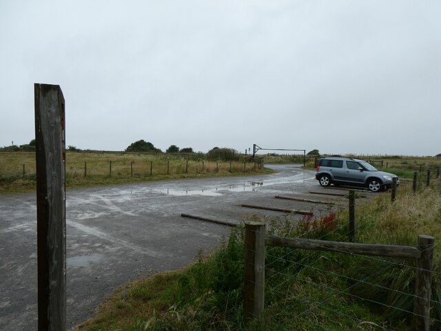
Steart Images
Images are sourced within 2km of 51.207338/-3.04211 or Grid Reference ST2745. Thanks to Geograph Open Source API. All images are credited.


Steart is located at Grid Ref: ST2745 (Lat: 51.207338, Lng: -3.04211)
Administrative County: Somerset
District: Sedgemoor
Police Authority: Avon and Somerset
What 3 Words
///afternoon.regulator.texted. Near Huntspill, Somerset
Nearby Locations
Related Wikis

Steart
Steart (pronounced Ste-art), historically also called Stert, is a small village in Somerset, England. It lies in an isolated position on the Steart Peninsula...

St Andrew's Church, Steart
St Andrew's Church is a Church of England church in Steart, Somerset, England. The church, which was built in 1882, is now used for services periodically...

Steart Peninsula
The Steart Peninsula (grid reference ST274459) is a peninsula in Somerset, England. At its outermost tip is Fenning Island (now joined to the mainland...
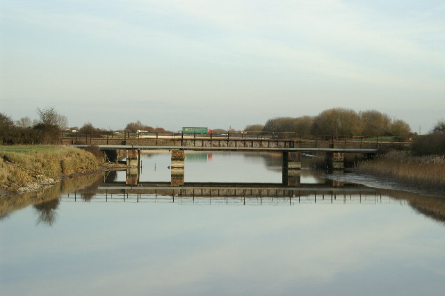
River Huntspill
The River Huntspill (or Huntspill River) is an artificial river, in the Somerset Levels, in the Sedgemoor district of Somerset, England. It was built in...

Stert Island
Stert Island is a low-lying uninhabited island in the Bristol Channel, off the coast of Somerset, England. It lies opposite Burnham-on-Sea, and is part...

River Brue
The River Brue originates in the parish of Brewham in Somerset, England, and reaches the sea some 50 kilometres (31 mi) west at Burnham-on-Sea. It originally...

River Parrett
The River Parrett flows through the counties of Dorset and Somerset in South West England, from its source in the Thorney Mills springs in the hills around...

West Huntspill
West Huntspill is a settlement and civil parish about 5 miles from Bridgwater, in the county of Somerset, England. The parish includes the village of...
Nearby Amenities
Located within 500m of 51.207338,-3.04211Have you been to Steart?
Leave your review of Steart below (or comments, questions and feedback).