Bodilly
Settlement in Cornwall
England
Bodilly
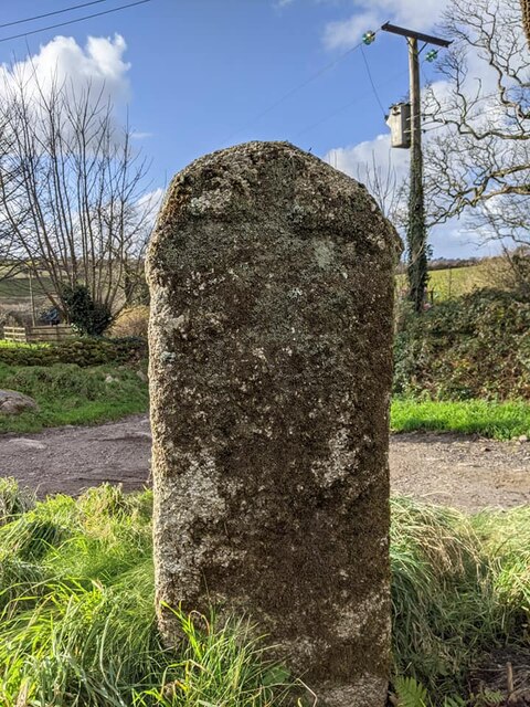
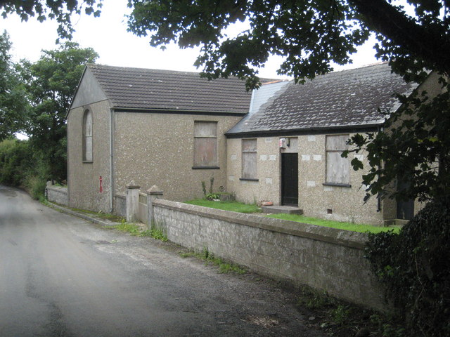
![Old Boundary Marker at Lower Prospidnick, Sithney parish Estate Boundary Marker on the north side of the road at Lower Prospidnick beside stone steps to a converted barn. Sithney parish. Inscribed LP (Lower Prospidnick) and HP (Higher Prospidnick) on adjacent faces. Assumed to have been moved as Higher Prospidnick is at [SW6387731897].
Milestone Society National ID: CW_SITH02em](https://s0.geograph.org.uk/geophotos/06/96/11/6961192_e4814326.jpg)
Bodilly is a small village located in the county of Cornwall, in the southwestern part of England. Situated in a rural area, it is surrounded by picturesque landscapes and natural beauty. The village is part of the wider civil parish of St. Erth, within the administrative district of Penwith.
Bodilly is characterized by its charming and traditional Cornish architecture, with stone houses and thatched roofs dotting the landscape. The village exudes a peaceful and serene atmosphere, making it an ideal destination for those seeking a tranquil retreat away from the bustling city life.
Although a small village, Bodilly has a close-knit community, with friendly and welcoming locals. The village has a few amenities, including a local pub, a village hall, and a small church, which serves as a focal point for social gatherings and community events.
Surrounded by rolling hills and fields, Bodilly offers numerous opportunities for outdoor activities. The region is known for its scenic walking trails and cycling routes, allowing visitors to explore the beautiful countryside. Additionally, the nearby coast provides access to stunning beaches and opportunities for water sports and leisure activities.
Bodilly's location also makes it a great base for exploring the wider Cornwall region. It is within close proximity to popular tourist destinations such as St. Ives, Penzance, and Land's End, which offer a variety of cultural attractions, historical sites, and stunning coastal scenery.
Overall, Bodilly offers a charming and peaceful village experience, with its idyllic setting and friendly community making it a delightful place to visit or reside in Cornwall.
If you have any feedback on the listing, please let us know in the comments section below.
Bodilly Images
Images are sourced within 2km of 50.141798/-5.2763065 or Grid Reference SW6632. Thanks to Geograph Open Source API. All images are credited.

Bodilly is located at Grid Ref: SW6632 (Lat: 50.141798, Lng: -5.2763065)
Unitary Authority: Cornwall
Police Authority: Devon and Cornwall
What 3 Words
///earplugs.commended.snapping. Near Wendron, Cornwall
Nearby Locations
Related Wikis
Releath
Releath (Cornish: Reslegh) is a hamlet southwest of Burras in west Cornwall, England. == References ==

Bodilly
Bodilly is a hamlet in south Cornwall, England, United Kingdom, that lends its name to neighbouring farms and settlements. It is situated in the civil...
Boscadjack
Boscadjack is an area of high ground in west Cornwall, England, United Kingdom, which gives its name to two farming settlements. The area lies to the west...

Prospidnick
Prospidnick is a small village and hill in the parish of Sithney in Cornwall, United Kingdom. It lies 0.6 miles east of Crowntown and 2.6 miles west of...
Nearby Amenities
Located within 500m of 50.141798,-5.2763065Have you been to Bodilly?
Leave your review of Bodilly below (or comments, questions and feedback).