Stanwell

Settlement in Middlesex Spelthorne

England

Stanwell

Terminal 5, Heathrow British Airways plane parked at terminal 5, Heathrow airport.
Terminal 5, Heathrow Credit: Alan Hughes

Stanwell is a small village located in the Spelthorne borough of Surrey, England. Situated in the county of Middlesex, it lies approximately 16 miles southwest of central London and is surrounded by the towns of Staines-upon-Thames, Ashford, and Feltham.

With a population of around 8,000 residents, Stanwell offers a peaceful and close-knit community atmosphere. The village is known for its picturesque surroundings, with the River Colne and Stanwell Moor providing scenic landscapes for residents and visitors alike. Additionally, nearby Stanwell Moor offers a nature reserve, providing opportunities for outdoor activities and wildlife observation.

Stanwell boasts a rich history, with archaeological evidence suggesting human habitation in the area as far back as the Iron Age. The village was mentioned in the Domesday Book of 1086, and its historical landmarks include the St. Mary's Church, which dates back to the 12th century.

Despite its small size, Stanwell offers various amenities and facilities to its residents. These include primary schools, local shops, restaurants, and recreational spaces such as parks and sports facilities. The village benefits from excellent transport links, with easy access to the M25 motorway and proximity to Heathrow Airport, making it a popular residential choice for commuters and airport employees.

Overall, Stanwell is a charming village that combines historical significance, natural beauty, and convenient location, making it an appealing place to live and visit in Middlesex.

If you have any feedback on the listing, please let us know in the comments section below.

Stanwell Images

Images are sourced within 2km of 51.455798/-0.480797 or Grid Reference TQ0574. Thanks to Geograph Open Source API. All images are credited.

Terminal 5, Heathrow British Airways plane parked at terminal 5, Heathrow airport.
Terminal 5, Heathrow
British Airways plane parked at terminal 5, Heathrow airport.
Staines Reservoir A view of the Staines Reservoirs in Surrey looking west along the causeway with the north and south basins either side.
Staines Reservoir
A view of the Staines Reservoirs in Surrey looking west along the causeway with the north and south basins either side.
Footpath between Roads A view of a cut through footpath between Town Lane and Diamedes Avenue in Stanwell in Surrey just east of the Staines Reservoirs.
Footpath between Roads
A view of a cut through footpath between Town Lane and Diamedes Avenue in Stanwell in Surrey just east of the Staines Reservoirs.
Staines Reservoir A view along the causeway of the Staines Reservoirs in Surrey looking west with the twin water towers visible at the end. The north and south basins are on either side of the causeway.
Staines Reservoir
A view along the causeway of the Staines Reservoirs in Surrey looking west with the twin water towers visible at the end. The north and south basins are on either side of the causeway.
Staines Reservoir A view looking across the north basin of Staines Reservoir in Surrey towards the village of Stanwell and Heathrow Airport beyond.
Staines Reservoir
A view looking across the north basin of Staines Reservoir in Surrey towards the village of Stanwell and Heathrow Airport beyond.
Terminal 5, Heathrow Airport Looking towards the C gates from the B gates.
Terminal 5, Heathrow Airport
Looking towards the C gates from the B gates.
Heathrow Airport, Terminal 5 A plaza to the front of arrivals at Heathrow Terminal 5.
Heathrow Airport, Terminal 5
A plaza to the front of arrivals at Heathrow Terminal 5.
Heathrow Terminal 5 The main waiting area in Heathrow Terminal 5.
Heathrow Terminal 5
The main waiting area in Heathrow Terminal 5.
British Airways aircraft, London Heathrow Airport This sleek aircraft is probably a Boeing 777. It will have been pushed back from Terminal 5 out of shot to the right.
British Airways aircraft, London Heathrow Airport
This sleek aircraft is probably a Boeing 777. It will have been pushed back from Terminal 5 out of shot to the right.
Staines and King George VI Reservoirs Close to Heathrow Airport. There is public access to the Staines Reservoir causeway, making the area popular with birdwatchers.
Staines and King George VI Reservoirs
Close to Heathrow Airport. There is public access to the Staines Reservoir causeway, making the area popular with birdwatchers.
Heathrow Terminal 3
Heathrow Terminal 3
T5 at London Heathrow Airport The plane docking on the right has just landed and will be heading off to Berlin within 45 minutes.
T5 at London Heathrow Airport
The plane docking on the right has just landed and will be heading off to Berlin within 45 minutes.
Business Lounge at Heathrow T5
BA0776 flight to Stockholm at T5 Heathrow Airport This route is flown by Finnair, it takes around 2½ hours  from Heathrow Airport to Arlanda Airport.
BA0776 flight to Stockholm at T5 Heathrow Airport
This route is flown by Finnair, it takes around 2½ hours from Heathrow Airport to Arlanda Airport.
Planes at C Gates, T5 Heathrow Airport Taken from seat 4A on Finnair flight BA0776.
Planes at C Gates, T5 Heathrow Airport
Taken from seat 4A on Finnair flight BA0776.
Rubble revealed when the south reservoir was drained In the 1970s it was possible to fish in the reservoirs, the Civil Service Angling Association having the rights dating back many years. This photograph was taken around 1970.
Rubble revealed when the south reservoir was drained
In the 1970s it was possible to fish in the reservoirs, the Civil Service Angling Association having the rights dating back many years. This photograph was taken around 1970.
British Airways aircraft at Heathrow Terminal 5C
Check-in Area at Heathrow Terminal 5 The calm before the storm in the Departure Area
Check-in Area at Heathrow Terminal 5
The calm before the storm in the Departure Area
Show me another place!

Stanwell is located at Grid Ref: TQ0574 (Lat: 51.455798, Lng: -0.480797)

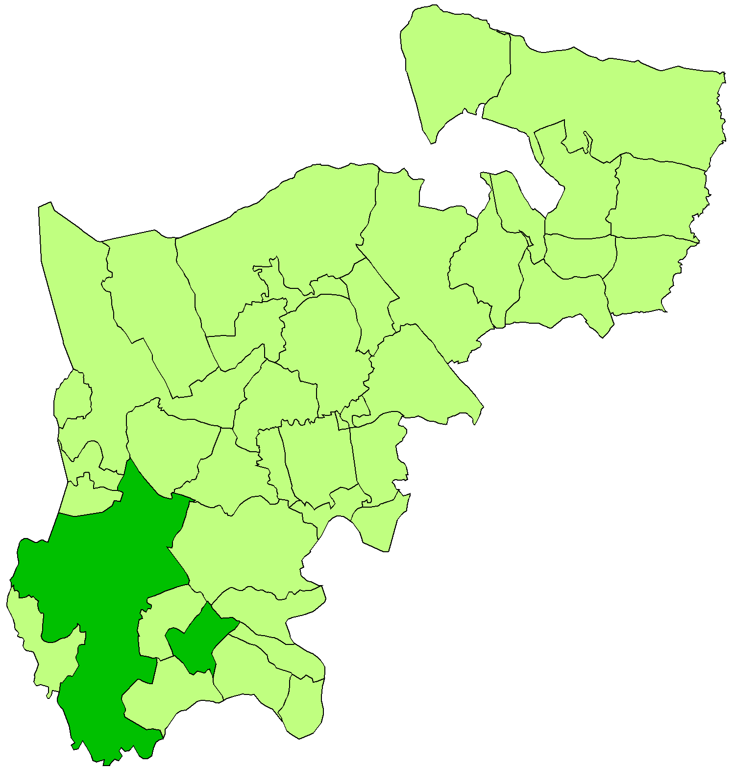
Administrative County: Surrey

District: Spelthorne

Police Authority: Surrey

What 3 Words

///wool.skinny.unrealistic. Near Ashford, Surrey

Nearby Locations

Stanwell

Related Wikis

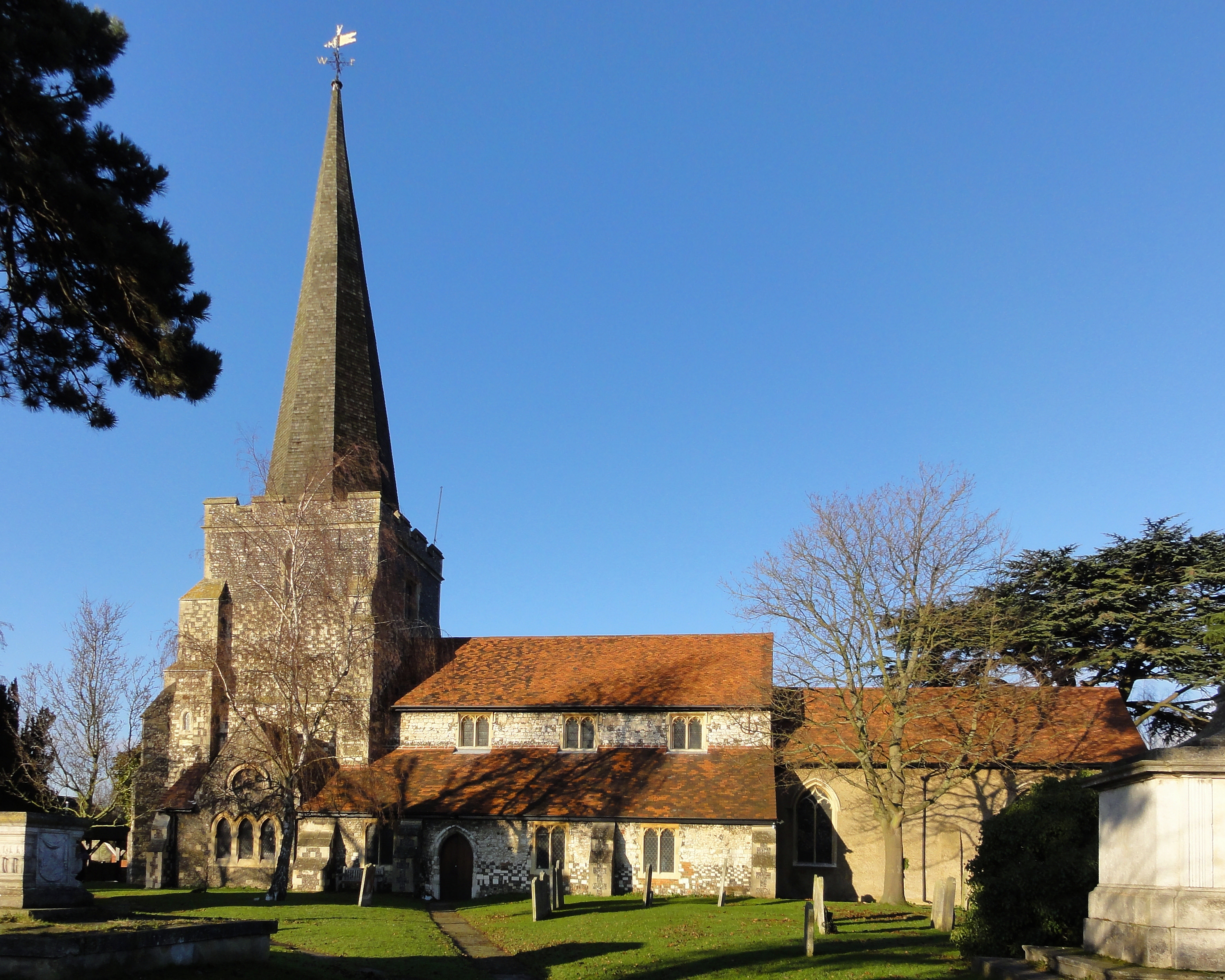
Church of St Mary, Stanwell

The Church of St Mary the Virgin, Stanwell, is a Church of England parish church in the village of Stanwell, Surrey. It dates to the 12th-century and is...

Stanwell

Stanwell is a village in the Borough of Spelthorne, Surrey, England. It is 16 miles (26 km) west of central London. A small corner of its land is used...

Staines Rural District

Staines Rural District was a rural district of Middlesex in England from 1894 to 1930. It was created in 1894 replacing the 1875-created Staines rural...
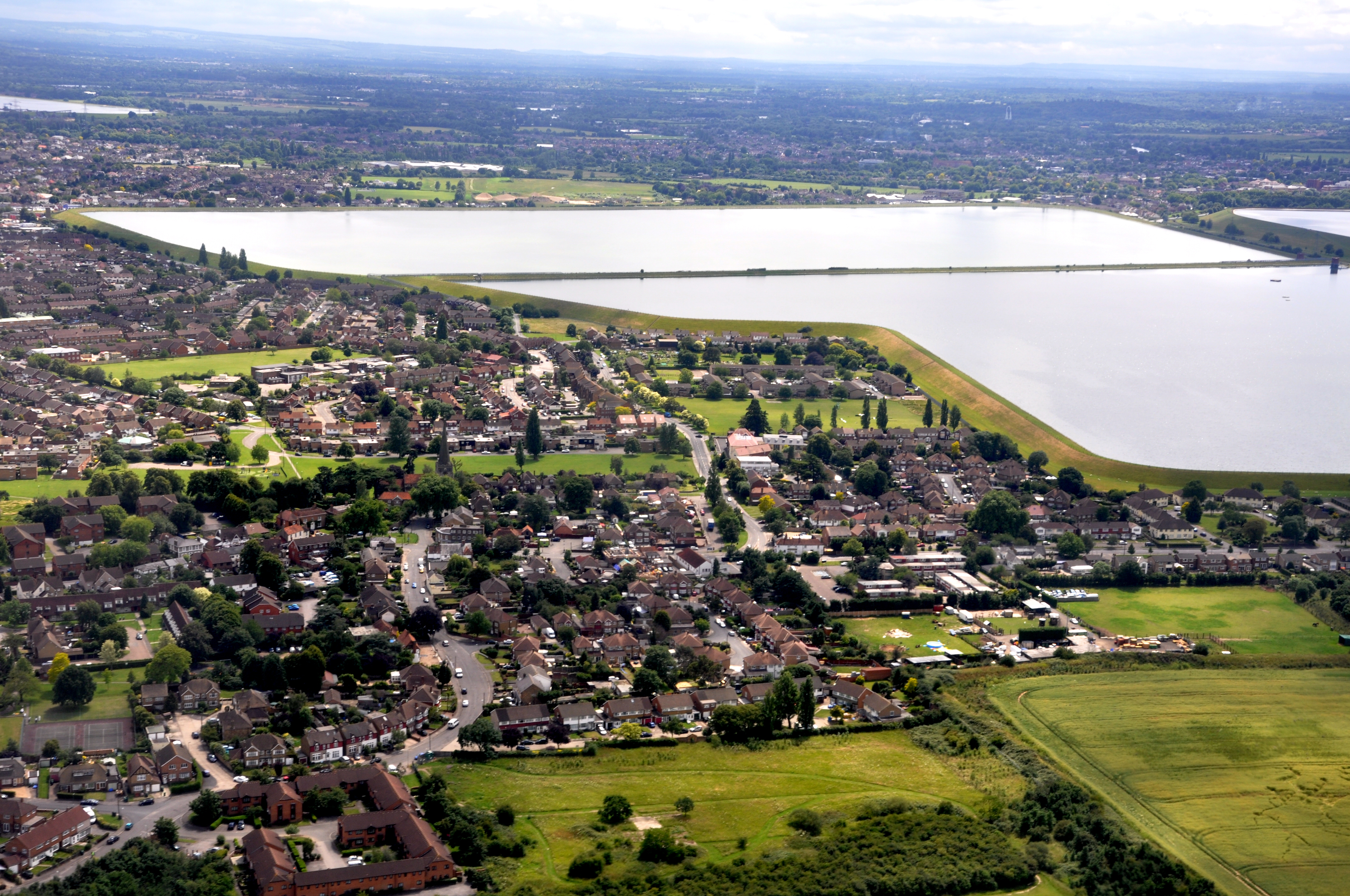
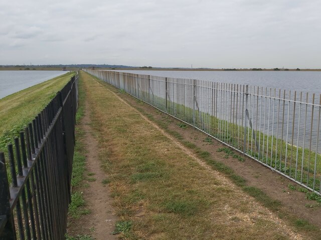
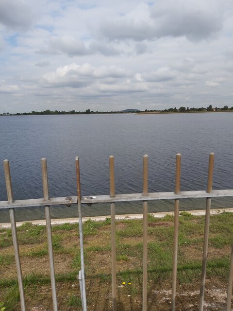
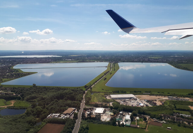
Staines Reservoirs

The Staines Reservoirs are two large pumped storage reservoirs sitting to the east of the King George VI Reservoir near Heathrow airport in Surrey within...

Nearby Amenities

Located within 500m of 51.455798,-0.480797
Stanwell
Place: village
Wikidata: Q3080673
Wikipedia: en:Stanwell
Lat/Long: 51.4544049/-0.4778216
Pub
The Wheatsheaf
Lat/Long: 51.4572131/-0.4822108
Turning Circle
Lat/Long: 51.456785/-0.48416
Turning Circle
Lat/Long: 51.4560391/-0.4841934
Turning Circle
Lat/Long: 51.4559493/-0.4835366
Post Box
Created By: Potlatch 0.9c
Lat/Long: 51.4574722/-0.4783825
Telephone
Booth: KX100
Covered: booth
Lat/Long: 51.4574049/-0.4801849
Post Office
Stanwell Post Office
Addr City: Staines-upon-Thames
Addr Housenumber: 53
Addr Postcode: TW19 7LJ
Addr Street: High Street
Addr Suburb: Stanwell
Opening Hours: Mo-Fr 09:00-17:30; Sa 09:00-13:00
Ref Pol Id: 19076
Website: https://www.postoffice.co.uk/branch-finder/1400258/stanwell
Lat/Long: 51.4574988/-0.4785331
Source: bing
Lat/Long: 51.457361/-0.480544
Saint Anne's Well
Created By: Potlatch 0.9c
Historic: well
Lat/Long: 51.4554352/-0.4819902
Turning Circle
Lat/Long: 51.456636/-0.4798909
Barrier: stile
Lat/Long: 51.4596184/-0.4793633
Turning Circle
Lat/Long: 51.4592545/-0.4766881
Turning Circle
Lat/Long: 51.4585487/-0.4774337
Bus Stop
Selwood Gardens
Naptan AtcoCode: 40004402003A
Naptan Bearing: W
Naptan CommonName: Selwood Gardens
Naptan Indicator: Just after
Naptan Landmark: Selwood Gardens
Naptan NaptanCode: surdagwa
Naptan Street: Park Road
Naptan Verified: no
Public Transport: platform
Source: naptan_import
Lat/Long: 51.4574276/-0.4863221
Bus Stop
Selwood Gardens
Naptan AtcoCode: 40004402003B
Naptan Bearing: E
Naptan CommonName: Selwood Gardens
Naptan Indicator: Opp
Naptan Landmark: Selwood Gardens
Naptan NaptanCode: surdajgm
Naptan Street: Park Road
Naptan Verified: no
Public Transport: platform
Source: naptan_import
Lat/Long: 51.4575058/-0.4851022
Bus Stop
Wheatsheaf
Naptan AtcoCode: 40004402004A
Naptan Bearing: N
Naptan CommonName: Wheatsheaf
Naptan Indicator: O/s
Naptan Landmark: The Swan / The Wheatsheaf
Naptan NaptanCode: surdajgp
Naptan Street: Town Lane
Naptan Verified: no
Public Transport: platform
Source: naptan_import
Lat/Long: 51.4572515/-0.4819902
Bus Stop
Wheatsheaf
Naptan AtcoCode: 40004402004B
Naptan Bearing: S
Naptan CommonName: Wheatsheaf
Naptan Indicator: Nr
Naptan Landmark: Wheatsheaf
Naptan NaptanCode: surdajma
Naptan Street: Town Lane
Naptan Verified: no
Public Transport: platform
Source: naptan_import
Lat/Long: 51.4571841/-0.4818444
Bus Stop
Wheatsheaf
Naptan AtcoCode: 40004402004C
Naptan Bearing: W
Naptan CommonName: Wheatsheaf
Naptan Indicator: Just after
Naptan Landmark: Swan
Naptan NaptanCode: surdajmw
Naptan Street: High Street
Naptan Verified: no
Public Transport: platform
Source: naptan_import
Lat/Long: 51.4573521/-0.4812366
Bus Stop
Wheatsheaf
Naptan AtcoCode: 40004402004D
Naptan Bearing: E
Naptan CommonName: Wheatsheaf
Naptan Indicator: Just Before
Naptan Landmark: Wheatsheaf
Naptan NaptanCode: surdajwg
Naptan Street: High Street
Naptan Verified: no
Public Transport: platform
Source: naptan_import
Lat/Long: 51.4573916/-0.4803603
Bus Stop
Medical Centre
Naptan AtcoCode: 40004402207A
Naptan Bearing: NW
Naptan CommonName: Medical Centre
Naptan Indicator: Just Before
Naptan Landmark: Stanwell Health Centre
Naptan NaptanCode: surdwpdg
Naptan Street: Hadrian Way
Naptan Verified: no
Public Transport: platform
Source: naptan_import
Lat/Long: 51.4538255/-0.4779086
Bus Stop
Medical Centre
Naptan AtcoCode: 40004402207B
Naptan Bearing: SE
Naptan CommonName: Medical Centre
Naptan Indicator: Just after
Naptan Landmark: Stanwell Health Centre
Naptan NaptanCode: surdwpdj
Naptan Street: Hadrian Way
Naptan Verified: no
Public Transport: platform
Source: naptan_import
Lat/Long: 51.4536203/-0.4774829
Bus Stop
St Marys Avenue
Naptan AtcoCode: 40004402214A
Naptan Bearing: E
Naptan CommonName: St Marys Avenue
Naptan Indicator: Opp
Naptan Landmark: St Marys Avenue
Naptan NaptanCode: surdwpgm
Naptan Street: St Marys Crescent
Naptan Verified: no
Public Transport: platform
Source: naptan_import
Lat/Long: 51.4546802/-0.481333
Bus Stop
St Marys Avenue
Naptan AtcoCode: 40004402214B
Naptan Bearing: W
Naptan CommonName: St Marys Avenue
Naptan Indicator: Just Before
Naptan Landmark: St Marys Avenue
Naptan NaptanCode: surdwpgp
Naptan Street: St Marys Crescent
Naptan Verified: no
Public Transport: platform
Source: naptan_import
Lat/Long: 51.4545685/-0.4816995
Bus Stop
Town Lane
Naptan AtcoCode: 40004402215A
Naptan Bearing: N
Naptan CommonName: Town Lane
Naptan Indicator: N-bound
Naptan Landmark: Town Lane
Naptan NaptanCode: surdwpgt
Naptan Street: Town Lane
Naptan Verified: no
Public Transport: platform
Source: naptan_import
Lat/Long: 51.4558296/-0.4822031
Bus Stop
Town Lane
Naptan AtcoCode: 40004402215B
Naptan Bearing: S
Naptan CommonName: Town Lane
Naptan Indicator: S-bound
Naptan Landmark: Town Lane
Naptan NaptanCode: surgtaga
Naptan Street: Town Lane
Naptan Verified: no
Public Transport: platform
Source: naptan_import
Lat/Long: 51.4559719/-0.4819888
Turning Circle
Lat/Long: 51.458277/-0.4748739
Turning Circle
Lat/Long: 51.4581061/-0.4810921
Turning Circle
Lat/Long: 51.4578597/-0.4865128
Turning Circle
Lat/Long: 51.4587488/-0.4811641
Mini Roundabout
Source: bing
Lat/Long: 51.4586697/-0.4756642
Turning Circle
Lat/Long: 51.455291/-0.4842859
Source: bing
Lat/Long: 51.4568211/-0.4864182
Londis
Brand: Londis
Brand Wikidata: Q21008564
Shop: convenience
Lat/Long: 51.4574731/-0.4784525
Pharmacy
Herman's Pharmacy
Dispensing: yes
Source: Local knowledge
Lat/Long: 51.4526876/-0.4768886
Library
Stanwell Library
Wikidata: Q61707369
Lat/Long: 51.4526041/-0.4768028
Doctors
St David's Family Practice
Opening Hours: Mo-Fr 08:30-18:30
Lat/Long: 51.4525539/-0.4769583
Speed Camera
Speed Camera
Maxspeed: 30 mph
Lat/Long: 51.4532271/-0.4820769
Nursing Home
Building: yes
Lat/Long: 51.4561507/-0.4756972
Direction: 175
Generator Method: photovoltaic
Generator Output Electricity: yes
Generator Solar Modules: 8
Generator Source: solar
Generator Type: solar_photovoltaic_panel
Location: roof
Power: generator
Lat/Long: 51.458079/-0.4821274
Direction: 170
Generator Method: photovoltaic
Generator Output Electricity: yes
Generator Solar Modules: 6
Generator Source: solar
Generator Type: solar_photovoltaic_panel
Location: roof
Power: generator
Lat/Long: 51.4577108/-0.4821159
Direction: 175
Generator Method: photovoltaic
Generator Output Electricity: yes
Generator Solar Modules: 8
Generator Source: solar
Generator Type: solar_photovoltaic_panel
Location: roof
Power: generator
Lat/Long: 51.4580786/-0.4820602
Direction: 175
Generator Method: photovoltaic
Generator Output Electricity: yes
Generator Solar Modules: 8
Generator Source: solar
Generator Type: solar_photovoltaic_panel
Location: roof
Power: generator
Lat/Long: 51.4580853/-0.4818101
Direction: 185
Generator Method: photovoltaic
Generator Output Electricity: yes
Generator Solar Modules: 6
Generator Source: solar
Generator Type: solar_photovoltaic_panel
Location: roof
Power: generator
Lat/Long: 51.457866/-0.4818794
Direction: 170
Generator Method: photovoltaic
Generator Output Electricity: yes
Generator Solar Modules: 6
Generator Source: solar
Generator Type: solar_photovoltaic_panel
Location: roof
Power: generator
Lat/Long: 51.4577342/-0.4818823
Direction: 170
Generator Method: photovoltaic
Generator Output Electricity: yes
Generator Solar Modules: 6
Generator Source: solar
Generator Type: solar_photovoltaic_panel
Location: roof
Power: generator
Lat/Long: 51.4577207/-0.4819985
Direction: 185
Generator Method: photovoltaic
Generator Output Electricity: yes
Generator Solar Modules: 12
Generator Source: solar
Generator Type: solar_photovoltaic_panel
Location: roof
Power: generator
Lat/Long: 51.456969/-0.4814559
Direction: 175
Generator Method: photovoltaic
Generator Output Electricity: yes
Generator Solar Modules: 8
Generator Source: solar
Generator Type: solar_photovoltaic_panel
Location: roof
Power: generator
Lat/Long: 51.4580835/-0.4819946
Direction: 175
Generator Method: photovoltaic
Generator Output Electricity: yes
Generator Solar Modules: 8
Generator Source: solar
Generator Type: solar_photovoltaic_panel
Location: roof
Power: generator
Lat/Long: 51.4580885/-0.4819346
Direction: 175
Generator Method: photovoltaic
Generator Output Electricity: yes
Generator Solar Modules: 8
Generator Source: solar
Generator Type: solar_photovoltaic_panel
Location: roof
Power: generator
Lat/Long: 51.458085/-0.4818769
Bench
Backrest: yes
Lat/Long: 51.4559226/-0.4790198
Bench
Backrest: yes
Lat/Long: 51.4559178/-0.4791379
Tactile Paving: yes
Lat/Long: 51.4575575/-0.4866965
Tactile Paving: yes
Lat/Long: 51.4575513/-0.4866257
Tactile Paving: yes
Lat/Long: 51.4575022/-0.4855747
Crossing
Bicycle: yes
Crossing: unmarked
Crossing Island: no
Traffic Calming: table
Lat/Long: 51.457554/-0.4866566
Tactile Paving: yes
Lat/Long: 51.4575022/-0.485471
Tactile Paving: yes
Lat/Long: 51.4574777/-0.4841871
Crossing
Bicycle: yes
Crossing: unmarked
Crossing Island: no
Traffic Calming: table
Lat/Long: 51.4575024/-0.4855201
Tactile Paving: yes
Lat/Long: 51.4574733/-0.4840995
Tactile Paving: yes
Lat/Long: 51.4574911/-0.4825831
Crossing
Bicycle: yes
Crossing: unmarked
Crossing Island: no
Traffic Calming: table
Lat/Long: 51.4574752/-0.4841368
Tactile Paving: yes
Lat/Long: 51.4574978/-0.4824919
Crossing
Bicycle: yes
Crossing: unmarked
Crossing Island: no
Lat/Long: 51.4574946/-0.4825311
Barrier: kerb
Kerb: flush
Lat/Long: 51.4564206/-0.4818287
Tactile Paving: yes
Lat/Long: 51.457386/-0.4813706
Crossing
Bicycle: yes
Crossing: unmarked
Crossing Island: no
Traffic Calming: table
Lat/Long: 51.457417/-0.4813636
Community Centre
Stanwell Village Hall
Community Centre: village_hall
Lat/Long: 51.4575643/-0.4813239
Tactile Paving: yes
Lat/Long: 51.4574436/-0.4813577
Kerb: flush
Tactile Paving: no
Lat/Long: 51.4574585/-0.4816137
Barrier: kerb
Kerb: flush
Lat/Long: 51.4572964/-0.4816288
Entrance: yes
Lat/Long: 51.4531497/-0.4793366
The data included in this document is from www.openstreetmap.org. The data is made available under ODbL.

Have you been to Stanwell?

Leave your review of Stanwell below (or comments, questions and feedback).