Stanhope

Settlement in Durham

England

Stanhope

Moor House beside B6278 Moor House is a small, deserted property beside the B6278 south of Stanhope. Scurfield House is partly hidden by the right hand tree.
Moor House beside B6278 Credit: Trevor Littlewood

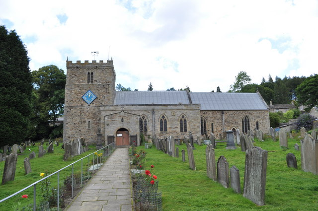
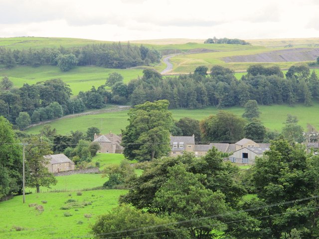
Stanhope is a charming village located in the county of Durham, England. Situated in the heart of the Durham Dales, this picturesque village is surrounded by stunning landscapes and offers residents and visitors a serene and idyllic setting.

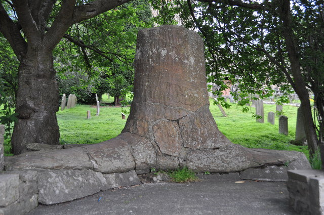
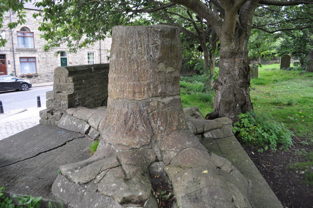
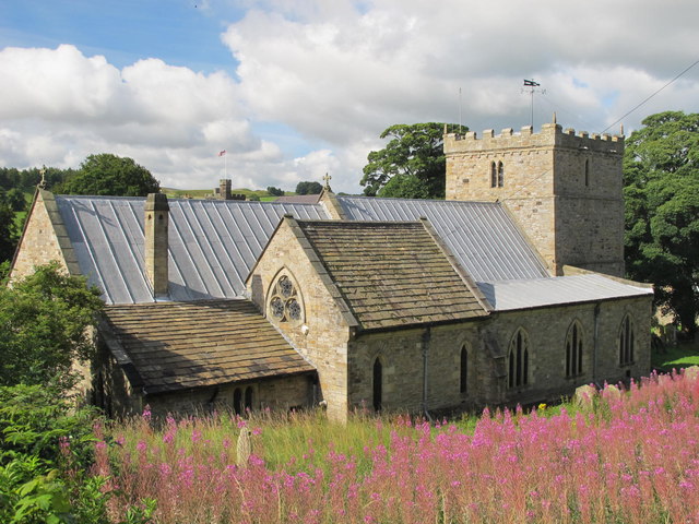
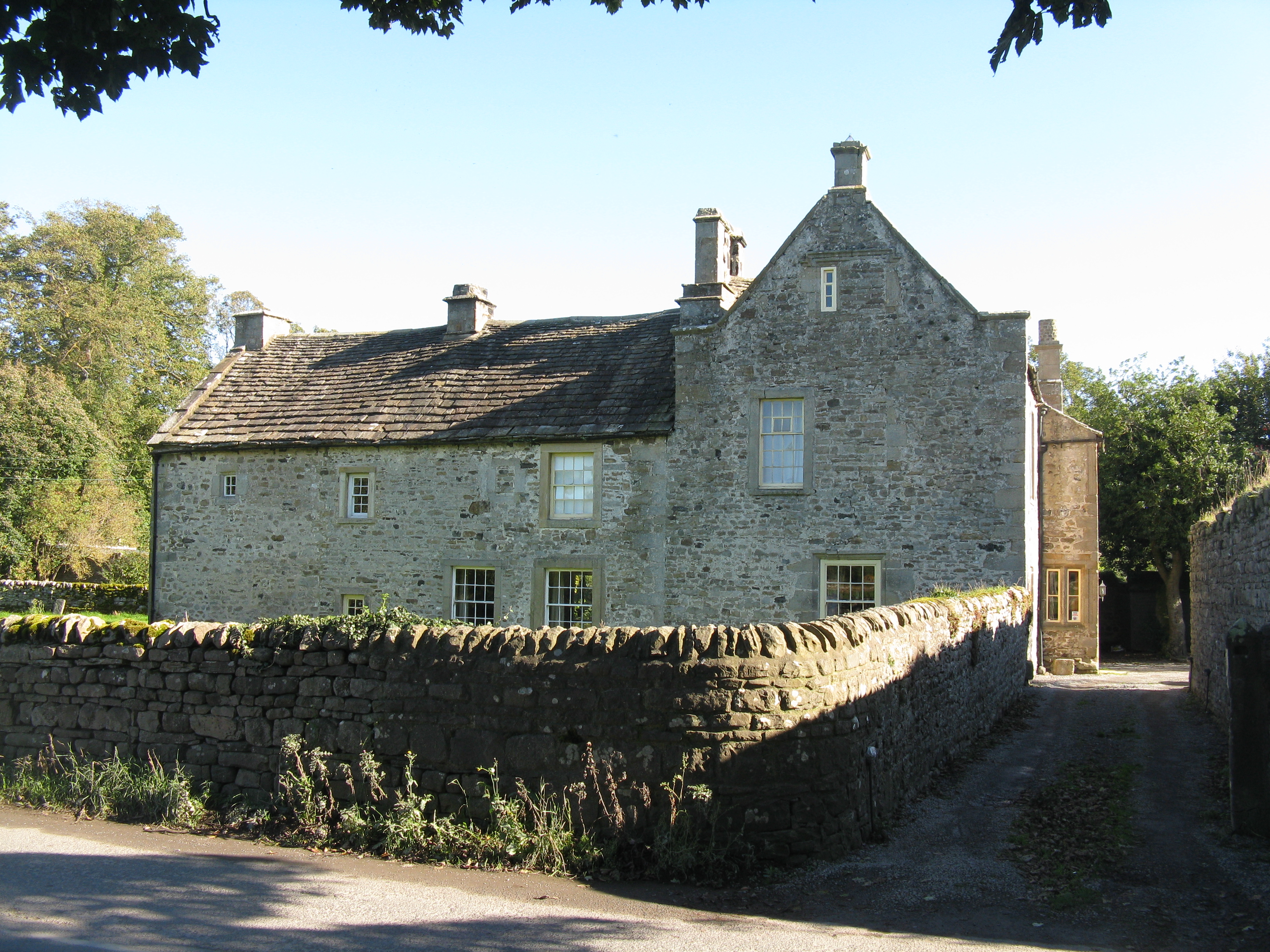
The village is known for its rich history, dating back to medieval times. One of the notable landmarks is Stanhope Castle, a 12th-century structure that has been beautifully preserved. The castle stands as a testament to the village's past and is a popular tourist attraction.

Stanhope is also famous for its vibrant market square, which serves as the center of community life. Here, locals and visitors can find a variety of quaint shops, cafes, and traditional pubs offering a warm and friendly atmosphere. The market square is also home to a weekly market, where fresh produce, local crafts, and other goods are sold.

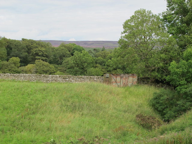
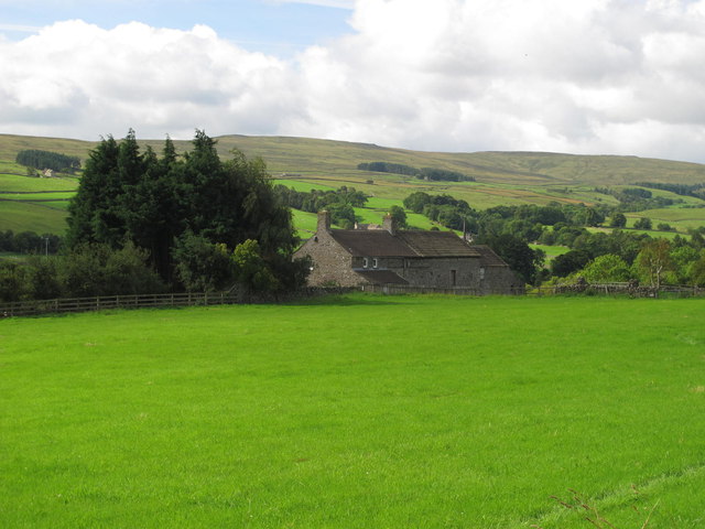
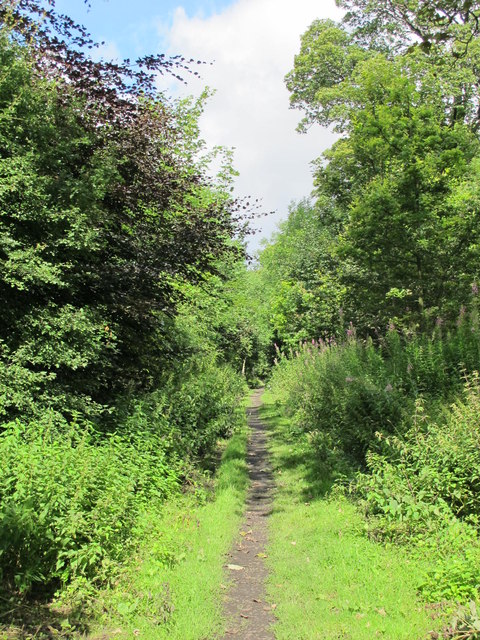
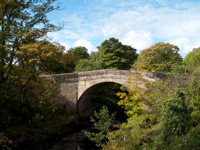
For nature enthusiasts, Stanhope offers access to stunning natural surroundings. The village is located on the edge of the North Pennines Area of Outstanding Natural Beauty, providing ample opportunities for outdoor activities such as hiking, cycling, and birdwatching. The nearby River Wear adds to the village's charm, with riverside walks offering peaceful moments of relaxation.

Stanhope is also a hub for cultural events, including the annual Stanhope Show, which showcases the area's agricultural heritage with livestock exhibitions, craft displays, and various entertainment options. The village's close-knit community actively participates in organizing and supporting these events, fostering a strong sense of community spirit.

Overall, Stanhope is a delightful village that combines history, natural beauty, and community spirit, making it a desirable destination for both residents and visitors seeking a tranquil and authentic English experience.

If you have any feedback on the listing, please let us know in the comments section below.

Stanhope Images

Images are sourced within 2km of 54.749087/-2.0117597 or Grid Reference NY9939. Thanks to Geograph Open Source API. All images are credited.

Moor House beside B6278 Moor House is a small, deserted property beside the B6278 south of Stanhope. Scurfield House is partly hidden by the right hand tree.
Moor House beside B6278
Moor House is a small, deserted property beside the B6278 south of Stanhope. Scurfield House is partly hidden by the right hand tree.
Stanhope Tree A preserved Sigillaria tree from the mid Carboniferous coal swamps. Instead of joining its coal friends it rotted away but was covered in sand which left a cast. <span class="nowrap"><a title="http://arthuride.files.wordpress.com/2010/12/sigillaria-tree1.jpg" rel="nofollow ugc noopener" href="http://arthuride.files.wordpress.com/2010/12/sigillaria-tree1.jpg">Link</a><img style="margin-left:2px;" alt="External link" title="External link - shift click to open in new window" src="https://s1.geograph.org.uk/img/external.png" width="10" height="10"/></span>

Preserved at a sand quarry it was brought here and erected in front of the church. The bark and root impressions are very good.
Stanhope Tree
A preserved Sigillaria tree from the mid Carboniferous coal swamps. Instead of joining its coal friends it rotted away but was covered in sand which left a cast. LinkExternal link Preserved at a sand quarry it was brought here and erected in front of the church. The bark and root impressions are very good.
St Thomas the Apostle Church, Stanhope The Church is an ancient structure, standing on the north side of the town. It is mainly of the Norman period, with its oldest portion being the lower stages of the tower. It consists of nave, aisles, chancel, south porch, and western tower. The chantry chapel at the east end of the south aisle, and dedicated to St. Mary, was probably added about 1225. (Carol Bleasdale)
St Thomas the Apostle Church, Stanhope
The Church is an ancient structure, standing on the north side of the town. It is mainly of the Norman period, with its oldest portion being the lower stages of the tower. It consists of nave, aisles, chancel, south porch, and western tower. The chantry chapel at the east end of the south aisle, and dedicated to St. Mary, was probably added about 1225. (Carol Bleasdale)
Stanhope Tree A preserved Sigillaria tree from the mid Carboniferous coal swamps. Instead of joining its coal friends it rotted away but was covered in sand which left a cast. <span class="nowrap"><a title="http://arthuride.files.wordpress.com/2010/12/sigillaria-tree1.jpg" rel="nofollow ugc noopener" href="http://arthuride.files.wordpress.com/2010/12/sigillaria-tree1.jpg">Link</a><img style="margin-left:2px;" alt="External link" title="External link - shift click to open in new window" src="https://s1.geograph.org.uk/img/external.png" width="10" height="10"/></span>

Preserved at a sand quarry it was brought here and erected in front of the church. The bark and root impressions are very good.
Stanhope Tree
A preserved Sigillaria tree from the mid Carboniferous coal swamps. Instead of joining its coal friends it rotted away but was covered in sand which left a cast. LinkExternal link Preserved at a sand quarry it was brought here and erected in front of the church. The bark and root impressions are very good.
Stanhope Railway Station Steam was due to be running but problems meant no service today. The station was restored in 2004 with reconstruction of the canopy. The Edwardian traveller would notice little difference apart from the footbridge, signal box and signage.
Stanhope Railway Station
Steam was due to be running but problems meant no service today. The station was restored in 2004 with reconstruction of the canopy. The Edwardian traveller would notice little difference apart from the footbridge, signal box and signage.
Stanhope Railway Station A view of the footbridge which hasn't changed in many years.
Stanhope Railway Station
A view of the footbridge which hasn't changed in many years.
Stanhope Railway Station The preserved railway station on the Weardale railway, a line offering a service to Bishops Auckland. Steam runs to Wolsingham and return. Since 2004 the canopy has been restored and facilities improved. <span class="nowrap"><a title="http://www.weardale-railway.org.uk/" rel="nofollow ugc noopener" href="http://www.weardale-railway.org.uk/">Link</a><img style="margin-left:2px;" alt="External link" title="External link - shift click to open in new window" src="https://s1.geograph.org.uk/img/external.png" width="10" height="10"/></span>
Stanhope Railway Station
The preserved railway station on the Weardale railway, a line offering a service to Bishops Auckland. Steam runs to Wolsingham and return. Since 2004 the canopy has been restored and facilities improved. LinkExternal link
Former Weardale Railway The line to Eastgate is now disused but ready for restoration.
Former Weardale Railway
The line to Eastgate is now disused but ready for restoration.
Old railway goods van near Greenhead Farm The location of this old railway goods van is shown in <a href="https://www.geograph.org.uk/photo/2559305">NY9739 : The valley of Allerton Burn near Greenhead Farm</a>.
Old railway goods van near Greenhead Farm
The location of this old railway goods van is shown in NY9739 : The valley of Allerton Burn near Greenhead Farm.
The valley of Allerton Burn near Greenhead Farm Shows the location of <a href="https://www.geograph.org.uk/photo/2559299">NY9739 : Old railway goods van near Greenhead Farm</a>.
The valley of Allerton Burn near Greenhead Farm
Weardale near Greenfoot
The Church of St. Thomas, Stanhope Viewed from Church Lane.
The Church of St. Thomas, Stanhope
Viewed from Church Lane.
Ashes Quarry (2) The quarry was a mile long and was worked for over 70 years. The North Pennines AONB has produced a leaflet about the quarry that includes a 2 mile walk around the area <span class="nowrap"><a title="http://www.northpennines.org.uk/getmedia.cfm?mediaid=13093" rel="nofollow ugc noopener" href="http://www.northpennines.org.uk/getmedia.cfm?mediaid=13093">Link</a><img style="margin-left:2px;" alt="External link" title="External link - shift click to open in new window" src="https://s1.geograph.org.uk/img/external.png" width="10" height="10"/></span>.
Ashes Quarry (2)
The quarry was a mile long and was worked for over 70 years. The North Pennines AONB has produced a leaflet about the quarry that includes a 2 mile walk around the area LinkExternal link.
Ashes Quarry The quarry was a mile long and was worked for over 70 years. The North Pennines AONB has produced a leaflet about the quarry that includes a 2 mile walk around the area <span class="nowrap"><a title="http://www.northpennines.org.uk/getmedia.cfm?mediaid=13093" rel="nofollow ugc noopener" href="http://www.northpennines.org.uk/getmedia.cfm?mediaid=13093">Link</a><img style="margin-left:2px;" alt="External link" title="External link - shift click to open in new window" src="https://s1.geograph.org.uk/img/external.png" width="10" height="10"/></span>. See also <a href="https://www.geograph.org.uk/photo/2559354">NY9939 : Ashes Quarry (2)</a>.
Ashes Quarry
The quarry was a mile long and was worked for over 70 years. The North Pennines AONB has produced a leaflet about the quarry that includes a 2 mile walk around the area LinkExternal link. See also NY9939 : Ashes Quarry (2).
Weardale around Allerton bridge west of Stanhope Looking south across the valley towards <a href="https://www.geograph.org.uk/photo/1226084">NY9838 : Newlandside Quarry</a> photographed by Peter McDermott.
Weardale around Allerton bridge west of Stanhope
Looking south across the valley towards NY9838 : Newlandside Quarry photographed by Peter McDermott.
Trackbed of the former mineral railway between Ashes Quarry and Crawleyside See <a href="https://www.geograph.org.uk/photo/2559354">NY9939 : Ashes Quarry (2)</a>.
Trackbed of the former mineral railway between Ashes Quarry and Crawleyside
Wooden sleepers in the trackbed of the former mineral railway between Ashes Quarry and Crawleyside See <a href="https://www.geograph.org.uk/photo/2562753">NY9939 : Trackbed of the former mineral railway between Ashes Quarry and Crawleyside</a>.
Wooden sleepers in the trackbed of the former mineral railway between Ashes Quarry and Crawleyside
Stanhope Bridge Stanhope Bridge is a grade II* listed building: 'Medieval and early C19 with C20 restoration' as the website British Listed Buildings tells - <span class="nowrap"><a title="http://britishlistedbuildings.co.uk/en-407548-stanhope-bridge-over-river-wear-stanhope" rel="nofollow ugc noopener" href="http://britishlistedbuildings.co.uk/en-407548-stanhope-bridge-over-river-wear-stanhope">Link</a><img style="margin-left:2px;" alt="External link" title="External link - shift click to open in new window" src="https://s1.geograph.org.uk/img/external.png" width="10" height="10"/></span> . The bridge provides a crossing of the River Wear just west of the town of Stanhope.
Stanhope Bridge
Stanhope Bridge is a grade II* listed building: 'Medieval and early C19 with C20 restoration' as the website British Listed Buildings tells - LinkExternal link . The bridge provides a crossing of the River Wear just west of the town of Stanhope.
Show me another place!

Stanhope is located at Grid Ref: NY9939 (Lat: 54.749087, Lng: -2.0117597)

Unitary Authority: County Durham

Police Authority: Durham

What 3 Words

///cardinal.renting.slept. Near Stanhope, Co. Durham

Related Wikis

Stanhope, County Durham

Stanhope is a market town and civil parish in the County Durham district, in the ceremonial county of Durham, England. It lies on the River Wear between...

Crawley railway station (Durham)

Crawley railway station served the village of Crawleyside, County Durham, England, from 1845 to 1846 on the Stanhope and Tyne Railway. == History == The...

Unthank, Stanhope

Unthank is a collection of houses in the civil parish of Stanhope, in County Durham, England. Unthank can be found just over Stanhope Ford and at the bottom...

Crawleyside

Crawleyside is a village in the civil parish of Stanhope, in County Durham, England. It is situated to the north of Stanhope, in Weardale. In the 2001...

Crawley Edge Cairns

The Crawley Edge Cairns are a series of forty-two Bronze Age round barrows, cairns and clearance cairns located in a field in Crawleyside, near Stanhope...

Greenfoot Quarry

Greenfoot Quarry is a Site of Special Scientific Interest in the Wear Valley district of west County Durham, England. It is a disused quarry, situated...

Shittlehope

Shittlehope is a hamlet in the civil parish of Stanhope, in County Durham, England. It is situated on the north side of Weardale between Stanhope and Frosterley...

Heathery Burn Cave

Heathery Burn Cave is a cave near Stanhope, County Durham, England, in which a large collection of Late Bronze Age weapons and tools was discovered and...

Nearby Amenities

Located within 500m of 54.749087,-2.0117597
Stanhope
Place: town
Source: npe
Wikidata: Q428342
Wikipedia: en:Stanhope, County Durham
Lat/Long: 54.7487932/-2.009305
Unthank
Place: hamlet
Wikidata: Q7897620
Wikipedia: en:Unthank, Stanhope
Lat/Long: 54.7467978/-2.0165697
Bus Stop
Market Place
Bench: yes
Bus: yes
Covered: yes
Departures Board: timetable
Naptan AtcoCode: 13004351H
Naptan Bearing: SW
Naptan CommonName: Market Place
Naptan Indicator: south west bound
Naptan Landmark: Landmark not known
Naptan NaptanCode: durdagdp
Naptan Notes: South of 4 Market Place- between Front Street and Lime Tree Walk- Stanhope
Naptan Street: A689 Front Street
Naptan Verified: no
Public Transport: platform
Shelter: yes
Source: naptan_import
Lat/Long: 54.7473895/-2.006921
Bus Stop
West Terrace
Naptan AtcoCode: 13004500A
Naptan Bearing: N
Naptan CommonName: West Terrace
Naptan Indicator: north bound
Naptan Landmark: Landmark not known
Naptan NaptanCode: durdapgm
Naptan Notes: 11 West Terrace- Stanhope
Naptan Street: B6278
Naptan Verified: no
Source: naptan_import
Lat/Long: 54.749746/-2.0143864
Bus Stop
West Terrace
Naptan AtcoCode: 13004500E
Naptan Bearing: S
Naptan CommonName: West Terrace
Naptan Indicator: south bound
Naptan Landmark: Landmark not known
Naptan NaptanCode: durdapgp
Naptan Notes: Oppsite 2 West Terrace- Stanhope.
Naptan Street: B6278
Naptan Verified: no
Source: naptan_import
Lat/Long: 54.7493955/-2.0141067
Bus Stop
Newtown House
Naptan AtcoCode: 13004503C
Naptan Bearing: E
Naptan CommonName: Newtown House
Naptan Indicator: east bound
Naptan Landmark: Landmark not known
Naptan NaptanCode: durdapjg
Naptan Notes: 4-5 Rose Terrace on A689 Front Street- Stanhope
Naptan Street: A689
Naptan Verified: no
Source: naptan_import
Lat/Long: 54.7490001/-2.0146814
Bus Stop
Newtown House
Naptan AtcoCode: 13004503G
Naptan Bearing: W
Naptan CommonName: Newtown House
Naptan Indicator: west bound
Naptan Landmark: Landmark not known
Naptan NaptanCode: durdapjm
Naptan Notes: Opposite 4-5 Rose Terrace on A68 Front Street- Stanhope
Naptan Street: A689
Naptan Verified: no
Source: naptan_import
Lat/Long: 54.7488832/-2.0146502
Bus Stop
Horn Hall
Naptan AtcoCode: 13004504C
Naptan Bearing: E
Naptan CommonName: Horn Hall
Naptan Indicator: east bound
Naptan Landmark: Landmark not known
Naptan NaptanCode: durdapjp
Naptan Notes: Horn Hall Hospital- off B6278 off A689- Stanhope
Naptan Street: B6278 Bollihope Road
Naptan Verified: no
Source: naptan_import
Lat/Long: 54.7480622/-2.0184602
Bus Stop
Fire Station
Naptan AtcoCode: 13004538D
Naptan Bearing: SE
Naptan CommonName: Fire Station
Naptan Indicator: south east bound
Naptan Landmark: Landmark not known
Naptan NaptanCode: durdatpm
Naptan Notes: Tourist Information Centre- Front Street- Stanhope
Naptan Street: A689 Front Street
Naptan Verified: no
Source: naptan_import
Lat/Long: 54.7482907/-2.0084669
Turning Circle
Lat/Long: 54.7521346/-2.0136651
Durham Dales Centre
Addr City: Bishop Auckland
Addr Postcode: DL13 2FJ
Addr Street: Castle Gardens
Addr Suburb: Stanhope
Information: office
Tourism: information
Lat/Long: 54.7482603/-2.0073881
Cafe
Durham Dales Centre Tea Room
Addr City: Bishop Auckland
Addr Housename: Durham Dales Centre
Addr Postcode: DL13 2FJ
Addr Street: Castle Gardens
Addr Town: Stanhope
Fhrs Id: 1079920
Outdoor Seating: yes
Source Addr: FHRS Open Data
Website: https://www.durhamdalescentre.co.uk/durham-dales-kitchen-2/
Lat/Long: 54.7481612/-2.0070447
Bench
Lat/Long: 54.7473745/-2.0156904
Bench
Lat/Long: 54.7473869/-2.0157977
Crossing Barrier: full
Railway: level_crossing
Lat/Long: 54.7461236/-2.0159533
Barrier: yes
Lat/Long: 54.7473734/-2.0155499
Bench
Backrest: yes
Mapillary: 364772234976793
Survey Date: 2016-04-15
Lat/Long: 54.7481423/-2.0074721
Bench
Backrest: yes
Mapillary: 736528677024881
Survey Date: 2016-04-15
Lat/Long: 54.7475572/-2.0066514
Bench
Lat/Long: 54.7475479/-2.006587
Bench
Lat/Long: 54.7475324/-2.0064958
Bench
Lat/Long: 54.7475246/-2.0064556
Bench
Lat/Long: 54.7475169/-2.0064126
Market Cross
Designation: scheduled_monument
Historic: wayside_cross
Religion: christian
Wikidata: Q17675031
Wikimedia Commons: File:Old Central Cross by the A689, Market Place, Stanhope (geograph 6049227).jpg
Lat/Long: 54.7474859/-2.0065602
Bench
Backrest: yes
Mapillary: 736528677024881
Survey Date: 2016-04-15
Lat/Long: 54.7475711/-2.0067184
Barrier: bollard
Lat/Long: 54.7475485/-2.00646
Barrier: bollard
Lat/Long: 54.7476071/-2.0067944
Entrance: main
Lat/Long: 54.7479378/-2.006346
Post Box
Lat/Long: 54.7493111/-2.0131579
Pub
The Grey Bull
Accommodation: yes
Addr City: Bishop Auckland
Addr Housenumber: 17
Addr Postcode: DL13 2PB
Addr Street: West Terrace
Addr Town: Stanhope
Fhrs Id: 304464
Image: https://www.geograph.org.uk/photo/5513373
Outdoor Seating: yes
Source Addr: FHRS Open Data
Lat/Long: 54.7491354/-2.0137856
Burnside Brae Guest House
Addr City: Bishop Auckland
Addr Housenumber: 23
Addr Postcode: DL13 2PE
Addr Street: Rose Terrace
Addr Suburb: Stanhope
Phone: +44 1388 528 727
Tourism: guest_house
Website: http://www.burnsidebraceguesthouse.com/
Lat/Long: 54.7490124/-2.0166334
Parking
Lat/Long: 54.7473626/-2.0165976
Bench
Lat/Long: 54.7462819/-2.0080119
Bench
Lat/Long: 54.7463066/-2.0080521
Bench
Lat/Long: 54.7462509/-2.007977
Weardale
Description: Valley of the River Wear, one of the major rivers of County Durham.
Natural: valley
Source: local_knowledge
Lat/Long: 54.7461314/-2.0127311
Barrier: kissing_gate
Source: survey;gps
Lat/Long: 54.7499605/-2.0074387
Barrier: stile
Material: stone
Source: survey;gps
Stile: stepover
Lat/Long: 54.7504168/-2.0068803
Waste Basket
Lat/Long: 54.7473226/-2.0069299
Pub
The Bonny Moorhen
Addr City: Bishop Auckland
Addr Housenumber: 25
Addr Postcode: DL13 2TS
Addr Street: Front Street
Addr Suburb: Stanhope
Disused Website: www.thebonnymoorhenstanhope.co.uk
Fhrs Id: 1695857
Fixme: Check extant. Website is dead.
Phone: +44 1388 528214
Source Addr: FHRS Open Data
Wikidata: Q26567443
Wikimedia Commons: File:Phoenix Inn was.jpg
Lat/Long: 54.7473925/-2.0063474
Cafe
Everyday Cafe
Addr City: Bishop Auckland
Addr Housenumber: 27
Addr Postcode: DL13 2TS
Addr Street: Front Street
Addr Suburb: Stanhope
Contact Facebook: everydaycafestanhope
Fhrs Id: 1052430
Old Name: Market Cafe and Takeaway
Phone: +44 1388 526013
Lat/Long: 54.747303/-2.0061715
Fast Food
Roots of India
Addr City: Bishop Auckland
Addr Housenumber: 31
Addr Postcode: DL13 2TS
Addr Street: Front Street
Addr Suburb: Stanhope
Contact Facebook: RootsOfIndiastanhope
Cuisine: indian
Fhrs Id: 635526
Mapillary: 282527743591447
Phone: +44 1388 526242
Takeaway: yes
Lat/Long: 54.7472524/-2.006054
Cafe
Bakers Loaf and Tea Shop
Addr City: Bishop Auckland
Addr Housenumber: 37
Addr Postcode: DL13 2TS
Addr Street: Front Street
Addr Suburb: Stanhope
Fhrs Id: 351965
Old Name: The Old Weardale Bakery & Tearoom
Lat/Long: 54.7470759/-2.0056749
Woodhalls Greengrocers
Addr City: Bishop Auckland
Addr Housename: Melton House
Addr Housenumber: 39
Addr Postcode: DL13 2TS
Addr Street: Front Street
Addr Suburb: Stanhope
Contact Facebook: woodhallsgreengrocers
Fhrs Id: 510677
Mapillary: 5929188363759812
Shop: greengrocer
Source Addr: FHRS Open Data
Lat/Long: 54.7470171/-2.0055336
Castle Bank Butchers
Addr City: Bishop Auckland
Addr Housenumber: 41
Addr Postcode: DL13 2TS
Addr Street: Front Street
Addr Town: Stanhope
Fhrs Id: 303754
Phone: +44 1388 528579
Shop: butcher
Source Addr: FHRS Open Data
Lat/Long: 54.7469696/-2.0054024
Bank
Barclays
Addr City: Bishop Auckland
Addr Housenumber: 55
Addr Postcode: DL13 2TU
Addr Street: Front Street
Addr Suburb: Stanhope
Atm: yes
Brand: Barclays
Brand Wikidata: Q245343
Phone: +44 345 734 5345
Lat/Long: 54.7468307/-2.0051051
Fast Food
Freddie's Fish and Chips
Addr City: Bishop Auckland
Addr Housenumber: 4A
Addr Postcode: DL13 2UL
Addr Street: The Market Place
Addr Suburb: Stanhope
Cuisine: fish_and_chips
Fhrs Id: 1003131
Not Addr Postcode: DL13 2UJ
Old Name: Stephenson's Fish & Chips
Lat/Long: 54.74749/-2.0070452
Co-Op Funeral Services
Addr City: Bishop Auckland
Addr Housename: Weardale House
Addr Housenumber: Lodge 5
Addr Postcode: DL13 2UN
Addr Street: The Market Place
Addr Suburb: Stanhope
Phone: +44 1388 528951
Shop: funeral_directors
Website: https://www.co-operativefuneralcare.co.uk/our-homes/the-co-operative-funeralcare-stanhope-weardale-lodge-stanhope
Lat/Long: 54.7471589/-2.0069791
Pub
Pack Horse Inn
Addr City: Bishop Auckland
Addr Housenumber: 8
Addr Postcode: DL13 2UJ
Addr Street: The Market Place
Addr Suburb: Stanhope
Fhrs Id: 304558
Phone: +44 1388 528407
Website: https://www.packhorsestanhope.co.uk/
Wikidata: Q26566860
Lat/Long: 54.747058/-2.0066173
Red Lodge
Addr City: Bishop Auckland
Addr Housenumber: 2
Addr Postcode: DL13 2UN
Addr Street: The Market Place
Addr Suburb: Stanhope
Fixme: Confirm still trading. No FHRS ID
Phone: +44 1388 526 152
Tourism: guest_house
Website: https://redlodgebnb.com/
Lat/Long: 54.7476403/-2.0071236
Fast Food
Stanhope Fish & Chips
Addr City: Bishop Auckland
Addr Housenumber: 3-5
Addr Postcode: DL13 2ND
Addr Street: Cross Street
Addr Suburb: Stanhope
Fhrs Id: 360728
Image: https://www.geograph.org.uk/photo/2751156
Phone: +44 1388 528179
Takeaway: only
Lat/Long: 54.7489077/-2.0101131
Post Box
Ref: DL13 138
Lat/Long: 54.7468427/-2.005252
Post Box
Ref: DL13 61
Lat/Long: 54.7512664/-2.0117141
Barrier: entrance
Lat/Long: 54.7482254/-2.0076254
Cafe
Fondant & Apron Strings
Lat/Long: 54.7475407/-2.0070342
Toilets
Access: yes
Fee: no
Female: yes
Male: yes
Wheelchair: yes
Lat/Long: 54.7482449/-2.0068759
Power: pole
Lat/Long: 54.7520777/-2.0171808
Power: pole
Lat/Long: 54.7519886/-2.015892
Power: pole
Lat/Long: 54.7519252/-2.0148419
Power: pole
Lat/Long: 54.7515366/-2.0137113
Waste Basket
Waste: dog_excrement
Lat/Long: 54.7508284/-2.0148271
Bench
Backrest: yes
Lat/Long: 54.7483717/-2.0085682
Grit Bin
Operator: Durham County Council
Operator Type: government
Operator Wikidata: Q5316492
Ref: WE 020
Lat/Long: 54.7483814/-2.0086929
Artwork Type: sculpture
Image: https://www.geograph.org.uk/photo/6841877
Tourism: artwork
Lat/Long: 54.7484758/-2.0074598
Entrance: yes
Lat/Long: 54.7483954/-2.0078358
Leisure: picnic_table
Lat/Long: 54.7480621/-2.0071614
Welcome to Stanhope
Information: map
Tourism: information
Lat/Long: 54.7484863/-2.0073894
Entrance: yes
Level: 1
Lat/Long: 54.7483147/-2.0074494
Access Land in the North Pennines
Hiking: yes
Information: map
Tourism: information
Lat/Long: 54.7487138/-2.0078011
Stanhope Old Hall B&B
Fixme: Confirm still trading. No FHRS ID
Tourism: guest_house
Lat/Long: 54.7493594/-2.017673
Fountain
Memorial Fountain
Wikidata: Q26566576
Wikimedia Commons: File:Memorial Fountain At Junction With Road To Ford.jpg
Lat/Long: 54.7488493/-2.0146219
Power: pole
Lat/Long: 54.7494615/-2.0052959
Power: pole
Lat/Long: 54.7496581/-2.0064466
Bench
Backrest: yes
Material: wood
Seats: 4
Lat/Long: 54.7475573/-2.0111694
Bench
Backrest: yes
Material: wood
Seats: 4
Lat/Long: 54.7474888/-2.0108496
Bench
Backrest: yes
Material: wood
Seats: 4
Lat/Long: 54.747409/-2.010643
Bench
Backrest: yes
Material: wood
Seats: 4
Lat/Long: 54.7471767/-2.0101132
Bench
Backrest: yes
Material: wood
Seats: 4
Lat/Long: 54.7470021/-2.0095661
Bench
Backrest: yes
Material: wood
Seats: 4
Lat/Long: 54.7468436/-2.0089902
Bench
Backrest: yes
Material: wood
Seats: 4
Lat/Long: 54.747149/-2.0067352
Bench
Backrest: yes
Material: wood
Seats: 4
Lat/Long: 54.7471677/-2.0067919
Bench
Backrest: yes
Material: wood
Seats: 4
Lat/Long: 54.7471874/-2.0068472
Bench
Backrest: yes
Material: wood
Seats: 4
Lat/Long: 54.7471036/-2.0062603
Bench
Backrest: yes
Material: wood
Seats: 4
Lat/Long: 54.7470636/-2.0061495
Stanhope War Memorial
Historic: memorial
Image: https://www.geograph.org.uk/photo/6658986
Memorial: war_memorial
Wikidata: Q26525510
Lat/Long: 54.7476662/-2.0066571
Welcome to the Durham Dales Centre
Board Type: notice
Information: board
Tourism: information
Lat/Long: 54.7485265/-2.0075704
Bench
Backrest: yes
Lat/Long: 54.7485575/-2.0074437
Entrance: yes
Lat/Long: 54.7488308/-2.0072227
Cobalt Ceramics
Addr Place: Durham Dales Centre
Addr Unit: Unit 1F
Contact Facebook: CobaltCeramics
Shop: pottery
Website: https://www.durhamdalescentre.co.uk/specialist-shops/colbalt-ceramics/
Lat/Long: 54.7483667/-2.0068603
Dales Floral Art
Addr Place: Durham Dales Centre
Addr Unit: Unit 1E
Shop: florist
Website: https://www.durhamdalescentre.co.uk/specialist-shops/dales-floral-art/
Lat/Long: 54.7483965/-2.0069542
Durham Dales Crafts
Addr Place: Durham Dales Centre
Addr Unit: Unit 1B
Shop: art
Website: https://www.durhamdalescentre.co.uk/specialist-shops/durham-dales-crafts/
Lat/Long: 54.7484747/-2.0071895
Veterinary
Old Stone Vets
Addr Place: Durham Dales Centre
Addr Unit: Units 1C & 1D
Website: http://www.oldstonevets.com/
Lat/Long: 54.7484267/-2.0070434
Woolmouse
Addr Place: Durham Dales Centre
Addr Unit: Unit 1H
Shop: wool
Website: https://www.thewoolmouse.co.uk/
Lat/Long: 54.7482931/-2.0068362
Entrance: yes
Lat/Long: 54.7483588/-2.0074486
Leisure: picnic_table
Lat/Long: 54.7482502/-2.0070447
Leisure: picnic_table
Lat/Long: 54.7482494/-2.007101
Leisure: picnic_table
Lat/Long: 54.7483346/-2.0073693
Leisure: picnic_table
Lat/Long: 54.7483051/-2.0072258
Regenerare
Artwork Type: sculpture
Image: https://www.geograph.org.uk/photo/6841890
Tourism: artwork
Lat/Long: 54.7483353/-2.0073009
Power: pole
Lat/Long: 54.7502909/-2.0092837
Stanhope substation
Power: pole
Transformer: distribution
Lat/Long: 54.7492324/-2.0090939
Ashes Quarry
Board Type: history
Information: board
Tourism: information
Lat/Long: 54.7513687/-2.0060798
Welcome to Ashes Quarry
Board Type: history
Information: board
Tourism: information
Lat/Long: 54.7504709/-2.0068569
Power: pole
Lat/Long: 54.7501446/-2.0084012
Power: pole
Lat/Long: 54.7503192/-2.0092307
Power: pole
Lat/Long: 54.7506288/-2.0103022
Barrier: kissing_gate
Foot: no
Lat/Long: 54.7508366/-2.0093226
Leisure: outdoor_seating
Lat/Long: 54.7490978/-2.0136731
Stanhope Travel
Addr City: Bishop Auckland
Addr Housenumber: 51
Addr Postcode: DL13 2TS
Addr Street: Front Street
Addr Suburb: Stanhope
Shop: travel_agency
Website: https://stanhopetravel.com/
Lat/Long: 54.7469064/-2.0052047
Entrance: yes
Lat/Long: 54.7482921/-2.0068926
Charging Station
Capacity: 4
Fixme: Add details
Motorcar: yes
Note: 2 units, 2 sockets each
Operator: mer
Lat/Long: 54.74871/-2.0076254
The data included in this document is from www.openstreetmap.org. The data is made available under ODbL.

Have you been to Stanhope?

Leave your review of Stanhope below (or comments, questions and feedback).