Bobbing

Settlement in Kent Swale

England

Bobbing

Field View at Keycol Farm Triangulation Pillar Looking westward.
Field View at Keycol Farm Triangulation Pillar Credit: Peter Wood

Bobbing is a small village located in the county of Kent, England. It is situated approximately 47 miles southeast of London and falls under the jurisdiction of the Swale district. The village is positioned on the Isle of Sheppey, which is separated from the mainland by the Swale Estuary.

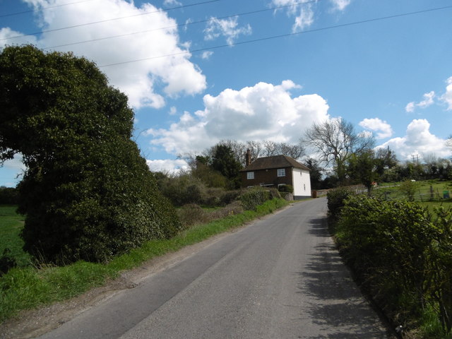
Bobbing is a rural settlement with a population of around 1,000 residents. The village is characterized by its picturesque countryside and is surrounded by agricultural fields and farmland. It offers a peaceful and tranquil environment, making it an ideal place for those seeking a quieter lifestyle away from the hustle and bustle of the city.

The village boasts a rich history, with evidence of human habitation dating back to the Roman times. There are several historical landmarks in the area, including St. Bartholomew's Church, which dates back to the 12th century and showcases stunning medieval architecture.

Despite its small size, Bobbing offers a range of amenities and services for its residents, including a primary school, a village hall, and a local pub. The village is well-connected to the surrounding areas by road, with easy access to nearby towns and cities.

Bobbing is surrounded by natural beauty, with plenty of opportunities for outdoor activities such as walking, cycling, and fishing. The nearby Elmley National Nature Reserve provides a haven for wildlife enthusiasts, with its diverse range of flora and fauna.

Overall, Bobbing is a charming and idyllic village that offers a peaceful lifestyle, rich history, and beautiful natural surroundings.

If you have any feedback on the listing, please let us know in the comments section below.

Bobbing Images

Images are sourced within 2km of 51.350384/0.701586 or Grid Reference TQ8864. Thanks to Geograph Open Source API. All images are credited.

Field View at Keycol Farm Triangulation Pillar Looking westward.
Field View at Keycol Farm Triangulation Pillar
Looking westward.
Wises Oast, Wises Lane, Borden
Wises Oast, Wises Lane, Borden 20th century, internal kiln oast house, built 1950's. One cowl to roof. Converted to offices known as Wises Oast Business Centre.
Wises Oast, Wises Lane, Borden
20th century, internal kiln oast house, built 1950's. One cowl to roof. Converted to offices known as Wises Oast Business Centre.
St Peter and St Paul Church, Borden The notable tower at Borden is Norman. The church was remodelled with aisles to the nave and chancel in the 13th century. The nave is short which reflects its Norman ancestry.
St Peter and St Paul Church, Borden
The notable tower at Borden is Norman. The church was remodelled with aisles to the nave and chancel in the 13th century. The nave is short which reflects its Norman ancestry.
Footpath near Borden Blossom brightens up this footpath just to the north of Borden.
Footpath near Borden
Blossom brightens up this footpath just to the north of Borden.
School Lane School Lane leads to Chestnut Street in the distance.
School Lane
School Lane leads to Chestnut Street in the distance.
Path through field of oilseed rape The path leads to Pond Farm Road and the village of Borden.
Path through field of oilseed rape
The path leads to Pond Farm Road and the village of Borden.
Borden War Memorial The notable tower at Borden is Norman. The church was remodelled with aisles to the nave and chancel in the 13th century. The nave is short which reflects its Norman ancestry. The war memorial is immediately outside the south porch.
Borden War Memorial
The notable tower at Borden is Norman. The church was remodelled with aisles to the nave and chancel in the 13th century. The nave is short which reflects its Norman ancestry. The war memorial is immediately outside the south porch.
St Peter and St Paul Church, Borden and the war memorial The notable tower at Borden is Norman. The church was remodelled with aisles to the nave and chancel in the 13th century. The nave is short which reflects its Norman ancestry. The war memorial is immediately outside the south porch.
St Peter and St Paul Church, Borden and the war memorial
The notable tower at Borden is Norman. The church was remodelled with aisles to the nave and chancel in the 13th century. The nave is short which reflects its Norman ancestry. The war memorial is immediately outside the south porch.
Lozenge graves at St Peter and St Paul Church, Borden The notable tower at Borden is Norman. The church was remodelled with aisles to the nave and chancel in the 13th century. The nave is short which reflects its Norman ancestry. The lozenge graves seen here are very typical of Kent as seen in the opening scenes of Great Expectations.
Lozenge graves at St Peter and St Paul Church, Borden
The notable tower at Borden is Norman. The church was remodelled with aisles to the nave and chancel in the 13th century. The nave is short which reflects its Norman ancestry. The lozenge graves seen here are very typical of Kent as seen in the opening scenes of Great Expectations.
Footpath signs near Chestnut Street Some of these looked new and some of the old stone signs were here too. The walk we followed around the Chestnut Street and Borden area referred to stone footpath signs, most of which had gone so perhaps this is where they ended up. Strangely enough the only stone sign we saw was only about 20 yards away at the entrance to Chestnut Wood - see <a title="https://www.geograph.org.uk/photo/4912149" href="https://www.geograph.org.uk/photo/4912149">Link</a>
Footpath signs near Chestnut Street
Some of these looked new and some of the old stone signs were here too. The walk we followed around the Chestnut Street and Borden area referred to stone footpath signs, most of which had gone so perhaps this is where they ended up. Strangely enough the only stone sign we saw was only about 20 yards away at the entrance to Chestnut Wood - see Link
Footpath signs near Chestnut Street This was in a depot next to Chestnut Wood. Some of these looked new and some of the old stone signs were here too. The walk we followed around the Chestnut Street and Borden area referred to stone footpath signs, most of which had gone so perhaps this is where they ended up. Strangely enough the only stone sign we saw was only about 20 yards away at the entrance to Chestnut Wood - see <a title="https://www.geograph.org.uk/photo/4912149" href="https://www.geograph.org.uk/photo/4912149">Link</a>
Footpath signs near Chestnut Street
This was in a depot next to Chestnut Wood. Some of these looked new and some of the old stone signs were here too. The walk we followed around the Chestnut Street and Borden area referred to stone footpath signs, most of which had gone so perhaps this is where they ended up. Strangely enough the only stone sign we saw was only about 20 yards away at the entrance to Chestnut Wood - see Link
Meeting of paths at Chestnut Wood Chestnut Wood is ahead. The path to the left leads to Sunnyhill and the one to the right to Munsgore Farm. This was right next to the depot where various old stone footpaths signs had been taken but on the walk we did via Borden and Oade Street, this was the only one we saw - see <a title="https://www.geograph.org.uk/photo/4912146" href="https://www.geograph.org.uk/photo/4912146">Link</a>
Meeting of paths at Chestnut Wood
Chestnut Wood is ahead. The path to the left leads to Sunnyhill and the one to the right to Munsgore Farm. This was right next to the depot where various old stone footpaths signs had been taken but on the walk we did via Borden and Oade Street, this was the only one we saw - see Link
School Lane School Lane leads from Chestnut Street to Borden.
School Lane
School Lane leads from Chestnut Street to Borden.
Horses alongside School Lane School Lane leads from Chestnut Street to Borden. This is just as it leaves Chestnut Street, some of the houses of which are on the left. There are a great number of horses in this area.
Horses alongside School Lane
School Lane leads from Chestnut Street to Borden. This is just as it leaves Chestnut Street, some of the houses of which are on the left. There are a great number of horses in this area.
Footpath near Borden The footpath heads across the field to a junction of paths in the middle of the field. To the left School Lane and Chestnut Street, ahead is Key Street and to the right is Wises Lane.
Footpath near Borden
The footpath heads across the field to a junction of paths in the middle of the field. To the left School Lane and Chestnut Street, ahead is Key Street and to the right is Wises Lane.
Pond Farm Road The road ahead leads to the village of Borden. The path to the left leads across a field of oilseed rape, the other side of which can be seen at <a title="https://www.geograph.org.uk/photo/4911994" href="https://www.geograph.org.uk/photo/4911994">Link</a>
Pond Farm Road
The road ahead leads to the village of Borden. The path to the left leads across a field of oilseed rape, the other side of which can be seen at Link
Show me another place!

Bobbing is located at Grid Ref: TQ8864 (Lat: 51.350384, Lng: 0.701586)

Administrative County: Kent

District: Swale

Police Authority: Kent

What 3 Words

///passes.cold.sprouted. Near Newington, Kent

Related Wikis

Bobbing, Kent

Bobbing is a village and civil parish in the Swale district of Kent, England, about a mile north-west of Sittingbourne, and forming part of its urban area...

Keycol

Keycol is a village near Sittingbourne in Kent, England. At the 2011 Census the population of the village was recorded in the civil parish of Bobbing....

Westlands School, Sittingbourne

Westlands School is a coeducational secondary school and sixth form with academy status, located in Sittingbourne in the English county of Kent.Previously...

A249 road

The A249 is a road in Kent, England, running from Maidstone to Sheerness on the Isle of Sheppey. It mainly functions as a link between the M2 and M20 motorways...

Nearby Amenities

Located within 500m of 51.350384,0.701586
Railway: crossing
Lat/Long: 51.3516474/0.7021483
Motorway Junction
Bobbing
Lat/Long: 51.3483442/0.7032156
Parking
Fee: no
Note: Mo-Fr part time single yellow line.
Parking: lane
Source: survey
Lat/Long: 51.3468203/0.699204
Source: local_knowledge
Lat/Long: 51.3467818/0.7043
Railway: crossing
Lat/Long: 51.3501616/0.707519
Source: local_knowledge
Lat/Long: 51.3463473/0.7013203
Source: local_knowledge
Lat/Long: 51.3462192/0.7012636
Source: local_knowledge
Lat/Long: 51.346262/0.7010154
Source: local_knowledge
Lat/Long: 51.3461736/0.701452
Source: local_knowledge
Lat/Long: 51.3463901/0.701072
Source: local_knowledge
Lat/Long: 51.3460389/0.700956
Source: local_knowledge
Lat/Long: 51.345994/0.7013771
Source: local_knowledge
Lat/Long: 51.3461814/0.7010155
Source: local_knowledge
Lat/Long: 51.3473056/0.7019736
Source: local_knowledge
Lat/Long: 51.3468368/0.7041915
Source: local_knowledge
Lat/Long: 51.3468309/0.704265
Source: local_knowledge
Lat/Long: 51.3480639/0.7066976
Source: local_knowledge
Lat/Long: 51.3489744/0.7082406
Source: local_knowledge
Lat/Long: 51.3486028/0.7079218
Curve Geometry: yes
Lat/Long: 51.3518746/0.7071031
Bobbing Hill
Place: locality
Lat/Long: 51.349251/0.7005984
Bobbing Court
Building: yes
Wikidata: Q26322403
Lat/Long: 51.3514017/0.7049313
Power: tower
Lat/Long: 51.3522529/0.7007651
Power: tower
Lat/Long: 51.3483463/0.6963878
Power: tower
Lat/Long: 51.3506916/0.6991236
Power: pole
Lat/Long: 51.3533283/0.6998106
Power: pole
Lat/Long: 51.350341/0.696848
Power: pole
Lat/Long: 51.3518519/0.6980897
Power: pole
Lat/Long: 51.3486326/0.6954423
Power: pole
Lat/Long: 51.3542766/0.7025243
Power: pole
Lat/Long: 51.3485799/0.6956264
Power: pole
Lat/Long: 51.3530974/0.7002437
Power: pole
Lat/Long: 51.3502679/0.6970248
Power: pole
Lat/Long: 51.3517712/0.6982722
Power: pole
Lat/Long: 51.3535712/0.7014479
Power: pole
Lat/Long: 51.3510276/0.697412
Power: pole
Lat/Long: 51.3539294/0.7007138
Power: pole
Lat/Long: 51.3523356/0.6986292
Power: pole
Lat/Long: 51.3494593/0.6961239
Power: pole
Lat/Long: 51.3545317/0.701611
Power: pole
Lat/Long: 51.3522522/0.6988558
Power: pole
Lat/Long: 51.3493956/0.6963084
Power: pole
Lat/Long: 51.3509869/0.6975836
Source: local_knowledge
Lat/Long: 51.3468621/0.7042617
Post Box
Brand: Royal Mail
Brand Wikidata: Q638098
Brand Wikipedia: en:Royal Mail
Collection Plate: CP7D
Collection Times: Mo-Fr 09:00; Sa 07:00; Su off
Operator: Royal Mail
Operator Wikidata: Q638098
Post Box Mounting: pier
Post Box Type: lamp
Ref: ME10 126D
Royal Cypher: EIIR
Royal Cypher Wikidata: Q33102113
Source: streetlevel imagery;aerial imagery;survey
Source 1: survey
Survey Date: 2023-08-10
Lat/Long: 51.3468334/0.6991088
Railway: crossing
Lat/Long: 51.3516834/0.7021667
Railway: crossing
Lat/Long: 51.3501936/0.7075551
Waste Basket
Ashtray: no
Colour: black
Covered: yes
Note: There is no formal stubber plate on this litter bin but there is a makeshift stubber plate area.
Source: survey
Waste: trash
Lat/Long: 51.3468632/0.699158
Parking
Fee: no
Note: This lay-by has a single yellow line which applies at certain times of the day.
Parking: layby
Source: survey
Survey Date: 2023-08-18
Lat/Long: 51.3461127/0.7002446
Grit Bin
Colour: yellow
Source: survey
Survey Date: 2023-10-17
Lat/Long: 51.3465649/0.698295
Generator Method: photovoltaic
Generator Output Electricity: yes
Generator Source: solar
Generator Type: solar_photovoltaic_panel
Location: roof
Power: generator
Lat/Long: 51.3480613/0.6980905
Generator Method: photovoltaic
Generator Output Electricity: yes
Generator Source: solar
Generator Type: solar_photovoltaic_panel
Location: roof
Power: generator
Lat/Long: 51.3486468/0.6998259
Generator Method: photovoltaic
Generator Output Electricity: yes
Generator Source: solar
Generator Type: solar_photovoltaic_panel
Location: roof
Power: generator
Lat/Long: 51.3480889/0.6981093
Generator Method: photovoltaic
Generator Output Electricity: yes
Generator Source: solar
Generator Type: solar_photovoltaic_panel
Location: roof
Power: generator
Lat/Long: 51.347908/0.6980516
The data included in this document is from www.openstreetmap.org. The data is made available under ODbL.

Have you been to Bobbing?

Leave your review of Bobbing below (or comments, questions and feedback).