St John's

Settlement in Yorkshire

England

St John's

Old milestone Another of the West Riding CC milestones at the northern end of Aberford on main Street near to Greystones Park.   Even though it is 'Listed'(II 1135617) and is in a village it is very neglected.  Many of the metal attachments for the original 615 WRCC milestones were cast at the Brayshaw & Booth Foundry in Liversedge and that is usually cast on the bevel.   However the remaining posts on this route between Ferrybridge and Boroughbridge, the old A1, have a plain bevel so it is not known where they were cast.
Old milestone Credit: Chris Minto

St John's is a small village located in the county of Yorkshire, England. Situated in the northern part of the county, it falls within the district of North Yorkshire. With a population of around 1,000 residents, St John's is known for its tranquil and picturesque setting.

The village is nestled amidst rolling hills and lush green landscapes, offering breathtaking views of the surrounding countryside. It is surrounded by several small hamlets and lies approximately 10 miles northeast of the town of Harrogate. St John's is well-connected, with good transport links to nearby towns and cities.

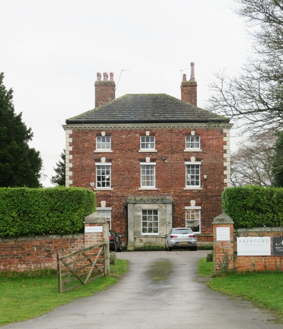
St John's boasts a rich history, with evidence of settlements dating back to the Roman era. The village is home to several historic buildings, including a beautiful medieval church that lends its name to the village. The church, dedicated to St John the Baptist, is a prominent feature and a centerpiece of the community.

The village itself offers a range of amenities for its residents, including a local primary school, a village hall, and a small convenience store. There are also a few traditional pubs that serve as popular gathering spots for locals and visitors alike.

St John's is a popular destination for outdoor enthusiasts, with its proximity to the Yorkshire Dales National Park. The park offers breathtaking walking trails, cycling routes, and opportunities for wildlife spotting. Additionally, the village is within close proximity to several historical sites and attractions, making it an ideal base for exploring the wider Yorkshire region.

In summary, St John's is a charming village in Yorkshire, offering a peaceful and idyllic setting, rich history, and convenient access to the surrounding natural beauty and cultural attractions.

If you have any feedback on the listing, please let us know in the comments section below.
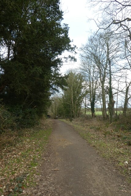
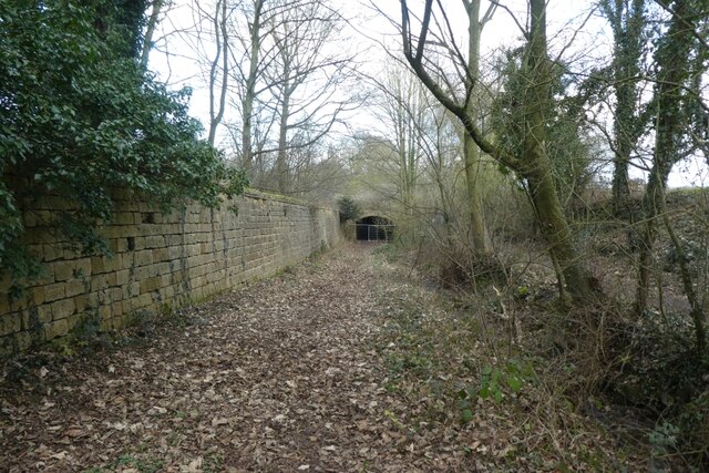
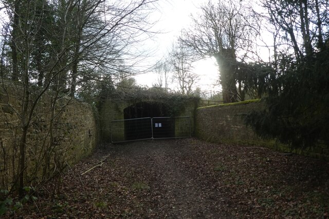
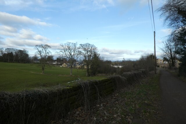
St John's Images

Images are sourced within 2km of 53.827494/-1.3482032 or Grid Reference SE4337. Thanks to Geograph Open Source API. All images are credited.

Old milestone Another of the West Riding CC milestones at the northern end of Aberford on main Street near to Greystones Park.   Even though it is 'Listed'(II 1135617) and is in a village it is very neglected.  Many of the metal attachments for the original 615 WRCC milestones were cast at the Brayshaw & Booth Foundry in Liversedge and that is usually cast on the bevel.   However the remaining posts on this route between Ferrybridge and Boroughbridge, the old A1, have a plain bevel so it is not known where they were cast.
Old milestone
Another of the West Riding CC milestones at the northern end of Aberford on main Street near to Greystones Park. Even though it is 'Listed'(II 1135617) and is in a village it is very neglected. Many of the metal attachments for the original 615 WRCC milestones were cast at the Brayshaw & Booth Foundry in Liversedge and that is usually cast on the bevel. However the remaining posts on this route between Ferrybridge and Boroughbridge, the old A1, have a plain bevel so it is not known where they were cast.
Old milestone At the southern end of Aberford on the route of the Great North Road/A1, now unclassified, is this West Riding CC milestone.  It is near the entrance to St Wilfrid's Priory on the east side of the road.  This is another metal attachment with deteriorating paintwork even though it is so near the village centre and is Grade II listed, 1200719
Old milestone
At the southern end of Aberford on the route of the Great North Road/A1, now unclassified, is this West Riding CC milestone. It is near the entrance to St Wilfrid's Priory on the east side of the road. This is another metal attachment with deteriorating paintwork even though it is so near the village centre and is Grade II listed, 1200719
A remnant of the old A1 This dead end road at the northern end of Aberford village marks a previous line of the A1, which passed through the village centre until 1963 when the by-pass was constructed. This in turn has been widened and upgraded to a six lane motorway [8 lanes in places past the village] which is the A1(M).
A remnant of the old A1
This dead end road at the northern end of Aberford village marks a previous line of the A1, which passed through the village centre until 1963 when the by-pass was constructed. This in turn has been widened and upgraded to a six lane motorway [8 lanes in places past the village] which is the A1(M).
Football ground, Aberford The ground is in a field to the west side of the old A1. It looks as though the main stand could accommodate at least 10 spectators.
Football ground, Aberford
The ground is in a field to the west side of the old A1. It looks as though the main stand could accommodate at least 10 spectators.
Former Catholic chapel, Aberford Now part of a private residence, this simple building was a very early [1793] Catholic place of worship, following the Catholic Relief Act of 1791.
Former Catholic chapel, Aberford
Now part of a private residence, this simple building was a very early [1793] Catholic place of worship, following the Catholic Relief Act of 1791.
The Gascoigne Almshouses A prominent feature on the southern approach to Aberford, this rather splendid building dates from c1844 and is now offices.
The Gascoigne Almshouses
A prominent feature on the southern approach to Aberford, this rather splendid building dates from c1844 and is now offices.
Hicklam House A rather fine mid 18th century house on the southern fringe of Aberford village.
Hicklam House
A rather fine mid 18th century house on the southern fringe of Aberford village.
Fishing pool near Gamekeepers Cottage Looking towards a fishing pool beside Parlington Lane.
Fishing pool near Gamekeepers Cottage
Looking towards a fishing pool beside Parlington Lane.
Parlington Lane near Gamekeepers Cottage A bridleway runs along Parlington Road between Barwick Road and Aberford. This path forms part of National Cycle Network route 66, with this section connecting Leeds and York.
Parlington Lane near Gamekeepers Cottage
A bridleway runs along Parlington Road between Barwick Road and Aberford. This path forms part of National Cycle Network route 66, with this section connecting Leeds and York.
Track east of Gamekeepers Cottage A bridleway runs along Parlington Road between Barwick Road and Aberford. This path forms part of National Cycle Network route 66, with this section connecting Leeds and York.
Track east of Gamekeepers Cottage
A bridleway runs along Parlington Road between Barwick Road and Aberford. This path forms part of National Cycle Network route 66, with this section connecting Leeds and York.
Along Parlington Lane A bridleway runs along Parlington Road between Barwick Road and Aberford. This path forms part of National Cycle Network route 66, with this section connecting Leeds and York.
Along Parlington Lane
A bridleway runs along Parlington Road between Barwick Road and Aberford. This path forms part of National Cycle Network route 66, with this section connecting Leeds and York.
Tunnel on Parlington Lane A bridleway runs along Parlington Road between Barwick Road and Aberford. This path forms part of National Cycle Network route 66, with this section connecting Leeds and York. The tunnel is currently closed for repair works, with a diversion path alongside.
Tunnel on Parlington Lane
A bridleway runs along Parlington Road between Barwick Road and Aberford. This path forms part of National Cycle Network route 66, with this section connecting Leeds and York. The tunnel is currently closed for repair works, with a diversion path alongside.
Closed tunnel on Parlington Lane A bridleway runs along Parlington Road between Barwick Road and Aberford. This path forms part of National Cycle Network route 66, with this section connecting Leeds and York. This tunnel is currently closed for repairs with a diversion to the left of the tunnel.
Closed tunnel on Parlington Lane
A bridleway runs along Parlington Road between Barwick Road and Aberford. This path forms part of National Cycle Network route 66, with this section connecting Leeds and York. This tunnel is currently closed for repairs with a diversion to the left of the tunnel.
Parlington Lane near the gardens A bridleway runs along Parlington Road between Barwick Road and Aberford. This path forms part of National Cycle Network route 66, with this section connecting Leeds and York.
Parlington Lane near the gardens
A bridleway runs along Parlington Road between Barwick Road and Aberford. This path forms part of National Cycle Network route 66, with this section connecting Leeds and York.
Snowdrops in Parlington Gardens A bridleway runs along Parlington Road between Barwick Road and Aberford. This path forms part of National Cycle Network route 66, with this section connecting Leeds and York. The path passes through Parlington Gardens, consisting of woodland with a good carpet of snowdrops.
Snowdrops in Parlington Gardens
A bridleway runs along Parlington Road between Barwick Road and Aberford. This path forms part of National Cycle Network route 66, with this section connecting Leeds and York. The path passes through Parlington Gardens, consisting of woodland with a good carpet of snowdrops.
Tunnel along Parlington Lane A bridleway runs along Parlington Road between Barwick Road and Aberford. This path forms part of National Cycle Network route 66, with this section connecting Leeds and York.
Tunnel along Parlington Lane
A bridleway runs along Parlington Road between Barwick Road and Aberford. This path forms part of National Cycle Network route 66, with this section connecting Leeds and York.
Parlington Lane near Parlington Lane Cottage A bridleway runs along Parlington Road between Barwick Road and Aberford. This path forms part of National Cycle Network route 66, with this section connecting Leeds and York.
Parlington Lane near Parlington Lane Cottage
A bridleway runs along Parlington Road between Barwick Road and Aberford. This path forms part of National Cycle Network route 66, with this section connecting Leeds and York.
Parlington Lane Cottage A bridleway runs along Parlington Road between Barwick Road and Aberford. This path forms part of National Cycle Network route 66, with this section connecting Leeds and York.
Parlington Lane Cottage
A bridleway runs along Parlington Road between Barwick Road and Aberford. This path forms part of National Cycle Network route 66, with this section connecting Leeds and York.
Show me another place!

St John's is located at Grid Ref: SE4337 (Lat: 53.827494, Lng: -1.3482032)

Division: West Riding

Unitary Authority: Leeds

Police Authority: West Yorkshire

What 3 Words

///obligated.print.spoke. Near Aberford, West Yorkshire

Related Wikis

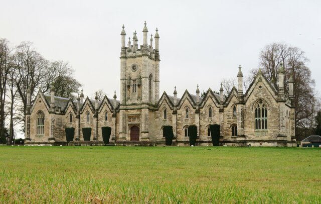
St Ricarius Church, Aberford

The Church of St Ricarius, Aberford, West Yorkshire, England, is an active Anglican parish church in the archdeaconry of York and the Diocese of Leeds...

Aberford railway station

Aberford railway station served the village of Aberford, West Yorkshire, England, from 1837 to 1924 on the Aberford Railway. == History == The station...

Aberford

Aberford is a village and civil parish on the eastern outskirts of the City of Leeds in West Yorkshire, England. It had a population of 1,059 at the 2001...
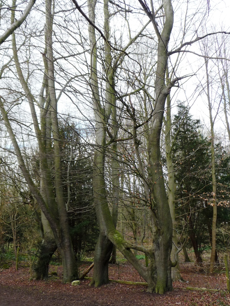
Nellie's Tree

Nellie's Tree (also known as the Love Tree) near Aberford, West Yorkshire is a group of three beech trees that have been grafted together in the shape...
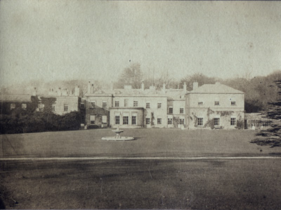
Parlington Hall

Parlington Hall was the seat of the Gascoigne family, Aberford near Leeds in West Yorkshire, England. == History == The Parlington estate was acquired...

Parlington

Parlington is a civil parish that includes part of Aberford, in the City of Leeds in West Yorkshire, England. In 2001 the parish had a population of 87...

Lotherton cum Aberford

Lotherton cum Aberford is a civil parish in the metropolitan borough of Leeds in West Yorkshire, England. The population of the civil parish (including...

Aberford Dykes

The Aberford Dykes are a series of archaeological monuments located around the valley of the Cock Beck, where it runs just north of the village of Aberford...

Nearby Amenities

Located within 500m of 53.827494,-1.3482032
Bus Stop
Cattle Lane Parlington Villas
Bus: yes
Local Ref: 45013287
Naptan AtcoCode: 450013287
Naptan Bearing: E
Naptan CommonName: Cattle Lane Parlington Villas
Naptan Crossing: Parlington Villas
Naptan Indicator: Stop 45013287
Naptan PlusbusZoneRef: LEEDS
Naptan ShortCommonName: Parlington Villas
Naptan Street: Cattle Lane
Naptan Verified: yes
Public Transport: platform
Ref: 45013287
Source: naptan_import
Lat/Long: 53.8299133/-1.345959
Aberford
Is In: West Yorkshire, England, UK
Place: village
Postal Code: LS25
Wikidata: Q2853591
Wikipedia: en:Aberford
Lat/Long: 53.8297708/-1.342764
Bus Stop
Cattle Lane Main Street
Bus: yes
Local Ref: 45010201
Naptan AtcoCode: 450010201
Naptan Bearing: W
Naptan CommonName: Cattle Lane Main Street
Naptan Crossing: Main Street
Naptan Indicator: Stop 45010201
Naptan Landmark: The Swan PH
Naptan PlusbusZoneRef: LEEDS
Naptan ShortCommonName: Main St Aberford
Naptan Street: Cattle Lane
Naptan Verified: no
Public Transport: platform
Source: naptan_import
Lat/Long: 53.8296651/-1.3435688
Bus Stop
Cattle Lane Parlington Villas
Bus: yes
Local Ref: 45013286
Naptan AtcoCode: 450013286
Naptan Bearing: W
Naptan CommonName: Cattle Lane Parlington Villas
Naptan Crossing: Parlington Villas
Naptan Indicator: Stop 45013286
Naptan PlusbusZoneRef: LEEDS
Naptan ShortCommonName: Parlington Villa
Naptan Street: Cattle Lane
Naptan Verified: no
Public Transport: platform
Source: naptan_import
Lat/Long: 53.8298235/-1.3462405
Bunkers Hill
Local Ref: 45026213
Naptan AtcoCode: 450026213
Naptan Bearing: S
Naptan BusStopType: CUS
Naptan CommonName: Bunkers Hill
Naptan Crossing: Adj Lotherton Lane
Naptan Indicator: Stop 45026213
Naptan Notes: Dummy stop for Stage Fair
Naptan PlusbusZoneRef: LEEDS
Naptan ShortCommonName: Lotherton Lane
Naptan Street: Bunkers Hill
Naptan Verified: no
Source: naptan_import
Lat/Long: 53.8260936/-1.3429865
Bunkers Hill
Local Ref: 45026214
Naptan AtcoCode: 450026214
Naptan Bearing: N
Naptan BusStopType: CUS
Naptan CommonName: Bunkers Hill
Naptan Crossing: Lotherton Lane
Naptan Indicator: Stop 45026214
Naptan Notes: Dummy stop for Fair Stage
Naptan PlusbusZoneRef: LEEDS
Naptan ShortCommonName: Lotherton Lane
Naptan Street: Bunkers Hill
Naptan Verified: no
Source: naptan_import
Lat/Long: 53.8261398/-1.3432137
Bus Stop
Cattle Lane Main Street
Bus: yes
Local Ref: 45050007
Naptan AtcoCode: 450050007
Naptan Bearing: E
Naptan BusStopType: CUS
Naptan CommonName: Cattle Lane Main Street
Naptan Indicator: Stop 45050007
Naptan PlusbusZoneRef: LEEDS
Naptan ShortCommonName: Main Street
Naptan Street: Cattle Lane
Naptan Verified: no
Public Transport: platform
Source: naptan_import
Lat/Long: 53.829764/-1.3435673
Turning Circle
Lat/Long: 53.8268198/-1.3444283
Noexit: yes
Lat/Long: 53.8279934/-1.3424299
Noexit: yes
Lat/Long: 53.8296289/-1.348955
Noexit: yes
Lat/Long: 53.8298368/-1.3488497
Post Box
Operator: Royal Mail
Post Box Type: wall
Ref: LS25 637
Lat/Long: 53.8287774/-1.3430201
Post Box
Operator: Royal Mail
Post Box Type: lamp
Ref: LS25 230
Lat/Long: 53.8243112/-1.3433696
Childcare
Aberford C Of E Primary School Extended Care
Addr City: Leeds
Addr Housename: Aberford Church of England Primary School
Addr Postcode: LS25 3BU
Addr Street: Main Street
Fhrs Id: 1018239
Lat/Long: 53.828001/-1.3446209
tank ramp
Service: repair
Lat/Long: 53.8254149/-1.3538156
Cafe
Village Hall Cafe
Addr City: Leeds
Addr Housename: Aberford Village Hall
Addr Postcode: LS25 3DA
Addr Street: Main Street
Fhrs Id: 1070570
Lat/Long: 53.8274231/-1.3428748
Waste Basket
Ref UK Leedscc Bin: 1969
Lat/Long: 53.826243/-1.343403
Waste Basket
Ref UK Leedscc Bin: 1972
Lat/Long: 53.829581/-1.343492
Power: pole
Lat/Long: 53.8279092/-1.3414908
Noexit: yes
Lat/Long: 53.8281672/-1.3423061
Noexit: yes
Lat/Long: 53.8278784/-1.3433884
Noexit: yes
Lat/Long: 53.827884/-1.3438455
Turning Circle
Lat/Long: 53.8266157/-1.344061
Noexit: yes
Lat/Long: 53.8242647/-1.3437592
Cattle Lane Main Street
Bus: yes
Local Ref: 45010201
Public Transport: stop_position
Lat/Long: 53.8297015/-1.3436884
Cattle Lane Parlington Villas
Bus: yes
Local Ref: 45013286
Public Transport: stop_position
Lat/Long: 53.8298706/-1.3462705
Cattle Lane Parlington Villas
Bus: yes
Local Ref: 45013287
Public Transport: stop_position
Lat/Long: 53.8298226/-1.3459079
Cattle Lane Main Street
Bus: yes
Local Ref: 45050007
Public Transport: stop_position
Lat/Long: 53.8297004/-1.343501
Crossing
Crossing: unmarked
Crossing Island: yes
Crossing Markings: no
Tactile Paving: yes
Traffic Calming: island
Lat/Long: 53.829686/-1.343133
Crossing
Colour: red
Crossing: uncontrolled
Crossing Markings: surface
Crossing Ref: none
Lat/Long: 53.8284662/-1.3430644
Crossing
Crossing: unmarked
Crossing Markings: no
Narrow Left: yes
Tactile Paving: yes
Traffic Calming: choker
Lat/Long: 53.8283816/-1.3430688
Crossing
Crossing: unmarked
Crossing Markings: no
Narrow Left: yes
Tactile Paving: yes
Traffic Calming: choker
Lat/Long: 53.8273973/-1.3431496
The data included in this document is from www.openstreetmap.org. The data is made available under ODbL.

Have you been to St John's?

Leave your review of St John's below (or comments, questions and feedback).