Spring Bank

Settlement in Staffordshire

England

Spring Bank

Council Housing - Castlebridge Estate Wednesfield UDC developed the Castlebridge Estate in the early 1950s with a cluster of four storey blocks beside the Wyley & Essington Canal.
Council Housing - Castlebridge Estate Credit: John M

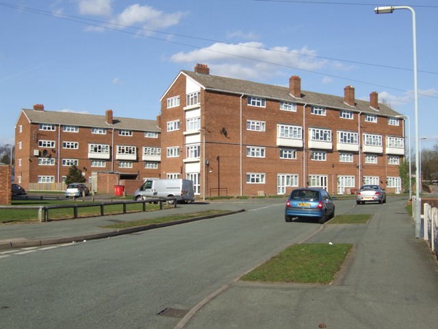
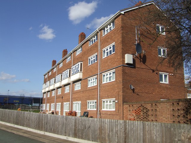
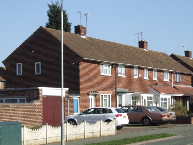
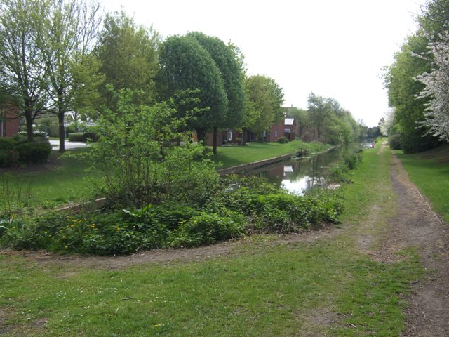
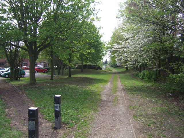
Spring Bank is a charming village located in the county of Staffordshire, England. Situated in a picturesque countryside setting, it is renowned for its natural beauty and tranquil atmosphere. The village is nestled amidst rolling hills and lush green fields, offering breathtaking views that attract both locals and tourists alike.

One of the notable features of Spring Bank is its close proximity to the stunning Cannock Chase, a designated Area of Outstanding Natural Beauty. This provides residents and visitors with ample opportunities for outdoor activities such as hiking, cycling, and horseback riding.

Despite its rural setting, Spring Bank is well-connected to surrounding towns and cities. The village benefits from excellent transport links, with easy access to major road networks, including the M6 motorway. This allows for convenient travel to nearby Stafford, which is approximately 5 miles away, as well as other urban centers such as Birmingham and Stoke-on-Trent.

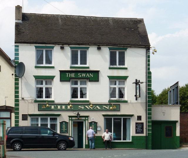
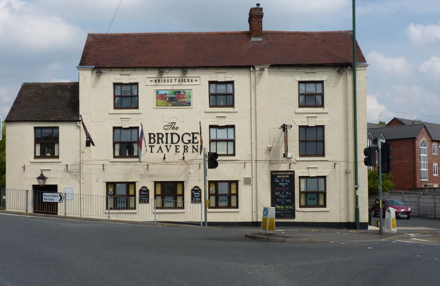
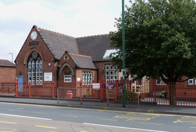
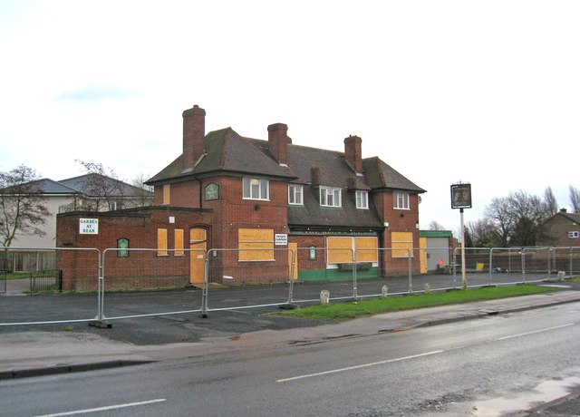
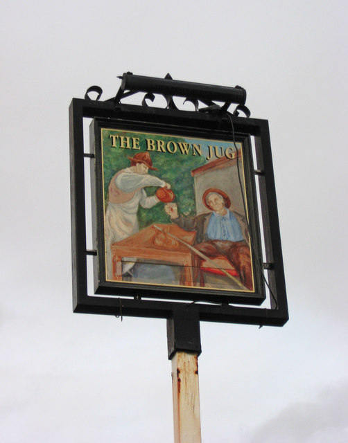
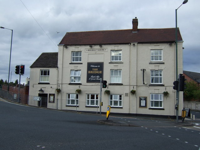
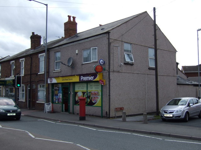
In terms of amenities, Spring Bank offers a range of facilities to cater to the needs of its residents. The village boasts a local pub, where locals can gather and socialize, and a small convenience store for daily essentials. There are also several schools in the area, providing education options for families with children.

Overall, Spring Bank offers a peaceful and idyllic lifestyle, surrounded by natural beauty and a strong sense of community. Its convenient location and range of amenities make it an attractive place to live for those seeking a balance between rural living and easy access to urban areas.

If you have any feedback on the listing, please let us know in the comments section below.

Spring Bank Images

Images are sourced within 2km of 52.590113/-2.051927 or Grid Reference SO9699. Thanks to Geograph Open Source API. All images are credited.

Council Housing - Castlebridge Estate Wednesfield UDC developed the Castlebridge Estate in the early 1950s with a cluster of four storey blocks beside the Wyley & Essington Canal.
Council Housing - Castlebridge Estate
Wednesfield UDC developed the Castlebridge Estate in the early 1950s with a cluster of four storey blocks beside the Wyley & Essington Canal.
Council Housing - Castlebridge Estate Wednesfield UDC developed the Castlebridge Estate in the early 1950s. This block comprises sixteen flats.
Council Housing - Castlebridge Estate
Wednesfield UDC developed the Castlebridge Estate in the early 1950s. This block comprises sixteen flats.
Council Housing - Merrick Road Post war housing built for Wednesfield UDC on the early 1950s Castlebridge Estate.
Council Housing - Merrick Road
Post war housing built for Wednesfield UDC on the early 1950s Castlebridge Estate.
Short Heath Basin Built in 1906 by the Hollybank Colliery as a colliery wharf and landsale. A mineral railway was constructed directly from the pit in Essington to eliminate the locks on the Wyrley Branch of the Curly Wyrley. The facility remained in use until the closure of the Hilton Main Colliery in the late 1960s.

A landsale was a site where coal was stockpiled to meet seasonal demand with local sale to coal merchants.
Short Heath Basin
Built in 1906 by the Hollybank Colliery as a colliery wharf and landsale. A mineral railway was constructed directly from the pit in Essington to eliminate the locks on the Wyrley Branch of the Curly Wyrley. The facility remained in use until the closure of the Hilton Main Colliery in the late 1960s. A landsale was a site where coal was stockpiled to meet seasonal demand with local sale to coal merchants.
Short Heath Landsale Following the former colliery railway to the landsale and basin at Short Heath.

A landsale was a site where coal was stockpiled to meet seasonal demand with local sale to coal merchants.
Short Heath Landsale
Following the former colliery railway to the landsale and basin at Short Heath. A landsale was a site where coal was stockpiled to meet seasonal demand with local sale to coal merchants.
Telecommunications mast, Ezekiel Lane
The Swan - a pub on Bentley Lane, Lane Head area
Willenhall Lawn Cemetery Cemetery, Gardens of Remembrance, Chapel of Rest etc, all on the site here beside Bentley Lane
Willenhall Lawn Cemetery
Cemetery, Gardens of Remembrance, Chapel of Rest etc, all on the site here beside Bentley Lane
The Bridge Tavern, Lane Head Very appropriately named, as it sits practically on the bridge over the Curly Wyrley cut.
The Bridge Tavern, Lane Head
Very appropriately named, as it sits practically on the bridge over the Curly Wyrley cut.
The Lane Head Nursery School
All gone! The site of the former Lane Heath Methodist Church - all that's left is a rather sad wooden sign just inside the chain-link fence, to give away the identity of the church that formerly occupied the site.
All gone!
The site of the former Lane Heath Methodist Church - all that's left is a rather sad wooden sign just inside the chain-link fence, to give away the identity of the church that formerly occupied the site.
Piling boat Wyrley & Essington canal Construction of Lane Head moorings adjacent to United Kingdom pub car park
Piling boat Wyrley & Essington canal
Construction of Lane Head moorings adjacent to United Kingdom pub car park
The former Brown Jug (1), 52 Sandbeds Road, Shortheath, Willenhall The Brown Jug pub has closed and is boarded up. I have no information on the future of the building.

<a href="https://www.geograph.org.uk/photo/2745585">SJ9700 : The former Brown Jug (2) - sign, 52 Sandbeds Road, Shortheath, Willenhall</a>.
The former Brown Jug (1), 52 Sandbeds Road, Shortheath, Willenhall
The Brown Jug pub has closed and is boarded up. I have no information on the future of the building. SJ9700 : The former Brown Jug (2) - sign, 52 Sandbeds Road, Shortheath, Willenhall.
The former Brown Jug (2) - sign, 52 Sandbeds Road, Shortheath, Willenhall The sign of this closed pub is still present, on top of a post in the front car park, adjacent to Sandbeds Road.

<a href="https://www.geograph.org.uk/photo/2745575">SJ9700 : The former Brown Jug (1), 52 Sandbeds Road, Shortheath, Willenhall</a>.
The former Brown Jug (2) - sign, 52 Sandbeds Road, Shortheath, Willenhall
The sign of this closed pub is still present, on top of a post in the front car park, adjacent to Sandbeds Road. SJ9700 : The former Brown Jug (1), 52 Sandbeds Road, Shortheath, Willenhall.
Willenhall Lawn Cemetery The NE corner of this extensive cemetery.
Willenhall Lawn Cemetery
The NE corner of this extensive cemetery.
The Bridge pub, Lane Head
Lane Head Stores and Post Office
Boarded up pub, Lane Head On High Road.
Boarded up pub, Lane Head
On High Road.
Show me another place!

Spring Bank is located at Grid Ref: SO9699 (Lat: 52.590113, Lng: -2.051927)

Unitary Authority: Walsall

Police Authority: West Midlands

What 3 Words

///prompting.cost.fits. Near Willenhall, West Midlands

Related Wikis

Willenhall Stafford Street railway station

Willenhall Stafford Street railway station was a station built by the Wolverhampton and Walsall Railway in 1872, and was operated by the Midland Railway...

St Giles Church, Willenhall

The Church of St Giles is a parish church in Willenhall, Metropolitan Borough of Walsall, West Midlands, England. Although the current church building...

Memorial Clock, Willenhall

The Memorial Clock is a clock tower in the market place of Willenhall, West Midlands, England. It was erected in 1892, in memory of a local doctor. �...
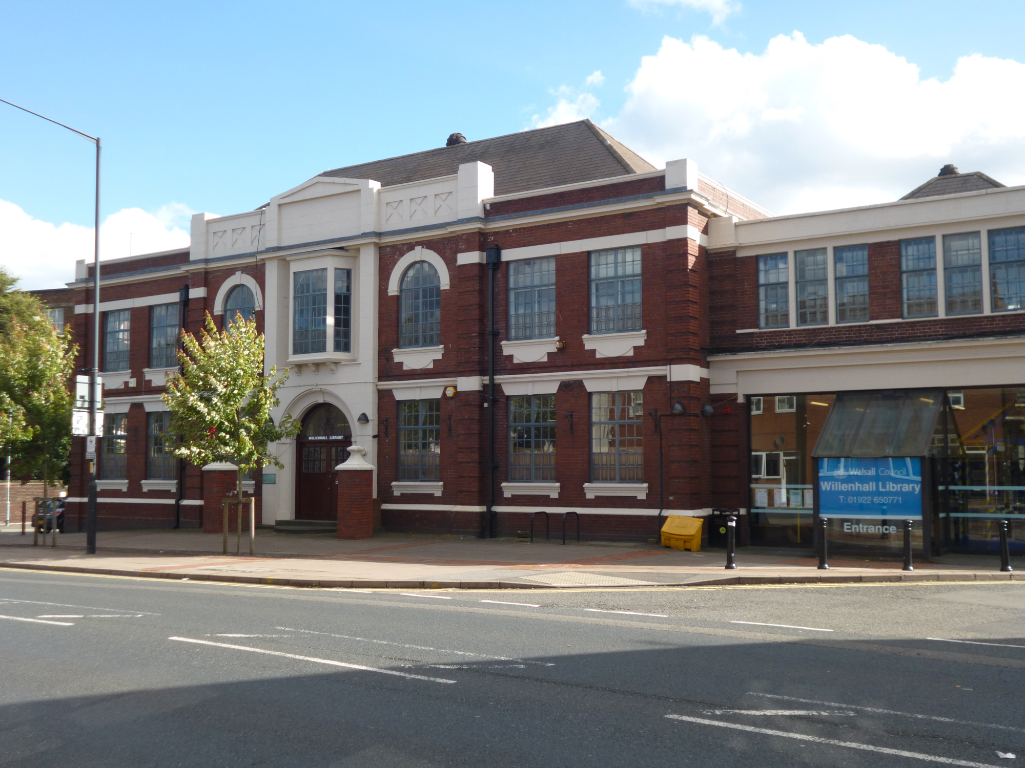
Willenhall Library

Willenhall Library, formerly Willenhall Town Hall, is a municipal building in Walsall Street in Willenhall, West Midlands, England. The building, which...

Willenhall Bilston Street railway station

Willenhall Bilston Street railway station was a station built on the Grand Junction Railway in 1837.: 22  It served the town of Willenhall, and was located...

Short Heath railway station

Short Heath railway station was a station built by the Wolverhampton and Walsall Railway in 1872, and was operated by the Midland Railway from 1876 onwards...

Locksmith's House

The Locksmith's House (formerly Willenhall Lock Museum) is a museum in Willenhall, England. The premises, on New Road, consist of a house and backyard...

Sporting Khalsa F.C.

Sporting Khalsa Football Club are a football club, formed in 1991, members of the Northern Premier League Division One Midlands, who play their home games...

Nearby Amenities

Located within 500m of 52.590113,-2.051927
Mini Roundabout
Direction: clockwise
Lat/Long: 52.5869836/-2.056835
Mini Roundabout
Direction: clockwise
Lat/Long: 52.5897867/-2.0566546
Crossing
Crossing: uncontrolled
Source: survey
Lat/Long: 52.5903075/-2.0576919
Bus Stop
Wednesfield Rd / Bull Ring
Bus: yes
Naptan AtcoCode: 43000775901
Naptan Bearing: NW
Naptan BusStopType: MKD
Naptan CommonName: Bull Ring
Naptan Indicator: after
Naptan NaptanCode: nwmtpmgt
Naptan PlusbusZoneRef: BHAMNWS
Naptan Status: ACT
Naptan StopType: BCT
Naptan Street: WEDNESFIELD RD
Naptan Towards: Wednesfield
Naptan Verified: no
Public Transport: platform
Route Ref: 25
Source: WMCA
Lat/Long: 52.5899264/-2.0572592
Bus Stop
Temple Bar / Harper St
NaPTANAreaCode: 43000780101
Bus: yes
Naptan AtcoCode: 43000780101
Naptan Bearing: N
Naptan BusStopType: MKD
Naptan CommonName: Harper St
Naptan Indicator: adj
Naptan NaptanCode: nwmjpgmt
Naptan PlusbusZoneRef: BHAMNWS
Naptan Status: ACT
Naptan StopType: BCT
Naptan Street: TEMPLE BAR
Naptan Towards: New Invention
Naptan Verified: no
Public Transport: platform
Route Ref: 41
Shelter: yes
Shelter Ref: 203113
Source: WMCA
Lat/Long: 52.5878638/-2.056756
Bus Stop
Temple Bar / Harper St
NaPTANAreaCode: 43000780102
Bus: yes
Naptan AtcoCode: 43000780102
Naptan Bearing: N
Naptan BusStopType: MKD
Naptan CommonName: Harper St
Naptan Indicator: adj
Naptan NaptanCode: nwmjpgmw
Naptan PlusbusZoneRef: BHAMNWS
Naptan Status: ACT
Naptan StopType: BCT
Naptan Street: TEMPLE BAR
Naptan Towards: Wednesfield
Naptan Verified: no
Public Transport: platform
Route Ref: 25
Shelter: yes
Shelter Ref: 203112
Source: WMCA
Lat/Long: 52.5873195/-2.0568425
Bus Stop
Temple Bar / Harper St
Bus: yes
Naptan AtcoCode: 43000780103
Naptan Bearing: S
Naptan BusStopType: MKD
Naptan CommonName: Harper St
Naptan Indicator: opp
Naptan NaptanCode: nwmjpgpa
Naptan PlusbusZoneRef: BHAMNWS
Naptan Status: ACT
Naptan StopType: BCT
Naptan Street: TEMPLE BAR
Naptan Towards: Willenhall
Naptan Verified: no
Public Transport: platform
Route Ref: 25;41
Source: WMCA
Lat/Long: 52.5874814/-2.0566804
Bus Stop
Lower Lichfield St / Church St
Bench: no
Bin: no
Bus: yes
Naptan AtcoCode: 43000780801
Naptan Bearing: SW
Naptan BusStopType: MKD
Naptan CommonName: Church St
Naptan Indicator: adj
Naptan NaptanCode: nwmjpgtm
Naptan PlusbusZoneRef: BHAMNWS
Naptan Status: ACT
Naptan StopType: BCT
Naptan Street: LOWER LICHFIELD ST
Naptan Towards: Willenhall
Naptan Verified: no
Public Transport: platform
Route Ref: 37;326;333X
Shelter: no
Source: WMCA
Tactile Paving: no
Lat/Long: 52.5863875/-2.0501402
Bus Stop
Lower Lichfield St / St Annes Rd
Bus: yes
Naptan AtcoCode: 43000780901
Naptan Bearing: SW
Naptan BusStopType: MKD
Naptan CommonName: St Annes Rd
Naptan Indicator: opp
Naptan NaptanCode: nwmjpgtp
Naptan PlusbusZoneRef: BHAMNWS
Naptan Status: ACT
Naptan StopType: BCT
Naptan Street: LOWER LICHFIELD ST
Naptan Towards: Willenhall
Naptan Verified: no
Public Transport: platform
Route Ref: 37;326;333X
Source: WMCA
Lat/Long: 52.5886359/-2.0478118
Bus Stop
Lower Lichfield St / New Hall St
Bus: yes
Naptan AtcoCode: 43000781001
Naptan Bearing: NE
Naptan BusStopType: MKD
Naptan CommonName: New Hall St
Naptan Indicator: adj
Naptan NaptanCode: nwmjpgtw
Naptan PlusbusZoneRef: BHAMNWS
Naptan Status: ACT
Naptan StopType: BCT
Naptan Street: LOWER LICHFIELD ST
Naptan Towards: Bentley, New Invention
Naptan Verified: no
Public Transport: platform
Route Ref: 37;326;333X
Source: WMCA
Lat/Long: 52.5874307/-2.0493591
Bus Stop
Bloxwich Road South / Granville St
Bench: no
Bin: yes
Bus: yes
Naptan AtcoCode: 43000781101
Naptan Bearing: NE
Naptan BusStopType: MKD
Naptan CommonName: Granville St
Naptan Indicator: opp
Naptan NaptanCode: nwmjpgwa
Naptan PlusbusZoneRef: BHAMNWS
Naptan Status: ACT
Naptan StopType: BCT
Naptan Street: BLOXWICH ROAD SOUTH
Naptan Towards: New Invention
Naptan Verified: no
Public Transport: platform
Route Ref: 41
Shelter: no
Source: WMCA
Tactile Paving: no
Lat/Long: 52.5905924/-2.0556068
Bus Stop
Bloxwich Road South / Granville St
Bench: no
Bus: yes
Naptan AtcoCode: 43000781102
Naptan Bearing: SW
Naptan BusStopType: MKD
Naptan CommonName: Granville St
Naptan Indicator: opp
Naptan NaptanCode: nwmjpgwd
Naptan PlusbusZoneRef: BHAMNWS
Naptan Status: ACT
Naptan StopType: BCT
Naptan Street: BLOXWICH ROAD SOUTH
Naptan Towards: Willenhall
Naptan Verified: no
Public Transport: platform
Route Ref: 41
Shelter: no
Source: WMCA
Lat/Long: 52.5903136/-2.0558721
Bus Stop
Bloxwich Road South / Clothier St
Bus: yes
Naptan AtcoCode: 43000781201
Naptan Bearing: N
Naptan BusStopType: MKD
Naptan CommonName: Clothier St
Naptan Indicator: adj
Naptan NaptanCode: nwmjpgwg
Naptan PlusbusZoneRef: BHAMNWS
Naptan Status: ACT
Naptan StopType: BCT
Naptan Street: BLOXWICH ROAD SOUTH
Naptan Towards: New Invention
Naptan Verified: no
Public Transport: platform
Route Ref: 41
Source: WMCA
Lat/Long: 52.59205/-2.05304
Bus Stop
Bloxwich Road South / Clothier St
NaPTANAreaCode: 43000781202
Bus: yes
Naptan AtcoCode: 43000781202
Naptan Bearing: SW
Naptan BusStopType: MKD
Naptan CommonName: Clothier St
Naptan Indicator: opp
Naptan NaptanCode: nwmjpgwj
Naptan PlusbusZoneRef: BHAMNWS
Naptan Status: ACT
Naptan StopType: BCT
Naptan Street: BLOXWICH ROAD SOUTH
Naptan Towards: Willenhall
Naptan Verified: no
Public Transport: platform
Route Ref: 41
Shelter: yes
Shelter Ref: 202102
Source: WMCA
Lat/Long: 52.5918792/-2.0529955
Bus Stop
Wednesfield Rd / Park Rd
Bus: yes
Naptan AtcoCode: 43000781302
Naptan Bearing: SE
Naptan BusStopType: MKD
Naptan CommonName: Park Rd
Naptan Indicator: adj
Naptan NaptanCode: nwmjpgwp
Naptan PlusbusZoneRef: BHAMNWS
Naptan Status: ACT
Naptan StopType: BCT
Naptan Street: WEDNESFIELD RD
Naptan Towards: Willenhall
Naptan Verified: no
Public Transport: platform
Route Ref: 25
Source: WMCA
Lat/Long: 52.590753/-2.058205
Bus Stop
Wednesfield Rd / Park Rd
Bus: yes
Naptan AtcoCode: 43000781303
Naptan Bearing: NW
Naptan BusStopType: MKD
Naptan CommonName: Park Rd
Naptan Indicator: adj
Naptan NaptanCode: nwmtpmgp
Naptan PlusbusZoneRef: BHAMNWS
Naptan Status: ACT
Naptan StopType: BCT
Naptan Street: WEDNESFIELD RD
Naptan Towards: Wednesfield
Naptan Verified: no
Public Transport: platform
Route Ref: 25
Source: WMCA
Lat/Long: 52.5904764/-2.0580267
Bus Stop
Stringes Lane / Barcroft
Bus: yes
Naptan AtcoCode: 43000788901
Naptan Bearing: NE
Naptan BusStopType: MKD
Naptan CommonName: Barcroft
Naptan Indicator: opp
Naptan NaptanCode: nwmjptjw
Naptan PlusbusZoneRef: BHAMNWS
Naptan Status: ACT
Naptan StopType: BCT
Naptan Street: STRINGES LANE
Naptan Towards: Walsall
Naptan Verified: no
Public Transport: platform
Route Ref: 37;326;333X
Source: WMCA
Lat/Long: 52.5893379/-2.0462023
Bus Stop
Stringes Lane / Barcroft
NaPTANAreaCode: 43000788902
Bus: yes
Naptan AtcoCode: 43000788902
Naptan Bearing: SW
Naptan BusStopType: MKD
Naptan CommonName: Barcroft
Naptan Indicator: adj
Naptan NaptanCode: nwmjptma
Naptan PlusbusZoneRef: BHAMNWS
Naptan Status: ACT
Naptan StopType: BCT
Naptan Street: STRINGES LANE
Naptan Towards: Willenhall
Naptan Verified: no
Public Transport: platform
Route Ref: 37;326;333X
Shelter: yes
Shelter Ref: 203252
Source: WMCA
Lat/Long: 52.5896527/-2.045054
Spring Bank
Place: suburb
Source: OS _OpenData _StreetView
Lat/Long: 52.5896703/-2.0498463
Little London
Place: suburb
Source: OS OpenData StreetView
Lat/Long: 52.5892158/-2.0584523
Wellington Place
Place: suburb
Source: OS _OpenData _StreetView
Lat/Long: 52.5926296/-2.0567725
Fast Food
St Anne's Road Chippy
Cuisine: fish_and_chips
Lat/Long: 52.5919523/-2.0507487
Traffic Mirror
Lat/Long: 52.5922008/-2.0554273
Barrier: bollard
Lat/Long: 52.5908518/-2.0493114
Crossing
Crossing: uncontrolled
Crossing Markings: yes
Lat/Long: 52.5856144/-2.0519847
The data included in this document is from www.openstreetmap.org. The data is made available under ODbL.

Have you been to Spring Bank?

Leave your review of Spring Bank below (or comments, questions and feedback).