Spitalbrook

Settlement in Hertfordshire Broxbourne

England

Spitalbrook

Hoddesdon Town Hoddesdon Town Centre showing War Memorial and White Swan Public House
Hoddesdon Town Credit: Chris Hunt

Spitalbrook is a small village located in the county of Hertfordshire, England. Situated approximately 20 miles north of London, it falls within the administrative district of East Hertfordshire. With a population of around 500 residents, Spitalbrook is known for its quaint and picturesque setting, surrounded by lush green fields and rolling hills.

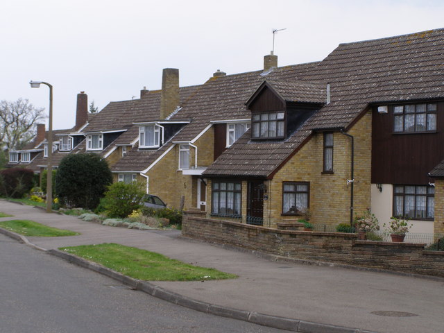
The village is primarily residential, consisting of a collection of traditional cottages and houses. Many of these properties date back several centuries, adding to the area's charm and character. The village also boasts a small church, St. Mary's, which serves as a focal point for the community and holds regular religious services.

Despite its small size, Spitalbrook benefits from its proximity to larger towns and cities in Hertfordshire. Nearby towns such as Hertford and Ware offer a range of amenities, including shopping centers, schools, and healthcare facilities. The village is well-connected to these towns and other parts of the county via a network of roads, with easy access to major motorways such as the A10 and the M25.

Surrounded by beautiful countryside, Spitalbrook offers residents and visitors ample opportunities for outdoor activities. The area is dotted with walking trails and nature reserves, allowing individuals to explore and enjoy the natural beauty of the region. Additionally, the village is located near several historic sites and attractions, including Hatfield House and Knebworth House, which further enrich the cultural experience for residents and tourists alike.

Overall, Spitalbrook is a tranquil and idyllic village that offers a peaceful retreat from the hustle and bustle of nearby urban areas, while still providing access to essential amenities and attractions.

If you have any feedback on the listing, please let us know in the comments section below.
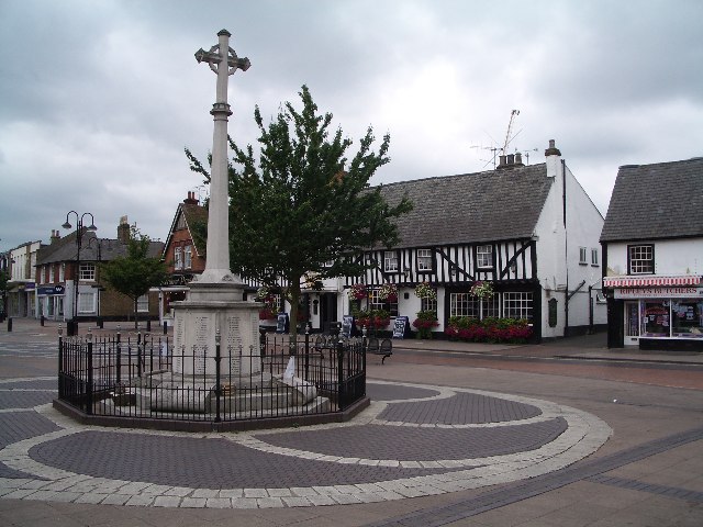
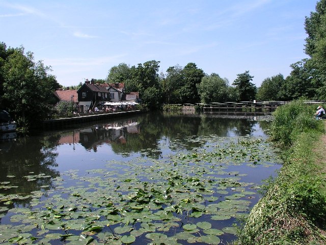
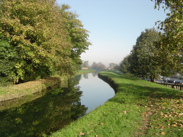
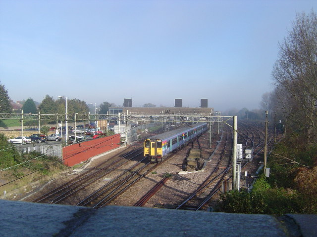
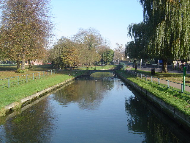
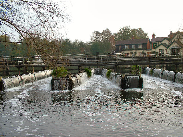
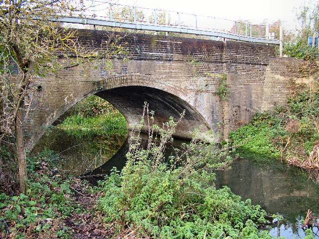
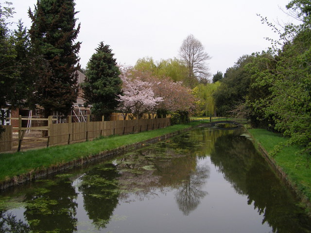
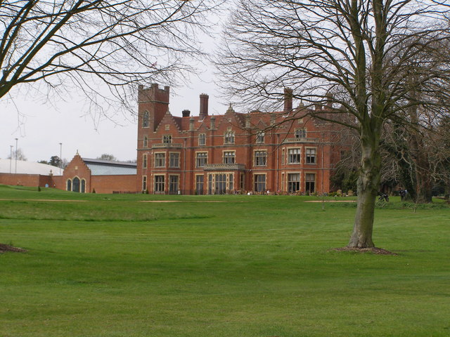
Spitalbrook Images

Images are sourced within 2km of 51.752486/-0.013033 or Grid Reference TL3707. Thanks to Geograph Open Source API. All images are credited.

Hoddesdon Town Hoddesdon Town Centre showing War Memorial and White Swan Public House
Hoddesdon Town
Hoddesdon Town Centre showing War Memorial and White Swan Public House
Barclay Park The photograph faces north across the Lake in Barclay Park. The park was given to the town of Hoddesdon in 1935 as a recreational area
Barclay Park
The photograph faces north across the Lake in Barclay Park. The park was given to the town of Hoddesdon in 1935 as a recreational area
Dobb's Weir, Nazeing. Fish & Eels pub by the canal at Dobb's Weir, Lea Valley, Nazeing & Hoddesdon area
Dobb's Weir, Nazeing.
Fish & Eels pub by the canal at Dobb's Weir, Lea Valley, Nazeing & Hoddesdon area
St Augustine's Church, Church Fields, Broxbourne St Augustine's is the Church of England Parish Church at Broxbourne, and is situated at Church Fields, Broxbourne.  This image was taken at wedding of Andrew Church and Sorrel Wallis on 24 July 2004.

<span class="nowrap"><a title="http://www.acny.org.uk/venue.php?V=7853" rel="nofollow ugc noopener" href="http://www.acny.org.uk/venue.php?V=7853">Link</a><img style="margin-left:2px;" alt="External link" title="External link - shift click to open in new window" src="https://s1.geograph.org.uk/img/external.png" width="10" height="10"/></span>
St Augustine's Church, Church Fields, Broxbourne
St Augustine's is the Church of England Parish Church at Broxbourne, and is situated at Church Fields, Broxbourne. This image was taken at wedding of Andrew Church and Sorrel Wallis on 24 July 2004. LinkExternal link
The New River, Broxbourne The New River is something of a misnomer since it is neither a river nor new. It is an aqueduct built under the direction of Sir Hugh Myddleton between 1607 and 1612 to bring fresh drinking water from Chadwell and Amwell Springs near Ware about 40 miles down the Lee Valley to London. <span class="nowrap"><a title="http://www.engineering-timelines.com/scripts/engineeringItem.asp?id=438" rel="nofollow ugc noopener" href="http://www.engineering-timelines.com/scripts/engineeringItem.asp?id=438">Link</a><img style="margin-left:2px;" alt="External link" title="External link - shift click to open in new window" src="https://s1.geograph.org.uk/img/external.png" width="10" height="10"/></span> for further information.
The New River, Broxbourne
The New River is something of a misnomer since it is neither a river nor new. It is an aqueduct built under the direction of Sir Hugh Myddleton between 1607 and 1612 to bring fresh drinking water from Chadwell and Amwell Springs near Ware about 40 miles down the Lee Valley to London. LinkExternal link for further information.
Broxbourne: Recreation Ground Viewed looking westwards from The New River
Broxbourne: Recreation Ground
Viewed looking westwards from The New River
Broxbourne railway station Viewed looking northwards from the Station Road bridge, Broxbourne station was moved from its old location by the bridge and rebuilt on its present site in 1960. The station is on the Liverpool Street to Cambridge and Stansted Airport and Hertford East lines. A southbound train for Liverpool Street is just leaving the station.
Broxbourne railway station
Viewed looking northwards from the Station Road bridge, Broxbourne station was moved from its old location by the bridge and rebuilt on its present site in 1960. The station is on the Liverpool Street to Cambridge and Stansted Airport and Hertford East lines. A southbound train for Liverpool Street is just leaving the station.
The New River, Broxbourne The New River is something of a misnomer since it is neither a river nor new. It is an aqueduct built under the direction of Sir Hugh Myddleton between 1607 and 1612 to bring fresh drinking water from Chadwell and Amwell Springs near Ware about 40 miles down the Lee Valley to London. <span class="nowrap"><a title="http://www.engineering-timelines.com/scripts/engineeringItem.asp?id=438" rel="nofollow ugc noopener" href="http://www.engineering-timelines.com/scripts/engineeringItem.asp?id=438">Link</a><img style="margin-left:2px;" alt="External link" title="External link - shift click to open in new window" src="https://s1.geograph.org.uk/img/external.png" width="10" height="10"/></span> for further information.
The New River, Broxbourne
The New River is something of a misnomer since it is neither a river nor new. It is an aqueduct built under the direction of Sir Hugh Myddleton between 1607 and 1612 to bring fresh drinking water from Chadwell and Amwell Springs near Ware about 40 miles down the Lee Valley to London. LinkExternal link for further information.
Meadow Lea Nursery, Dobbs Weir Road Meadow Lea Nursery, south side of Dobbs Weir Road, opposite Netherhall Fishery
Meadow Lea Nursery, Dobbs Weir Road
Meadow Lea Nursery, south side of Dobbs Weir Road, opposite Netherhall Fishery
Rye House Power Station Rye House Power Station is partly in Grid Reference TL3809 and partly in TL3808
Rye House Power Station
Rye House Power Station is partly in Grid Reference TL3809 and partly in TL3808
The Fish & Eels P.H. at Dobbs Weir
Bridge over The River Lea at Nazeing
Railway Bridge at Old Mill Broxbourne
Suburban Housing Broxbourne Herts One of many relatively new housing estates that have been built in Broxbourne to help cater for the ever growing demand for housing in the South East.
Suburban Housing Broxbourne Herts
One of many relatively new housing estates that have been built in Broxbourne to help cater for the ever growing demand for housing in the South East.
New River The new river is an aqueduct originally built to transfer water from Amwell Springs in Hertfordshire to London.
New River
The new river is an aqueduct originally built to transfer water from Amwell Springs in Hertfordshire to London.
Hertfordshire Golf and Country Club House The club House is a grade ii listed building formerly known as Broxbournebury Mansion.
Hertfordshire Golf and Country Club House
The club House is a grade ii listed building formerly known as Broxbournebury Mansion.
Broxbourne Sailing Club  The club uses the Lake formed on the site of a former gravel extraction pit.
Broxbourne Sailing Club
The club uses the Lake formed on the site of a former gravel extraction pit.
River Lea Navigation Part of the Lea Valley Park. The river lea has been straightened in this section to allow barge traffic
River Lea Navigation
Part of the Lea Valley Park. The river lea has been straightened in this section to allow barge traffic
Show me another place!

Spitalbrook is located at Grid Ref: TL3707 (Lat: 51.752486, Lng: -0.013033)

Administrative County: Hertfordshire

District: Broxbourne

Police Authority: Hertfordshire

What 3 Words

///globe.pasta.tops. Near Broxbourne, Hertfordshire

Nearby Locations

Spitalbrook Broxbourne

Related Wikis

Spital Brook

Spital Brook is a minor tributary of the River Lea which rises in Hoddesdonpark Wood in the county of Hertfordshire, England. Spital Brook flows eastwards...

Robert Barclay Academy

Robert Barclay Academy (formerly Sheredes School) is a co-educational secondary school and sixth form located in Hoddesdon in the English county of Hertfordshire...

Rawdon House

Rawdon House is a former residence in the High Street of Hoddesdon, Hertfordshire, England. It was built as a house in 1622 by Marmaduke Rawdon, and extended...

Broxbourne railway station

Broxbourne railway station is on the West Anglia Main Line serving the towns of Broxbourne and Hoddesdon in Hertfordshire, England. It is 17 miles 17 chains...

Nearby Amenities

Located within 500m of 51.752486,-0.013033
Crossing
Crossing: traffic_signals
Lat/Long: 51.755772/-0.0130822
Crossing: informal
Lat/Long: 51.7537724/-0.0106415
Created By: YahooApplet 1.0
Lat/Long: 51.7558017/-0.0082978
Created By: YahooApplet 1.0
Lat/Long: 51.7519496/-0.0113877
Railway: switch
Lat/Long: 51.7519656/-0.0067303
Bus Stop
St David's Drive
Bench: yes
Lit: yes
Local Ref: NR
Naptan AtcoCode: 210021701400
Naptan Bearing: NE
Naptan CommonName: St David's Drive
Naptan Indicator: nr
Naptan Landmark: Unknown
Naptan NaptanCode: hrtamdtg
Naptan PlusbusZoneRef: BROXBRN
Naptan ShortCommonName: NA
Naptan Street: High Road
Naptan Verified: yes
Public Transport: platform
Shelter: yes
Source: naptan_import
Tactile Paving: yes
Lat/Long: 51.7516469/-0.016388
Bus Stop
Lowewood Museum
Bench: yes
Bus: yes
Local Ref: NR
Naptan AtcoCode: 210021701420
Naptan Bearing: N
Naptan CommonName: Broxbourne Civic Hall
Naptan Crossing: Police Station
Naptan Indicator: nr
Naptan Landmark: Police Station
Naptan NaptanCode: hrtamdtj
Naptan PlusbusZoneRef: BROXBRN
Naptan ShortCommonName: NA
Naptan Street: High Street
Naptan Verified: no
Public Transport: platform
Shelter: yes
Source: naptan_import
Tactile Paving: yes
Lat/Long: 51.7550734/-0.0134868
Bus Stop
Lowewood Museum
Bench: no
Bus: yes
Naptan AtcoCode: 210021702540
Naptan Bearing: S
Naptan CommonName: Broxbourne Civic Hall
Naptan Crossing: opp Police Station
Naptan Indicator: opp
Naptan Landmark: opp Police Station
Naptan NaptanCode: hrtamama
Naptan PlusbusZoneRef: BROXBRN
Naptan ShortCommonName: NA
Naptan Street: High Street
Naptan Verified: yes
Public Transport: platform
Shelter: no
Source: naptan_import
Tactile Paving: no
Lat/Long: 51.7551884/-0.0131879
Bus Stop
St David's Drive
Bench: no
Lit: yes
Naptan AtcoCode: 210021702560
Naptan Bearing: SW
Naptan CommonName: St David's Drive
Naptan Crossing: New Road
Naptan Indicator: opp
Naptan Landmark: New Road
Naptan NaptanCode: hrtamamd
Naptan PlusbusZoneRef: BROXBRN
Naptan ShortCommonName: NA
Naptan Street: High Road
Naptan Verified: yes
Public Transport: platform
Shelter: no
Source: naptan_import
Tactile Paving: no
Lat/Long: 51.7513812/-0.0165577
Post Box
Collection Times: Mo-Fr 16:45, Sa 11:00
Post Box Design: penfold
Post Box Type: pillar
Ref: EN11 109
Royal Cypher: VR
Royal Cypher Wikidata: Q33102356
Lat/Long: 51.7552177/-0.0134168
Post Box
Collection Times: Mo-Fr 09:00; Sa 07:00
Post Box Type: lamp
Ref: EN11 128
Royal Cypher: EIIR
Royal Cypher Wikidata: Q33102113
Lat/Long: 51.753249/-0.0101436
Give Way
Direction: backward
Lat/Long: 51.7559449/-0.0129596
Traffic Calming: hump
Lat/Long: 51.7568625/-0.0139915
Man Made: silo
Lat/Long: 51.7499928/-0.0089015
Railway: buffer_stop
Lat/Long: 51.7484835/-0.0098343
Railway: buffer_stop
Lat/Long: 51.7484998/-0.0099005
Railway: switch
Lat/Long: 51.7490926/-0.0090593
Railway: switch
Lat/Long: 51.7495332/-0.0087993
Railway: switch
Lat/Long: 51.7500223/-0.0083511
Railway: switch
Lat/Long: 51.7503744/-0.007859
Railway: switch
Lat/Long: 51.7524849/-0.0064667
Railway: switch
Lat/Long: 51.7486777/-0.0093506
Railway: switch
Lat/Long: 51.7489824/-0.0089914
Entrance: yes
Lat/Long: 51.7560601/-0.0148421
Entrance: yes
Lat/Long: 51.7556423/-0.0147883
Entrance: yes
Lat/Long: 51.7555831/-0.0147934
Barrier: lift_gate
Lat/Long: 51.7557567/-0.0148259
Recycling
Lat/Long: 51.7558562/-0.0143025
Parking Space: disabled
Lat/Long: 51.7559623/-0.0145619
Parking Space: disabled
Lat/Long: 51.7559995/-0.0145548
Parking Space: disabled
Lat/Long: 51.7558924/-0.0145751
Parking
Parking Space: disabled
Lat/Long: 51.7557045/-0.0147924
Parking
Parking Space: disabled
Lat/Long: 51.7556738/-0.0147951
Parking Space: disabled
Lat/Long: 51.7559281/-0.0145683
Entrance: yes
Lat/Long: 51.7556023/-0.0147917
Entrance: yes
Lat/Long: 51.7556258/-0.0147897
Railway: switch
Lat/Long: 51.7491982/-0.0088898
Give Way
Direction: forward
Lat/Long: 51.7514663/-0.0186642
Give Way
Direction: backward
Lat/Long: 51.7519711/-0.0160678
Barrier: swing_gate
Lat/Long: 51.7558748/-0.0141322
Barrier: swing_gate
Lat/Long: 51.7562552/-0.0140392
Traffic Calming: hump
Lat/Long: 51.7566693/-0.014107
Give Way
Direction: forward
Lat/Long: 51.7565007/-0.0139252
Recycling
Recycling Type: centre
Lat/Long: 51.752826/-0.0142948
Give Way
Direction: backward
Lat/Long: 51.7543986/-0.0136823
Crossing
Crossing: traffic_signals
Lat/Long: 51.7520044/-0.0158002
Give Way
Direction: forward
Lat/Long: 51.7518994/-0.0159932
Give Way
Direction: backward
Lat/Long: 51.7513267/-0.0167942
Barrier: kissing_gate
Lat/Long: 51.7537259/-0.0106711
Barrier: kissing_gate
Lat/Long: 51.7538203/-0.01061
Colour Back: green
Colour Text: white
Information: guidepost
Tourism: information
Lat/Long: 51.7537468/-0.0106395
The data included in this document is from www.openstreetmap.org. The data is made available under ODbL.

Have you been to Spitalbrook?

Leave your review of Spitalbrook below (or comments, questions and feedback).