Spartylea

Settlement in Northumberland

England

Spartylea

Road crossing ford of River East Allen There's a mere trickle of water across the concrete of the ford near to Low Huntwell on this occasion but the water depth indicator to the right of the crossing suggests a depth of up to six feet might be possible: a frightening prospect!
Road crossing ford of River East Allen Credit: Trevor Littlewood

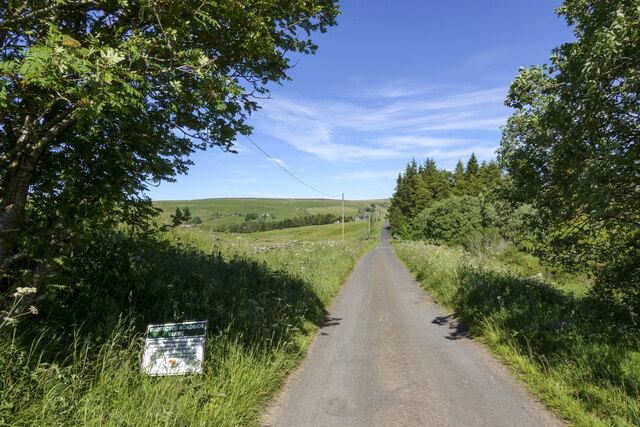
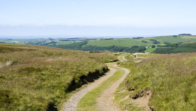
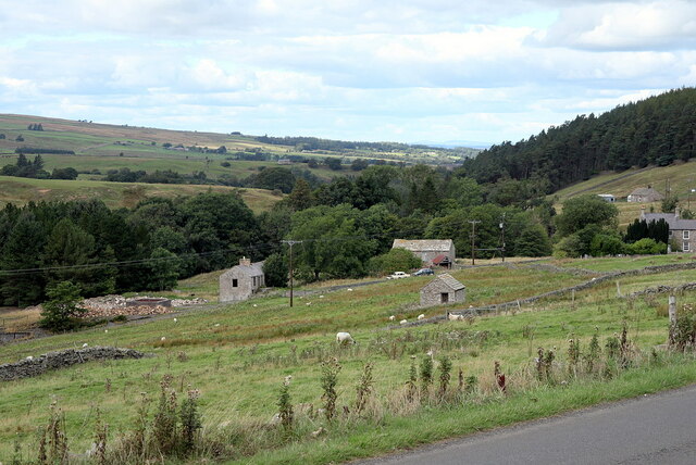
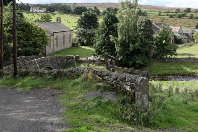
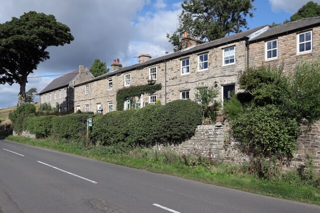
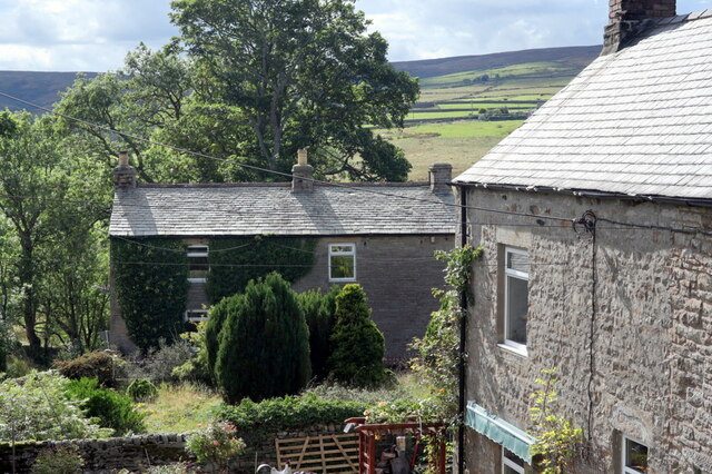
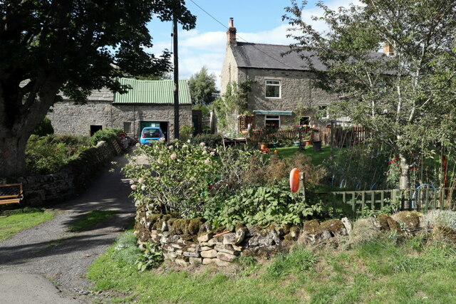
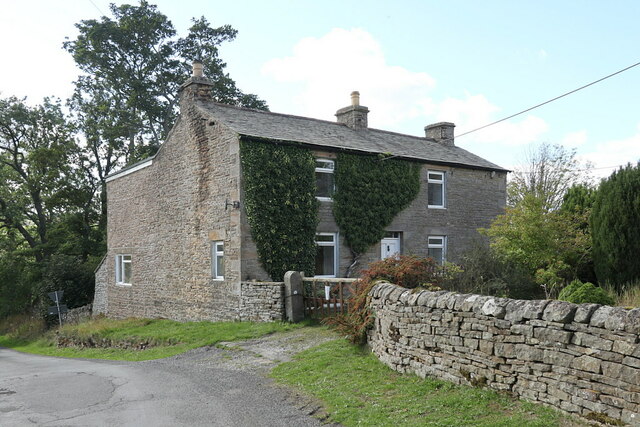
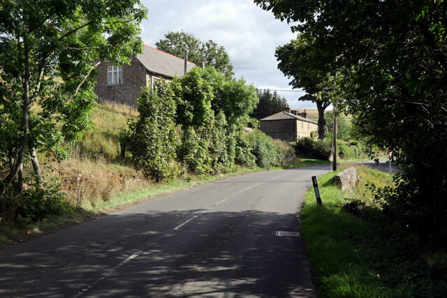
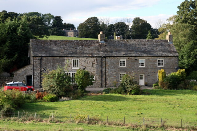
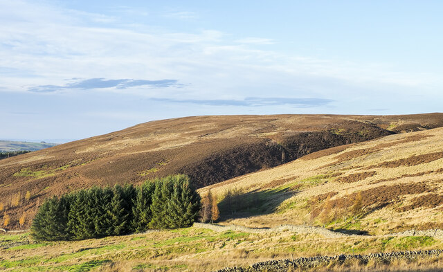
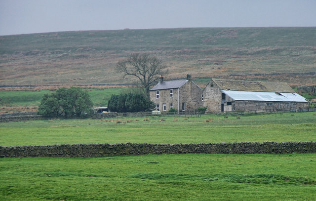
Spartylea is a small village located in the county of Northumberland, England. Situated in the picturesque countryside, the village is surrounded by rolling hills and lush green fields, providing a tranquil and idyllic setting for its residents.

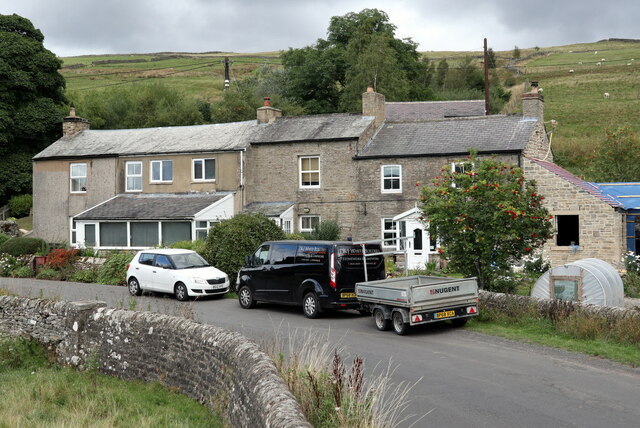
With a population of around 200 people, Spartylea is a close-knit community where neighbors know each other by name. The village is predominantly residential, with a scattering of charming cottages and traditional houses lining its streets. The architecture reflects the area's rich history, showcasing a blend of traditional and modern styles.

Although small in size, Spartylea boasts a strong sense of community spirit. The village has a community center which hosts various events and activities throughout the year, bringing residents together and fostering a sense of belonging. Additionally, there is a village pub, The Oak Inn, which serves as a popular meeting spot for locals and visitors alike.

Surrounded by natural beauty, Spartylea offers plenty of opportunities for outdoor enthusiasts. The nearby countryside provides ample space for hiking, cycling, and horse riding, with numerous trails and paths to explore. The village is also in close proximity to the River Coquet, attracting anglers seeking a peaceful spot for fishing.

While Spartylea may be small, its charm and sense of community make it a delightful place to live or visit. The tranquil surroundings, friendly atmosphere, and abundance of outdoor activities make it an appealing destination for those seeking a slower pace of life or a peaceful retreat.

If you have any feedback on the listing, please let us know in the comments section below.
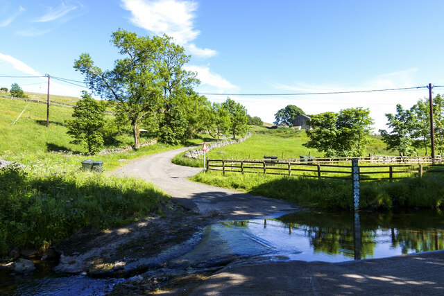
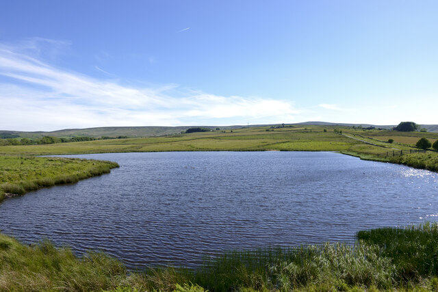
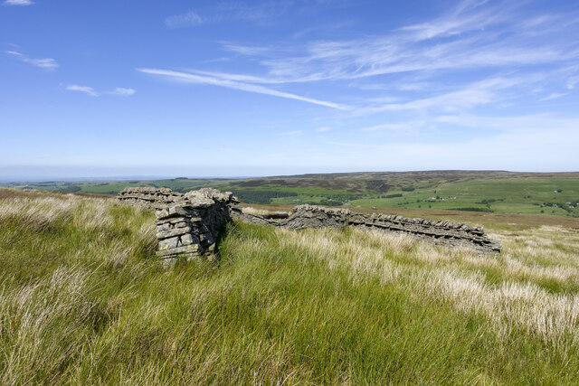
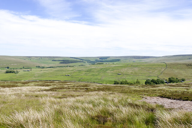
Spartylea Images

Images are sourced within 2km of 54.834451/-2.238258 or Grid Reference NY8448. Thanks to Geograph Open Source API. All images are credited.

Road crossing ford of River East Allen There's a mere trickle of water across the concrete of the ford near to Low Huntwell on this occasion but the water depth indicator to the right of the crossing suggests a depth of up to six feet might be possible: a frightening prospect!
Road crossing ford of River East Allen
There's a mere trickle of water across the concrete of the ford near to Low Huntwell on this occasion but the water depth indicator to the right of the crossing suggests a depth of up to six feet might be possible: a frightening prospect!
Coatenhill Reservoir Coatenhill Reservoir is one of a number constructed to supply water for power generation in the lead mines of East Allendale. It's in use now as a fishing lake.
Coatenhill Reservoir
Coatenhill Reservoir is one of a number constructed to supply water for power generation in the lead mines of East Allendale. It's in use now as a fishing lake.
Philipson's Fold Philipson's Fold is on moorland overlooking East Allendale and is probably not actually a sheepfold.
A sheepfold is a pen of some kind which can be used to confine animals. The structure here is in the form of a distorted 'H' shape and is probably more of a shelter about which sheep could gather for protection from weather coming from any direction.
Philipson's Fold
Philipson's Fold is on moorland overlooking East Allendale and is probably not actually a sheepfold. A sheepfold is a pen of some kind which can be used to confine animals. The structure here is in the form of a distorted 'H' shape and is probably more of a shelter about which sheep could gather for protection from weather coming from any direction.
Moorland below route of bridleway The heather and grass moorland is on a slope descending towards Swin Hope, a tributary valley of East Allendale; that main valley lies beyond the middle-distance ridge. The village of Allenheads is there, below the coniferous plantations.
Moorland below route of bridleway
The heather and grass moorland is on a slope descending towards Swin Hope, a tributary valley of East Allendale; that main valley lies beyond the middle-distance ridge. The village of Allenheads is there, below the coniferous plantations.
Road beside 'protected verge' An unusual notice beside the road: it tells that the verge is being 'positively managed' by Northumberland County Council to conserve wild plants. It gives no added information as to what measures are being taken or how the public should act as a result.
Road beside 'protected verge'
An unusual notice beside the road: it tells that the verge is being 'positively managed' by Northumberland County Council to conserve wild plants. It gives no added information as to what measures are being taken or how the public should act as a result.
Black Way heading north Black Way is a hill road on the west side of East Allendale. It's also the route used by the named walk, Isaac's Tea Trail which has joined it just behind the camera position.
Black Way heading north
Black Way is a hill road on the west side of East Allendale. It's also the route used by the named walk, Isaac's Tea Trail which has joined it just behind the camera position.
Location of Sipton Lead Mines The capped shaft of the Blackett Level at Sipton can be seen left, centre. This photo was taken as an attempt to reproduce an old photograph. The mine buildings were pulled down in 1950.

The small building in the field (150 metres South Of Sipton Terrace), just right of centre, was the mine Powder House or explosive Store.

Allen Valleys Local History Group: <span class="nowrap"><a title="http://www.allenvalleyslocalhistory.org.uk/photo/sipton-mine-0002-162/" rel="nofollow ugc noopener" href="http://www.allenvalleyslocalhistory.org.uk/photo/sipton-mine-0002-162/">Link</a><img style="margin-left:2px;" alt="External link" title="External link - shift click to open in new window" src="https://s1.geograph.org.uk/img/external.png" width="10" height="10"/></span> <span class="nowrap"><a title="https://web.archive.org/web/20220918142027/http://www.allenvalleyslocalhistory.org.uk/photo/sipton-mine-0002-162/" rel="nofollow ugc noopener" href="https://web.archive.org/web/20220918142027/http://www.allenvalleyslocalhistory.org.uk/photo/sipton-mine-0002-162/">Archive Link</a><img style="margin-left:2px;" alt="External link" title="External link - shift click to open in new window" src="https://s1.geograph.org.uk/img/external.png" width="10" height="10"/></span>
Location of Sipton Lead Mines
The capped shaft of the Blackett Level at Sipton can be seen left, centre. This photo was taken as an attempt to reproduce an old photograph. The mine buildings were pulled down in 1950. The small building in the field (150 metres South Of Sipton Terrace), just right of centre, was the mine Powder House or explosive Store. Allen Valleys Local History Group: LinkExternal link Archive LinkExternal link
Lowshield Close, Ellershope Bridge, Spartylea View of 'Spartylea Corner' c.1910 on Allen Valleys Local History Group website: <span class="nowrap"><a title="http://www.allenvalleyslocalhistory.org.uk/photo/spartylea-1910-0033-003/" rel="nofollow ugc noopener" href="http://www.allenvalleyslocalhistory.org.uk/photo/spartylea-1910-0033-003/">Link</a><img style="margin-left:2px;" alt="External link" title="External link - shift click to open in new window" src="https://s1.geograph.org.uk/img/external.png" width="10" height="10"/></span> <span class="nowrap"><a title="https://web.archive.org/web/20220918172320/http://www.allenvalleyslocalhistory.org.uk/photo/spartylea-1910-0033-003/" rel="nofollow ugc noopener" href="https://web.archive.org/web/20220918172320/http://www.allenvalleyslocalhistory.org.uk/photo/spartylea-1910-0033-003/">Archive Link</a><img style="margin-left:2px;" alt="External link" title="External link - shift click to open in new window" src="https://s1.geograph.org.uk/img/external.png" width="10" height="10"/></span>
Lowshield Close, Ellershope Bridge, Spartylea
View of 'Spartylea Corner' c.1910 on Allen Valleys Local History Group website: LinkExternal link Archive LinkExternal link
St Peter's Church & Corn Mill from east There is a similar view c.1905 on the website of the Allen Valleys Local History Group: <span class="nowrap"><a title="http://www.allenvalleyslocalhistory.org.uk/photo/allendale-1905-0031-052/" rel="nofollow ugc noopener" href="http://www.allenvalleyslocalhistory.org.uk/photo/allendale-1905-0031-052/">Link</a><img style="margin-left:2px;" alt="External link" title="External link - shift click to open in new window" src="https://s1.geograph.org.uk/img/external.png" width="10" height="10"/></span> <span class="nowrap"><a title="https://web.archive.org/web/20220918172001/http://www.allenvalleyslocalhistory.org.uk/photo/allendale-1905-0031-052/" rel="nofollow ugc noopener" href="https://web.archive.org/web/20220918172001/http://www.allenvalleyslocalhistory.org.uk/photo/allendale-1905-0031-052/">Archive Link</a><img style="margin-left:2px;" alt="External link" title="External link - shift click to open in new window" src="https://s1.geograph.org.uk/img/external.png" width="10" height="10"/></span>
St Peter's Church & Corn Mill from east
There is a similar view c.1905 on the website of the Allen Valleys Local History Group: LinkExternal link Archive LinkExternal link
Spartylea Terrace, Spartylea
Old Post Office, Spartylea There is another photo here <a href="https://www.geograph.org.uk/photo/7286475">NY8448 : Old Post Office, Spartylea</a>

The current Post Office is in the building on the right <a href="https://www.geograph.org.uk/photo/7286472">NY8549 : Post Office, Spartylea</a>.

There is an old postcard view of the Post Office and Sparty Lea here: <span class="nowrap"><a title="http://www.allenvalleyslocalhistory.org.uk/photo/spartylea-1910-0037-015/" rel="nofollow ugc noopener" href="http://www.allenvalleyslocalhistory.org.uk/photo/spartylea-1910-0037-015/">Link</a><img style="margin-left:2px;" alt="External link" title="External link - shift click to open in new window" src="https://s1.geograph.org.uk/img/external.png" width="10" height="10"/></span> <span class="nowrap"><a title="https://web.archive.org/web/20220918171534/http://www.allenvalleyslocalhistory.org.uk/photo/spartylea-1910-0037-015/" rel="nofollow ugc noopener" href="https://web.archive.org/web/20220918171534/http://www.allenvalleyslocalhistory.org.uk/photo/spartylea-1910-0037-015/">Archive Link</a><img style="margin-left:2px;" alt="External link" title="External link - shift click to open in new window" src="https://s1.geograph.org.uk/img/external.png" width="10" height="10"/></span>
Old Post Office, Spartylea
There is another photo here NY8448 : Old Post Office, Spartylea The current Post Office is in the building on the right NY8549 : Post Office, Spartylea. There is an old postcard view of the Post Office and Sparty Lea here: LinkExternal link Archive LinkExternal link
Post Office, Spartylea
Old Post Office, Spartylea
Road at Spartylea The old chapel is on the left <a href="https://www.geograph.org.uk/photo/6637472">NY8548 : Primitive Methodist Chapel, Spartylea</a> with the terrace further along the road <a href="https://www.geograph.org.uk/photo/7286457">NY8548 : Spartylea Terrace, Spartylea</a>.
Road at Spartylea
The old chapel is on the left NY8548 : Primitive Methodist Chapel, Spartylea with the terrace further along the road NY8548 : Spartylea Terrace, Spartylea.
Burnfoot, Allenheads Burnfoot Farmhouse and barn were built in the late 17th century. An inscription above a lintel reads: ANNO DOMINI 1678 with the initials 'W D'. The house was altered in the late 18th century and the barn added in the early 19th century.

Burnfoot is a Grade II Listed Building (1154819): <span class="nowrap"><a title="https://historicengland.org.uk/listing/the-list/list-entry/1154819" rel="nofollow ugc noopener" href="https://historicengland.org.uk/listing/the-list/list-entry/1154819">Link</a><img style="margin-left:2px;" alt="External link" title="External link - shift click to open in new window" src="https://s1.geograph.org.uk/img/external.png" width="10" height="10"/></span>

The house on the hill behind is Hammershield <a href="https://www.geograph.org.uk/photo/2121463">NY8447 : Hammershield Farm</a>
Burnfoot, Allenheads
Burnfoot Farmhouse and barn were built in the late 17th century. An inscription above a lintel reads: ANNO DOMINI 1678 with the initials 'W D'. The house was altered in the late 18th century and the barn added in the early 19th century. Burnfoot is a Grade II Listed Building (1154819): LinkExternal link The house on the hill behind is Hammershield NY8447 : Hammershield Farm
Small plantation near to Sipton Burn Sipton Burn flows in the valley beyond the trees.
The flat-topped moorland dome is Sipton Law.
Small plantation near to Sipton Burn
Sipton Burn flows in the valley beyond the trees. The flat-topped moorland dome is Sipton Law.
High Knock Shield High Knock Shield Farm in Allendale.
High Knock Shield
High Knock Shield Farm in Allendale.
Bridle Path to Fell View
Show me another place!

Spartylea is located at Grid Ref: NY8448 (Lat: 54.834451, Lng: -2.238258)

Unitary Authority: Northumberland

Police Authority: Northumbria

What 3 Words

///flocking.impressed.balanced. Near Alston, Cumbria

Related Wikis

Hexhamshire Moors

Hexhamshire Moors is a Site of Special Scientific Interest covering an extensive area of moorland in the Wear Valley district of north-west County Durham...

Sinderhope

Sinderhope is a hamlet situated on the east Allen Valley in south-west Northumberland. The population is spread over farms in an area approximately 25...

Acton, Northumberland

Acton is a small hamlet in Northumberland, north-east England, about 3 miles (5 km) south of Allendale Town. Acton is usually Anglo-Saxon Old English...

Allendale Moors

Allendale Moors is a Site of Special Scientific Interest (SSSI) in Northumberland, England. The upland moorland ridge site is listed for its heath, flush...

Allenheads

Allenheads is a former mining village in the Pennines to the north of Weardale in Northumberland, England. Lead extraction was the settlement's industry...

Carr Shield

Carrshield is a village in Northumberland, in England. It is situated in the Pennines approximately between Penrith and Hexham. It is a small village with...

Throssel Hole Buddhist Abbey

Throssel Hole Buddhist Abbey is a Buddhist monastery and retreat centre located in Northumberland, in northern England. The monastic order is equally for...

Coalcleugh

Coalcleugh is a hamlet in Northumberland, England. It is situated in the Pennines between Penrith and Hexham. In the past it was well known as a lead mining...

Nearby Amenities

Located within 500m of 54.834451,-2.238258
Barrier: yes
Lat/Long: 54.8328229/-2.2389062
Barrier: yes
Lat/Long: 54.832036/-2.236625
The data included in this document is from www.openstreetmap.org. The data is made available under ODbL.

Have you been to Spartylea?

Leave your review of Spartylea below (or comments, questions and feedback).