Southwick
Settlement in Northamptonshire
England
Southwick

Southwick is a small village located in the county of Northamptonshire, in the East Midlands region of England. Situated about 3 miles south of Oundle, it is nestled in a picturesque rural landscape, characterized by rolling hills and open farmland. Southwick falls within the local government district of East Northamptonshire.
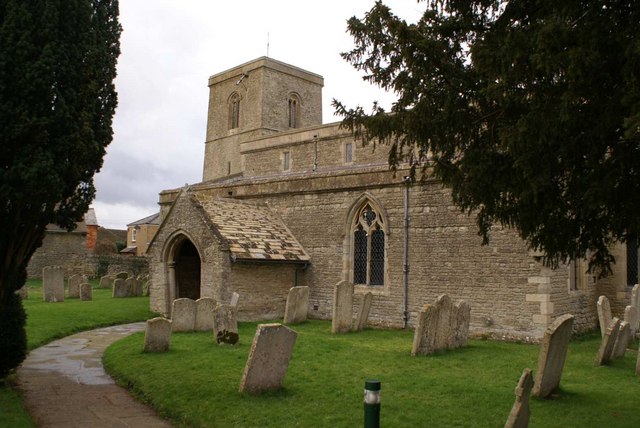
The village has a population of around 200 residents, contributing to its close-knit and friendly community atmosphere. The architecture of Southwick showcases a blend of historic and modern buildings, with some dating back centuries. The village church, St. Mary's, stands as a prominent landmark, boasting a beautiful medieval tower and stained glass windows.
Despite its small size, Southwick offers a range of amenities for its residents. These include a village hall, where various social and recreational activities take place, a primary school providing education for local children, and a post office that serves as the hub for postal services. The village also has a pub, The Red Lion, which serves as a gathering place for locals and visitors alike.
For outdoor enthusiasts, Southwick is surrounded by stunning countryside, offering ample opportunities for walking, cycling, and exploring the natural beauty of the area. The nearby Nene Way footpath provides a scenic route along the River Nene, offering picturesque views and wildlife sightings.
Overall, Southwick, Northamptonshire is a charming village that prides itself on its community spirit and tranquil setting. It offers a peaceful retreat for residents and visitors seeking a slice of rural English life.
If you have any feedback on the listing, please let us know in the comments section below.
Southwick Images
Images are sourced within 2km of 52.516821/-0.49785978 or Grid Reference TL0292. Thanks to Geograph Open Source API. All images are credited.


Southwick is located at Grid Ref: TL0292 (Lat: 52.516821, Lng: -0.49785978)
Unitary Authority: North Northamptonshire
Police Authority: Northamptonshire
What 3 Words
///whimpered.clarifies.pint. Near Oundle, Northamptonshire
Nearby Locations
Related Wikis
Southwick, Northamptonshire
Southwick (pronounced "Suth-ick") is a small village and civil parish in Northamptonshire, England. It is approximately 3 miles (4.8 km) north of the town...

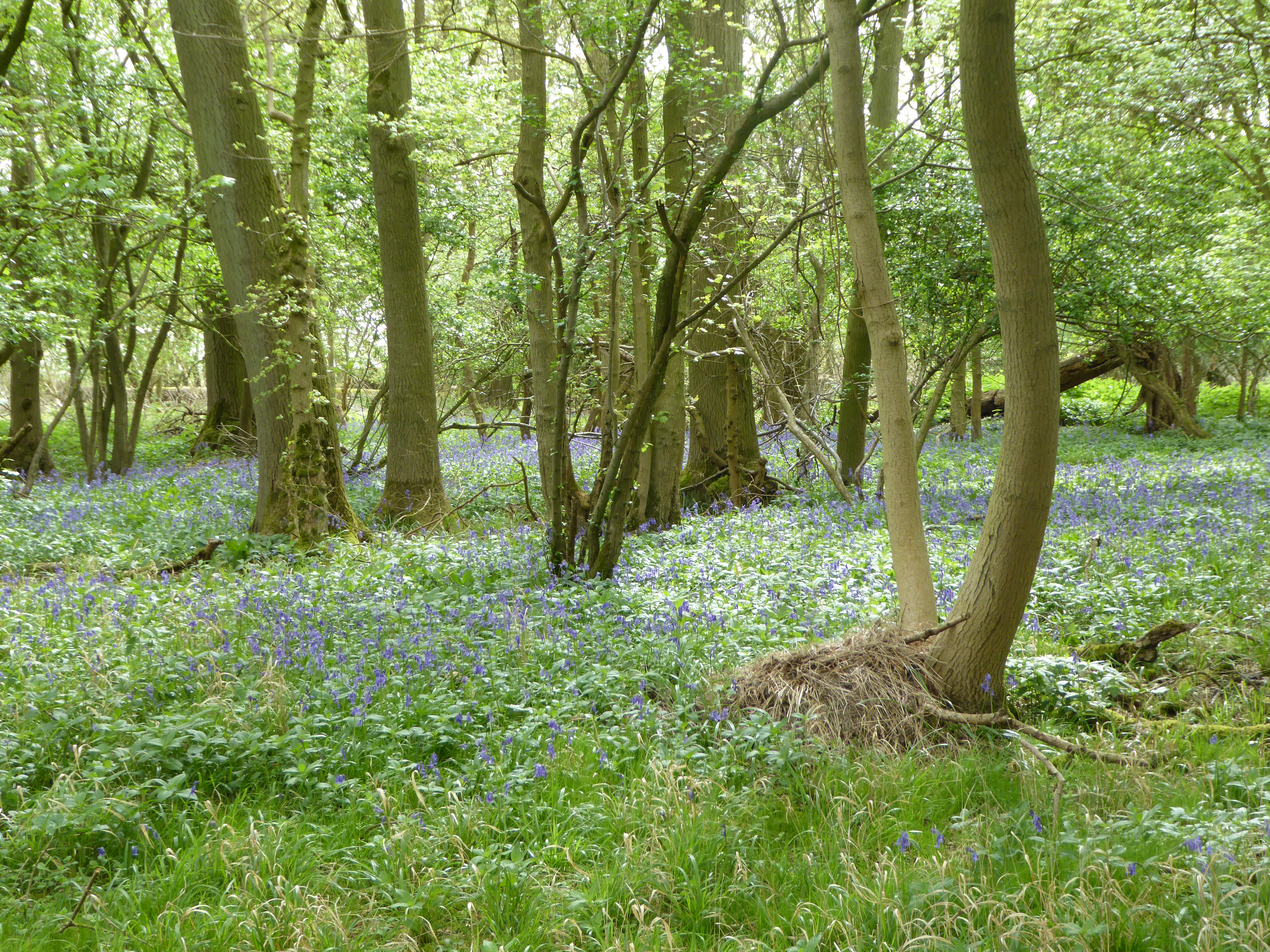
Short Wood and Southwick Wood
Short Wood and Southwick Wood is a 54.7-hectare (135-acre) nature reserve north-west of Oundle in Northamptonshire. It is managed by the Wildlife Trust...

Glapthorn
Glapthorn is a village and civil parish in North Northamptonshire, England. At the time of the 2001 census, the parish's population was 264 people, increasing...
Glapthorn Cow Pasture
Glapthorn Cow Pasture is a 28.2-hectare (70-acre) biological Site of Special Scientific Interest north-west of Oundle in Northamptonshire. It is managed...
Oundle and Thrapston Rural District
Oundle and Thrapston was a rural district in Northamptonshire, England from 1935 to 1974. It was formed in 1935 under the County Review Order as a merger...
Cotterstock
Cotterstock is a village and civil parish in North Northamptonshire, England. The population of the civil parish at the 2011 census was 153. == Geography... ==

Woodnewton
Woodnewton is a village in Northamptonshire, England. Essentially a pair of parallel streets, the village lies to the north of a small stream, the Willow...

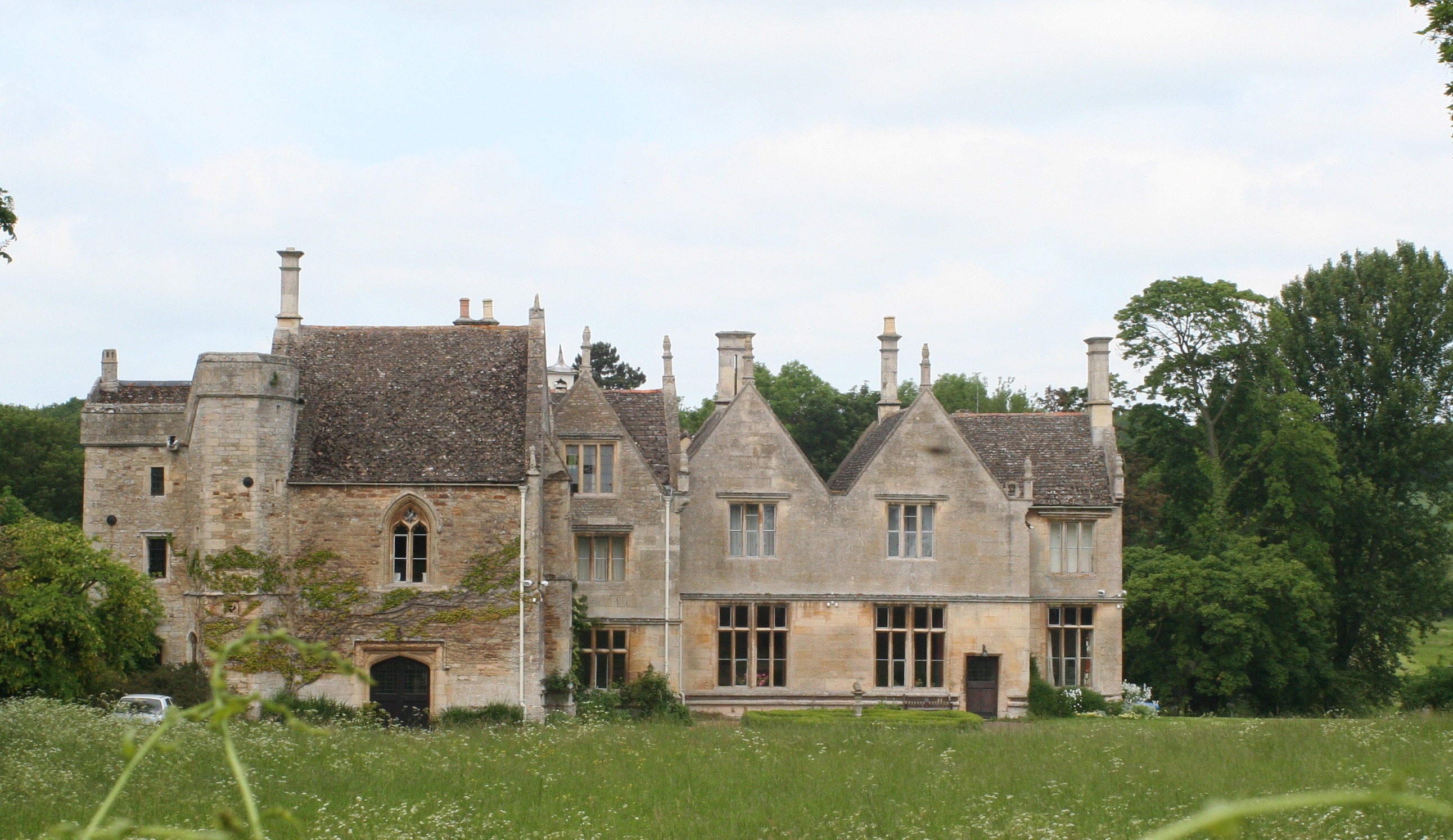
Apethorpe Palace
Apethorpe Palace (pronounced Ap-thorp), formerly known as "Apethorpe Hall", is a Grade I listed country house, dating to the 15th century, close to Apethorpe...
Nearby Amenities
Located within 500m of 52.516821,-0.49785978Have you been to Southwick?
Leave your review of Southwick below (or comments, questions and feedback).