Southwater Street

Settlement in Sussex Horsham

England

Southwater Street

Sheep and Blackthorn In the field crossed by footpath 1628/3 north of Christ's Hospital.
Sheep and Blackthorn Credit: Robin Webster

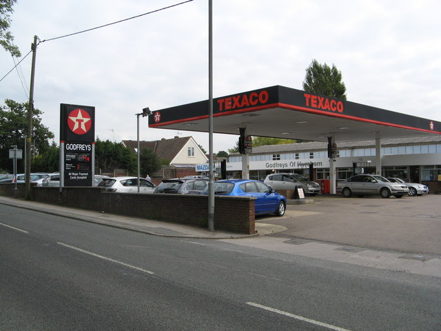
Southwater Street is a charming and bustling thoroughfare located in West Sussex, England. Situated in the heart of the village of Southwater, this street serves as the main artery of the town, offering a variety of amenities and attractions.

Lined with an array of independent shops and boutiques, Southwater Street provides a unique shopping experience for locals and visitors alike. From trendy clothing stores to quaint gift shops, there is something to suit every taste and style. Additionally, the street is home to a number of cafes and restaurants, offering a diverse range of culinary delights, from traditional British cuisine to international dishes.

Not only is Southwater Street a hub for shopping and dining, but it is also a vibrant community center. The street plays host to regular events and festivals throughout the year, showcasing the talents of local artists and musicians. This creates a lively atmosphere and a sense of community spirit that is palpable as you stroll along the street.

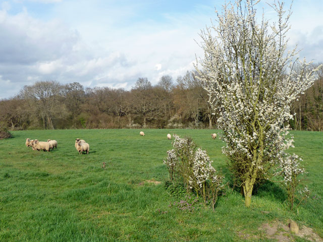
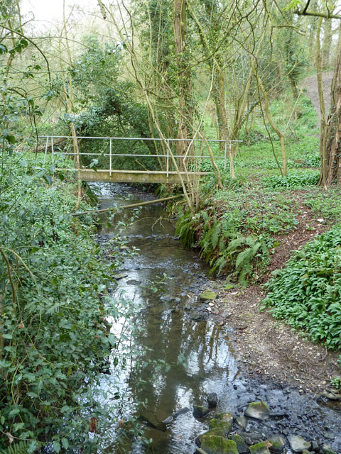
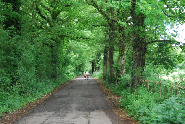
Southwater Street is conveniently located near Southwater Country Park, a picturesque nature reserve that offers opportunities for leisurely walks and outdoor activities. Visitors can enjoy the tranquility of the park before venturing into the vibrant street to explore the various shops and eateries on offer.

Overall, Southwater Street in Sussex is a charming and lively destination that offers a delightful mix of shopping, dining, and community spirit. Whether you are a local resident or a tourist passing through, this street is well worth a visit.

If you have any feedback on the listing, please let us know in the comments section below.

Southwater Street Images

Images are sourced within 2km of 51.035613/-0.345103 or Grid Reference TQ1627. Thanks to Geograph Open Source API. All images are credited.

Sheep and Blackthorn In the field crossed by footpath 1628/3 north of Christ's Hospital.
Sheep and Blackthorn
In the field crossed by footpath 1628/3 north of Christ's Hospital.
Footbridge on path 1628/3 The junction with footpath 1637 is just to the right of the view - this path can just be seen climbing out of the gill.
Footbridge on path 1628/3
The junction with footpath 1637 is just to the right of the view - this path can just be seen climbing out of the gill.
Godfreys of Horsham
Godfreys of Horsham
Downs Link under the A24 The Downs Link is a 37-mile (59 km) footpath and bridleway linking the North Downs Way <a title="https://www.geograph.org.uk/snippet/174" href="https://www.geograph.org.uk/snippet/174">Link</a>  at St. Martha's Hill in Surrey with the South Downs Way <a title="https://www.geograph.org.uk/snippet/1186" href="https://www.geograph.org.uk/snippet/1186">Link</a>  near Steyning in West Sussex and on via the Coastal Link to Shoreham-by-Sea. Most of the route follows two dismantled railway lines, both closed by the Beeching cuts in the 1960s. The Shoreham-On-Sea to Christ’s Hospital line and the Christ’s Hospital to Shalford Junction line. The link opened in 1984. 
Cycle Route 223 follows the Downs link from Guildford to Shoreham.
The logo for the walk is the viaduct across the River Arun <a href="https://www.geograph.org.uk/photo/1870646">TQ0932 : Double Viaduct over the River Arun</a>.
A full history of the Cranleigh line (Christ’s Hospital to Shalford Junction) can be read at <span class="nowrap"><a title="http://en.wikipedia.org/wiki/Cranleigh_Line" rel="nofollow ugc noopener" href="http://en.wikipedia.org/wiki/Cranleigh_Line">Link</a><img style="margin-left:2px;" alt="External link" title="External link - shift click to open in new window" src="https://s1.geograph.org.uk/img/external.png" width="10" height="10"/></span>
Downs Link under the A24
The Downs Link is a 37-mile (59 km) footpath and bridleway linking the North Downs Way Link at St. Martha's Hill in Surrey with the South Downs Way Link near Steyning in West Sussex and on via the Coastal Link to Shoreham-by-Sea. Most of the route follows two dismantled railway lines, both closed by the Beeching cuts in the 1960s. The Shoreham-On-Sea to Christ’s Hospital line and the Christ’s Hospital to Shalford Junction line. The link opened in 1984. Cycle Route 223 follows the Downs link from Guildford to Shoreham. The logo for the walk is the viaduct across the River Arun TQ0932 : Double Viaduct over the River Arun. A full history of the Cranleigh line (Christ’s Hospital to Shalford Junction) can be read at LinkExternal link
Bridleway sign, Downs Link The Downs Link is a 37-mile (59 km) footpath and bridleway linking the North Downs Way <a title="https://www.geograph.org.uk/snippet/174" href="https://www.geograph.org.uk/snippet/174">Link</a>  at St. Martha's Hill in Surrey with the South Downs Way <a title="https://www.geograph.org.uk/snippet/1186" href="https://www.geograph.org.uk/snippet/1186">Link</a>  near Steyning in West Sussex and on via the Coastal Link to Shoreham-by-Sea. Most of the route follows two dismantled railway lines, both closed by the Beeching cuts in the 1960s. The Shoreham-On-Sea to Christ’s Hospital line and the Christ’s Hospital to Shalford Junction line. The link opened in 1984. 
Cycle Route 223 follows the Downs link from Guildford to Shoreham.
The logo for the walk is the viaduct across the River Arun <a href="https://www.geograph.org.uk/photo/1870646">TQ0932 : Double Viaduct over the River Arun</a>.
A full history of the Cranleigh line (Christ’s Hospital to Shalford Junction) can be read at <span class="nowrap"><a title="http://en.wikipedia.org/wiki/Cranleigh_Line" rel="nofollow ugc noopener" href="http://en.wikipedia.org/wiki/Cranleigh_Line">Link</a><img style="margin-left:2px;" alt="External link" title="External link - shift click to open in new window" src="https://s1.geograph.org.uk/img/external.png" width="10" height="10"/></span>
Bridleway sign, Downs Link
The Downs Link is a 37-mile (59 km) footpath and bridleway linking the North Downs Way Link at St. Martha's Hill in Surrey with the South Downs Way Link near Steyning in West Sussex and on via the Coastal Link to Shoreham-by-Sea. Most of the route follows two dismantled railway lines, both closed by the Beeching cuts in the 1960s. The Shoreham-On-Sea to Christ’s Hospital line and the Christ’s Hospital to Shalford Junction line. The link opened in 1984. Cycle Route 223 follows the Downs link from Guildford to Shoreham. The logo for the walk is the viaduct across the River Arun TQ0932 : Double Viaduct over the River Arun. A full history of the Cranleigh line (Christ’s Hospital to Shalford Junction) can be read at LinkExternal link
Telecommunications station, Southwater
Downs Link approaching Southwater
Woodland by Downs Link
Downs Link (Stakers Lane) The Downs Link is a 37-mile (59 km) footpath and bridleway linking the North Downs Way <a title="https://www.geograph.org.uk/snippet/174" href="https://www.geograph.org.uk/snippet/174">Link</a>  at St. Martha's Hill in Surrey with the South Downs Way <a title="https://www.geograph.org.uk/snippet/1186" href="https://www.geograph.org.uk/snippet/1186">Link</a>  near Steyning in West Sussex and on via the Coastal Link to Shoreham-by-Sea. Most of the route follows two dismantled railway lines, both closed by the Beeching cuts in the 1960s. The Shoreham-On-Sea to Christ’s Hospital line and the Christ’s Hospital to Shalford Junction line. The link opened in 1984. 
Cycle Route 223 follows the Downs link from Guildford to Shoreham.
The logo for the walk is the viaduct across the River Arun <a href="https://www.geograph.org.uk/photo/1870646">TQ0932 : Double Viaduct over the River Arun</a>.
A full history of the Cranleigh line (Christ’s Hospital to Shalford Junction) can be read at <span class="nowrap"><a title="http://en.wikipedia.org/wiki/Cranleigh_Line" rel="nofollow ugc noopener" href="http://en.wikipedia.org/wiki/Cranleigh_Line">Link</a><img style="margin-left:2px;" alt="External link" title="External link - shift click to open in new window" src="https://s1.geograph.org.uk/img/external.png" width="10" height="10"/></span>
Downs Link (Stakers Lane)
The Downs Link is a 37-mile (59 km) footpath and bridleway linking the North Downs Way Link at St. Martha's Hill in Surrey with the South Downs Way Link near Steyning in West Sussex and on via the Coastal Link to Shoreham-by-Sea. Most of the route follows two dismantled railway lines, both closed by the Beeching cuts in the 1960s. The Shoreham-On-Sea to Christ’s Hospital line and the Christ’s Hospital to Shalford Junction line. The link opened in 1984. Cycle Route 223 follows the Downs link from Guildford to Shoreham. The logo for the walk is the viaduct across the River Arun TQ0932 : Double Viaduct over the River Arun. A full history of the Cranleigh line (Christ’s Hospital to Shalford Junction) can be read at LinkExternal link
Stakers Lane (Downs Link) The Downs Link is a 37-mile (59 km) footpath and bridleway linking the North Downs Way <a title="https://www.geograph.org.uk/snippet/174" href="https://www.geograph.org.uk/snippet/174">Link</a>  at St. Martha's Hill in Surrey with the South Downs Way <a title="https://www.geograph.org.uk/snippet/1186" href="https://www.geograph.org.uk/snippet/1186">Link</a>  near Steyning in West Sussex and on via the Coastal Link to Shoreham-by-Sea. Most of the route follows two dismantled railway lines, both closed by the Beeching cuts in the 1960s. The Shoreham-On-Sea to Christ’s Hospital line and the Christ’s Hospital to Shalford Junction line. The link opened in 1984. 
Cycle Route 223 follows the Downs link from Guildford to Shoreham.
The logo for the walk is the viaduct across the River Arun <a href="https://www.geograph.org.uk/photo/1870646">TQ0932 : Double Viaduct over the River Arun</a>.
A full history of the Cranleigh line (Christ’s Hospital to Shalford Junction) can be read at <span class="nowrap"><a title="http://en.wikipedia.org/wiki/Cranleigh_Line" rel="nofollow ugc noopener" href="http://en.wikipedia.org/wiki/Cranleigh_Line">Link</a><img style="margin-left:2px;" alt="External link" title="External link - shift click to open in new window" src="https://s1.geograph.org.uk/img/external.png" width="10" height="10"/></span>
Stakers Lane (Downs Link)
The Downs Link is a 37-mile (59 km) footpath and bridleway linking the North Downs Way Link at St. Martha's Hill in Surrey with the South Downs Way Link near Steyning in West Sussex and on via the Coastal Link to Shoreham-by-Sea. Most of the route follows two dismantled railway lines, both closed by the Beeching cuts in the 1960s. The Shoreham-On-Sea to Christ’s Hospital line and the Christ’s Hospital to Shalford Junction line. The link opened in 1984. Cycle Route 223 follows the Downs link from Guildford to Shoreham. The logo for the walk is the viaduct across the River Arun TQ0932 : Double Viaduct over the River Arun. A full history of the Cranleigh line (Christ’s Hospital to Shalford Junction) can be read at LinkExternal link
Field by Downs Link
Field by Downs Link
Gate by the Downs Link
Cripplegate Lane
Cripplegate Lane
Cripplegate Lane
Cripplegate Lane
Car park, Southwater Country Park
Downs Link, Southwater Country Park
Footpath sign, Downs Link The Downs Link is a 37-mile (59 km) footpath and bridleway linking the North Downs Way <a title="https://www.geograph.org.uk/snippet/174" href="https://www.geograph.org.uk/snippet/174">Link</a>  at St. Martha's Hill in Surrey with the South Downs Way <a title="https://www.geograph.org.uk/snippet/1186" href="https://www.geograph.org.uk/snippet/1186">Link</a>  near Steyning in West Sussex and on via the Coastal Link to Shoreham-by-Sea. Most of the route follows two dismantled railway lines, both closed by the Beeching cuts in the 1960s. The Shoreham-On-Sea to Christ’s Hospital line and the Christ’s Hospital to Shalford Junction line. The link opened in 1984. 
Cycle Route 223 follows the Downs link from Guildford to Shoreham.
The logo for the walk is the viaduct across the River Arun <a href="https://www.geograph.org.uk/photo/1870646">TQ0932 : Double Viaduct over the River Arun</a>.
A full history of the Cranleigh line (Christ’s Hospital to Shalford Junction) can be read at <span class="nowrap"><a title="http://en.wikipedia.org/wiki/Cranleigh_Line" rel="nofollow ugc noopener" href="http://en.wikipedia.org/wiki/Cranleigh_Line">Link</a><img style="margin-left:2px;" alt="External link" title="External link - shift click to open in new window" src="https://s1.geograph.org.uk/img/external.png" width="10" height="10"/></span>
Footpath sign, Downs Link
The Downs Link is a 37-mile (59 km) footpath and bridleway linking the North Downs Way Link at St. Martha's Hill in Surrey with the South Downs Way Link near Steyning in West Sussex and on via the Coastal Link to Shoreham-by-Sea. Most of the route follows two dismantled railway lines, both closed by the Beeching cuts in the 1960s. The Shoreham-On-Sea to Christ’s Hospital line and the Christ’s Hospital to Shalford Junction line. The link opened in 1984. Cycle Route 223 follows the Downs link from Guildford to Shoreham. The logo for the walk is the viaduct across the River Arun TQ0932 : Double Viaduct over the River Arun. A full history of the Cranleigh line (Christ’s Hospital to Shalford Junction) can be read at LinkExternal link
Show me another place!

Southwater Street is located at Grid Ref: TQ1627 (Lat: 51.035613, Lng: -0.345103)

Administrative County: West Sussex

District: Horsham

Police Authority: Sussex

What 3 Words

///concerts.storeroom.vision. Near Southwater, West Sussex

Related Wikis

Haywards Heath Town F.C. Women

Haywards Heath Town F.C. Women (formerly Crawley Wasps Ladies FC) is an English women's football club, that currently plays in the FA Women's National...

Copthorne F.C.

Copthorne Football Club is a football club based in Copthorne in West Sussex, England. They are currently members of the Southern Combination Division...

Horsham F.C.

Horsham Football Club are a non-League football club based in Horsham, West Sussex, England, currently playing in the Isthmian League Premier Division...

Southwater railway station

Southwater was a railway station on the Steyning Line which served the village of Southwater. A goods siding allowed for the transportation of coal and...

Southwater

Southwater is a large village and civil parish in the Horsham District of West Sussex, England, with a population of roughly 10,000. It is administered...

Holy Innocents Church, Southwater

Holy Innocents Church is the Anglican parish church of Southwater, a village in the Horsham District of West Sussex, England. Built in 1849, the church...

Christ's Hospital

Christ's Hospital is a public school (English fee-charging boarding school for pupils aged 11–18) with a royal charter located to the south of Horsham...

Downs Link

The Downs Link is a 36.7 miles (59.1 km) footpath and bridleway linking the North Downs Way at St. Martha's Hill in Surrey with the South Downs Way near...

Nearby Amenities

Located within 500m of 51.035613,-0.345103
Traffic Calming: chicane
Lat/Long: 51.0351625/-0.3505114
Post Box
Operator: Royal Mail
Operator Wikidata: Q638098
Ref: RH13 142
Lat/Long: 51.0389819/-0.3462897
Post Box
Operator: Royal Mail
Operator Wikidata: Q638098
Ref: RH13 243
Lat/Long: 51.0327429/-0.3420991
Pub
Hen and Chicken
Addr City: Southwater
Addr Postcode: RH13 9BH
Addr Street: Worthing Road
Fhrs Id: 158594
Source Addr: FHRS Open Data
Lat/Long: 51.0360419/-0.3495537
Bus Stop
Southwater Street
Bus: yes
Naptan AtcoCode: 4400HO0015
Naptan Bearing: N
Naptan CommonName: Southwater Street
Naptan Indicator: adj Allendale
Naptan Landmark: Southwater Street
Naptan NaptanCode: wsxapmgd
Naptan Street: Worthing Road
Naptan Verified: no
Public Transport: platform
Source: naptan_import
Lat/Long: 51.0342655/-0.3509306
Bus Stop
Southwater Street
Bus: yes
Naptan AtcoCode: 4400HO0016
Naptan Bearing: S
Naptan CommonName: Southwater Street
Naptan Indicator: opp. Allendale
Naptan Landmark: Southwater Street
Naptan NaptanCode: wsxapmgj
Naptan Street: Worthing Road
Naptan Verified: no
Public Transport: platform
Source: naptan_import
Lat/Long: 51.0340674/-0.3508325
Bus Stop
Bourne Hill Nursery
Bus: yes
Naptan AtcoCode: 4400HO0017
Naptan Bearing: NE
Naptan CommonName: Bourne Hill Nursery
Naptan Indicator: o/s
Naptan Landmark: Lorna Doone House
Naptan NaptanCode: wsxapmgm
Naptan Street: Worthing Road
Naptan Verified: no
Public Transport: platform
Source: naptan_import
Lat/Long: 51.0390836/-0.3461682
Bourne Hill Nursery
Bus: yes
Public Transport: stop_position
Lat/Long: 51.0393544/-0.3458543
Traffic Calming: bump
Lat/Long: 51.0347067/-0.3506857
Traffic Calming: bump
Lat/Long: 51.0338199/-0.3510226
Post Box
Collection Plate: CP5
Collection Times: Mo-Fr 17:00; Sa 10:30
Operator: Royal Mail
Operator Wikidata: Q638098
Post Box Type: wall
Ref: RH13 48
Royal Cypher: VR
Royal Cypher Wikidata: Q33102356
Lat/Long: 51.0339276/-0.3509048
Bus Stop
Bourne Hill Nursery
Bus: yes
Naptan AtcoCode: 4400HO0018
Naptan Bearing: SW
Naptan CommonName: Bourne Hill Nursery
Naptan Indicator: adj Martindale Farm
Naptan Landmark: Martindale Farm
Naptan NaptanCode: wsxapmgp
Naptan Street: Worthing Road
Naptan Verified: no
Public Transport: platform
Source: naptan_import
Lat/Long: 51.0393546/-0.3457621
Sunnymeade Farm
Place: farm
Lat/Long: 51.0344358/-0.3382052
The data included in this document is from www.openstreetmap.org. The data is made available under ODbL.

Have you been to Southwater Street?

Leave your review of Southwater Street below (or comments, questions and feedback).