Ae

Settlement in Dumfriesshire

Scotland

Ae

Gravel road towards Ae Forest
Gravel road towards Ae Forest Credit: Steven Brown

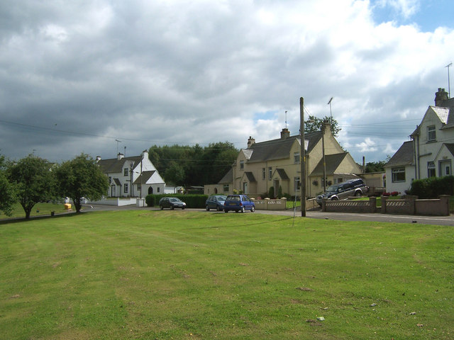
Ae is a small village located in Dumfriesshire, a historic county in the southwest of Scotland. Situated in the picturesque Ae Valley, it is nestled amidst the rolling hills and lush green landscapes of the Southern Uplands. With a population of around 100 inhabitants, Ae offers a tranquil and idyllic rural setting.

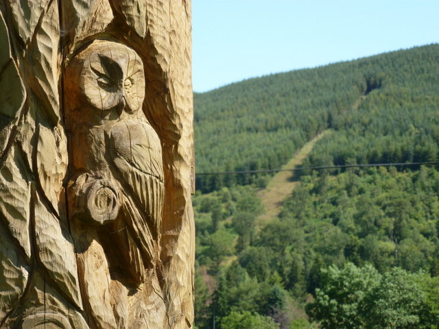
The village is best known for its proximity to the Ae Forest, a popular destination for outdoor enthusiasts and nature lovers. The forest covers an expansive area of over 10,000 acres, offering a diverse range of recreational activities such as walking, mountain biking, and wildlife spotting. The extensive network of trails caters to all ability levels and provides breathtaking views of the surrounding countryside.

Ae also boasts a thriving mountain biking scene, attracting enthusiasts from far and wide. The renowned Ae Bike Park within the forest features a range of challenging trails and jumps, making it a favorite hotspot for adrenaline seekers.

Although small, the village does offer some amenities to cater to both locals and visitors. These include a café and a bike shop, providing essential services and refreshments to those exploring the forest.

For those seeking a peaceful retreat away from the hustle and bustle of city life, Ae provides an ideal escape. Its stunning natural beauty, combined with its accessibility to outdoor activities, makes it an attractive destination for both adventure seekers and nature enthusiasts.

If you have any feedback on the listing, please let us know in the comments section below.

Ae Images

Images are sourced within 2km of 55.187091/-3.596036 or Grid Reference NX9889. Thanks to Geograph Open Source API. All images are credited.

Gravel road towards Ae Forest
Farm road to Glenmaid
Gated access to forestry at Gledenholm Moor
Minor road to Ae Village
Partially cleared forest at Gledenholm Moor
Ae: totem pole A totem pole stands in the middle of the green at Ae; it was sculpted and erected in 2006 and features many images and symbols of the village and Forest of Ae.
Ae: totem pole
A totem pole stands in the middle of the green at Ae; it was sculpted and erected in 2006 and features many images and symbols of the village and Forest of Ae.
Ae: totem pole detail A close-up of <a href="https://www.geograph.org.uk/photo/2520137">NX9889 : Ae: totem pole</a> showing a carving of an owl - it is just one of any number of close-ups I could have chosen, such as squirrel and other wildlife, mountain biker, heavy plant carrying logs. The slopes of the Forest of Ae are in the background.
Ae: totem pole detail
A close-up of NX9889 : Ae: totem pole showing a carving of an owl - it is just one of any number of close-ups I could have chosen, such as squirrel and other wildlife, mountain biker, heavy plant carrying logs. The slopes of the Forest of Ae are in the background.
Ae: the Woodman Inn A pub which I believe used to be the village post office, which closed in about 1999. The presence of the postbox in the wall, still operational, supports my woolly memory of the village 15 years ago.
Ae: the Woodman Inn
A pub which I believe used to be the village post office, which closed in about 1999. The presence of the postbox in the wall, still operational, supports my woolly memory of the village 15 years ago.
Ae: postbox № DG1 112 This Elizabeth II-reign postbox is set into the side wall of the <a href="https://www.geograph.org.uk/photo/2520147">NX9889 : Ae: the Woodman Inn</a> which I believe was once the post office stores. The box is emptied at 11:15 each morning except Sunday.
Ae: postbox № DG1 112
This Elizabeth II-reign postbox is set into the side wall of the NX9889 : Ae: the Woodman Inn which I believe was once the post office stores. The box is emptied at 11:15 each morning except Sunday.
The Goukstane Burn from Lakehead Bridge
Forest sign at Ae
Forest sign at Ae
Gledenholm Plantation Trees of three different ages within Forestry Commission Gledenholmm Plantation. There is a ranger's high seat in the centre of the view.
Gledenholm Plantation
Trees of three different ages within Forestry Commission Gledenholmm Plantation. There is a ranger's high seat in the centre of the view.
Cycle path, Ae Start of the mountain bike trails at Ae.
Cycle path, Ae
Start of the mountain bike trails at Ae.
Ae road at Burngrove
Crossroads at Ae
Crossroads at Ae
The totem pole in the village of Ae
Telephone box at Ae
Telephone box at Ae
A bridge across the Water of Ae
Show me another place!

Ae is located at Grid Ref: NX9889 (Lat: 55.187091, Lng: -3.596036)

Unitary Authority: Dumfries and Galloway

Police Authority: Dumfries and Galloway

What 3 Words

///registers.polished.decimals. Near Locharbriggs, Dumfries & Galloway

Nearby Locations

Ae

Related Wikis

Ae, Dumfries and Galloway

Ae (pronounced ) is a village in Dumfries and Galloway, south west Scotland. The village is located on the edge of a 15,000-acre (61 km2) human-made conifer...

Ae Bridgend

Ae Bridgend is a hamlet in the Scottish council area of Dumfries and Galloway next to the River Ae. It is located at an altitude of 96.9 meters above sea...

Parkgate, Dumfries and Galloway

Parkgate is a small village in Dumfries and Galloway, Scotland. The village centre is located just to the east of the A701 approximately 8 miles (13 km...

Wallace's House

Wallace's House is an earthen rampart, located near Lochmaben, Scotland, that is associated with William Wallace. The promontory fort is a scheduled item...

Forest of Ae

The Forest of Ae is located between Nithsdale and Annandale in Dumfries and Galloway in south-west Scotland. The forest was first planted in the 1920s...

Loch Ettrick

Loch Ettrick is a body of water near Thornhill and Ae, Dumfries and Galloway, in the Southern Uplands of Scotland.

Duncow

Duncow is a small settlement in the civil parish of Kirkmahoe, Dumfries and Galloway, Scotland. Located in the geographical centre of the parish, Duncow...

Dalswinton

Dalswinton is a small village in the historical county of Dumfriesshire in Dumfries and Galloway in the south of Scotland. It is located about six miles...

Nearby Amenities

Located within 500m of 55.187091,-3.596036
Ae
Place: village
Wikidata: Q776829
Wikipedia: en:Ae, Dumfries and Galloway
Lat/Long: 55.1875064/-3.5990425
Bus Stop
Post Office
Naptan AtcoCode: 680000202111
Naptan Bearing: SE
Naptan CommonName: Post Office
Naptan Indicator: opp PO
Naptan Landmark: Post Office
Naptan NaptanCode: 34232894
Naptan Notes: none
Naptan Street: Main Street
Naptan Verified: no
Source: naptan_import
Lat/Long: 55.1864816/-3.5978647
Bus Stop
Village
Naptan AtcoCode: 680000622222
Naptan Bearing: SE
Naptan CommonName: Village
Naptan Indicator: Low Road
Naptan Landmark: Ae
Naptan NaptanCode: 34232923
Naptan Notes: none
Naptan Street: C6
Naptan Verified: no
Source: naptan_import
Lat/Long: 55.1870646/-3.5965843
Ae Bikes
Shop: bicycle
Lat/Long: 55.1887475/-3.5962871
Cafe
Ae Cafe
Lat/Long: 55.1886359/-3.5963458
Relic Hill
Ele: 170
Natural: peak
Lat/Long: 55.1835715/-3.5917484
7stanes - Ae
Sport: cycling
Lat/Long: 55.1914007/-3.5949882
Noexit: yes
Lat/Long: 55.1849951/-3.5974193
Turning Circle
Lat/Long: 55.1866478/-3.5992392
Post Box
Ref: DG1 112
Lat/Long: 55.1865462/-3.5976174
Power: pole
Lat/Long: 55.188263/-3.5978519
Power: pole
Lat/Long: 55.1882582/-3.5992394
Power: pole
Lat/Long: 55.1882654/-3.5999288
Power: pole
Lat/Long: 55.1882582/-3.600561
Power: pole
Lat/Long: 55.1897103/-3.6013693
Power: pole
Lat/Long: 55.1889606/-3.6009387
Power: pole
Lat/Long: 55.1896509/-3.6006947
Power: pole
Lat/Long: 55.1901571/-3.6016769
Power: pole
Lat/Long: 55.1863797/-3.5979792
Power: pole
Lat/Long: 55.1865432/-3.5979326
Power: pole
Lat/Long: 55.186909/-3.5979601
Power: pole
Lat/Long: 55.1874225/-3.5979347
Power: pole
Lat/Long: 55.1879493/-3.5979177
Power: pole
Lat/Long: 55.1886651/-3.597818
Power: pole
Lat/Long: 55.1891786/-3.5977692
Power: pole
Lat/Long: 55.1863192/-3.6027143
Power: pole
Lat/Long: 55.1864379/-3.6018997
Power: pole
Lat/Long: 55.1866123/-3.600665
Power: pole
Lat/Long: 55.1867467/-3.5997018
Power: pole
Lat/Long: 55.1874286/-3.6001007
Power: pole
Lat/Long: 55.1829094/-3.5962499
Power: pole
Lat/Long: 55.1837589/-3.5967918
Power: pole
Lat/Long: 55.1844751/-3.5972657
Power: pole
Lat/Long: 55.1845428/-3.5968716
Power: pole
Lat/Long: 55.1845781/-3.5966784
Power: pole
Lat/Long: 55.1829838/-3.5957382
Power: pole
Lat/Long: 55.1832279/-3.5943008
Power: pole
Lat/Long: 55.183453/-3.5930283
Power: pole
Lat/Long: 55.1836118/-3.5920829
The data included in this document is from www.openstreetmap.org. The data is made available under ODbL.

Have you been to Ae?

Leave your review of Ae below (or comments, questions and feedback).