Blue Anchor

Settlement in Somerset Somerset West and Taunton

England

Blue Anchor

Farmland at Marshwood Almost level land forms a plateau around 10-20m above sea level, above the cliffs at Blue Anchor.
Farmland at Marshwood Credit: Stephen Craven

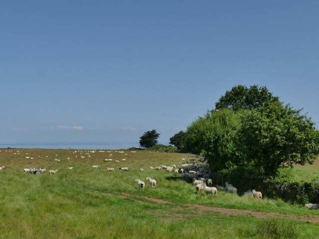
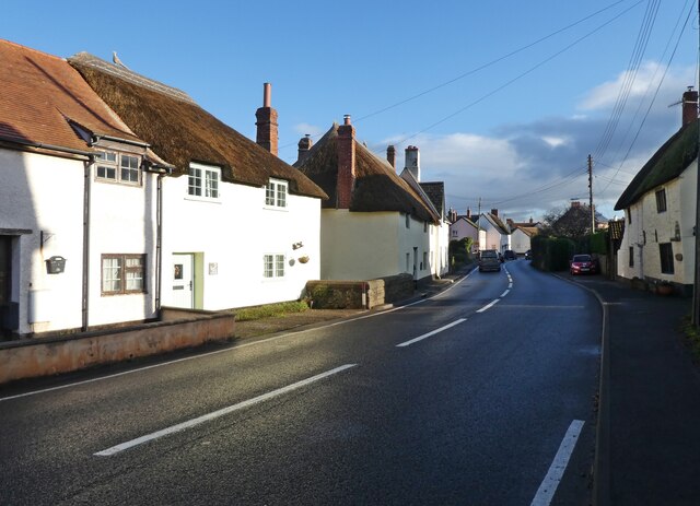
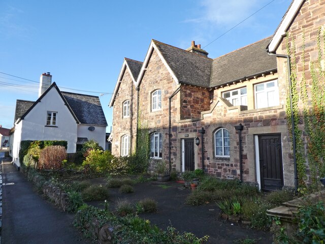
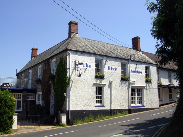
Blue Anchor is a small coastal village located in Somerset, England. Situated on the Bristol Channel, it forms part of the West Somerset district. With its picturesque surroundings and tranquil atmosphere, Blue Anchor is a popular destination for both locals and tourists alike.

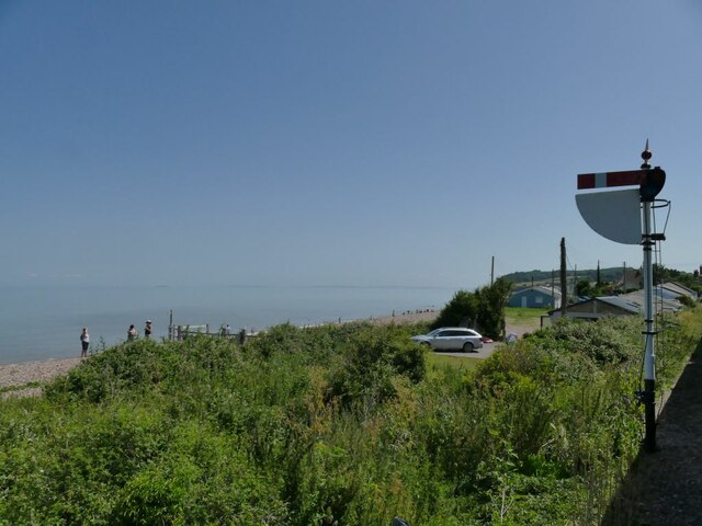
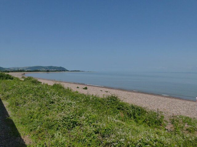
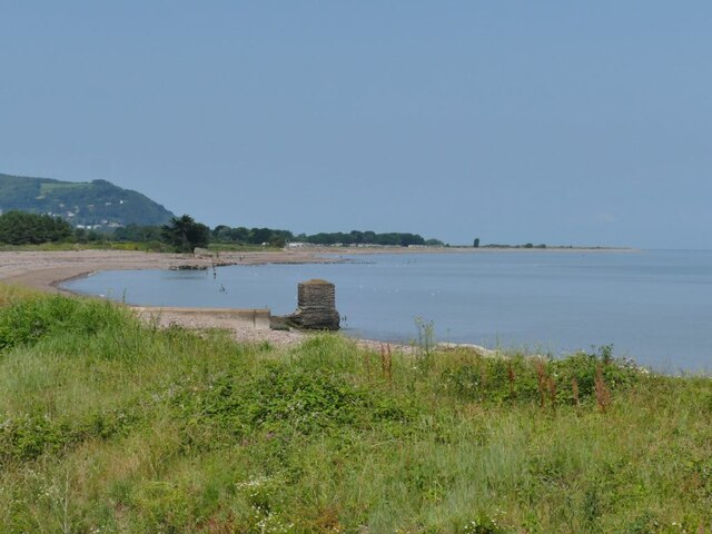
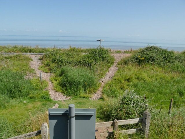
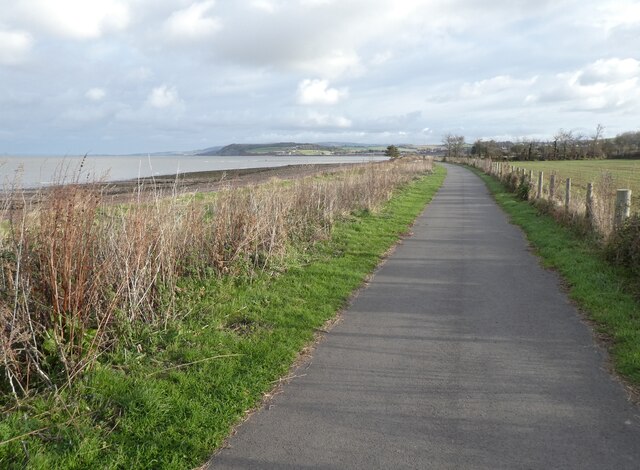
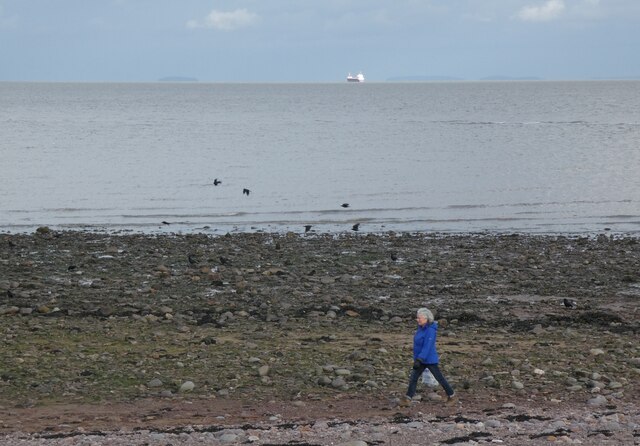
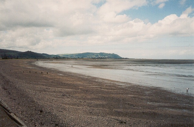
The village is best known for its beautiful pebble beach, which stretches for miles and offers stunning views of the surrounding countryside. The beach is a designated Site of Special Scientific Interest (SSSI) due to its unique geology and diverse wildlife. Visitors can enjoy leisurely walks along the shoreline, take a dip in the sea, or simply relax and soak up the sun.

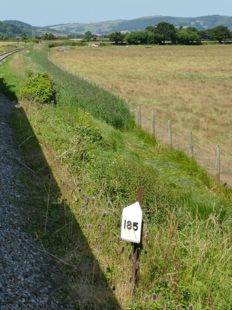
Blue Anchor is also home to the West Somerset Railway, a heritage steam railway that runs between Minehead and Bishops Lydeard. The railway station in Blue Anchor is a charming and well-preserved Victorian building, and visitors can take a nostalgic journey on the steam train, enjoying the scenic countryside along the way.

The village itself is quaint and picturesque, with a small selection of shops, cafes, and pubs. There are also several holiday parks and campsites in the area, making Blue Anchor a popular choice for those seeking a seaside getaway.

Overall, Blue Anchor offers a peaceful and idyllic retreat for visitors. With its stunning beach, heritage railway, and charming village atmosphere, it is a hidden gem within the Somerset countryside.

If you have any feedback on the listing, please let us know in the comments section below.

Blue Anchor Images

Images are sourced within 2km of 51.180934/-3.400632 or Grid Reference ST0243. Thanks to Geograph Open Source API. All images are credited.

Farmland at Marshwood Almost level land forms a plateau around 10-20m above sea level, above the cliffs at Blue Anchor.
Farmland at Marshwood
Almost level land forms a plateau around 10-20m above sea level, above the cliffs at Blue Anchor.
Static caravans at Blue Anchor Bay Seen from a passing train.
Static caravans at Blue Anchor Bay
Seen from a passing train.
Cereal crop at Marshwood Farm Seen from a passing train.
Cereal crop at Marshwood Farm
Seen from a passing train.
Lower quadrant signal for Blue Anchor station This is the home signal which would be set to danger (horizontal) if there was a train already in the station.
Lower quadrant signal for Blue Anchor station
This is the home signal which would be set to danger (horizontal) if there was a train already in the station.
Blue Anchor station According to the railway's guide book, this halt was opened in 1904 as a speculative development preceding a new holiday resort, which never came fruition. It now acts as a passing loop on the West Somerset Railway.  Here, a westbound steam train encounters a diesel locomotive on the other track, which was attached to the rear to  be used for shunting movements at the temporary terminus at Dunster.
Blue Anchor station
According to the railway's guide book, this halt was opened in 1904 as a speculative development preceding a new holiday resort, which never came fruition. It now acts as a passing loop on the West Somerset Railway. Here, a westbound steam train encounters a diesel locomotive on the other track, which was attached to the rear to be used for shunting movements at the temporary terminus at Dunster.
Blue Anchor railway museum The museum occupies the building on the down (westbound) side of the station.
Blue Anchor railway museum
The museum occupies the building on the down (westbound) side of the station.
Up home signal for Blue Anchor station  The West Somerset Railway still uses these archaic lower-quadrant signals.
Up home signal for Blue Anchor station
The West Somerset Railway still uses these archaic lower-quadrant signals.
Blue Anchor Bay Seen from the West Somerset Railway which runs along the edge of the coast for a short distance.
Blue Anchor Bay
Seen from the West Somerset Railway which runs along the edge of the coast for a short distance.
Sewer outfalls into Blue Anchor Bay See <a href="https://www.geograph.org.uk/photo/1186598">ST0143 : Blue Anchor : Water Shoots out into the Sea</a> and <a href="https://www.geograph.org.uk/photo/5830818">ST0143 : Drainage outlets into the Bristol Channel</a> for close-ups, which show that they do sometimes get used.
Sewer outfalls into Blue Anchor Bay
See ST0143 : Blue Anchor : Water Shoots out into the Sea and ST0143 : Drainage outlets into the Bristol Channel for close-ups, which show that they do sometimes get used.
Footpath crossing to Blue Anchor Bay It gives access to the South-west Coast Path. See <a href="https://www.geograph.org.uk/photo/5830490">ST0143 : Path over the railway on Ker Moor</a> for the other side of the sign in the foreground.
Footpath crossing to Blue Anchor Bay
It gives access to the South-west Coast Path. See ST0143 : Path over the railway on Ker Moor for the other side of the sign in the foreground.
Milepost on Ker Moor It marks 185 miles from London Paddington via Taunton.
Milepost on Ker Moor
It marks 185 miles from London Paddington via Taunton.
Sheep on Ker Moor Seen from a passing train.
Sheep on Ker Moor
Seen from a passing train.
Old pillbox on Ker Moor One of many World War II defences along this coast, set in the middle of a crop field. See <a href="https://www.geograph.org.uk/photo/4868471">ST0044 : Old structure on Ker Moor</a> for the other side of it seen from the coastal path.
Old pillbox on Ker Moor
One of many World War II defences along this coast, set in the middle of a crop field. See ST0044 : Old structure on Ker Moor for the other side of it seen from the coastal path.
Blue Anchor Railway Station
Steam Coast Trail, Blue Anchor Bay
Woman and ship, Blue Anchor Bay
Station Road, Carhampton A rather optimistic road name. The nearest railway station is over a mile away in Blue Anchor.
Station Road, Carhampton
A rather optimistic road name. The nearest railway station is over a mile away in Blue Anchor.
The Old School house, Carhampton
Show me another place!

Blue Anchor is located at Grid Ref: ST0243 (Lat: 51.180934, Lng: -3.400632)

Administrative County: Somerset

District: Somerset West and Taunton

Police Authority: Avon and Somerset

What 3 Words

///gates.protected.chef. Near Watchet, Somerset

Nearby Locations

Pill Copse Blue Anchor

Related Wikis

Blue Anchor

Blue Anchor is a seaside village, in the parish of Old Cleeve, close to Carhampton in the Somerset West and Taunton district of Somerset, England. The...

Blue Anchor to Lilstock Coast SSSI

Blue Anchor to Lilstock Coast SSSI (grid reference ST033435 to grid reference ST195462) is a 742.8 hectare geological Site of Special Scientific Interest...

Blue Anchor railway station

Blue Anchor railway station is situated in the seaside village of Blue Anchor, Somerset, England, close to the larger village of Carhampton. It is on the...
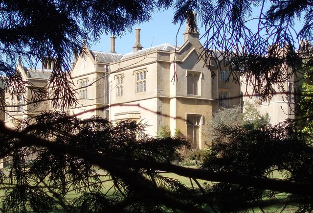
Chapel Cleeve Manor

Chapel Cleeve Manor in Chapel Cleeve, Somerset, England started life in the 1450s as a pilgrims' hostel. It was enlarged in the 19th and 20th centuries...

River Avill

The River Avill is a small river on Exmoor in Somerset, England. It rises on the eastern slopes of Dunkery Beacon and flows north through Timberscombe...
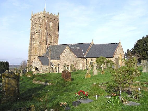
Carhampton

Carhampton is a village and civil parish in Somerset, England, 4 miles (6.4 km) to the east of Minehead. Carhampton civil parish stretches from the Bristol...

Withycombe

Withycombe is a village, civil parish, and former manor 2.5 miles (4 km) south east of Dunster, and 5 miles (8 km) from Minehead within the Exmoor National...
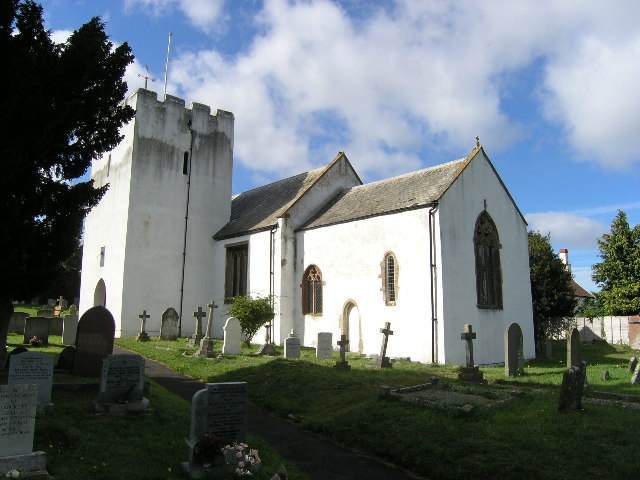
Old Cleeve

Old Cleeve is a village 5 miles (8 km) south east of Minehead in the Somerset West and Taunton district of Somerset, England, and also a civil parish....

Nearby Amenities

Located within 500m of 51.180934,-3.400632
Source: PGS
Lat/Long: 51.182444/-3.3953414
Source: PGS
Lat/Long: 51.1824322/-3.3960526
Source: PGS
Lat/Long: 51.1824221/-3.3964014
Source: PGS
Lat/Long: 51.1823929/-3.3971378
Source: PGS
Lat/Long: 51.182405/-3.398057
Source: PGS
Lat/Long: 51.1823718/-3.3990329
Source: PGS
Lat/Long: 51.1823489/-3.3995929
Source: PGS
Lat/Long: 51.1823738/-3.4003332
Source: PGS
Lat/Long: 51.1824281/-3.4016603
Source: PGS
Lat/Long: 51.1825367/-3.403646
Source: PGS
Lat/Long: 51.1827454/-3.4057302
Railway: signal
Railway Signal Direction: forward
Railway Signal Main: GB-NR:main
Railway Signal Main Form: semaphore
Railway Signal Position: left
Lat/Long: 51.1808241/-3.3969388
Operator: West Somerset Railway plc
Railway: switch
Lat/Long: 51.1813165/-3.398755
Blue Anchor
Addr City: Minehead
Addr Country: GB
Addr County: Somerset
Addr Postcode: TA24 6LG
Addr Street: Carhampton Road
Addr Village: Blue Anchor
Fhrs Authority: West Somerset
Fhrs Id: 161875
Fhrs Local Authority Id: PI/000001964
Naptan AtcoCode: 940GZZWSBLA
Network: West Somerset Railway
Network Wikidata: Q12072724
Operator: West Somerset Railway Plc
Operator Wikidata: Q20970722
Public Transport: station
Railway: station
Start Date: 1874
Start Date Railway: 1874
Train: yes
Usage: tourism
Wikidata: Q4928826
Wikipedia: en:Blue Anchor railway station
Lat/Long: 51.1816647/-3.4009333
Operator: West Somerset Railway plc
Railway: switch
Lat/Long: 51.1819316/-3.4028854
Level Crossing: automatic_barrier
Railway: level_crossing
Lat/Long: 51.1817756/-3.4017764
Cafe
Driftwood Cafe
Addr City: Minehead
Addr Country: GB
Addr County: Somerset
Addr Postcode: TA24 6LD
Addr Street: Blue Anchor Road
Addr Village: Blue Anchor
Fhrs Authority: West Somerset
Fhrs Id: 160700
Fhrs Local Authority Id: PI/000000489
Outdoor Seating: yes
Lat/Long: 51.1819474/-3.4003339
Post Box
Brand: Royal Mail
Brand Wikidata: Q638098
Collection Times: Mo-Fr 12:00; Sa 11:00
Note: Collection plate worn, no reference visible
Operator: Royal Mail
Operator Wikidata: Q638098
Post Box Mounting: brick_wall
Post Box Type: wall
Royal Cypher: GR
Royal Cypher Wikidata: Q33102273
Lat/Long: 51.1784378/-3.4041291
Railway: signal
Railway Signal Direction: backward
Railway Signal Main: GB-NR:main
Railway Signal Main Form: semaphore
Railway Signal Position: left
Lat/Long: 51.1813717/-3.3990266
Level Crossing: automatic_barrier
Railway: level_crossing
Lat/Long: 51.181748/-3.401788
Blue Anchor Signal Box - G4825
Man Made: survey_point
Ref: G4825
Type: benchmark
Lat/Long: 51.1818342/-3.401713
Access: customers
Barrier: lift_gate
Lat/Long: 51.1821245/-3.3971831
Blue Anchor
Is In: Somerset, England, United Kingdom
Place: village
Wikidata: Q4928825
Wikipedia: en:Blue Anchor
Lat/Long: 51.1791156/-3.4033128
The Langbury
Addr City: Minehead
Addr Country: GB
Addr County: Somerset
Addr Postcode: TA24 6LB
Addr Street: Carhampton Road
Addr Village: Blue Anchor
Fhrs Authority: West Somerset
Fhrs Id: 160633
Fhrs Local Authority Id: PI/000000380
Tourism: guest_house
Lat/Long: 51.1809706/-3.4021381
Railway: signal
Railway Signal Direction: backward
Railway Signal Main: GB-NR:main
Railway Signal Main Form: semaphore
Railway Signal Position: left
Lat/Long: 51.1819424/-3.4029631
Railway: signal
Railway Signal Direction: forward
Railway Signal Main: GB-NR:main
Railway Signal Main Form: semaphore
Railway Signal Position: left
Lat/Long: 51.1817406/-3.4017325
Blue Anchor Bay Garage
Shop: car
Lat/Long: 51.1784091/-3.4040215
Entrance: main
Lat/Long: 51.181999/-3.4003358
Access: customers
Door: yes
Entrance: main
Lat/Long: 51.1815819/-3.4008141
Cafe
The Bay
Addr Housename: Hoburne Holiday Park
Addr Street: Blue Anchor Bay Road
Note: Open to the general public.
Outdoor Seating: yes
Lat/Long: 51.1821529/-3.397433
Entrance: yes
Lat/Long: 51.1819448/-3.3972851
Entrance: yes
Lat/Long: 51.1822008/-3.3974454
Access: permissive
Operator: West Somerset Railway
Tourism: picnic_site
Lat/Long: 51.1816174/-3.4012362
The data included in this document is from www.openstreetmap.org. The data is made available under ODbL.

Have you been to Blue Anchor?

Leave your review of Blue Anchor below (or comments, questions and feedback).