Lancing, South

Settlement in Sussex Adur

England

Lancing, South

Grinstead Lane railway bridge The Bridge was built in the mid sixties for the new A2025 bypass road. The level crossing could be avoided.
Grinstead Lane railway bridge Credit: James Emmans

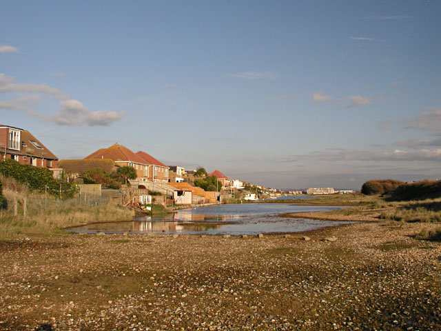
Lancing is a small but vibrant town located in the South of Sussex, England. Situated on the coast, it boasts a population of around 19,000 residents. Lancing is part of the larger district of Adur and is conveniently situated between the bustling city of Brighton and the historic town of Worthing.

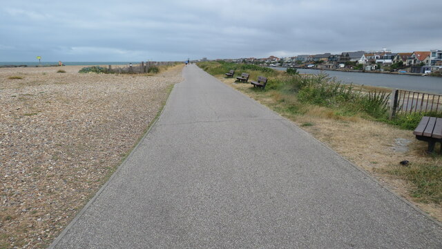
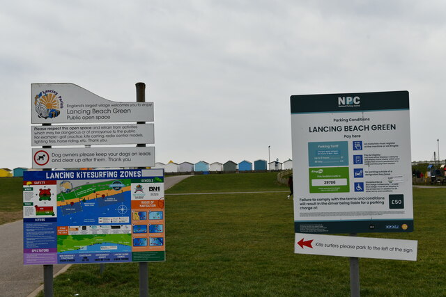
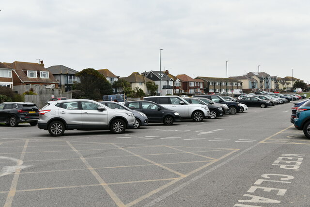
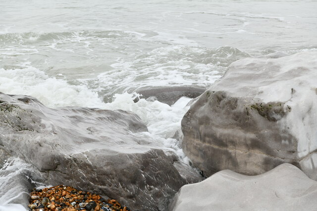
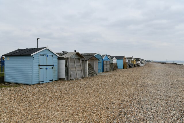
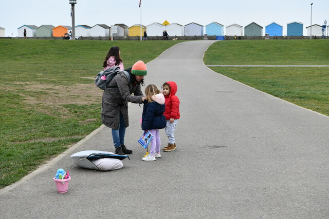
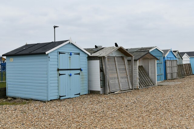
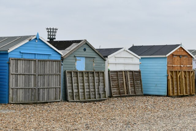
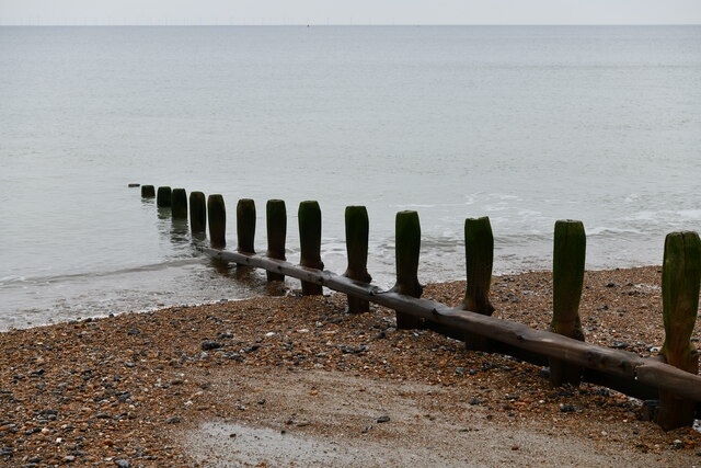
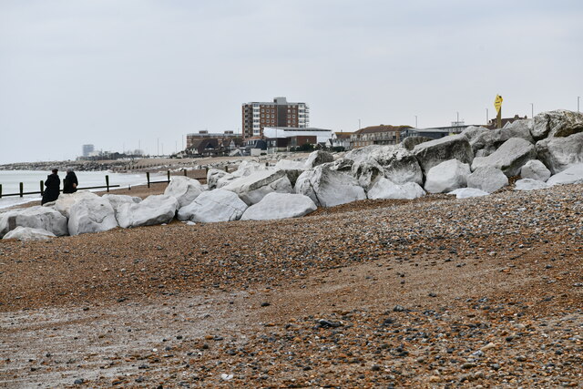
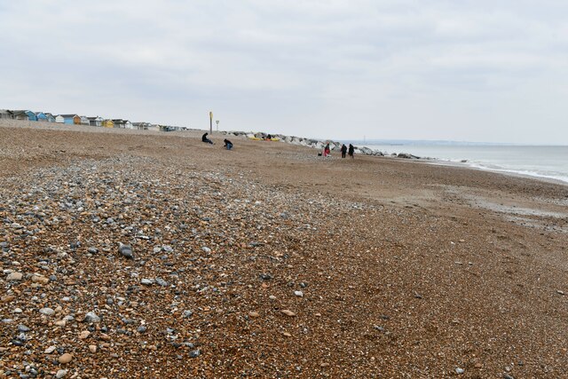
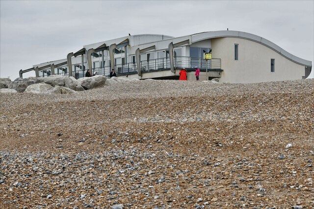
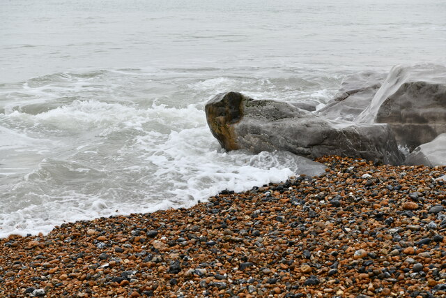
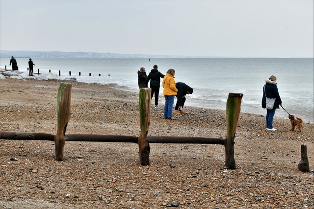
The town is known for its beautiful pebble beach, which stretches for approximately two miles along the coast. Lancing Beach is a popular spot for locals and tourists alike, offering stunning views of the English Channel and providing opportunities for various recreational activities, such as swimming, sunbathing, and beachcombing.

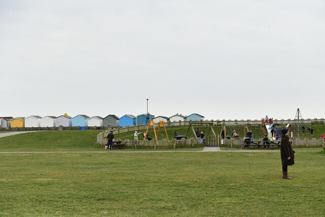
Lancing has a charming town center, offering a range of amenities and services to its residents. The high street is home to a variety of shops, cafes, restaurants, and pubs, providing a vibrant and welcoming atmosphere. The town also boasts several parks and green spaces, where residents can enjoy leisurely walks, picnics, or outdoor sports.

Education is well catered for in Lancing, with both primary and secondary schools available to local families. The town is also home to North Lancing Primary School, a highly regarded institution with a strong reputation for academic excellence.

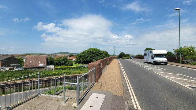
Transport links in Lancing are excellent, with regular train services connecting the town to Brighton, Worthing, and London. The A27 road runs nearby, providing easy access to other parts of Sussex and beyond.

Overall, Lancing offers a delightful coastal living experience, combining its natural beauty, community spirit, and convenient location to create an attractive place to call home.

If you have any feedback on the listing, please let us know in the comments section below.

Lancing, South Images

Images are sourced within 2km of 50.826082/-0.308364 or Grid Reference TQ1904. Thanks to Geograph Open Source API. All images are credited.

Grinstead Lane railway bridge The Bridge was built in the mid sixties for the new A2025 bypass road. The level crossing could be avoided.
Grinstead Lane railway bridge
The Bridge was built in the mid sixties for the new A2025 bypass road. The level crossing could be avoided.
Path by Widewater Lagoon, lancing Widewater Lagoon is an area of brackish water landlocked by a man-made shingle bank. It lies between the beach and A259 coast road (Brighton Road) in Lancing; between the far east of Lancing Beach and the far west of Shoreham Beach.
This path runs between the beach and lagoon
Path by Widewater Lagoon, lancing
Widewater Lagoon is an area of brackish water landlocked by a man-made shingle bank. It lies between the beach and A259 coast road (Brighton Road) in Lancing; between the far east of Lancing Beach and the far west of Shoreham Beach. This path runs between the beach and lagoon
The Quadrant, Marlborough Road, Lancing
Lancing: Play area
Lancing: Play area
Lancing: Beach Green information boards
Lancing: Beach Green Car Park
Lancing: Beach Green Car Park, 'pay by card'
Lancing: Incoming tide on the large boulder breakwater
Lancing Beach: Huts
Lancing Beach: Huts
Lancing Beach Green: Path to the beach
Lancing Beach: Huts
Lancing Beach: Huts
Lancing Beach: Huts
Lancing Beach: Huts
Lancing Beach: Breakwater
Lancing Beach: Large boulder breakwater
Lancing Beach looking east
Lancing Beach: Perch Cafe and Gym
Lancing: Incoming tide on the large boulder breakwater
Lancing Beach
Lancing Beach
Show me another place!

Lancing, South is located at Grid Ref: TQ1904 (Lat: 50.826082, Lng: -0.308364)

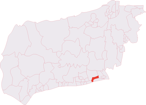
Administrative County: West Sussex

District: Adur

Police Authority: Sussex

What 3 Words

///shine.parts.drives. Near Lancing, West Sussex

Related Wikis

Widewater Lagoon

Widewater Lagoon is a 8.8-hectare (22-acre) Local Nature Reserve in Lancing in West Sussex. It is owned by West Sussex County Council and managed by Lancing...

Lancing (electoral division)

Lancing is an electoral division of West Sussex in the United Kingdom, and returns one member to sit on West Sussex County Council. == Extent == The division...

Lancing, West Sussex

Lancing is a large coastal village and civil parish in the Adur district of West Sussex, England, on the western edge of the Adur Valley. It occupies part...

Lancing railway station

Lancing railway station is in Lancing in the county of West Sussex, England. It is 8 miles 19 chains (13.3 km) down the line from Brighton. The station...

Nearby Amenities

Located within 500m of 50.826082,-0.308364
Bus Stop
Willowbrook Park
Bus: yes
Naptan AtcoCode: 4400AD0069
Naptan Bearing: NE
Naptan CommonName: Willowbrook Park
Naptan Indicator: opp Happy Days Caravan Park
Naptan Landmark: Happy Days Caravan Park
Naptan NaptanCode: wsxadgjm
Naptan ShortCommonName: Willowbrook Park
Naptan Street: Freshbrook Road
Naptan Verified: no
Public Transport: platform
Source: naptan_import
Lat/Long: 50.8232558/-0.312517
Willowbrook Park
Naptan AtcoCode: 4400AD0070
Naptan Bearing: SW
Naptan BusStopType: CUS
Naptan CommonName: Willowbrook Park
Naptan Indicator: adj Happy Days Caravan Park
Naptan Landmark: Happy Days Caravan Park
Naptan NaptanCode: wsxadgjp
Naptan ShortCommonName: Willowbrook Park
Naptan Street: Freshbrook Road
Naptan Verified: no
Source: naptan_import
Lat/Long: 50.8231916/-0.3124341
Bus Stop
Thornberry School
Naptan AtcoCode: 4400AD0071
Naptan Bearing: NW
Naptan CommonName: Thornberry School
Naptan Indicator: opp The Paddocks
Naptan Landmark: The Paddocks
Naptan NaptanCode: wsxadgjt
Naptan ShortCommonName: Thornberry School
Naptan Street: Freshbrook Road
Naptan Verified: no
Source: naptan_import
Lat/Long: 50.8265157/-0.313436
Thornberry School
Naptan AtcoCode: 4400AD0072
Naptan Bearing: SE
Naptan BusStopType: CUS
Naptan CommonName: Thornberry School
Naptan Indicator: adj The Paddocks
Naptan Landmark: The Paddocks
Naptan NaptanCode: wsxadgjw
Naptan ShortCommonName: Thornberry School
Naptan Street: Freshbrook Road
Naptan Verified: no
Source: naptan_import
Lat/Long: 50.8265678/-0.3133064
Bus Stop
South Bank Court
Naptan AtcoCode: 4400AD0175
Naptan Bearing: NE
Naptan CommonName: South Bank Court
Naptan Indicator: o/s 261
Naptan Landmark: Caravan Park
Naptan NaptanCode: wsxadmjg
Naptan Street: Brighton Road
Naptan Verified: no
Source: naptan_import
Lat/Long: 50.8235311/-0.3073104
Bus Stop
South Bank Court
Naptan AtcoCode: 4400AD0176
Naptan Bearing: SW
Naptan CommonName: South Bank Court
Naptan Indicator: o/s South Bank Court
Naptan Landmark: Old Salts Farm Rd
Naptan NaptanCode: wsxadmjm
Naptan Street: Brighton Road
Naptan Verified: no
Public Transport: platform
Shelter: no
Source: naptan_import
Lat/Long: 50.8230916/-0.3086325
Bus Stop
Old Salts Farm Rd
Bench: yes
Bin: no
Bus: yes
Naptan AtcoCode: 4400AD0177
Naptan Bearing: E
Naptan CommonName: Old Salts Farm Rd
Naptan Indicator: adj Old Salts Farm Rd
Naptan Landmark: Old Salts Farm Road
Naptan NaptanCode: wsxadmjp
Naptan Street: Brighton Road A259
Naptan Verified: no
Public Transport: platform
Shelter: yes
Source: naptan_import
Lat/Long: 50.8225434/-0.3123865
Noexit: yes
Lat/Long: 50.8235803/-0.3129806
Noexit: yes
Lat/Long: 50.8270855/-0.3127862
Fixme: where does it end?
Lat/Long: 50.8239335/-0.310888
Check Date: 2024-03-26
Leisure: fitness_station
Lat/Long: 50.8272013/-0.311712
Leisure: fitness_station
Lat/Long: 50.8274427/-0.3118208
Leisure: fitness_station
Lat/Long: 50.8273643/-0.3117334
Post Box
Brand: Royal Mail
Brand Wikidata: Q638098
Brand Wikipedia: en:Royal Mail
Collection Plate: CP1D
Collection Times: Mo-Fr 09:00; Sa 07:00
Operator: Royal Mail
Operator Wikidata: Q638098
Post Box Type: pillar
Ref: BN15 1377D
Royal Cypher: GR
Royal Cypher Wikidata: Q33102273
Lat/Long: 50.8243682/-0.3033426
Post Box
Brand: Royal Mail
Brand Wikidata: Q638098
Brand Wikipedia: en:Royal Mail
Collection Plate: CP1D
Collection Times: Mo-Fr 09:00; Sa 07:00
Operator: Royal Mail
Operator Wikidata: Q638098
Post Box Type: pillar
Ref: BN15 1376D
Royal Cypher: GVIR
Royal Cypher Wikidata: Q33102169
Lat/Long: 50.8227628/-0.3109355
Post Box
Brand: Royal Mail
Brand Wikidata: Q638098
Brand Wikipedia: en:Royal Mail
Collection Plate: CP7D
Collection Times: Mo-Fr 09:00; Sa 07:00
Operator: Royal Mail
Operator Wikidata: Q638098
Post Box Type: lamp
Ref: BN15 1423D
Royal Cypher: EIIR
Royal Cypher Wikidata: Q33102113
Lat/Long: 50.8229653/-0.3119059
Camera Tower
Man Made: tower
Tower Type: observation
Lat/Long: 50.8294008/-0.3100601
Post Box
Brand: Royal Mail
Brand Wikidata: Q638098
Brand Wikipedia: en:Royal Mail
Operator: Royal Mail
Operator Wikidata: Q638098
Post Box Type: lamp
Ref: BN15 1379D
Royal Cypher: EIIR
Royal Cypher Wikidata: Q33102113
Lat/Long: 50.8243305/-0.3148511
Post Box
Brand: Royal Mail
Brand Wikidata: Q638098
Brand Wikipedia: en:Royal Mail
Operator: Royal Mail
Operator Wikidata: Q638098
Post Box Type: lamp
Ref: BN15 1421D
Royal Cypher: EIIR
Royal Cypher Wikidata: Q33102113
Lat/Long: 50.8265679/-0.3135422
Barrier: yes
Lat/Long: 50.8246161/-0.3111337
Height: 10
Man Made: antenna
Material: metal
Lat/Long: 50.8270276/-0.3130081
Height: 10
Man Made: antenna
Material: metal
Lat/Long: 50.8269742/-0.3129417
Entrance: main
Lat/Long: 50.8278282/-0.3138797
Entrance: main
Lat/Long: 50.8278391/-0.3138725
Entrance: main
Lat/Long: 50.8279247/-0.3137781
Entrance: main
Lat/Long: 50.8279353/-0.3137713
Frequency: 50
Power: transformer
Lat/Long: 50.8271337/-0.3140384
Frequency: 50
Power: transformer
Lat/Long: 50.827142/-0.3140805
Entrance: main
Lat/Long: 50.8273921/-0.3131499
Entrance: main
Lat/Long: 50.8274034/-0.3131427
Entrance: main
Lat/Long: 50.8275137/-0.3129832
Entrance: main
Lat/Long: 50.8275235/-0.3129769
Entrance: main
Lat/Long: 50.827291/-0.313224
Entrance: main
Lat/Long: 50.8273034/-0.3132156
Entrance: main
Lat/Long: 50.8274876/-0.3133265
Entrance: main
Lat/Long: 50.8275017/-0.3133173
Entrance: main
Lat/Long: 50.8276025/-0.3132984
Entrance: main
Lat/Long: 50.827614/-0.3132909
Entrance: main
Lat/Long: 50.8276192/-0.3129134
Entrance: main
Lat/Long: 50.8276312/-0.3129055
Entrance: main
Lat/Long: 50.8277132/-0.3131389
Entrance: main
Lat/Long: 50.8277254/-0.3131309
Entrance: main
Lat/Long: 50.8277339/-0.3128728
Entrance: main
Lat/Long: 50.8277458/-0.312865
Entrance: main
Lat/Long: 50.8278216/-0.3130338
Entrance: main
Lat/Long: 50.8278334/-0.3130265
Street Lamp
Height: 9
Lamp Mount: straight_mast
Lamp Type: electric
Lat/Long: 50.8270722/-0.3129796
Noexit: yes
Lat/Long: 50.8236672/-0.3131262
Street Lamp
Lat/Long: 50.8290743/-0.3119909
Street Lamp
Lat/Long: 50.8291358/-0.3116268
Street Lamp
Lat/Long: 50.829199/-0.3112637
Street Lamp
Lat/Long: 50.8295069/-0.3094599
Street Lamp
Lat/Long: 50.8294061/-0.3100614
Street Lamp
Lat/Long: 50.8292998/-0.3106682
The data included in this document is from www.openstreetmap.org. The data is made available under ODbL.

Have you been to Lancing, South?

Leave your review of Lancing, South below (or comments, questions and feedback).